Meridiani Planum on Mars, where the Mars Rover Opportunity has been traversing the past four plus years, is not just covered with flat, endless plains. Of course, Opportunity has been entering and studying a few of the craters in the region.
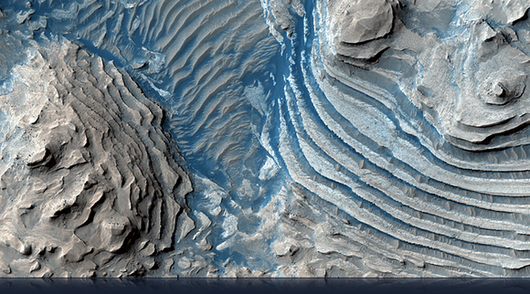
Here’s a crater in Meridiani that’s a whopper. This image from the HiRISE Camera (High Resolution Imaging Science Experiment) on the Mars Reconnaissance Orbiter. This crater is so large that the HiRISE image is entirely within it, and the crater rim is not visible. The most prominent feature is layered sedimentary rocks that look like a grand stairway. These rocks have been eroded, most likely by wind, or possibly flowing water. The original sand and dust were deposited in distinct layers within the crater; these layers now give the mounds their distinctive stair-stepped appearance, and are all that remain from this once extensive deposit.
Click here for a full resolution picture of this area.
HiRISE also has taken some great images of the polygon features found in the high northern latitudes, that form from the ground seasonally freezing and thawing. These are the features found around th Phoenix lander. Here’s the latest interesting picture of polygons and a few dunes, too…

At high northern latitudes, shallow troughs in the ice-rich ground form the polygonal patterns. They polygons form over many years as the near-surface ice contracts and expands seasonally.
On top of this patterned ground in this image are dunes. Loose sand and dust are blown across the hard-cemented surface until collecting and forming a dune. Streaks of dust are visible in this color image coming from the horns of the dunes, while the higher portion of the dune blocks the dust from being blown across the surface.
Small ripples are also visible, and the small bright spots are the remnants of the seasonal carbon dioxide polar cap that coats this area in the winter.

The Head of Athabasca Valles. Credit: Credit: NASA/JPL/University of Arizona
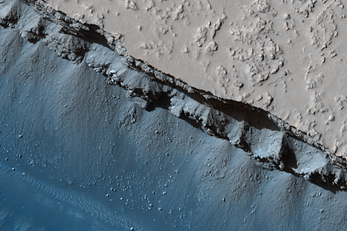
This image is from an area on Mars known as Elysium Planitia, and is located at the head of the Athabasca Valles channel system, which lies just north of Mars’ equator in a low-elevation region. This particular feature is known as a trough, found along a network of what are believed to be faults on Mars.
Athabasca Valles has an interesting geologic history. It was probably carved by one or more catastrophic floods of water, but more recently, a flood of lava coursed through the channel system. Both the water and the lava erupted from a few discrete points (or “ventsâ€) along the Cerberus Fossae, a 1600-kilometer (1000-mile) long network of extensional (or “normalâ€) faults.
This trough was not always as wide as it is today. Erosional processes have widened the troughs over time. Major eruptions occurred along both of the fault segments seen in this image, though they occurred to either side of the imaged area itself. Lava that erupted from the western vent covers the northern half of the image.
For more spectacular images, see the HiRISE website.


What are those shades of blue on some rocks?
Without distance scale bars on the photo’s, they are of very limited scientific value.
Beautiful piccies, once again from HIRES, but I agree with Cherry: what’s causing the blue cast on the images?
Looking at some of those pics, the structure reminds me of a sea floor, or the bottom of a large lake. Very cool!