Here’s this week’s Where In The Universe Challenge. You know what to do: take a look at this image and see if you can determine where in the universe this image is from; give yourself extra points if you can name the instrument responsible for the image. We’ll provide the image today, but won’t reveal the answer until tomorrow. This gives you a chance to mull over the image and provide your answer/guess in the comment section. Please, no links or extensive explanations of what you think this is — give everyone the chance to guess.
UPDATE: The answer has now been posted below.
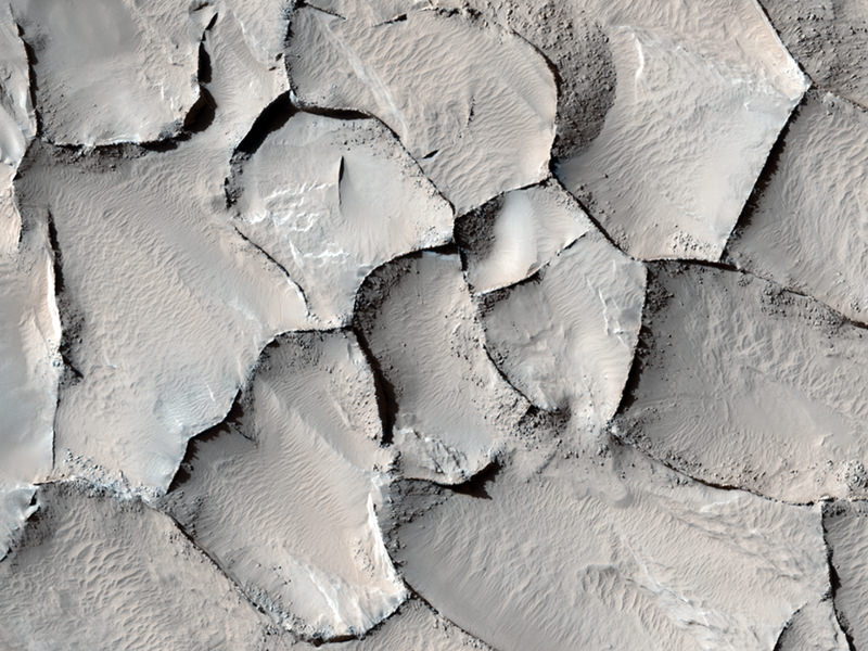
This is Mars, from the HiRISE camera on the Mars Reconnaissance Orbiter, and this is a new image that was just released this week. It’s from the Gordii Dorsum region, which is an equatorial area just west of the Thasis bulge. The image shows a large area covered with polygonal ridges in an almost geometric pattern. If you remember, there were polygon features around the Phoenix landing site near the Mars Arctic region, and scientists thought they were created from freezing and thawing of suburface ice. But these polygons are huge, and Nicolas Thomas of the HiRISE teams writes,” The ridges may have originally been dunes which hardened (indurated) through the action of an unknown process. Groundwater might have been involved.”


I’m going to guess more streaky dune slopes on Mars, courtesy of the MRO and HiRISE.
Mars or Earth?
Ah, a real planetary challenge, this time.
I’d say Earth here, for no particular reason, even if HiRISE is perfectly capable of coming up with something like this. As for the spacecraft… maybe something shot out of some ISS window…
This appears similar to ice flows breaking up off Greenland, Baffin island or maybe Antarctica.
LC
I’m going to have to say somewhere in the Arctic Ocean. No idea what sat or aircraft took it though. There are so many of them…
Mars HiRISE
I think it´s Earth.
Looks like a system of fences built in a sandy area in order to keep the wind from blowing the sand away.
Polygonal Ridges from the Gordii Dorsum Region of Mars.
Mars Reconnaissance Orbiter and the High Resolution Imaging Science Experiment (MRO/HiRISE)
i am with bystander on this one 😉
bystander is right
Europa
by Galileo
Looks like dried mud on earth.
the dunes eliminate any body without an atmosphere. the biggest structures are more than 100 m across (guess based on the ripple/dune size). There are no animals/houses to suggest earth, although the boulders may be mistaken.
I’d like to say HiRISE, Mars except the colors are inconsistent with other images I’ve seen.
Earthly dunes with narrow, tree filled valleys. I’ll be amazed if this is correct. 2nd guess: Mars dunes with bolders. I’ll be amazed if this is correct too! Good one!
Mars polar cap
I can say with a strong degree of certainty that this is neither of the polar ice caps on Mars.
Sandy Ice dunes at a Martian pole taken by MRO
It is a HIRISE picture of polygonal ridges at the Gordii Dorsum region of Mars.
Mars and HiRISE!!
Nice job J Major & bystander… I think you two hit it first.
I always get a kick out the people who say the answer after the original correct answer. It’s like a 5 year old loudly saying the same thing right after an adult does.
…or in this case…Google all the answers so far and see if any are right. Then repeat the correct answer so you can look like an id-jut.
For once, Aodhhan, I agree with you!