Plastic Waste on our Beaches Now Visible from Space, Says New Study

Yellow spot indicating plastic on the blue satellite image of an otherwise pristine beach. Credit: RMIT

According to the United Nations, the world produces about 430 million metric tons (267 U.S. tons) of plastic annually, two-thirds of which are only used for a short time and quickly become garbage. What’s more, plastics are the most harmful and persistent fraction of marine litter, accounting for at least 85% of total marine waste. This problem is easily recognizable due to the Great Pacific Garbage Patch and the amount of plastic waste that washes up on beaches and shores every year. Unless measures are taken to address this problem, the annual flow of plastic into the ocean could triple by 2040.

One way to address this problem is to improve the global tracking of plastic waste using Earth observation satellites. In a recent study, a team of Australian researchers developed a new method for spotting plastic rubbish on our beaches, which they successfully field-tested on a remote stretch of coastline. This satellite imagery tool distinguishes between sand, water, and plastics based on how they reflect light differently. It can detect plastics on shorelines from an altitude of more than 600 km (~375 mi) – higher than the International Space Station‘s (ISS) orbit.

Continue reading “Plastic Waste on our Beaches Now Visible from Space, Says New Study”

NASA Reveals the Mind-Boggling Scale of Hurricane Milton seen from Space

Hurricane Milton Seen from Space

We often talk about Jupiter’s Great Red Spot quite candidly but forget that hurricanes can be devastating, destructive forces here on Earth. Hurricane Milton is a reminder of the awful effects here on Earth. It came out of nowhere, appearing in the Gulf of Mexico as a tropical storm and two days later was a category 5 hurricane. It tracked a course and hit land near Siesta Key in Florida. NASA have been tracking the storm from space, recording high sea temperatures that fuelled the storm allowing it to grow. Images have been released from the ISS showing the sheer enormity of the hurricane.

Continue reading “NASA Reveals the Mind-Boggling Scale of Hurricane Milton seen from Space”

A NASA Rocket Has Finally Found Earth’s Global Electric Field

NASA's Endurance Rocket lifts off from Svalbard in 2022. The results are in and the rocket successfully measured Earth's global electric field. Image Credit: NASA/Brian Bonsteel

Scientists have discovered that Earth has a third field. We all know about the Earth’s magnetic field. And we all know about Earth’s gravity field, though we usually just call it gravity.

Now, a team of international scientists have found Earth’s global electric field.

Continue reading “A NASA Rocket Has Finally Found Earth’s Global Electric Field”

Our Carbon Dioxide Emissions Have a Mesmerizing Side

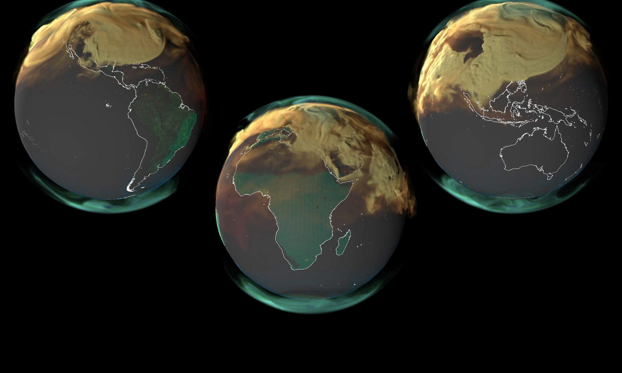
This screenshot is from NASA's new global CO2 visualization. Image Credit: NASA/SVS

Our CO2 emissions are warming the planet and making life uncomfortable and even unbearable in some regions. In July, the planet set consecutive records for the hottest day.

NASA is mapping our emissions, and while what they show us isn’t uplifting, it is visually appealing in a ghoulish way. Maybe the combination of visual appeal and ghoulishness will build momentum in the fight against climate change.

Continue reading “Our Carbon Dioxide Emissions Have a Mesmerizing Side”

Another Giant Antarctic Iceberg Breaks Free

Modified data obtained by the ESA's Copernicus Sentinel-1 satellite. Credit: ESA/USGS

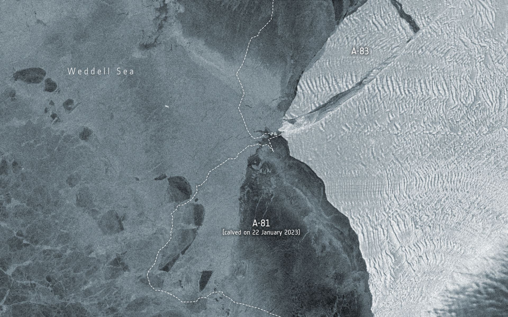
On May 20th, 2024, an iceberg measuring 380 square kilometers (~147 mi2) broke off the Brunt Ice Shelf in Antarctica. This event (A-83) is this region’s third significant iceberg calving in the past four years. The first came In 2021, when A-74 broke off the ice sheet, while an even larger berg named A-81 followed in 2023. The separation of this iceberg was captured by two Earth Observation satellites – the ESA’s Copernicus Sentinel-1 and NASA’s Landsat 8 satellites – which provided radar imaging and thermal data, respectively.

Continue reading “Another Giant Antarctic Iceberg Breaks Free”

Satellite Measurements Show That Global Carbon Emissions are Still Rising

Tracking carbon emissions and sinks to determine Earth's annual Global Carbon Budget. Credit: NASA GEOS

According to the Intergovernmental Panel on Climate Change (IPCC) Sixth Assessment Report (AR6), human activities have significantly impacted the planet. As global greenhouse gas emissions (mainly carbon dioxide) have continued to increase, so too have global temperatures – with severe ecological consequences. Between 2011 and 2020, global surface temperatures rose by an estimated 1.07 °C (2.01 °F) above the average in 1850–1900. At this rate, temperatures could further increase by 1.5 to 2 °C (2.7 to 3.6 °F) in the coming decades, depending on whether we can achieve net zero by 2050.

Unfortunately, the data for the past year is not encouraging. According to the 2023 Global Carbon Budget (GCB), an annual assessment of Earth’s carbon cycle, emissions in 2023 continued to rise by 1.1 percent compared to the previous year. This placed the total fossil fuel emissions from anthropogenic sources at 36.8 billion metric tons (over 40 US tons) of carbon dioxide, with an additional 4.1 billion metric tons (4.5 US tons) added by deforestation, extreme wildfires, and other sources. This trend indicates we are moving away from our goals and that things will get worse before they get better!

Continue reading “Satellite Measurements Show That Global Carbon Emissions are Still Rising”

The World's Largest Iceberg Sets Sail for Adventure Beyond Antarctic Waters

Iceberg A23a seen from space. Credit: ESA.

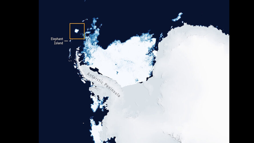
In November 2023, the monster iceberg A23e finally dislodged from the seafloor after being grounded and stuck there for 40 years. A series of recent satellite images show that the mighty iceberg is now heading away from Antarctic waters, seeking fame and fortune in the high seas. A23a measures 4,000 sq kilometers in area and is over 280 meters thick, and is currently the world’s largest iceberg. Its first path will follow the Antarctic Circumpolar Current, heading towards South America.

Tiny Elephant Island, an ice-covered, mountainous island off the coast of Antarctica seen in the image above, has an area of only 215 sq km.

Continue reading “The World's Largest Iceberg Sets Sail for Adventure Beyond Antarctic Waters”

Red Sprites are Best Seen from Space

Image of a red sprite taken from the International Space Station in October 2023 by Expedition 70 Commander, Dr. Andreas Mogensen. (Credit: ESA/DTU/ A. Mogensen)

Planet Earth is full of some truly awe-inspiring spectacles, but few are as intriguing as a sprite, which are officially known as a Transient Luminous Event (TLE) and consist of large-scale electric discharges that shoot upwards while occurring above the cloud tops in the Earth’s mesosphere at approximate altitudes of 50-90 km (31-56 mi). In October 2023, European Space Agency (ESA) astronaut, Dr. Andreas Mogensen, who is currently onboard the International Space Station (ISS) as Commander of the Expedition 70 mission, took an incredible image of a red sprite with the Davis camera as part of the Thor-Davis experiment and his Huginn mission.

Continue reading “Red Sprites are Best Seen from Space”

After Stalling Out for 40 Years, the Largest Iceberg in the World is on the Move

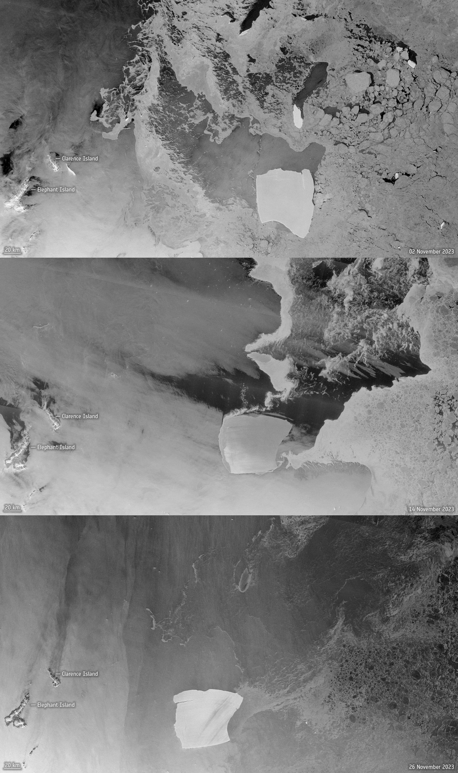
An animation from Copernicus Sentinel-1 images shows iceberg A23a’s movements from 2 November 2023, 14 November 2023 and 26 November 2023. Credit: ESA.

In 1986, a gigantic iceberg separated from the Fichner-Ronne ice shelf in West Antarctica. It was so big that it became grounded, stuck to the seafloor, and remained in position for 40 years. Finally, it has now been pushed off the seafloor and has begun drifting in the Weddell Sea to a region in the South Atlantic called Iceberg Alley. Designated A23a, this monster berg measures 4000 sq km (1,500 square miles) and is about 400 meters (1,300 feet) thick – the world’s largest.

Continue reading “After Stalling Out for 40 Years, the Largest Iceberg in the World is on the Move”

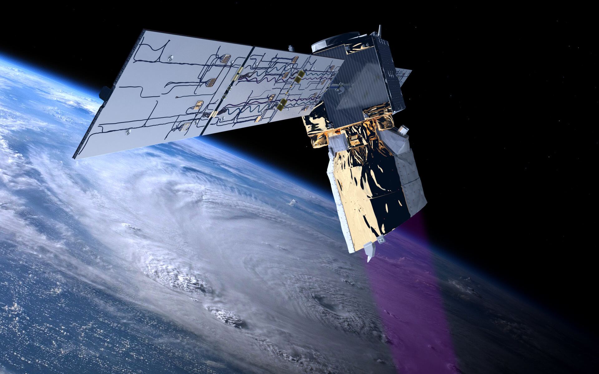
Follow a Simulated Journey of the Destruction of ESA’s Aeolus Mission

The Aeolus spacecraft orbited Earth and used lidar to study the winds in various parts of our atmosphere. It was brought back to Earth in a controlled re-entry on July 28th. Courtesy ESA.
The Aeolus spacecraft used lidar to study the winds in various parts of our atmosphere. It was brought back to Earth in a controlled re-entry on July 28th. Courtesy ESA.

On July 28th, the European Space Agency commanded its long-working Aeolus wind profile mission to re-enter Earth’s atmosphere. It did that and disintegrated into pieces over Antarctica. Of course, satellites do this often. But, Aeolus was different. It maneuvered its way into a safe re-entry profile, a first-of-its kind activity designed to avoid populated regions on Earth.

Continue reading “Follow a Simulated Journey of the Destruction of ESA’s Aeolus Mission”