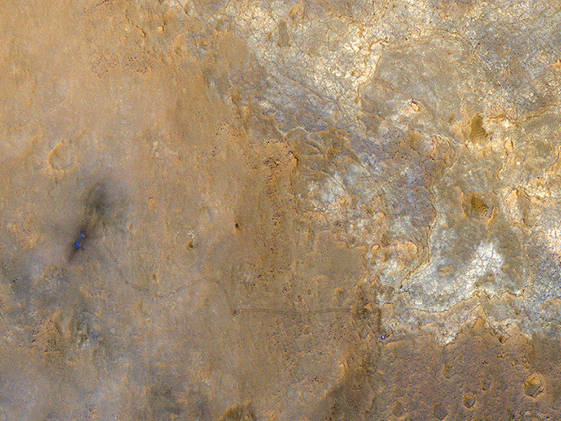
I spy the Curiosity Rover! With the Sun over its shoulders, the High Resolution Imaging Science Experiment (HiRISE) camera on the Mars Reconnaissance Orbiter snapped this image of the Curiosity rover on June 27, 2013, when Curiosity was at an outcrop called “Shaler” in the “Glenelg” area of Gale Crater. The rover appears as a bluish dot near the lower right corner of this enhanced-color image, and also visible are the rover’s tracks.
“The rover tracks stand out clearly in this view,” wrote HiRISE principal investigator Alfred McEwen on the HiRISE website, “extending west to the landing site where two bright, relatively blue spots indicate where MSL’s landing jets cleared off the redder surface dust.”
McEwen explained how MRO was maneuvered to provide unique lighting, where the Sun was almost directly behind the camera, so that the Sun, MRO, and MSL on the surface were all aligned in nearly a straight line.
When HiRISE captured this view, the Mars Reconnaissance Orbiter was rolled for an eastward-looking angle rather than straight downward. The afternoon sun illuminated the scene from the western sky, so the lighting was nearly behind the camera. Specifically, the angle from sun to orbiter to rover was just 5.47 degrees.
McEwen said this geometry hides shadows and better reveals subtle color variations. “With enhanced colors, we can view the region around the landing site and Yellowknife Bay,” he said.
For scale, the two parallel lines of the wheel tracks are about 10 feet (3 meters) apart.
Curiosity has now moved on, and is now heading towards the large mound in Gale Crater (with long drives!) officially named Aeolis Mons (also called Mount Sharp.)

