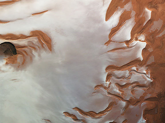
Get a satellite’s-eye view of the Martian north pole in this new animation from the Mars Express spacecraft, using data from the Mars Advanced Radar for Subsurface and Ionospheric Sounding instrument, MARSIS. This instrument allows for studying the surface heights, providing a 3-D view of the Mars’ north pole.
You can see the prominent gap in the ice cap, which is a 318 km-long, 2 km-deep chasm called Chasma Boreale.
In all, the ice cap has a diameter of about 1000 km and consists of many thin layers of ice mixed with dust that extend to a depth of around 2 km below the cap.
ESA says the layers result from variations in the orbit and rotation of Mars that affect the amount of sunlight received at the poles, and thus the amount of melting and deposition of materials over time. Meanwhile, strong prevailing winds are thought to be responsible for shaping the spiral troughs.
The MARSIS instrument works by sending low-frequency radio waves towards the surface of Mars, and they are reflected back to the spacecraft from the planet’s surface. The strength and timing of the radar echoes are a gauge of the depths of different types of interfaces, such as between rock, water or ice.
Video credit: ESA/ASI/NASA/JPL/La Sapienza University/INAF (A. Frigeri)


The spiral shape is obviously due to water flowing into a vacated volcanic vent. It only happened 2,700 years ago. ESA scientists cannot believe this and are trying to find an explanation that fits their outdated ideas of the solar system. See
cycliccatastrophism.org and search for Martian Drain Pipe…