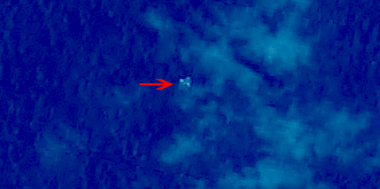
Chinese satellite image of suspected floating objects from the missing Malaysia Airlines plane MH 370. Credit: China SASTIND/China Resources Satellite Application Center
See more satellite imagery below[/caption]
Chinese government satellites orbiting Earth may have detected floating, crash related debris from the missing Malaysian Airline flight MH-370 that disappeared without a trace last week – and which could be a key finding in spurring the ongoing and so far fruitless search efforts.
Today, Wednesday, March 12, Chinese space officials released a trio of images that were taken by Chinese satellites on Sunday, March 9, showing the possible crash debris in the ocean waters between Malaysia and Vietnam.
China’s State Administration of Science, Technology and Industry for National Defence (SASTIND) posted the images on its website today, although they were taken on Sunday at about 11 a.m. Beijing local time.
I found the images today directly on SASTIND’s Chinese language website and they are shown here in their full resolution – above and below.
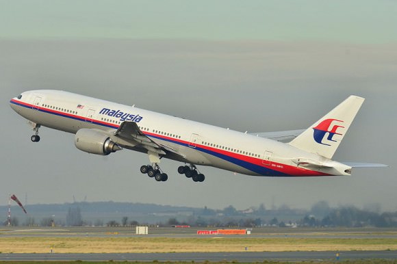
The Boeing 777-200ER jetliner went missing on Saturday on a flight en route from Kuala Lampur, Malaysia to Beijing, China.
The images appear to show “three floating objects in the suspected site of missing Malaysian plane,” according to SASTIND.
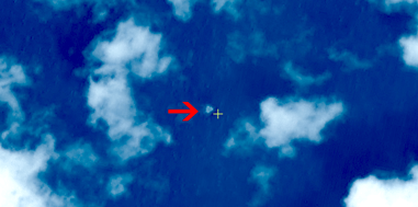
The plane carrying 227 passengers and 12 crew members mysteriously lost radio contact and vanished from radar while flying over the South China Sea. The transponder stopped sending signals.
And not a trace of the jetliner has been found despite days of searching by ships and planes combing a vast search area that expands every day.
Smaller versions of the satellites images and a video report have also been posted on China’s government run Xinhua and CCTV news agencies.
The three suspected floating objects measure 13 by 18 meters (43 by 59 feet), 14 by 19 meters (46 by 62 feet) and 24 by 22 meters (79 feet by 72 feet).
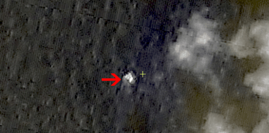
These suspected debris are surprising large, about the size of the jetliners wing, according to commentators speaking tonight on NBC News and CNN.
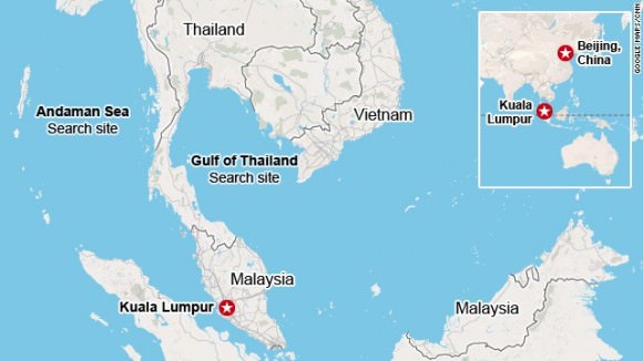
SASTIND said that “the three suspected objects were monitored at 6.7 degrees north latitude and 105.63 degrees east longitude, spreading across an area with a radius of 20 kilometers, according to Xinhua.
These coordinates correspond with the ocean waters between Malaysia and Vietnam, near the expected flight path.
“Some 10 Chinese satellites have been used to help the search and rescue operation,” reported CCTV.
China, the US, Malaysia and more than a dozen counties are engaged in the continuing search and rescue effort that has yielded few clues and no answers for the loved ones of the missing passengers and crew on board. Our hearts and prayers go out to them.
The search area currently encompasses over 35,000 nautical square miles.
Ships and planes are being dispatched to the location shown by the new satellite imagery to help focus the search effort and find the black boxes recording all the critical engineering data and cockpit voices of the pilot and copilot and aid investigators as to what happened.
No one knows at this time why the Malaysia Airlines flight mysteriously disappeared.

Given that most large modern passenger jet aircraft are equipped with ACARS (Aircraft Communications Addressing and Reporting System), a “digital datalink system for transmission of short, relatively simple messages between aircraft and ground stations via radio or satellite” – source Wikipedia – it’s completely unacceptable that the location of the crash site is still unknown nearly five days after the aircraft was reported missing.
ACARS message were actually received, but the last one was at 01:07, shortly before the plane disappeared from radar screens at 01:22. The position at that time was known. But there was no other valid information received after that fateful moment. So it is very unfortunate that we have no other information of the fate of the plane, but I would not say this is unacceptable. It is an accident, most probably a catastrophe, so technical resources on the plane cannot be counted for any more.
Update 15.03.2014:
It looks like ACARS pinged Inmarsat satellites for up to FIVE hours after last voice contact. US Navy search is focusing far to the west (Indian Ocean) of the current search area.
Thanks for your many posts.
One can only hope these new images lead to discovering the true position of the wreckage and eventually what happened on that flight. This is so totally reminiscent of that Air France crash several years ago over the southern Atlantic. It actually took a couple of years to finally pin down the locations and cause(s) of that crash, which turned out to be pilot error.
Unfortunately it was not so. Ships sent to the place shown by the satellite images found nothing. The pictures were taken on March 9 and we are now four days later; even if debris were floating there on the 3/9, they probably sunk or drifted away.
There is very good web page that deals with all type of incidents/accidents/catastrophes in commercial aviation, managed by knowledgeable people of the trade. To those that would like to have updated information on MH370, it is preferable to consult (and eventually discuss) there. The link is: avherald.com
Flight MH 370 may be a victim of icing, just like AF 447 which crashed for this reason (not pilot error). See journalofcosmology.com volume 21 for the reasons. Turbulence at the equator is extremely intermittent, and can cause deadly icing conditions.
What happens near the equator is that rare turbulence events rapidly sweep up supercooled water vapor to high altitudes. Icing is triggered first by the pitot tubes and then by the tail. Pilots soon can no longer control the plane. AF 447 was nose up and wandering for the 5 minutes it took to hit the sea, and no one could have saved them. BH 370 may be the first crash triggered by global warming. See journalofcosmology.com volumes 21 and 23 for the full story.