After dodging space debris and living to tell the tale, Sentinel-1A is now being put through its paces for its primary mission: to beam back pictures of the Earth as quickly as possible, to provide officials with the information they need during natural disasters or weather events.
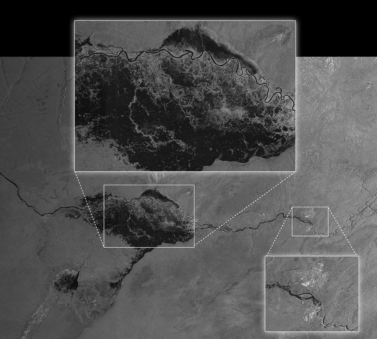
The picture above gives a taste of what the European satellite will do when it’s fully commissioned. The picture of flooding in Namibia was downloaded only two hours after acquisition and then made available generally less than an hour after that, the European Space Agency said. Not only that, believe it or not — the view was socked in by cloud when the image was taken.
“Sentinel-1A’s ability to ‘see’ through cloud and rain and in pitch darkness make it particularly useful for monitoring floods and for offering images for emergency response,” the European Space Agency stated. “In fact, this area of the Caprivi plain was shrouded in thick cloud when the satellite acquired the image on 13 April.”
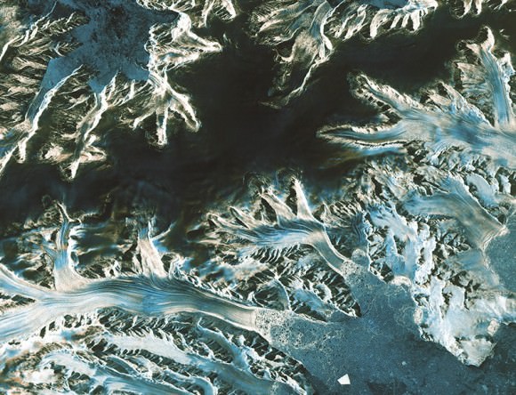
The satellite can also monitor long-term but serious weather events such as climate change, as the picture below of Pine Island Glacier shows.

“As well as monitoring glaciers, Sentinel-1A is poised to generate timely maps of sea-ice conditions, particularly for the increasingly busy Arctic waters,” ESA stated. “Images from its advanced radar can be used to distinguish clearly between the thinner more navigable first-year ice and the hazardous, much thicker multiyear ice to help assure safe year-round navigation in polar waters.”
Read more about the Sentinel-1A mission in this past Universe Today story.
Source: European Space Agency


Does anyone have an idea of the resolution of this satellite’s pictures? This article gives us no clue.
How small an iceberg can it find?
How small a ship?
From the ESA website:
Sentinel 1 Facts & Figures
Operational modes:
Interferometric wide-swath mode at 250 km and 5×20 m resolution
Wave-mode images of 20×20 km and 5×5 m resolution (at 100 km intervals)
Strip map mode at 80 km swath and 5×5 m resolution
Extra wide-swath mode of 400 km and 20×40 m resolution