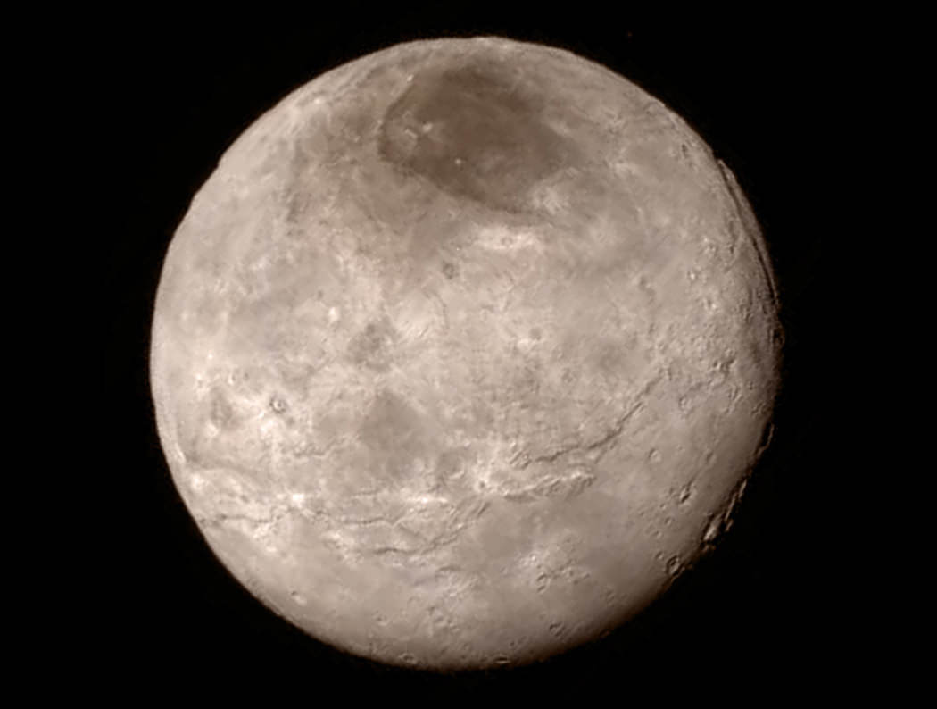
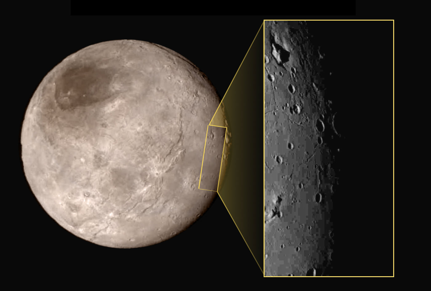
This new image of an area on Pluto’s largest moon Charon has a captivating feature — a depression with a peak in the middle, shown here in the upper left corner of the inset. The image shows an area approximately 240 miles (390 kilometers) from top to bottom, including few visible craters. The image was taken at approximately 6:30 a.m. EDT on July 14, 2015, about 1.5 hours before closest approach to Pluto, from a range of 49,000 miles (79,000 kilometers). Credits: NASA-JHUAPL-SwRI
Story updated[/caption]
APPLIED PHYSICS LABORATORY, LAUREL, MD – A mysterious mountain in the middle of a moat on Pluto’s biggest moon Charon, has captivated and baffled scientists leading NASA’s New Horizons mission which made history when it became the first spacecraft to visit our solar system’s most distant planet barely two days ago on Tuesday morning, July 14, 2015.
NASA released the first close-up image of Charon today (July 16), shown above, and it has the geology team scratching their heads in amazement and wonder. They can’t figure out the nature of a big mountain set inside a moat.
The new image shows a depression with a mountain peak in the middle.
“The most intriguing feature is a large mountain sitting in a moat,” said Jeff Moore with NASA’s Ames Research Center, Moffett Field, California, who leads New Horizons’ Geology, Geophysics and Imaging team. “This is a feature that has geologists stunned and stumped.”
The location of the “mountain in a moat” is shown in the inset of a global view of Charon.
The new high resolution image of Charon was taken at approximately 6:30 a.m. EDT (10:30 UTC), barely an hour and a half before the piano-shaped spacecraft’s closest approach to Pluto on July 14, 2015, from a range of only 49,000 miles (79,000 kilometers).
The image was captured by New Horizons’ high resolution Long Range Reconnaissance Imager (LORRI).

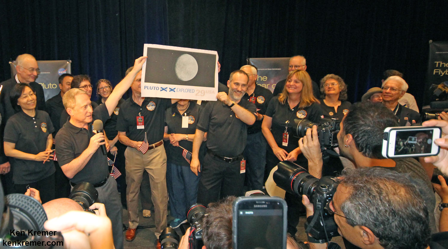
The New Horizons mission team celebrates successful flyby of Pluto in the moments after closest approach at 7:49 a.m. EDT on July 14, 2015. New Horizons Principal Investigator Alan Stern of Southwest Research Institute (SwRI), Boulder, CO., left, Johns Hopkins University Applied Physics Laboratory (APL) Director Ralph Semmel, center, and New Horizons Co-Investigator Will Grundy Lowell Observatory hold an enlarged print of an U.S. stamp with their suggested update after Pluto became the final planet in our solar system to be explored by an American space probe (crossing out the words ‘not yet’) – at the Johns Hopkins University Applied Physics Laboratory (APL) in Laurel, Maryland. Credit: Ken Kremer/kenkremer.com
A much sharper view is yet to come, because the image is heavily compressed.
“Sharper versions are anticipated when the full-fidelity data from New Horizons’ Long Range Reconnaissance Imager (LORRI) are returned to Earth,” say NASA officials.
Altogether it will take 16 months to transmit all the data collected by New Horizons at the Pluto system.
The area in the LORRI image comprises an area approximately 240 miles (390 kilometers) from top to bottom.

Notably there are few visible craters “indicating a relatively young surface that has been reshaped by geologic activity.”
And a “swath of cliffs and troughs stretching about 600 miles (1,000 kilometers) suggests widespread fracturing of Charon’s crust, likely the result of internal geological processes,” notes the team.
The Texas-sized moon measures about 750 miles (1200 kilometers) across, about half the diameter of Pluto. Pluto spans 1,471 miles (2,368 km) across.
After a nine year voyage through interplanetary space, New Horizons barreled past the Pluto system on Tuesday, July 14 for a history making first ever flyby at over 31,000 mph (49,600 kph), and survived the passage by swooping barely 7,750 miles (12,500 kilometers) above the planet’s amazingly diverse surface at 7:49 a.m. EDT. It passed about 17,900 miles (28,800 kilometers) from Charon during closest approach.

Watch for Ken’s continuing coverage of the Pluto flyby on July 14. He was onsite reporting live on the flyby and media briefing from the Johns Hopkins University Applied Physics Laboratory (APL).
New images will be released on Friday, July 17 – watch for my story.
Stay tuned here for Ken’s continuing Earth and planetary science and human spaceflight news.


Nice job Ken, getting the pictures to us, and then the explanation, f what they can make of it at this time. Thanks.
thank you. more thrills upcoming today
Sixteen months to down load all the data. wow! The excitement never stops.
“A mysterious mountain in the middle of a moat . . . has captivated and baffled scientists leading NASA’s New Horizons mission”
So, there are no other examples of this elsewhere in the solar system? Very cool!
So THAT’S where they put that secret WWII base. And we all thought it was on the far side of the moon! 😉
It looks like a Crater made at an angle and the (Mountain) is the central peak of the Crater I don’t see anything so baffling about this feature there are many (similar) on Mars
Care to note a specific example? I think you are thinking of splatter craters with ejecta patterns. I think this is different. The “central peak” is most of the width of the crater. It could be a melt zone turned tidal wave but then frozen in mid progress but I’ve seen no discussion recognizing how impact melt on water ice would behave.
To me it looks more like a mountain got built for some reason and then later there was a melting event in the region which the mountain partly resisted and the terrain became soft. Then the mountain, like a glacier, settled into the landscape which was retreating and then everything re-froze. What cause the regional melting? Not sure…
Lots of speculation in there…
Steven..no problem with the example, go to http://www.nasa.com and click on NASA images of the day “Light Toned Deposit in the Aureum Chaos Region of Mars look at (Hirise) camera it is almost an exact copy but the Central Peak on Charon is higher because the Gravity is lower (so it can)
You mean this – found it elsewhere – http://phys.org/news/2015-07-image-toned-deposit-aureum-chaos.html
Overall that region is thought to be heavily eroded by something. So it’s not a crater press though it could be a crater eroded. But no one’s saying erosion is common on Charon.
How is it that you continually understand things that scientists running missions completely miss? You ARE an intellectual Jupiter!
Jeffrey Boerst If Brains were Planets you are indeed Pluto and yes I am Jupiter, Now with regards to the Central Mountain Peak the reason the peak is so high is due to the low gravity on Charon (allowing it to stand) I rest my case…..
.
The larger Tycho crater on the Moon is famous for its central peak. But it is much smaller relative to the crater size. Maybe it was formed in a similar way but has just filled in somehow, or maybe it’s something completely different. At those low temperature there are other solids and (temporary) liquids and I suppose impacts are different too in a region with comets instead of asteroids.
THe crater in the center of higher resolution image looks more like the proportions of the Tycho crater, and other known similar formations.
I don’t see the parallel.
See http://www.damianpeach.com/lunar12/tycho_2012_02_01_1921ut.jpg
Doing a search for wide central peaks I found this – http://www.lpi.usra.edu/education/explore/shaping_the_planets/impact_cratering.shtml
Look down page for “A complex crater in the northern region of Mars.”
Also here – http://www.livingcosmos.com/ejection.htm
This impact is said to be in the midst of soft/wet ground the splattered and the rebound was wide and tall. But Charon’s sinking mountain has no splattering like this. It seems more to have sunk in place.
I almost never speculate about what I think anomalous features we discover on other worlds are because I know I’m only educated in geology on a pedestrian level, but Charon makes me pause this practice. It seems to me that not only the “mountain -in-a-moat” but also the large, curving “4 to 6 mile deep” chasm at the two o’clock position on the above image of the object could be due to relatively shallow sub-surface melting underneath massive and more solid mountainous surface features causing them to sink or melt down into the surface.
Curved chasm? I think the “cracks” look hexagonal. Btw the big shadow of the “mountain in a moat”, I suppose reveals how steep the far side “moat” wall is, right?. The ridge of the “mountain” is much flatter than the top of the shadow it casts because it is projected on a near parallel wall, right? The “moat” certainly looks more like an elongated deep “moat” than a crater. Maybe the long shadows this near the terminator is playing tricks with guys like me who just try to use intuition.
looks like part of craterwall that toppled at an angle.
… a large craterwall flake, tower op pisa style.
The cheese is softer near the edges than in the middle! The mountain of Gouda simply settled.
(Or maybe it was hit by a Klingon blaster!)
Geez, guys, give it a break! Everyone seems to want to beat the ex-spurts to their guesses!
I once tried staying blank minded while staring at an image
All i recall is … must have been just a dark image of black.
We all try to understand what it is we see.
Or we move on to something we DO understand.
Cheesy, isn’t it.
Looks a lot like a finger pointing to the northwest (in the image). Wonder what exciting alien structures or foreign objects it is pointing out for us lowly humans? 😉
Nice one MikeF318 Just saw the pointing finger 🙂
KEN IS RIGHT, IT IS 8
http://i2.photobucket.com/albums/y33/HeadAroundU/KEN%20IS%20RIGHT%20IT%20IS%208.jpg