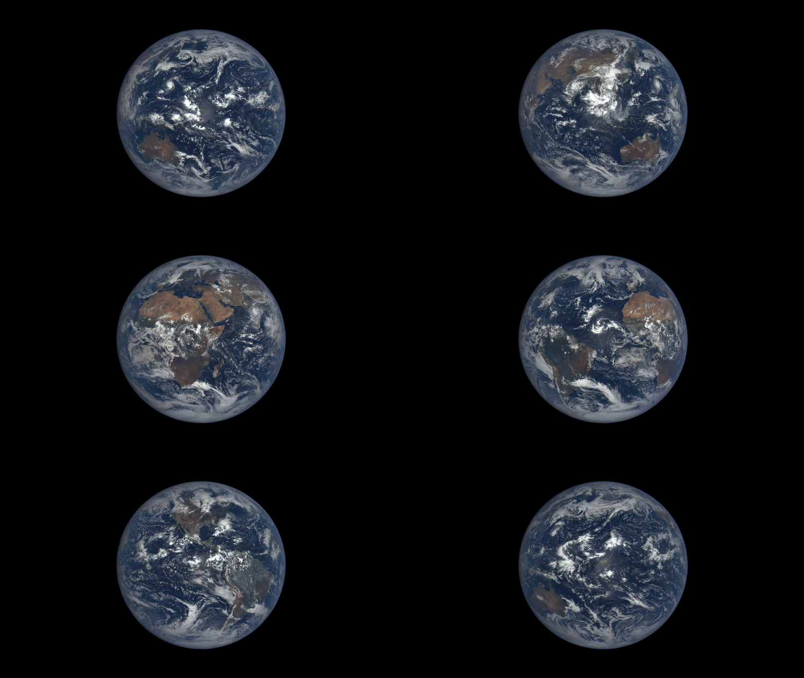

Earth rotates through an entire day as captured in this animation of 22 still images taken on Sept. 17, 2015 by NASA’s Earth Polychromatic Imaging Camera (EPIC) camera on the Deep Space Climate Observatory (DSCOVR) spacecraft. Credits: NASA
At long last, beautiful new high resolution views of the rotating Earth can be seen daily by everyone at a new NASA website – all courtesy of images taken by NASA’s EPIC camera on board the Deep Space Climate Observatory (DSCOVR) spacecraft. And as seen in the time-lapse animation above, they provide a wonderful new asset for students everywhere to learn geography that’s just a finger tip away!
The EPIC camera, which stands for Earth Polychromatic Imaging Camera (EPIC), is located a million miles away on the DSCOVR real time space weather monitoring satellite and is designed to take full disk color images of the sunlit side of our home planet multiple times per day.
The EPIC NASA images are literally just a finger tip away, after a 17 year wait to get the satellite into the launch queue since it was first proposed by former VP Al Gore. They are all easily viewed at NASA’s new EPIC camera website which went online today, Monday, October 19, 2015.
To see the daily sequence of rotating images, visit the EPIC website link: http://epic.gsfc.nasa.gov/
This EPIC image was taken on Oct.17 and shows the Australian continent and a portion of Asia.


An annotated guide map illustration identifying the visible land masses accompanies each EPIC image and follows along as the Earth rotates daily.
What a great geography learning tool for student classrooms worldwide!
DSCOVR is a joint mission between NOAA, NASA, and the U.S Air Force (USAF) that is managed by NOAA. The satellite and science instruments were provided by NASA and NOAA.
EPIC is a four megapixel CCD camera and telescope mounted on DSCOVR and orbiting around the L1 Lagrange Point – a neutral gravity point that lies on the direct line between Earth and the sun.
NASA says that once per day they will post “at least a dozen new color images of Earth acquired from 12 to 36 hours earlier” taken by the agency’s EPIC camera. The EPIC images will be stored in an archive searchable by date and continent.
The image sequence will show “the Earth as it rotates, thus revealing the whole globe over the course of a day.”
“The effective resolution of the DSCOVR EPIC camera is somewhere between 6.2 and 9.4 miles (10 and 15 kilometers),” said Adam Szabo, DSCOVR project scientist at NASA’s Goddard Space Flight Center, Greenbelt, Maryland, in a statement.
“The color Earth images are created by combining three separate single-color images to create a photographic-quality image equivalent to a 12-megapixel camera. The camera takes a series of 10 images using different narrowband filters — from ultraviolet to near infrared — to produce a variety of science products. The red, green and blue channel images are used to create the color images. Each image is about 3 megabytes in size.”
EPIC will capture “a constant view of the fully illuminated Earth as it rotates, providing scientific observations of ozone, vegetation, cloud height and aerosols in the atmosphere.”
The couch sized probe was launched atop a SpaceX Falcon 9 on Feb. 11, 2015 from Cape Canaveral, Florida, to start the million mile journey to its deep space observation post at L1. The rocket was funded by the USAF.
The primary goal of the $340 million DSCOVR satellite is to monitor the solar wind and aid very important forecasts of space weather at Earth from L1.
L1 is located 1.5 million kilometers (932,000 miles) sunward from Earth. At L1 the gravity between the sun and Earth is perfectly balanced and the DSCOVR satellite orbits about that spot just like a planet.
The mission is vital because its solar wind observations are crucial to maintaining accurate space weather forecasts to protect US infrastructure such as power grids, aviation, planes in flight, all types of Earth orbiting satellites for civilian and military needs, telecommunications, ISS astronauts and GPS systems.
DSCOVR was first proposed in 1998 by then US Vice President Al Gore as the low cost ‘Triana’ satellite to take near continuous views of the Earth’s entire globe to feed to the internet as a means of motivating students to study math and science.
It was also dubbed “Goresat.”
The probe was eventually resurrected and partially rebuilt at NASA Goddard Space Flight Center as a much more capable Earth science satellite that would also conduct the space weather observations.
But Triana was shelved for purely partisan political reasons and the satellite was placed into storage at NASA Goddard.
Thus the practical and teachable science and daily scenes of the gorgeously rotating Earth were lost – until now!
Former VP Al Gore was clearly delighted with today’s launch of NASA’s EPIC website in this pair of tweets:
“Today @NASA launched its site for #DSCOVR’s daily images. I look forward to seeing more from #DSCOVR,” tweeted Al Gore.
“DSCOVR’s site displaying new daily images of Earth from L1 was launched today! Congratulations to all those who made this happen!”
Stay tuned here for Ken’s continuing Earth and planetary science and human spaceflight news.
Some exoplanets have characteristics totally alien to our Solar System. Hot Jupiters are one such…
Stars form in Giant Molecular Clouds (GMCs), vast clouds of mostly hydrogen that can span…
Let’s dive into one of those cosmic curiosities that's bound to blow your mind: how…
The majority of the universe remains unmapped, but we have a potential window into it…
NASA engineers are pressing ahead with preparations for the Artemis II mission unless someone tells…
It’s not uncommon for space missions to be tested here on planet Earth. With the…