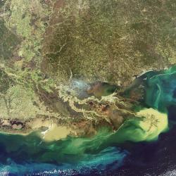
 Here’s a beautiful photograph of the Mississippi River Delta taken by ESA’s Envisat Earth observation satellite. The image shows how the river empties sediment into the Gulf of Mexico, slowly building up the jutting peninsula. Natural and man-made factors have reversed this process over the last century, though, and Louisiana is losing its protective wetlands. The city of New Orleans is visible as the white crescent just below the inland Lake Pontchartrain.
Original Source: ESA News Release
