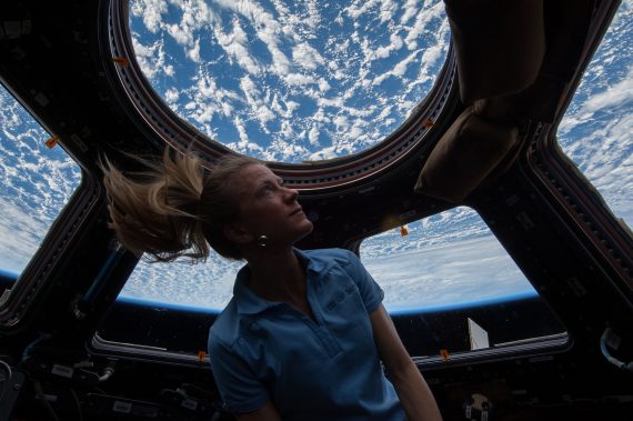
Calling all citizen scientists, geography buffs, fans of the International Space Station and those who love that orbital perspective!
CosmoQuest has a brand new project in coordination with NASA and the Astronomical Society of the Pacific (ASP) where you can help identify features in photographs taken by astronauts from the space station.
The project is called Image Detective. I’ve tried it out, and wow, THIS is a lot of fun!
Now, I absolutely love seeing the images taken of Earth from the ISS, and I routinely follow all the astronauts on board on social media so I can see their latest images. And I also love the concept of regular, everyday people doing science. Plus I’m a big fan of CosmoQuest and their ‘quest’ to bring science to the public.
But still, the setup CosmoQuest has is really great and the process is easy. Citizen scientists are asked to help identify geographic features (natural or human-made) and then determine the location on Earth where the photo is centered.
I found that last part to be the most difficult, but I’ve been known to have trouble reading a map … so I’m hoping that I can improve a bit with more practice.
Public Invited to Test New Tool to Study Earth using Photos Taken by International Space Station Astronauts https://t.co/zKuSbwTvZx pic.twitter.com/JslJU6DIxo
— Cosmo Quest (@cosmoquestX) September 28, 2017
“The astronauts’ photos of Earth are visually stunning, but more than that, they can be used to study our changing Earth,” said our good friend Dr. Pamela Gay, who is the Director of Technology and Citizen Science at ASP. “From erupting volcanoes, to seasonal flooding, these images document the gradual changes that happen to our landscape. The trick is, we need to make these images searchable, and that means taking the time to sort through, analyze, and label (add metadata) the unidentified images within the database of 1.5 million plus photos.”
You can try it out here: http://cosmoquest.org/ImageDetective.
The team says that Image Detective spreads the significant work necessary to label all of the images out to citizen scientists across the world.
“This is a unique, powerful, and beautiful image data set that has already yielded excellent research science. But the data set needs the many eyes and minds of citizen scientists to reach its full potential as a publicly available, searchable catalog,” said Dr. Jennifer Grier, a Senior Scientist and Senior Education and Communication Specialist at Planetary Science Institute (PSI) and CosmoQuest’s lead support scientist. “With the additions that citizen scientists as detectives can make, professional research scientists will be able to conduct more research into our changing world, and do so much more effectively.”


I’ve tried the tutorial and I’m not sure how close the map is supposed to be to the picture. Are we to assume the software can present a location that is close to the picture or do we have to search the globe to fine a match?
Hi Ken,
The program uses what we know about where the ISS or spacecraft was when the astronaut took the photo, but it’s not exact. Usually it gives a pretty good starting spot, but sometimes it can be off. You will not usually have the whole globe to search. And it is very easy to say “Next photo, please,” because some of these may be extremely difficult to match up. We just ask for folks to do their very best!
Please let us know if you have any more questions or run into issues!