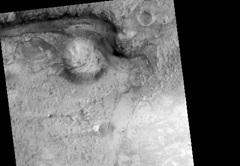
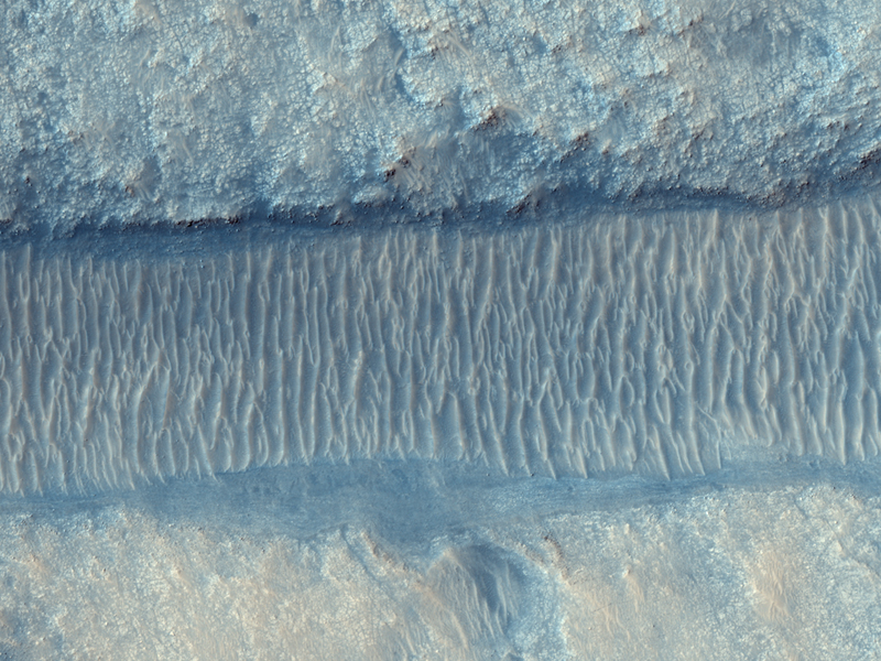
The Mars Reconnaissance Orbiter had a busy week, and here are just a few of the images released from the spacecraft’s HiRISE camera. First up is this false color image of a water-carved channel in the Nili Fossae region on Mars. Billions of years ago sediments were transported across the Martian surface via this channel. MRO’s spectrometer, CRISM has detected water-bearing clay minerals in these plains, which were eroded by flows down the channel. Clays are also seen in the sediments deposited on the floor of Jezero Crater, which you can see in the image below.

The sediments deposited form a delta-like mound on the crater floor, which suggests that the crater may have contained a lake at one time. Planetary scientists use these clues found in the form and composition of the Martian surface to provide insights into an ancient era when liquid water may have been more common at the surface.

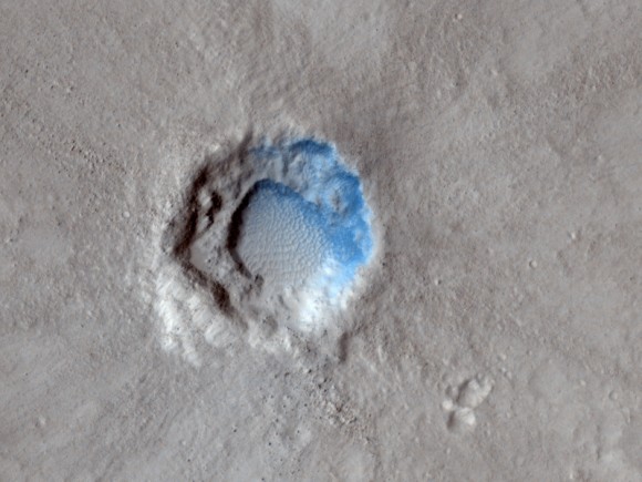
This image taken on a spring afternoon on Mars shows a young impact crater in the northern part of Isidis Planitia. The crater is fresh enough that some interesting features are visible, where in older craters these features have been eroded.
The ejecta blanket of material thrown out of the crater is distinctly dark and rough, with many small boulders and rugged texture. To the south of the crater there is a wedge-shaped area with little ejected material. This may indicate that the impactor which formed this crater came from the south, since at moderate impact angles ejecta is preferentially thrown in the direction of motion of the impactor. But some erosion has already begun, as seen in the wind-blown ripples on the crater floor.
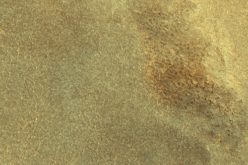
Of great interest this week is the region on Mars where the Phoenix spacecraft will land on Sunday, May 25. One of the reasons this specific area of Mars was selected for the landing site is based on the overall lack of rocks that could prove hazardous to the lander. Phoenix will analyze the surface dust as well as dig into an ice-rich layer which is predicted to lie within inches of the Martian surface. The polygon-like shapes on the surface here are most likely the result of temperature oscillations which cause the ice to crack. Here’s hoping for a successful landing for Phoenix, with lots of great science returns.
Source: HiRISE


Good luck and success!
Posted this link in http://www.surfurls.com
Best wishes for Phoenix …
Looking forward for some interesting science results soon..
It’s been called 7 minutes of terror, but why look at it like that? A hopefully inspirational video I put together about the Phoenix mission:
Water created sand ripples would be only inches deep, I would think. The ripples in the picture from an orbiter several miles up look to be several feet deep. How wide is the channel? Anyone?
Wow, great video Davin, thanks for posting it here. I’m hoping that with the cadre of craft now orbiting Mars we might get to see actual images of Phoenix’s fiery entrance through the atmosphere of the planet.
It’s almost like 1969 again, America is at a war ,nobody likes it, people are unhappy with political leadership, but throught out all this paul we still can move our, this human foot print, futher into the heavens for all mankind.
Good comment by Dan.