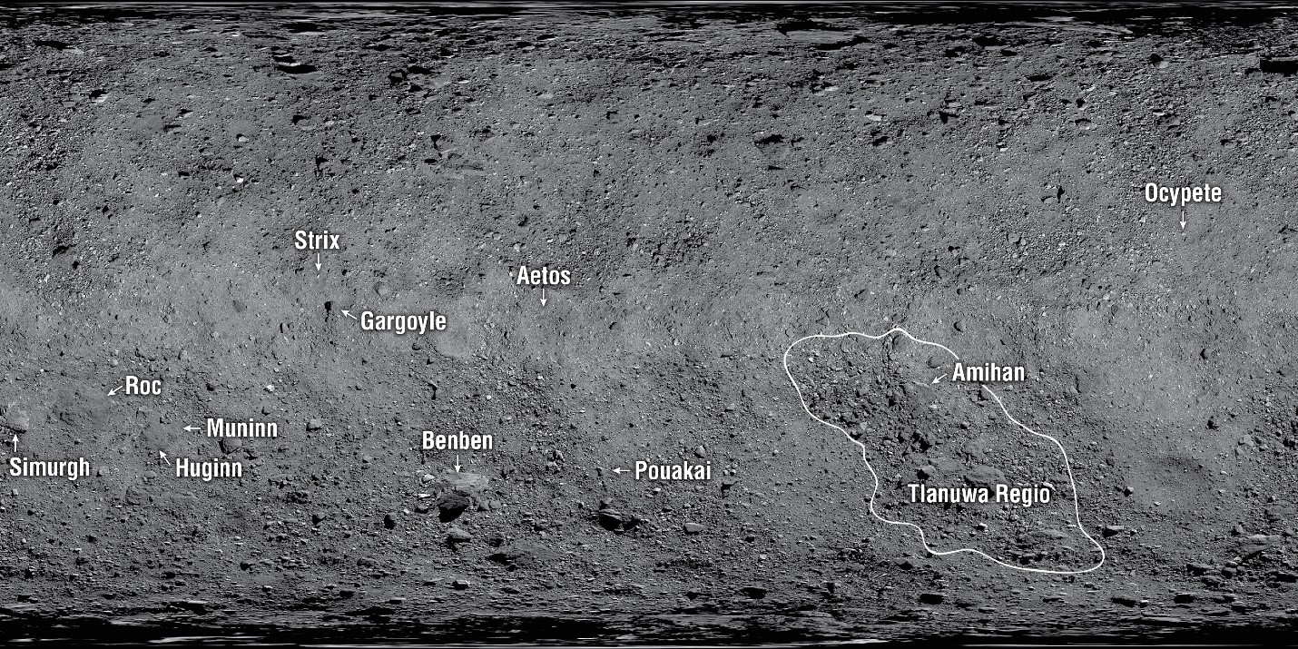
Late last summer, NASA and the International Astronomical Union’s Working Group for Planetary System Nomenclature (a.k.a WGPSN) approved the naming convention for features on Bennu, the asteroid currently being orbited and studied by the OSIRIS-Rex spacecraft. The naming theme chosen was “birds and bird-like creatures in mythology.”
The first twelve features thusly named have now been announced. But more importantly, some of these features will be instrumental in helping to guide OSIRIS-REx to the surface of the asteroid later this year.
“Since arriving at the asteroid, the OSIRIS-REx team has become incredibly familiar with all of the geological features on Bennu,” said Dante Lauretta, OSIRIS-REx principal investigator at the University of Arizona, Tucson. “These features are providing us with insight into Bennu’s history, and their new names symbolize the essence of the mission – studying the past to both discover our origins and understand our future.”

The surface of the spinning-top-shaped asteroid is proving to be much more treacherous than expected. For its small size — about one-third of a mile (half a kilometer) wide at its equator — Bennu has quite diverse terrain, including craters, ridges, and trenches. And all these regions seem to be blanketed by rocks and huge boulders. This is going to make collecting a sample from the surface much more challenging and the team has decided to change their original plans for how to perform the Touch-And-Go (TAG) sample collection event on Bennu.
The OSIRIS-REx team had originally planned to use a LIDAR system to navigate down to the asteroid’s surface. LIDAR is like radar, but it uses laser pulses rather than radio waves to measure distance. This system works well for a relatively hazard-free surface. Bennu is anything but that.
Mission planners were envisioning a touchdown site 164 ft (50 meters) in diameter, but the largest safe areas on Bennu are much smaller. The biggest site is just 52 ft (16 m) wide, or roughly 10% of the safe area envisioned. The team realized that they needed a more precise navigation technique that would allow the spacecraft to accurately target very small sites while dodging potential hazards.

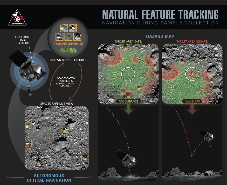
The new navigation method is called Natural Feature Tracking (NFT). NFT provides more extensive navigation capabilities than LIDAR, and is key for executing what the team is calling “Bullseye TAG,” which delivers the spacecraft to the much smaller sampling area. As an optical navigation technique, it requires the creation of a high-resolution image catalog onboard the spacecraft.
In observing the surface from orbit – and making close passes like the recent dip on March 3 – OSIRIS-REx has been precisely mapping the surface. They are now using the hazardous boulders much like signposts to help create a safe landing for sample collection.
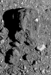
Giving names to features and landmarks on planetary bodies has become a tradition among scientists and engineers for space missions. But the naming helps the team to quickly orient themselves as they become familiar with the terrain. Plus, the names are more fun. Instead of calling Bennu’s largest boulder simply “Boulder 1” this big landmark is now dubbed Benben Saxum.
Benben Saxum and 11 other named features on the asteroid were approved by the International Astronomical Union (IAU), the internationally recognized authority for naming celestial bodies and their surface features. The names were proposed by NASA’s OSIRIS-REx team members.
You can see all the newly named features on the OSIRIS-REx website.
Find out how the names are chosen for surface features on various planetary bodies at the Gazetteer of Planetary Nomenclatures.

