Evidence of Mars’ watery past is written all over the surface of the planet. Between dried-up river valleys, outflow channels, and sedimentary deposits, it is clear that Mars was once a much different place. But until recently, the mystery of where this water went has remained unsolved. This changed in 2018 when data obtained by the ESA’s Mars Express probe indicated the existence of water beneath the south pole of the planet.
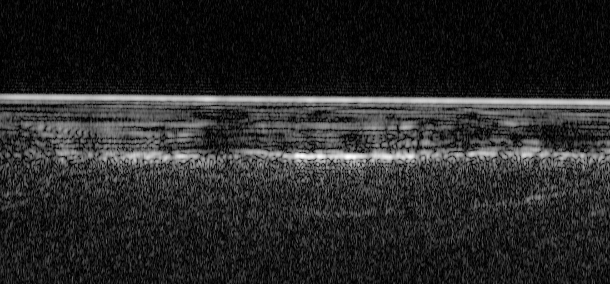
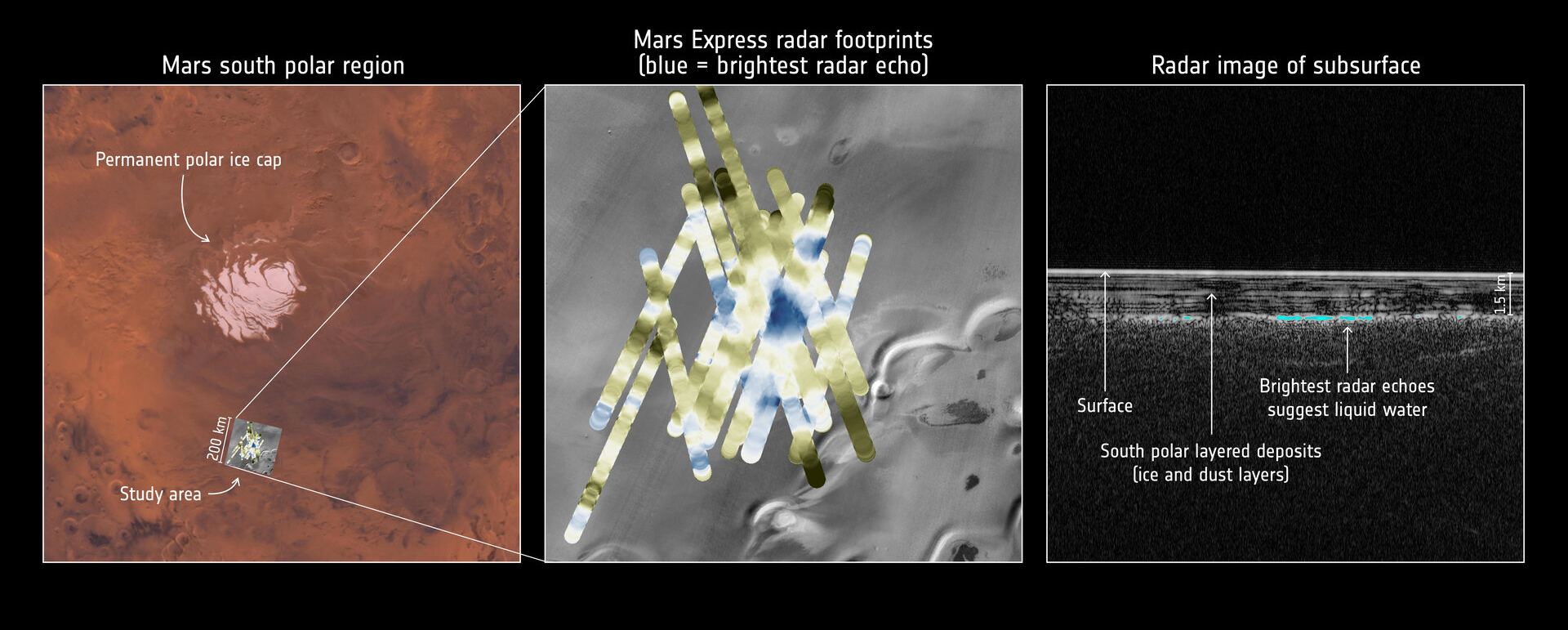
According to the Mars Express probe’s Mars Advanced Radar for Subsurface and Ionosphere Sounding (MARSIS), this body of water is in a 20 km (~12.5 mi) wide area about 1.5 km (~1 mi) beneath the surface. And now, further analysis of the data by a team led by the Roma Tre University has revealed the existence of three new ponds, the largest of which measures about 20 x 30 km (~12.5 x 18.5 mi) and is surrounded by many smaller ponds.
A research paper that describes the discovery was recently published in the journal Nature Astronomy. The study was led by Dr. Sebastian Emanuel Lauro (a researcher with the Dept. of Mathematics and Physics at the Roma Tre University) and included researchers from the University of Southern Queensland, Jacobs University Bremen, the Istituto Nazionale di Astrofisica (INAF), and the Italian National Research Council (CNR).

Based on decades worth of surface and atmospheric data, scientists have determined that over three billion years ago, Mars had standing bodies of water, rivers, and ocean an ocean that covered much of its northern hemisphere. Today, it is impossible for water to remain stable on the surface owing to the extremely thin atmosphere. However, there is considerable amounts of water frozen in its polar regions.
Furthermore, the radar investigation conducted by the Mars Express probe showed that beneath the southern polar ice cap, the subsurface is made of many layers of ice and dust down to a depth of about 1.5 km in the 200 km-wide area analyzed in this study. The MARSIS data also found a particularly bright radar reflection beneath the layered deposits that measured roughly 20 km (~12.5 mi) in area.
The techniques used to analyze the MARSIS radar data are similar to those used to investigate subglacial lakes in Antarctica, Canada, and Greenland. A good example is Lake Vostok, which is located beneath 4 km (mi) of ice in Antarctica. Since its discovery, scientists have speculated that this lake (and others like it) might harbor unique ecosystems, which makes them a useful analogy for astrobiologists how life can survive in extreme environments.
The latest analysis of this data indicated that there are at least more ponds in the 200 km (125 mi) region scanned by Mars Express, which the team believes are the kind of hypersaline perchlorate brines (aka. very salty water) that are known to form in the Martian polar region. These results open the possibility that an entire system of ancient salty lakes might exist underground that date back millions (or even billions) of years.
While they would be difficult to reach, these would be the ideal spots to search for evidence of present-day life on Mars. Much like the existence of liquid water on the surface, scientists speculate that the only place where life could still exist on Mars is underground, most likely in patches of briny water. The existence of life in subsurface ponds also raises ethical questions about humans living on Mars in the future.
Several proposals for establishing a permanent human presence on Mars depend upon the availability of subsurface aquifers. But if in fact these are home to simple life forms or entire biospheres, then harvesting the water would be an ecological disaster and tantamount to genocide, and could even harmful for human beings consuming it.
This, among other recent discoveries, highlights the need for more research on Mars before we attempt to send regular missions there.
Further Reading: ESA

