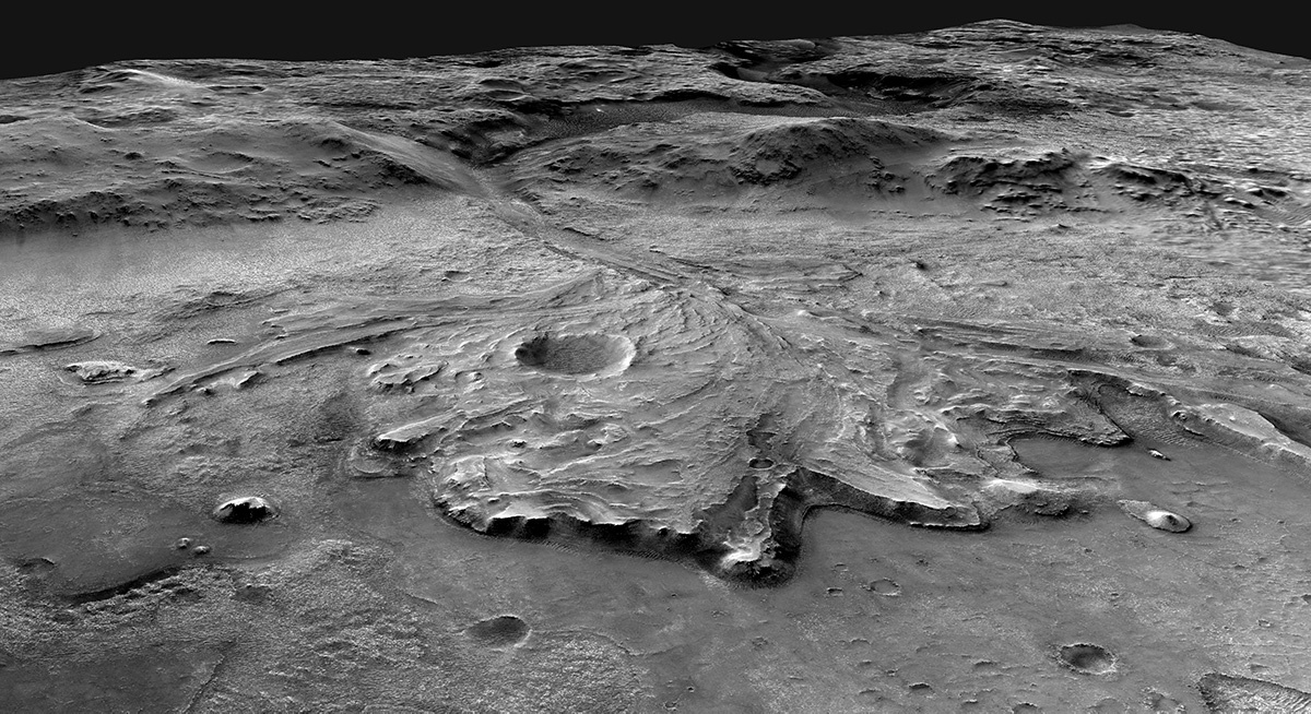
On February 18th, 2021, NASA’s Perseverance rover set down on the surface of Mars. During the next two years of its primary mission, the rover will search the Jezero crater (where it landed) for evidence of past life on Mars. This will consist of collecting soil and rock samples from the preserved delta feature that formed billions of years ago from sediments deposited by flowing water.
The question is, where should it look for this possible evidence? A possible route the rover will take during its primary mission is shown in a series of recent images provided by NASA and the US Geological Survey (USGS). As illustrated in the image below, this path would take it from the cliffs that form the edge of the delta, up and across its surface towards possible “shoreline” deposits, and up to the rim of the crater.

The Jezero crater was selected as a landing site for the Perseverance mission because scientists believe that the area was once flooded with water. It was one of sixty candidate locations considered by a panel made up of members of the mission team and scientists from around the world. After five years of study and examination of potential sites, Jezero was considered the most promising site.
This is because Jezero has several features that are believed to be the remains of ancient environments, ones that are thought to have been habitable at one time. Much like the Gale Crater, where the Curiosity rover (Persevrerance’s sister mission) landed in 2012, these features formed in the presence of water and therefore offer clues to Mars’ past, which was able to support flowing water periodically.
The base of the delta’s cliff, for example, defines the outer edge of where sediments were deposited by the river that flowed into the crater billions of years ago (at a time when Mars was significantly warmer and had abundant flowing water on its surface). The surface of the delta and possible shoreline are likely places to find fossilized bacteria, which the rover will leave in a cache for future retrieval.
Meanwhile, the crater rim – which measures 610 meters (2,000 feet) high – marks the boundary of the ancient lake and most likely retains indications of the lake’s elevation over time. Once it gets there, Perseverance will explore it and the surrounding plains to learn more about when the crater became a lakebed. It is also hoped that it will learn more about how and when the lake lost its water over time.

The path is several dozen kilometers long and would keep the rover occupied for the duration of its primary mission. For reference, the prominent crater nestled in the delta feature (near the center of the image) measures about 1 km (0.6 miles) in diameter. In the event of a mission extension – which, barring any problems, seems very likely – the mission controllers will start looking for another promising path to follow.
Like its predecessors, Perseverance could be exploring Mars for many years to come! But this mission will also conduct an unprecedented scientific operation, where the samples it collects will be returned to Earth by a separate ESA mission. This will allow scientists to analyze rocks and soil from Mars in Earth laboratories for decades to come.
Much like the Moon rocks returned by the Apollo astronauts, the study of these extraterrestrial materials will lead to breakthroughs in our understanding of how the rocky planets of our Solar System formed, and maybe even how life began on Earth (and possibly Mars as well). It promises to be an exciting time, that much is certain!
Further Reading: NASA

