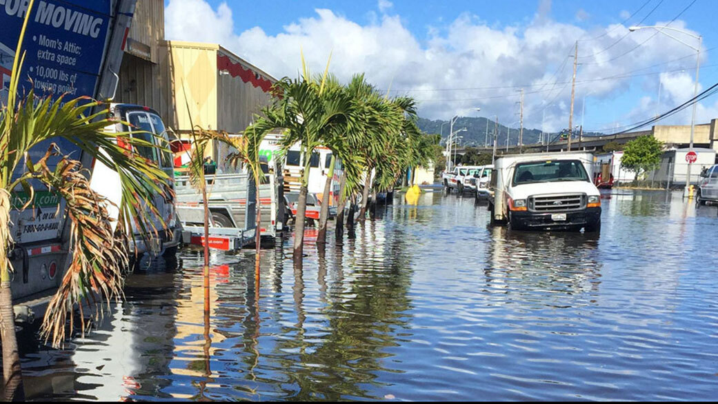
Planet Earth is currently experiencing an unprecedented warming trend. Average global temperatures are rising at an accelerated rate in response to greenhouse gas emissions produced by human activity. These rising temperatures, in turn, result in the release of additional greenhouse gases (like methane), leading to positive feedback loops that threaten to compound the problem further.
This scientific consensus is based on multiple lines of evidence, all of which indicate the need for swift action. According to new research led by members of the NASA Sea Level Change Science Team (N-SLCT) at the University of Hawaii at Manao (UHM), a new Lunar cycle that will begin by the mid-2030s will amplify sea levels already rising due to climate change. This will mean even more coastal flooding during high tides and coastal storms in the near future.
The study that describes their findings, titled “Rapid increases and extreme months in projections of United States high-tide flooding,” was published last month in Nature Climate Change. The research was led by Phil Thompson, an assistant professor at UHM’s Joint Institute for Marine and Atmospheric Research, and included members from UC San Diego’s Scripps Institution of Oceanography, the University of South Florida, NASA JPL, and the National Oceanic and Atmospheric Administration (NOAA).

Also known as “nuisance floods” (or sunny day floods), high tide floods (HTFs) are already a problem in many coastal cities around the world. These occur when tides reach anywhere from 0.5 to 0.6 m (1.75 to 2 ft) above the daily average for high tides, leading to flooded shorelines, streets, storm drains, and basements in coastal communities. According to reports by the NOAA, more than 600 of these floods occurred in 2019 alone.
Similar reports indicated that between May 2020 and April 2021, coastal communities in the US saw twice as many HTFs as they did in 2000. In addition, 14 locations along the Southeast Atlantic and Gulf coastlines tied or broke their records for the number of HTF days by a factor of 4 to 11 over what they experienced in 2000, and the number of HTF events is now accelerating at 80% of NOAA water level stations along the East and Gulf Coasts.
According to this recent study, the situation is going to become more severe by the mid-2030s and after. At that point, the position and alignment of the Earth, Moon, and Sun will result in the Moon exerting an increased gravitational influence on Earth’s oceans. This will result in high tides exceeding the known flooding thresholds in the US more often, not to mention floods occurring in clusters that could last for a month or longer.
The reason the Moon’s gravitational pull will exacerbate sea level rise has to do with the plane of the Moon’s orbit, which gradually rotates over the course of 18.6 years. Earth’s regular daily tides are suppressed during half of this cycle where high tides are lower and low tides are higher than the average. In the other half, the tides are amplified, with the high ones getting higher and the low ones getting lower.
For the sake of their study, the research team studied data from 89 tide gauge locations in every coastal U.S. state and territory (except for Alaska) and combined them with the NOAA’s sea-level rise scenarios, flooding thresholds, and how often they are exceeded annually. They also considered statistical representations for various meteorological cycles (i.e., El Niño events) and astronomical cycles.
As Thompson pointed out in a NASA press release, HTFs tend to be viewed as less of a problem when compared to hurricane storm surges, which push high tides much higher. “It’s the accumulated effect over time that will have an impact,” he said. “But if it floods 10 or 15 times a month, a business can’t keep operating with its parking lot under water. People lose their jobs because they can’t get to work. Seeping cesspools become a public health issue.”
In fact, the study shows that the combination of climate change and the Moon’s gravitational pull may mean that coastal communities along the US mainland, Hawaii, and Guam could be dealing with floods every day or two. Like in Alaska, only far northern coastlines will be spared for another decade or so because coastlines in these areas are rising due to long-term geological processes. As NASA Administrator Bill Nelson described in a recent NASA press release:
“Low-lying areas near sea level are increasingly at risk and suffering due to the increased flooding, and it will only get worse. The combination of the Moon’s gravitational pull, rising sea levels, and climate change will continue to exacerbate coastal flooding on our coastlines and across the world. NASA’s Sea Level Change Team is providing crucial information so that we can plan, protect, and prevent damage to the environment and people’s livelihoods affected by flooding.”
This model is the first to take into account all known oceanic and astronomical causes of floods, and the results are projected to 2080. It’s also an improvement on the high-tide flood tool (also developed by Thomson) that is available on the NASA team’s sea level portal. This tool, which is a resource for decision-makers and the general public, will be updated in the near future to incorporate the findings of this study.
Ben Hamlington, a researcher with NASA’s Jet Propulsion Laboratory (JPL) and a co-author on the paper, is also the leader of NASA’s Sea Level Change Team. As he indicated, the findings of the new study will be a vital resource for coastal urban planners in the coming years since they will need to prepare for extreme weather events in addition to more flooding.
“From a planning perspective, it’s important to know when we’ll see an increase,” he said. “Understanding that all your events are clustered in a particular month, or you might have more severe flooding in the second half of a year than the first – that’s useful information.”
Further Reading: NASA, Nature Climate Change

