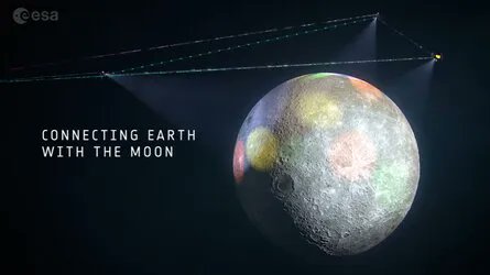
GPS and the world’s other global positioning systems all have one very limiting disadvantage: they’re global to only one world. There is no equivalent to the precise geolocation features these systems offer for any other body in our solar system. Recently, there has been an increased focus on Lunar missions, but no way for anything on the Lunar surface to know precisely where it is. Enter the European Space Agency and their Moonlight initiative, which was showcased in a recent video on their YouTube channel.
The Moonlight Initiative is ESA’s plan to put a series of satellites into orbit around the Moon that will serve two purposes: pinpoint geolocation on the surface of the Moon and high-speed data transmission back to Earth. Specifically, these services will be targeted at one particular location: the lunar south pole.
Most plans for a permanent human presence on the Moon also revolve around the south pole, primarily for two reasons. First, at least part of it is almost always in daylight, so it doesn’t suffer from the two-week-long periods of no sunlight that can drain a settlement’s batteries. Second, it has extant ice on the surface, which can be used as a water supply.
Credit – ESA YouTube Channel
Having a particular location, like the south pole, will allow the Moonlight Initiative to get by with fewer satellites than would be necessary to provide location and general data at every point on the lunar surface. ESA estimates it will require between 3-4 satellites in highly eccentric orbits focused on the south pole.
Those satellites will link back up with three dedicated ground stations located back on Earth. Each will be located so that the satellites around the Moon will never be locked out of the network, no matter which side of the Earth is facing it.
In addition, all vehicles planned for operation on the lunar surface can be designed to interface with the network. It can also act as a mesh system, allowing a rover or other mobile vehicle to transmit back to the network through a base station, such as one attached to a lander. According to some graphics provided as part of the video, the data network might even extend to other orbital platforms, such as the Lunar Gateway.
All of this infrastructure, while necessary, is still a long way off. According to a disclaimer near the end of the video, “Moonlight’s satellite numbers, size, and design are currently being defined,” which is undoubtedly a long way off from being finalized, let alone ready for launch. But they do have some time.
Artemis, NASA’s flagship lunar exploration program, isn’t planned until 2025 at the earliest, but given the system’s travails, it might take even longer. Ultimately, the goal of that program is a permanent human presence on the lunar surface; there will be plenty of time, even after the initial landing, to provide this vital service.
ESA plans to coordinate with a series of commercial partners to provide that service. Theoretically, if there is enough interest in a lunar base, the entire Moonlight Initiative could eventually be privatized and become part of the commercial infrastructure of humanity’s expansion into space. But for now, that is just speculation, and while the video is impressive, there is still a lot of work to do before there are any positioning or data services on the Moon to speak of.
Learn More:
ESA – What is ESA’s Moonlight initiative?
UT – Here’s The Exact Point of the Moon’s South Pole
UT – Five Rover Teams Chosen to Help Explore the Moon’s South Pole
UT – Why Is The Moon’s South Pole So Important? It’s All About Water
Lead Image:
Depiction of the network connection over the Moon that Moonlight will initiate.
Credit – ESA

