Looking for a picture of Earth from Space? Here is a collection.
[/caption]
Here’s a spectacular image of the earth with the full coverage of the Pacific Ocean. This image was obtained by the Galileo spacecraft on December 12, 1990 while on its way to planet Jupiter 1.6 million miles from the Earth.
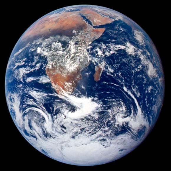
This is a spectacular full view of our planet earth. It was taken by the Apollo 17 during their journey to the moon in December 7, 1972. The south polar ice cap of Antarctica can be clearly seen in the image. This region constitutes 70% of the world’s freshwater. This photo of the earth was the first to feature the south polar ice cap.
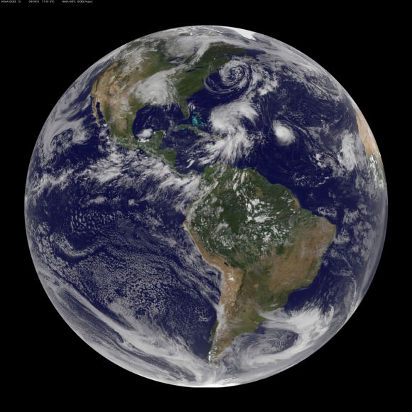
Here’s an image of different storms and hurricanes forming at the Atlantic Ocean. This image was generated using the data provided by the Geostationary Operational Environmental Satellite (GOES) satellite on September 3, 2008.
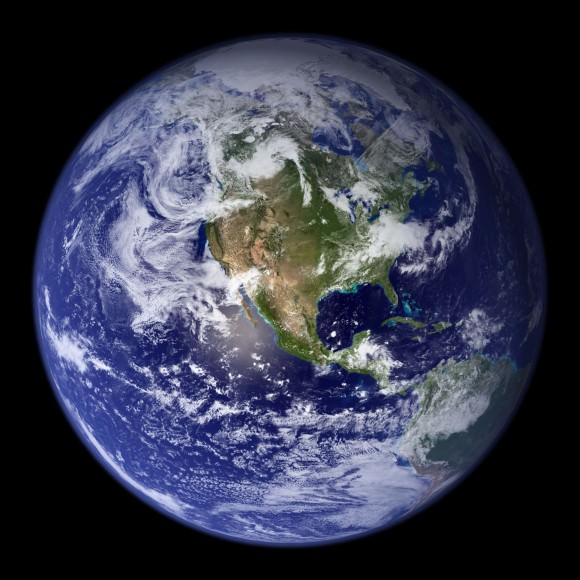
Here’s a nice view of the earth particularly focusing on the Western Hemisphere. Earth is the third planet from the sun and is the only place in the universe where life is known to exist.
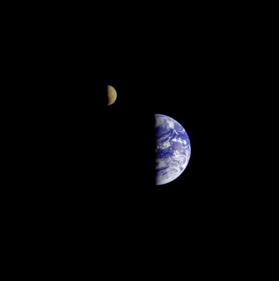
This is a nice view of the planet earth and the moon in one frame as seen from the Galileo spacecraft 6.2 million kilometers away.
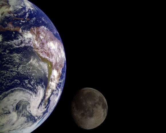
Here’s a picture of Earth from Space as well as the Moon. These images were taken separately and then stitched together on computer to show them together.
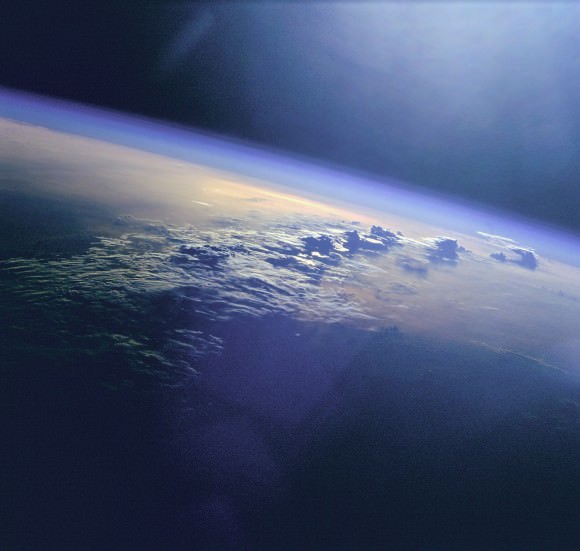
This picture was taken by the Space Shuttle, and shows the Earth from high orbit. You can see how the clouds rise up into the atmosphere.
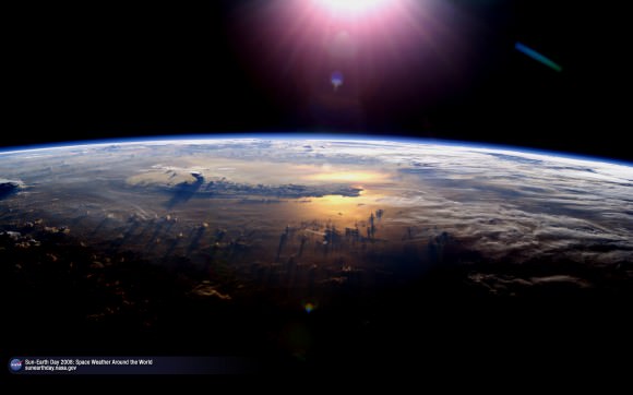
Here’s another picture of Earth. Again, this was taken from the space shuttle.
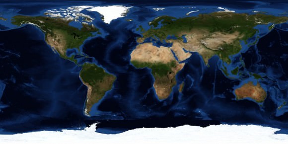
This is a satellite map that shows all of the Earth.
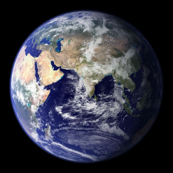
This is the classic “Blue Marble” photo of Earth.
Earth from Space at Night
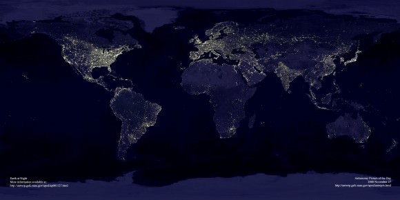
Here’s a photo of the entire Earth, seen from space at night. You can easily see cities and towns in North America, Asia and Europe. And you can also see vast regions of the Earth which are totally dark.
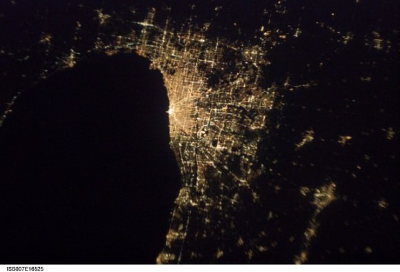
Here’s a photo of the city of Chicago at night. It might look upside down, but that’s because it was captured from the International Space Station as it was passing over the city.
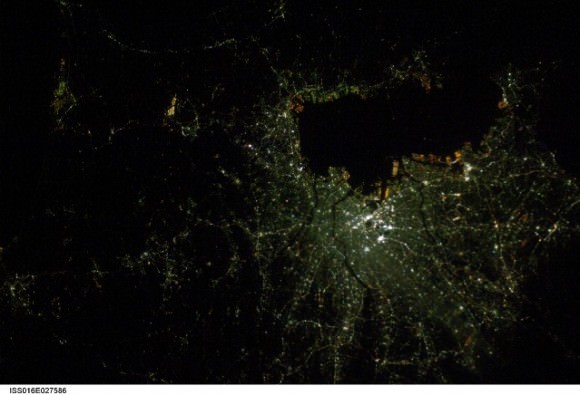
This night space image shows the city of Tokyo at night. The blue green glow in the photograph comes from the mercury vapor lighting that lines the streets of the city.
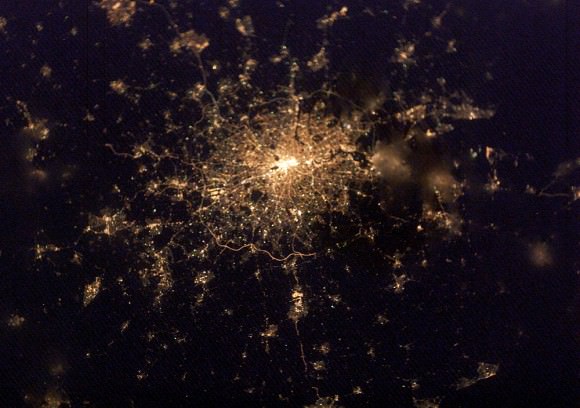
This space pic from night shows the city of London. You can see the brightest areas are the most densely populated, and the less dense areas are dimmer. You can see the ring road that surrounds London, as well as the path of the Thames river.
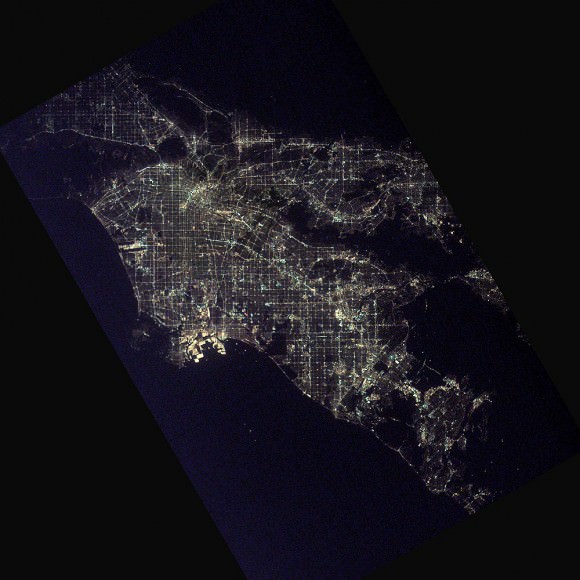
Here’s one of the brightest cities in the world. It’s Los Angeles from space, seen at night.
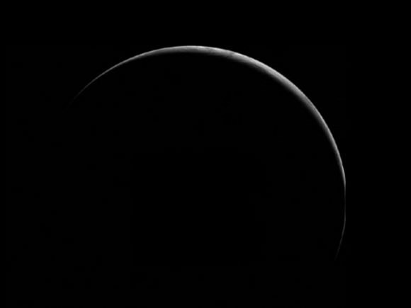
Here’s an amazing picture of the earth in crescent. This breathtaking view of our planet was obtained by the Geostationary Operational Environmental Satellite (GOES-8) on June 22, 1996. GOES is primarily assigned in monitoring the weather particularly the development of storms and hurricanes in different parts of the earth.
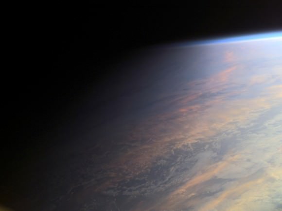
This is an amazing still photo of the earth taken during its transition from day to night. This beautiful photo was taken from the International Space Station in June 2001.
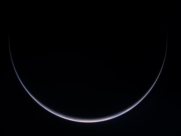
This spectacular image of the crescent earth was captured by the Optical Spectroscopic and Infrared Remote Imaging System (OSIRIS) camera on board the Rosetta spacecraft in November 2007.
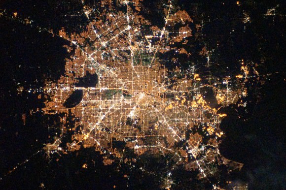
Here’s a nice view of Houston, Texas at night as seen from the International Space Station on February 28, 2010. This photo was taken by the crew member of the Expedition 22 mission. Houston, Texas is the world’s energy capital.
Earth from Orbit

Here’s an image of the Manicougan Reservoir situated at Canadian Shield in the province of Quebec. This was taken from the International Space Station in December 1983. Manicougan Reservoir covers an area of about 1,942 km².
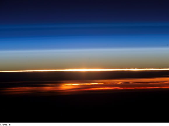
This image of the sunset on earth was captured from the International Space Station by an Expedition 13 astronaut in August 10, 2006. Expedition 13 mission was able to accomplish a total of 2,886 orbits.
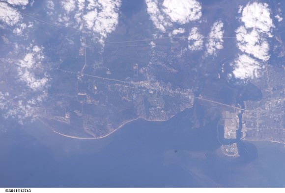
This photo shows the Central Gulf Coast obtained from the International Space Station by an Expedition 11 astronaut in September 10, 2005.
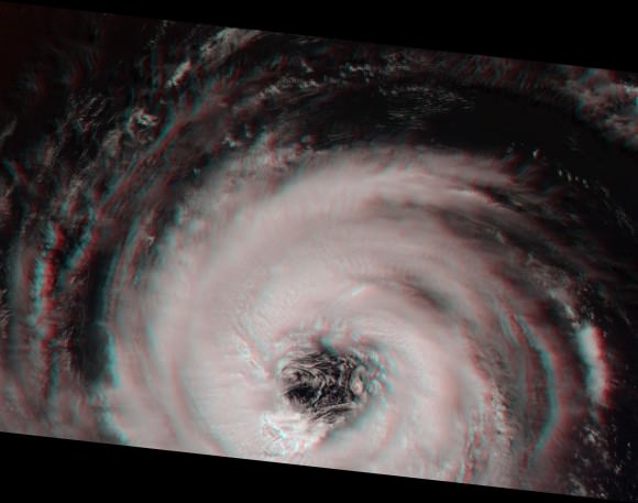
This is a photo of the eye of Hurricane Alberto taken in August 19, 2000 during the Terra orbit 3571. Hurricane Alberto is a Category 3 hurricane in the Atlantic that lasted for 19.75 days.
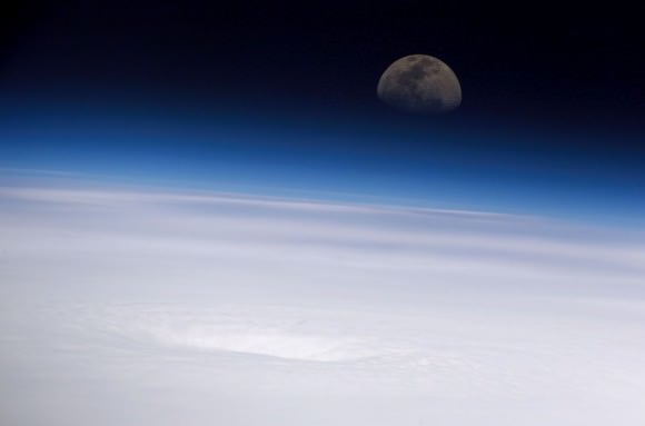
This beautiful view of the eye of Hurricane Emily and the moon was captured from the International Space Station in July 16, 2005. Hurricane Emily is a Category 5 hurricane having a maximum wind speed of 160 mph.
Earth from the Space Shuttle
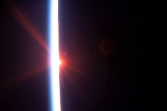
This photo of the earth’s atmosphere during sunrise was taken in July 2005 by a Discovery crew member during the STS-114 mission. STS-114 mission was the first Return to Flight mission after the unfortunate loss of the Columbia space shuttle.
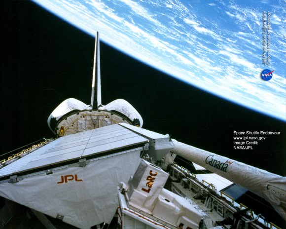
This image of the earth was taken from the space shuttle Endeavor during the STS-59 mission in April 12, 1994. The image particularly shows the shuttle’s payload bay and the region of the Andes Mountains in Bolivia.
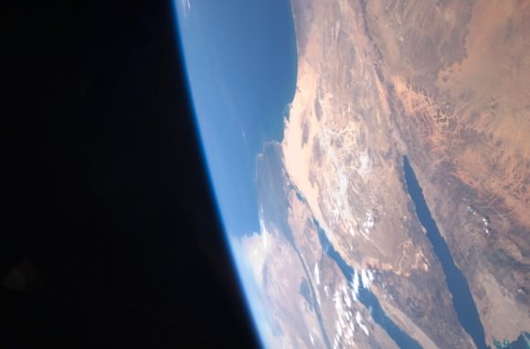
Here’s a stunning image of the Sinai Peninsula and the Mediterranean Sea as seen from the space shuttle Atlantis. A crew member of the STS-125 mission took this photo during the mission’s first flight in space.
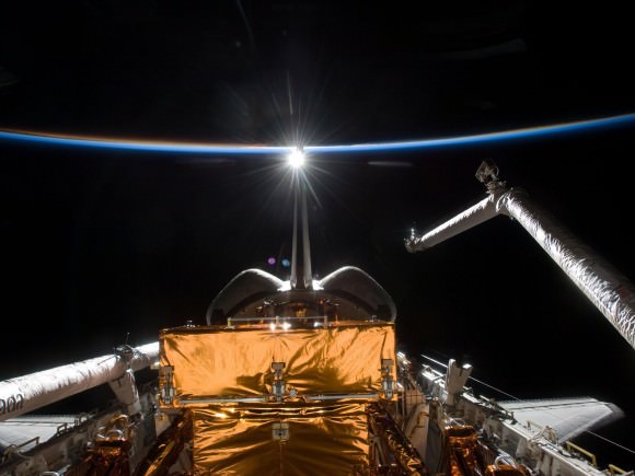
Here’s a unique photo of the earth’s atmosphere taken by the crew members of Atlantis’ STS-125 mission during its preparation for landing on May 20, 2009.
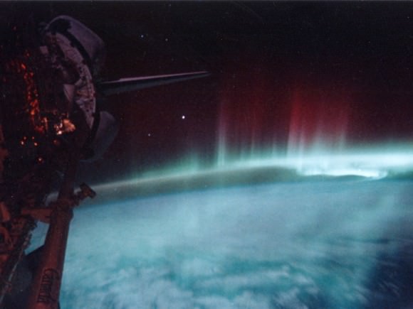
Here’s a great view of the Aurora Australis taken in May 1991 by the STS-39 crew member onboard the space shuttle.
We have written many articles about pictures of Earth from Space for Universe Today. Here’s a story about the Earth from space at night, and here’s an article about images of cities from space.
You can get many more images of Earth from space at NASA’s Earth Observatory website.
We have recorded a whole episode of Astronomy Cast about our planet. Listen to it here, Episode 51: Earth.

