[/caption]
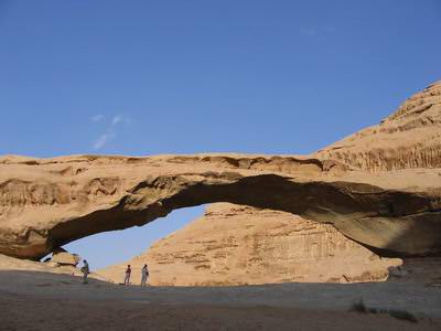
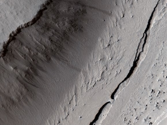
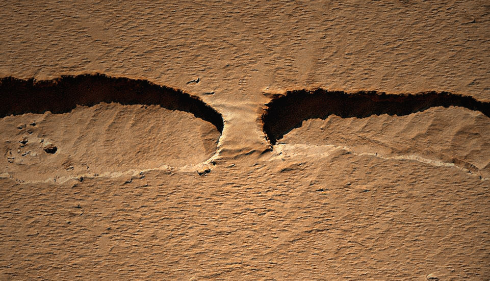
The HiRISE camera on the Mars Reconnaissance Orbiter took an image of a thin channel, and a portion of it contains a naturally occurring bridge over the chasm. Kelly Kolb from the HiRISE team says it is probably a remnant of the original surface, the rest of which has collapsed downward. It isn’t likely there’s a opening underneath the formation, but if there were, it would look very similar to a rock bridge formation found in Jordan in the Wadi Rum, the Valley of the Moon. See an image below.
Kolb also said this is unlikely to be a channel formed by a running water, as there are no obvious source or deposit regions. The channel is probably a just a collapse feature.
And see the full HiRISE image of the thin channel, found in Mars northern hemisphere between some “knobs” called Tartarus Colles, below.


For more information about this image on Mars, see the HiRISE website.


The mention of rock bridges brought back memories of such formations in the hilly southeast region of Ohio. Streams had eroded many features into the soft sandstone including several natural rock bridges. The largest, Rockbridge Natural Bridge, is over 100ft long and spans 50ft across a ravine. At ~15ft in width, it was relatively easy to walk across the full length: http://www.hockinghills.com/rock_bridge.html
While not the largest example in the states, it is still an impressive sight to see ‘up close’.
Looks like Martian footprints!
Whoa! An intriguing image! Mars is so different… yet~
Oh come on! This surely was taken somewhere is Arizona?
If you look really carefully you can see footprints where Tars Tarkas chased Deja Thoris under the bridge!
@ Malcolm
Really Hilarious ! (Made me laugh)
Edgar Rice Burroughs probably has a broad smile on his face!
Which leads to the question, what collaped exactly?
Since channel parallels the ridge right next to it, it looks more like a fissure between two massive plates?
davesmith_au, good question. Usually it is lava tubes. I’ve google hunted the hills of Tartarus Colles into the Diacria quadrangle, which is a map area “at the northwestern edge of the Tharsis volcanic plateau” (by the Mons’es).
[And that is all the energy I have for that quest at the moment: my nose is in my first coffee for today. :-o]
My perception of the closeup was 2 plateaus… then I got the perception write. funny how suggestion can alter perception.
As far as why it collapsed, lava flows, but could it also have been sinkhole phenomenon?
sorry I hit enter..
But I was thinking sinkholes especially if Mars was at point heavily watered, the underground reservoirs could have been percolated and evaporated over time with the elimination of the protective atmosphere?
jeez…right instead of write….wow.
Any explanation why the “bridge” should be smoother than the ground either side or below in the channel?
@Skoyles: wind? Perhaps wind is being channeled in the channel and picking up speed as it goes over the bridge…?
Seems strange that only a small part of the channel would remain intact while long stretches on either side collapsed. I guess different rock structure there.