[/caption]
“I enjoy seeing our rover again,“ says Steve Squyres in an exclusive for Universe Today. Squyres is the top scientist for the Opportunity and Spirit Mars rovers.
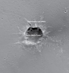
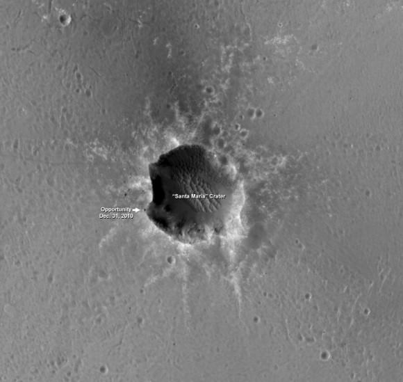
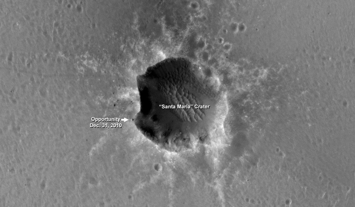
NASA’s Opportunity rover was just been photographed from Mars Orbit while perched at the precipice of Santa Maria crater – just meters away from the edge of the Southwest rim. The photo was taken on New Year’s Eve, Dec. 31, 2010 on Sol 2466 of the mission which has lasted nearly 7 years ! Opportunity landed on Mars on Jan. 24, 2004.
This newly released photo was taken by the high resolution HiRISE camera circling overhead in Mars orbit aboard NASA’s Mars Reconnaissance Orbiter (MRO).
“Well, it’s always great to see images like that,” Steve Squyres just informed me after seeing the new photos of Opportunity. Squyres, of Cornell University, is the Principal Scientific Investigator for NASA’s Spirit and Opportunity Mars rovers.
“This one reminds me a lot of the first time we ever saw a rover from orbit, just after Opportunity had arrived at the rim of Victoria crater. It’s a very evocative scene, and it’s hard not to project certain things onto the rover (“valiant”, “lonely”) when you see it. Mostly, though, I just enjoy seeing our rover again.”
“The last time I laid eyes on Opportunity was about seven and a half years ago, and it’s nice getting another glimpse of her,” said Squyres.

Opportunity arrived at the western rim of Santa Maria on Dec. 16 (Sol 2451) after a long and arduous trek of some 19 km since departing from Victoria Crater over 2 years ago in September 2008.
The rover has been exploring around the western portion of Santa Maria crater since arriving and is now heading to the southeast rim which possesses deposits of hydrated minerals.
Opportunity drove some 40 meters south along the steep rim from the initial location at “Palos” Promontory and then bumped incrementally further up to the edge on Sol 2464 at a place dubbed “Wanahani”.
The rover was photographed from Mars orbit while perched at “Wanahani” on New Years Eve, Dec 31, 2010 on Sol 2466.
“We are driving the vehicle in a counterclockwise direction around Santa Maria to reach the very interesting hydrated sulfates on the other side,” according to Ray Arvidson, the deputy principal investigator for the rovers, in an interview from Washington University in St. Louis. “We’ll make 3 stops or more depending on what we see”
Simultaneously to being photographed from orbit, the rover itself was of course merrily snapping a ground level view of Santa Maria. To experience the surface eye view from Opportunity, see our photo mosaic – stitched from the raw images – to display the rovers panoramic perspective whilst gazing outwards from “Wanahani” to the cliffs of Santa Maria on Sols 2464 and 2466.

Wanahani outlook at Santa Maria Crater. Opportunity took this panaromic mosaic from “Wanhani” just meters from the crater rim on Dec 29, 2010 (Sol 2464). Note rover tracks near rim at left, relatively clean solar panel at right and numerous ejecta rocks. The rim is inclined roughly 5 degrees here. CRISM mapper results suggest water bearing materials are located at the southeastern edge of the crater rim, nicknamed “Yuma”. Portions of distant Endeavour Crater are faintly visible as bumps on the horizon in the background. Mosaic Credit: NASA/JPL/Cornell, Ken Kremer, Marco Di Lorenzo
“Opportunity is imaging the crater interior to better understand the geometry of rock layers as a means of defining the stratigraphy and the impact process, says Matt Golembek, Mars Exploration Program Landing Site Scientist at the Jet Propulsion Laboratory (JPL), Pasadena, Calif.
Santa Maria is a relatively young, 90 meter-diameter impact crater (note blocks of ejecta around the crater), but old enough to collect sand dunes in its interior.
Santa Maria Crater, located in Meridiani Planum, is about 6 kilometers from the rim of Endeavour Crater, which contains spectral indications of phyllosilicates, or clay bearing minerals that are believed to have formed in wet conditions that could have been more habitable than the later acidic conditions in which the sulfates Opportunity has been exploring formed.
Data from the CRISM mineral mapper aboard MRO data show indications of hydrated sulfates on the Southeast edge of the Santa Maria Crater at which Opportunity is planning on spending the upcoming solar conjunction. After that, Opportunity will traverse to the Northwest rim of Endeavour Crater, aided tremendously by HiRISE images like the one here for navigation and targeting interesting smaller craters along the way.


I would so love to see a robotic drilling rig descend into that crater and do a sampling core near the dunes…