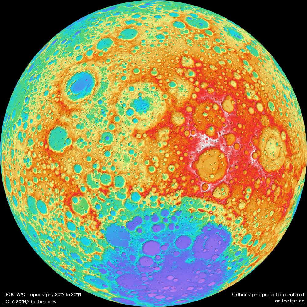

Lunar Reconnaissance Orbiter Wide Angle Camera color shaded relief of the lunar farside (NASA/GSFC/DLR/Arizona State University).
[/caption]
You’re looking at a brand new view of the lunar farside, as never seen before. The team from the Lunar Reconnaissance Orbiter has released the first version of a topographic map of nearly the entire Moon, from data from the Wide Angle Camera (WAC) on the spacecraft.
“This amazing map shows you the ups and downs over nearly the entire Moon, at a scale of 100 meters across the surface, and 20 meters or better vertically,” said principal investigator Mark Robinson, writing on the LROC website. “Despite the diminutive size of the WAC (it fits in the palm of one’s hand), it images nearly the entire Moon every month.”
Every month? So why is this a “new” map since LRO has been in lunar orbit since mid-2009?
Robinson said that each month the Moon’s lighting changes, so the WAC methodically builds up a record of how different rocks reflect light under different conditions, and adds to the LROC library of stereo observations.
“The WAC really is the little camera that could!” Robinson said.
It is very similar to the MARCI camera (Mars Color Imager) on the Mars Reconnaissance Orbiter, another wide-angle, low-resolution camera specially built for orbital observations; both cameras were built by Malin Space Science Systems.
Topographic maps provide a detailed and accurate graphic representation of natural features on the ground, and Robinson this new map of the Moon will help both lunar scientists and future explorers on the Moon.
Combing data from the WAC along with the LRO Lunar Orbiter Laser Altimeter (LOLA), the scientists are able to provide a topographic map of nearly the entire Moon. Due to persistent shadows near the poles it is not possible to create a complete WAC stereo map at the very highest latitudes, but LOLA provides a very high resolution topographic model of the poles.
How is a digital topographic map created from stereo images? The WAC stereo images were compared one against another by pattern-matching a moving box of pixels until the best fit was found between two images with different viewing angles. The new topographic model was constructed from 69,000 WAC stereo models.
Robinson and his team are already looking towards improvements they can make with subsequent versions of their topographic maps.
“The current model incorporates the first year of stereo imaging, and there is another year of data that can be added to the solution,” he said. “These additional stereo images will not only improve the sharpness (resolution) of the model but also fill in very small gaps that exist in the current map. The LROC team has made small improvements to the camera distortion model, and the LOLA team has improved our knowledge of the spacecraft position over time. These next generation steps will further improve the accuracy of Version 2 of the LROC GLD100 topographic model of the Moon.”
You can see the “zoomable” full resolution versions of the new map for both the far and near side at this link.
Source: LROC website
Some exoplanets have characteristics totally alien to our Solar System. Hot Jupiters are one such…
Stars form in Giant Molecular Clouds (GMCs), vast clouds of mostly hydrogen that can span…
Let’s dive into one of those cosmic curiosities that's bound to blow your mind: how…
The majority of the universe remains unmapped, but we have a potential window into it…
NASA engineers are pressing ahead with preparations for the Artemis II mission unless someone tells…
It’s not uncommon for space missions to be tested here on planet Earth. With the…