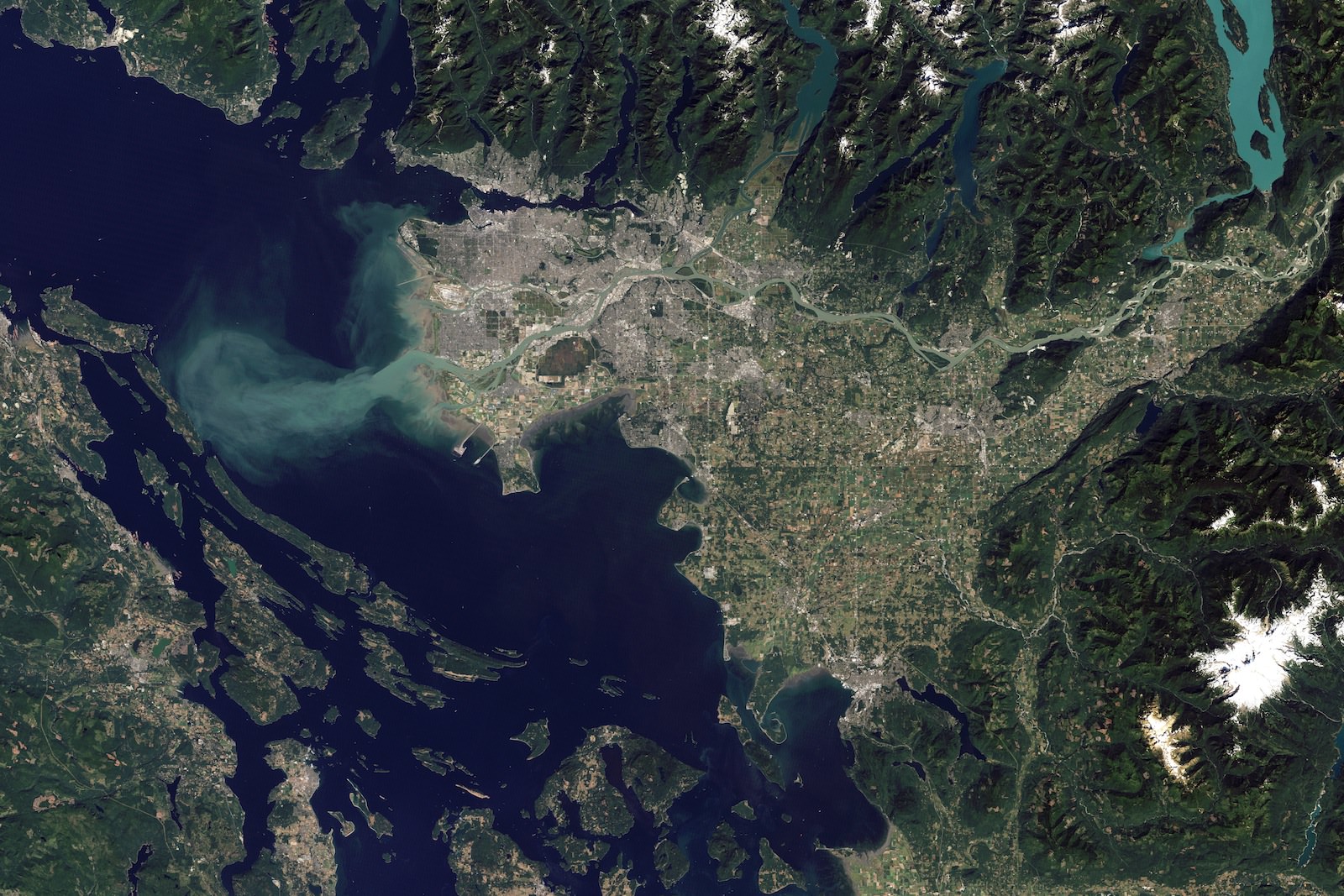
[/caption]
I just had to post this satellite photograph of Vancouver with the sediment plume streaming out of the Fraser River. Not just because it’s beautiful, which it is, but also because so much of my life is tied together with that city and river.
I was born in Vancouver, and spent half my time there and half my time over on Vancouver Island which is on the left-hand side of this image. I currently live on Vancouver Island, but I have to commute to Vancouver quite a bit, which involves taking a ferry ride across the Straight of Georgia. When you take the route that carries you from Nanaimo (on the island) over to Tsawassen (the ferry terminal that juts out), you have to cross this plume.
Where you see the plume depends on the tides and the amount of material flowing out of the Fraser River, but it’s a stunning sight to see. It’s like the water has been separated into two different colors, with a very distinct dividing line between them.
You can see the line from a few kilometers away standing on the ferry deck, and then it approaches and widens, and then you cross it. The water switches from deep blue to muddy brown with almost no blending in between. Even the shape of the waves in the plume is different.
Anyway, cool image, thanks to NASA’s Earth Observatory.


So is that why your name is Fraser? 🙂
I think they named the river after him. LOL
I’m named after my grandfather, who was named after the river… so, in a round about way, I’m named after the river.
And the river was named after the explorer Simon Fraser who descended it! So really you’re named after him 😉
Great piece. While approaching Vancouver Airport on a gorgeous sunny day, the United Airlines pilot announced “Ladies and Gentlemen, the real Jewel Of the Pacific”. For those not familiar with the Vancouver area, the ferry terminal is at the end of the southern most of the two very long causeways that you can see south of the Fraser River plume. The northern one is a commercial shipping terminal. Just a few kilometers to the south of the ferry terminal you’ll see a small jut of land, about half of which is on the southern side of the 49th parallel and therefore in the United States, replete with Customs and Immigration.
Nice, I’ve lived in Vancouver since ’87. Even though it rains all the time and there is a lot of light pollution I love it here! 🙂 Cool satellite image
Nice personal touch article!
I’m a big fan of NASA, ISS, Fraser, and Vancouver, and I hope this isn’t misunderstood as a negative post, but, unless a photo from the ISS is regarding a current item of interest such as volcanic activity, weather, or night shots, Google Earth usually offers a *much* higher resolution to J. Citizen, including for the area depicted in this article’s image!
Sometimes we forget the amazing astronomy related tools we have at our disposal.
Vancouver and Vancouver Island are a beautiful part of the world. I have family in Birch Bay, WA which is right across the Canadian border, and grew up in Seattle, so I’ve had the good fortune to spend significant time in the area. Thanks for sharing this Fraser!