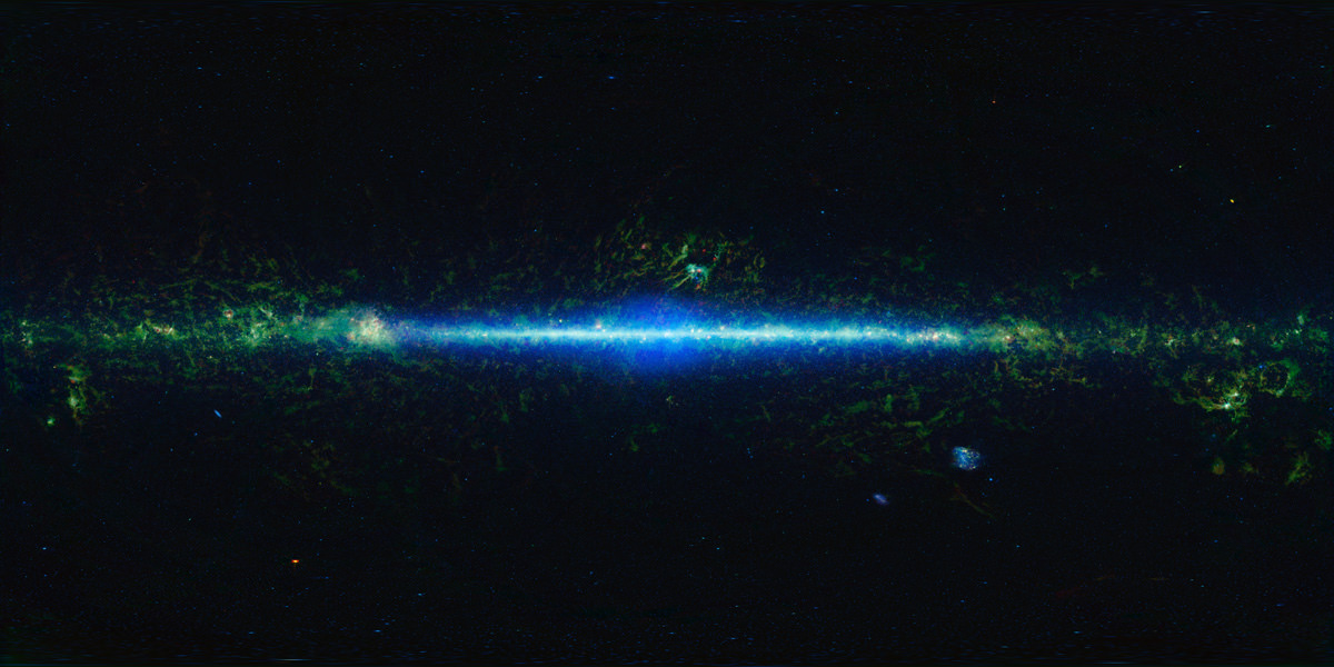
[/caption]
Love all the great things you can see in infrared? Then zoom on into the big view of the entire sky from the Wide-field Infrared Survey Explorer (WISE) mission. WISE has collected more than 15 trillion bytes of data with 2.7 million images of the sky at infrared light. It’s captured everything from nearby asteroids to distant galaxies, finding “Y-dwarfs,” a Trojan asteroid sharing Earth’s orbit, and stars and galaxies that had never been seen before, as well as showing astronomers that there are significantly fewer mid-size asteroids than previously thought.
Today NASA released a new atlas and catalog of the entire sky in infrared, and now even more discoveries are expected since anyone can have access to the whole sky as seen by the spacecraft.
“With the release of the all-sky catalog and atlas, WISE joins the pantheon of great sky surveys that have led to many remarkable discoveries about the universe,” said Roc Cutri, who leads the WISE data processing and archiving effort at the Infrared and Processing Analysis Center at the California Institute of Technology in Pasadena. “It will be exciting and rewarding to see the innovative ways the science and educational communities will use WISE in their studies now that they have the data at their fingertips.”
Thanks to John Williams at Starry Critters, you can now zoom into WISE’s entire map of the infrared sky. John notes some interesting things in the image: “The bright swath across the center is the Milky Way Galaxy; our home galaxy. The view is toward the center of the galaxy with the spiral arms stretching to the edges. Some artifacts were left in such as bright red spots off the plane of the galaxy. These are Saturn, Jupiter and Mars.”
An introduction and quick guide to accessing the WISE all-sky archive for astronomers is online at: http://wise2.ipac.caltech.edu/docs/release/allsky/
Click here for a collection of WISE images released to date.


Where’s the zoomable image? This one isn’t very high resolution.
You might want to look here:
Did you two read the article? “Thanks to John Williams at Starry Critters, you can now zoom into WISE’s entire map of the infrared sky.
Nancy, perhaps Ernie has in mind something like the Spitzer zoomable images which essentially let you explore the entire data set. The WISE image is available in two zoomable versions (Aitoff and rectangular), but both are quite low resolution (comparable to IRAS from about 30 years ago but without the cooler dust.)
It would be great if there was a zoomable version that had a bit more of their full dataset (which granted is huge).
Indeed, “quite low resolution”, that’s my problem, too.
Why, O why does everyone persist upon creating rectangular images from spherical ones? At least do the oval thing where proportions toward the poles are bit more realistic.
It looks like a Mollweide projection to me and from what I can tell it is more realistic towards the poles, with regard to surface area at least.
If you go to the WISE allsky image you do see this projection, where the oval is a slightly different shade. You also get some script indicating what you are looking at.
LC
http://wise.ssl.berkeley.edu/gallery_images/WISE2012-003-packaged.jpg
Ah, yes, that’s better. Thanks. I know that there’s still distortion . . . but at least it’s a bit less.
Sorry, some intelligent script destroyed my comment. Next try: http://wise.ssl.berkeley.edu/gallery_thesky.html
Well, I don’t know how to handle this. I give up.