NASAs First Orion Capsule and New Space Operations Center Unveiled

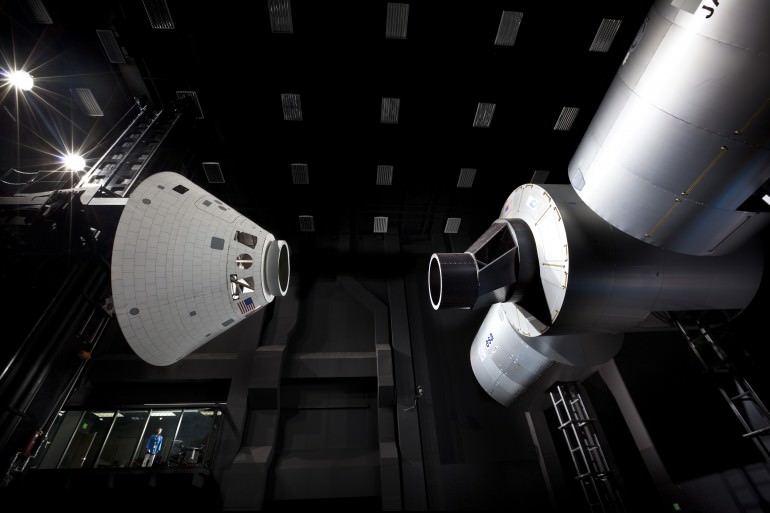
Lockheed Martin’s Space Operations Simulation Center in Littleton, Colorado, simulates on-orbit docking maneuvers with full-scale Orion and International Space Station mockups. The spacious center includes an 18,000 square-foot high bay area used to validate Orion’s new relative navigation system (STORRM), which will be tested on orbit during the STS-134 mission set to blast off on April19, 2011. Credit: Lockheed Martin

[/caption]

The inaugural version of NASA’s new Orion human space exploration capsule was unveiled by Lockheed Martin at the company’s new state-of-the-art Space Operation Simulation Center (SOSC) located in Denver, Colorado. Orion is designed to fly human crews to low Earth orbit (LEO) and the International Space Station, the Moon, Asteroids, Lagrange Points and beyond to deep space and Mars.

Lockheed Martin is aiming for a first unmanned orbital test flight of Orion as soon as 2013, said John Karas, vice president and general manager for Lockheed Martin’s Human Space Flight programs in an interview with Universe Today . The first operational flight with humans on board is now set for 2016 as stipulated in the NASA Authorization Act of 2010.
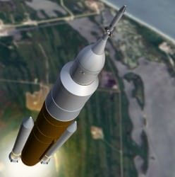
Orion manned capsule could launch in 2016 atop proposed NASA heavy lift booster from the Kennedy Space Center

This Orion prototype capsule was assembled at NASA’s Michoud Assembly Facility (MAF) in New Orleans, LA and shipped by truck to Denver. At Denver, the capsule will be put through a rigorous testing program to simulate all aspects of a space mission from launch to landing and examine whether the vehicle can withstand the harsh and unforgiving environment of deep space.

Orion was originally designed to be launched by the Ares 1 booster rocket, as part of NASA’s Project Constellation Return to the Moon program, now cancelled by President Obama. The initial Orion test flight will likely be atop a Delta IV Heavy rocket, Karas told me. The first manned flight is planned for the new heavy lift rocket ordered by the US Congress to replace the Project Constellation architecture.

The goal is to produce a new, US-built manned capsule capable of launching American astronauts into space following the looming forced retirement of NASA’s Space Shuttle orbiters later this year. Thus there will be a gap of at least three years until US astronauts again can launch from US soil.

“Our nation’s next bold step in exploration could begin by 2016,” said Karas in a statement. “Orion was designed from inception to fly multiple, deep-space missions. The spacecraft is an incredibly robust, technically advanced vehicle capable of safely transporting humans to asteroids, Lagrange Points and other deep space destinations that will put us on an affordable and sustainable path to Mars.”
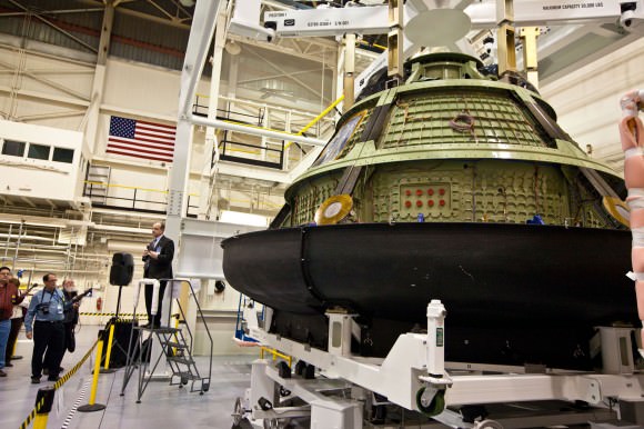
Jim Bray, Director, Orion Crew & Service Module, unveils the first Orion crew module to guests and media at the Lockheed Martin Space Systems Company Waterton Facility in Denver, CO. The vehicle is temporarily positioned in the composite heat shield before installation begins. Following installation of the heat shield and thermal backshell panels, the spacecraft will undergo rigorous testing to validate Orion’s ability to endure the harsh environments of deep space. Credit: Lockheed Martin

Lockheed Martin is the prime contractor for Orion under a multiyear contract awarded by NASA worth some $3.9 Billion US Dollars.

The SOSC was built at a cost of several million dollars. The 41,000 square foot facility will be used to test and validate vehicles, equipment and software for future human spaceflight programs to ensure safe, affordable and sustainable space exploration.

Mission scenarios include docking to the International Space Station, exploring the Moon, visiting an Asteroid and even journeying to Mars. Lockheed has independently proposed the exploration of several challenging deep space targets by astronauts with Orion crew vehicles which I’ll report on in upcoming features.
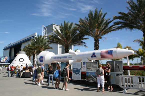
Orion capsule and Abort rocket mockups on display at Kennedy Space Center.
Full scale mockups of the Orion capsule and emergency abort rocket are on public display at the Kennedy Space Center Visitor Complex in Florida. Orion crew capsule mockup (at left) and Launch Abort System (LAS) at right. The emergency rocket will be bolted atop an Orion spaceship for the initial orbital test flight currently slated for 2013 launch. The LAS mockup was used in launch pad exercises at the New Mexico launch site of the LAS rocket blast-off in May 2010. Credit: Ken Kremer

The SOSC facility provides the capability for NASA and Lockheed Martin engineers to conduct full-scale motion simulations of many types of manned and robotic space missions. Demonstrations are run using laser and optically guided robotic navigation systems.
Inside the SOSC, engineers can test the performance of a vehicles ranging, rendezvous, docking, proximity operations, imaging, descent and landing systems for Earth orbiting mission as well as those to other bodies in our solar system.

“The Orion spacecraft is a state-of-the-art deep space vehicle that incorporates the technological advances in human life support systems that have accrued over the last 35 years since the Space Shuttle was designed.” says Karas. “In addition, the Orion program has recently been streamlined for additional affordability, setting new standards for reduced NASA oversight. Orion is compatible with all the potential HLLVs that are under consideration by NASA, including the use of a Delta IV heavy for early test flights.”
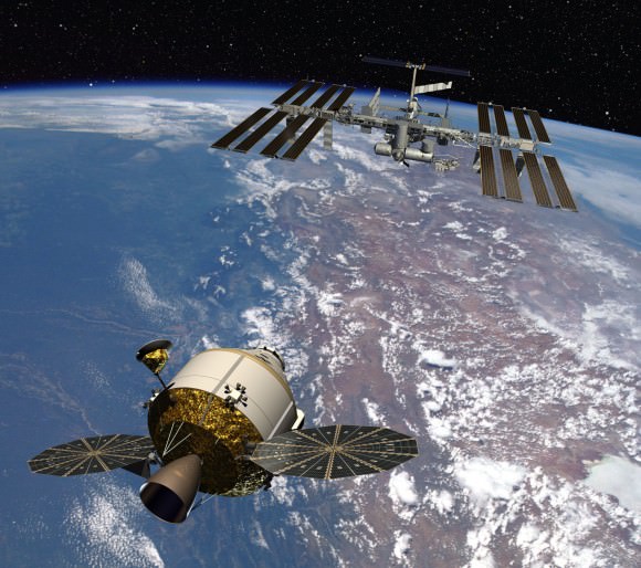
Orion approaches the ISS

At this moment, the SOSC is being used to support a test of Orion hardware that will be flying on the upcoming STS-134 mission of Space Shuttle Endeavour. Orion’s Relative Navigation System – dubbed STORRM (Sensor Test for Orion RelNav Risk Mitigation) – will be put through its paces in several docking and navigation tests by the shuttle astronauts as they approach and depart the ISS during the STS-134 flight slated to launch on April19, 2011.

The Orion flight schedule starting in 2013 is however fully dependent on the level of funding which NASA receives from the Federal Government.

This past year the, Orion work was significantly slowed by large budget cuts and the future outlook is murky. Project Orion is receiving about half the funding originally planned by NASA.

And more deep cuts are in store for NASA’s budget – including both manned and unmanned projects – as both political parties wrangle about priorities as they try to pass a federal budget for this fiscal year. Until then, NASA and the entire US government are currently operating under a series of continuing resolutions passed by Congress – and the future is anything but certain.
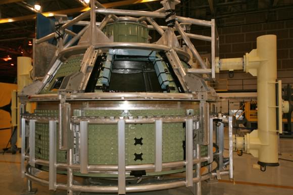
Orion prototype crew cabin with crew hatch and windows
built at NASA Michoud Assembly Facility, New Orleans, LA. Credit: Ken Kremer
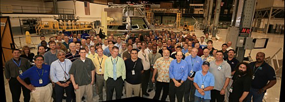
Lockheed Martin team of aerospace engineers and technicians poses with first Orion crew cabin after welding into one piece at NASA Michoud Assembly Facility, New Orleans, LA. Credit: Ken Kremer
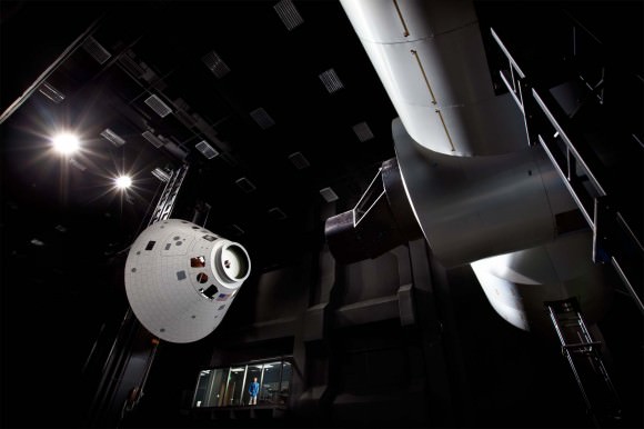
Orion and ISS simulated docking

Opportunity Rover Completes Exploration of fascinating Santa Maria Crater

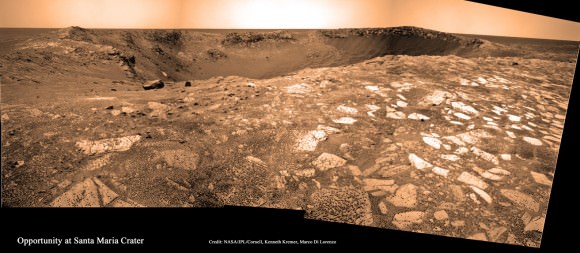
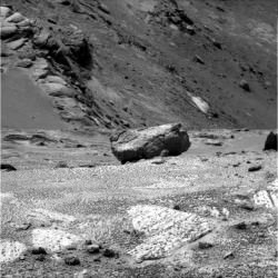
Yuma Outlook at Santa Maria Crater on Sol 2476, Jan 10, 2011. Opportunity arrived at the hydrated mineral deposits located here at the southeast rim of the crater. Self portrait of Opportunity at left, casts shadow of rover deck and mast at right. Credit: NASA/JPL/Cornell, Marco Di Lorenzo, Kenneth Kremer High resolution version on APOD, Jan. 29, 2011 ; http://apod.nasa.gov/apod/ap110129.html

[/caption]

NASA’s long lived Opportunity Mars rover has completed a three month long exploration of Santa Maria crater along the trail towards its biggest target ever, Endeavour crater, some 22 kilometers in diameter. Santa Maria has simultaneously offered a series of stunning vistas and a scientific bonanza as a worthy way station in the rovers now seven year long overland expedition across the Martian plains of Meridiani Planum.

Opportunity made landfall at the western edge of Santa Maria on Dec. 15, 2010 (Sol 2450) after a long and arduous journey of some 19 kilometers since departing from Victoria Crater nearly two and one half years ago in September 2008. Santa Maria is the largest crater that the rover will encounter on the epic trek between Victoria and Endeavour.

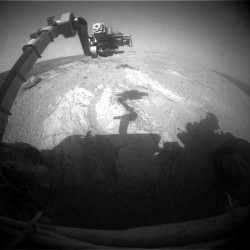
Robotic arm at work on Mars on Sol 2513, Feb 17, 2011. Opportunity grinds into rock target Luis De Torres’ with the RAT. Credit: NASA/JPL/Cornell
The science team decided that Santa Maria would be the best location for an intermediate stop as well as permit a focused science investigation because of the detection of attractive deposits of hydrated minerals. The stadium sized and oval shaped crater is some 80 to 90 meters wide (295 feet) and about nine meters in depth.

Opportunity has since been carefully driven around the lip of the steep walled crater in a counterclockwise direction to reach the very interesting hydrated sulfates on the other side. The rover made several stops along the way to collect long baseline high resolution stereo images creating 3 D digital elevation maps and investigate several rocks in depth.

Opportunity was directed to Santa Maria based on data gathered from Mars orbit by the mineral mapping CRISM spectrometer – onboard the Mars Reconnaissance Orbiter (MRO) – which indicated the presence of exposures of water bearing sulfate deposits at the southeast rim of the crater.

Opportunity rover panoramic photomosaic near lip of Santa Maria Crater on Sol 2519, Feb. 23, 2011. Opportunity drove to exposed rock named Ruiz Garcia to investigate hydrated mineral deposits located here at southeast portion of crater. Credit: NASA/JPL/Cornell, Kenneth Kremer, Marco Di Lorenzo

“Santa Maria is a relatively fresh impact crater. It’s geologically very young, hardly eroded at all, and hard to date quantitatively,” said Ray Arvidson from Washington University in St. Louis. Arvidson is the deputy principal investigator for the Spirit and Opportunity rovers.

The rover had to take a pause anyway in its sojourn to Endeavour because of a restrictive period of solar conjunction. Conjunction is the period when the Sun is directly in between the Earth and Mars and results in a temporary period of communications disruptions and blackouts.

During conjunction – which lasted from Jan. 28 to Feb. 12 – the rover remained stationary. No commands were uplinked to Opportunity out of caution that a command transmission could be disrupted and potentially have an adverse effect.

Advantageously, the pause in movement also allows the researchers to do a long-integration assessment of the composition of a selected target which they might not otherwise have conducted.

By mid-January 2011, Opportunity had reached the location – dubbed ‘Yuma’ – at the southeast rim of the crater where water bearing sulfate deposits had been detected. A study of these minerals will help inform researchers about the potential for habitability at this location on the surface of Mars.

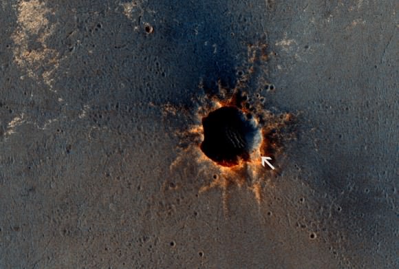
Opportunity at rim of Santa Maria crater as imaged from Mars orbit on March 1, 2011, Sol 2524.
Rover was extending robotic arm to Ruiz Garcia rock as it was imaged by NASA’s MRO orbiter.
Credit: NASA/JPL-Caltech/Univ. of Arizona

Opportunity snapped a collection of raw images from ‘Yuma’ which Marco Di Lorenzo and myself assembled into a panoramic photo mosaic (shown above) to illustrate the location. The high resolution version was selected to appear at Astronomy Picture of the Day on Jan. 29, 2011.

The rover turned a few degrees to achieve a better position for deploying Opportunity’s robotic arm, formally known as the instrument deployment device or IDD, to a target within reach of the arms science instruments.

“Opportunity is sitting at the southeast rim of Santa Maria,” Arvidson told me. “We used Opportunity’s Rock Abrasion Tool (RAT) to brush a selected target and the Moessbauer spectrometer was placed on the brushed outcrop. That spot was named ‘Luis De Torres’, said Arvidson.

Ruiz Garcia rock imaged by pancam camera on Sol 2419. Credit: NASA/JPL/Cornell
‘Luis De Torres’ was chosen based on the bright, extensive outcrop in the region in which CRISM sees evidence of a hydrated sulfate signature.”

Opportunity successfully analyzed ‘Luis De Torres’ with all the instruments located at the end of the robotic arm; including the Microscopic Imager (MI), the alpha particle X-ray spectrometer (APXS) and then the Moessbauer spectrometer (MB) for a multi-week integration of data collection.

After emerging in fine health from the conjunction, the rover performed a 3-millimeter deep grind on ‘Luis De Torres’ with the RAT in mid-February 2011 to learn more about the rocks interior composition. Opportunity then snapped a series of microscopic images and collected spectra with the APXS spectrometer.

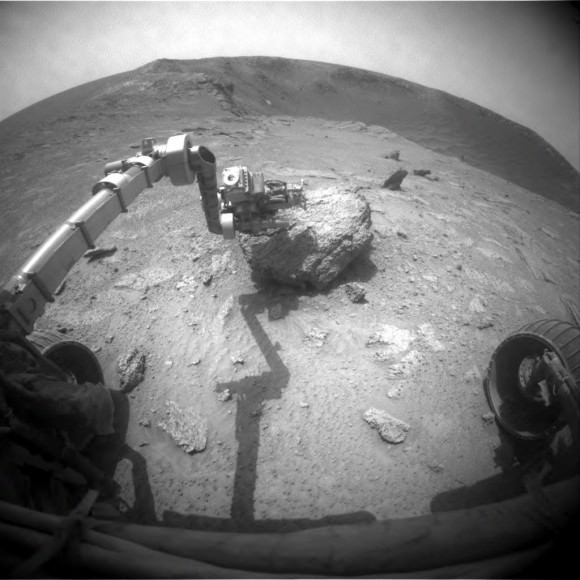
The rover then continued its counterclockwise path along the eastern edge of the crater, driving northwards some 30 meters along the crater rim to a new exposed rock target – informally named ‘Ruiz Garcia’ to collect more APXS spectra and microscopic images. See our mosaic showing “Ruiz Garcia” at the lip of the crater (above).

Opportunity finished up the exploration of the eastern side of Santa Maria in March by snapping a few more high resolution panoramas before resuming the drive to Endeavour crater which lies some 6.5 kilometers (4 miles) away.

Endeavour is Opportunity’s ultimate target in the trek across the Martian dunes because it possesses exposures of a hitherto unexplored type of even more ancient hydrated minerals, known as phyllosilicates, that form in neutral water more conducive to the formation of life.

Raw image from Opportunity's front hazard-avoidance camera on Sol 2524 ( March 1, 2011)
showing the robotic arm extended to Ruiz Garcia rock target. Credit: NASA/JPL/Cornell

Stardust-NExT sees Jets and impact crater at Comet Tempel 1 and says Farewell !

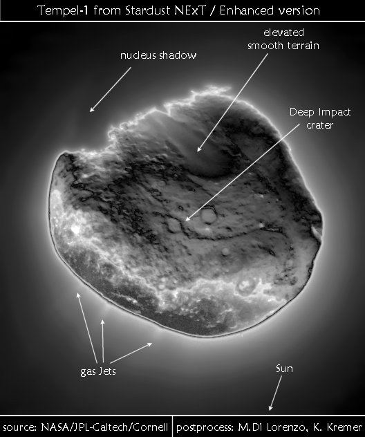
Stardust-NExT photographed jets of gas and particles streaming from Comet Tempel 1 during Feb 14, 2011 flyby. The raw image taken during closest approach has been extensively enhanced by outside analysts to visibly show the jets. Annotations show the location of the jets and the man-made crater created by a projectile hurled by NASA’s prior Deep Impact mission in 2005. Credit: NASA/JPL-Caltech/University of Maryland/Post process and annotations by Marco Di Lorenzo/Kenneth Kremer

[/caption]Farewell Stardust-NExT !

Today marks the end to the final chapter in the illustrious saga of NASA’s Stardust-NExT spacecraft, a groundbreaking mission of cometary exploration.

Mission controllers at NASA’s Jet Propulsion Laboratory commanded the probe to fire the main engines for the very last time today at about 7 p.m. EDT (March 24). The burn will continue until the spacecraft entirely depletes the tiny amount of residual fuel remaining in the propellant tanks. The Stardust probe is now being decommissioned and is about 312 million kilometers away from Earth.

This action will effectively end the life of the storied comet hunter, which has flown past an asteroid (Annefrank), two comets (Wild 2 and Tempel 1) and also returned the first ever pristine samples of a comet to Earth for high powered analysis by the most advanced science instruments available to researchers.

NASA’s Stardust space probe completed her amazing science journey on Feb. 14, 2011 by streaking past Comet Tempel 1 at 10.9 km/sec, or 24,000 MPH and successfully sending back 72 high resolution images of the comets nucleus and other valuable science data. Tempel 1 became the first comet to be visited twice by spacecraft from Earth.

During the Feb. 14, 2011 flyby of Comet Tempel 1, Stardust-NExT discovered the man-made crater created back in 2005 by NASA’s Deep Impact mission and also imaged gas jets eminating from the comet. My imaging partner Marco Di Lorenzo and myself prepared two posters illustrating the finding of the jets and the Deep Impact crater included in this article.

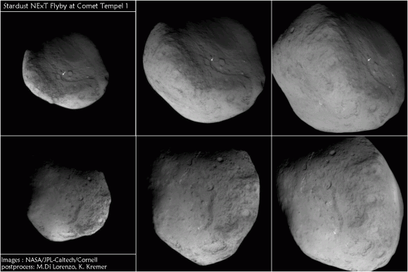
6 Views of Comet Tempel 1 and Deep Impact crater from Stardust-NExT spacecraft flyby on Feb. 14, 2011. Arrows show location of man-made crater created in 2005 by NASA’s prior Deep Impact comet smashing mission and newly imaged as Stardust-NExT zoomed past comet in 2011.
The images progress in time during closest approach to comet beginning at upper left and moving clockwise to lower left. Credit: NASA/JPL-Caltech/University of Maryland/Post process and annotations by Marco Di Lorenzo/Kenneth Kremer

The rocket burn will be the last of some 2 million rocket firings all told since the Stardust spacecraft was launched back in 1999. Over a dozen years, Stardust has executed 40 major flight path maneuvers and traveled nearly 6 billion kilometers.

The rocket firing also serves another purpose as a quite valuable final contribution to science. Since there is no fuel gauge on board or precise method for exactly determining the quantity of remaining fuel, the firing will tell the engineers how much fuel actually remains on board.

To date the team has relied on several analytical methods to estimate the residual fuel. Comparing the results of the actual firing experiment to the calculations derived from estimates will aid future missions in determining a more accurate estimation of fuel consumption and reserves.

“We call it a ‘burn to depletion,’ and that is pretty much what we’re doing – firing our rockets until there is nothing left in the tank,” said Stardust-NExT project manager Tim Larson of NASA’s Jet Propulsion Laboratory in Pasadena, Calif in a statement. “It’s a unique way for an interplanetary spacecraft to go out. Essentially, Stardust will be providing us useful information to the very end.”

Just prior to the burn, Stardust will turn its medium gain antenna towards Earth and transmit the final telemetry in real time. Stardust is being commanded to fire the thrusters for 45 minutes but the team expects that there is only enough fuel to actually fire for up to perhaps around ten minutes.

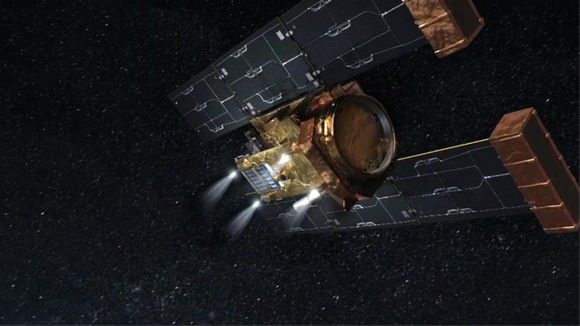
On March 24, at about 4 p.m. PDT, four rocket motors on NASA's Stardust spacecraft, illustrated in this artist's concept, are scheduled to fire until the spacecraft's fuel is depleted. Image credit: NASA/JPL-Caltech

As its final act, the transmitters will be turned off (to prevent accidental transmissions to other spacecraft), all communications will cease and that will be the end of Stardust’s life.

With no more fuel available, the probe cannot maintain attitude control, power its solar array or point its antenna. And its far enough away from any targets that there are no issues related to planetary protection requirements.

“I think this is a fitting end for Stardust. It’s going down swinging,” Larson stated in the press release.

Stardust-NExT website

Read more about the Stardust-NExT Flyby and mission in my earlier stories here, here, here, here, here, here and here

Relive the Feb. 14 Flyby of Comet Tempel 1 in this movie of NASA/JPL images

Stardust-NExT: 2 Comet Flybys with 1 Spacecraft.
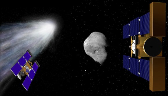
Stardust-NExT made history on Valentine’s Day - February, 14, 2011 – Tempel 1 is the first comet to be visited twice by spacrecraft from Earth. Stardust has now successfully visited 2 comets and gathered science data: Comet Wild 2 in 2004 (left) and Comet Tempel 1 in 2011 (right).
Artist renderings Credit: NASA. Collage: Ken Kremer.
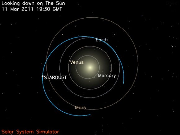
Stardust-NExT location on March 11, 2011 just prior to farewell transmission. Credit: NASA/JPL

Revolutionary Dawn Closing in on Asteroid Vesta with Opened Eyes

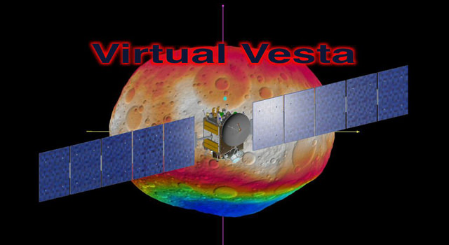
Virtual Vesta. Taking their best guess, the science team on NASA’s Dawn Asteroid Orbiter have created a series of still images and videos (see below) to simulate what the protoplanet Vesta might look like. The exercise was carried out by mission planners at NASA's Jet Propulsion Laboratory and science team members at the German Aerospace Center and the Planetary Science Institute. Image credit: NASA/JPL-Caltech/ESA/UCLA/DLR/PSI/STScI/UMd

[/caption]

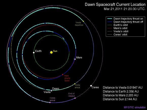
The excitement is building as NASA’s innovative Dawn spacecraft closes in on its first protoplanetary target, the giant asteroid Vesta, with its camera eyes now wide open. The probe is on target to become the first spacecraft from Earth to orbit a body in the main asteroid belt and is set to arrive about four months from now in late July 2011.

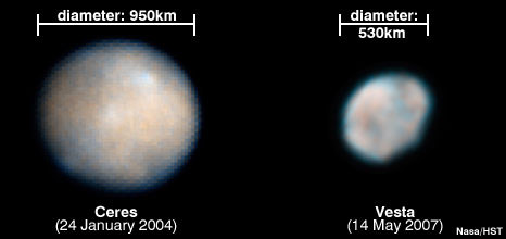
Vesta is the second most massive object in the Asteroid Belt between Mars and Jupiter (map below). Since it is also one of the oldest bodies in our Solar System, scientists are eager to study it and search for clues about the formation and early history of the solar system. Dawn will spend about a year orbiting Vesta. Then it will fire its revolutionay ion thrusters and depart for Ceres, the largest asteroid in our solar system.

Dawn is equipped with three science instruments to photograph and investigate the surface mineralogy and elemental composition of the asteroid. The instruments were provided by the US, Germany and Italy. The spacecraft has just awoken from a six month hibernation phase. All three science instruments have been powered up and reactivated.

Dawn will image about 80 percent of Vesta’s surface at muliple angles with the onboard framing cameras to generate topographical maps. During the year in orbit, the probe will adjust its orbit and map the protoplanet at three different and decreasing altitudes between 650 and 200 kilometers, and thus increasing resolution. The cameras were provided and funded by Germany.

To prepare for the imaging campaign, mission planners from the US and Germany conducted a practice exercise to simulate the mission as though they were mapping Vesta. The effort was coordinated among the science and engineering teams at NASA’s Jet Propulsion Laboratory, the Institute of Planetary Research of the German Aerospace Center (DLR) in Berlin and the Planetary Science Institute in Tuscon, Ariz.

Simulated Vesta from the South Pole
This image shows the scientists' best guess to date of what the surface of the protoplanet Vesta might look like from the south pole, as projected onto a sphere 250 kilometers (160 miles) in radius. It was created as part of an exercise for NASA's Dawn mission involving mission planners at NASA's Jet Propulsion Laboratory and science team members at the Planetary Science Institute in Tuscon, Ariz. Credit: NASA/JPL-Caltech/UCLA/PSI

“We won’t know what Vesta really looks like until Dawn gets there,” said Carol Raymond in a NASA statement. Raymond is Dawn’s deputy principal investigator, based at JPL, who helped orchestrate the activity. “But we needed a way to make sure our imaging plans would give us the best results possible. The products have proven that Dawn’s mapping techniques will reveal a detailed view of this world that we’ve never seen up close before.”

Two teams worked independently and used different techniques to derive the topographical maps from the available data sets. The final results showed only minor differences in spatial resolution and height accuracy.

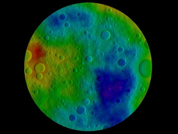
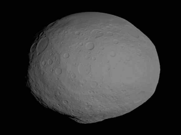
Using the best available observations from the Hubble Space Telescope and ground based telescopes and computer modeling techniques, they created maps of still images and a rotating animation (below) showing their best guess as to what Vesta’s surface actually looks like. The maps include dimples, bulges and craters based on the accumulated data to simulate topography and thus give a sense of Virtual Vesta in three dimensions (3 D).

“Working through this exercise, the mission planners and the scientists learned that we could improve the overall accuracy of the topographic reconstruction, using a somewhat different observation geometry,” said Nick Mastrodemo, Dawn’s optical navigation lead at JPL. “Since then, Dawn science planners have worked to tweak the plans to implement the lessons of the exercise.”

Dawn launch on September 27, 2007 by a Delta II rocket from Cape Canaveral Air Force Station, Florida. Credit: Ken Kremer
Of course no one will know how close these educated guesses come to matching reality until Dawn arrives at Vesta.

The framing camera system consists of two identical cameras developed and built by the Max Planck Institute for Solar System Research, Katlenburg-Lindau, Germany and the German Aerospace Center (DLR) in Berlin.

“The camera system is working flawlessly. The dry run was a complete success,” said Andreas Nathues, lead investigator for the framing camera at the Max Planck Institute in Katlenburg-Lindau, Germany.

Since the probe came out of hibernation, the mechanical and electrical components were checked out in mid March and found to be in excellent health and the software was updated.

Dawn is a mission of many firsts.

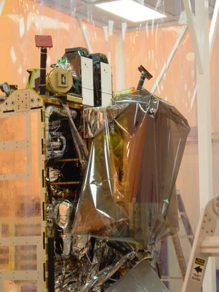
Dawn spacecraft under construction in Cleanroom.
Picture shows close up view of two science instruments;
The twin Framing Cameras at top (white rectangles) and VIR Spectrometer at right. Credit: Ken Kremer
The spacecraft is NASA’s first mission specifically to the Asteroid Belt. It will become the first mission to orbit two solar system bodies.

The revolutionary Dawn mission is powered by exotic ion propulsion which is vastly more efficient than chemical propulsion thrusters. Indeed the ability to orbit two bodies in one mission is only enabled via the use of the ion engines fueled by xenon gas.

Vesta and Ceres are very different worlds that orbit between Mars and Jupiter. Vesta is rocky and may have undergone volcanism whereas Ceres is icy and may even harbor a subsurface ocean conducive to life.

Dawn will be able to comparatively investigate both celestial bodies with the same set of science instruments and try to unlock the mysteries of the beginnings of our solar system and why they are so different.

Dawn is part of NASA’s Discovery program and was launched in September 2007 by a Delta II rocket from Cape Canaveral Air Force Station, Florida.

Virtual Vesta in 2 D.
This image shows a model of the protoplanet Vesta, using scientists' best guess to date of what the surface of the protoplanet might look like. The images incorporate the best data on dimples and bulges of Vesta from ground-based telescopes and NASA's Hubble Space Telescope. The cratering and small-scale surface variations are computer-generated, based on the patterns seen on the Earth's moon, an inner solar system object with a surface appearance that may be similar to Vesta. Credit: NASA/JPL-Caltech/UCLA/PSI
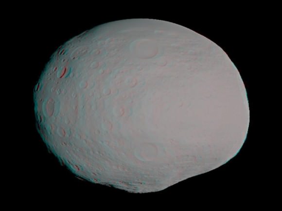
Virtual Vesta in 3 D.
This anaglyph -- best viewed through red-blue glasses -- shows a 3-D model of the protoplanet Vesta, using scientists' best guess to date of what the surface of the protoplanet might look like. Image credit: NASA/JPL-Caltech/UCLA/PSI
Dawn Spacecraft current location approaching Asteroid Vesta on March 21, 2011

Curiosity Rover Testing in Harsh Mars-like Environment

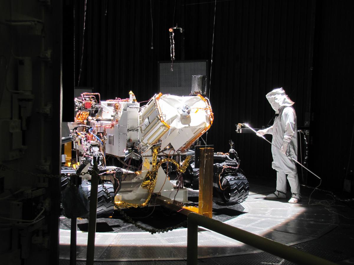
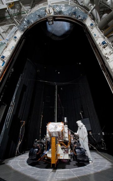
NASA’s Curiosity Rover inside a high vacuum environmental testing chamber at NASA's Jet Propulsion Laboratory. Engineers placed Curiosity inside the chamber to simulate the surface conditions on Mars that the rover will experience after landing in August 2012. Credit: NASA/JPL-Caltech

[/caption]

NASA’s next Mars rover, named Curiosity, is now undergoing crucial tests that are designed to simulate the harsh environmental conditions of the Martian surface that awaits the rover when she lands there in August 2012.

Curiosity, also known as the Mars Science Laboratory or MSL, is the size of a mini-Cooper. It was placed inside a 7.6 meter (25 foot) diameter high vacuum chamber at NASA’s Jet Propulsion Laboratory. Engineers are now conducting an extensive regimen of tests that will check out the performance and operational capabilities of the rover under Mars-like conditions.

Curiosity enters the 7.6-meter-diameter space-simulation chamber on March 8, 2011 at NASA's Jet Propulsion Laboratory, Pasadena, Calif. The rover is fully assembled with all primary flight hardware and instruments. The test chamber's door is still open in this photo. Credit: NASA/JPL-Caltech
Since the atmosphere of Mars is very thin – roughly 0.6% compared to Earth – most of the air was pumped out to simulate the meager atmospheric pressure on the surface of Mars.

The internal chamber temperature was decreased to minus 130 degrees Celsius (minus 202 degrees Fahrenheit) using liquid nitrogen flowing through the chamber walls to approximate the Antarctic like bone chilling cold. Martian lighting conditions are being simulated by a series of powerful lamps.

Upon successful completion of the testing, all components of the MSL spacecraft system will be shipped to the Kennedy Space Center for final integration. This includes the cruise stage, descent stage and back shell.

The launch window for MSL extends from Nov. 25 to Dec. 18, 2011 atop an Atlas V rocket from pad 41 at Cape Canaveral, Florida.

MSL will land using a new and innovative sky crane system instead of airbags. Using the helicopter-like sky crane permits the delivery of a heavier rover to Mars and with more weight devoted to the science payload. Indeed the weight of Curiosity’s science payload is ten times that of any prior Mars rover mission.

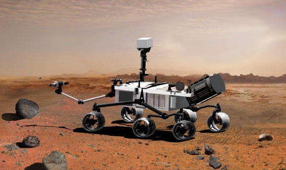
Artist's concept illustrates Mars rover Curiosity traversing across martian surface. Credit: NASA/JPL-Caltech

MSL also features a precision landing system to more accurately guide the rover to the desired target than past missions, to within an ellipse about 20 kilometers long. After extensive evaluation, four landing sites where water once flowed have been selected for further evaluation. The final decision will come sometime in 2011.

Curiosity is about twice the size and four times the weight compared to NASA’s Spirit and Opportunity Mars Explorations Rovers which landed on Mars back in 2004. Opportunity continues to stream back science data from Mars after seven years. The fate of Spirit is unknown at this time as the plucky rover has been out of contact since entering hibernation in March 2010.

The science goal of Curiosity is to search the landing site for clues about whether environmental conditions favorable for microbial life existed in the past or even today on Mars and whether evidence for life may have been preserved in the geological record.

The rover is being targeted to an area where it is believed that liquid water once flowed and may be habitable. In particular the science teams hope to sample and investigate phyllosilicate clays, which are minerals that form in neutral watery conditions more favorable to the formation of life compared to the more acidic environments investigated thus far by Spirit and Opportunity.

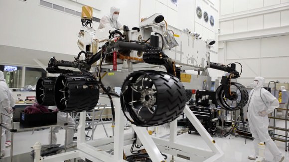
Engineers work on the six wheeled Curiosity rover in a clean room at NASA's Jet Propulsion Laboratory. Credit: NASA/JPL-Caltech

Shuttle Endeavour Photo Special: On Top of Pad 39A for Final Flight

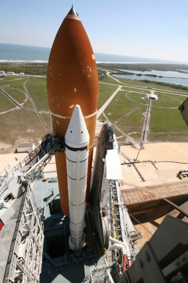
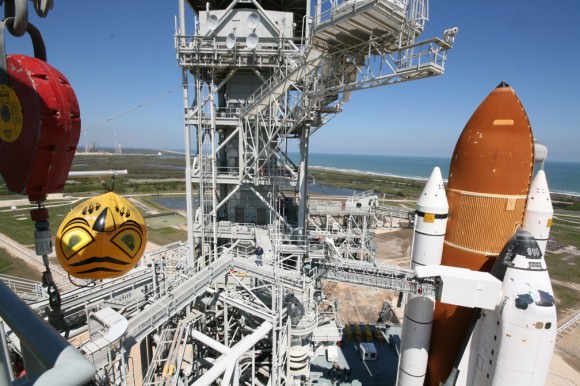
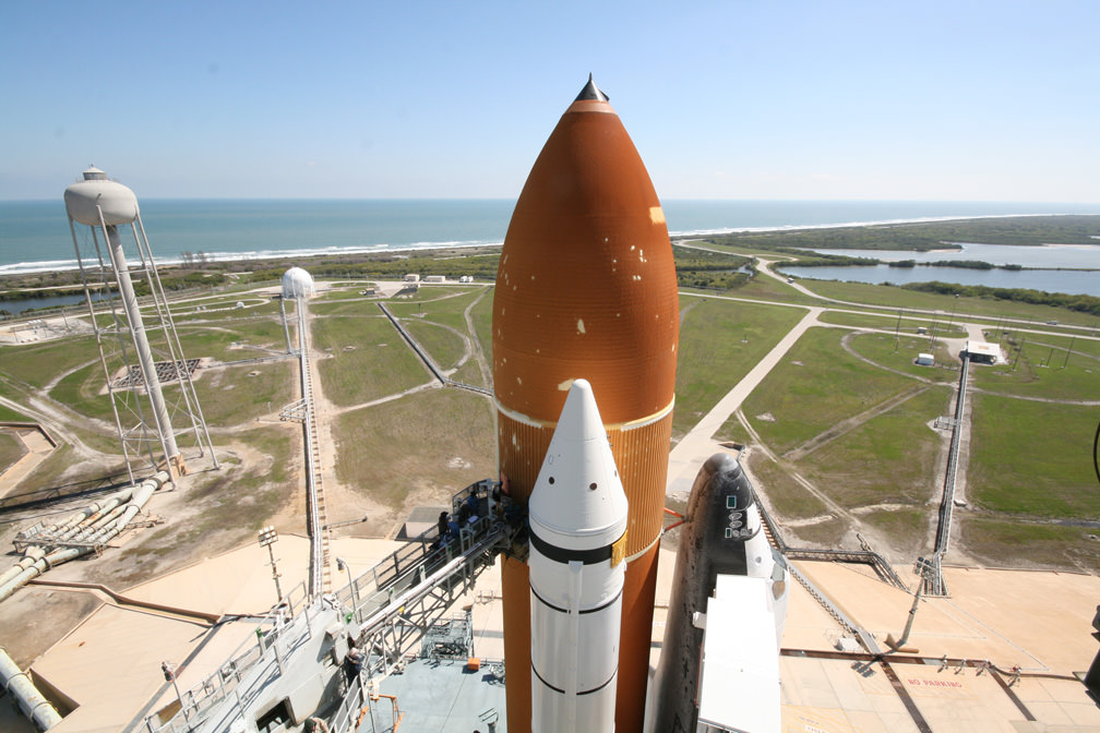
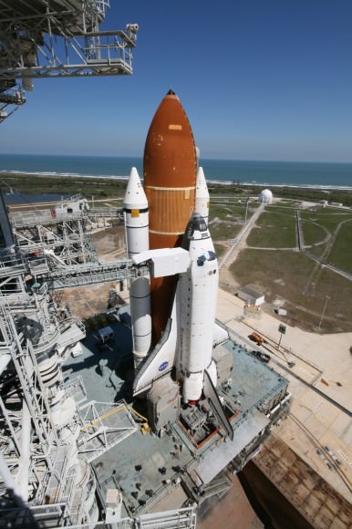
Panoramic view from the upper reaches of the Shuttle Gantry - Fixed Service Structure - at Launch Pad 39A at the Kennedy Space Center. View shows the top of the shuttle stack and Florida Space Coastline. Credit: Ken Kremer

[/caption]

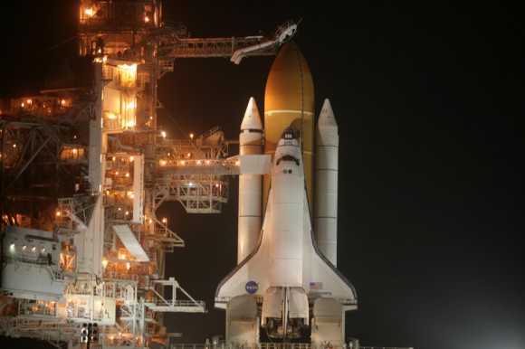
Space Shuttle Endeavour now sits majestically at launch pad 39 A at the Kennedy Space Center, awaiting her historic final spaceflight on the STS-134 mission. Following her nighttime rollout to the pad, I was part of a lucky band of photographers and journalists permitted to travel along and participate in the ultimate photo op on a picture perfect day.

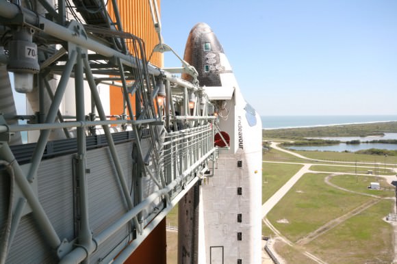
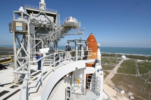
NASA allowed us to get breathtakingly close and document Endeavour from multiple absolutely awesome vantage points all around the launch pad from top to bottom. We were given access to shoot from the upper reaches of the launch gantry with stunning panoramic vistas of the Florida coastline to the bottom of the launch platform and standing directly beneath the External Tank and adjacent to the Twin Solid Rocket Boosters.

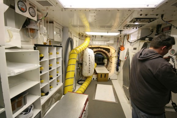
Here is part 1 of my photo album which focuses on the upper levels and includes our visit to the White Room – where the astronauts enter the crew hatch to board the shuttle orbiter to take their seats for the adventure of a lifetime.

Walkway to the White Room and astronaut’s crew hatch at Pad 39 A. Credit: Ken Kremer www.kenkremer.com

With the shuttle era rapidly drawing to a close, NASA has opened up media access in ways not previously allowed so that we can share these rarely seen views of the shuttle with the public.

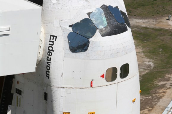
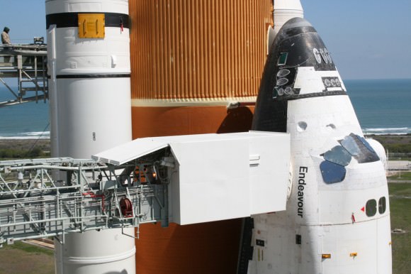
Close up of Endeavour crew cabin, ET, SRB and astronaut walkway to the White Room. Credit: Ken Kremer
STS-134 will be the 25th and final flight for Space Shuttle Endeavour. Liftoff is set slated for April 19 with an all veteran crew of six, led by Shuttle Commander Mark Kelly.

Endeavour will haul the Alpha Magnetic Spectrometer (AMS) to orbit and attach this premiere science experiment to the truss structure of the International Space Station. AMS will search for dark matter and antimatter and seak to determine the origin of the universe.

Read more about the STS-134 mission in my prior reports here and here

View from top levels of Launch Pad 39A to Endeavour and Florida coast. Credit: Ken Kremer
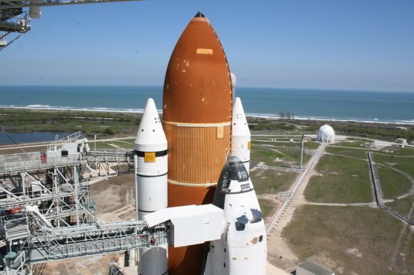
Space Shuttle Endeavour awaits April 19 launch from Pad 39A at KSC. Credit: Ken Kremer
Side view of Space Shuttle Endeavour from on top of Pad 39A at KSC looking out to Florida coastline. at KSC. Credit Ken Kremer
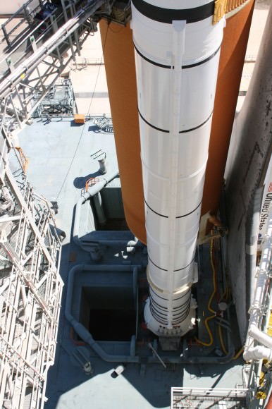
Looking down along the Solid Rocket Boosters to the base of the Mobile Launch Platform at Pad 39A. Credit: Ken Kremer
View from the top of the retracted Rotating Service Structure (RSS) at Pad 39A to Endeavour and gaseous oxygen vent hood – beanie cap - with humerous wind monitor and Pad 39B off in the distance at left. Credit: Ken Kremer
Close up of Endeavour crew cabin attached to the White Room, Credit: Ken Kremer
Inside the White Room at Pad 39 A and the crew hatch to Shuttle Endeavour. Credit: Ken Kremer
Ken on top of the Rotating Service Structure (RSS) at Pad 39A with Endeavour and
gaseous oxygen vent hood – beanie cap. Credit: Ken Kremer
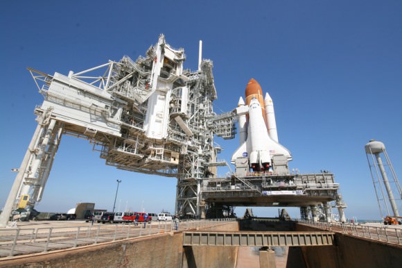
Space Shuttle Endeavour and launch gantry at Launch Pad 39A at KSC.
For context, the photos above were taken from the upper levels of the pad service structures at left (Rotating Service Structure and Fixed Service Structure) and the White Room attached to crew cabin at center. The Flame Trench is at bottom, center. Credit: Ken Kremer
Robo Trek Debuts … Robonaut 2 Unleashed and joins First Human-Robot Space Crew

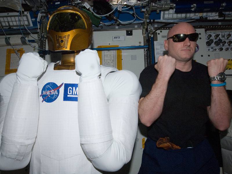
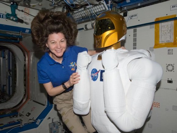
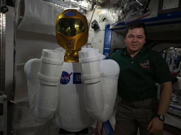
For a moment we had 2 @AstroRobonaut. ISS Commander Scott Kelly and Robonaut 2 pose together in the Destiny laboratory module. Credit: ESA/NASA

Star Trek’s Data must be smiling.

One of his kind has finally made it to the High Frontier. The voyages of Robo Trek have begun !

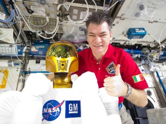
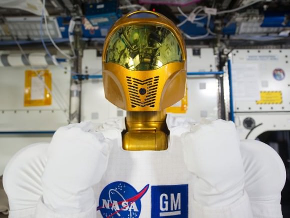
Robonaut 2, or R2, was finally unleashed from his foam lined packing crate by ISS crewmembers Cady Coleman and Paolo Nespoli on March 15 and attached to a pedestal located inside its new home in the Destiny research module. R2 joins the crew of six human residents as an official member of the ISS crew. See the video above and photos below.

[/caption]

The fancy shipping crate goes by the acronym SLEEPR, which stands for Structural Launch Enclosure to Effectively Protect Robonaut. R2 had been packed inside since last summer.

Robonaut 2 is the first dexterous humanoid robot in space and was delivered to the International Space Station by Space Shuttle Discovery on STS-133.

”Robonaut is now onboard as the newest member of our crew. We are happy to have him onboard. It’s a real good opportunity to help understand the interface of humans and robotics here in space.” said Coleman. “We want to see what Robonaut can do. Congratulations to the team of engineers [at NASA Johnson Space center] who got him ready to fly.”

ISS Flight Engineer Cady Coleman and Robonaut 2

Discovery blasted off for her historic final mission on Feb. 24 and made history to the end by carrying the first joint Human-Robot crew to space.

The all veteran human crew of Discovery was led by Shuttle Commander Steve Lindsey. R2 and SLEEPR were loaded aboard the “Leonardo” storage and logistics module tucked inside the cargo bay of Discovery. Leonardo was berthed at the ISS on March 1 as a new and permanent addition to the pressurized habitable volume of the massive orbiting outpost.

“It feels great to be out of my SLEEPR, even if I can’t stretch out just yet. I can’t wait until I get to start doing some work!” tweeted R2.

The 300-pound R2 was jointly developed in a partnership between NASA and GM at a cost of about $2.5 million. It consists of a head and a torso with two arms and two hands. It was designed with exceptionally dexterous hands and can use the same tools as humans.

ISS Flight Engineer Paolo Nespoli and Robonaut 2

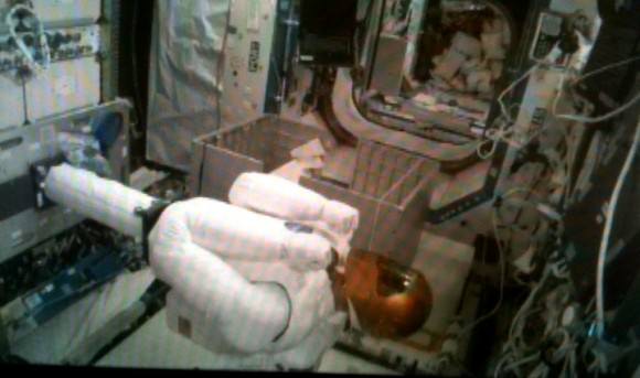
R2 will function as an astronaut’s assistant that can work shoulder to shoulder alongside humans and conduct real work, ranging from science experiments to maintenance chores. After further upgrades to accomplish tasks of growing complexity, R2 may one day venture outside the ISS to help spacewalking astronauts.

“It’s a dream come true to fly the robot to the ISS,” said Ron Diftler in an interview at the Kennedy Space Center. Diftler is the R2 project manager at NASA’s Johnson Space Center.

President Obama called the joint Discovery-ISS crew during the STS-133 mission and said he was eager to see R2 inside the ISS and urged the crew to unpack R2 as soon as possible.

“I understand you guys have a new crew member, this R2 robot,” Obama said. “I don’t know whether you guys are putting R2 to work, but he’s getting a lot of attention. That helps inspire some young people when it comes to science and technology.”

Commander Lindsey replied that R2 was still packed in the shipping crate – SLEEPR – and then joked that, “every once in a while we hear some scratching sounds from inside, maybe, you know, ‘let me out, let me out,’ we’re not sure.”

Robonaut 2 is free at last to meet his destiny in space and Voyage to the Stars.

“I don’t have a window in front of me, but maybe the crew will let me look out of the Cupola sometime,” R2 tweeted from the ISS.

Read my earlier Robonaut/STS-133 stories here, here, here and here.

This isn’t an animation or computer graphics.
I’m in space, says Robonaut 2 from inside the Destiny module at the ISS. Credit: NASA
Robonaut 2 unveiled at the ISS.
Robonaut 2, the dexterous humanoid astronaut helper, is pictured in the Destiny laboratory of the International Space Station.
Flight Engineer Oleg Skripochka and Robonaut 2 inside the ISS
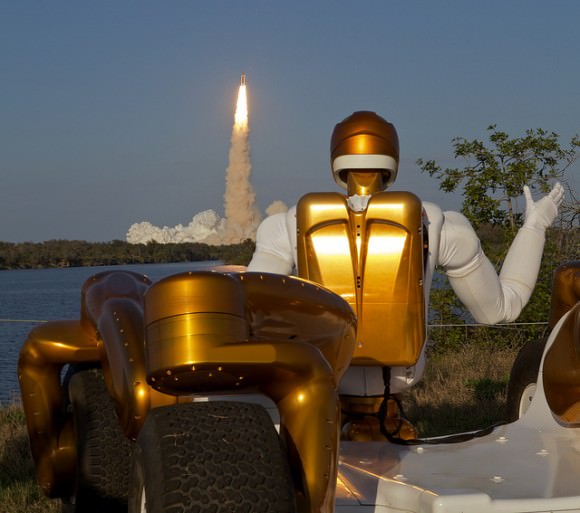
R2A waving goodbye.
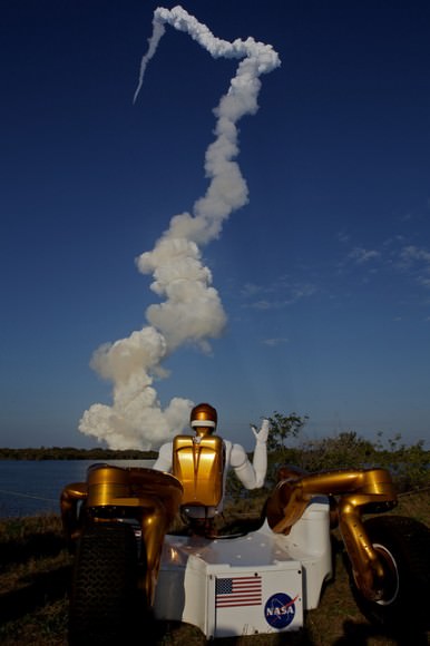
Robonaut R2A waving goodbye as Robonaut R2B launches into space aboard STS-133 from the Kernnedy Space Center. R2 is the first humanoid robot in space. Credit: Joe Bibby
R2A waving goodbye to twin brother R2B launching aboad Space Shuttle Discovery on Feb 14, 2011. Credit: Joe Bibby
Discovery launched on Feb. 14 with crew of six human astronauts and R2 Robonaut on STS-133 mission.
First joint Human – Robot crew. Credit: Ken Kremer
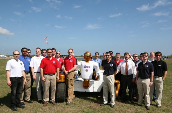
The twin brother of the R2 Robonaut and their NASA/GM creators at KSC.
Robonaut 2 and the NASA/GM team of scientists and engineers watched the launch of Space Shuttle Discovery and the first joint Human-Robot crew on the STS-133 mission on Feb. 24, 2011 from the Kennedy Space Center. Credit: Ken Kremer
NASA Lunar Reconnaissance Orbiter Delivers Treasure Trove of Data

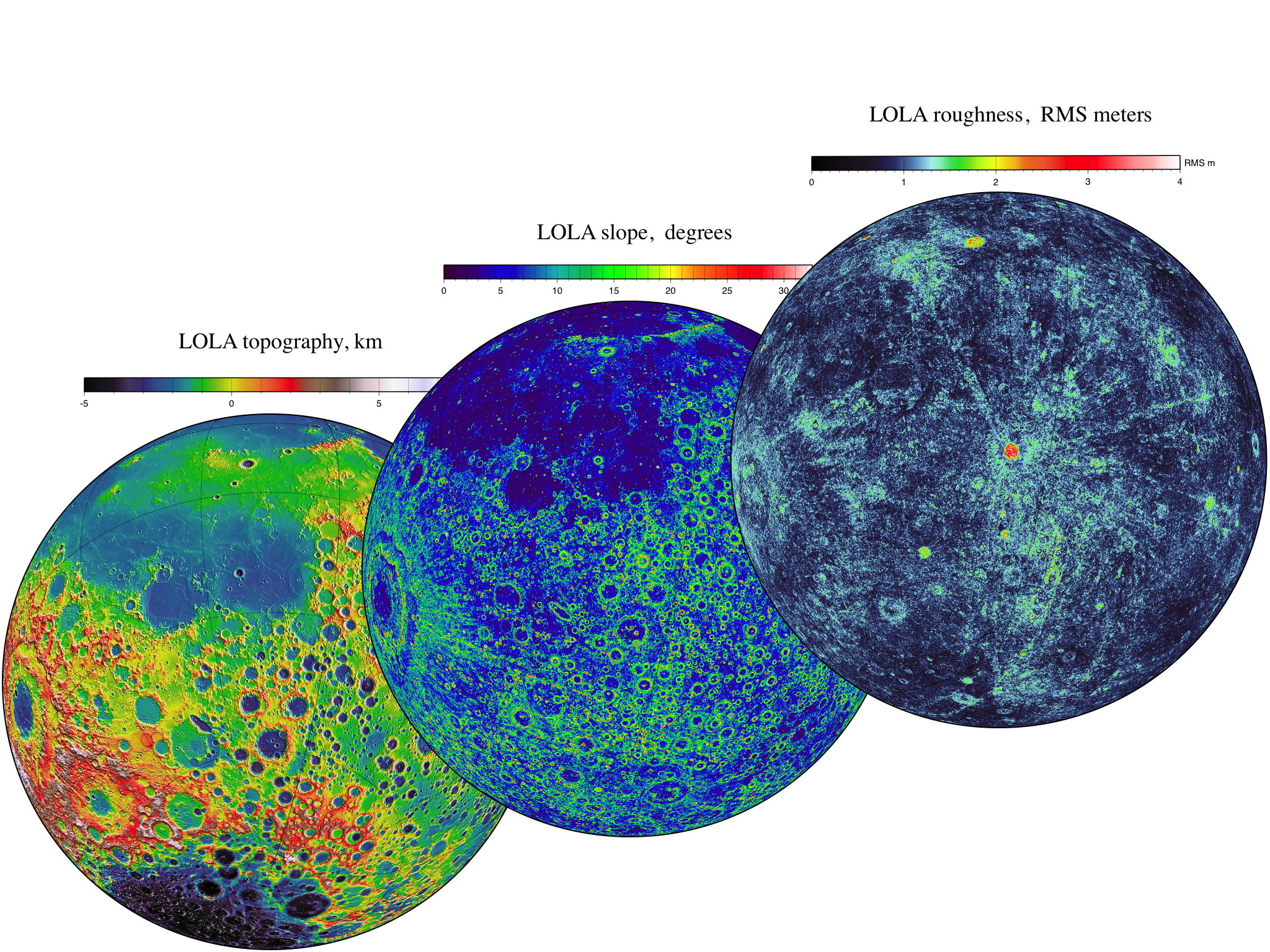
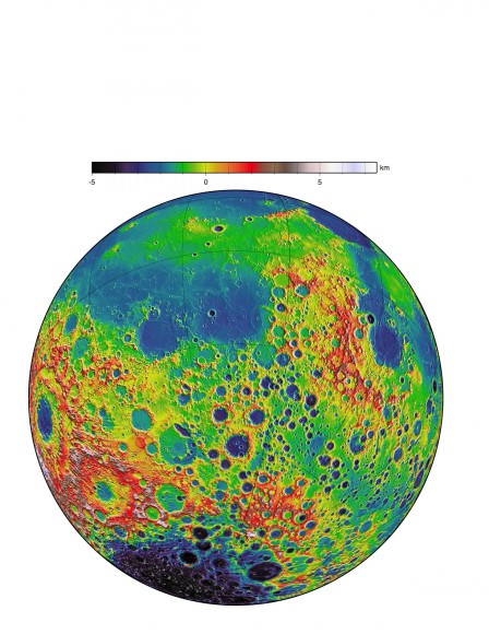
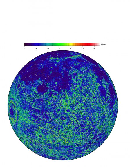
LOLA data give us three complementary views of the near side of the moon: the topography (left) along with new maps of the surface slope values (middle) and the roughness of the topography (right). All three views are centered on the relatively young impact crater Tycho, with the Orientale basin on the left side. The slope magnitude indicates the steepness of terrain, while roughness indicates the presence of large blocks, both of which are important for surface operations. Lunar topography is the primary measurement being provided, while ancillary datasets are steadily being filled in at the kilometer scale. Credit: NASA/LRO/LOLA Science Team

[/caption]

NASA’s Lunar Reconnaissance Orbiter (LRO) has completed its initial phase of operations during the exploration phase which lasted one year from Sept. 15, 2009 through Sept. 15, 2010 and has now transitioned to the science phase which will last for several more years depending on the funding available from NASA, fuel reserves and spacecraft health. The exploration phase was in support of NASA’s now cancelled Project Constellation

To mark this occasion NASA released a new data set that includes an overlap of the last data from the exploration phase and the initial measurements from the follow on science mapping and observational phase.

This is the fifth dataset released so far. All the data is accessible at the Planetary Data System (PDS) and the LROC website and includes both the raw data and high level processed information including mosaic maps and images.

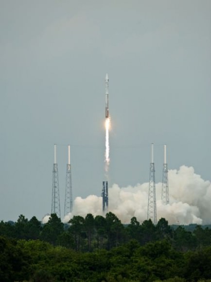
LRO was launched on June 18, 2009 atop an Atlas V/Centaur rocket as part of a science satellite duo with NASA’s Lunar Reconnaissance Orbiter & Lunar Crater Observation and Sensing Satellite (LCROSS) from Launch Complex 41 at Cape Canaveral Air Force Station in Florida.

After achieving elliptical orbit, LRO underwent a commissioning phase and the orbit was lowered with thruster firings to an approximately circular mapping orbit at about 50 km altitude.

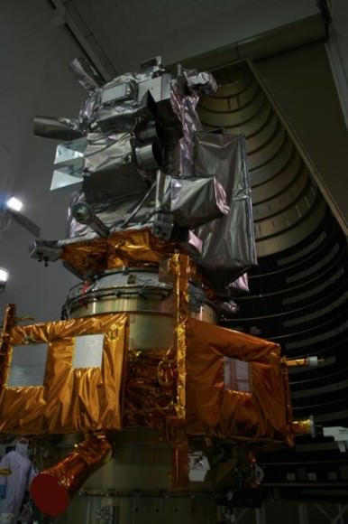
LRO spacecraft (top) protected by gray colored blankets is equipped with 7 science instruments located at upper right side of spacecraft. Payload fairing in background protects the spacecraft during launch and ascent. Credit: Ken Kremer
LRO was equipped with 7 science instruments that delivered more than 192 terabytes of data and with an unprecedented level of detail. Over 41,000 DVDs would be required to hold the new LRO data set.

“The release of such a comprehensive and rich collection of data, maps and images reinforces the tremendous success we have had with LRO in the Exploration Systems Mission Directorate and with lunar science,” said Michael Wargo, chief lunar scientist of the Exploration Systems Mission Directorate at NASA Headquarters in Washington according to a NASA statement.

The new data set includes a global map produced by the onboard Lunar Reconnaissance Orbiter Camera (LROC) that has a resolution of 100 meters. Working as an armchair astronaut, anyone can zoom in to full resolution with any of the mosaics and go an exploration mission in incredible detail because the mosaics are humongous at 34,748 pixels by 34,748 pixels, or approximately 1.1 gigabytes.

Browse the Lunar Reconnaissance Orbiter Camera (LROC) Image Gallery here:

The amount of data received so far from LRO equals the combined total of all other NASA’s planetary missions. This is because the moon is nearby and LRO has a dedicated ground station.

Topographic map from LRO data. Credit: NASA

Data from the other LRO instruments is included in the release including visual and infrared brightness, temperatures maps from Diviner; locations of water-ice deposits from the Lyman-Alpha Mapping Project (LAMP) especially in the permanently shadowed areas and new maps of slope, roughness and illumination conditions from the Lunar Orbiter Laser Altimeter team.

Additional new maps were generated from data compilations from the Lunar Exploration Neutron Detector (LEND), the Cosmic Ray Telescope for the Effects of Radiation and the Miniature Radio Frequency (mini RF) instruments

The combined result of all this LRO data is to give scientists the best ever scientific view of the moon.

“All these global maps and other data are available at a very high resolution — that’s what makes this release exciting,” said Goddard’s John Keller, the LRO deputy project scientist. “With this valuable collection, researchers worldwide are getting the best view of the moon they have ever had.”

Slope image. Credit: NASA
The Atlas V/Centaur carrying NASA's Lunar Reconnaissance Orbiter & Lunar Crater Observation and Sensing Satellite hurtles off Launch Complex 41 at Cape Canaveral Air Force Station in Florida on June18, 2009. Credit: NASA/Tom Farrar, Kevin O'Connell

Source: NASA Press Release

Japan Quake May Have Shortened Earth Days, Moved Axis

TerraSAR-X Change Analysis of Sendai Area, Japan. Map show coastal area of Sendai effected by 9,0 magnitude Earthquake that triggered ensuing destructive Tsunami. Credit: Deutsches Zentrum fur Luft- und Raumfahrt (DLR) - German Aerospace Center

[/caption]

The terribly destructive magnitude 9.0 earthquake which struck Japan on March 11, may have had another effect – Shortening the length of each Earth day and shifting its axis. Did you notice any change ?

Well according to NASA, the changes are so small that you won’t notice the difference.

Based on initial calculations conducted by Richard Gross, a research scientist at NASA’s Jet Propulsion Laboratory, the earthquake should have caused Earth to rotate just slightly faster, shortening the length of the day by about 1.8 microseconds (a microsecond is one millionth of a second), according to a statement released by NASA.

A reader posted this link to before and after photos

Gross used complex modeling and estimates of fault slippage to perform a preliminary theoretical calculation of how the earth’s rotation may have been affected.

Calculations by Gross also indicate that the position of Earth’s figure axis could have shifted by about 17 centimeters (6.5 inches), towards 133 degrees east longitude. The figure axis is the axis about which Earth’s mass is balanced.
Earth’s figure axis is therefore different and offset from the north-south axis by about 10 meters.

“This shift in Earth’s figure axis will cause Earth to wobble a bit differently as it rotates, but it will not cause a shift of Earth’s axis in space-only external forces such as the gravitational attraction of the sun, moon and planets can do that,” according to the NASA statement.

The estimates for both the shortening in the Earth’s rotation and shift in the figure axis are preliminary and will very likely change as more data is collected and the calculations are refined.

The March 11 earthquake was the fifth largest since 1900. So far, over 4000 people are confirmed dead and the overall death total may exceed 10,000.

Several heavily damaged nuclear reactors at the Fukushima plant are in danger of meltdown as hero workers inside put their lives on the line to avoid a catastrophic failure and try to prevent the spread of lethal radiation.

This view of Earth comes from NASA's Moderate Resolution Imaging Spectroradiometer aboard the Terra satellite

Previously, Gross had calculated the affects of the magnitude 8.8 Chilean quake in 2010 and found them to be slightly smaller compared to the Japanese quake. He calculated a shortening in the length of day of about 1.26 microseconds and shifting of Earth’s figure axis of about 8 centimeters (3 inches). These affects are dependent on the magnitude of the quake, exactly where it is located as well as how the particulars of how the fault slips.

In fact, Earth’s rotation is changing all the time as a result of continual changes in atmospheric winds and oceanic currents and these effects are about 550 times larger than the Japanese earthquake.

“Over the course of a year, the length of the day increases and decreases by about a millisecond,” says Gross. Indeed, the effects of earthquakes on changing rotation are so tiny that they are smaller than the margin of error in the measurements themselves.

By comparison, measurements of the figure axis are much more reliable and meaningful. Changes to the figure axis can be accurately measured to within about 5 centimeters. This means that the estimated 17 centimeter shift from the Japanese quake may be real after accounting for the effects of the atmospheric winds and ocean currents. Further research is needed as more data are collected and analyzed.

“These changes in Earth’s rotation are perfectly natural and happen all the time. People shouldn’t worry about them,” said Gross.

Source: NASA Press Release:

Discoverys Last Launch and Landing Captured in Exquisite Amateur Videos

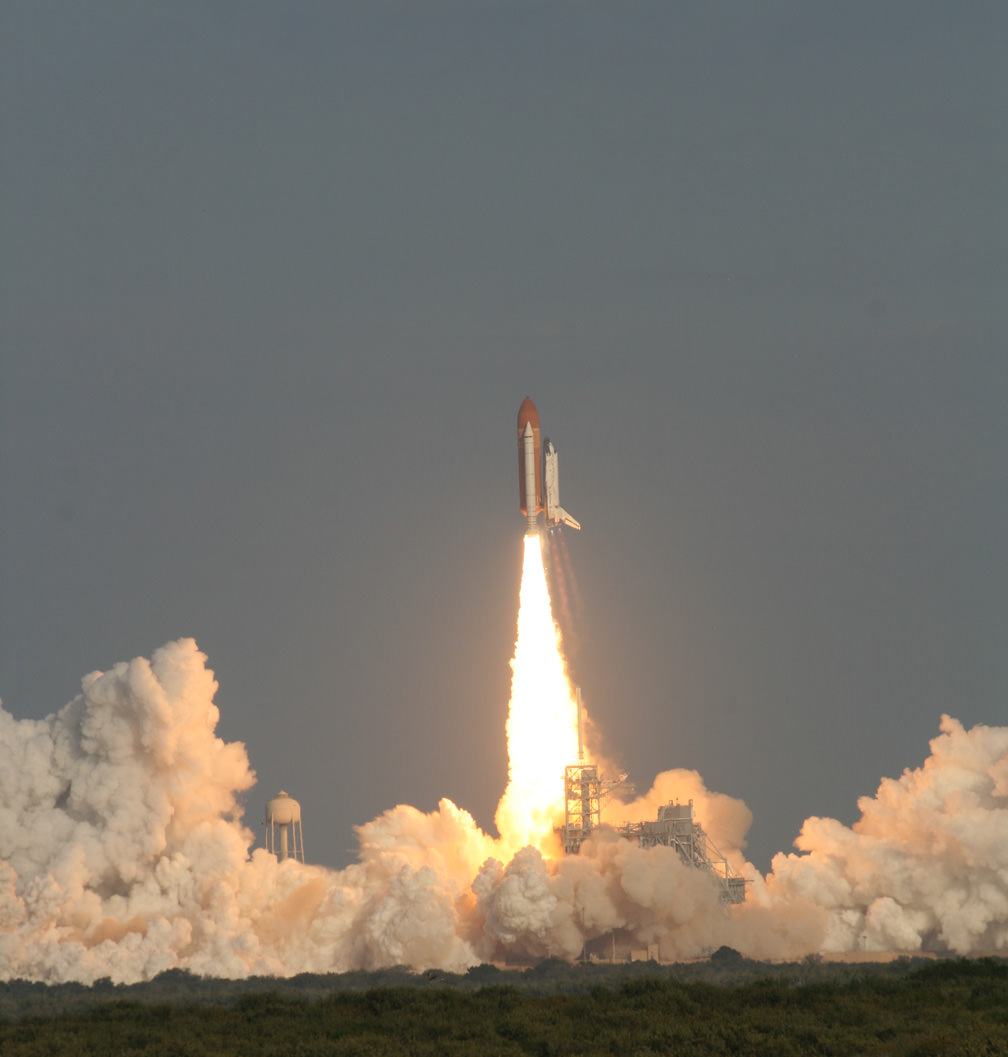
Launch of Space Shuttle Discovery on Feb. 24 at 4:53 p.m. from launch pad 39 A at the Kennedy Space Center. Credit: Ken Kremer

Watch the HD version. More photos below

Imagine ….. “You Are There ! ”

… in the middle of the whooping, cheering crowd at the Kennedy Space Center (KSC) for the historic final launch of Space Shuttle Discovery on the STS-133 mission to the International Space Station.
That’s the feeling you’ll get from this exquisite and exciting piece from amateur videographer Anton Janssen from the Netherlands. Anton has captured the sights and sounds of excitement of the giant crowd in the thick of the action in this amazingly sharp video of Discovery’s last blast to space.

Anton’s vantage point from the NASA Causeway enabled him to film the liftoff with a birds eye view of the entire orbiter to the base of the launch pad – not blocked by the launch gantry at all. And to top that off, the video shows panoramic reaction shots of the large and exuberant crowd. What’s more is you can hear the cheering multitudes at multiple milestones as Discovery ascends with a deafening roar and spewing intense scorching flames out her rear like a gigantic blowtorch burning an indelible hole in the sky.

I happened to meet Anton at Port Canaveral a few days after the launch as Discovery’s powerful Solid Rocket Boosters (SRB’s) were being towed along the canal following their retrieval from the Atlantic Ocean.

[/caption]

Anton told me he bought the camera new and especially for the STS-133 launch after he purchased one of the very hard to get VIP Tickets from the KSC Visitor Complex. He arrived at the viewing site several hours early, along with tens of thousands of other onlookers along the Florida Space Coast beaches and roadways.

“The NASA Causeway was a great viewing site because you could see the shuttle right from the start,” Anton explained.

Check out this amazing close up video view of the final moments of Discovery’s final landing and the finale of her space career as record by Matt Travis, of Spacearium, taken at the Shuttle Landing Facility where I was also stationed.

This timelapse of Discovery’s launch was shot from the Kennedy Space Center Causeway Viewing Site, by David Gonzales of Project Soar. (See our previous article about them.) Here, approximately 12 minutes is condensed into 27 seconds, so about 27 times as fast. Replayed at 15 fps. See the launch and smokey plume change over time as it is tugged on by wind.

Only 1 or 2 flight remain for the Space Shuttle Program until they are forcibly retired for lack of money.

Next up is the launch of Endeavour on April 19 at dusk. Should make for some extremely cool videos and snapshots! Get your gear ready!

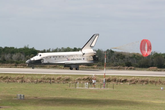
Space Shuttle Discovery concluded her magnificent final journey with a safe landing on March 9, 2011 at the Kennedy Space Center in Florida at 11:57 a.m. EST. Credit: Ken Kremer