Poopy Ideas Net $30,000 For Challenge Finalists

NASA's Space Poop Challenge. Credit: NASA.

You may have thought that whole ‘going to the bathroom in space’ issue had already been resolved, with the International Space Station operating continuously with crew on board since 2000. But as we reported back in December, long-duration, deep-space human missions will create a possible scenario of needing to take care of human waste in a spacesuit longer than just a couple of hours. And so NASA and HeroX issued a Space Poop Challenge, to create an “in-suit waste management system” that can handle six days’ worth of bathroom needs.

HeroX announced this week that five thousand different teams had submitted entries to this challenge, but Air Force officer and flight surgeon Thatcher Cardon won the $15,000 top prize by thinking out of the box, or out of the spacesuit in this case. His concept figures out a way to handle waste by getting it outside of and away from the spacesuit.

For this challenge, NASA wanted to crowdsource the concept of getting away from the MAGs (Maximum Absorbency Garment) – basically adult diapers – currently worn during 7-8 hour-long spacewalks. They need something to handle ‘bathroom needs’ for long duration missions or even an emergency (think Mark Watney) where astronauts might need to spend several days in a spacesuit.
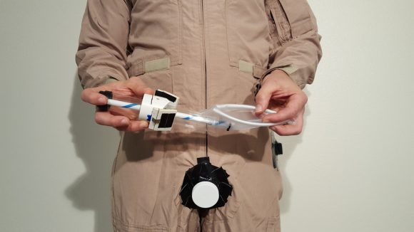
A concept of the MACES Perineal Access & Toileting System, with a perineal access port in the crotch area. Image Courtesy Dr. Thatcher Cardon

Drawing on his “flight surgeon expertise and borrowing a design from the lingerie industry,” Cardon created the “MACES Perineal Access & Toileting System” that places a small airlock opening called the “perineal access port” in the crotch — or “fig leaf area” as Cardon’s press release called it — through which various devices can be inserted to handle liquid or solid waste.

Cardon said the port imitates surgical technologies such as laparoscopy that use small openings to insert surgical instruments and uses devices that are maneuverable with a spacesuit-style gloved hand.
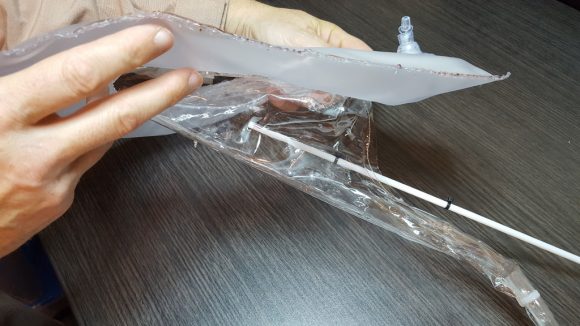
The inflatable bed pan as part of the MACES Perineal Access & Toileting System. Image courtesy Courtesy Dr. Thatcher Cardon.

And if you think inflatable space modules are the wave of the future, you’ll love Cardon’s proposal for an inflatable bed pan. The bedpan has an absorbent liner and is can be slide through the port. Once in place inside the spacesuit, it inflates to capture the waste.

Cardon also invented a diaper made of one, long strip. The strip has segments of absorbent gel alternated with plastic segments that layer over the crotch. When one layer is soaked, the astronaut pulls it out through the port and tears it off like tape from a dispenser, exposing a fresh layer of gel.

Cardon said he filed a patent on his devices this week, as many NASA technologies have found widespread use on Earth. Cardon thinks his ideas may have extensive application. For example, the strip diaper might reduce the number of diaper changes needed by bedridden patients.

The $10,000 second-place prize went to three doctors from Houston that called themselves the “Space Poop Unification of Doctors” team. They created a devices that would direct waste through tube that empties into a small storage tank inside the suit.

In third place for a $5,000 prize was the “SWIMSuit—Zero Gravity Underwear.” These underwear disinfect the waste and store it inside the suit.
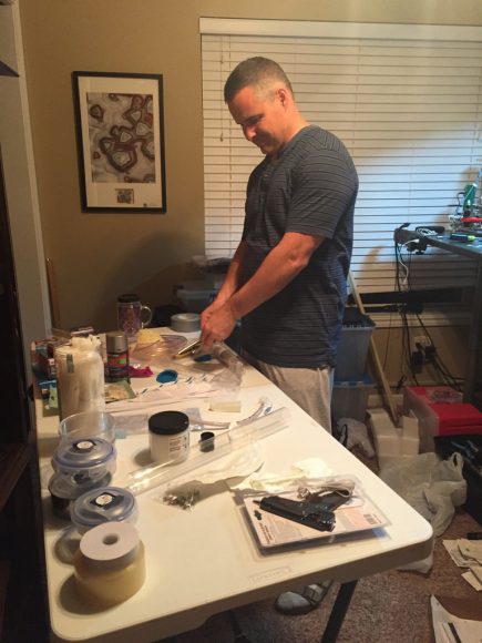
Dr. Thatcher Cardon working on his inventions for the NASA-HeroX Space Poop Challenge. Image Courtesy Dr. Thatcher Cardon.

Cardon said in a press release that his involvement in the Space Poop Challenge was “a ton of fun,” and that he involved his entire family and co-workers, and that his small family practice office “was in an uproar” while he was working on his inventions.

Cardon said he will celebrate his win with a poop themed party for his colleagues, family, base community and church friends, complete with poop emoji cupcakes, special-ordered from the local bakery.

Thanks to Dr. Cardon for sharing his images with Universe Today.

Find out more about the Space Poop Challenge here.

Will You Be The Discoverer Of Planet 9?

Artist concept of Planet 9. Credit: NASA/JPL-Caltech.

Citizen science projects are a great way for anyone to be involved in the scientific process. Average, everyday folks have discovered things like supernovae, previously unseen craters on the Moon and Mars and even new planets orbiting a distant star.

Now, you could be part of one of the most exciting quests yet: finding a mysterious, unseen planet in the far reaches of our own solar system. Last year, Caltech astronomers Mike Brown and Konstantin Batygin found indirect evidence for the existence of a large planet, likely located out past Pluto, and since then, the search has been on. But so far, it has come up empty. And so, astronomers decided they would bring in a little help: You.

“Backyard Worlds: Planet 9 has the potential to unlock once-in-a-century discoveries, and it’s exciting to think they could be spotted first by a citizen scientist,” said UC Berkeley postdoctoral researcher Aaron Meisner, who is helping to head up this latest citizen science project.

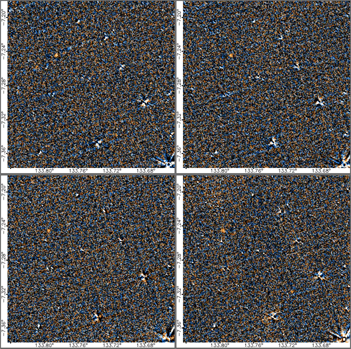
A previously cataloged brown dwarf named WISE 0855?0714 shows up as a moving
orange dot (upper left) in this loop of WISE images spanning five years. By viewing
movies like this, anyone can help discover more brown dwarfs or even a 9th planet. Credit: NASA/WISE.

People who sign on to the Backyard World: Planet 9 website will be basically using the same type of technique that was used to find the last planet discovered in our solar system, Pluto. Clyde Tombaugh used a special machine that systematically switched images on glass astronomical plates back and forth, looking for any objects in the night sky that ‘moved’ between the images.

For Backyard Worlds: Planet 9, users will view brief “flipbook” movies made from images captured by NASA’s Wide-field Infrared Survey Explorer (WISE) mission. A faint spot seen moving through background stars might be a new and distant planet in our solar system. Or it could be a nearby brown dwarf star, which would be another exciting discovery.

WISE’s infrared images cover the entire sky about six times over. This has allowed astronomers to search the images for faint, glowing objects that change position over time, which means they are relatively close to Earth. Objects that produce their own faint infrared glow would have to be large, Neptune-size planets or brown dwarfs, which are slightly smaller than stars. WISE images have already turned up hundreds of previously unknown brown dwarfs, including the objects fairly close to us, so astronomers hope that the Backyard Worlds search will turn up a new nearest neighbor to our sun.

NASA wants to bring in all the humans it can for this search, because the human eye is much better than computers at seeing changes between images.

“Automated searches don’t work well in some regions of the sky, like the plane of the Milky Way galaxy, because there are too many stars, which confuses the search algorithm,” said Meisner.

“There are just over four light-years between Neptune, the farthest known planet in our solar system, and Proxima Centauri, the nearest star, and much of this vast territory is unexplored,” said NASA astronomer Marc Kuchner, the lead researcher and an astrophysicist at NASA’s Goddard Space Flight Center. “Because there’s so little sunlight, even large objects in that region barely shine in visible light. But by looking in the infrared, WISE may have imaged objects we otherwise would have missed.”

Check out Backyard Worlds: Planet 9 here, and give Universe Today the scoop when you make your big discovery!

You can find more info in the video below:

Source: UC Berkeley

Watch the Curiosity Rover Roll Across Mars’ Surface

The Mars rover Curiosity on the road to Hematite Ridge. Credit: NASA/JPl-Caltech/MSSS/Seán Doran.

We all love the ‘selfies’ the Curiosity rover takes of itself sitting on Mars. We love them because it’s so amazing to see a human-made object on another world, and these images give us hope that one day we might have pictures of ourselves standing on the surface of the Red Planet.

But wouldn’t it be great if we see Curiosity ‘in action’ on Mars, and be like a fly on a rock, watching the rover roll past us?

Thanks to creative artist Seán Doran, we can do just that. Take a look at this absolutely amazing video Seán created, using real images of the Mars landscape from Curiosity and the HiRISE camera on the Mars Reconnaissance Orbiter, with a GCI Curiosity roving around.

Naukluft Traverse 1080

Please note that Curiosity doesn’t actually move this fast, as in the video it is going about 8 kph, whereas in reality, the rover travels at a top speed of about .16 kph. But still, this is just fantastic!

“As much as I enjoy looking at the images from Mars, it is difficult to get a real sense of the scene as there is no obvious Earthly scale cue,” Seán told Universe Today via email. “No trees, plants, buildings or humans. So, I decided to put Curiosity into her own photographs to help us relate to them.”

Seán has provided a glimpse at how to do this, and says there are two ways of achieving these results.

One, is the easy way:

Create a photomosaic of a scene where tracks are present.

https://flic.kr/p/FnJqxE

Render a 3D model of Curiosity to the same relative angle of the tracks and composite this into the image.

https://flic.kr/p/GfSDzm

Or, there’s the hard way, a process which allows Seán to ‘drive’ Curiosity across the field of view of any photomosaic the rover has taken, whether there are tracks or not. This process involves using the what are called Digital Terrain Model (DTM) data from HiRISE, which provide elevation and terrain information (more info about DTMs in our recent article here) and by mapping with a virtual camera.

Here is an example:

https://flic.kr/p/JefsHi

You can see Doran’s work on this model in Sketchfab, which he has been putting together for several months.

But to make everything realistic, your virtual rover needs to be the right size and even the right weight.

“It is critical to accurately determine the size of Curiosity in the virtual scene and this is done by comparing images of the rover taken by HiRISE and making sure they match,” Seán said. “By matching the viewpoint and the field of view it is possible to derive an accurate scale for Curiosity at any point in the scene.”

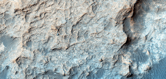
So by using this view from HiRISE of Curiosity sitting on the Naukluft Plateau:

HiRISE image of the Curiosity rover on the surface of Mars, on the Naukluft Plateau. Credit: NASA/JPL/University of Arizona

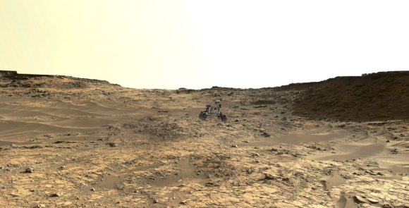
And then using Curiosity’s image of the same location, he can put a true-to-size rover in the image:

A true-to-size CGI rover inserted in the view of the Naukluft Plateau. Credit: NASA/JPL/University of Arizona/Seán Doran.

Then he ‘builds’ the route and terrain to make it even more realistic.

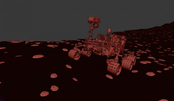
“Before I drive Curiosity I need to build a rocky collision course so she can physically interact with the environment,” he said. “This really helps to sell the final shot.”

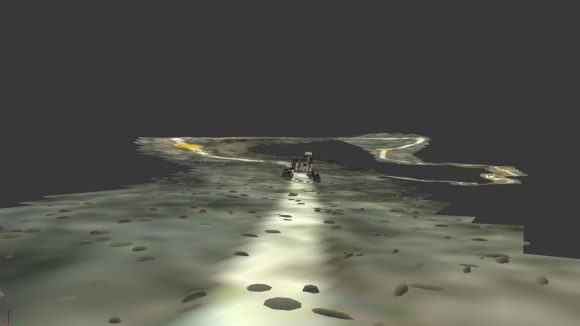
Simulated terrain and rover on the Naukluft Plateau. Credit: Seán Doran.

Then Seán builds a ‘car rig’ for Curiosity and drives her across the scene, in line with the actual route taken. Seán says good choices for doing this are using MadCar and DriveMaster for 3DS Max.

Simulated Curiosity rover on the Martian terrain, created using MadCar & DriveMaster for 3DS Max. Credit: Seán Doran.

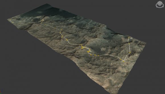
Then he takes a look at the big picture, taking the HiRISE image of the area and using the DTM files to create elevation and texture, and adds the route the rover will take so he knows where to ‘drive’ the rover:

Full extent of Naukluft Plateau built with HiRISE elevation and texture data, with the route superimposed. Credit: NASA/JPL/University of Arizona/Seán Doran.

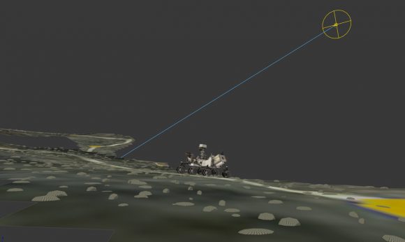
Then comes the time-consuming part, where once he has a good animation, he needs to render out each shot, plus he matches the Sun position so the virtual shadows cast will match those in the photomosaic. (Wow!)

Simulated rover and terrain with position of the Sun. Credit: Seán Doran.

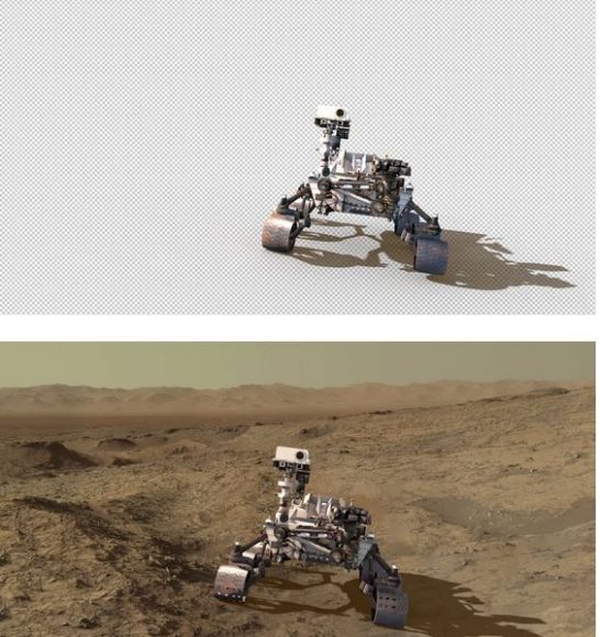
“I render separate passes for the background photomosaic and the foreground Curiosity,” Seán explained. “The HiRISE physics model is rendered with a Shadow Matte material which only catches shadows, this enables the rover to be easily blended in the final stage of the build.”

Then, everything is brought together in Adobe After Effects, where further image processing is used to blend both render elements together.

Simulated rover inserted in the scene with Adobe After Effects. Credit: Seán Doran.

We thank Seán Doran not only for completing this intricate process we can all enjoy, but for sharing the details!

“There is nothing trivial about building these assets, they are made out of fascination with the material and desire to communicate the excitement of being ‘present’ on another planet,” Seán said. “But I think it a great way to help people engage with such an exciting mission.”

More views from the video:

https://flic.kr/p/PUAbxN

https://flic.kr/p/Q1isdt

You can see many more images of Curiosity from Doran’s Flickr account, and his Sketchfab account has a lot of VR-ready content to explore.

Doran’s Gigapan account has extremely high resolution images of Gale Crater built using HiRISE data.

And to see his latest work and follow what he is currently working on, follow Seán Doran on Twitter: @_TheSeaning

A Black Hole’s Record Breaking Lunch

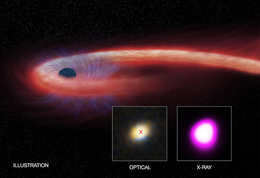
A trio of X-ray observatories has captured a decade-long eating binge by a black hole almost two billion light years away. Credit: X-ray: NASA/CXC/UNH/D.Lin et al, Optical: CFHT, Illustration: NASA/CXC/M.Weiss.

Does a distant black hole provide a new definition of pain and suffering?

The black hole, named XJ1500+0154, appears to be the real-life equivalent of the Pit of Carkoon, the nesting place of the all-powerful Sarlacc in Star Wars, which slowly digested its victims.

Over ten years ago, this giant black hole ripped apart a star and has since continued a very long lunch, feasting on the stars’ remains. Astronomers have been carefully monitoring this slow ‘digestion,’ because it is so unusual for what are called tidal disruption events (TDEs), where tidal forces from black holes tear stars apart.

“We have witnessed a star’s spectacular and prolonged demise,” said Dacheng Lin from the University of New Hampshire in Durham, New Hampshire, who led the observations of this event. “Dozens of tidal disruption events have been detected since the 1990s, but none that remained bright for nearly as long as this one.”

This artist’s illustration depicts what astronomers call a “tidal disruption event,” or TDE, when an object such as a star wanders too close to a black hole and is destroyed by tidal forces generated from the black hole’s intense gravitational forces. (Credit: NASA/CXC/M.Weiss.

This decade-long feast has gone on ten times longer than any other observed TDE.

XJ1500+0154 is located in a small galaxy about 1.8 billion light years from Earth, and three telescopes have been monitoring this X-ray event: the Chandra X-ray Observatory, the Swift satellite, and the XMM-Newton.

TDEs are different from another, more common black-hole related source of X-rays in the galaxy, active galactic nuclei (AGN). Like the digestion of the Sarlacc, AGNs really can last for thousands of years. These are supermassive black holes at the center of galaxies that pull in surrounding gas and “emit copious amounts of radiation, including X-rays,” explained Lin in a blog post on the Chandra website. “Radiation from AGNs do not vary a lot because the gas surrounding them extends over a large scale and can last for tens of thousands of years.”

In contrast, TDEs are relatively short-lived, lasting only a few months. During a TDE, some of the stellar debris is flung outward at high speeds, while the rest falls toward the black hole. As it travels inwards to be consumed by the black hole, the material heats up to millions of degrees, generating a distinct X-ray flare.

XJ1500+0154 has provided an extraordinarily long, bright phase, spanning over ten years. Lin and his team said one explanation could be the most massive star ever to be completely torn apart during a TDE.

“To have the event last so long at such high luminosity requires full disruption of a relatively massive star, about twice the mass of the sun,” Lin wrote; however, “disruption of such massive stars by the SMBH is very unlikely because stars this massive are rare in most galaxies, unless the galaxy is young and actively forming stars, as in our case.

So, another more likely explanation is that this is the first TDE observed where a smaller star was completely torn apart.

Lin also said this event has broad implications for black hole physics.

An X-ray image of the full field of view by of the region where the ‘tidal disruption event’ is taking place. The purple smudge in the lower right shows the disruption from the black hole XJ1500+0154. Credit: X-ray: NASA/CXC/UNH/D.Lin et al.

“To fully explain the super-long duration of our event requires the application of recent theoretical progress on the study of TDEs,” he wrote. “In the last two years, several groups independently found that it can take a long time after the disruption of the star for the stellar debris to settle onto the accretion disk and into the SMBH. Therefore, the event can evolve much more slowly than previously thought.”

Additionally, the X-ray data also indicate that radiation from material surrounding this black hole has consistently surpassed what is called the Eddington limit, which is defined as a balance between the outward pressure of radiation from the hot gas and the inward pull of the gravity of the black hole.

Seeing evidence of such rapid growth may help astronomers understand how supermassive black holes were able to reach masses about a billion times higher than the sun when the universe was only about a billion years old.

“This event shows that black holes really can grow at extraordinarily high rates,” said co-author Stefanie Komossa of QianNan Normal University for Nationalities in Duyun City, China. “This may help understand how precocious black holes came to be.”

Lin and his team will continue to monitor this event, and they expect the X-ray brightness to fade over the next few years, meaning the supply of ‘food’ for this long lunch will soon be consumed.

For further reading:
Paper: A likely decade-long sustained tidal disruption event
Lin’s blog post on the Chandra website
Chandra press release
Additional images and information from Chandra

Get Away From It All with these Amazing DTM Views of Mars

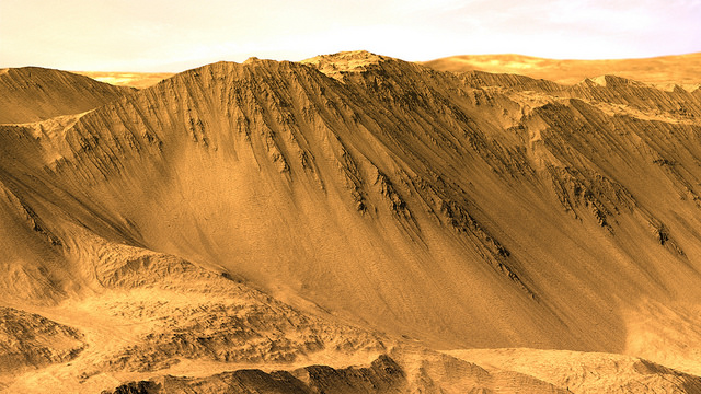
The rim of Tooting Crater on Mars, rendered from HiRISE data using Autodesk Maya and Adobe Photoshop. Credit: NASA/JPL/University of Arizona/USGS/image editing by Kevin Gill.

By day, Kevin Gill is a software engineer at the Jet Propulsion Laboratory. But on nights and weekends he takes data from spacecraft and turns them into scenes that can transport you directly to the surface of Mars.

Gill is one of many so-called “amateur” image editing enthusiasts that take real, high-resolution data from spacecraft and create views that can make you feel like you are standing on the surface of Mars, or out flying around the Solar System.

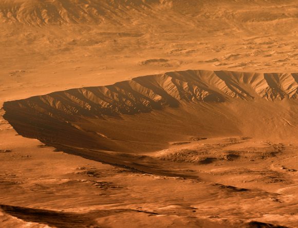
Gasa Crater on Mars. Rendered using Autodesk Maya and Adobe Photoshop. HiRISE data processed using HiView and gdal. Credit: NASA/JPL/University of Arizona/USGS/image editing by Kevin Gill.

Some of the best data around for these purposes come from the HiRISE camera on board the Mars Reconnaissance Orbiter. Data known as Digital Terrain Model (DTM) files, the HiRISE DTMs are made from two or more images of the same area of a region on Mars, taken from different angles. This data isn’t just for making stunning images or amazing movies. For scientists, DTMs are very powerful research tools, used to take measurements such a elevation information and model geological processes.

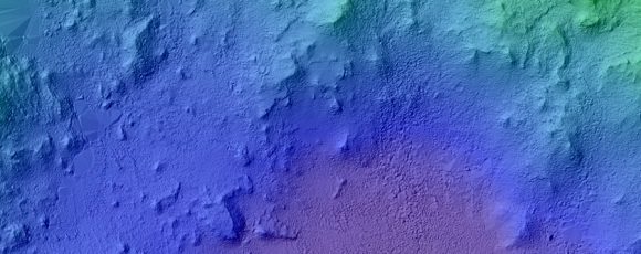
So, just how do you go from this DTM image from HiRISE:

DTM image of the Central Peak of Elorza Crater on Mars. Credit: NASA/JPL/University of Arizona/USGS

To this amazing image?

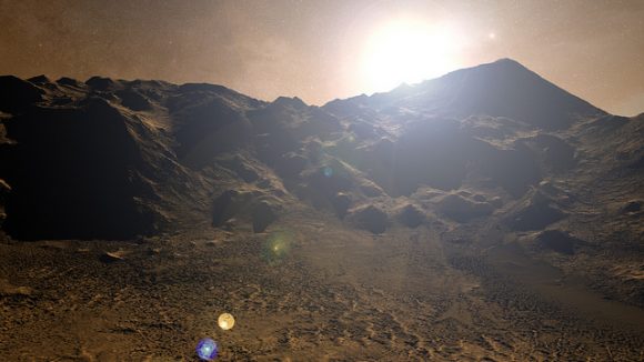
Martian sunrise over the Central Peak of Elorza Crater. Rendered using Autodesk Maya and Adobe Photoshop. HiRISE data processed using HiView and gdal. Credit: NASA/JPL/University of Arizona/USGS/image editing by Kevin Gill

I’m going to let Kevin explain it:

To prep the data, I use Photoshop (to convert the JP2 file to a TIFF), and then standard GIS tools like gdal (Geospatial Data Abstraction Library) to create textures for 3D modeling. Using Autodesk Maya, I input those into a material as a color texture (orthoimagery) or displacement map (the DTM data).

I connect that material to a NURBS plane (sort of like a polygon mesh) that is scaled similarly to the physical properties of the data. I set up a camera at a nice angle (it takes a number of low-resolution test renders to get an angle I like) and let it render.

Then I just pull that render into Photoshop where I have a series of monochromatic color tints which gives the image it’s Martian feel. For the sky, I use either a sky from a MSL MastCam image or one that I took outside with my cell phone. If I’m using a sky I took with my cell phone, I’ll adjust the colors to make it look more like it would on Mars. If the colors in the image are still boring at this point, I may run a HDR adjustment on it in Photoshop.

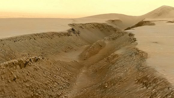
Fissure in the Cerberus region. This false color view of a volcanic fissure in the Cerberus region of Mars was created using a digital terrain model (DTM) from the High Resolution Imaging Science Experiment (HiRISE) camera aboard NASA’s Mars Reconnaissance Orbiter. The horizon was taken from Curiosity Mastcam imagery. Credit: NASA/JPL-Caltech/University of Arizona/ image editing by Kevin Gill.

What all this means is that you can create all these amazing view, plus incredible flyover videos, like this one Kevin put together of Endeavour Crater:

Or you can have some fun and visualize where the Curiosity rover is sitting:

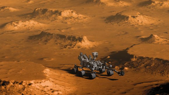
Doin’ Science with Curiosity. Created using HiRIST DTM and Ortho data and NASA model of Curiosity. Rendered using Autodesk Maya and Adobe Photoshop. Curiosity Model: Brian Kumanchik, NASA/JPL-Caltech. Image editing by Kevin Gill.

We’ve written about this type of image editing previously, with the work of the people at UnmannedSpaceflight.com and others. Of course, the image editing software keeps improving, along with all the techniques.

Kevin also wanted to point out the work of other image editing enthusiast, Sean Doran.

“Sean’s work is resulting in views similar to mine,” Kevin said via email. “I know he’s using a process very different from mine, but we are thinking along the same lines in what we want out of the end product. His are quite impressive.”

For example, here is a flyover video of the Opportunity rover sitting along the rim of Endeavour Crater:

You can see more of Sean’s work on his Flickr page

And you can see all of Kevin’s Mars DTM images at his Flick page here. Kevin also recently wrote up a great explanation of his image editing for The Planetary Society, which you can read here.

Thanks to Kevin Gill for sharing his images and expertise!

Unprecedented Views of Saturn’s Rings as Cassini Dances Death Spiral

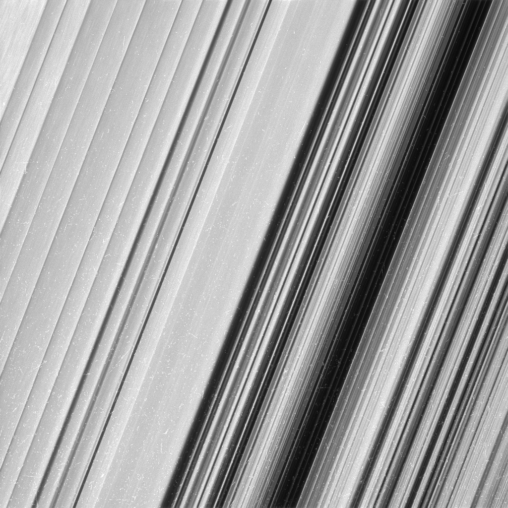
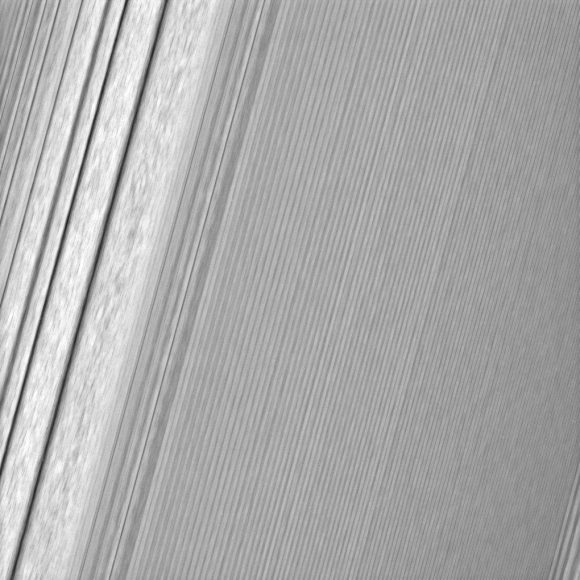
This image shows a region in Saturn's outer B ring. NASA's Cassini spacecraft viewed this area at a level of detail twice as high as it had ever been observed before. And from this view, it is clear that there are still finer details to uncover. Credit: NASA/JPL-Caltech/Space Science Institute

As the Cassini spacecraft moves ever closer to Saturn, new images provide some of the most-detailed views yet of the planet’s spectacular rings. From its “Ring-Grazing” orbit phase, Cassini’s cameras are resolving details in the rings as small as 0.3 miles (550 meters), which is on the scale of Earth’s tallest buildings.

On Twitter, Cassini Imaging Team Lead Carolyn Porco called the images “outrageous, eye-popping” and the “finest Cassini images of Saturn’s rings.”

Project Scientist Linda Spilker said the ridges and furrows in the rings remind her of the grooves in a phonograph record.

These images are giving scientists the chance to see more details about ring features they saw earlier in the mission, such as waves, wakes, and things they call ‘propellers’ and ‘straw.’

This Cassini image features a density wave in Saturn’s A ring (at left) that lies around 134,500 km from Saturn. Density waves are accumulations of particles at certain distances from the planet. This feature is filled with clumpy perturbations, which researchers informally refer to as “straw.” Credit: NASA/JPL-Caltech/Space Science Institute

As of this writing, Cassini just started the 10th orbit of the 20-orbit ring-grazing phase, which has the spacecraft diving past the outer edge of the main ring system. The ring-grazing orbits began last November, and will continue until late April, when Cassini begins its grand finale. During the 22 finale orbits, Cassini will repeatedly plunge through the gap between the rings and Saturn. The first of these plunges is scheduled for April 26.

The spacecraft is actually close enough to the ‘F’ ring that occasionally tenuous particle strike Cassini, said project scientist Linda Spilker, during a Facebook Live event today.
“These are very small and tenuous, only a few microns in size,” Spilker said, “like dust particles you’d see in the sunlight. We can actually ‘hear’ them hitting the spacecraft in our data, but these particles are so small, they won’t hurt Cassini.”

I talked with Spilker about ring particles for my book “Incredible Stories From Space:”

Spilker has envisioned holding a ring particle in her hand. What would it look like?

“We have evidence of the particles that have an icy core covered with fluffy regolith material that is very porous,” she said, “and that means the particle can heat up and cool down very quickly compared to a solid ice cube.”

The straw features are caused by clumping ring particles and the propellers are caused by small, embedded moonlets that creates propeller shaped wakes in the rings.

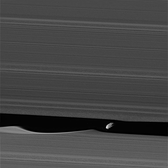
The wavemaker moon, Daphnis, is featured in this view, taken as NASA’s Cassini spacecraft made one of its ring-grazing passes over the outer edges of Saturn’s rings on Jan. 16, 2017. This is the closest view of the small moon obtained yet. Daphnis is 5 miles or 8 kilometers across. Credit: NASA/JPL-Caltech/Space Science Institute

This stunning view of the moon Daphnis shows the moon interacting with the ring particles, creating waves in the rings around it.

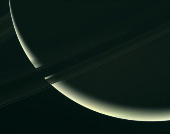
A close-up of Saturn and its rings. Assembled using raw uncalibrated RGB filtered images taken by the Cassini spacecraft on January 18 2017. Credit:
NASA/JPL-Caltech/SSI/image editing by Kevin M. Gill

“These close views represent the opening of an entirely new window onto Saturn’s rings, and over the next few months we look forward to even more exciting data as we train our cameras on other parts of the rings closer to the planet,” said Matthew Tiscareno, a Cassini scientist who studies Saturn’s rings at the SETI Institute, Mountain View, California. Tiscareno planned the new images for the camera team.

Further reading: JPL, CICLOPS

Juno Just Took One Of The Best Images Of Jupiter Ever

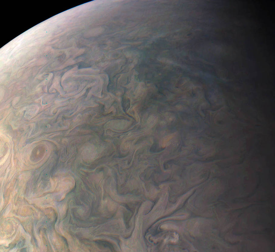
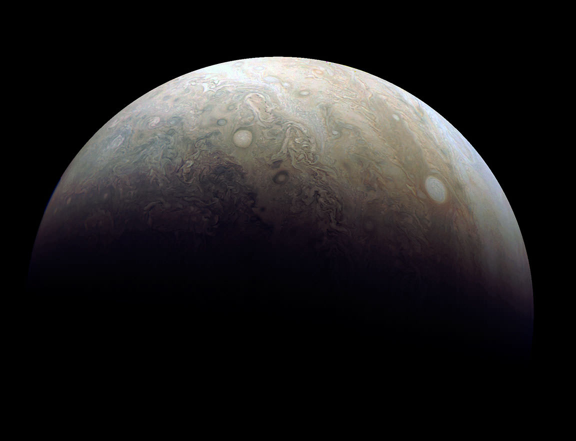
A portion of a new image taken by the JunoCam imager on NASA’s Juno spacecraft of Jupiter’s northern latitudes on Dec. 11, 2016. Credit: NASA/JPL-Caltech/SwRI/MSSS/Gerald Eichstaedt/John Rogers.

Wow! If you’ve ever wanted to know what it would be like to hang above Jupiter’s clouds, here you go. This absolutely stunning view of Jupiter’s northern latitudes shows incredible detail of gas giant’s swirling cloudtops. And it features, in the lower left in the image below, the storm on the gas planet known as NN-LRS-1, or more colloquially, the Little Red Spot.

The JunoCam imager on NASA’s Juno spacecraft snapped this shot of Jupiter’s northern latitudes on Dec. 11, 2016. Credit: NASA/JPL-Caltech/SwRI/MSSS/Gerald Eichstaedt/John Rogers.

Juno’s JunoCam, a visible light camera, is able to get never-before-seen images like this because it is doing something that no other mission to Jupiter has done.

“The spacecraft’s proximity to Jupiter is very unusual,” Rick Nybakken told me during an interview at JPL last year. Nybakken is Juno’s project manager. “Juno has an elliptical orbit that brings it just 3,107 miles (5,000 km) above the cloud tops. No other mission has been this close, and we’re right on top of Jupiter so to speak.”

Special instruments are studying Jupiter’s radiation belt and magnetosphere, its interior structure, and the turbulent atmosphere, as well as providing views of the planet with spectacular, close-up images.

And another great thing about this image is that it was processed by citizen scientists. Gerald Eichstaedt and John Rogers processed the image and drafted the caption, and this will be the norm for many of the JunoCam images, because it’s “the public’s camera.”

“I’m excited though for what we’re doing with the visible light camera,” said Juno Project Scientist Steve Levin, who I also interviewed at JPL. “We’re making JunoCam as much as much as we possibly can an instrument that belongs to the public. We’ll solicit the aid of the public in picking which images to take, and releasing the data in its rawest form, and allow people to go and make the images.”

Scientist Candy Hansen is leading this citizen science effort, and she uses the phrase, “science in a fishbowl,” meaning the JunoCam team is showing people what it is like to do science by allowing anyone to participate and see the data as it arrives from Juno.

Damian Peach reprocessed one of the latest images taken by Juno’s JunoCam during its 3rd close flyby of the planet on Dec. 11. The photo highlights two large ‘pearls’ or storms in Jupiter’s atmosphere. Credit: NASA/JPL-Caltech/SwRI/MSSS

You can find the raw images here, so go ahead and test out your image processing skills.

JunoCam is designed to capture remarkable pictures of Jupiter’s poles and cloud tops. Although its images will be helpful to the science team to help provide context for the spacecraft’s other instruments, it is not considered one of the mission’s science instruments. JunoCam was included on the spacecraft specifically for purposes of engaging and including the public.

The Little Red Spot is the third largest anticyclonic oval on the planet, which Earth-based observers have tracked for the last 23 years. An anticyclone is a weather phenomenon with large-scale circulation of winds around a central region of high atmospheric pressure. They rotate clockwise in the northern hemisphere, and counterclockwise in the southern hemisphere. The Little Red Spot shows very little color these days, just a pale brown smudge in the center. Back in 2006, the storm was stronger and the color changed darker and more red. Now, with the storm not quite as active, the color is very similar to the surroundings, making it difficult to see.

If you’d like to download a larger version of this processed image (need a new wallpaper?) you can find it on NASA’s website.

Could NASA Be Muzzled Under Trump Administration?

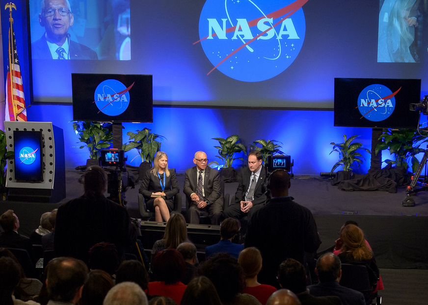
A NASA town hall meeting on Jan. 12, 2017 at NASA Headquarters with NASA employees, featured outgoing Deputy Administrator Dava Newman, left, NASA Administrator Charles Bolden, center, and the now acting NASA Administrator Robert Lightfoot. Credit: (NASA/Bill Ingalls)

The Trump Administration appears to be trying to change how government agencies disseminate information to the public. According to reports from multiple outlets, several agencies are being told to discontinue or suppress communications with the public, the media and even Congress.

Additionally, Reuters is reporting that the Trump administration has instructed the Environmental Protection Agency (EPA) to remove information about climate change from its website. (An update today from The Hill quotes Doug Ericksen, EPA transition team spokesman as they are only “taking a look at everything on there.”)

All this has anyone interested in NASA’s activities wondering if the US space agency could be ordered to stifle its very active social media presence, or to remove the extensive information it has available on several NASA-related sites on climate change.

Universe Today contacted several NASA sources to see if the space agency has received any orders similar to the other agencies. All indications appear that, for now, NASA has not received any such orders.

John Yembrick, who heads NASA Headquarters’ social media team told us via email that “Nothing has changed here at NASA. We are continuing to share information about our missions on social media.”

Another NASA employee who wished to remain anonymous said they would be surprised and horrified if the social media blocks would extend to NASA but it seems nothing is out of the question now.

This morning, several NASA social media accounts on Twitter and Facebook are posting as usual.

Jeff Foust from Space News reported on Twitter last night that he attended a talk by Michael Freilich, the director of NASA’s Earth science division at the meeting of the American Meteorological Society (AMS) going on this week in Seattle, Washington, and Freilich was asked if NASA been given direction like EPA and other agencies to not communicate with public. Foust tweeted that Freilich said they “have been given no direction to change” and that the transition to the new administration’s “landing team” of about eight people at NASA has gone smoothly.

NASA’s ‘meatball’ logo.

It is important to remember that federal law has required NASA to widely disseminate information about its activities and scientific research in a timely way. National Aeronautics and Space Act of 1958 chartered NASA to “provide for the widest practicable and appropriate dissemination of information concerning its activities and the results thereof.”

The anonymous NASA source Universe Today talked to said the bigger issue for them right now is the hiring freeze that was imposed on all government agencies, and a possible grant freeze, such as the freezes posed on the EPA. Many scientists and graduate student work programs rely on grants for their salaries.

Other agencies that have been reportedly muzzled are the Interior Department (and the National Park Service), the Department of Agriculture (USDA), Department of Commerce, and Health and Human Services. All this is sparking concerns that the new president might be attempting to silence any dissenting views and control any information from federal agencies.

A news article out this morning says the USDA has now “disavowed the gag order”, calling it “flawed” and indicating that new guidance would be sent to its employees.

“This internal email was released without Departmental direction, and prior to Departmental guidance being issued,” the USDA said in a statement.

Is This ‘Normal?’

It’s important to point out that previous incoming presidential administrations have placed somewhat similar restrictions on limiting communications during the transition in order to have consistent messages come out across agencies.

But of course, there hasn’t been a new administration for eight years, and during those years the amount of information government agencies have made available on the internet has increased exponentially, and participation on social media has exploded. So, the moves to limit or silence the information disseminated by the agencies via online outlets is therefore unprecedented.

And many say this presidential transition feels completely different from any before.

National Public Radio (NPR) correspondent Nathan Rott interviewed Andrew Light, Senior Fellow in the Climate Program at the World Resources Institute in Washington, D.C., who formerly worked at the State Department. Light said the muzzling of agencies “seems to be aimed at a cluster of science-driven agencies that primarily work on the environment or climate change, and that seems unique or targeted in this case and unprecedented.”

You can listen to the NPR interview below:

The two highest people in leadership at NASA under the Obama Administration, Administrator Charles Bolden and Deputy Administrator Dava Newman, both stepped down on January 20 at the end of Obama’s term. NASA Associate Administrator Robert Lightfoot was named as acting administrator of NASA. Two White House appointees were named, Erik Noble as White House senior advisor and Greg Autry as White House liaison, part of an eight-member “landing team” assigned to NASA by Trump’s transition team.

Autry is an assistant professor of entrepreneurship at the University of Southern California. He has been “a proponent of commercial space activities,” according to Space News. Noble, who earned a Ph.D. in environmental studies from the University of Colorado, spent seven years at the NASA Goddard Institute of Space Studies in New York, working on weather and climate models.

Concern about agencies being silenced were heightened yesterday when a National Park Service (NPS) Twitter account from the Badlands National Park in South Dakota began posting information about climate change, which were later deleted. The NPS told media outlets that a former employee without approved access wrote the Tweets and that’s why they were deleted.

A screenshot of a now-deleted Tweet from the Badlands National Park Twitter account.

This came just days after the NPS was told to shut down its Twitter activity over two retweets about crowd sizes at presidential inaugurations. The Department of the Interior said those tweets were deemed inconsistent with the agency’s mission.

About 60 science and journalism organizations have requested a meeting with President Trump and Vice President Mike Pence to discuss access to government, but the newly elected team has not replied to the request.

The Sunlight Foundation, “a nonpartisan, nonprofit organization that uses technology, open data, policy analysis and journalism to make our government and politics more accountable and transparent to all,” has posted a list of government agencies that have reportedly been directed to not communicate with the public.

Bullseye: Amazing SpaceX Images Highlight Perfect Falcon 9 Landing

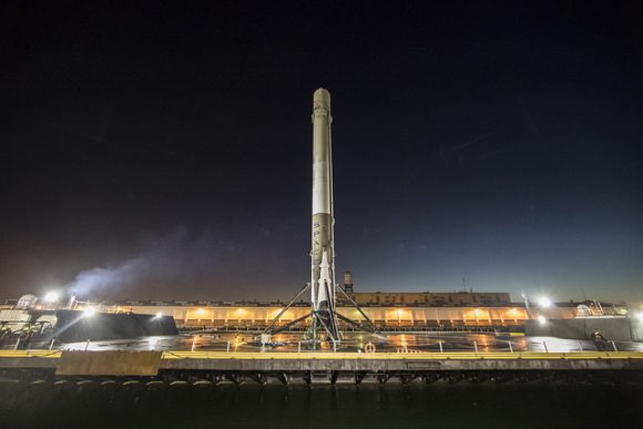
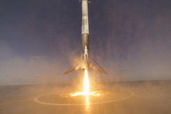
A SpaceX Falcon 9 rocket just before landing on the drone ship ‘Just Read the Instructions’ in the Pacific Ocean, on January 14, 2017 following the launch of 10 Iridium NEXT satellites into orbit. Credit: SpaceX.

SpaceX was able to celebrate a successful return to flight this week with a picture-perfect launch of the Falcon 9 rocket on January 14, 2017 that successfully delivered a fleet of ten advanced Iridium NEXT mobile voice and data relay satellites to orbit. But the icing on the cake was the dead-center landing and recovery of the Falcon 9 booster on their drone barge (named “Just Read The Instructions”) in the Pacific Ocean, off the west coast of California.

SpaceX released some images from the landing that are absolutely stunning, like this one, below:

A stunning view of the Falcon 9 rocket just before landing on a barge in the Pacific Ocean, on January 14, 2017 following the launch of 10 Iridium NEXT satellites into orbit. Credit: SpaceX.

The Falcon 9 launched from Space Launch Complex 4E on Vandenberg Air Force Base in California, and the main goal of the mission was to deploy the payload of the first ten Iridium Next communication satellites to low Earth orbit. Iridium plans to eventually have a fleet of 81 such satellites.

It was the first launch for the commercial company since the September 1, 2016 explosion on the launchpad at Cape Canaveral Air Force Station in Florida during a routine launchpad test. The explosion destroyed the Falcon 9 rocket and the payload of the Amos-6 communications satellite, which had an estimated value of $200 million. The explosion was traced back to a failure of a high-pressure helium vessel inside the Falcon 9’s second-stage liquid-oxygen tank.

Enjoy more images and video from the landing below:

Another view of the SpaceX Falcon 9 booster after landing on a barge in the Pacific Ocean on January 14, 2017. Credit: SpaceX.
The Falcon 9 booster sitting successfully on the barge after landing. Credit: SpaceX.

Here’s the full webcast of both the launch and landing:

You can see all of SpaceX’s latest images on their Flickr stream.

New NASA-themed TV Pilot by ‘The Martian’ Author Andy Weir

'Mission Control' is the name of a pilot for new TV series for CBS.

Author Andy Weir, who wrote the bestselling novel “The Martian” on which the successful 2015 movie of the same name was based, announced CBS is picking up his idea for a new pilot for a television show called “Mission Control.”

“For the past several months, I’ve been working on a TV show pilot, and I’m happy to announce that CBS is going to make it!” Weir posted on Facebook. “Of course, I’m all about scientific accuracy and this show will be no exception.”

Weir added (in what I assume was his best Tom Hanks), “Should be a hell of a show.”

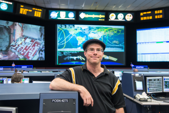
Author Andy Weir in NASA’s Mission Control Center in Houston during a tour. Credit: NASA/James Blair and Lauren Hartnett.

The show will be a drama, with the main characters working as flight controllers at the Mission Control Center in Houston, and how they “juggle their personal and professional lives during a critical mission with no margin for error,” reported Deadline Hollywood.

Weir said casting for the actors is about to begin, but there is already “an impressive group of behind-the-camera people already involved,” he said. “Notably: [producer] Aditya Sood, whom I worked with before on “The Martian”.

Additionally, Simon Kinberg, another producer for the “The Martian,” will be the executive producer of the new series.

Andy Weir on Universe Today’s “Weekly Space Hangout” in January 2015:

Weir was first hired as a programmer for a national laboratory at age fifteen then worked as a software engineer. But as a lifelong space nerd and a devoted hobbyist of subjects like relativistic physics, orbital mechanics, and the history of manned spaceflight, he wrote “The Martian” in his spare time. Weir originally self-published the novel in 2011, but it was so successful, the rights to it were purchased by Crown Publishing and it was re-released it in 2014. A film adaptation directed by Ridley Scott and starring Matt Damon, was released in October 2015.

“The Martian” is the story of astronaut Mark Watney, who becomes stranded alone on Mars in the year 2035, and does everything he can to survive.

Weir didn’t provide a timeline of when the show would air, but Keith Cowing at NASAWatch reported that NASA Public Affairs “has been approached by the show’s producers and they are waiting on a script for final consideration. At this point NASA has not committed to assist the producers, allow use of its logo, facilities, staff etc.”