Solar ‘Bombs’ And Mini-Tornadoes Spotted By Sun-Watching Spacecraft

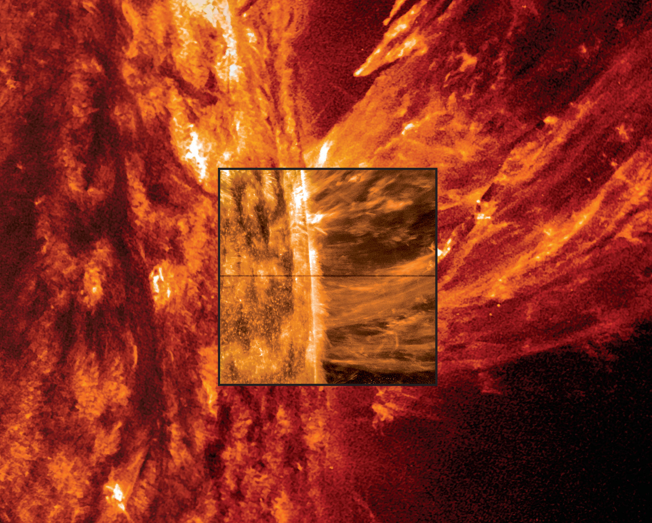
An image of a May 9, 2014 coronal mass ejection from the Sun using data from both the Interface Region Imaging Spectrograph (IRIS) spacecraft and the Solar Dynamics Observatory. Credit: NASA, Lockheed Martin Solar & Astrophysics Laboratory

My, the Sun is a violent place. I mean, we knew that already, but there’s even more evidence for that using new data from a brand-new NASA spacecraft. There’s talk now about tornadoes and jets and even “bombs” swirling amid our Sun’s gassy environment.

A huge set of results from NASA’s Interface Region Imaging Spectrograph (IRIS) spacecraft reveals the true nature of a mysterious transition zone between Sun’s surface and the corona, or atmosphere. Besides the pretty fireworks and videos, these phenomena are telling scientists more about how the Sun moves energy from the center to the outskirts. And, it could tell us more about how stars work in general.

The results are published in five papers yesterday (Oct. 15) in Science magazine. Below, a brief glimpse of what each of these papers revealed about our closest star.

Bombs

This is a heck of a lot of energy packed in here. Raging at temperatures of 200,000 degrees Fahrenheit (111,093 degrees Celsius) are heat “pockets” — also called “bombs” because they release energy quickly. They were found lower in the atmosphere than expected. The paper is here (led by Hardi Peter of the Max Planck Institute for Solar System Research in Gottingen, Germany.)

Tornadoes

It’s a twist! You can see some structures in the chromosphere, just above the Sun’s surface, showing gas spinning like a tornado. They spin around as fast as 12 miles (19 kilometers) a second, which is considered slow-moving on the Sun. The paper is here (led by Bart De Pontieu, the IRIS science lead at Lockheed Martin in California).

High-speed jets

Artist's impression of the solar wind from the sun (left) interacting with Earth's magnetosphere (right). Credit: NASA
Artist’s impression of the solar wind from the sun (left) interacting with Earth’s magnetosphere (right). Credit: NASA

How does the solar wind — that constant stream of charged particles that sometimes cause aurora on Earth — come to be? IRIS spotted high-speed jets of material moving faster than ever observed, 90 miles (145 kilometers) a second. Since these jets are emerging in spots where the magnetic field is weaker (called coronal holes), scientists suspect this could be a source of the solar wind since the particles are thought to originate from there. The paper is here (led by Hui Tian at the Harvard-Smithsonian Center for Astrophysics in Massachusetts.)

Nanoflares
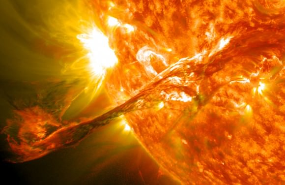
A solar filament erupts with a coronal mass ejection in this image captured by NASA's Solar Dynamics Observatory in August 2012. Credit: NASA's GSFC, SDO AIA Team
A solar filament erupts with a coronal mass ejection in this image captured by NASA’s Solar Dynamics Observatory in August 2012. Credit: NASA’s GSFC, SDO AIA Team

Those solar flares the Sun throws off happen when magnetic field lines cross and then snap back into place, flinging particles into space. Nanoflares could do the same thing to heat up the corona, and that’s something else that IRIS is examining. The paper is here (led by Paola Testa, at the Harvard-Smithsonian Center for Astrophysics.)

Structures and more

And here is the transition region in glorious high-definition. Improving on data from the Skylab space station in the 1970s (bottom of video), you can see all sorts of mini-structures on the Sun. The more we learn about these 2,000-mile (3,220-km) objects, the better we’ll understand how heating moves through the Sun. The paper is here (led by Viggo Hansteen, at the University of Oslo in Norway.)

Source: NASA

‘Death Star’ Ocean? Seven Moons That Could Host Huge Hidden Liquid Reservoirs

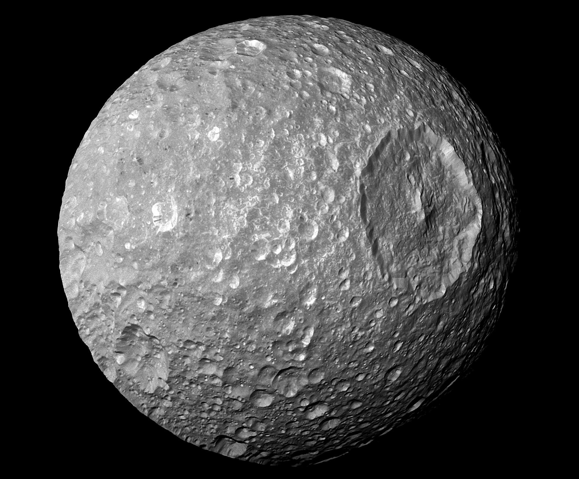
A view of Mimas from the Cassini spacecraft. Credit: NASA/JPL/Space Science Institute

Could there be an ocean hidden somewhere in that Death Star-like picture? This is an image of Mimas, a moon of Saturn, and just yesterday (Oct. 15) newly released data from the Cassini spacecraft suggests there are big liquid reservoirs underneath its surface.

“The amount of the to-and-fro motion indicates that Mimas’ interior is not uniform. These wobbles can be produced if the moon contains a weirdly shaped, rocky core or if a sub-surface ocean exists beneath its icy shell,” said Cornell University in a press release. More flybys with the Cassini spacecraft will be required to learn more about what lies beneath.

You can read more about the study (led by Cornell astronomy research associate Radwan Tajeddine) in Science, where it was published. Below, learn more about other worlds in the Solar System that could host oceans under their surface.

Enceladus

Recent Cassini images of Saturn's moon Enceladus backlit by the sun show the fountain-like sources of the fine spray of material that towers over the south polar region. This image was taken looking more or less broadside at the "tiger stripe" fractures observed in earlier Enceladus images. It shows discrete plumes of a variety of apparent sizes above the limb (edge) of the moon. This image was acquired on Nov. 27, 2005.   Image Credit:   NASA/JPL/Space Science Institute
Cassini images of Saturn’s moon Enceladus backlit by the sun show the fountain-like sources of the fine spray of material that towers over the south polar region. This image was taken looking more or less broadside at the “tiger stripe” fractures observed in earlier Enceladus images. It shows discrete plumes of a variety of apparent sizes above the limb (edge) of the moon. This image was acquired on Nov. 27, 2005. Image Credit: NASA/JPL/Space Science Institute

After nearly a decade of speculation, this year the Cassini spacecraft returned gravity data suggesting Enceladus (another moon of Saturn) does have a large subsurface ocean near its south pole, if not a global ocean. If confirmed, that could help explain why scientists see water gushing out of fractures in that area. As this recent paper by Cassini scientists shows, Enceladus is a promising location for habitability.

Titan

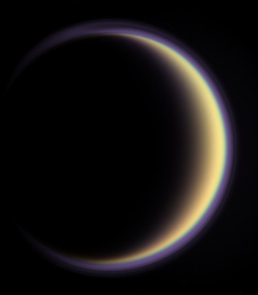
A halo of light surrounds Saturn's moon Titan in this  backlit picture, showing its atmosphere. Credit: NASA/JPL/Space Science Institute
A halo of light surrounds Saturn’s moon Titan in this backlit picture, showing its atmosphere. Credit: NASA/JPL/Space Science Institute

By the way, anyone noticed that we still haven’t even left Saturn’s system? Titan is usually high on astrobiology wish lists for researchers because its hydrocarbon chemistry could be precursors to how life evolved. What’s not talked about as much, though, is at least two research findings pointing to evidence of a hidden ocean. Evidence comes from Titan’s tidal flexing from interacting with Saturn — which is 10 times more than what would be expected with a solid core — and the way that it moves on its own axis as well as around Saturn.

Europa

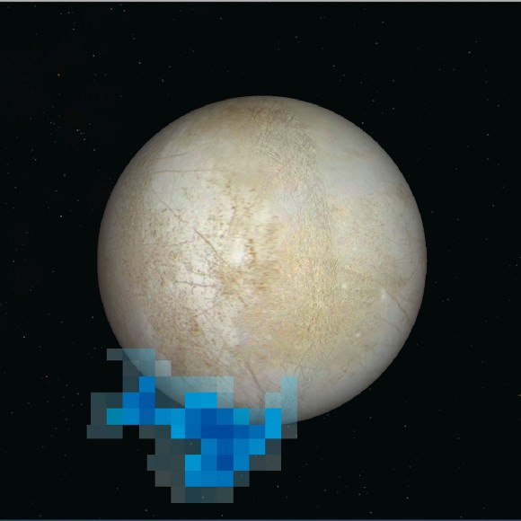
Rendering showing the location and size of water vapor plumes coming from Europa's south pole. Credit: NASA/ESA/L. Roth/SWRI/University of Cologne
Rendering showing the location and size of water vapor plumes coming from Europa’s south pole. Credit: NASA/ESA/L. Roth/SWRI/University of Cologne

That Minecraft-looking object floating beside Europa there is a rendering showing where water vapor erupted from the Jovian moon, spotted by the Hubble Space Telescope in 2013. We were lucky enough to have a close-up view of Europa in the 1990s and early 2000s courtesy of NASA’s Galileo spacecraft. What we know for sure is there’s thick ice on Europa. What’s underneath is not known, but there’s long been speculation that it could be a subsurface ocean that may have more water than our own planet.

Io

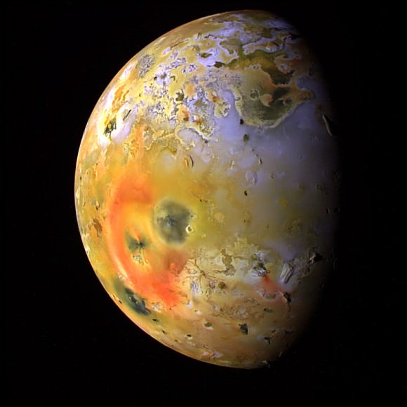
Jupiter's volcanic moon Io , imaged by the Galileo spacecraft in 1997. Credit: NASA/JPL/University of Arizona
Jupiter’s volcanic moon Io , imaged by the Galileo spacecraft in 1997. Credit: NASA/JPL/University of Arizona

Still flying around Jupiter here, we now turn our attention to Io — a place that is often remarked upon because of its blotchy appearance as well as all of the volcanoes on its surface. A newer analysis of Galileo data in 2011 — looking at some of the lesser-understood magnetic field data signatures — led one research team to conclude there could be a magma ocean lurking underneath that violence.

Triton

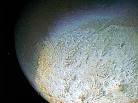
A glimpse of Triton from the Voyager 2 spacecraft, which flew by the Neptunian moon in August 1989. Credit: NASA/JPL

Little is known about Triton because only one spacecraft whizzed by it — Voyager 2, which took a running pass through the Neptune system in August 1989. An Icarus paper two years ago speculated that the world could host a subsurface ocean, but more data is needed. The energy of Neptune (which captured Triton long ago) could have melted its interior through tidal heating, possibly creating water from the ice in its crust.

Charon

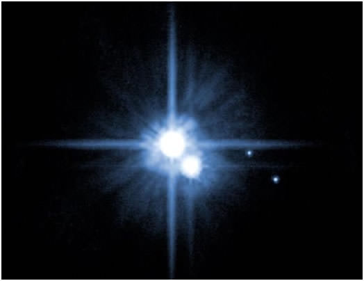
Hubble image of Pluto and some of its moons, Charon, Nix and Hydra. Image Credit: NASA, ESA, H. Weaver (JHU/APL), A. Stern (SwRI), and the HST Pluto Companion Search Team

We don’t have any close-up pictures of this moon of Pluto yet, but just wait a year. The New Horizons spacecraft will zoom past Charon and the rest of the system in July 2015. In the meantime, however, findings based on a model came out this summer in Icarus suggesting Charon — despite being so far from the Sun — might have had a subsurface ocean in the past. Or even now. The key is its once eccentric orbit, which would have produced tidal heating while interacting with Pluto. The science team plans to look for cracks that could be indicative of “the structure of the moon’s interior and how easily it deforms, and how its orbit evolved,” stated Alyssa Rhoden of NASA’s Goddard Space Flight Center in Maryland, who led the research.

Gallery: NASA Astronauts Spacewalk Boldly Into The Void, Finishing Vital Repairs

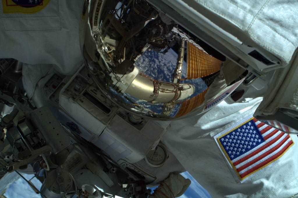
NASA astronaut Reid Wiseman (Expedition 41) captured during an Oct. 15 spacewalk by fellow astronaut Butch Wilmore. Credit: Reid Wiseman / Twitter

What a view! NASA’s Reid Wiseman and Butch Wilmore spacewalked successfully yesterday (Oct. 15) for more than 6.5 hours, replacing a faulty camera as well as a broken power regulator that was reducing the amount of power available on the International Space Station. The astronauts also shifted equipment to get ready for some bigger upgrades on station to prepare for commercial spacecraft arriving in 2017.

Check out the stunning pictures from the spacewalk below.

Pluto Planning: Hubble Spots 3 Objects NASA Spacecraft Could Visit Next

Two potential targets for the New Horizons mission emerge in these Hubble Space Telescope multiple-exposure images. Both are about four billion miles (6.4 billion kilometers) away. NASA, ESA, SwRI, JHU/APL, and the New Horizons KBO Search Team

Where could New Horizons visit after it flies by Pluto next year? NASA’s Hubble Space Telescope is on the case. In a program that pushed the limits of the 24-year-old observatory, Hubble found three potential Kuiper Belt Objects for the spacecraft to visit.

The wrinkle is there is no money approved yet for New Horizons to do an extended mission yet, but team members (including Alex Parker from the Southwest Research Institute, who is quoted from Twitter below) are celebrating the milestone. To them, the most promising target (PT1) is the one on the left of the images you see above. Read more about it below the jump.

The Kuiper Belt is a zone of icy objects about four billion miles (6.4 billion kilometers) from the Sun, considered to be leftovers of the building blocks that put together the Solar System billions of years ago. It’s an area that Pluto itself drifts through from time to time on its elliptical orbit around the Sun. Roughly 1,000 objects there have been cataloged, although many more are believed to exist.

The team used Hubble from June 16 to 26 in a test program to look at 20 sky zones for evidence of KBOs, finding two that had never been spotted before by ground-based telescopes. More searching between July and September revealed one object that is “definitely reachable”, NASA stated, and two others that require more scrutiny.

Each of the three candidates would take a while to reach, as they are all about one billion miles (1.6 billion km) beyond Pluto. They’re also tiny, with two estimated at 34 miles (55 kilometers) across and the third at 15 miles (25 kilometers). This makes them 10 times bigger than the average comet, but only 1-2% the size of small Pluto.

“This was a needle-in-haystack search for the New Horizons team because the elusive KBOs are extremely small, faint, and difficult to pick out against a myriad background of stars in the constellation Sagittarius, which is in the present direction of Pluto,” NASA wrote in a press release.

New Horizons’ team plans to ask for the extended mission in late 2016. Meanwhile, the spacecraft (which has been flying ever outwards since 2006) will finally zoom past its main target of Pluto in July 2015.

Ice Alert! Mercury’s Deposits Could Tell Us More About How Water Came To Earth

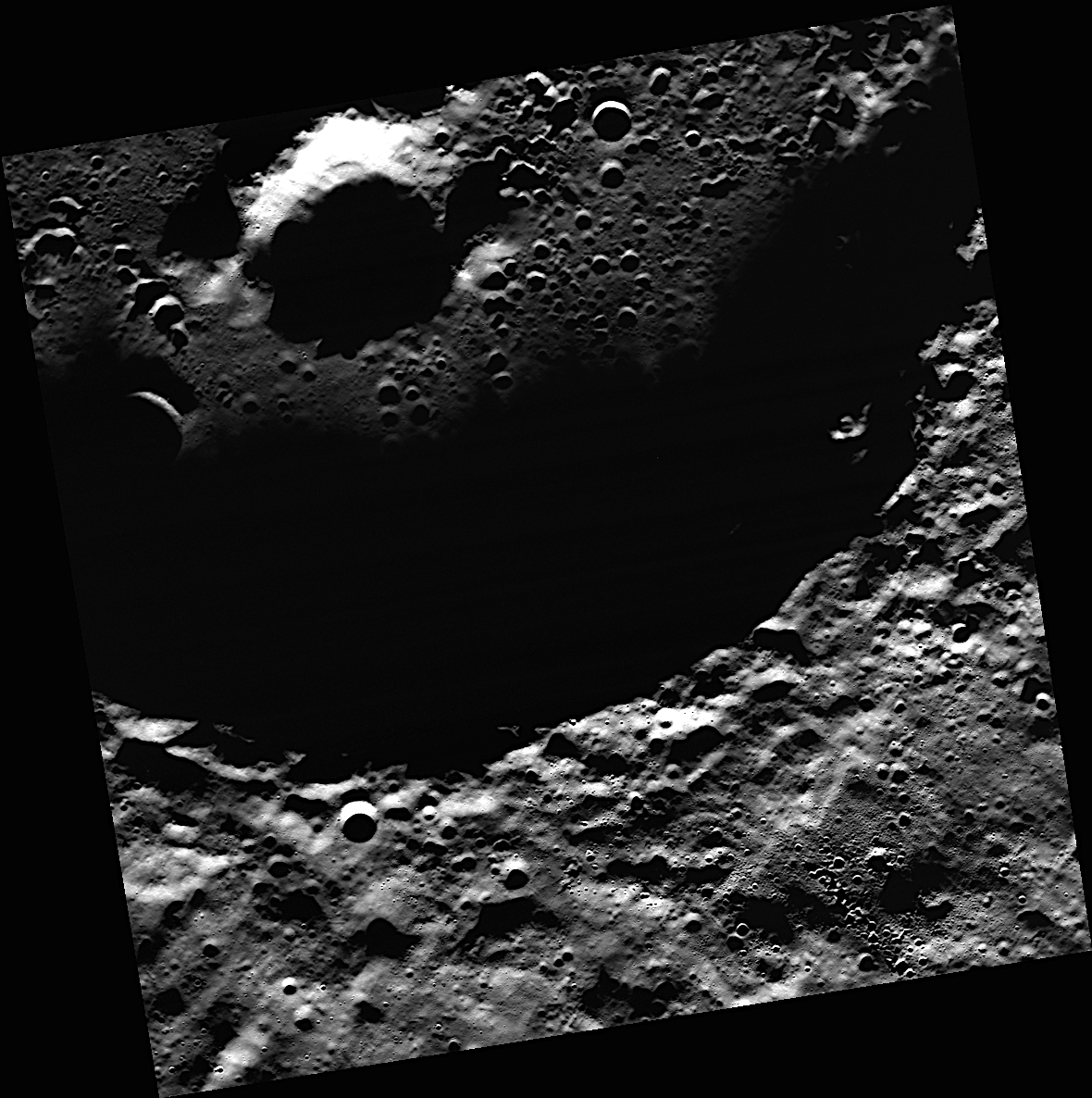
A view of the crater Prokofiev on Mercury. The crater is the largest one on the planet's north pole area to have "radar-bright" material, a probable sign of ice. Credit: NASA/Johns Hopkins University Applied Physics Laboratory/Carnegie Institution of Washington.

New pictures of water ice at Mercury’s north pole — the first such optical images ever — could help scientists better understand how water came to planets in the rest of the Solar System, including Earth. The image you see above came courtesy of NASA’s MErcury Surface, Space ENvironment, GEochemistry, and Ranging (MESSENGER) spacecraft.

Mercury is a hot planet (it’s the closest one to the Sun), so the only way the ice survives is in deep shadow. This makes it hard to spot unless scientists use some clever techniques. In this case, they examined some scattered light from Prokofiev, the biggest crater in Mercury’s north pole suspected to hold the deposits.

The pictures show that Prokofiev’s surface water ice likely arrived after the craters underneath. And in an intriguing find, there is probably other water ice sitting under dark materials believed to be “frozen organic-rich compounds,” stated the Johns Hopkins University Applied Physics Laboratory.

“This result was a little surprising, because sharp boundaries indicate that the volatile deposits at Mercury’s poles are geologically young, relative to the time scale for lateral mixing by impacts,” stated lead researcher Nancy Chabot, the Instrument Scientist for MESSENGER’s Mercury dual imaging system.

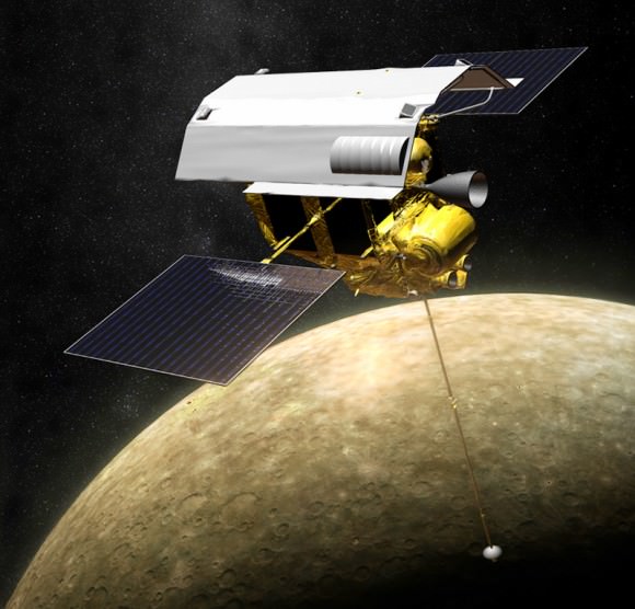
Illustration of MESSENGER in orbit around Mercury (NASA/JPL/APL)

“One of the big questions we’ve been grappling with is ‘When did Mercury’s water ice deposits show up?’ Are they billions of years old, or were they emplaced only recently?”, added Chabot, who is a planetary scientist at the Johns Hopkins University Applied Physics Laboratory in Maryland. “Understanding the age of these deposits has implications for understanding the delivery of water to all the terrestrial planets, including Earth.”

Another intriguing property comes when scientists compare Mercury to the Moon: because the ice looks different on both relatively atmosphere-less bodies, scientists believe the water came more recently to the Moon. But more study is required.

Results were published recently in the journal Geology.

Source: Johns Hopkins University Applied Physics Laboratory

Mars One Dustup: Founder Says Mission Won’t Fail As MIT Study Predicts

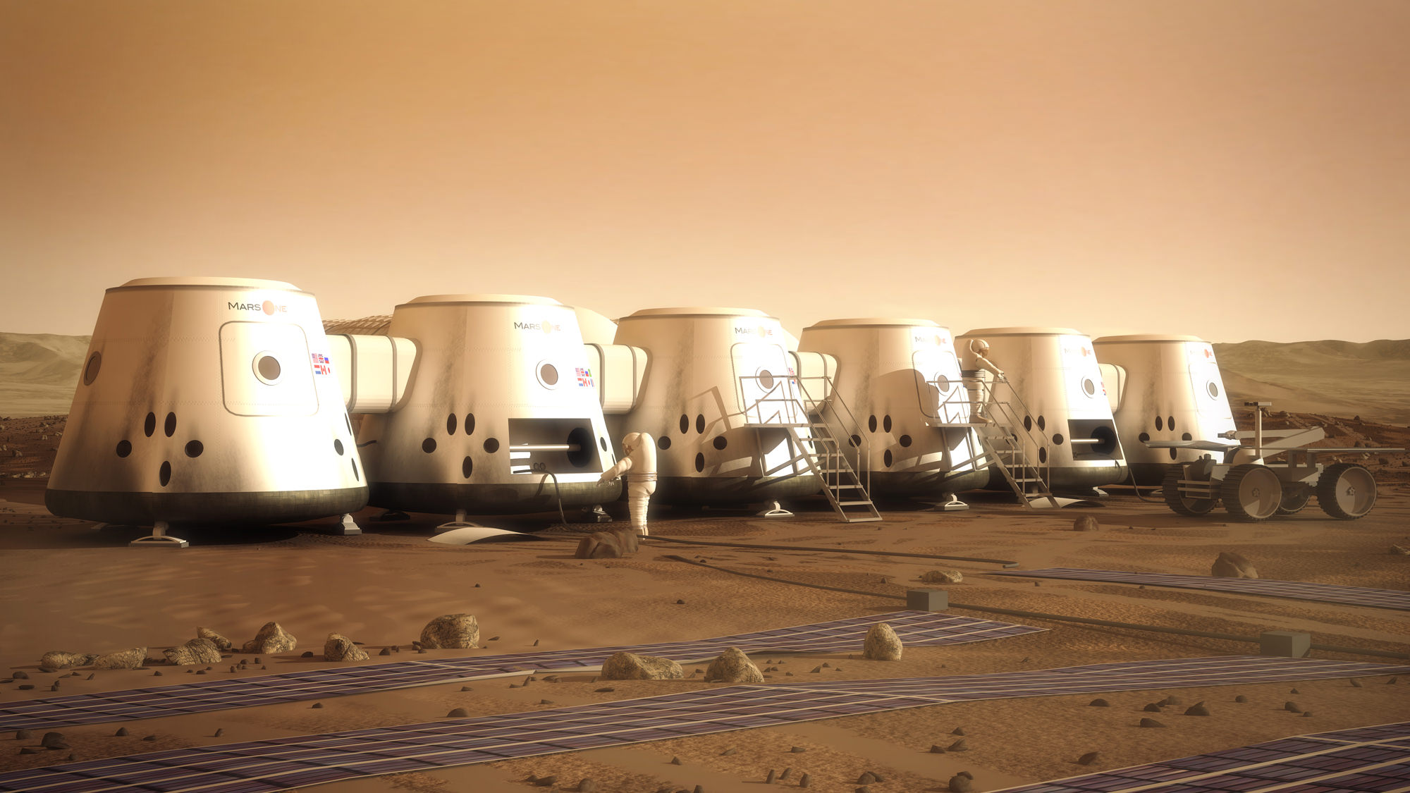
Artist's conception of Mars One human settlement. Credit: Mars One/Brian Versteeg

How possible is it to land humans on Mars? And can Mars One, the organization proposing to start with sending four astronauts one way, capable of doing it by 2025 as it promises?

A new study says that the Mars One concept could fail on several points: oxygen levels could skyrocket unsafely. Using the local resources to generate habitability is unproven. The technology is expensive. But the founder of Mars One says the Massachusetts Institute of Technology (MIT) student study is based on the wrong assumptions.

“It’s based on technology available on the ISS [International Space Station],” said Bas Landorp in an interview with Universe Today. “So you end up with a completely different Mars mission than Mars One. So their analysis has nothing to do with our mission.”

The mission has sparked a debate about sending humans on a trip with no promise for a return, but thousands of applicants vied for the chance to do it. After two cuts, the interim shortlist is now at 700 people. Those folks are awaiting interviews (more news is coming shortly, Landorp says) and no date has yet been announced for the next “cut.”

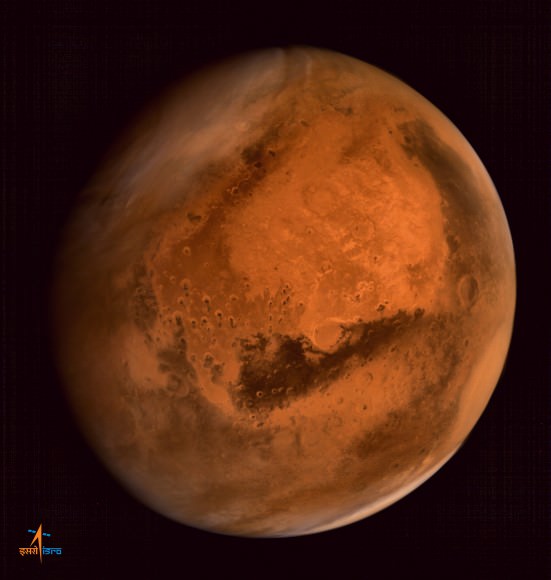
ISRO's Mars Orbiter Mission captures spectacular portrait of the Red Planet and swirling dust storms with the on-board Mars Color Camera from an altitude of 74500 km on Sept. 28, 2014.  Credit: ISRO
ISRO’s Mars Orbiter Mission captures spectacular portrait of the Red Planet and swirling dust storms with the on-board Mars Color Camera from an altitude of 74500 km on Sept. 28, 2014. Credit: ISRO

A couple of weeks ago, MIT students presented a technical feasibility analysis of Mars One at the International Astronautical Congress in Toronto, Canada. The study is 35 pages long, so we recommend you read it to get the whole picture. The students’ main concerns are that crops (if they are responsible for 100% of the food) would send oxygen levels to unsafe margins, with no way to remove it. There are concerns with how well the in-situ resource utilization (using the resources on Mars to live off of) would perform. And the mission would cost $4.5 billion at a minimum — for the first crew only.

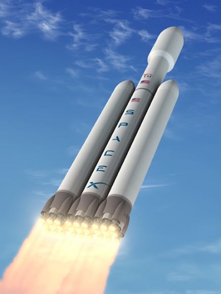
Cost: To get to Mars, the students say it will cost $4.5 billion and take 15 Falcon Heavy launches (a proposed next-generation rocket from SpaceX). Landorp says he can do it for $1.625 billion (since he doesn’t require constant Earth resupply) and as few as 13 launches (assuming $125 million per launch, a figure Landrop says is from SpaceX) by taking advantage of a few quirks of physics. If Mars One chooses a landing site that is four kilometers (2.5 miles) below the average Martian surface height, they will have both a thicker atmosphere and more time to land the payloads than, say, the Curiosity rover that landed about two kilometers (1.24 miles) above the average surface height. Mars One’s numbers show they could carry a payload of 2,500 kilograms (5,512 pounds) per mission, which they say is well within reach of what spacecraft can do today. The 13 launches would be divided into 11 robotic launches to send equipment to the surface, and two for humans (one to head to Earth orbit for assembly, and the other for the colonists to head to the in-orbit spacecraft and fly to Mars. The assembly crew would then fly back to Earth on the launch vehicle.)

Life support: While many of the technologies planned for use in life support are similar to those on the ISS — such as a trace gas system for air revitalization — Landorp says there will be some crucial differences. They are in talks with Paragon Space Systems Corp. (which describes itself as an environmental control firm for extreme environments, and whose customers include NASA and Bigelow.) As for the unsafe oxygen levels, Landorp points out there are plenty of oxygen removal systems available and that are used in hospitals and militaries. All that is needed is more testing in space. Landorp also points out these systems will be tested for two years robotically before humans land. “If that is not successful, then obviously we will not send humans,” he said.

The proposed Falcon Heavy rocket. Credit: SpaceX

In-situ resource utilization: Landorp acknowledges this requires more study, but says the robotic missions will be an important precursor for the human landings. Technologies needing to be developed will include nitrogen extraction from the Martian atmosphere. Oxygen production from water is well-studied in space, but water from the Martian surface (through vaporizing water in the soil) will require more work.

Another concern raised in media from time to time is where the money is coming from to fund Mars One. Landorp says right now funds are flowing from private investors. Mars One representatives are also in serious talks with a United Kingdom-based listed investment fund willing to finance the mission. In the long run, Landorp is confident money will come from broadcast deals similar to what partially fund the Olympics and the Fédération Internationale de Football Association (FIFA) competitions. Associated sponsorships would also help. But these won’t kick in until the colonists launch and land, since that’s when the world’s eyeballs will be on the mission.

Another stream of revenue, which may take five to seven years to kick in, will be intellectual property deals Mars One one representatives are working on closing now with potential suppliers, such as Lockheed Martin and Paragon. These agreements, should they go through as planned, would give Mars One a share of future revenue from any technologies flowing from the IP. “In the short term it’s not that interesting, it takes time to mature, but in the long term that will be interesting,” Landorp said.

Gravity’s Magic: New Seafloor Map Shows Earth’s Uncharted Depths

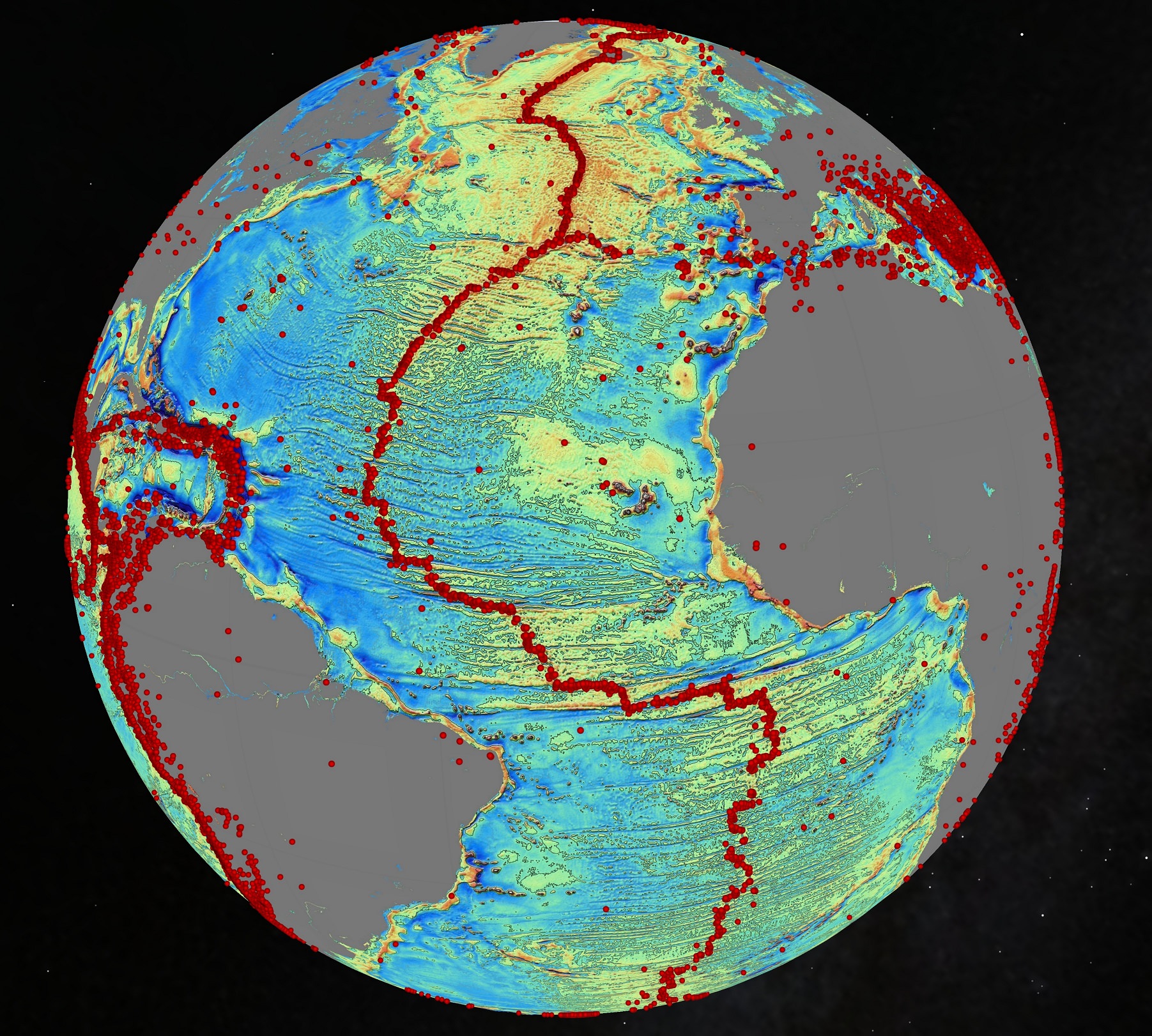
An October 2014 gravity map of the Earth's oceans using data from the European Space Agency's CryoSat mission and the CNES-NASA Jason-1 satellite. Findings include "continental connections" between South American and Africa, and evidence of seafloor spreading in the Gulf of Mexico that took place 150 million years ago. The red dots are volcanoes. Credit: Scripps Institution of Oceanography

Volcanoes! Seafloor spreading! Hidden ridges and mountains! These are the wonders being revealed in new maps of Earth’s sea floor. And no, it didn’t require a deep-sea dive to get there. Instead we got this information from a clever use of gravity (combining the data of two satellites making measurements from orbit.)

The data has caught the attention of Google, which plans to use this data for its upcoming ocean maps release. Scientists also say the information will tell us more about the 80% of the ocean floor that is either unexamined or obscured by thick sand.

So here’s where the data came from. The Scripps Institution of Oceanography combined information from two satellites — the European Space Agency’s ongoing CryoSat mission and the now defunct Jason-1 satellite from NASA and the French space agency CNES, which was decommissioned in 2013 after nearly 12 years of operations.

CryoSat is designed to map the thickness of ice using a radar altimeter (which is a clue to the effects of climate change). But this altimeter can be used all over the world, including to look at how high the sea floor is. Jason-1, for its part, was told to look at the Earth’s gravity field in the last year of its mission. And what a world pops out when this data is used.

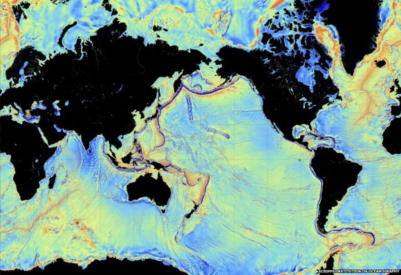
A 2014 view of the Earth's sea floor using data from the European Space Agency's CryoSat mission and the CNES-NASA Jason-1 satellite. Credit: Scripps Institution of Oceanography
A 2014 view of the Earth’s sea floor using data from the European Space Agency’s CryoSat mission and the CNES-NASA Jason-1 satellite. Credit: Scripps Institution of Oceanography

“The effect of the slight increase in gravity caused by the mass of rock in an undersea mountain is to attract a mound of water several meters high over the seamount. Deep ocean trenches have the reverse effect,” ESA wrote in a statement.  “These features can only be detected by using radar altimetry from space.”

Some of the new findings include finding new bridges between Africa and South America and uncovering seafloor spreading that happened in the Gulf of Mexico 150 million years ago. Results based on the study, led by Scripps’ David Sandwell, recently appeared in the journal Science.

Long-time readers of Universe Today may also recall a gravity map from ESA’s Gravity Field and Steady-State Ocean Circulation Explorer (GOCE), which revealed Earth’s gravity as a lumpy potato shape in 2011.

Source: European Space Agency

Observing Wow! 28 Moon Pictures Captured In A Single Collage

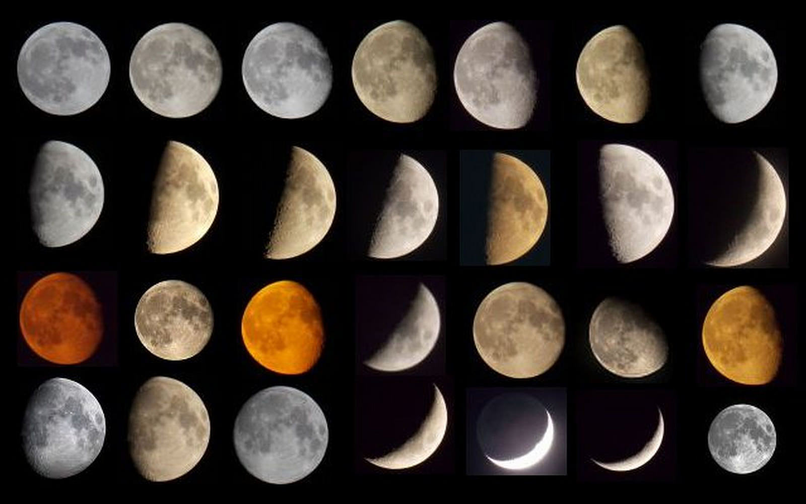
A collage of moon photos that photographer David Blanchflower took between March and October 2014 from Newcastle upon Tyne, United Kingdom, using a Nikon Coolpix L810 camera. One picture used a telescope (Skywatcher Explorer 200P).

We think of the Moon as a grey and unchanging world, but throw in the effects of Earth’s atmosphere and orbit and you get some really cool effects. It can look yellow or red or almost blue. It changes from a full disc to a crescent and back again. It gets bigger and smaller as the Moon drifts forward and backward in its orbit. Sometimes it’s even eclipsed.

Remarkably, one photographer has captured many of these moods in a single collage. The picture above from David Blanchflower was recently posted to the Universe Today Flickr pool, showing images between March and October 2014.

“All from Newcastle upon Tyne with a Nikon Coolpix L810 Camera,” Blanchflower wrote. “One of the pictures was taken with the aid of a telescope (Sky-Watcher Explorer 200P). They show a variety of colours and phases.”

We’d love to see your shots of the moon as well, so please feel free to contribute to the Flickr pool. Posting a picture means we could use it in a future story.

By the way, we have used Blanchflower’s work before in this recent collection of SuperMoon photos.

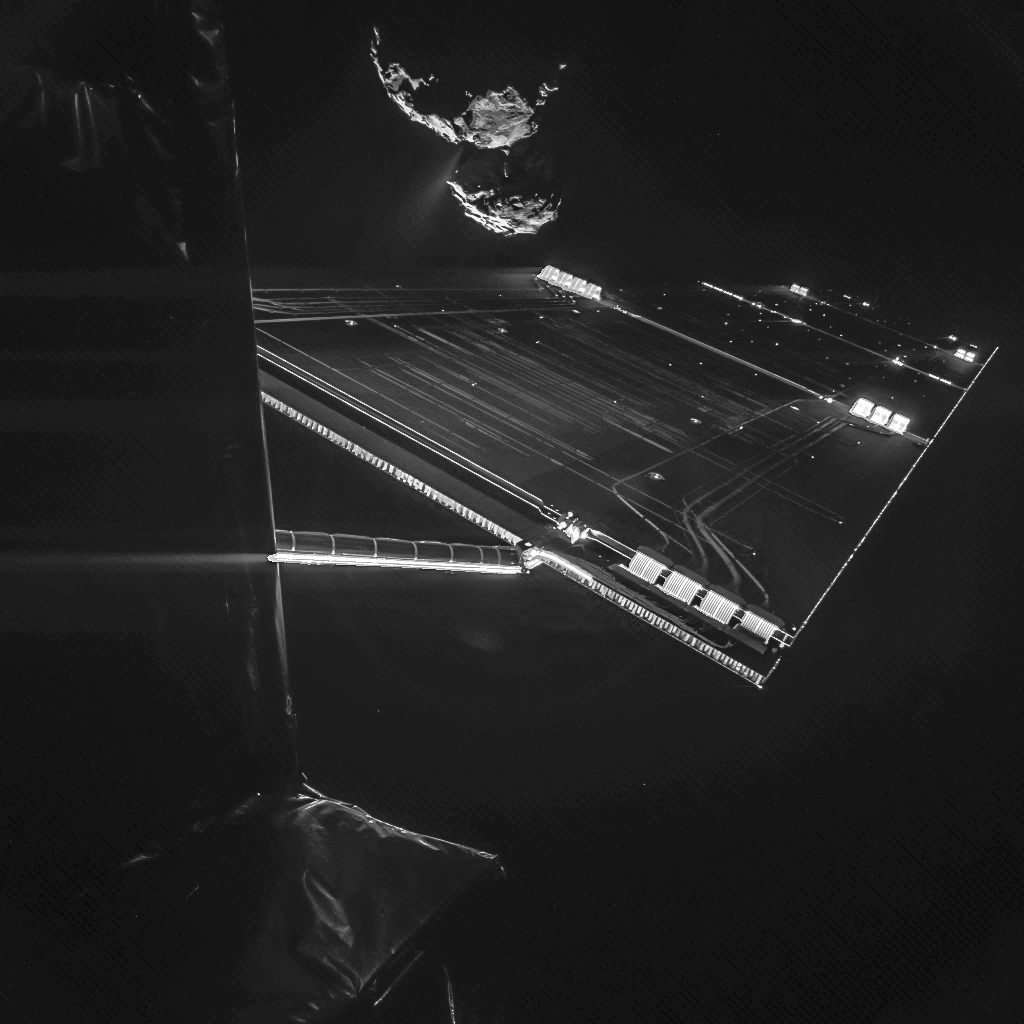
Creepy Comet Looms In The Background Of Newest Philae Spacecraft Selfie

The Rosetta spacecraft takes a selfie Oct. 7 with its target, 67P/Churyumov–Gerasimenko, from an altitude of about 9.9 miles (16 kilometers). Credit: ESA/Rosetta/Philae/CIVA

So this spacecraft — taking this picture — is going to land on the surface of THAT comet. Doesn’t this give you a pit in your stomach? This is a selfie taken from the Philae spacecraft that, riding piggyback, captured the side of the Rosetta spacecraft orbiting  Comet 67P/Churyumov-Gerasimenko.

The image is so close-up — just 9.9 miles (16 kilometers) from 67P’s surface — that mission planners can even spot Landing Site J on the comet’s smaller lobe.

“Two images, one with a short exposure time, one with a longer one, were combined to capture the whole dynamic range of the scene, from the bright parts of the solar arrays to the dark comet and the dark insulation cladding the Rosetta spacecraft,” the European Space Agency stated.

It’s quite the zoom-in after the last selfie that Philae produced for the public in September, which was taken from 31 miles (50 kilometers) away. The spacecraft is expected to make the first touchdown ever on a comet next month. Rosetta, meanwhile, will keep following 67P as it gets closest to the sun in 2015, between the orbits of Earth and Mars.

Tomorrow (Oct. 15), mission managers will announce if Site J is go or no go for a landing. More information is coming from Rosetta’s examination of the site from its new, lower altitude of 6.2 miles (10 kilometers).

Source: European Space Agency

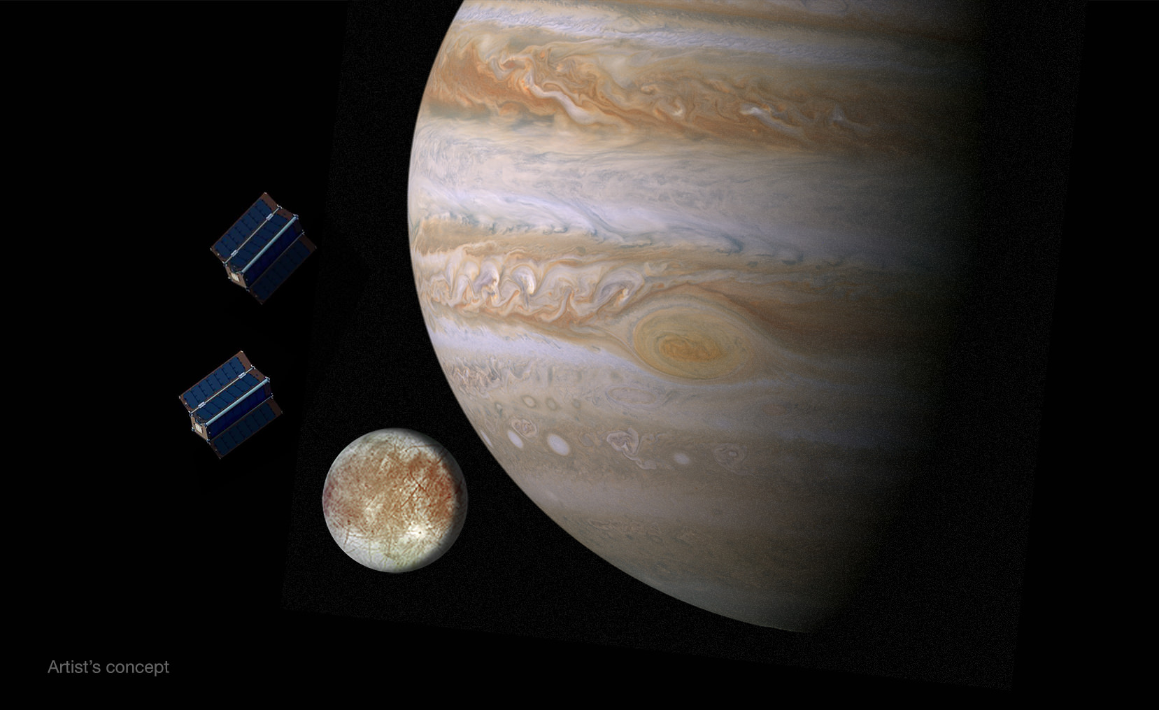
Tiny Satellites Could Hitchhike To Europa With Bigger NASA Mission Concept

Artist's conception of CubeSats near Europa (left) and Jupiter. Credit: NASA/JPL

When you’ve got a $2 billion mission concept to head to Europa, it’s likely a good idea to pack as much science on this mission as possible. That’s the thinking that NASA had as it invited 10 universities to send their ideas for CubeSats — tiny satellites — that would accompany the Europa Clipper mission to the Jupiter system.

Europa Clipper is only on the drawing board right now and not fully funded, and should not be confused with the lower-cost $1 billion Europa mission that NASA proposed earlier this year (also not fully funded). But however NASA gets there, the agency is hoping to learn if the moon could be a good spot for life.

Each university is being awarded up to $25,000 to develop their ideas further, and they will have until next summer to work on them. Investigations include searching the surface for future landing sites, or examining Europan properties such as gravity, its atmosphere, magnetic fields or radiation.

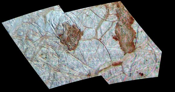
Two reddish spots (Thera and Thrace) stick out on this image of Europa taken by the Galileo orbit in the 1990s. NASA says they display "enigmatic terrain." Credit: NASA/JPL/University of Arizona
Two reddish spots (Thera and Thrace) stick out on this image of Europa taken by the Galileo orbit in the 1990s. NASA says they display “enigmatic terrain.” Credit: NASA/JPL/University of Arizona

“Using CubeSats for planetary exploration is just now becoming possible, so we want to explore how a future mission to Europa might take advantage of them,” said Barry Goldstein, pre-project manager for the Europa Clipper mission concept, in a press release.

If Europa Clipper flies, it would do at least 45 flybys at altitudes between 16 miles and 1,700 miles (25 kilometers and 2,700 kilometers.) Part of its expense comes from the long distance, and also from all the radiation shielding the spacecraft would need as it orbits immense Jupiter.

Science instruments are still being figured out, but some ideas include radar (to look under Europa’s crust), an infrared spectrometer (to see what is on the ice), a camera to image the surface and a spectrometer to look at the moon’s thin atmosphere.

While there are no Europa missions officially booked now, NASA does have an active spacecraft called Juno that will arrive at Jupiter in July 2016.