Seen From Space: Sand Dunes on Mars Covered by Frost

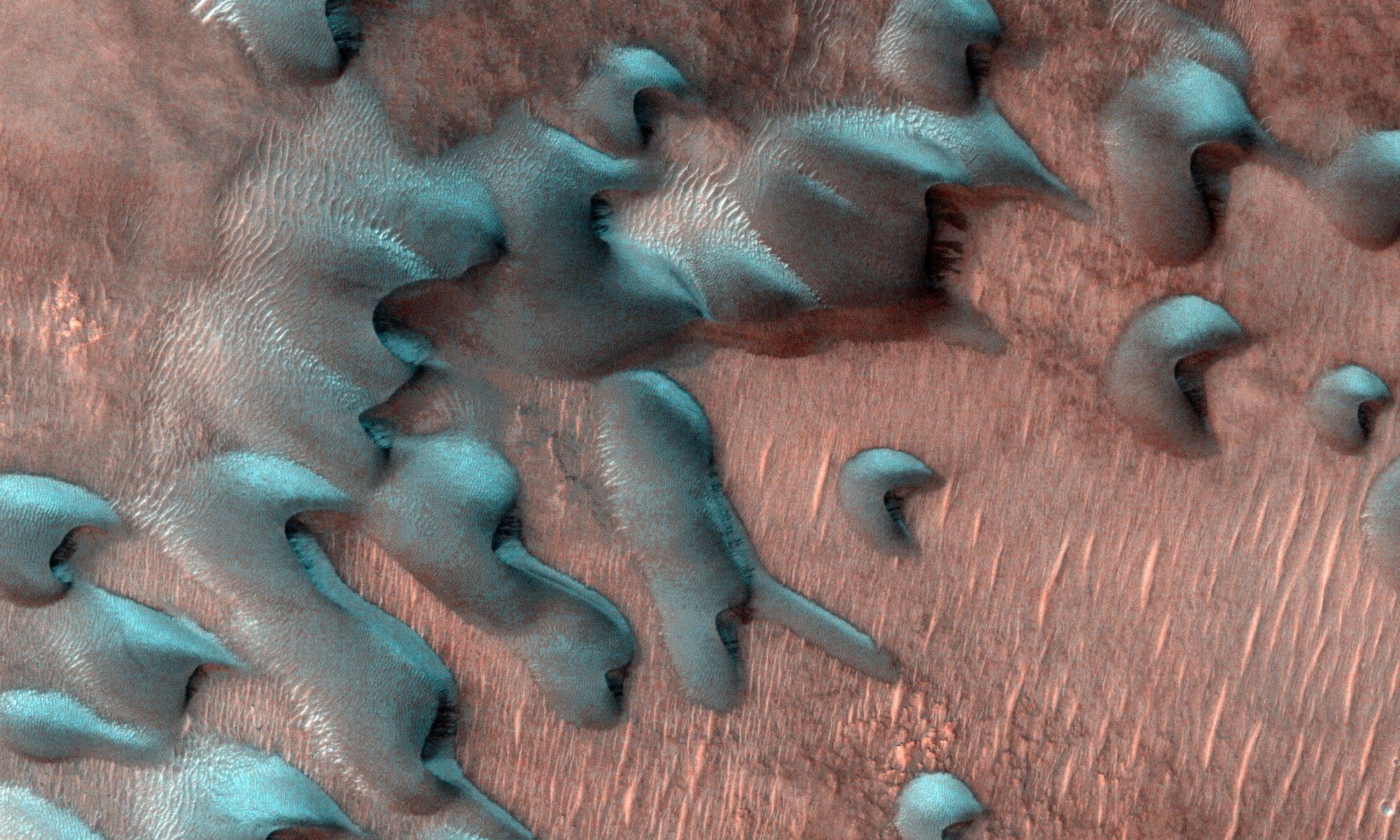
This image acquired on July 22, 2022 by NASA's Mars Reconnaissance Orbiter shows sand dunes moving across the landscape. Winter frost covers the colder, north-facing half of each dune. Credit: NASA/JPL-Caltech/University of Arizona

It’s winter here on Earth, for those living in the northern hemisphere. This means snow, rain, colder temperatures, and all the other things we associate with “the festive season.” Much the same is true for Mars (aka. “Earth’s Twin”), which is also experiencing winter in its northern hemisphere right now. This means colder temperatures, especially around the polar regions where it can get as low as -123 °C (-190 °F), as well as ice, snow, frost, and the expansion of the polar ice caps – which are composed of both water ice and frozen carbon dioxide (“dry ice”).

While Mars does not experience snowfall the same way Earth does, seasonal change results in some very interesting phenomena. Thanks to the many robotic explorers NASA and other space agencies have sent to Mars in the past fifty years, scientists have been able to get a close-up look at these phenomena. These include the Viking orbiters and landers that studied the planet in the 1970s (with groundbreaking results) to the Mars Reconnaissance Orbiter (MRO), the Mars Exploration Rovers (Spirit and Opportunity), and the Curiosity and Perseverance rovers exploring the surface today.

Continue reading “Seen From Space: Sand Dunes on Mars Covered by Frost”
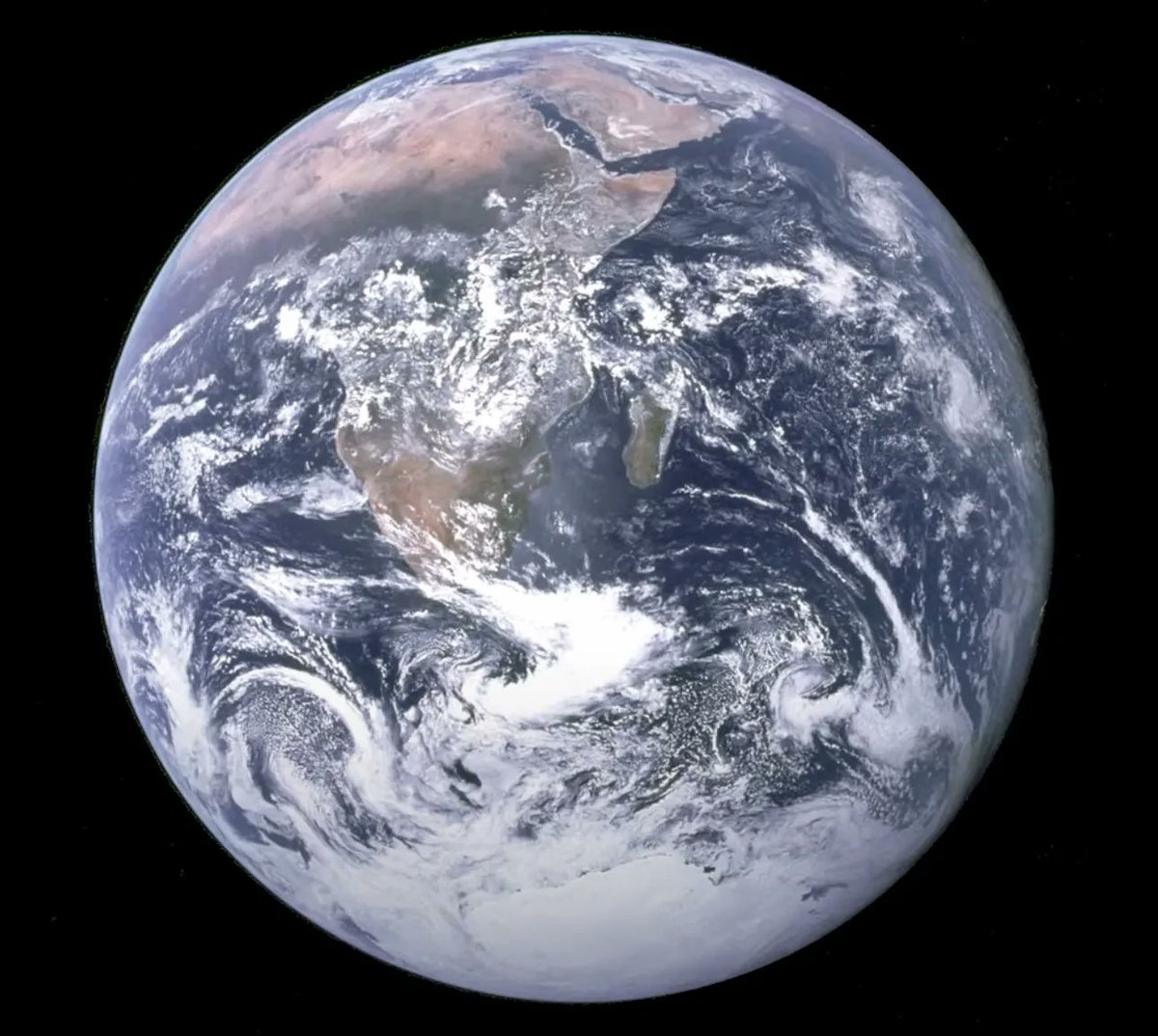
A Supercomputer Climate Model is so Accurate it Predicted the Weather Patterns Seen in the Famous 1972 “Blue Marble” Image of Earth

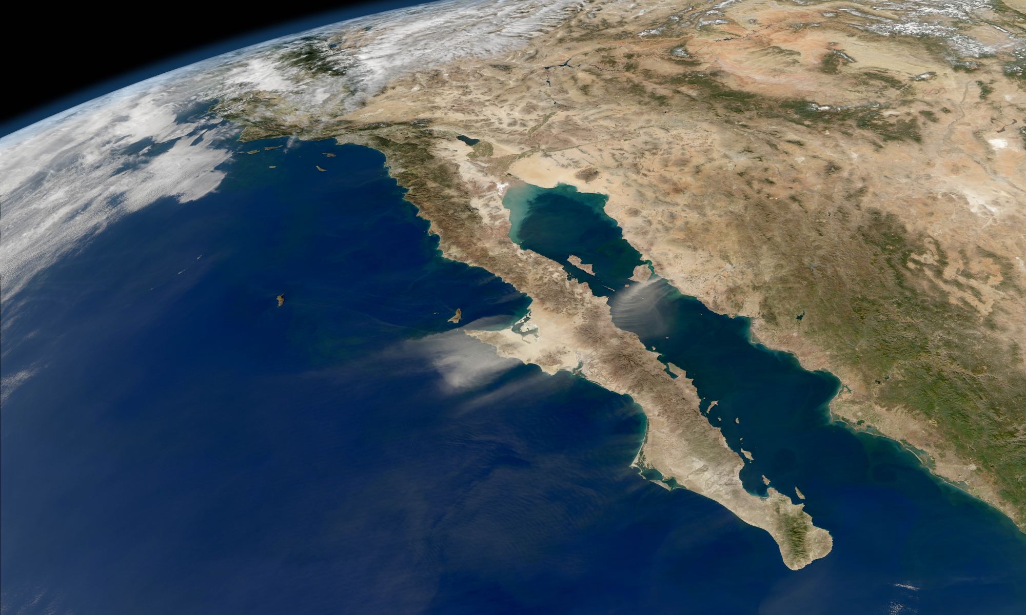
The “Blue Marble” was one of the most iconic pictures of the Apollo era. Taken by the astronauts of Apollo 17 on their return trip from the moon, the first fully illuminated image of the Earth taken by a person captured how the world looked on December 7th, 1972, just over 50 years ago. Now, a team from the Max Planck Institute for Meteorology has recreated that iconic image using a climate model.

Continue reading “A Supercomputer Climate Model is so Accurate it Predicted the Weather Patterns Seen in the Famous 1972 “Blue Marble” Image of Earth”

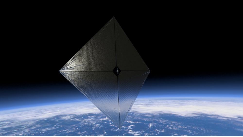
To Fight Climate Change, We Could Block the Sun. A Lightweight Solar Sail Could Make it Feasible

Could a solar-sail-like structure (or structures) tethered to an asteroid provide a sunshade for Earth to block sunlight and mitigate climate change? A recent study looks into it. Courtesy NASA.

Can we build an enormous umbrella to dim the Sun? Such a feat would be a megaproject on a scale like no other. It would take at least 400 dedicated rocket launches a year, for ten years (There have been 172 rocket launches by all nations so far in 2022). The project would weigh in at 550,000 tons: at its lightest. And it would be an ecological experiment that puts us all – the entire planet – in the petri dish, with high risk and high reward. But could such a project actually reverse climate change and bring us back from the brink of global disaster?

The answer seems to be yes, it could work. But there are consequences, and with the planet at stake, it seems wise to examine them before committing to such a thing.

Continue reading “To Fight Climate Change, We Could Block the Sun. A Lightweight Solar Sail Could Make it Feasible”

NASA is Mapping Giant Clouds of Methane Released by “Super-Emitters” Across the World

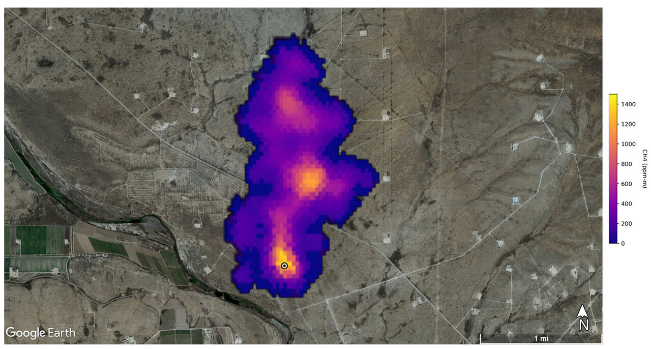
Methane super-emitters
This image shows a methane plume 2 miles (3 kilometers) long that NASA’s Earth Surface Mineral Dust Source Investigation mission detected southeast of Carlsbad, New Mexico. Methane is a potent greenhouse gas that is much more effective at trapping hea... Credit: NASA/JPL-Caltech

Everybody’s heard of methane. It’s a major part of the atmosphere in places like Uranus and Neptune. On Earth, it’s also part of our atmosphere, where it works to warm things up. Some of it gets there from natural causes. But, a lot of it comes from industrial super-emitters and other human-caused processes. That’s not good because too much methane works, along with other greenhouse gases (like carbon dioxide, or CO2) to “over warm” our atmosphere.

Continue reading “NASA is Mapping Giant Clouds of Methane Released by “Super-Emitters” Across the World”

27 to 78 cm of sea Level Rise Could be Locked in From Melting Greenland ice Caps

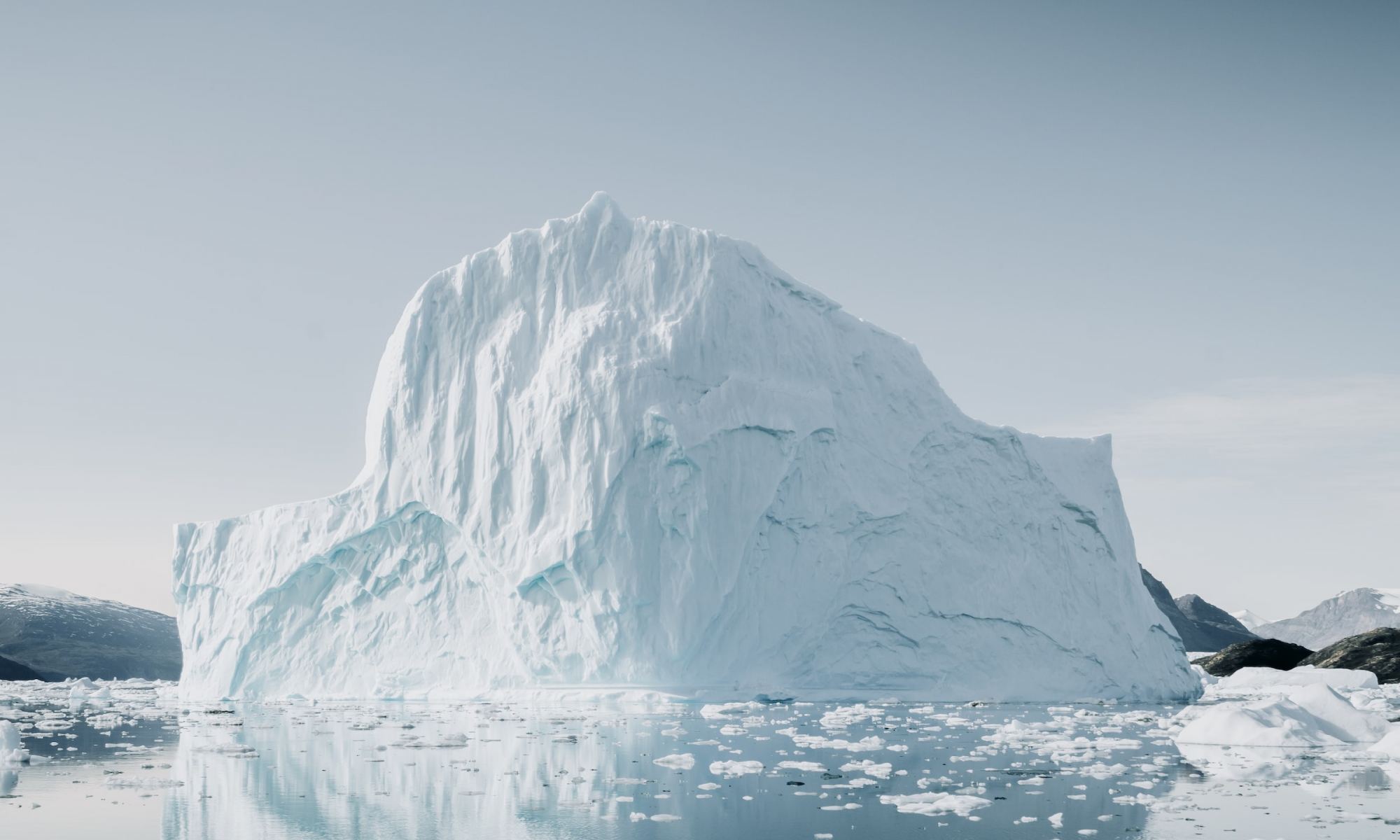
Image: The latest research using satellite data has confirmed that rising sea levels are inevitable. Credit: Annie Spratt.

Recent climate research, published in the Nature Climate Change journal has confirmed that melting icecaps in Greenland will contribute a minimum of 27cm rise in ocean levels even if we collectively stop burning fossil fuels immediately. We have reached a “point of no return”. And what makes it worse is that this is the most conservative estimate, as it only factors the contribution made by the ice shelf in Greenland. Projections have also confirmed that overall planetary warming has exceeded the original estimates for global heating, and that we are in for a difficult millennium if drastic action isn’t taken immediately.

Continue reading “27 to 78 cm of sea Level Rise Could be Locked in From Melting Greenland ice Caps”

Alaska Has New Lakes. Unfortunately, They’re Releasing a lot of Methane

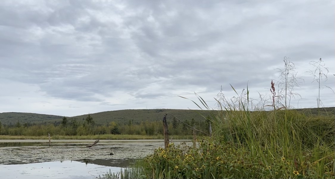
methane in a thermokarst lake
Big Trail Lake is one of Alaska’s newest lakes and one of the largest methane emission hotspots in the Arctic. Credit: NASA / Katie Jepson

A NASA scientist is finding newly formed lakes in Alaska that are belching greenhouse gases at a high rate. The main one is methane, a gas many people use in their natural gas-fueled grills. She’s tracking these emissions in one of Earth’s most remote regions—the Arctic. It has millions of lakes, many of them hundreds or thousands of years old. But, only the youngest of them are releasing high amounts of methane. And that is due to the effects of climate change on these delicate environments.

Continue reading “Alaska Has New Lakes. Unfortunately, They’re Releasing a lot of Methane”

Climate Change is Making the Skies Worse for Astronomy

climate change could affect observatories like these on Mauna Kea in Hawaii.
The top of Mauna Kea is a prime site for telescopes, as shown in this image. It boasts clear, dry atmospheric conditions. Global climate change could alter that. Image courtesy Mauna Kea Observatories

Light pollution. Satellite trains and radio frequency interference. Encroaching civilization. These all pose threats to ground-based astronomy. But, did anyone ever think that global climate change might wreak havoc on observatories? It turns out the answer is “yes.”

Continue reading “Climate Change is Making the Skies Worse for Astronomy”

MIT Researchers Propose Space Bubbles to Stop Climate Change

Artist's conception of bubbles used to reduce sunlight to combat climate change (Image credit: MIT)

Climate change is a real problem. Human caused outputs of greenhouse gases like carbon dioxide and methane are the main driver of an unprecedented rise in global average temperatures at a speed never before seen in the Earth’s geologic record. The problem is so bad that any attempts to mitigate greenhouse gas emissions may be too little and too late. And so a team based at the Massachusetts Institute of Technology have proposed a radical new solution: bubbles…in space.

Continue reading “MIT Researchers Propose Space Bubbles to Stop Climate Change”

A New Instrument is Going to the ISS to Study the Climate Impact of Dust in Earth’s Upper Atmosphere

People often seem surprised when they learn that NASA doesn’t just look out to the other planets, stars, and galaxies. It’s also an agency that studies our own home planet—from space! And why not? Earth is part of the solar system, too. So, to that end, there’s a new Earth studies mission called EMIT on its way to the International Space Station. It’s designed to track dust as it moves from one place to another on our planet through through our atmosphere.

The official name of the mission is the Earth Surface Mineral Dust Source Investigation (EMIT, for short). It will use a high-tech imaging spectrometer to study dust around the globe over the next year.

A dust plume stretches over the eastern Mediterranean, shrouding parts of Greece, Turkey, and Cyprus. The June 2020 image has been cropped and enhanced to improve contrast, and lens artifacts have been removed. NASA’s EMIT mission will help scientists better understand how airborne dust affects climate. Credits: NASA
A dust plume stretches over the eastern Mediterranean, shrouding parts of Greece, Turkey, and Cyprus. The June 2020 image has been cropped and enhanced to improve contrast, and lens artifacts have been removed. NASA’s EMIT mission will help scientists better understand how airborne dust affects climate. Credit: NASA
Continue reading “A New Instrument is Going to the ISS to Study the Climate Impact of Dust in Earth’s Upper Atmosphere”

Antarctica Lost an Ice Shelf, but Gained an Island

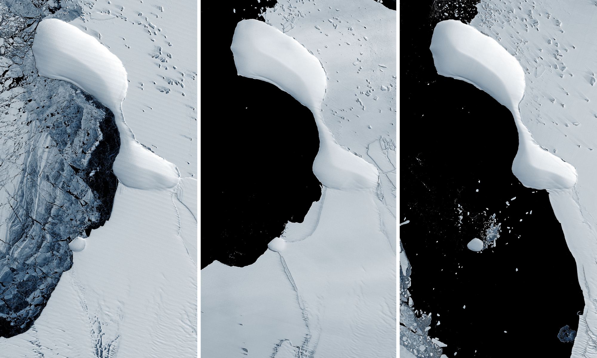
The eastern coast of Antarctica has lost most of the Glenzer and Conger ice shelves, as seen in these satellite images taken between November 15, 1989 - January 9, 2022. Credit: NASA GSFC/UMBC JCET.

Collapsing ice shelves on the eastern coast of Antarctica has revealed something never seen before: a landform that might be an island. But this is not the first newly revealed island off the Antarctic coast. A series of islands have appeared as the ice shelves along the continent’s coastline has disintegrated over the past few years.

Continue reading “Antarctica Lost an Ice Shelf, but Gained an Island”