Curiosity’s Latest Mars Panorama, Captured in 1.8 Billion Glorious Pixels

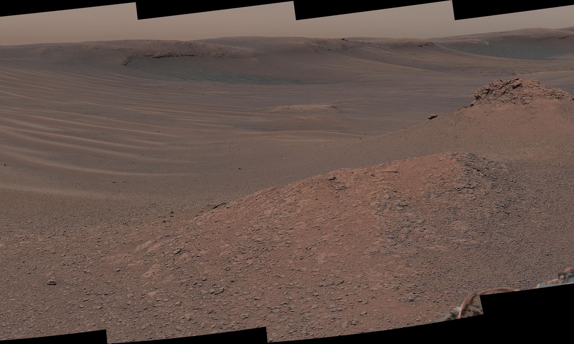
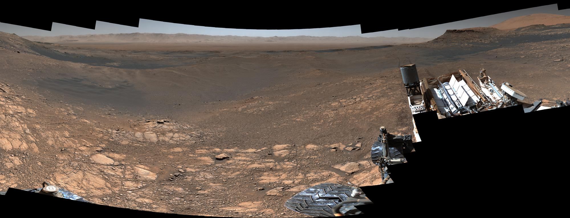
Curiosity's 1.8-Billion-Pixel Panorama Credits: NASA/JPL-Caltech/MSSS.

The Curiosity rover on Mars has captured the most detailed panoramic image ever taken of the Red Planet’s surface. The image is made from over 1,000 images, containing 1.8 billion pixels of the Martian landscape, with 2.43 GB of high-resolution planetary goodness.

“This is the first time during the mission we’ve dedicated our operations to a stereo 360-degree panorama,” said Curiosity Project Scientist Ashwin Vasavada.

Continue reading “Curiosity’s Latest Mars Panorama, Captured in 1.8 Billion Glorious Pixels”
A Glitch Caused Curiosity to Freeze in Place. But It’s Better Now

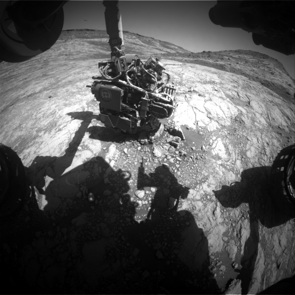
Image taken by the Curiosity rover's Front Hazard Avoidance Camera (Front Hazcam) on January 17, 2020, (Sol 2648). Credit: NASA/JPL-Caltech

Article updated at 3:40 pm CST, 1/24/20.

NASA’s Curiosity Mars rover experienced a technical glitch last week, causing it to temporarily lose its sense of direction and freeze in its tracks. But the talented rover repair team back on Earth enabled a fix, and Curiosity is now back in action.

Continue reading “A Glitch Caused Curiosity to Freeze in Place. But It’s Better Now”

Curiosity Looked up and Saw Phobos During the Daytime

Credit: NASA/JPL-Caltech/MSSS/Kevin M. Gill

For fans and enthusiasts of space exploration, the name Kevin Gill ought to be a familiar one. As a software engineer at NASA’s Jet Propulsion Laboratory who specializes in data visualization and analysis, he has a long history of bringing space exploration to life through imagery. Among his most recent offerings is a very interesting pic taken by the Curiosity rover early in its mission.

Continue reading “Curiosity Looked up and Saw Phobos During the Daytime”

Curiosity Sniffs a Spike in Methane. Could it be a Sign of Life?

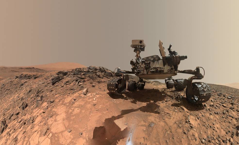
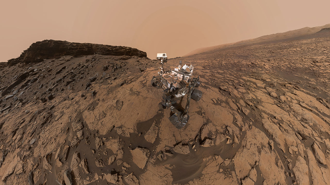
This low-angle self-portrait of NASA's Curiosity Mars rover shows the vehicle at the site from which it reached down to drill into a rock target called "Buckskin" on lower Mount Sharp. Credits: NASA/JPL-Caltech/MSSS

Since it landed on Mars in 2012, one of the main scientific objectives of the Curiosity rover has been finding evidence of past (or even present) life on the Red Planet. In 2014, the rover may have accomplished this very thing when it detected a tenfold increase in atmospheric methane in its vicinity and found traces of complex organic molecules in drill samples while poking around in the Gale Crater.

About a year ago, Curiosity struck pay dirt again when it found organic molecules in three-billion-year-old sedimentary rocks located near the surface of lower Mount Sharp. But last week, the Curiosity rover made an even more profound discovery when it detected the largest amount of methane ever measured on the surface of Mars – about 21 parts per billion units by volume (ppbv).

Continue reading “Curiosity Sniffs a Spike in Methane. Could it be a Sign of Life?”

Curiosity has Found the Mother Lode of Clay on the Surface of Mars

Curiosity at Mt. Sharp, Gale Crater, Mars. To the left of the rover are two drill holes into the rocks "Aberlady" and "Kilmarie." Curiosity found high concentrations of clay in both rocks. Image Credit: NASA/JPL-Caltech/MSSS

Clay is a big deal on Mars because it often forms in contact with water. Find clay, and you’ve usually found evidence of water. And the nature, history, and current water budget on Mars are all important to understanding that planet, and if it ever supported life.

Continue reading “Curiosity has Found the Mother Lode of Clay on the Surface of Mars”

Curiosity has Finally Sampled a Clay-Rich Region on Mars

A mast-cam mosaic image of the so-called "clay-bearing unit". After almost seven years on Mars, MSL Curiosity has finally been able to drill into the clay-rich region. Image Credit: NASA/JPL-Caltech/MSSS

It’s hard to believe that MSL Curiosity has been on Mars for almost seven years. But it has, and during that time, the rover has explored Gale Crater and Mt. Sharp, the central peak inside the crater. And while it has used its drill multiple times to take rock samples, this is the first sample it’s gathered from the so-called ‘clay unit.’

Continue reading “Curiosity has Finally Sampled a Clay-Rich Region on Mars”

Two Solar Eclipses Seen From the Surface of Mars by Curiosity

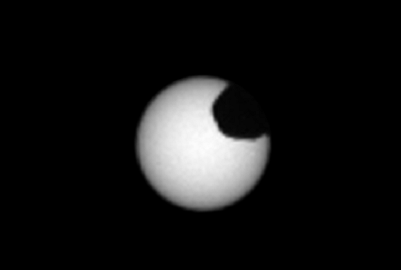
The Martian moon Phobos as it crossed in front of the Sun, as seen by NASA's Curiosity Mars rover on Sunday, March 26, 2019 (Sol 2359). Credit: NASA/JPL-Caltech/MSSS

Ever since the Curiosity rover landed on Mars in 2012, it has provided NASA scientists with invaluable data about the planet’s past, as well as some breathtaking images of the planet’s surface. Much like its predecessors, the Spirit and Opportunity rover, many of these images have shown what it is like to look up at the sky from the surface of Mars and witness celestial events.

Of these events, one of the most intriguing has to be the many Martian solar eclipses that have taken place since the rover’s landed. Last month, the Curiosity rover witnessed two eclipses as the moons of Phobos and Deimos both passed in front of the Sun. These latest eclipses will allow scientists to fine-tune their predictions about Mars’ satellites and how they orbit the Red Planet.

Continue reading “Two Solar Eclipses Seen From the Surface of Mars by Curiosity”

Curiosity Crashed, but it’s Working Fine Again. NASA Won’t Have to Send Astronauts to Turn it off and Back on Again.

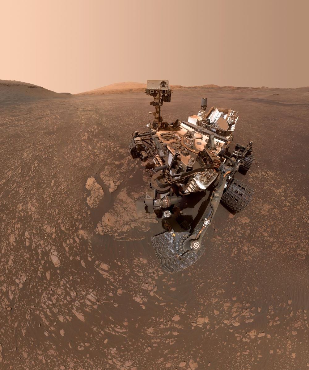
This low-angle self-portrait of NASA's Curiosity Mars rover shows the vehicle at the site from which it reached down to drill into a rock target called "Buckskin" on lower Mount Sharp. Credits: NASA/JPL-Caltech/MSSS

In 2012, NASA’s Curiosity rover landed in the Gale Crater on Mars and began exploring for clues about the planet’s past and subsequent evolution. Since 2014, it has been investigating Mount Sharp (aka. Aeolis Mons) – the central peak within Mars’ Gale Crater – in the hopes of learning more about Mars’ warm, watery past (and maybe find signs of past life!)

On February 15th of this year (Sol 2320), Curiosity gave mission controllers a bit of a scare when it suffered a technical glitch and automatically entered safe mode. Luckily, as of Thursday, Feb. 28th, Curiosity’s science team reported that after getting the rover back online and running a series of checks, the rover is in good shape and ready to resume normal science operations.

Continue reading “Curiosity Crashed, but it’s Working Fine Again. NASA Won’t Have to Send Astronauts to Turn it off and Back on Again.”

NASA used Curiosity’s Sensors to Measure the Gravity of a Mountain on Mars

Panoramic image of the Curiosity rover, from September 2016. The pale outline of Aeolis Mons can be seen in the distance. Credit: NASA/JPL-Caltech/MSSS

Some very clever people have figured out how to use MSL Curiosity’s navigation sensors to measure the gravity of a Martian mountain. What they’ve found contradicts previous thinking about Aeolis Mons, aka Mt. Sharp. Aeolis Mons is a mountain in the center of Gale Crater, Curiosity’s landing site in 2012.

Gale Crater is a huge impact crater that’s 154 km (96 mi) in diameter and about 3.5 billion years old. In the center is Aeolis Mons, a mountain about 5.5 km (18,000 ft) high. Over an approximately 2 billion year period, sediments were deposited either by water, wind, or both, creating the mountain. Subsequent erosion reduced the mountain to its current form.

Now a new paper published in Science, based on gravity measurements from Curiosity, shows that Aeolis Mons’ bedrock layers are not as dense as once thought.

Continue reading “NASA used Curiosity’s Sensors to Measure the Gravity of a Mountain on Mars”

Mars InSight Lands on November 26th. Here’s where it’s going to touch down

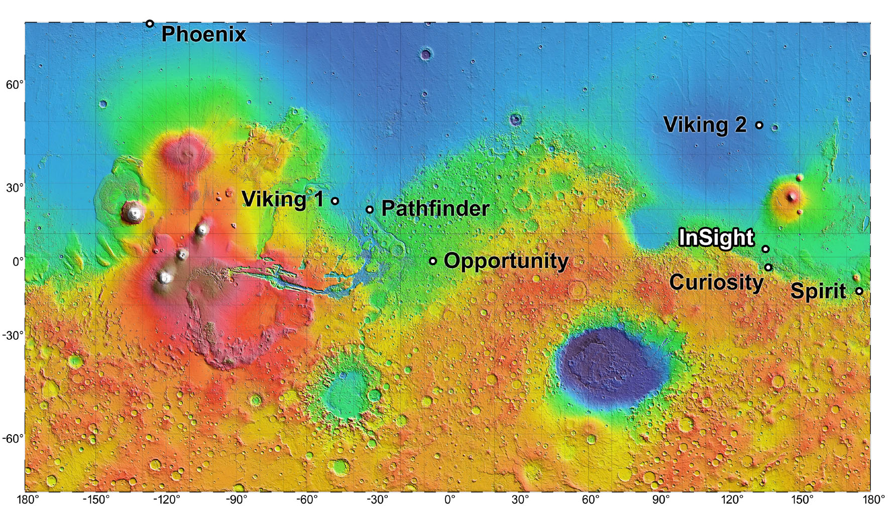
The site where the InSight lander will set down, relief map based on data provided by the Mars Global Surveyor (MGS). Credit: NASA/JPL-Caltech

In the course of exploring Mars, the many landers, rovers and orbiters that have been sent there have captured some truly stunning images of the landscape. Between Spirit, Opportunity, Curiosity, the Mars Reconnaissance Orbiter (MRO) and others, we have treated to some high-definition images over the years of sandy dunes, craters and mountains – many of which call to mind places here on Earth.

However, if one were to describe the region where NASA’s Interior Exploration using Seismic Investigations, Geodesy and Heat Transport (InSight) lander will be landing (on Nov. 26th, 2018), the word “plain” would probably come to mind (and it would be appropriate). This region is known as Elysium Planitia, and it is where InSight will spend the next few years studying Mars’ interior structure and tectonic activity for the sake of learning more about its history.

Continue reading “Mars InSight Lands on November 26th. Here’s where it’s going to touch down”