Cat 4 Hurricane Gonzalo Threatens Bermuda and Delays Antares Launch to Space Station

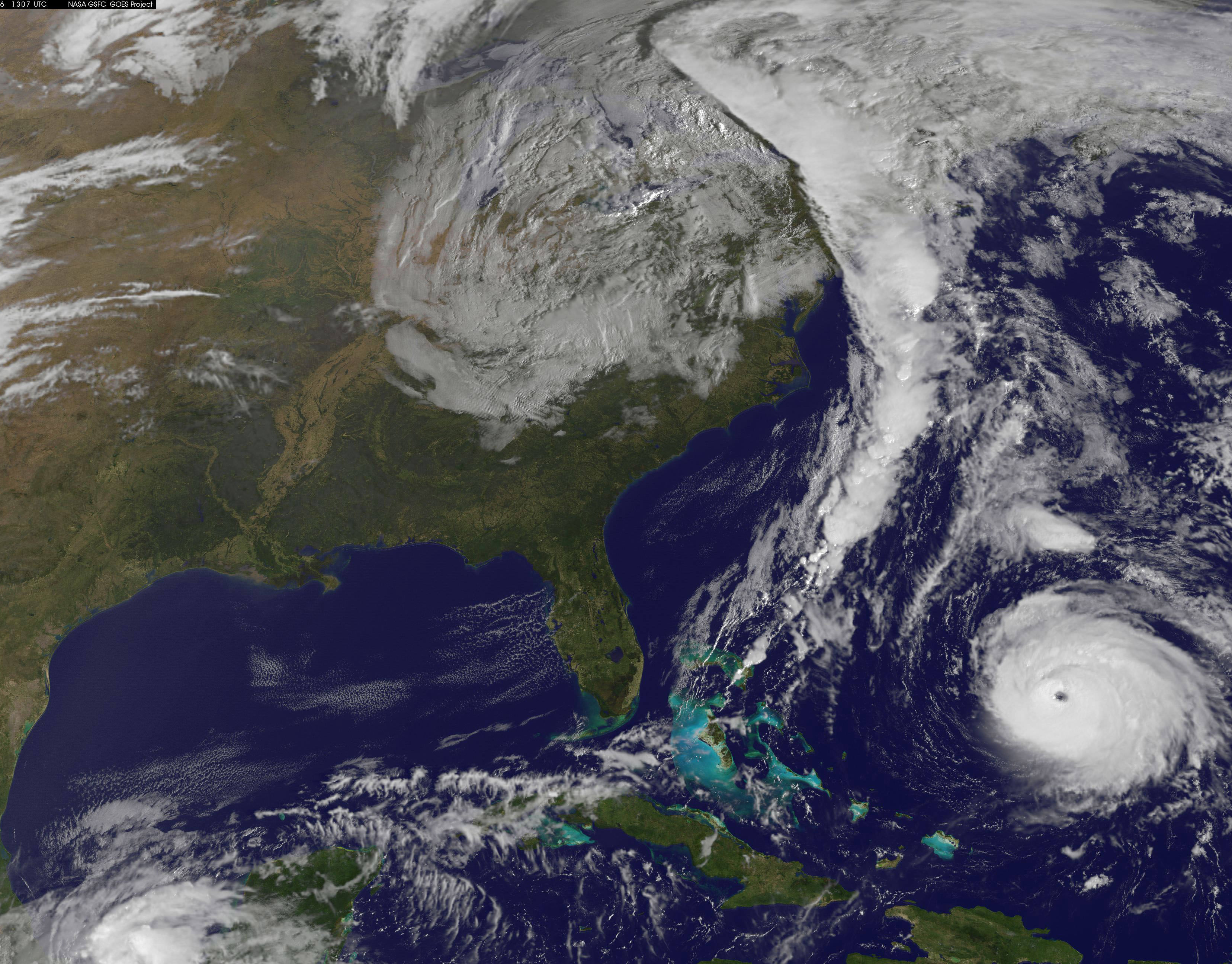
NOAA's GOES-East satellite captured this image of Hurricane Gonzalo off the U.S. East Coast on Oct. 16 at 13:07 UTC (9:07 a.m. EDT). Gonzalo is classified as Category 4 storm. Credit: NASA/NOAA GOES Project

Hurricane Gonzalo, the first major Atlantic Ocean basin hurricane in three years, has strengthened to a dangerous Category 4 storm, threatening Bermuda and forcing a postponement of the upcoming launch of the Orbital Sciences Antares rocket to the space station from the Virginia shore to no earlier than Oct. 27.

A hurricane warning is in effect for the entire island of Bermuda.

NASA and Orbital Sciences had no choice but to delay the Antares blastoff from Oct. 24 to no earlier than Oct. 27 because Bermuda is home to an “essential tracking site” that must be operational to ensure public safety in case of a launch emergency situation.

Antares had been slated for an early evening liftoff with the Cygnus cargo carrier on the Orb-3 mission to the International Space Station (ISS).

NASA and Orbital issued the following statement:

“Due to the impending arrival of Hurricane Gonzalo on the island of Bermuda, where an essential tracking site used to ensure public safety during Antares launches is located, the previously announced “no earlier than” (NET) launch date of October 24 for the Orb-3 CRS mission to the International Space Station for NASA is no longer feasible.”
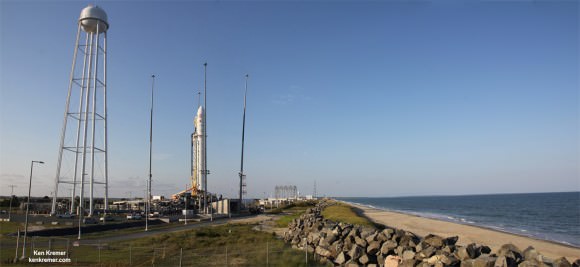
Orbital Sciences Corporation Antares rocket and Cygnus spacecraft prior to blast off on July 13  2014 from Launch Pad 0A at NASA Wallops Flight Facility , VA, on the Orb-2 mission bound for the International Space Station.  Credit: Ken Kremer - kenkremer.com
Orbital Sciences Corporation Antares rocket and Cygnus spacecraft prior to blast off on July 13 2014 from Launch Pad 0A at NASA Wallops Flight Facility , VA, on the Orb-2 mission bound for the International Space Station. Credit: Ken Kremer – kenkremer.com

The powerful Gonzalo is currently expected to make a direct hit on Bermuda on Friday afternoon, Oct. 17. It’s packing devastating maximum sustained winds exceeding 145 mph (225 kph).

NASA and NOAA satellites including the Terra, Aqua and GOES-East satellites are providing continuous coverage of Hurricane Gonzalo as it moves toward Bermuda, according to a NASA update today.

The ISS-RapidScat payload tracking ocean winds, that was just attached to the exterior of the ISS, is also designed to help with hurricane monitoring and forecasting.

Tropical storm force winds and 20 to 30 foot wave heights are expected to impact Bermuda throughout Friday and continue through Saturday and into Sunday.

“The National Hurricane Center expects hurricane-force winds, and rainfall totals of 3 to 6 inches in Bermuda. A storm surge with coastal flooding can be expected in Bermuda, with large and destructive waves along the coast. In addition, life-threatening surf and riptide conditions are likely in the Virgin Islands, Puerto Rico, Dominican Republic, Bahamas. Those dangerous conditions are expected along the U.S. East Coast and Bermuda today, Oct. 16,” according to NASA.
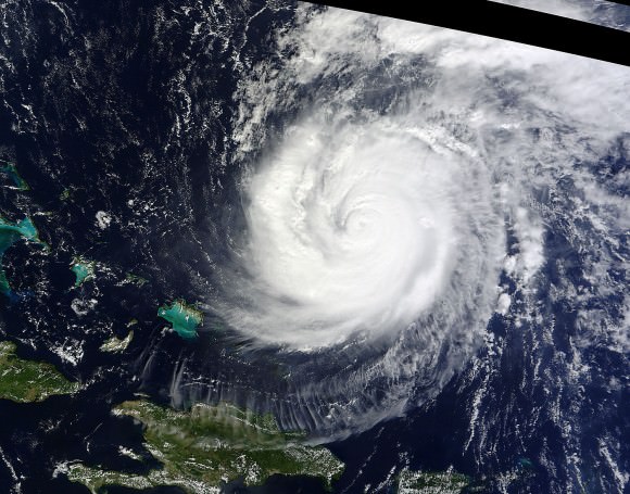
On Oct. 15 at 15:30 UTC (11:30 a.m. EDT) NASA's Terra satellite captured this image of Hurricane Gonzalo in the Atlantic Ocean. Credit: NASA Goddard MODIS Rapid Response Team
On Oct. 15 at 15:30 UTC (11:30 a.m. EDT) NASA’s Terra satellite captured this image of Hurricane Gonzalo in the Atlantic Ocean. Credit: NASA Goddard MODIS Rapid Response Team

After the hurricane passes, a team will be sent to assess the impact of the storm on Bermuda and the tracking station. Further delays are possible if Bermuda’s essential infrastructure systems are damaged, such as power, transportation and communications.

The Antares/Cygnus rocket and cargo ship launch from the Mid-Atlantic Regional Spaceport at NASA’s Wallops Flight Facility along the eastrn shore of Virginia.

Liftoff is currently target for October 27 at 6:44 p.m. (EDT). The rendezvous and berthing of Cygnus with the ISS remains on November 2, with grapple of the spacecraft by the station’s robotic arm at approximately 4:58 a.m. (EST), according to a NASA update.

Stay tuned here for Ken’s continuing Earth and Planetary science and human spaceflight news.

Ken Kremer

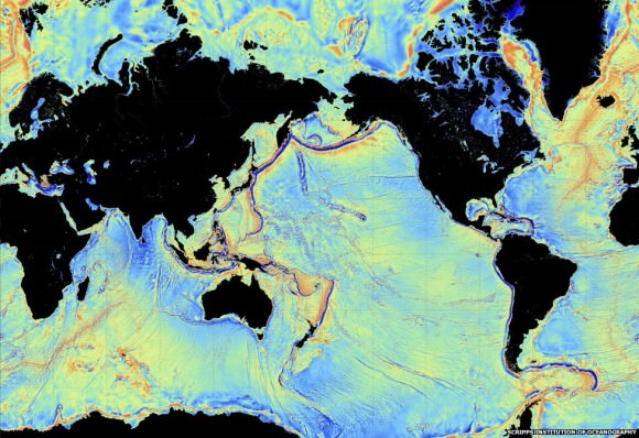
Gravity’s Magic: New Seafloor Map Shows Earth’s Uncharted Depths

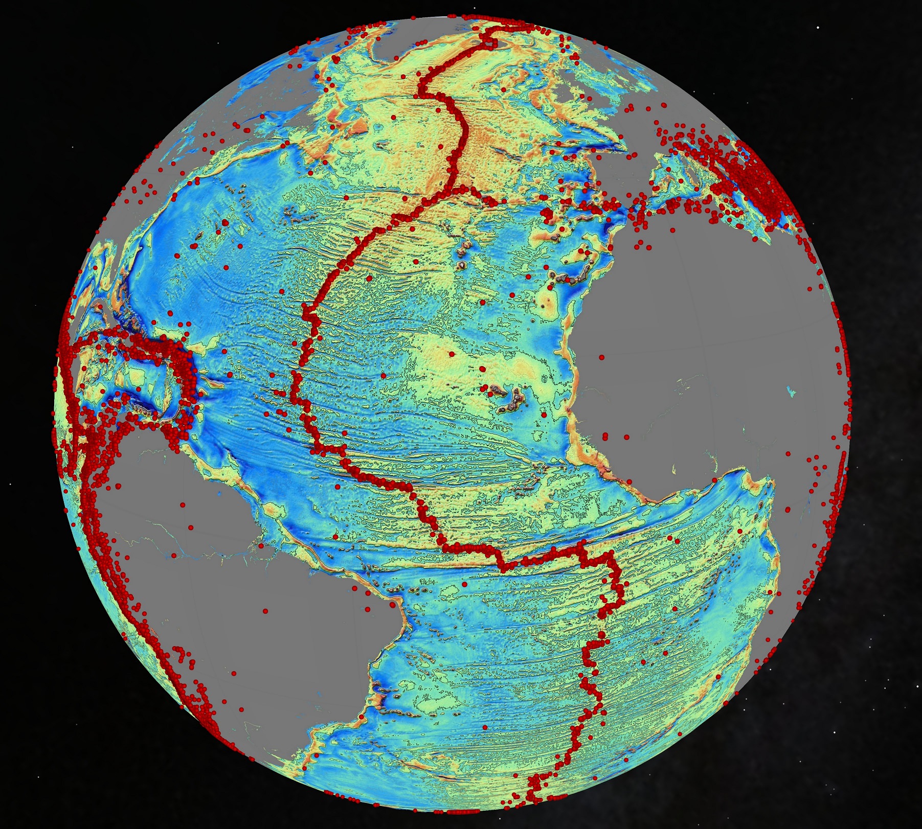
An October 2014 gravity map of the Earth's oceans using data from the European Space Agency's CryoSat mission and the CNES-NASA Jason-1 satellite. Findings include "continental connections" between South American and Africa, and evidence of seafloor spreading in the Gulf of Mexico that took place 150 million years ago. The red dots are volcanoes. Credit: Scripps Institution of Oceanography

Volcanoes! Seafloor spreading! Hidden ridges and mountains! These are the wonders being revealed in new maps of Earth’s sea floor. And no, it didn’t require a deep-sea dive to get there. Instead we got this information from a clever use of gravity (combining the data of two satellites making measurements from orbit.)

The data has caught the attention of Google, which plans to use this data for its upcoming ocean maps release. Scientists also say the information will tell us more about the 80% of the ocean floor that is either unexamined or obscured by thick sand.

So here’s where the data came from. The Scripps Institution of Oceanography combined information from two satellites — the European Space Agency’s ongoing CryoSat mission and the now defunct Jason-1 satellite from NASA and the French space agency CNES, which was decommissioned in 2013 after nearly 12 years of operations.

CryoSat is designed to map the thickness of ice using a radar altimeter (which is a clue to the effects of climate change). But this altimeter can be used all over the world, including to look at how high the sea floor is. Jason-1, for its part, was told to look at the Earth’s gravity field in the last year of its mission. And what a world pops out when this data is used.

A 2014 view of the Earth's sea floor using data from the European Space Agency's CryoSat mission and the CNES-NASA Jason-1 satellite. Credit: Scripps Institution of Oceanography
A 2014 view of the Earth’s sea floor using data from the European Space Agency’s CryoSat mission and the CNES-NASA Jason-1 satellite. Credit: Scripps Institution of Oceanography

“The effect of the slight increase in gravity caused by the mass of rock in an undersea mountain is to attract a mound of water several meters high over the seamount. Deep ocean trenches have the reverse effect,” ESA wrote in a statement.  “These features can only be detected by using radar altimetry from space.”

Some of the new findings include finding new bridges between Africa and South America and uncovering seafloor spreading that happened in the Gulf of Mexico 150 million years ago. Results based on the study, led by Scripps’ David Sandwell, recently appeared in the journal Science.

Long-time readers of Universe Today may also recall a gravity map from ESA’s Gravity Field and Steady-State Ocean Circulation Explorer (GOCE), which revealed Earth’s gravity as a lumpy potato shape in 2011.

Source: European Space Agency

NASA Inaugurates New Space Station Era as Earth Science Observation Platform with RapidScat Instrument

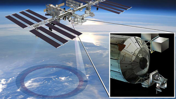
ISS-RapidScat instrument, shown in this artist's rendering, was launched to the International Space Station aboard the SpaceX CRS-4 mission on Sept. 21, 2014 and attached at ESA’s Columbus module. It will measure ocean surface wind speed and direction and help improve weather forecasts, including hurricane monitoring. Credit: NASA/JPL-Caltech/Johnson Space Center.

NASA inaugurated a new era of research for the International Space Station (ISS) as an Earth observation platform following the successful installation and activation of the ISS-RapidScat science instrument on the outposts exterior at Europe’s Columbus module.

The ISS Rapid Scatterometer, or ISS-RapidScat, is NASA’s first research payload aimed at conducting near global Earth science from the station’s exterior and will be augmented with others in coming years.

RapidScat is designed to monitor ocean winds for climate research, weather predictions, and hurricane monitoring.

The 1280 pound (580 kilogram) experimental instrument is already collecting its first science data following its recent power-on and activation at the station.

“Its antenna began spinning and it started transmitting and receiving its first winds data on Oct.1,” according to a NASA statement.

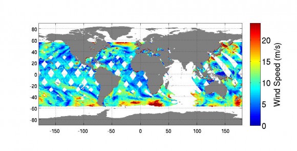
The first image from RapidScat was released by NASA on Oct. 6, shown below, and depicts preliminary measurements of global ocean near-surface wind speeds and directions.

Launched Sept. 21, 2014, to the International Space Station, NASA's newest Earth-observing mission, the International Space Station-RapidScat scatterometer to measure global ocean near-surface wind speeds and directions, has returned its first preliminary images.  Credit: NASA-JPL/Caltech
Launched Sept. 21, 2014, to the International Space Station, NASA’s newest Earth-observing mission, the International Space Station-RapidScat scatterometer to measure global ocean near-surface wind speeds and directions, has returned its first preliminary images. Credit: NASA-JPL/Caltech

The $26 million remote sensing instrument uses radar pulses to observe the speed and direction of winds over the ocean for the improvement of weather forecasting.

“Most satellite missions require weeks or even months to produce data of the quality that we seem to be getting from the first few days of RapidScat,” said RapidScat Project Scientist Ernesto Rodriguez of NASA’s Jet Propulsion Laboratory, Pasadena, California, which built and manages the mission.

“We have been very lucky that within the first days of operations we have already been able to observe a developing tropical cyclone.

“The quality of these data reflect the level of testing and preparation that the team has put in prior to launch,” Rodriguez said in a NASA statement. “It also reflects the quality of the spare QuikScat hardware from which RapidScat was partially assembled.”

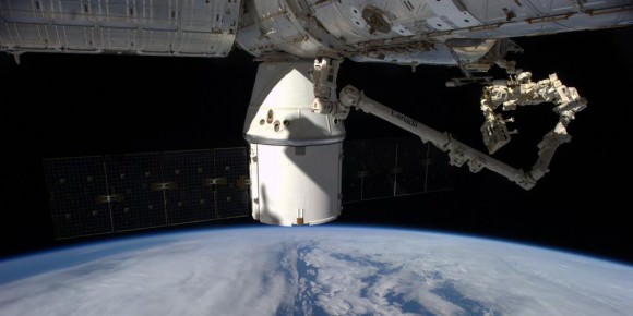
RapidScat, payload was hauled up to the station as part of the science cargo launched aboard the commercial SpaceX Dragon CRS-4 cargo resupply mission that thundered to space on the company’s Falcon 9 rocket from Space Launch Complex-40 at Cape Canaveral Air Force Station in Florida on Sept. 21.

Dragon was successfully berthed at the Earth-facing port on the station’s Harmony module on Sept 23, as detailed here.

It was robotically assembled and attached to the exterior of the station’s Columbus module using the station’s robotic arm and DEXTRE manipulator over a two day period on Sept 29 and 30.

Ground controllers at Johnson Space Center intricately maneuvered DEXTRE to pluck RapidScat and its nadir adapter from the unpressurized trunk section of the Dragon cargo ship and attached it to a vacant external mounting platform on the Columbus module holding mechanical and electrical connections.

Fascinating: #Canadarm & Dextre installed the #RapidScat Experiment on Columbus! @ISS_Research @NASAJPL @csa_asc. Credit: ESA/NASA/Alexander Gerst

The nadir adapter orients the instrument to point at Earth.

The couch sized instrument and adapter together measure about 49 x 46 x 83 inches (124 x 117 x 211 centimeters).

Engineers are in the midst of a two week check out process that is proceeding normally so far. Another two weeks of calibration work will follow.

Thereafter RapidScat will begin a mission expected to last at least two years, said Steve Volz, associate director for flight programs in the Earth Science Division, NASA Headquarters, Washington, at a prelaunch media briefing at the Kennedy Space Center.

RapidScat is the forerunner of at least five more Earth science observing instruments that will be added to the station by the end of the decade, Volz explained.

The second Earth science instrument, dubbed CATS, could be added by year’s end.

The Cloud-Aerosol Transport System (CATS) is a laser instrument that will measure clouds and the location and distribution of pollution, dust, smoke, and other particulates in the atmosphere.

CATS is slated to launch on the next SpaceX resupply mission, CRS-5, currently targeted to launch from Cape Canaveral, FL, on Dec. 9.

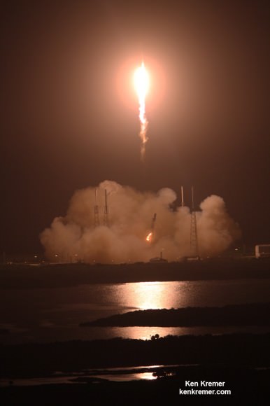
A SpaceX Falcon 9 rocket carrying a Dragon cargo capsule packed with science experiments and station supplies blasts off from Space Launch Complex 40 at Cape Canaveral Air Force Station, Florida, at 1:52 a.m. EDT on Sept. 21, 2014 bound for the ISS.  Credit: Ken Kremer/kenkremer.com
A SpaceX Falcon 9 rocket carrying a Dragon cargo capsule packed with science experiments and station supplies blasts off from Space Launch Complex 40 at Cape Canaveral Air Force Station, Florida, at 1:52 a.m. EDT on Sept. 21, 2014, bound for the ISS. Credit: Ken Kremer/kenkremer.com

This has been a banner year for NASA’s Earth science missions. At least five missions will be launched to space within a 12 month period, the most new Earth-observing mission launches in one year in more than a decade.

ISS-RapidScat is the third of five NASA Earth science missions scheduled to launch over a year.

NASA has already launched the Global Precipitation Measurement (GPM) Core Observatory, a joint mission with the Japan Aerospace Exploration Agency in February, and the Orbiting Carbon Observatory-2 (OCO-2) carbon observatory in July 2014.

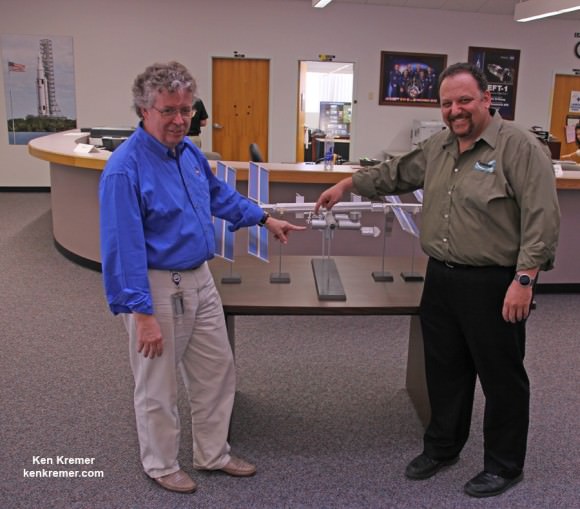
NASA managers show installed location of ISS-RapidScat instrument on the Columbus module on an ISS scale model at the Kennedy Space Center press site during launch period for the SpaceX CRS-4 Dragon cargo mission.  Posing are Steve Volz, associate director for flight programs in the Earth Science Division, NASA Headquarters, Washington and Howard Eisen, RapidScat Project Manager.  Credit: Ken Kremer - kenkremer.com
NASA managers show installed location of ISS-RapidScat instrument on the ESA Columbus module on an ISS scale model at the Kennedy Space Center press site during launch period for the SpaceX CRS-4 Dragon cargo mission. Posing are Steve Volz, associate director for flight programs in the Earth Science Division, NASA Headquarters, Washington, and Howard Eisen, RapidScat Project Manager. Credit: Ken Kremer – kenkremer.com

Stay tuned here for Ken’s continuing Earth and Planetary science and human spaceflight news.
Ken Kremer

…………….

Learn more about Commercial Space Taxis, Orion and NASA Human and Robotic Spaceflight at Ken’s upcoming presentations:

Oct 14: “What’s the Future of America’s Human Spaceflight Program with Orion and Commercial Astronaut Taxis” & “Antares/Cygnus ISS Rocket Launches from Virginia”; Princeton University, Amateur Astronomers Assoc of Princeton (AAAP), Princeton, NJ, 7:30 PM

Oct 23/24: “Antares/Cygnus ISS Rocket Launch from Virginia”; Rodeway Inn, Chincoteague, VA

Earth Shines In Space Pictures In Glory You’ve Rarely Seen Before

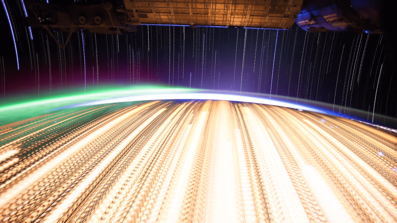
A timelapse photo of Earth created from a video made by the Expedition 28 and 29 crews on the International Space Station. Credit: zqyogl

We truly live on a beautiful planet, and sometimes it just takes a bit of an unusual picture to remind us of that fact. An intrepid amateur took time lapse pictures from the Expedition 28 and 29 crews (filmed in 2011) and combined the shots to create some incredible composite pictures of our planet.

The pictures below are the result of blending 9 different timelapse sequences in two different ways,” wrote a user dubbed zqyogl on Imgur. “The first in each set of two was made by finding the brightest colour for each pixel, and the second by averaging every frame of the timelapse.”

Anyone else out there reminded of Don Pettit’s stunning pictures from space a few years ago? To check out the entire gallery, visit this website to download everything in high-resolution glory. The source video is below the jump.

Earth from Michael König on Vimeo.

h/t Reddit

REAL Images of Eclipses Seen From Space

JAXA

That ‘amazing astro-shot that isn’t’ is making the rounds of ‘ye ole web again.

You know the one. “See an Amazing Image of an Eclipse… From SPACE!!!” screams the breathless headline, with the all-too-perfect image of totality over the limb of the Earth, with the Milky Way thrown in behind it for good measure.

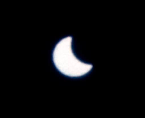
As the old saying goes, if it looks too good to be true, it probably is. Sure, the pic is a fake, and it’s been debunked many, many times since it was first released into the wild a few years back. But never let reality get in the way of a good viral meme. As eclipse season 2 of 2 gets underway tonight with a total lunar eclipse followed by a partial solar eclipse on October 23rd both visible from North America, the image is once again making its rounds. But there’s a long history of authentic captures of eclipses from space that are just as compelling. We’ve compiled just such a roll call of real images of eclipses seen from space:

SDO
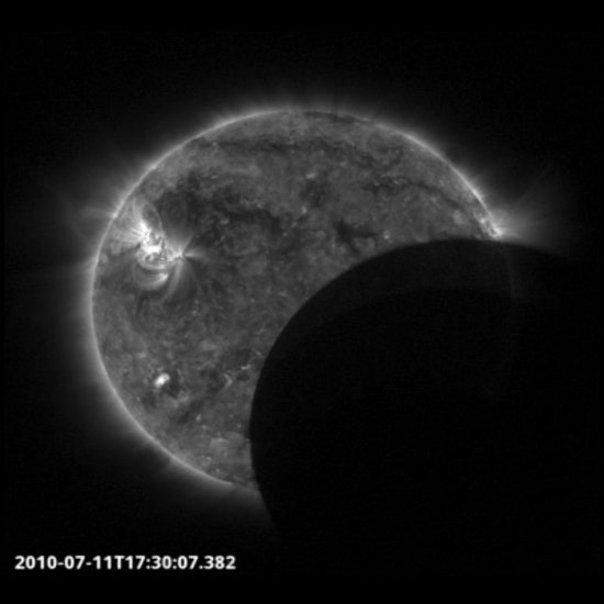
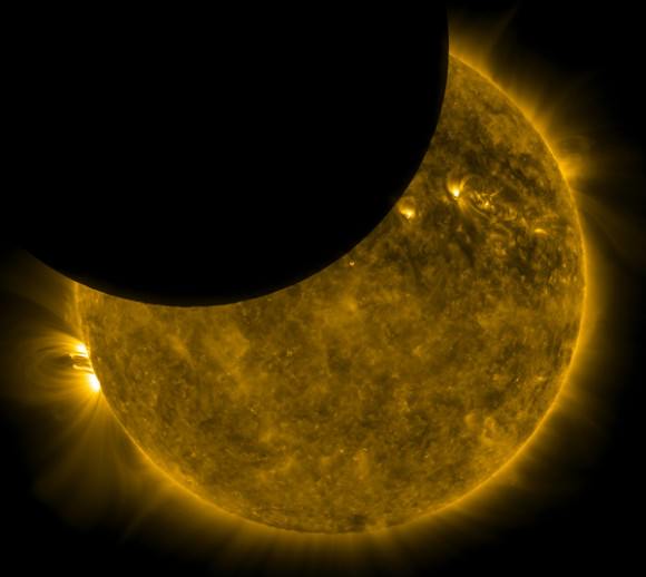
A partial solar eclipse as captured by SDO. Credit: NASA/SDO.

The Solar Dynamics Observatory:

Launched in 2010, The Solar Dynamics Observatory or SDO is NASA’s premier orbiting solar observatory. But unlike Sun-staring satellites based in low Earth orbit, SDO’s geosynchronous orbit assures that it tends to see a cycle of partial solar eclipses twice a year, roughly around the equinoxes. And like many satellites, SDO also passes into the Earth’s shadow as well, offering unique views of a solar eclipse by the limb of the Earth from its vantage point.

JAXA
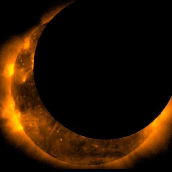
The Moon ‘photobombs’ the view of Hinode. Credit: NASA/JAXA.

Hinode:

A joint mission between NASA and JAXA (the Japanese Aerospace Exploration Agency) launched in 2006, Hinode observes the Sun from low Earth orbit. As a consequence, it nearly has a similar vantage point as terrestrial viewers and frequently nabs passages of the Moon as solar eclipses occur. Such events, however, are fleeting; moving at about eight kilometres per second, such eclipses last only seconds in duration!

ESA
Catching the passage of the Moon during a brief partial eclipse. Credit: ESA.

Proba-2:

Like Hinode, Proba-2 is the European Space Agency’s flagship solar observing spacecraft based in low Earth orbit. It also catches sight of the occasional solar eclipse, and these fleeting passages of the Moon in front of the Earth happen in quick multiple cycles. Recent images from Proba-2 are available online.

Eclipses from the ISS:

The International Space Station isn’t equipped to observe the Sun per se, but astronauts and cosmonauts aboard have managed to catch views of solar eclipses in an unusual way, as the umbra of the Moon crosses the surface of the Earth. Such a view also takes the motion of the ISS in low Earth orbit into account. Cosmonauts aboard the late Mir space station also caught sight of the August 11th, 1999, total solar eclipse over Europe.

NASA GOES
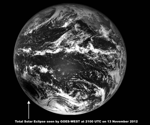
NASA’ s GOES-WEST spies the umbra of the Moon. Credit: NASA-GOES.

NASA-GOES:

Weather satellites can, and do, occasionally catch sight of the inky black dot of the Moon’s penumbra crossing the disk of the Earth.  GOES-West snapped the above image of the November 13th, 2012, solar eclipse. The umbra of the Moon’s shadow races about 1700 kilometres per hour from west to east during an eclipse, and we can expect some interesting images in 2017 when the next total solar eclipse crosses the United States on August 21st, 2017.

NASA
An ‘Apollo eclipse!’ Credit: NASA.

Apollo-Soyuz Test Project:

The final mission of Apollo program, the 1975 Apollo-Soyuz Test Project, also yielded an unusual and little known effort to observe the Sun. The idea was to use the Apollo command module as a “coronagraph” and have cosmonauts image the Sun from the Soyuz as the Apollo spacecraft blocked it out after undocking. Unfortunately, the Apollo thrusters smeared the exposure, and it became a less than iconic— though unusual — view from the space age.

Gemini XII
A partial solar eclipse snapped by the crew of Gemini XII. Credit: NASA.

Gemini XII and the first eclipse seen from space:

On November 12th, 1966, a total solar eclipse graced South America. Astronauts James Lovell Jr. and Edwin “Buzz” Aldrin Jr. were also in orbit at the time, and managed to snap the first image of a solar eclipse from space. Gemini XII was the last flight of the program, and the astronauts initially thought they’d missed the eclipse after a short trajectory burn.

ISS
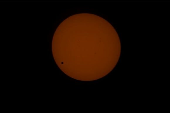
The 2012 transit of Venus as seen from the ISS. Credit: NASA/Don Pettit.

ISS Astronauts catch a transit of Venus:

We were fortunate that the International Space Station had its very own amateur astronomer in residence in 2012 to witness the historic transit of Venus from space. NASA astronaut Don Pettit knew that the transit would occur during his rotation, and packed a full-aperture white light solar filter for the occasion. Of course, a planetary transit meets the very loosest definition of a partial eclipse, but it’s a unique capture nonetheless.

Kaguya:

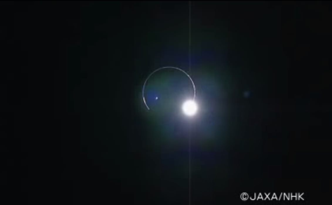
Japan’s SELENE-Kaguya spacecraft entered orbit around the Moon in 2007 and provided some outstanding imagery of our solitary natural neighbor. On February 10th, 2009, it also managed to catch a high definition view of the Earth eclipsing the Sun as seen from lunar orbit. A rare catch, such an event occurs during every lunar eclipse as seen from the Earth.

Mars eclipse
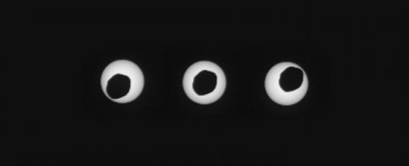
Curiosity captures a misshapen eclipse from the surface of Mars. Credit: NASA/JPL.

An unusual eclipse… seen from Mars:

We’re fortunate to live in an epoch in time and space where total solar eclipses can occur as seen from the Earth. But bizarre eclipses and transits can also be seen from Mars. The Spirit and Opportunity rovers have witnessed brief transits of the Martian moons Phobos and Deimos across the face of the Sun, and in 2010, the Curiosity rover recorded the passage of Phobos in front of the Sun in a bizarre-potato shaped “annular eclipse”. But beyond just the “coolness” factor, the event also helped researchers refine our understanding of orbital path of the Martian moon.

The future: It’s also interesting to think of what sort of astronomical wonders await travelers as we venture out across the solar system. For example, no human has yet to stand on the Moon and witness a solar eclipse. Or how about a ring plane passage through Saturn’s rings, thus far only witnessed via the robotic eyes of Cassini? Of course, for the best views of Saturn’s rings, we recommend a vacation stay on Iapetus, the only major Saturnian moon whose orbit is inclined to the ring plane. And stick around ‘til November 10th, 2084, and you can witness a transit of Earth, the Moon and Phobos as seen from the slopes of Elysium Mons on Mars:

Hopefully, they’ll have perfected that whole Futurama “head-in-a-jar” thing by then…

-Looking for eclipses in science fiction? Check out the author’s tales Exeligmos and Shadowfall.

ISRO and NASA Ink Deal to Collaborate on Red Planet and Home Planet Science Missions

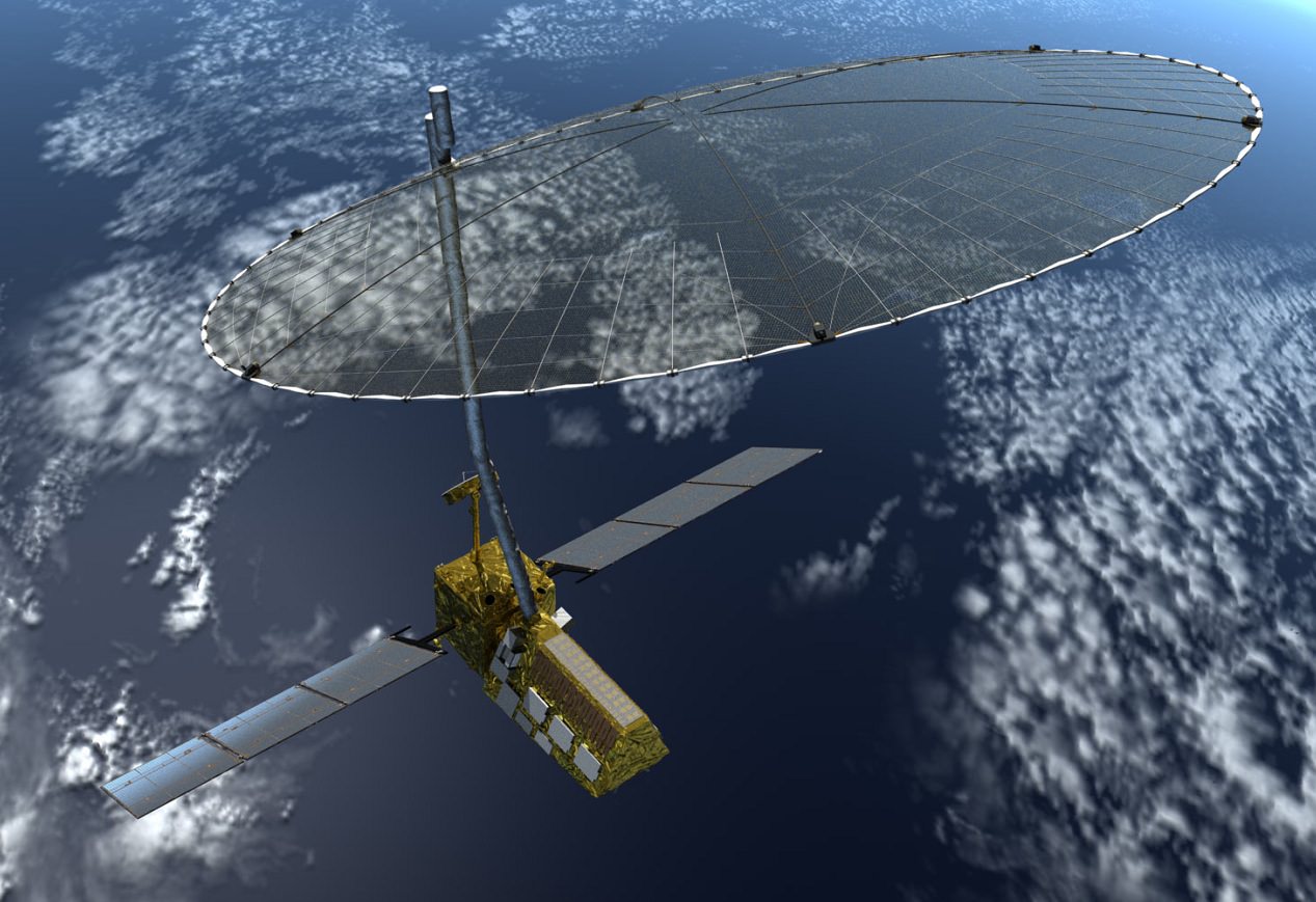
The NASA-ISRO Synthetic Aperture Radar (NISAR) mission, targeted to launch in 2020, will make global measurements of the causes and consequences of a variety of land surface changes on Earth. Image Credit: NASA

ISRO and NASA have inked a deal to collaborate on future missions to jointly explore the Red Planet and our Home Planet hot on the heels of ISRO’s wildly successful Mars Orbiter Mission (MOM), India’s first ever interplanetary voyager to explore Mars.

NASA Administrator Charles Bolden and K. Radhakrishnan, chairman of the Indian Space Research Organisation (ISRO), signed an agreement to collaborate on future science missions to explore Mars as well as to build and launch a joint NASA-ISRO mission to observe Earth.

The leaders of NASA and ISRO met in Toronto, Canada on Tuesday, Sept. 30 and “signed two documents to launch a NASA-ISRO satellite mission to observe Earth and establish a pathway for future joint missions to explore Mars,” according to a NASA statement.

Bolden and Rao met at the International Astronautical Congress underway in Toronto.

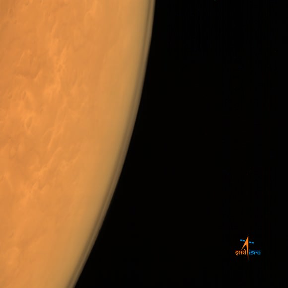
ISRO's Mars Orbiter Mission captures the limb of Mars with the Mars Color Camera from an altitude of 8449 km soon after achieving orbit on Sept. 23/24, 2014. . Credit: ISRO
ISRO’s Mars Orbiter Mission captures the limb of Mars with the Mars Color Camera from an altitude of 8449 km soon after achieving orbit on Sept. 23/24, 2014. . Credit: ISRO

They signed one agreement defining each agency’s responsibilities for the joint NASA-ISRO Synthetic Aperture Radar (NISAR) mission, targeted to launch in 2020. NISAR will make global measurements of the causes and consequences of land surface changes.

The second agreement “establishes a NASA-ISRO Mars Working Group to investigate enhanced cooperation between the two countries in Mars exploration.”

“The signing of these two documents reflects the strong commitment NASA and ISRO have to advancing science and improving life on Earth,” said NASA Administrator Charles Bolden, in a NASA statement.

“This partnership will yield tangible benefits to both our countries and the world.”

NISAR will be the first Earth observing mission to be equipped two different synthetic aperture radar (SAR) frequencies (L-band and S-band) – one each from NASA and ISRO.

NASA will also provide “the high-rate communication subsystem for science data, GPS receivers, a solid state recorder, and a payload data subsystem.”

ISRO will provide the spacecraft bus and launch vehicle.

The radars will be able to measure subtle changes in Earth’s surface of less than a centimeter across stemming from the flow of glaciers and ice sheets as well as earthquakes and volcanoes.

Regarding Mars, the first subject the joint working group will tackle will be to coordinate observations from each nation’s recently arrived Mars orbiters – ISRO’s MOM and NASA’s MAVEN. They will also examine areas of future collaboration on surface rovers and orbiters.

“NASA and Indian scientists have a long history of collaboration in space science,” said John Grunsfeld, NASA Associate Administrator for Science.

“These new agreements between NASA and ISRO in Earth science and Mars exploration will significantly strengthen our ties and the science that we will be able to produce as a result.”

Stay tuned here for Ken’s continuing Earth and planetary science and human spaceflight news.
Ken Kremer

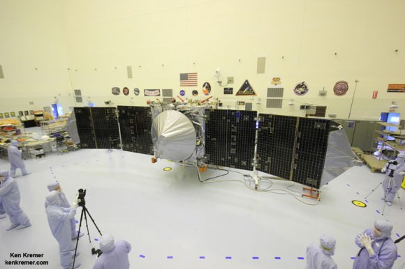
MAVEN is NASA’s next Mars orbiter and launched on Nov. 18, 2014 from Cape Canaveral, Florida. It will study the evolution of the Red Planet’s atmosphere and climate. Universe Today visited MAVEN inside the clean room at the Kennedy Space Center. With solar panels unfurled, this is exactly how MAVEN looks when flying through space and circling Mars and observing Comet Siding Spring. Credit: Ken Kremer/kenkremer.com
MAVEN is NASA’s next Mars orbiter and launched on Nov. 18, 2014, from Cape Canaveral, Florida. It will study the evolution of the Red Planet’s atmosphere and climate. Universe Today visited MAVEN inside the clean room at the Kennedy Space Center. With solar panels unfurled, this is exactly how MAVEN looks when flying through space and circling Mars and observing Comet Siding Spring. Credit: Ken Kremer/kenkremer.com

One More Absolutely Amazing Timelapse from the International Space Station

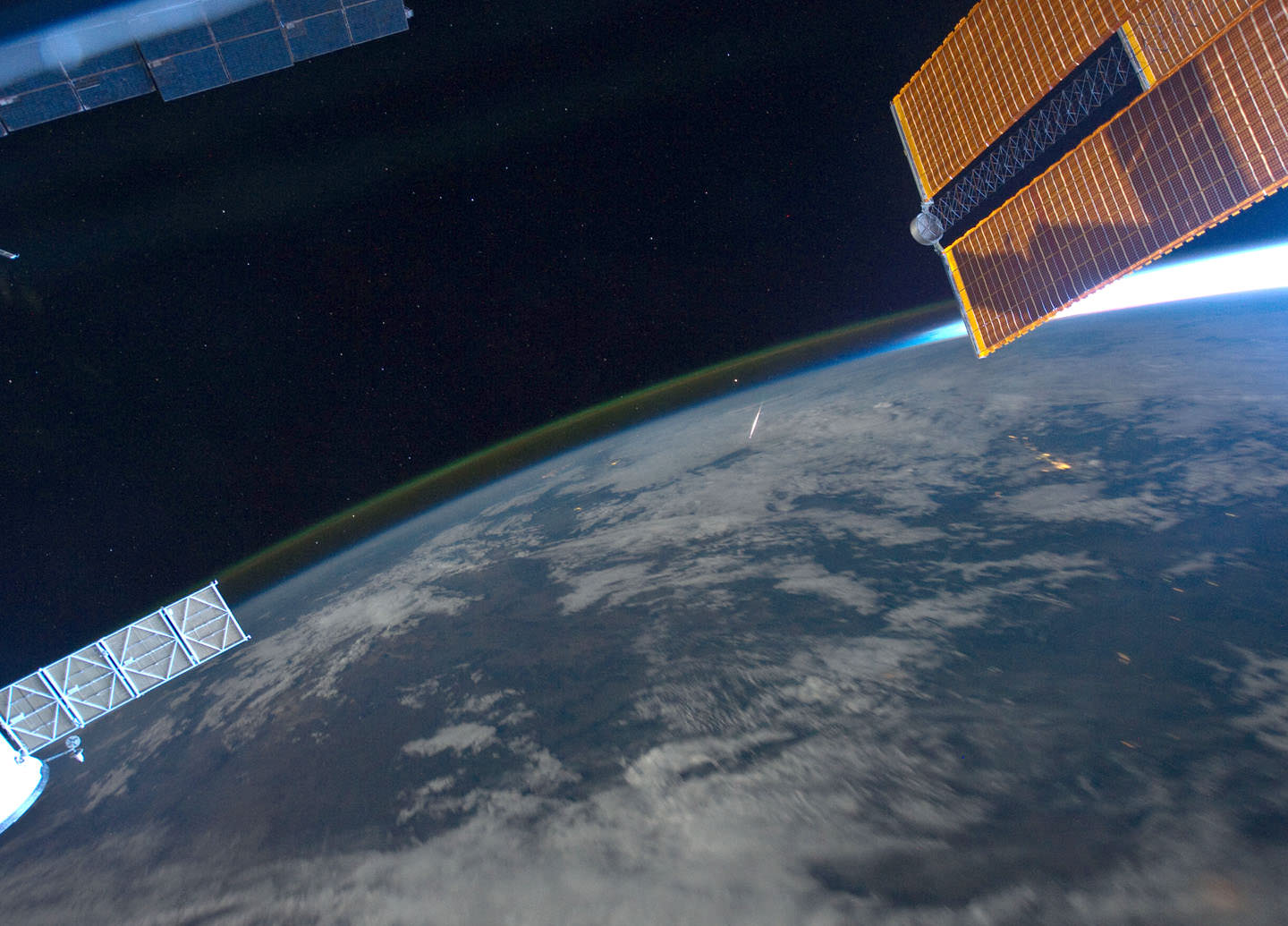
Perseid meteor as seen from the ISS by astronaut Ron Garan on August 13, 2011. Credit: NASA/Ron Garan.

We’ve featured several timelapse compilations of footage and imagery taken from the International Space Station (like here, here and here) but this one put together by Phil Selmes is great in that it also includes footage *of* the ISS, as shot by the astronauts on the space shuttle as well as actual space to ground audio communications. Phil said he included the audio clips “to remind the audience of the humanity that inhabits the space station.”

There is just something about these videos from the ISS that speaks to your soul. Phil told Universe Today that while putting this together, he saw “how different our world looks just 370kms above our heads. I didn’t see politics, races, borders, countries, religions or differences,” he said via email. “I saw one planet, one world, one incredibly beautiful miracle in the absolute vastness of the universe. It gave me some perspective, ironically it brought me ‘back to earth.’”

The video and imagery is from the Johnson Space Center’s Gateway to Astronaut Photography of the Earth.

Look for more #TimelapseThursday videos in the weeks to come.

SpaceX Commercial Resupply Dragon Set for Sept. 21 Blastoff to Station – Watch Live

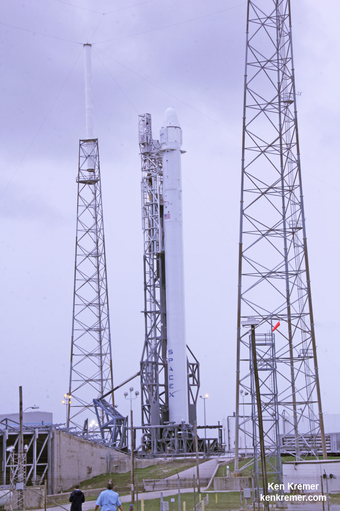
SpaceX Falcon 9 erect at Cape Canaveral launch pad 40 awaiting launch on Sept 20, 2014 on the CRS-4 mission. Credit: Ken Kremer - kenkremer.com

SpaceX Falcon 9 erect at Cape Canaveral launch pad 40 awaiting launch on Sept 20, 2014 on the CRS-4 mission.
Credit: Ken Kremer – kenkremer.com
Story/launch date/headline updated[/caption]

KENNEDY SPACE CENTER, FL – SpaceX is on the cusp of launching the company’s fourth commercial resupply Dragon spacecraft mission to the International Space Station (ISS) shortly after midnight, Saturday, Sept. 20, 2014, continuing a rapid fire launch pace and carrying NASA’s first research payload – RapidScat – aimed at conducting Earth science from the stations exterior.

Final preparations for the launch are underway right now at the Cape Canaveral launch pad with the stowage of sensitive late load items including a specially designed rodent habitat housing 20 mice.

Update 20 Sept: Poor weather scrubs launch to Sept. 21 at 1:52 a.m.

Fueling of the two stage rocket with liquid oxygen and kerosene propellants commences in the evening prior to launch.

If all goes well, Saturday’s launch of a SpaceX Falcon 9 rocket would be the second in less than two weeks, and the fourth over the past ten weeks. The last Falcon 9 successfully launched the AsiaSat 6 commercial telecom satellite on Sept. 7 – detailed here.

“We are ready to go,” said Hans Koenigsmann, SpaceX vice president of mission assurance, at a media briefing at the Kennedy Space Center today, Sept. 19.

Liftoff of the SpaceX Falcon 9 rocket on the CRS-4 mission bound for the ISS is targeted for an instantaneous window at 2:14 a.m. EDT from Space Launch Complex 40 at Cape Canaveral Air Force Station in Florida at the moment Earth’s rotation puts Cape Canaveral in the flight path of the ISS.

A SpaceX Falcon 9 rocket with Dragon cargo capsule bound for the ISS launched from Space Launch Complex 40 at Cape Canaveral, FL.   File photo.  Credit: Ken Kremer/kenkremer.com
A SpaceX Falcon 9 rocket with Dragon cargo capsule bound for the ISS launched from Space Launch Complex 40 at Cape Canaveral, FL. File photo. Credit: Ken Kremer/kenkremer.com
Story/launch date/headline updated

You can watch NASA’s live countdown coverage which begins at 1 a.m. on NASA Television and NASA’s Launch Blog: http://www.nasa.gov/multimedia/nasatv/

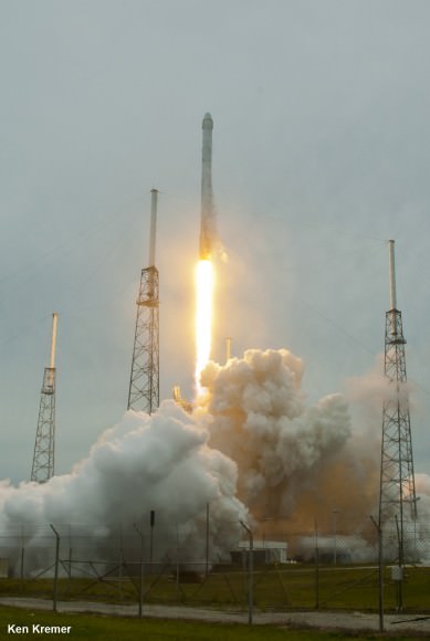
Liftoff of SpaceX Falcon 9 rocket and Dragon from Cape Canaveral Air Force Station, Fla, April 18, 2014.   Credit: Ken Kremer/kenkremer.com
Liftoff of SpaceX Falcon 9 rocket and Dragon from Cape Canaveral Air Force Station, Fla, April 18, 2014. Credit: Ken Kremer/kenkremer.com

The weather forecast is marginal at 50/50 with rain showers and thick clouds as the primary concerns currently impacting the launch site.

The Dragon spacecraft is loaded with more than 5,000 pounds of science experiments, spare parts, crew provisions, food, clothing and supplies to the six person crews living and working aboard the ISS soaring in low Earth orbit under NASA’s Commercial Resupply Services (CRS) contract.

The CRS-4 missions marks the start of a new era in Earth science. The truck of the Dragon is loaded Dragon with the $30 Million ISS-Rapid Scatterometer to monitor ocean surface wind speed and direction.

RapidScat is NASA’s first research payload aimed at conducting Earth science from the stations exterior. The stations robot arm will pluck RapidScat out of the truck and attach it to an Earth-facing point on the exterior trusswork of ESA’s Columbus science module.

Dragon will also carry the first 3-D printer to space for studies by the astronaut crews over at least two years.

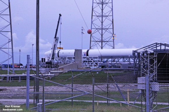
SpaceX Falcon 9  rests horizontally at Cape Canaveral launch pad 40 awaiting blastoff reset to Sept 21, 2014 on the CRS-4 mission.  Credit: Ken Kremer - kenkremer.com
SpaceX Falcon 9 rests horizontally at Cape Canaveral launch pad 40 awaiting blastoff reset to Sept 21, 2014 on the CRS-4 mission. Credit: Ken Kremer – kenkremer.com

The science experiments and technology demonstrations alone amount too over 1644 pounds (746 kg) and will support 255 science and research investigations that will occur during the station’s Expeditions 41 and 42 for US investigations as well as for JAXA and ESA.

“This flight shows the breadth of ISS as a research platform, and we’re seeing the maturity of ISS for that,” NASA Chief Scientist Ellen Stofan said during a prelaunch news conference held today, Friday, Sept. 19 at NASA’s Kennedy Space Center.

After a two day chase, Dragon will be grappled and berth at an Earth-facing port on the stations Harmony module.

The Space CRS-4 mission marks the company’s fourth resupply mission to the ISS under a $1.6 Billion contract with NASA to deliver 20,000 kg (44,000 pounds) of cargo to the ISS during a dozen Dragon cargo spacecraft flights through 2016.

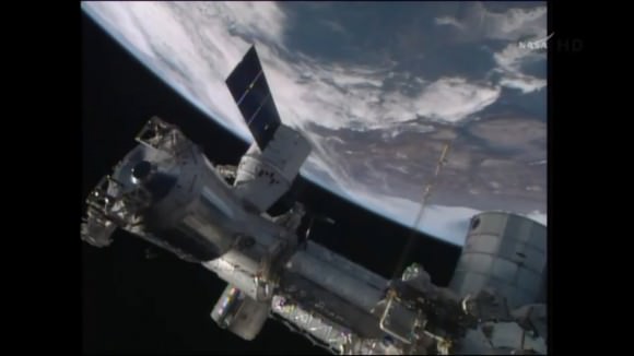
SpaceX Dragon resupply spacecraft arrives for successful berthing and docking at the International Space Station on Easter Sunday morning April 20, 2014. Credit: NASA TV

This week, SpaceX was also awarded a NASA contact to build a manned version of the Dragon dubbed V2 that will ferry astronauts crews to the ISS starting as soon as 2017.

NASA also awarded a second contact to Boeing to develop the CST-100 astronaut ‘space taxi’ to end the nation’s sole source reliance on Russia for astronaut launches in 2017.

Dragon V2 will launch on the same version of the Falcon 9 launching this cargo Dragon

Stay tuned here for Ken’s continuing SpaceX, Boeing, Sierra Nevada, Orbital Sciences, commercial space, Orion, Mars rover, MAVEN, MOM and more planetary and human spaceflight news.
Ken Kremer

SpaceX Falcon 9 awaits launch on Sept 20, 2014 on the CRS-4 mission. Credit: NASA

Spectacular Ultra-High Definition Timelapse from the Space Station

Imagery from the new ESA timelapse in 4K from the International Space Station.

Holy moly! Take a look at this new 4K timelapse video from ESA created from imagery taken by astronaut Alexander Gerst. Before you watch, however, you might want to change your video viewing setting to as high as they can go.

The imagery was taken at a resolution of 4256 x 2832 pixels at a rate of one every second. ESA said the high resolution allowed their production team to create a 3840 x 2160 pixel movie, also known as Ultra HD or 4K.

Playing these sequences at 25 frames per second, the film runs 25 times faster than it looks for the astronauts in space. They also did some nice effects creating trails from from stars and lights from cities on Earth for that “hyper-space” look. There’s a great sequence starting at about :55 of the Orbital Cygnus capsule being unberthed from the ISS and then it zooms away from the station.

Low On Fuel, Rainfall Satellite Slowly Spirals To Its Death In 2016

Artist's conception of the Tropical Rainfall Measuring Mission (TRMM) satellite in space over a cyclone. Credit: NASA

After 17 years of faithful service, the end is in sight for the Tropical Rainfall Measuring Mission (TRMM). The joint NASA-Japanese mission is out of fuel (except for a small reserve amount for emergencies) and beginning its slow descent back to Earth.

From that fall, the satellite is not going to recover. It’s expected to re-enter the atmosphere and be destroyed around November 2016. The satellite will be shut down around February 2016, depending on how much solar activity pumps up the atmosphere.

“TRMM has met and exceeded its original goal of advancing our understanding of the distribution of tropical rainfall and its relation to the global water and energy cycles,” stated Scott Braun, the mission’s project scientist at NASA’s Goddard Space Flight Center in Maryland.

The satellite was designed to operate at about 250 miles (400 kilometers), and will slowly fall untl it gets to around 75-93 miles (120-150 kilometers), where it will break up.

While there’s no longer enough fuel to keep it at its normal operating altitude, NASA emphasized the satellite will still function well enough to estimate rains, floods and cyclones during the descent. However, its microwave imager will be affected because the field of view changes as the satellite descends.

GPM lifts off on Feb. 27, EST (Feb. 28 JST) to begin its Earth-observing mission.  Credit: NASA/Bill Ingalls
GPM lifts off on Feb. 27, EST (Feb. 28 JST) to begin its Earth-observing mission. Credit: NASA/Bill Ingalls

NASA also pointed out that the successor satellite, the Global Precipitation Measurement (GPM) Core Observatory, is performing well since its launch on Feb. 27 this year.

“The GPM Core Observatory’s area of coverage extends beyond TRMM’s, covering the area from the Arctic Circle to the Antarctic Circle. While this means fewer observations of the tropics, it also means that GPM will be able to observe hurricanes, like Sandy in 2012, that travel north (or south) farther into the mid-latitudes,” NASA wrote.

“GPM will also be able to detect light rain and snowfall, a major source of available fresh water in some regions. The joint NASA/JAXA mission will study rain and snow around the world, joining with an international network of partner satellites to provide global precipitation datasets on half hourly and longer time scales.”

Source: NASA