NASA Set to Launch OCO-2 Observatory on July 1 – Sniffer of Carbon Dioxide Greenhouse Gas

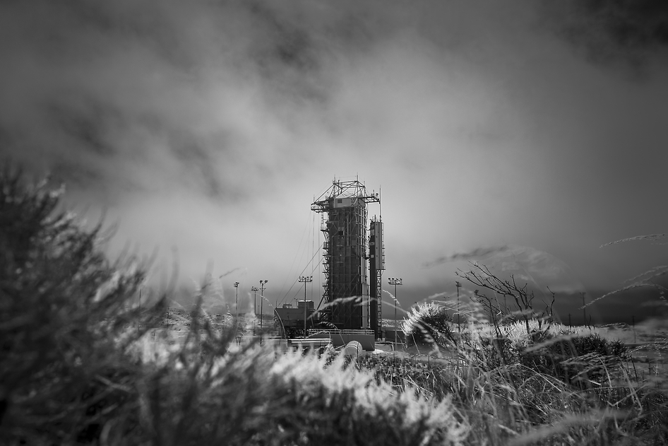
NASA’s Orbiting Carbon Observatory-2 (OCO-2) at the Launch Pad. This black-and-white infrared view shows the launch gantry, surrounding the United Launch Alliance Delta II rocket with the Orbiting Carbon Observatory-2 (OCO-2) satellite onboard. The photo was taken at Space Launch Complex 2, Friday, June 27, 2014, Vandenberg Air Force Base, Calif. OCO-2 is set for a July 1, 2014 launch. Credit: NASA/Bill Ingalls

NASA’s Orbiting Carbon Observatory-2 (OCO-2) at the Launch Pad
This black-and-white infrared view shows the launch gantry, surrounding the United Launch Alliance Delta II rocket with the Orbiting Carbon Observatory-2 (OCO-2) satellite onboard. The photo was taken at Space Launch Complex 2, Friday, June 27, 2014, Vandenberg Air Force Base, Calif. OCO-2 is set for a July 1, 2014 launch. Credit: NASA/Bill Ingalls[/caption]

After a lengthy hiatus, the workhorse Delta II rocket that first launched a quarter of a century ago and placed numerous renowned NASA science missions into Earth orbit and interplanetary space, as well as lofting dozens of commercial and DOD missions, is about to soar again this week on July 1 with NASA’s Orbiting Carbon Observatory-2 (OCO-2) sniffer to study atmospheric carbon dioxide (CO2).

OCO-2 is NASA’s first mission dedicated to studying atmospheric carbon dioxide, the leading human-produced greenhouse gas and the principal human-produced driver of climate change.

The 999 pound (454 kilogram) observatory is equipped with one science instrument consisting of three high-resolution, near-infrared spectrometers fed by a common telescope. It will collect global measurements of atmospheric CO2 to provide scientists with a better idea of how CO2 impacts climate change.
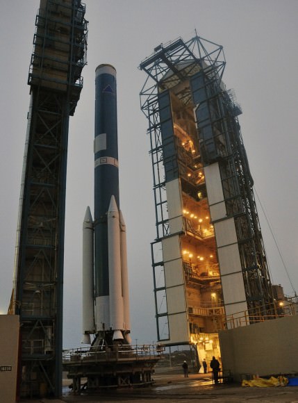
OCO-2's Delta II Rocket, First Stage  At Space Launch Complex 2 on Vandenberg Air Force Base in California, the mobile service tower rolls away from the launch stand supporting the first stage of the Delta II rocket for NASA's Orbiting Carbon Observatory-2 mission. Three solid rocket motors (white) have been attached to the first stage. The photo was taken during operations to mate the rocket's first and second stages. Credit: NASA/Randy Beaudoin
OCO-2’s Delta II Rocket, First Stage At Space Launch Complex 2 on Vandenberg Air Force Base in California, the mobile service tower rolls away from the launch stand supporting the first stage of the Delta II rocket for NASA’s Orbiting Carbon Observatory-2 mission. Three solid rocket motors (white) have been attached to the first stage. The photo was taken during operations to mate the rocket’s first and second stages. Credit: NASA/Randy Beaudoin

The $467.7 million OCO-2 mission is set to blastoff atop the United Launch Alliance (ULA) Delta II rocket on Tuesday, July 1 from Space Launch Complex 2 at Vandenberg Air Force Base in California.

Liftoff is slated for 5:56 a.m. EDT (2:56 a.m. PDT) at the opening of a short 30-second launch window.

NASA TV will broadcast the launch live with countdown commentary beginning at 3:45 a.m. EDT (12:45 a.m. PDT): http://www.nasa.gov/multimedia/nasatv/

The California weather prognosis is currently outstanding at 100 percent ‘GO’ for favorable weather conditions at launch time.
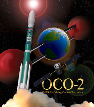
OCO-2 poster. Credit: ULA/NASA

The two stage Delta II 7320-10 launch vehicle is 8 ft in diameter and approximately 128 ft tall. It is equipped with a trio of strap on solid rocket motors. This marks the 152nd Delta II launch overall and the 51st for NASA since 1989.

The last time a Delta II rocket flew was nearly three years ago in October 2011 from Vandenberg for the Suomi National Polar-Orbiting Partnership (NPP) weather satellite.

The final Delta II launch from Cape Canaveral on Sept. 10, 2011 boosted NASA’s twin GRAIL gravity mapping probes to the Moon.

The Delta II will boost OCO-2 into a 438-mile (705-kilometer) altitude, near-polar orbit. Spacecraft separation from the rocket occurs 56 minutes 15 seconds after launch.

It will lead a constellation of five other international Earth monitoring satellites that circle Earth.
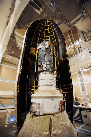
NASA's Orbiting Carbon Observatory-2, or OCO-2, inside the payload fairing in the mobile service tower at Space Launch Complex 2 on Vandenberg Air Force Base in California. The fairing will protect OCO-2 during launch aboard a United Launch Alliance Delta II rocket, scheduled for 5:56 a.m. EDT on July 1. OCO-2 is NASA’s first mission dedicated to studying atmospheric carbon dioxide, the leading human-produced greenhouse gas driving changes in Earth’s climate.   Credit: NASA/30th Space Wing USAF
NASA’s Orbiting Carbon Observatory-2, or OCO-2, inside the payload fairing in the mobile service tower at Space Launch Complex 2 on Vandenberg Air Force Base in California. The fairing will protect OCO-2 during launch aboard a United Launch Alliance Delta II rocket, scheduled for 5:56 a.m. EDT on July 1. OCO-2 is NASA’s first mission dedicated to studying atmospheric carbon dioxide, the leading human-produced greenhouse gas driving changes in Earth’s climate. Credit: NASA/30th Space Wing USAF

The phone-booth sized OCO-2 was built by Orbital Sciences and is a replacement for the original OCO which was destroyed during the failed launch of a Taurus XL rocket from Vandenberg back in February 2009 when the payload fairing failed to open properly.

OCO-2 is the second of NASA’s five new Earth science missions launching in 2014 and is designed to operate for at least two years during its primary mission. It follows the successful blastoff of the joint NASA/JAXA Global Precipitation Measurement (GPM) Core Observatory satellite on Feb 27.

Orbiting Carbon Observatory-2 (OCO-2) mission will provide a global picture of the human and natural sources of carbon dioxide, as well as their “sinks,” the natural ocean and land processes by which carbon dioxide is pulled out of Earth’s atmosphere and stored, according to NASA..

“Carbon dioxide in the atmosphere plays a critical role in our planet’s energy balance and is a key factor in understanding how our climate is changing,” said Michael Freilich, director of NASA’s Earth Science Division in Washington.

“With the OCO-2 mission, NASA will be contributing an important new source of global observations to the scientific challenge of better understanding our Earth and its future.”
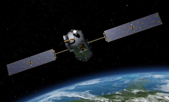
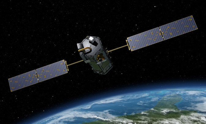
Artist's rendering of NASA's Orbiting Carbon Observatory (OCO)-2, one of five new NASA Earth science missions set to launch in 2014, and one of three managed by JPL. Credit:  NASA-JPL/Caltech
Artist’s rendering of NASA’s Orbiting Carbon Observatory (OCO)-2, one of five new NASA Earth science missions set to launch in 2014, and one of three managed by JPL. Credit: NASA-JPL/Caltech

It will record around 100,000 CO2 measurements around the world every day and help determine its source and fate in an effort to understand how human activities impact climate change and how we can mitigate its effects.

At the dawn of the Industrial Revolution, there were about 280 parts per million (ppm) of carbon dioxide in Earth’s atmosphere. As of today the CO2 level has risen to about 400 parts per million.

Stay tuned here for Ken’s continuing OCO-2, GPM, Curiosity, Opportunity, Orion, SpaceX, Boeing, Orbital Sciences, MAVEN, MOM, Mars and more Earth & Planetary science and human spaceflight news.
Ken Kremer

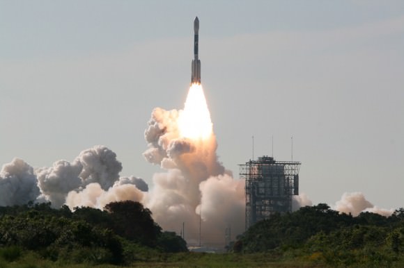
Blastoff of twin GRAIL A and B lunar gravity mapping spacecraft on a Delta II Heavy rocket on Sept. 10 from Pad 17B Cape Canaveral Air Force Station in Florida at 9:08 a.m. EDT. Credit: Ken Kremer/kenkremer.com
Blastoff of twin GRAIL A and B lunar gravity mapping spacecraft on a Delta II Heavy rocket on Sept. 10, 2011, from Pad 17B Cape Canaveral Air Force Station in Florida at 9:08 a.m. EDT. Credit: Ken Kremer/kenkremer.com

The Place Where Earth from Space Looks Like a Floating Piece of Cardboard

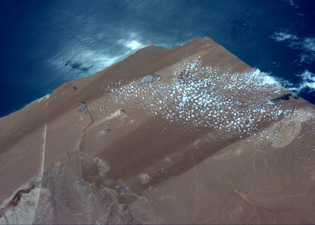
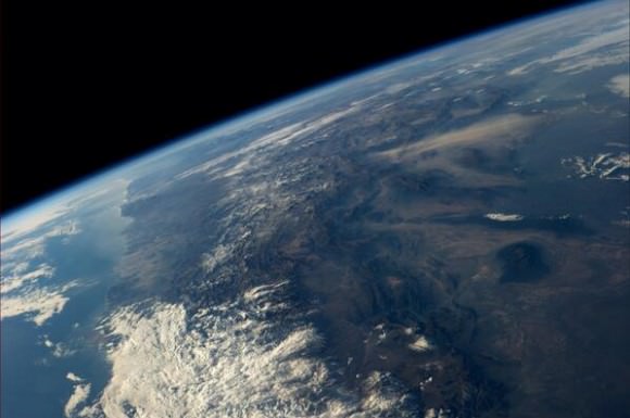
An image taken from the International Space Station taken on Jun 23, 2014 showing Western Sahara , near El Aaiun. Credit: Reid Wiseman/NASA.

As we’ve noted before, astronaut Reid Wiseman is sending out a bevy of tweets and pictures from his perch on board the International Space Station, but this recent image got our attention.

“Can’t explain it, just looked oddly unnatural to me and I liked it,” Wiseman said on Twitter, leaving no info on what Earthly feature might be.

Floating cardboard? That’s what many people thought. Comments from Twitter:

So what is this image and where on Earth is it?

I checked with Peter Caltner, who regularly tweets information on astronaut photos and he said the image shows Western Sahara, near El Aaiun (coordinates 26.824071,-13.222504) and the straight white line is a conveyor belt facility from a phosphate mine at Bou Craa that goes to a loading port at the coast. The conveyer belt is about 60 miles/100 km long, Peter noted.

You can see more images of this feature in this Google search, but none of them have quite the angle Wiseman had, which gave it the straight-edge box-like appearance from space.

See more comments about the image here.

Thanks again to Peter Caltner for his assistance!

Mountains Soar Above the Appalachians in this Dramatic NASA Photo

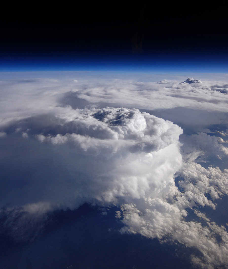
Giant storm clouds swirl over North Carolina (Credit: NASA / Stu Broce)

Except these are mountains made of water, not rock! Taken from an altitude of 65,000 feet, the image above shows enormous storm cells swirling high over the mountains of western North Carolina on May 23, 2014. It was captured from one of NASA’s high-altitide ER-2 aircraft during a field research flight as part of the Integrated Precipitation and Hydrology Experiment (IPHEx) campaign.

The photo was NASA’s Image of the Day for June 19, 2014.

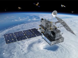
Visualization of the GPM Core Observatory satellite (NASA/Britt Griswold)

For six weeks the IPHEx campaign team from NASA, NOAA, and Duke University set up ground stations and flew ER-2 missions over the southeastern U.S., collecting data on weather and rainfall that will be used to supplement and calibrate data gathered by the GPM Core Observatory launched in February.

By the time its role in IPHEx was completed on June 16, the Lockheed ER-2 aircraft had flown more than 95 hours during 18 flights over North and South Carolina, Georgia, Florida, and Tennessee. Its high-altitude capabilities allow researchers to safely fly above storm systems, taking measurements like a satellite would.

Learn more about the ER-2 flights here, and read more about the IPHEx campaign on Duke University’s Pratt School of Engineering site here.

Source: NASA

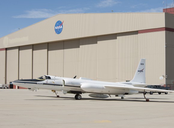
NASA's ER-2 at the Armstrong Flight Research Center's Building 703 in Palmdale, CA (NASA / Tom Tschida)
NASA’s ER-2 at the Armstrong Flight Research Center’s Building 703 in Palmdale, CA (NASA/Tom Tschida)

It’s Hurricane Season and NASA is Ready Like Never Before

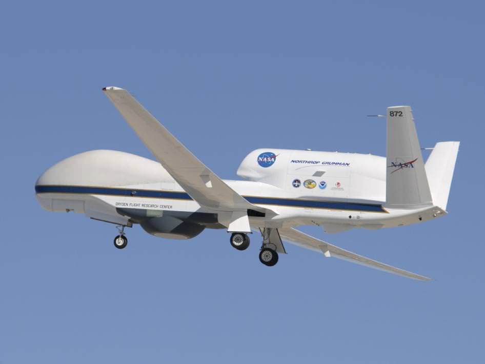
A member of NASA's Global Hawk fleet takes to the air. Credit: NASA/Armstrong Spaceflight Research Center.

What’s in the cards weather-wise for the 2014 Atlantic hurricane season? Although the start of astronomical summer for the northern hemisphere is still over a week away on June 21st, meteorological summer has already begun and with it, hurricane season, which runs from June 1st to November 30th.

This year, NASA is deploying its latest weapons in its hurricane-hunting arsenal to study tropical storms like never before, including two new Earth observing satellites and two uncrewed Global Hawk aircraft.

The Global Hawk flights are set to begin on August 26th from NASA’s Wallops Flight Facility based along the Virginia coast and run through September 29th. This coincides with the peak of the Atlantic hurricane season, when storm activity should be in full swing. The campaign is part of NASA’s airborne Hurricane and Severe Storm Sentinel mission, also known as HS3.

“This year, we’re going full-force into tropical cyclone research,” stated HS3 mission principal investigator Scott Braun in a recent press release from NASA’s Goddard Space Flight center headquartered at Greenbelt, Maryland. “We’ll have two Global Hawks equipped with six instruments. The new NASA-JAXA Global Precipitation Measurement (GPM) Core Observatory will be providing much higher quality data than previously available on rain structure in tropical cyclones in all ocean basins. The surface-wind monitoring ISS-RapidScat instrument to be launched to the International Space Station this season will provide valuable information on surface winds and storms.”

One of the key mysteries that the HS3 program is targeting is the role that a dry hot air phenomenon known as the Saharan Air Layer or SAL plays in hurricane formation and subsequent intensification. Some studies suggest the SAL feeds and triggers hurricane formation off of the north African coast —a mainstream view held by many meteorologists — while other studies imply that it may actually suppress it. HS3 will also give researchers the enhanced capability to monitor and track the formation of thunderstorms near the core of hurricanes and tropical storms and follow their progression.

To accomplish this, the HS3 Global Hawk aircraft will deploy devices that measure humidity, temperature and wind speeds known as dropsondes. All of the dropsondes to be deployed by NASA in the 2014 season are managed by the National Oceanic and Atmospheric Administration.

Global Hawk aircraft are ideal for hurricane tracking and hunting because they can stay aloft for up to 26 hours and fly at altitudes of over 18,000 metres. HS3 mission control for the Global Hawks is based out of NASA’s Wallops Flight Facility.

The first Global Hawk will provide data on the storm’s environment. The gear it uses to accomplish this will include the Cloud Physics Lidar (CPL), the Advanced Vertical Atmospheric Profiling System (AVAPS), and the Scanning High-resolution Interferometer Sounder (S-HIS).

Global Hawk number two will analyze the core storm regions to gauge temperature, humidity, surface winds and precipitation. It will use an array of instruments to accomplish this, including the High-Altitude Monolithic Microwave Integrated Circuit Sounding Radiometer (HAMSR), the Hurricane Imaging Radiometer (HIRAD), and Doppler Radar.

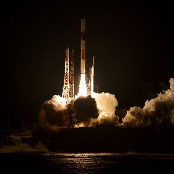
The dramatic night launch of the GPM satellite from Tanegashima, Japan. Credit: NASA/JAXA

In orbit, the Global Precipitation Mission (GPM) will continue with the legacy of the Tropical Rainfall Measuring Mission (TRMM) and follow hurricanes through all phases of formation and decay. A joint NASA/JAXA mission, GPM was launched atop an H-IIA rocket earlier this year on February 27th from Tanegashima Space Center located on the southern tip of Kyushu Island in Japan. Of particular interest to GPM researchers is the formation of deep thunderstorms known as hot towers near the hurricane eyewall. GPM is located in an 65° degree inclination in low Earth orbit and will be able to track hurricanes and study hot tower formation as they move out of the tropics.

Newsflash- no sooner than we finished this article than we noticed that a rocket booster associated with the GPM launch is set to reenter soon on June 17th.

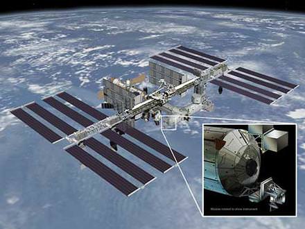
A diagram of RapidScat's future home on the ISS. Credit: NASA/JPL-Caltech/Johnson Spaceflight Center.
A diagram of RapidScat’s future home on the ISS. Credit: NASA/JPL-Caltech/Johnson Spaceflight Center.

And finally, RapidScat is set to head to the International Space Station later this year. Set to be mounted on the exterior of the Columbus module of the ISS, RapidScat will be an invaluable tool for monitoring ocean surface winds and is a cost effective replacement for the QuickScat satellite that ceased operation in 2009. RapidScat is set to launch on a SpaceX Falcon-9 rocket as part of the CRS-4 Dragon resupply mission slated for sometime this August.

These assets will give NASA the ability to study hurricanes that form during the 2014 season like never before. And speaking of the ISS, the live camera that now broadcasts HD images 24 hours a day will make for some interesting views of hurricanes online from space.

And what’s on tap for the 2014 Atlantic season? Well, forecast models out of Colorado State University suggest that an anomalous cooling early on in the Atlantic will lead to fewer than usual named storms, with perhaps only 9, as opposed to the usual average number of 12. Of these, perhaps 1-2 will reach category 3 or higher, as opposed to the average number of 3. A leading factor in this weakened trend is the possibility of a moderate to strong El Nino event earlier this year. Keep in mind through, that it only takes one destructive hurricane to wreak havoc, and these still can and do occur, even on off years.

Whatever the case, NASA and the NOAA will have all their tools at their disposal ready to study these powerful storms as the season rolls on.

“Carbon Copy” Spacecraft Ready to Track Global Carbon Dioxide

Artist's rendering of NASA's Orbiting Carbon Observatory (OCO)-2, one of five new NASA Earth science missions set to launch in 2014, and one of three managed by JPL. Image Credit: NASA-JPL/Caltech

On February 24, 2009, the launch of the Orbiting Carbon Observatory (OCO) mission — designed to study the global fate of carbon dioxide — resulted in failure. Shortly after launch, the rocket nose didn’t separate as expected, and the satellite could not be released.

But now, a carbon copy of the original mission, called OCO-2 is slated to launch on July 1, 2014.

The original failure ended in “heartbreak. The entire mission was lost. We didn’t even have one problem to solve,” said OCO-2 Project Manager Ralph Basilio in a press conference earlier today. “On behalf of the entire team that worked on the original OCO mission, we’re excited about this opportunity … to finally be able to complete some unfinished business.”

The motivation for the mission is simple: in the last few hundred years, human beings have played a large role in the planet-wide balancing act called the carbon cycle. Our activities, such as fossil fuel burning and deforestation are pushing the cycle out of its natural balance, adding more carbon dioxide to the atmosphere.

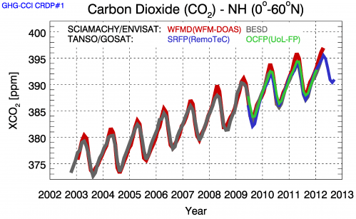
“There’s a steady increase in atmospheric carbon dioxide concentrations over time,” said OCO-2 Project Scientist Mike Gunson. “But at the same time, we can see that this has an annual cycle of dropping every summer, in this case in the northern hemisphere, as the forests and plants grow. And this is the Earth breathing.”

Time series of atmospheric carbon dioxide over the northern hemisphere retrieved from the Sciamachy instrument on Envisat and the TANSO instrument on Japan’s GOSAT.  While carbon dioxide increases over the ten-year period, it experiences annual fluctuations caused by vegetation’s absorption and release of the gas due to photosynthesis and respiration. The different colours represent different methods of extracting carbon dioxide measurements from the measured spectra of reflected solar radiation. Credit: University Bremen/ESA Read more at: http://phys.org/news/2013-09-planet-earth-carbon-dioxide-space.html#jCp
Time series of atmospheric carbon dioxide over the northern hemisphere retrieved from the Sciamachy instrument on Envisat and the TANSO instrument on Japan’s GOSAT. The different colours represent different methods of extracting carbon dioxide measurements from the measured spectra of reflected solar radiation. Credit: University Bremen/ESA

Carbon dioxide is both one of the best-measured greenhouse gases and least-measured. Half of the emissions in the atmosphere become largely distributed around the globe in a matter of months. But the other half of the emissions — the half that is being absorbed through natural processes into the land or the ocean — is not evenly distributed.

To understand carbon dioxide absorption, we need a high-resolution global map.

This is where the launch failure of OCO proved to be a blessing in disguise. It gave OCO-2 scientists a chance to work with project managers of the Japanese Greenhouse Gases Observing Satellite (GOSAT), which successfully launched in 2009. The unexpected collaboration allowed them to stumble upon a hidden surprise.

“A couple of my colleagues made what I think is a fantastic discovery,” said Gunson. They discovered fluorescent light from vegetation.

As plants absorb sunlight, some of the light is dissipated as heat, while some is re-emitted at longer wavelengths as fluorescence. Although scientists have measured fluorescence in laboratory settings and ground-based experiments, they have never done so from space.

Measuring the fluorescent glow proves to be a challenge because the tiny signal is overpowered by reflected sunlight. Researchers found that by tuning their GOSAT spectrometer — an instrument that can measure light across the electromagnetic spectrum — to look at very narrow channels, they could see parts of the spectrum where there was fluorescence but less reflect sunlight.

This surprise will give OCO-2 an unexpected global view from space, shedding new light on the productivity of vegetation on land. It will provide a regional map of absorbed carbon dioxide, helping scientists to estimate photosynthesis rates over vast scales and better understand the second half of the carbon cycle.

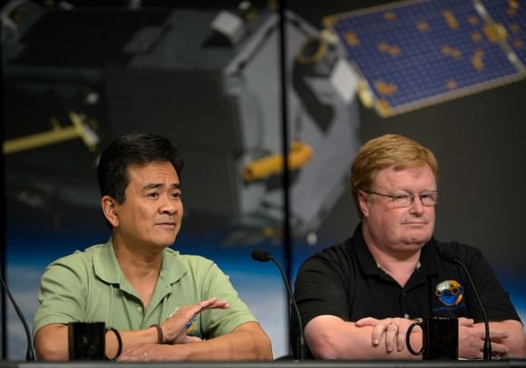
Ralph Basilio, OCO-2 project manager with NASA’s Jet Propulsion Laboratory (JPL) in Pasadena, California, left, and Mike Gunson, OCO-2 project scientist at JPL, discuss the Orbiting Carbon Observatory-2 (OCO-2), NASA’s first spacecraft dedicated to studying carbon dioxide, during a press briefing, Thursday, June 12, 2014, at NASA Headquarters in Washington. Credit: NASA.

“The OCO-2 satellite has one instrument: a three-channel grating spectrometer,” said OCO-2 Program Executive Betsy Edwards. “But with this one instrument we’re going to collect hundreds of thousands of measurements each day, which will then provide a global description of carbon dioxide in the atmosphere. It’s going to be an unprecedented level of coverage and resolution, something we have not seen before with previous spacecraft.”

OCO-2 will result in nearly 100 times more observations of both carbon dioxide and fluorescence than GOSAT. It will launch from Vandenberg Air Force Base in California at 2:56 a.m. on July 1.

“Climate change is the challenge of our generation,” said Edwards. “NASA is particularly ready to … provide information, on documenting and understanding what these changes are on the climate, in predicting the impact of these changes to the Earth, and in sharing all of this information that we gather for the benefit of society.”

Stunning Snapshots from Space Courtesy of Reid Wiseman

Sunset-lit clouds swirl over Perth on May 31, 2014 (Reid Wiseman/NASA)

On May 28 the crew of Expedition 40/41 launched from Baikonur Cosmodrome, their Soyuz TMA-13M arriving at the International Space Station about eight and a half hours later. And it didn’t take much time for the newly-arrived NASA astronaut Reid Wiseman to start taking photos from his new vantage point in orbit and sharing them on Twitter for the rest of us to enjoy! Here are some of Reid’s latest images from the edge of space, looking down on the beautiful blue world we call home.

One of Reid Wiseman's first few tweets from space
One of Reid Wiseman’s first few tweets from space!
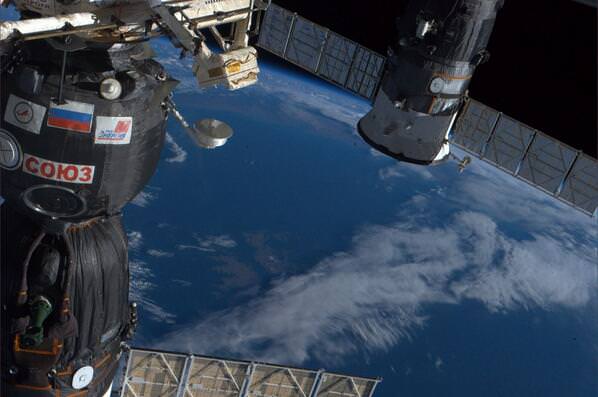
A "beautiful pass over the Falkland Islands" (aka Malvinas) on May 30 with docked Soyuz in the foreground
A “beautiful pass over the Falkland Islands” (aka Islas Malvinas) on May 30 with docked Soyuz in the foreground
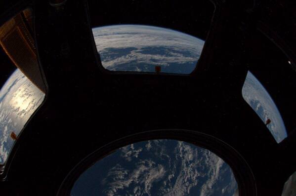
Reid confirmed that the Earth is indeed round with a 12mm lens on June 1
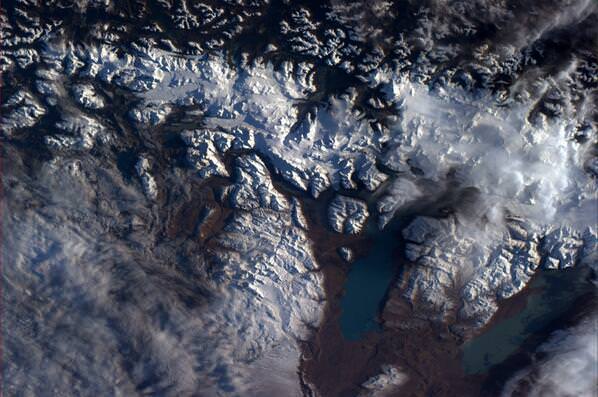
Looking down on glacial flows near the Strait of Magellan
Pink clouds at sunset may look beautiful from Earth but "not as pretty here" according to Reid Wiseman
Pink clouds at sunset may look beautiful from Earth but “not as pretty here” according to Reid Wiseman
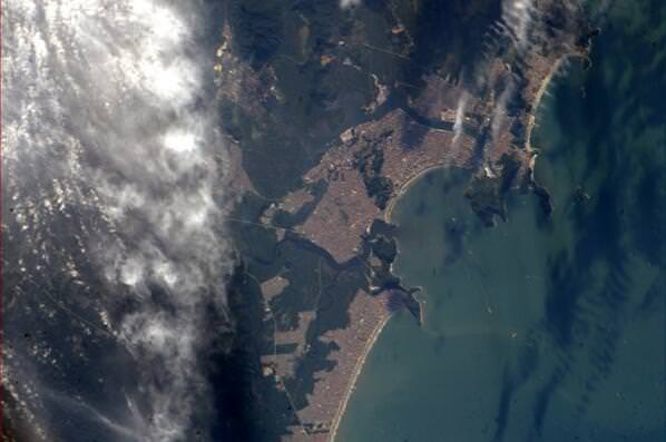
May 31 was a "nice day to hit the beach" in Santos, Brazil
May 31 was a “nice day to hit the beach” in Santos, Brazil
"Our planet is almost all ocean and so pretty," Tweeted Reid on June 1
“Our planet is almost all ocean and so pretty,” Tweeted Reid on June 1
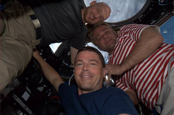
A "Soyuz selfie" in the cupola with Expedition 40/41 crew members Alexander Gerst, Oleg Artemyev, and Reid Wiseman, shared on June 2
A “Soyuz group selfie” in the cupola with Expedition 40/41 crew members Alexander Gerst, Oleg Artemyev, and Reid Wiseman, shared on June 2
"Chile just left me speechless," Reid tweeted on June 4
“Chile just left me speechless,” Reid tweeted on June 4
"Clouds turn 2D into 3D" tweeted Reid on Thursday, June 5
“Clouds turn 2D into 3D” tweeted Reid on Thursday, June 5
Just a week into his stay aboard the ISS microgravity is already second nature!

See these photos (and more as they are taken!) on Reid Wiseman’s Twitter feed, and learn more about Expedition 40 here.

Photos courtesy Reid Wiseman/NASA.

Selfies from Around the World Combine to Make a Portrait of Earth

Images of Earth assembled from over 36,000 fan-submitted "selfless" on Earth Day, April 22, 2014 (NASA)

On Earth Day, April 22, NASA invited people around the world to share their “selfies” on social media sites like Twitter, Facebook, Google+, and Instagram, showing where on Earth they are and marking them with the hashtag #GlobalSelfie. Well, here we are a month later and the results have just been released… proof of what a beautiful world we all make up!

The image above was built using 36,422 fan-submitted self-portraits from 113 countries, and is based upon images of Earth acquired on April 22 by NASA/NOAA’s Visible Infrared Imaging Radiometer Suite instrument aboard the Suomi National Polar-orbiting Partnership (NPP) satellite. (See the original NPP images here.)

How cool is that? A picture of Earth, as seen from space, recomposed of pictures of people on Earth taken the very same day!

Did you send in a #GlobalSelfie? I’m in there somewhere too, but I haven’t located myself (yet). They’re organized by hue and tone, not location, so I could be representing a spot in the middle of the Peruvian jungle instead of along the Providence River.

View the full zoomable 3.2-gigapixel image on GigaPan here.

The GlobalSelfie campaign was more than just a PR gimmick. 2014 is a big year for NASA Earth observation, with five missions launched to monitor our planet’s wind, oceans, soil, and atmosphere. GlobalSelfie was used to kick off the Earth Right Now campaign, helping to raise awareness about these missions and the data they’ll gather to ultimately benefit people around the world.

Source: NASA/GSFC

Pink Floyd and Coldplay Go to Space

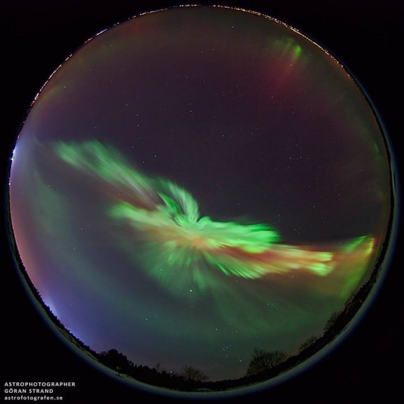
An allsky photo of the aurora in February, 2014 as seen from Östersund, Sweden. Credit and copyright: Göran Strand.

Two great music videos published this week feature incredible imagery from space. Above, Pink Floyd released an 20th anniversary video version of their instrumental “Marooned” which uses timelapse video photography taken by astronauts on the International Space Station (which we’ve featured many times, like here and here). For you Pink Floyd-aphiles, the anniversary edition of ‘The Division Bell‘ will be released on June 30th — including a double vinyl edition!

Below, a new video from Coldplay and their song “Sky Full of Stars” uses aurora imagery taken by Swedish astrophotopher Göran Strand, whose work we post frequently:

This version of a “A Sky Full of Stars” was used in the NBC special Coldplay: Ghost Stories. Göran recorded the aurora over Östersund on March 17, 2013. He photographed the aurora for 4 hours and then put all the images together to a movie showing the development of the aurora across the entire sky. See his original aurora video below.

Scientists Now Suspect More Sea Level Rise from Greenland’s Glaciers

Floating ice at the calving front of Greenland's Kangerdlugssuaq glacier, photographed in 2011 during Operation IceBridge (Credit: NASA/Michael Studinger)

Greenland’s glaciers may contribute more to future sea level rise than once thought, despite earlier reports that their steady seaward advance is a bit slower than expected. This is just more sobering news on the current state of Earth’s ice from the same researchers that recently announced the “unstoppable” retreat of West Antarctic glaciers.

Using data collected by several international radar-mapping satellites and NASA’s airborne Operation IceBridge surveys, scientists at NASA and the University of California, Irvine have discovered deep canyons below the ice sheet along Greenland’s western coast. These canyons cut far inland, and are likely to drive ocean-feeding glaciers into the sea faster and for longer periods of time as Earth’s climate continues to warm.

Some previous models of Greenland’s glaciers expected their retreat to slow once they receded to higher altitudes, making their overall contribution to sea level increase uncertain. But with this new map of the terrain far below the ice, modeled with radar soundings and high-resolution ice motion data, it doesn’t seem that the ice sheets’ recession will halt any time soon.

According to the team’s paper, the findings “imply that the outlet glaciers of Greenland, and the ice sheet as a whole, are probably more vulnerable to ocean thermal forcing and peripheral thinning than inferred previously from existing numerical ice-sheet models.”

Read more: Scientists Set Their Sights on Arctic Ice Loss

Watch a video of the new topography map below:

“The glaciers of Greenland are likely to retreat faster and farther inland than anticipated, and for much longer, according to this very different topography we have discovered. This has major implications, because the glacier melt will contribute much more to rising seas around the globe.

– Mathieu Morlighem, project scientist, University of California, Irving

Many of the newly-discovered canyons descend below sea level and extend over 65 miles (100 kilometers) inland, making them vulnerable — like the glaciers in West Antarctica — to undercutting by warmer ocean currents.

The team’s findings were published on May 18 in a report titled Deeply Incised Submarine Glacial Valleys Beneath the Greenland Ice Sheet in the journal Nature Geoscience.

Source: NASA/JPL press release & University of California,Irvine News

_______________

What would happen if all the ice on land melted into the ocean? Find out what the world would look like here.

Dramatic Timelapse Shows Develpment of Supercell “Mothership” Storm Cloud in Wyoming

Yikes! The Mothership has returned to Wyoming a laClose Encounters of the Third Kind!” Yesterday a gigantic storm cloud spun into a flying saucer shape in eastern Wyoming near Newcastle and a storm-chasing group called Basehunters captured it all on film. Luckily, by the end of the footage, the storm dissipates.

You can see some images from Twitter below:

Continue reading “Dramatic Timelapse Shows Develpment of Supercell “Mothership” Storm Cloud in Wyoming”