NASA’s Magnetospheric Multiscale Mission to Provide 1st 3-D View of Earth’s Magnetic Reconnection Process – Cleanroom visit with Bolden

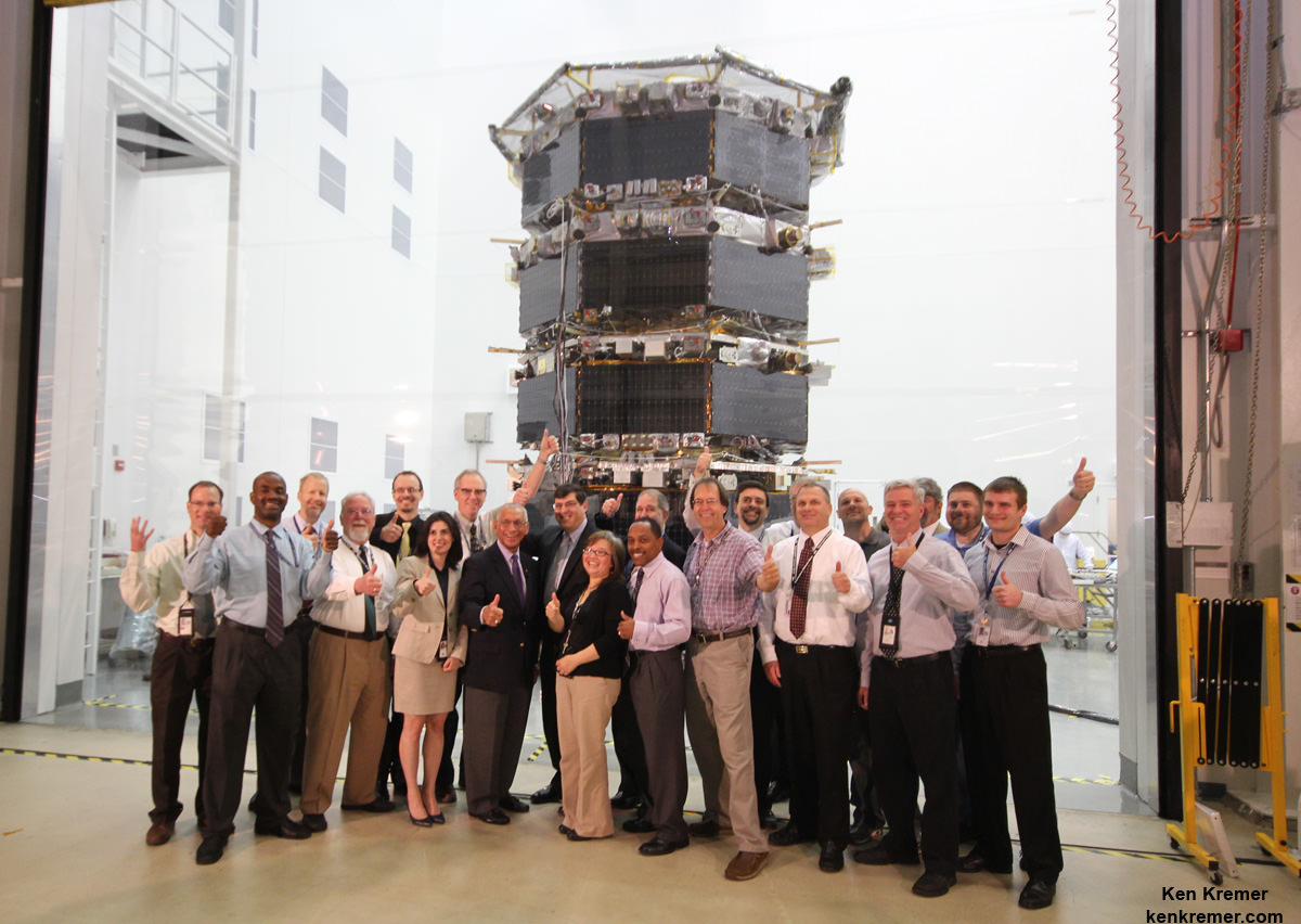
NASA Administrator Charles Bolden poses with the agency’s Magnetospheric Multiscale (MMS) spacecraft, mission personnel, Goddard Center Director Chris Scolese and NASA Associate Administrator John Grunsfeld, during visit to the cleanroom at NASA's Goddard Space Flight Center in Greenbelt, Md., on May 12, 2014. Credit: Ken Kremer- kenkremer.com

NASA Administrator Charles Bolden poses with the agency’s Magnetospheric Multiscale (MMS) spacecraft, mission personnel, Goddard Center Director Chris Scolese and NASA Associate Administrator John Grunsfeld, during visit to the cleanroom at NASA’s Goddard Space Flight Center in Greenbelt, Md., on May 12, 2014. Credit: Ken Kremer- kenkremer.com
Story updated[/caption]

NASA GODDARD SPACE FLIGHT CENTER, MD – NASA’s upcoming Magnetospheric Multiscale (MMS) mission is comprised of a quartet of identically instrumented observatories aimed at providing the first three-dimensional views of a fundamental process in nature known as magnetic reconnection. They were unveiled to greet NASA Administrator Charles Bolden on Monday, May 12, in a rare fully stacked arrangement inside the Goddard cleanroom.

Universe Today was on hand with NASA Administrator Bolden, Science Mission Chief John Grunsfeld and the MMS mission team at Goddard for a first hand inspection and up close look at the 20 foot tall, four spacecraft stacked configuration in the cleanroom and for briefings about the projects fundamental science goals.

“I’m visiting with the MMS team today to find out the status of this mission scheduled to fly early in 2015. It’s one of many projects here at Goddard,” NASA Administrator Bolden told me in an exclusive one-on-one interview at the MMS cleanroom.

“MMS will help us study the phenomena known as magnetic reconnection and help us understand how energy from the sun – magnetic and otherwise – affects our own life here on Earth. MMS will study what effects that process … and how the magnetosphere protects Earth.”

Magnetic reconnection is the process whereby magnetic fields around Earth connect and disconnect while explosively releasing vast amounts of energy.
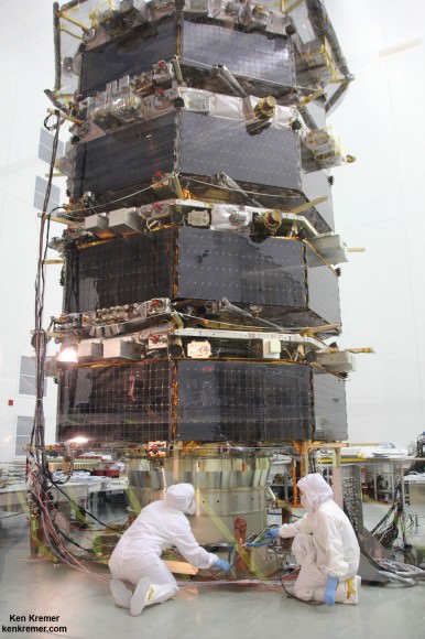
Technicians work on NASA’s 20-foot-tall Magnetospheric Multiscale (MMS) mated quartet of stacked observatories in the cleanroom at NASA's Goddard Space Flight Center in Greenbelt, Md., on May 12, 2014.  Credit: Ken Kremer- kenkremer.com
Technicians work on NASA’s 20-foot-tall Magnetospheric Multiscale (MMS) mated quartet of stacked observatories in the cleanroom at NASA’s Goddard Space Flight Center in Greenbelt, Md., on May 12, 2014. Credit: Ken Kremer- kenkremer.com

MMS measurements should lead to significant improvements in models for yielding better predictions of space weather and thereby the resulting impacts for life here on Earth as well as for humans aboard the ISS and robotic satellite explorers in orbit and the heavens beyond.

The four identical spacecraft – which are still undergoing testing – were stacked in a rarely seen launch arrangement known affectionately as the “IHOP configuration” – because they look rather like a stack of luscious pancakes.

“MMS is a fundamental heliophysics science mission,” Craig Tooley told me at the MMS cleanroom. Tooley is MMS project manager at NASA Goddard.

“Unlike Hubble that uses remote sensing, MMS is like a flying laboratory ‘in situ’ that will capture events that are the major energy transfer from the sun’s magnetic field into our Earth’s space weather environment and magnetosphere.”

“These are called magnetic reconnection events that pump enormous amounts of energy into the plasma and the fields around Earth. It’s one of the main drivers of space weather and a fundamental physical process that is not very well understood,” Tooley explained.

“The spacecraft were built in-house here at Goddard and just completed vibration testing.”

MMS will launch atop an Atlas V rocket in March 2015 from Space launch Complex 41, Cape Canaveral Air Force Station, Florida.
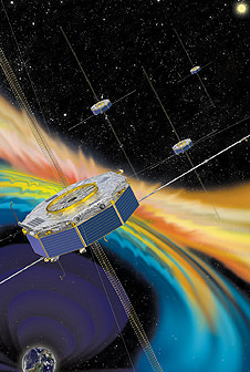
Artist rendition of the four MMS spacecraft in orbit in Earth’s magnetic field. Credit: NASA

The vibration testing is a major milestone and is conducted to ensure the spacecraft can withstand the most extreme vibration and dynamic loads they will experience and which occurs during liftoff inside the fairing of the Atlas V booster.

MMS is also another highly valuable NASA science mission (along with MAVEN, LADEE and others) which suffered launch delays and increased costs as a result of the US government shutdown last October 2013, Bolden confirmed to Universe Today.

“We ended up slipping beyond the original October 2014 date due to the government shutdown and [the team] being out of work for a couple of weeks. MMS is now scheduled to launch in March 2015,” Bolden told me.

“So then you are at the mercy of the launch provider.”

“The downside to slipping that far is that’s its [MMS] costing more to launch,” Bolden stated.

Each of the Earth orbiting spacecraft is outfitted with 25 science sensors to study the microphysics of three fundamental plasma processes: magnetic reconnection, energetic particle acceleration, and turbulence.

Magnetic reconnection occurs throughout our universe.

“The primary mission will last two years,” Tooley told me.

“Each spacecraft carries about 400 kilograms of fuel. There is a possibility to extend the mission by about a year based on fuel consumption.”

NASA Administrator Charles Bolden and Ken Kremer (Universe Today) inspect NASA’s Magnetospheric Multiscale (MMS) mated quartet of stacked spacecraft at the cleanroom at NASA's Goddard Space Flight Center in Greenbelt, Md., on May 12, 2014.  Credit: Ken Kremer- kenkremer.com
NASA Administrator Charles Bolden and Ken Kremer (Universe Today) inspect NASA’s Magnetospheric Multiscale (MMS) mated quartet of stacked spacecraft at the cleanroom at NASA’s Goddard Space Flight Center in Greenbelt, Md., on May 12, 2014. Credit: Ken Kremer- kenkremer.com

The spacecraft will use the Earth itself as a laboratory to unlock the mysteries of magnetic reconnection – the primary process that transfers energy from the solar wind into Earth’s magnetosphere and is responsible for geomagnetic storms.

“To understand the fundamental physics, they will fly in a pyramid-like formation and capture the magnetic reconnection events in 3-D by flying through them as they happen – that’s why we have 4 spacecraft,” Tooley explained.

“Initially they will be spaced apart by about 10 to 30 kilometers while they fly in a tetrahedron formation and scan with their booms spread out – depending on what the scientists says is the optimal configuration.”

“They fly in a highly elliptical orbit between about 7,000 and 75,000 kilometers altitude during the first half of the mission. Eventually the orbit will be extended out to about 150,000 kilometers.”

The best place to study magnetic reconnection is ‘in situ’ in Earth’s magnetosphere.

This will lead to better predictions of space weather phenomena.
NASA’s Magnetospheric Multiscale (MMS) science mission

Magnetic reconnection is also believed to help trigger the spectacular aurora known as the Northern or Southern lights.

Stay tuned here for Ken’s continuing MMS, Curiosity, Opportunity, SpaceX, Orbital Sciences, Boeing, Orion, LADEE, MAVEN, MOM, Mars and more planetary and human spaceflight news.

Ken Kremer

………

Ken’s upcoming presentation: Mercy College, NY, May 19: “Curiosity and the Search for Life on Mars” and “NASA’s Future Crewed Spaceships.”
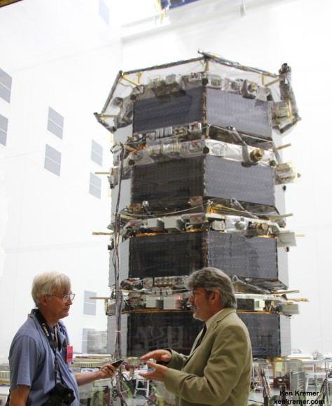
MMS Project Manager Craig Tooley (right) and Ken Kremer (Universe Today) discuss  science objectives of NASA’s upcoming Magnetospheric Multiscale mission by 20 foot tall mated quartet of stacked spacecraft at the cleanroom at NASA's Goddard Space Flight Center in Greenbelt, Md., on May 12, 2014.  Credit: Ken Kremer- kenkremer.com
MMS Project Manager Craig Tooley (right) and Ken Kremer (Universe Today) discuss science objectives of NASA’s upcoming Magnetospheric Multiscale mission by 20 foot tall mated quartet of stacked spacecraft at the cleanroom at NASA’s Goddard Space Flight Center in Greenbelt, Md., on May 12, 2014. Credit: Ken Kremer- kenkremer.com

NASA West Antarctic Ice Sheet Findings: Glacier Loss Appears Unstoppable

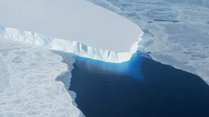
Credit: NASA

It’s a key piece of the climate change puzzle. For years, researchers have been eyeing the stability of the Western Antarctic Ice Sheet as global temperatures rise. Melting of the ice sheet could have dire consequences for sea level rise.

And though not unexpected, news from today’s NASA press conference delivered by Tom Wagner, a cryosphere program scientist with the Earth Science Division of NASA’s Science Mission Directorate in Washington D.C., Sridhar Anandakrishnan, a professor of geosciences at Pennsylvania University, and Eric Rignot, JPL glaciologist and professor of Earth system science at the University of California Irvine was certainly troubling.

Credit: NASA
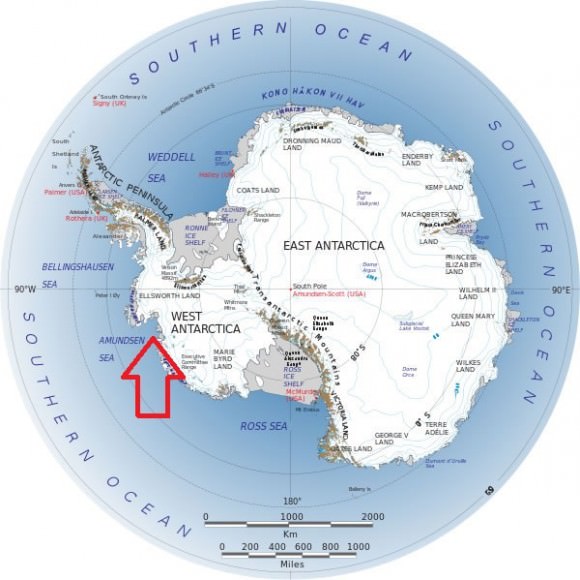
The key region targeted in the study (arrowed) Credit: NASA

The Western Antarctic Ice Sheet is a marine-based ice sheet below sea level that is bounded by the Ronne and Ross Ice Shelf and contains glaciers that drain into the Amundsen Sea. The study announced today incorporates 40 years of data citing multiple lines of observational evidence measuring movement and thickness of Antarctic ice sheets. A key factor to this loss is a thinning along the grounding line of the glaciers from underneath. The grounding line for an ice sheet is the crucial boundary where ice becomes detached from ground underneath and stretches out to become free floating. A slow degradation of the Western Antarctic Ice Sheet has been observed, one that can be attributed to increased stratospheric circulation along with the advection of ocean heat coupled with anthropogenic global warming.

Credit: Eric Rignot
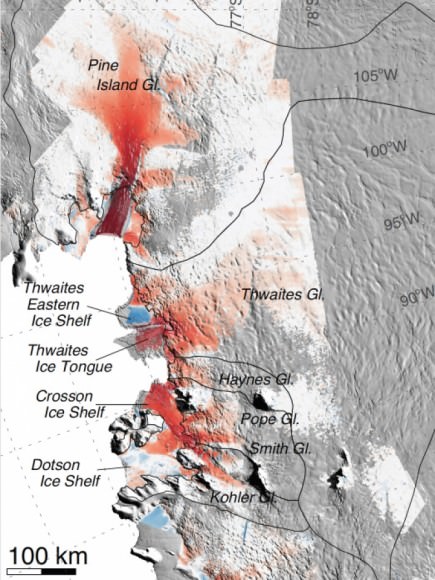
A closeup of the region: red indicates regions where flow speeds have accelerated in the past 40 years. Credit: Eric Rignot

“This sector will be a major contributor to sea level rise in the decades and centuries to come,” Rignot said in today’s press release. “A conservative estimate is it would take several centuries for all of the ice to flow into the sea.”

Thickness contributes to the driving stress of a glacier. Accelerating flow speeds stretch these glaciers out, reducing their weight and lifting them off of the bedrock below in a continuous feedback process.

A key concern for years has been the possible collapse of western Antarctica’s glaciers, leading to a drastic acceleration in sea-level rise worldwide. Such a catastrophic glacial retreat would dump millions of tons of ice into the sea over a relatively short span of time. And while it’s true that ice calves off of the Western Antarctic ice sheet every summer, the annual overall rate is increasing.

The study is backed up by satellite, airborne and ground observations looking at thickness of ice layers over decades.

Researchers stated that the Amundsen Sea Embayment sector alone contains enough ice to increase global sea level by 1.2 metres.  A strengthening of wind circulation around the South Pole region since the 1980s has accelerated this process, along with the loss of ozone. This circulation also makes the process more complex than similar types of ice loss seen in Greenland in the Arctic.

The research paper, titled Widespread, rapid grounding line retreat of Pine Island, Thwaites, Smith and Kohler glaciers, West Antarctica from 1992 to 2011 has been accepted for publication in the American Geophysical Union’s journal Geophysical Research Letters. The American Association for the Advancement of Science will also be releasing a related study on the instability of the West Antarctic ice sheet today in the journal Science.

The most spectacular retreat referenced in the study was seen occurring at the Smith/Kohler glaciers, which migrated about 35 kilometres and became ungrounded over a 500 kilometre square region during the span of 1992 to 2011.

Another telling factor cited in the study was the large scale synchronous ungrounding of several glaciers, suggesting a common trigger mechanism — such as ocean heat flux — is at play.

On the ice shelf proper, the key points that anchor or pin the glaciers to the bedrock below are swiftly vanishing, further destabilizing the ice in the region.

Assets that were used in the study included interferometry data from the Earth Remote Sensing (ERS-1/2) satellites’ InSAR (Interferormetry Synthetic Aperture Radar) instruments, ground team observations and data collected from NASA’s Operation IceBridge overflights of the Antarctic. IceBridge uses a converted U.S. Navy P-3 Orion submarine hunting aircraft equipped with radar experiment packages used to take measurements of the thickness of the ice sheet.

Possible follow up studies targeting the region are upcoming, including five Earth science and observation missions scheduled to be launched this year, which include the Soil Moisture and Passive (SMAP) mission, The Orbiting Carbon Observatory (OCO-2) and the Global Precipitation Measurement (GPM) Core Observatory, launched this past February.

Along with these future NASA missions, there are also two missions — RapidScat and the Cloud-Aerosol Transport System or CATS — slated to study climate headed for the International Space Station this year.

This comes as recent United Nations and United States reports have also announced the reality of climate change and anthropogenic global warming.

“The collapse of this sector of West Antarctica appears to be unstoppable,” Rignot said. “The fact that the retreat is happening simultaneously over a large sector suggests it was triggered by a common cause, such as an increase in the amount of ocean heat beneath the floating sections of the glaciers.”

Of course, the solar cycle, volcanic activity, global dimming (via changes in reflectivity, known as albedo) and human activity all play a role in the riddle that is climate change. The bad news is, taking only natural factors into account, we should be in a cooling period right now.

And yes, reflective ice cover also plays a role in the albedo of the Earth, but researchers told Universe Today that no significant overall seasonal variations in the extent of surface layer of ice will change, as the key loss comes from the ungrounding of ice from below. Thus, this ice loss does not present a significant contribution to changes in overall global albedo, though of course, much of this additional moisture will eventually be available for circulation in the atmosphere. And the same was noted in the press conference for those pinning their hopes on the 2014 ice extent being greater than previous years, a season that was a mere blip on the overall trend. The change and retreat in the grounding line below seen in the study was irrespective of the ice extent above.

NASA’s Operation IceBridge will continue to monitor the ice flow when the next Antarctic deployment cycle resumes in October of this year.

And in the meantime, the true discussion is turning to the challenges of living with a warmer planet. Insurance companies, the Department of Defense and residents of low-lying coastal regions such as Miami’s South Beach already know that the reality of global warming and sea level rise is here. Perhaps the very fact that naysayers have at least backed up their positions a bit in recent years from “global warming isn’t happening” to “Its happening, but there are natural cycles” can at least give us a starting point for true intelligent science-based dialogue  to begin.

– Social media questions from today’s conference can be reviewed at the #AskNASA hastag.


The Newest ‘Earthrise’ Image, Courtesy of the Lunar Reconnaissance Orbiter

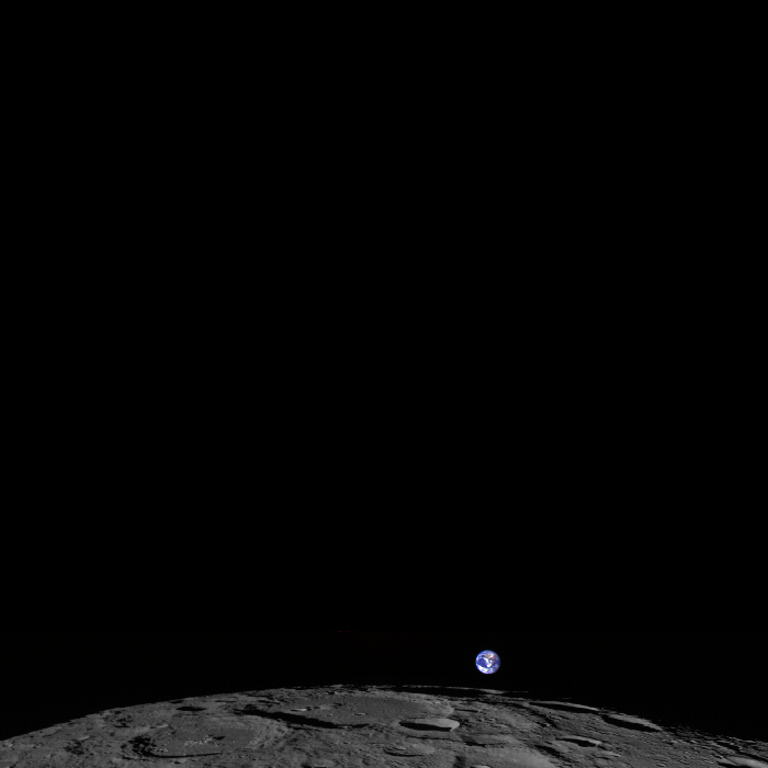
The Moon, tiny Earth and the vastness of space,as seen by the Lunar Reconnaissance Orbiter Wide Angle Camera (WAC). Credit: NASA/GSFC/Arizona State University.

That’s Earth. That’s us. Way off in the distance as a fairly small, blue and swirly white sphere. This is the newest so-called “Earthrise” image, and it was taken on February 1, 2014 by the Lunar Reconnaissance Orbiter.

“LRO experiences twelve earthrises every day, however LROC is almost always busy imaging the lunar surface so only rarely does an opportunity arise such that LROC can capture a view of the Earth,” wrote LROC Principal Investigator Mark Robinson on the instrument’s website. “On the first of February of this year LRO pitched forward while approaching the north pole allowing the LROC WAC to capture the Earth rising above Rozhdestvenskiy crater (180-km diameter).”

Robinson went on to explain that the Earth is a color composite from several frames and the colors are very close to what the average person would see if they were looking back at Earth themselves from lunar orbit. “Also, in this image the relative brightness between the Earth and the Moon is correct, note how much brighter the Earth is relative to the Moon,” Robinson said.

Gorgeous.

Below is a gif image that demonstrates how images are combined over several orbits to create a full image from the Wide Angle Camera.

A gif image showing the “venetian blind” banding demonstrates how a WAC image is built up frame-by-frame. The gaps between the frames are due to the real separation of the WAC filters on the CCD. Credit: NASA/GSFC/Arizona State University.

The frames were acquired at two second intervals, so the total time to collect the sequence was 5 minutes. The video is faster than reality by a factor of about 20.

Earth From Space: The Moon Over Mexico

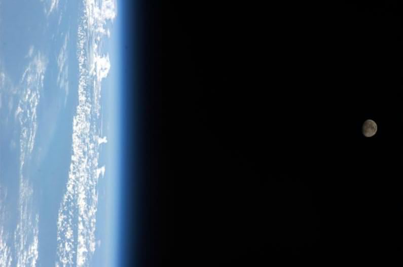
The Moon over Mexico, taken March 12, 2014 from the International Space Station by astronaut Rick Mastracchio. Credit: NASA/Rick Mastracchio.

Happy Cinco de Mayo! This beautiful image of Earth from Space was taken earlier this year, but today is a perfect day to share it. ISS astronaut Rick Mastracchio snapped this photo of the waxing gibbous Moon on March 12, 2014.

The 5th of May commemorates a victory for Mexico in the Battle of Puebla in 1862 during the Franco-Mexican War. It wasn’t an especially crucial battle, but it became a symbol of Mexican pride and a celebration of Mexican culture in the United States. Cinco de Mayo isn’t widely celebrated in Mexico, but it is celebrated by many Americans regardless of their heritage (like St. Patrick’s Day and Oktoberfest).

This photo reminds us of the fragility and beauty of our world that we all inhabit together.

Via Fragile Oasis

HD Livestream of Earth Now Available 24/7 from the Space Station

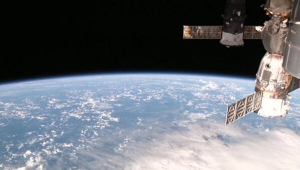
Screenshot from the HDEV cameras on the International Space Station. Via @ISS101


Live streaming video by Ustream

Now, live from space, it’s Earth all the time! A new experiment called the High Definition Earth Viewing (HDEV) was launched on April 18, 2014 in the “trunk” on the SpaceX Dragon spacecraft and has been set up outside the International Space Station. The set of four commercial HD video cameras and is now operational, after being installed on the External Payload Facility of the ESA Columbus module yesterday. The cameras and electronics are enclosed in a pressurized box to provide protection to the equipment from the harsh environment of space.

Above is the UStream video, or you can bookmark the UStream site here, or view this page from Johnson Space Center which also provides a visual tracker of where the ISS is located over Earth.

Please note that the screen will appear black when the ISS is in orbital night — which happens every 90 minutes and lasts about 40 minutes. There also has been some downtime off and on that I’ve noted while watching this morning. This may be due to some initial setup/operation issues, or some occurrences of loss of signal. UPDATE: NASA’s now provided additional info on what’s happening if you’re not seeing beautiful views of Earth at anytime during the live feed: Black Scenes = Night side of the Earth; Gray Scenes = Switching to the next camera, or the communications downlink from the ISS in not available at the moment.

Also, the live video feed from HDEV will occasionally be unavailable due to loss of Ku-band transmission from the International Space Station. If that happens, just check the site again later.

But, having live HD streaming views of Earth is pretty awesome – but it’s also nifty to note that this is part of a student project.

High school students helped design of some of the HDEV components through the High Schools United with NASA to Create Hardware (HUNCH) program. Student teams will also help operate the experiment.

This experiment is completely separate from the UrtheCast commercial cameras on the ISS.

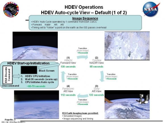
The HDEV does not record video on board the ISS, but all video is transmitted to the ground in real time. See the graphic below that explains how the cameras cycle automatically.

Part of the experiment is to test out the camera and equipment and assess the hardware’s ability to survive and function for long periods in space.

Enjoy!

HDEV11

Views of Earth From Space on Earth Day 2014

NOAA's GOES-East satellite captured this stunning view of the Americas on Earth Day, April 22, 2014 at 11:45 UTC/7:45 a.m. EDT. The data from GOES-East was made into an image by the NASA/NOAA GOES Project at NASA's Goddard Space Flight Center. Credit: NASA/NOAA.

It’s been said that one of the reasons Earth Day was started back in 1970 was because of the images of Earth from space taken during the Apollo missions to the Moon. So, what better way to celebrate than to see how Earth looks today from space?

NOAA’s GOES-East satellite captured this stunning view of the Americas on Earth Day, April 22, 2014 at 11:45 UTC/7:45 a.m. EDT.

Find out more about this image and what all is visible here.

More satellite images will likely be taken today, and we’ll add them as they become available.

Speedy Satellite Beams Pictures Of Massive Floods Only Weeks After Reaching Orbit

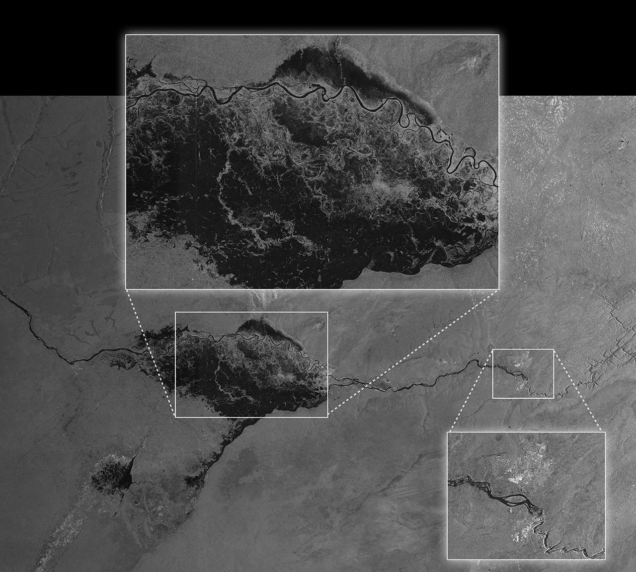
The Zambezi River in Namibia floods the Caprivi plain in this picture captured from Sentinel-1A. The satellite was not only noted for its high resolution of the flood, but its ability to send the image quickly -- it was downloaded only two hours after it was acquired. Credit: European Space Agency

After dodging space debris and living to tell the tale, Sentinel-1A is now being put through its paces for its primary mission: to beam back pictures of the Earth as quickly as possible, to provide officials with the information they need during natural disasters or weather events.

The picture above gives a taste of what the European satellite will do when it’s fully commissioned. The picture of flooding in Namibia was downloaded only two hours after acquisition and then made available generally less than an hour after that, the European Space Agency said. Not only that, believe it or not — the view was socked in by cloud when the image was taken.

“Sentinel-1A’s ability to ‘see’ through cloud and rain and in pitch darkness make it particularly useful for monitoring floods and for offering images for emergency response,” the European Space Agency stated. “In fact, this area of the Caprivi plain was shrouded in thick cloud when the satellite acquired the image on 13 April.”

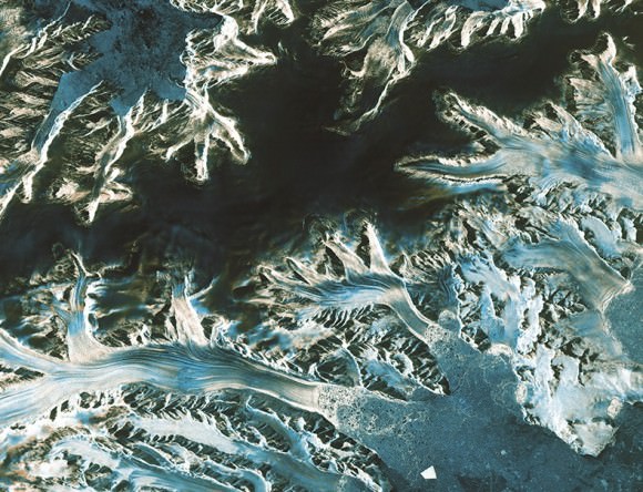
The satellite can also monitor long-term but serious weather events such as climate change, as the picture below of Pine Island Glacier shows.

The northern part of the Antarctic Peninsula as seen from Sentinel-1 on April 13, 2014. Credit: ESA

“As well as monitoring glaciers, Sentinel-1A is poised to generate timely maps of sea-ice conditions, particularly for the increasingly busy Arctic waters,” ESA stated. “Images from its advanced radar can be used to distinguish clearly between the thinner more navigable first-year ice and the hazardous, much thicker multiyear ice to help assure safe year-round navigation in polar waters.”

Read more about the Sentinel-1A mission in this past Universe Today story.

Source: European Space Agency

NASA’s Operation IceBridge In Search Of Ice Change In Arctic

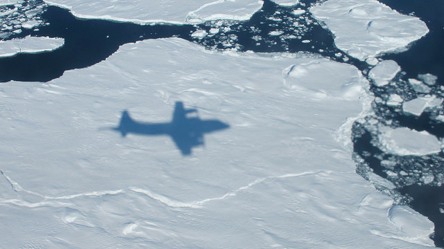
The NASA P-3B's shadow on sea ice off of southeast Greenland during an IceBridge survey on Apr. 9, 2013. Flying at a low altitude allows IceBridge researchers to gather detailed data. Credit: NASA / Jim Yungel

How much is the polar ice melting, and how are the sheets being affected by climate change? These are some of the questions that NASA’s Operation IceBridge seeks to answer. You can see a quick overview of the mission in the video above.

“IceBridge, a six-year NASA mission, is the largest airborne survey of Earth’s polar ice ever flown,” NASA stated in the YouTube description accompanying the video.

“It will yield an unprecedented three-dimensional view of Arctic and Antarctic ice sheets, ice shelves and sea ice. These flights will provide a yearly, multi-instrument look at the behavior of the rapidly changing features of the Greenland and Antarctic ice,” the agency added.

The aerial survey is intended to supplement information from NASA’s Ice Cloud and Land Elevation Satellite (ICESat), which has been orbiting Earth since 2003, and the forthcoming ICESat-2 that is expected to launch in early 2016.

The surveys started in 2009 and are expected to wrap up in 2016. This year’s field season runs from about March to May. For more information on IceBridge, check out this 2013 Universe Today article by Ken Kremer.

Watch Live: Next-Gen Environment Satellite Aims For Space

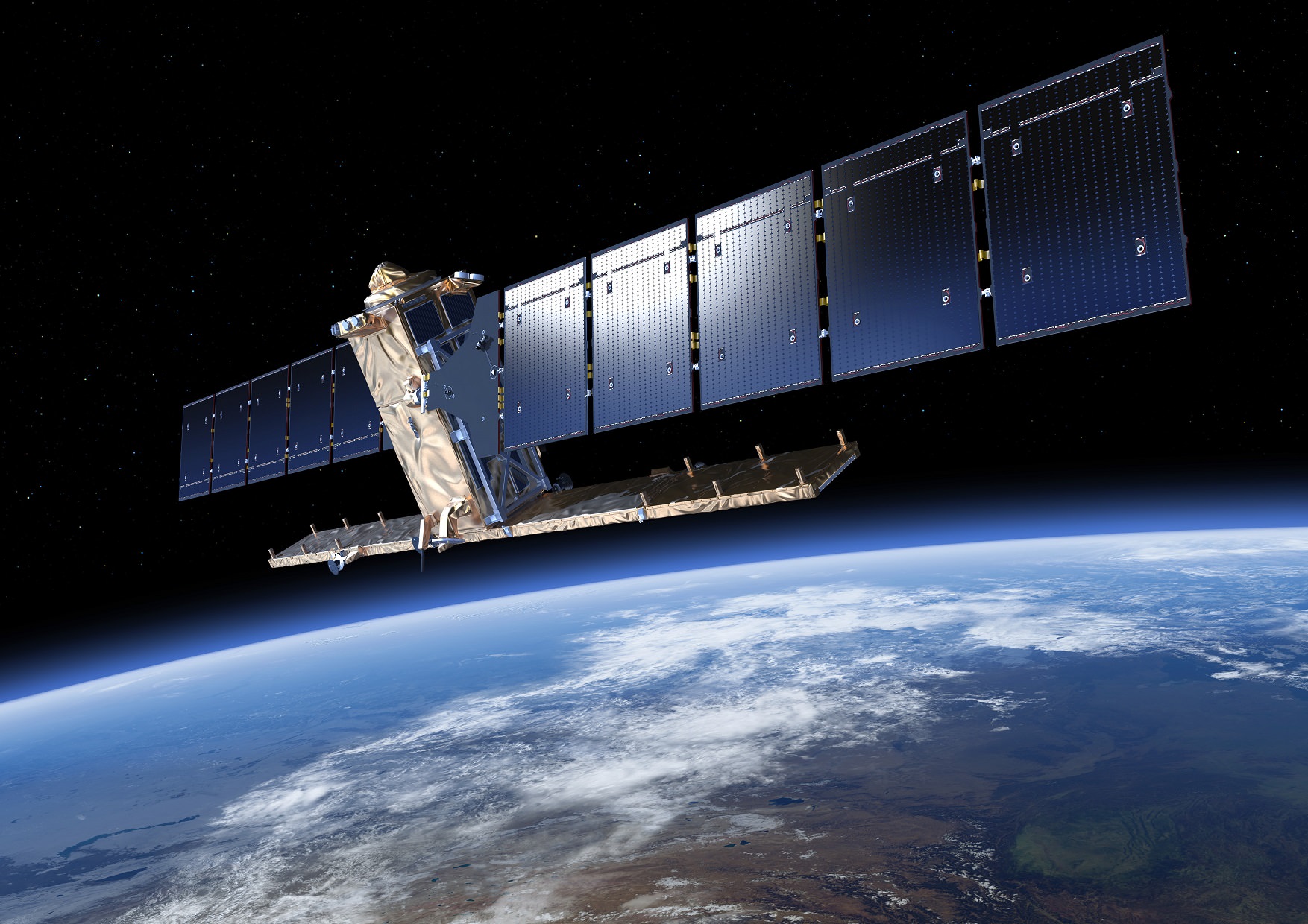
Artist's conception of Sentinel-1, an environment-monitoring satellite from the European Space Agency. Credit: ESA/ATG medialab

UPDATE, APRIL 4: The satellite safely made it into space! Watch the launch replay and successful satellite separation here.

Just in case you aren’t already in French Guiana, here’s your chance to watch a European environment radar satellite take a rocket ride. Tune into the webcast above to see Sentinel-1A’s launch. If the schedule holds, the launch will be at 5:02 p.m. EDT (9:02 p.m. UTC) on April 3, 2014. Watch live above!

ESA heralds Sentinel-1 as a “new era in Earth observation” because the satellite duo (yes, it will be eventually two satellites) will vastly improve their ability to send out information on natural disasters and quick-moving Earth observation events. Sentinel-1 will in fact be the first of a satellite series feeding into the same information system.

Once the second half of the duo launches in 2016, Sentinel-1 will have a wide swath of geographical coverage, could go to the same areas quickly, and would send data out quickly. Repeatable and rapid Earth observations will bring data quickly into the hands of the authorities who could make decisions about evacuations and other things. 

This information will be fed into Copernicus, a new system that will co-ordinate all of the Sentinel satellites for users to gain information.

“The Sentinels will provide a unique set of observations, starting with the all-weather, day and night radar images from Sentinel-1 to be used for land and ocean services,” ESA stated in an explanation about Copernicus.

“Sentinel-2 will deliver high-resolution optical images for land services and Sentinel-3 will provide data for services relevant to the ocean and land. Sentinel-4 and Sentinel-5 will provide data for atmospheric composition monitoring from geostationary and polar orbits, respectively.”

And here are a few of the other applications ESA foresees it would be useful for: sea-ice measurements, looking for oil spills, tracking ships, flagging land with “motion risks” and also doing mapping for the forestry industry.

As far as the webcast, there’s a schedule of speeches and events beforehand at the European Space Agency’s space operations center in Darmstadt, Germany. Be sure to tune in a bit earlier at 3:30 p.m. EST (7:30 p.m. UTC) to see the ceremonies.

Source: European Space Agency

Arctic Melting Is Lasting Longer And Affecting More Ice: Study

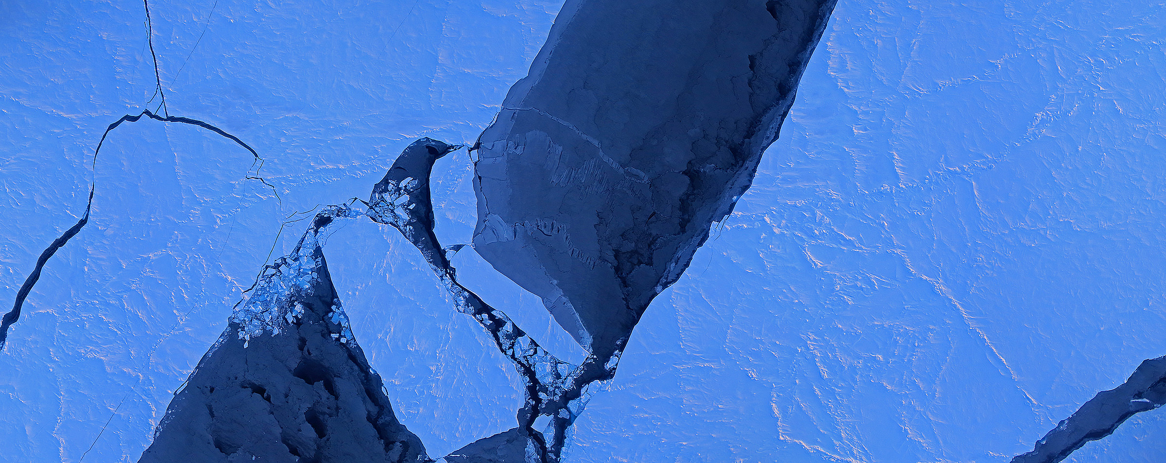
An image mosaic of ice breaking up in the Arctic Ocean's Canada Basin on March 28, 2014. Image taken by Operation IceBridge's Digital Mapping System. Credit: Digital Mapping System/NASA Ames

The Arctic melt season is averaging five days longer with each passing decade, a new study by NASA and the National Snow and Ice Data Center reveals. And with more ice-free days, the water (which is darker than the surrounding ice) is absorbing the sun’s heat and accelerating the process. This means the Arctic ice cap has shrank by as much as four feet.

The sobering news comes following a study of satellite data from 1979 to 2013. By the end of this century, scientists believe, there will be a fully melted Arctic Ocean during the entire summer. And the news also comes in the same week that the Intergovernmental Panel on Climate Change  (IPCC) released its own report on global warming.

“The Arctic is warming and this is causing the melt season to last longer,” stated Julienne Stroeve, a senior scientist at NSIDC, Boulder and lead author of a new study. “The lengthening of the melt season is allowing for more of the sun’s energy to get stored in the ocean and increase ice melt during the summer, overall weakening the sea ice cover.”

The research further revealed that solar radiation absorption depends on when the melt season begins; this is particularly true since the sun rises higher during the spring, summer and fall than in the winter. It’s still hard to predict when things will melt or freeze, however, since this depends on weather.

“There is a trend for later freeze-up, but we can’t tell whether a particular year is going to have an earlier or later freeze-up,” Stroeve said. “There remains a lot of variability from year to year as to the exact timing of when the ice will reform, making it difficult for industry to plan when to stop operations in the Arctic.”

Data was collected with NASA’s (long deceased) Nimbus-7 Scanning Multichannel Microwave Radiometer and instruments aboard Defense Meteorological Satellite Program spacecraft.

“When ice and snow begin to melt, the presence of water causes spikes in the microwave radiation that the snow grains emit, which these sensors can detect,” NASA stated. “Once the melt season is in full force, the microwave emissivity of the ice and snow stabilizes, and it doesn’t change again until the onset of the freezing season causes another set of spikes.”

The research has been accepted for publication in Geophysical Research Letters.

Source: NASA