Stunning Movie Shows What Earth Looks Like to an Incoming Spacecraft

A mosaic of images of the Earth and Moon taken by the incoming Juno spacecraft as it flew past Earth in October 2013. Credit: NASA/JPL

When NASA’s Juno spacecraft flew past Earth in October of this year, it focused some of its cameras on the Earth-Moon system. Immediately after the flyby, images taken by the Junocam were released, but today, NASA released an amazing video taken by the Advanced Stellar Compass (ASC) camera, a low-light camera that is primarily used as a star tracking a navigation tool. Over the course of three days, it captured the orbital ballet-like dance between the Earth and Moon.

“This is profound, and I think our movie does the same thing as “Pale Blue Dot” image from Voyager, except it’s a movie instead of an image,” said Scott Bolton, Juno principal investigator, speaking during a press briefing from the American Geophysical Union conference today in San Fransisco. “Like Carl Sagan said, everything we know is on this dot. To me this says, ‘we’re all in this together.’”

The Oct. 9 flyby was a gravity assist, accelerating Juno out of the inner solar system and toward Jupiter’s orbit. The probe is expected to arrive at Jupiter on July 4, 2016.

The movie begins at 2:00 UTC on Oct. 6, more than four days before Juno’s closest approach, when the spacecraft was approximately 2.1 million miles (3.3 million kilometers) from Earth. Earth’s moon is seen transiting in front of our planet, and then moves out of frame toward the right as Juno enters the space inside the orbit of our natural satellite. As Juno gets closer to Earth, hints of clouds and continents are visible before the planet’s brightness overwhelms the cameras, which were not designed to image so bright an object. The sequence ends as Earth passes out of view, which corresponds to approximately 17:35 UTC Oct. 9 when Juno was at an altitude of about 47,000 miles (76,000 kilometers) above Earth’s surface.

“From a half-million kilometers out, the Moon is dark as charcoal and but Earth way brighter, as a shiny blue dot,” said John Joergensen, who lead the team that designed the star tracking cameras. “It’s amazing to think that all of humanity being scanned in this movie, and to see how small the Moon is relative to Earth.”

The cameras that took the images for the movie are located near the pointed tip of one of the spacecraft’s three solar-array arms. They are part of Juno’s Magnetic Field Investigation (MAG) and are normally used to determine the orientation of the magnetic sensors. These cameras look away from the sunlit side of the solar array, so as the spacecraft approached, the system’s four cameras pointed toward Earth. Earth and the moon came into view when Juno was about 600,000 miles (966,000 kilometers) away — about three times the Earth-moon separation.

During the flyby, timing was everything. Juno was traveling about twice as fast as a typical satellite, and the spacecraft itself was spinning at 2 rpm. To assemble a movie that wouldn’t make viewers dizzy, the star tracker had to capture a frame each time the camera was facing Earth at exactly the right instant. The frames were sent to Earth, where they were processed into video format.

As Juno is a spinning spacecraft, the images were aligned to remove their apparent rotation. The original ASC images are monochrome; faint coloration has been added by converting the measured grayscale values into false colors matching a true color image of Earth.

JPL press release

How People from Earth said “Hi” to a Passing Spacecraft

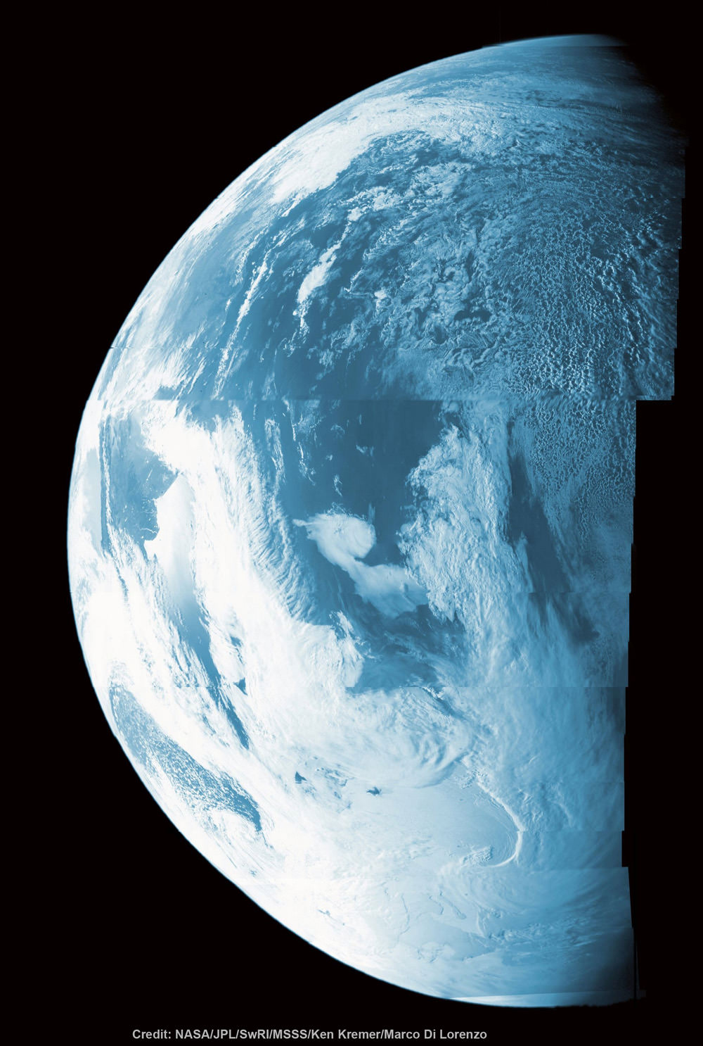
This colorized composite shows more than half of Earth’s disk over the coast of Argentina and the South Atlantic Ocean as the Juno probe slingshotted by on Oct. 9, 2013 for a gravity assisted acceleration to Jupiter. The mosaic was assembled from raw images taken by the Junocam imager. Credit: NASA/JPL/SwRI/MSSS/Ken Kremer/Marco Di Lorenzo

Um, something in my eye. This wonderful video details a what took place when the Jupiter-bound Juno spacecraft swung past Earth on Oct. 9, 2013 for a gravity assist, and amateur radio operators around the world sent a Morse Code saying “HI” to the spacecraft.

“We wanted to know, if this were an interplanetary spacecraft, could they we tell there was intelligent life on Earth?” said Bill Kurth, co-investigator for the Juno Waves Investigation from the University of Iowa.

Watch the video to find out if it worked.

“We obviously haven’t heard anything like this from any other planet,” said Scott Bolton, Juno principal investigator, speaking during a press briefing from the American Geophysical Union conference today in San Fransisco.

And the Coldest Place on Earth Is …

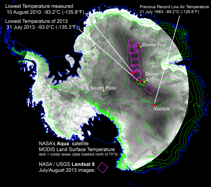
With remote-sensing satellites, scientists have found the coldest places on Earth, just off a ridge in the East Antarctic Plateau. The coldest of the cold temperatures dropped to minus 135.8 F (minus 93.2 C) -- several degrees colder than the previous record. Image Credit: Ted Scambos, National Snow and Ice Data Center.

What is the coldest place on Earth? Scientists say it’s a place so cold that ordinary mercury or alcohol thermometers won’t work there. If you were there, every breath would be painful, your clothing would crackle every time you moved, and if you threw hot water into the air, it would fall to the ground as tiny shards of ice. At this place, the new record of minus 136 F (minus 93.2 C) was set on Aug. 10, 2010. Researchers analyzed data from several satellite instruments and found the coldest place on Earth in the past 32 years is … a high ridge in Antarctica between Dome Argus and Dome Fuji, two summits on the ice sheet known as the East Antarctic Plateau. Temperatures in several hollows were found to dip to the new record.

“We had a suspicion this Antarctic ridge was likely to be extremely cold,” said Ted Scambos, from the National Snow and Ice Data Center in Boulder, Colorado. “With the launch of Landsat 8, we finally had a sensor capable of really investigating this area in more detail.”

This beats out the previous low of minus 128.6 F (minus 89.2 C), set in 1983 at the Russian Vostok Research Station in East Antarctica. The coldest permanently inhabited place on Earth is northeastern Siberia, where temperatures in the towns of Verkhoyansk and Oimekon dropped to a bone-chilling 90 degrees below zero Fahrenheit (minus 67.8 C) in 1892 and 1933, respectively.

Scambos and his team made the discovery while analyzing the most detailed global surface temperature maps to date, developed with data from remote sensing satellites. The new findings were reported at the American Geophysical Union meeting in San Francisco.

The pursuit to find the coldest place on Earth started when the researchers were studying large snow dunes, sculpted and polished by the wind, on the East Antarctic Plateau. When the scientists looked closer, they noticed cracks in the snow surface between the dunes, possibly created when wintertime temperatures got so low the top snow layer shrunk. This led scientists to wonder what the temperature range was, and prompted them to hunt for the coldest places using data from two types of satellite sensors.

They used data from the Moderate Resolution Imaging Spectroradiometer (MODIS) instruments on NASA’s Terra and Aqua satellites and the Advanced Very High Resolution Radiometer (AVHRR) on several National Oceanic and Atmospheric Administration satellites. These sensitive instruments can pick up thermal radiation emitted from Earth’s surface, even in areas lacking much heat.

Using these sensors to scan the East Antarctic Plateau, Scambos detected extremely cold temperatures on a 620-mile stretch of the ridge at high elevations between Argus and Fuji, and even colder temperatures lower elevations in pockets off the ridge. Then, with the higher resolution of the Thermal Infrared Sensor (TIRS) aboard Landsat 8, the research team pinpointed the record-setting pockets.

The team compared the sites to topographic maps to explore how it gets so cold. Already cold temperatures fall rapidly when the sky clears. If clear skies persist for a few days, the ground chills as it radiates its remaining heat into space. This creates a layer of super-chilled air above the surface of the snow and ice. This layer of air is denser than the relatively warmer air above it, which causes it to slide down the shallow slope of domes on the Antarctic plateau. As it flows into the pockets, it can be trapped, and the cooling continues.

“By causing the air to be stationary for extended periods, while continuing to radiate more heat away into space, you get the absolute lowest temperatures we’re able to find,” Scambos said. “We suspected that we would be looking for one magical site that got extremely cold, but what we found was a large strip of Antarctica at high altitude that regularly reached these record low temperatures.”

Source: NASA

SpaceX Scores Spectacular Success Scorching Florida Sky with Next Gen Rocket

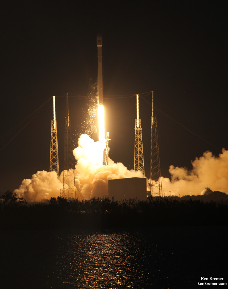
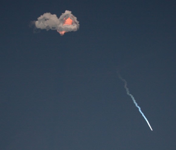
SpaceX is suing the Air Force for the right to compete for US national security satellites launches using Falcon 9 rockets such as this one which successfully launched the SES-8 communications satellite on Dec. 3, 2013 from Pad 40 at Cape Canaveral, FL. Credit: Ken Kremer/kenkremer.com

CAPE CANAVERAL AIR FORCE STATION, FL – SpaceX scored a spectacular launch success this evening (Dec. 3 ) when the maiden flight of their upgraded Falcon 9 rocket from Florida scorched the sky of the Florida Space Coast and successfully delivered a commercial space satellite to geostationary orbit for the first time ever – thereby revolutionizing the commercial space industry from this day forward.

The third time was finally the charm as the Falcon 9 blasted off precisely on time at 5:41 p.m. EST from Launch Complex 40 at Cape Canaveral following a pair of launch scrubs last week on Nov. 25 and Thanksgiving Day Nov. 28 caused by technical problems with the first stage engine.

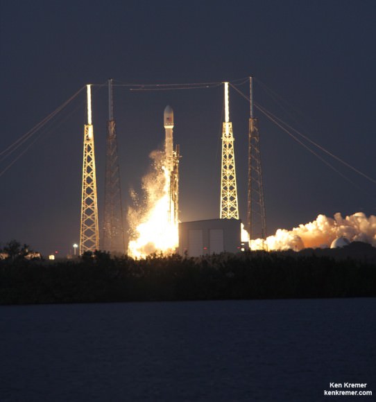
The booster thundered off the pad and pierced the completely cloud free evening sky soon after sunset as the blistering roar rumbled deafeningly all across the space coast viewing area.

The rocket exhaust plume was easily visible for several minutes after liftoff of the historic mission.

Next Generation SpaceX Falcon 9 rocket blasts off with SES-8 communications satellite on Dec. 3, 2013 from Pad 40 at Cape Canaveral, FL. Credit: Ken Kremer/kenkremer.com

The 3,138 kg (6,918 lbs) SES-8 satellite was built by Orbital Sciences for SES and is a hybrid Ku- and Ka-band spacecraft that will provide TV and communications coverage for the South Asia and Asia Pacific regions.

This new version of the Falcon 9 rocket has nearly 50% more thrust compared to the original Falcon 9.

The stakes could not have been higher for the future of SpaceX.

The firms future launch manifest of more than 50 flights for NASA and a variety of commercial entities worth billions of dollars were riding on the success of tonight’s liftoff from Cape Canaveral Air Force Station, Florida.

With 54 satellites in orbit SES is one of the largest commercial telecommunications satellite operators in the world.

The next generation Falcon 9 rocket injected the SES-8 telecommunications to its targeted geostationary transfer orbit flying 295 x 80,000 km above Earth.

A restart of the second stage engine was absolutely essential to the success of the mission since a failure to ignite would have doomed the SES-8 satellite from reaching is desired orbit since it’s a requirement for all geostationary transfer missions.

The picture-perfect flight met 100% of the mission objectives, SpaceX said in a post-launch statement.

“The successful insertion of the SES-8 satellite confirms the upgraded Falcon 9 launch vehicle delivers to the industry’s highest performance standards,” said Elon Musk, CEO and Chief Designer of SpaceX.

“As always, SpaceX remains committed to delivering the safest, most reliable launch vehicles on the market today. We appreciate SES’s early confidence in SpaceX and look forward to launching additional SES satellites in the years to come.”

Today’s launch marked SpaceX’s first commercial launch from Florida as well as the first commercial flight from Cape Canaveral Air Force Station in over five years.

Satellite operators have booked their commercial launches with other rocket companies overseas due to the high cost of other American expendable rockets.

SpaceX’s entire corporate aim has been to significantly cut the high cost of access to space.

“This is really rocking the industry. Everybody has to look out,” said Martin Halliwell, SES chief technical officer, at the prelaunch meeting with reporters including Universe Today.

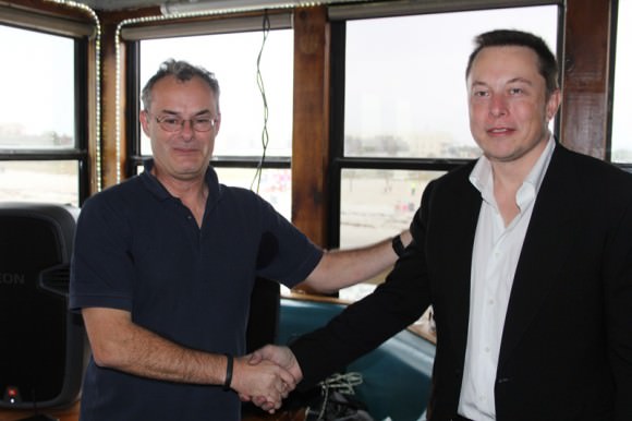
SpaceX founder and CEO Elon Musk (right) and Martin Halliwell (left), SES chief technical officer briefs reporters including Universe Today on Sunday (Nov. 24) in Cocoa Beach, FL prior to planned SpaceX Falcon 9 rocket blastoff with SES-8 communications satellite set for Nov. 25, 2013 from Cape Canaveral, FL. Credit: Ken Kremer/kenkremer.com
SpaceX founder and CEO Elon Musk (right) and Martin Halliwell (left), SES chief technical officer briefs reporters including Universe Today on Sunday (Nov. 24) in Cocoa Beach, FL prior to planned SpaceX Falcon 9 rocket blastoff with SES-8 communications satellite from Cape Canaveral, FL. Credit: Ken Kremer/kenkremer.com

With today’s SpaceX is sure to sign even more contracts bringing additional commercial telecommunications satellite space launches back to American soil.

Approximately 185 seconds into flight, the Falcon 9’s second stage equipped with a single Merlin 1-D engine ignited.

It burned for five minutes and 20 seconds to inject SES-8 satellite into its initial parking orbit.

Eighteen minutes later the second stage engine relit for a second time and fired for just over one minute to deliver SES-8 satellite to its final geostationary transfer orbit.

SpaceX Falcon 9 rocket with SES-8 communications satellite soars to orbit.  Credit: Ken Kremer/kenkremer.com
SpaceX Falcon 9 rocket with SES-8 communications satellite soars to orbit. Credit: Ken Kremer/kenkremer.com

This extra powerful new version of the Falcon 9 dubbed v1.1 is powered by a cluster of nine of SpaceX’s new Merlin 1D engines that are about 50% more powerful compared to the standard Merlin 1C engines. The nine Merlin 1D engines 1.3 million pounds of thrust at sea level rises to 1.5 million pounds as the rocket climbs to orbit.

The Merlin 1 D engines are arrayed in an octaweb layout for improved efficiency.

Therefore the upgraded Falcon 9 can boost a much heavier cargo load to the ISS, low Earth orbit, geostationary orbit and beyond.

The next generation Falcon 9 is a monster. It measures 224 feet tall and is 12 feet in diameter. That compares to a 130 foot tall rocket for the original Falcon 9.

Stay tuned here for continuing SpaceX & MAVEN news and Ken’s SpaceX launch reports from on site at Cape Canaveral & the Kennedy Space Center press site.

Ken Kremer

SES- 8 Falcon 9

…………….

Learn more about SpaceX, MAVEN, MOM, Mars rovers, Orion and more at Ken’s upcoming presentations

Dec 3/4: “SpaceX launch, MAVEN Mars Launch and Curiosity Explores Mars, Orion and NASA’s Future”, Kennedy Space Center Quality Inn, Titusville, FL, 8 PM

Dec 11: “Curiosity, MAVEN and the Search for Life on Mars”, “LADEE & Antares ISS Launches from Virginia”, Rittenhouse Astronomical Society, Franklin Institute, Phila, PA, 8 PM

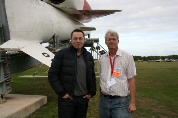
SpaceX CEO Elon Musk and Ken Kremer of Universe Today discuss Falcon 9/SES-8 launch by SpaceX Mission Control at Cape Canaveral Air Force Station. Florida.  Credit: Ken Kremer/kenkremer.com
SpaceX CEO Elon Musk and Ken Kremer of Universe Today discuss Falcon 9/SES-8 launch by SpaceX Mission Control at Cape Canaveral Air Force Station. Florida. Credit: Ken Kremer/kenkremer.com

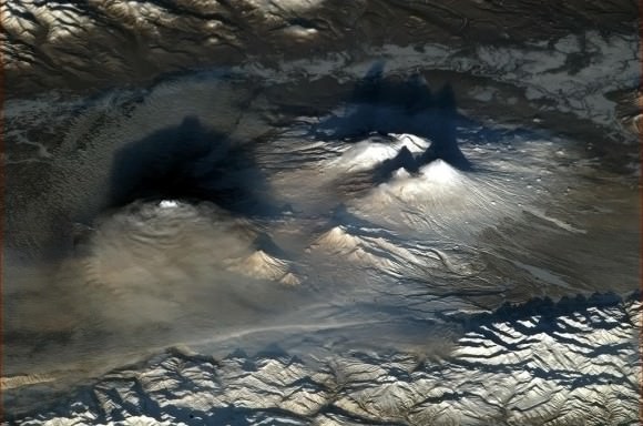
Awesome ‘Sideways’ View from Space of the Erupting Kliuchevskoi Volcano

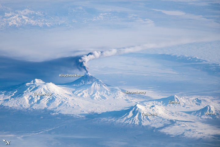
Image taken by astronauts on the International Space Station showing an oblique view of an eruption plume emanating from the Kliuchevskoi volcano on Russia’s Kamchatka Peninsula. Credit: NASA.

We’ve seen some great views from space of erupting volcanoes, like Pavlov, Shiveluch, and Nabro. While most of the views from space look straight down in a in a nadir view, this photo was taken from the International Space Station with an oblique or sideways viewing angle. This provides a three-dimensional-type view, similar to what might be seen from an airplane instead of a flattened view that looks straight down. This image was taken by an astronaut when the ISS was located over a ground position more than 1,500 kilometers (900 miles) to the southwest of the Kamchatka Peninsula in the far eastern part of Russia. The Kliuchevskoi volcano is just one of 160 volcanoes in this region, with 29 of the 160 being active.

NASA says the plume—likely a combination of steam, volcanic gases, and ash—stretched to the east-southeast due to prevailing winds. The dark region to the north-northwest is likely a product of shadows and of ash settling out. Several other volcanoes are visible in the image, including Ushkovsky, Tolbachik, Zimina, and Udina. To the south-southwest of Kliuchevskoi lies Bezymianny Volcano, which appears to be emitting a small steam plume (at image center).

These volcanic peaks are an eye-catching landmark from orbit. Here’s an image of the same region taken by astronaut Chris Hadfield earlier this year:

Volcanoes of Kamchatka, Russia at dawn, as seen from the International Space Station. Credit: NASA/CSA/Chris  Hadfield
Volcanoes of Kamchatka, Russia at dawn, as seen from the International Space Station. Credit: NASA/CSA/Chris Hadfield

Source: NASA Earth Observatory

India’s MOM Mars Probe Images Earth’s Children Prior to Nail Biting Red Planet Insertion

First ever image of Earth Taken by Mars Color Camera aboard India’s Mars Orbiter Mission (MOM) spacecraft while orbiting Earth and before the Trans Mars Insertion firing on Dec. 1, 2013. Image is focused on the Indian subcontinent. Credit: ISRO

CAPE CANAVERAL, FL – MOM is looking at you, kid!

And if the spectacular new image of billions of Earth’s children captured by India’s Mars Orbiter Mission (MOM) is any indication (see above), then we can expect absolutely gorgeous scenes of the Red Planet once the groundbreaking probe arrives there in September 2014.

But despite all that’s been accomplished so far, the space drama is still in its infant stages – because MOM still needs to ignite her thrusters this weekend in order to achieve escape velocity, wave good bye to Earth forever and eventually say hello to Mars!

The picture – snapped from Earth orbit – is focused on the Indian subcontinent, the probes origin.

MOM has captured the imagination of space enthusiasts worldwide.

And she’s the pride of all India – as the country’s first ever interplanetary space mission.

During testing of the MOM probes payloads – while it’s still flying in a highly elliptical orbit around our Home Planet – engineers from India’s space agency turned the crafts camera homewards to capture the “First ever image of Earth Taken by Mars Color Camera,” according to the Indian Space Research Organization (ISRO).

The beautiful image was taken on Nov. 20 at around 1350 hrs (IST) from a height of almost 70,000 km above earth and has a spatial resolution of 3.5 km, said ISRO.

The image also gives a rather good approximation of what MOM’s color camera will actually see from apoapsis after reaching the Red Planet since the probe will enter a similarly highly elliptical orbit around Mars – ranging in altitude from 366 kilometers (km) x 80,000 kilometers (km).

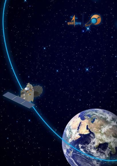
MOM has just passed by its penultimate perigee.  With this, the final orbit of MOM around Earth begins! Credit: ISRO
MOM has just passed by its penultimate perigee. With this, the final orbit of MOM around Earth begins! Credit: ISRO

Following a 10 month interplanetary cruise, MOM is due to arrive in the vicinity of Mars on September 24, 2014 to study the Red Planets’ atmosphere.

At that time, the 440 Newton liquid fueled main engine must fire precisely as planned during the absolutely essential Mars orbital insertion burn to place the probe into orbit about Mars.

But before MOM can accomplish anything at Mars, she must first successfully fire her main engine – to complete the crucial departure from Earth and Trans Mars Insertion (TMI) scheduled for this Saturday!

MOM’s picture perfect Nov. 5 liftoff atop India’s highly reliable four stage Polar Satellite Launch Vehicle (PSLV) C25 from the ISRO’s Satish Dhawan Space Centre SHAR, Sriharikota, precisely injected the spacecraft into an initial elliptical Earth parking orbit of 247 x 23556 kilometers with an inclination of 19.2 degrees.

Since then the engine has fired 6 times to gradually raise the spacecrafts apogee.

The most recent orbit raising maneuver occurred at 01:27 hrs (IST) on Nov 16, 2013 with a burn time of 243.5 seconds increased the apogee from 118,642 km to 192,874 km.

The nail-biting final main engine burn of 1351 seconds is set for this weekend on Dec. 1. It will place MOM on a precise interplanetary trajectory to the Red Planet.

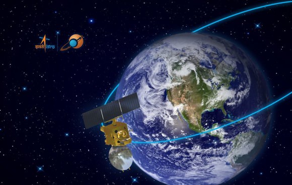
Graphic of MOM approaching its penultimate perigee pass on Nov 26. Credit: ISRO

If all continues to goes well, India will join an elite club of only four who have launched probes that successfully investigated the Red Planet from orbit or the surface – following the Soviet Union, the United States and the European Space Agency (ESA).

The low cost $69 Million MOM mission is the first of two new Mars orbiter science probes from Earth that flawlessly blasted off for the Red Planet this November.

Half a world away, NASA’s $671 Million MAVEN orbiter launched as scheduled on Nov. 18 – from Cape Canaveral, Florida.

Both MAVEN and MOM’s goal is to study the Martian atmosphere, unlock the mysteries of its current atmosphere and determine how, why and when the atmosphere and liquid water was lost – and how this transformed Mars climate into its cold, desiccated state of today.

The MAVEN and MOM science teams will “work together” to unlock the secrets of Mars atmosphere and climate history, MAVEN’s top scientist Prof. Bruce Jakosky told Universe Today.

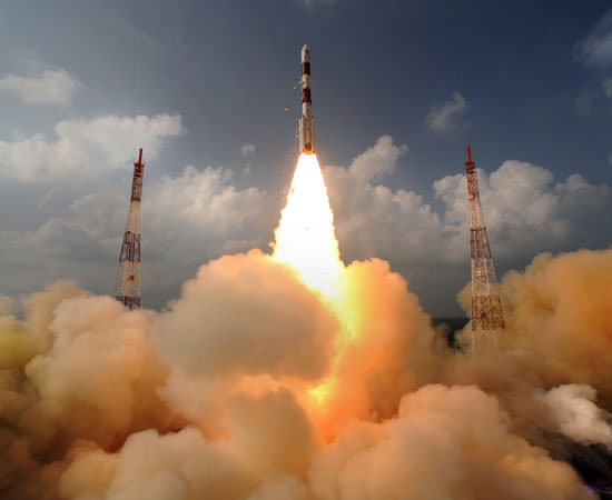
Clouds on the ground !  The sky seems inverted for a moment ! Blastoff of India’s Mars Orbiter Mission (MOM) on Nov. 5, 2013 from the Indian Space Research Organization’s (ISRO) Satish Dhawan Space Centre SHAR, Sriharikota. Credit: ISRO
Clouds on the ground ! The sky seems inverted for a moment ! Blastoff of India’s Mars Orbiter Mission (MOM) on Nov. 5, 2013 from the Indian Space Research Organization’s (ISRO) Satish Dhawan Space Centre SHAR, Sriharikota. Credit: ISRO

Stay tuned here for continuing MOM and MAVEN news and Ken’s MAVEN and SpaceX Falcon 9 launch reports from on site at the Kennedy Space Center press center and Cape Canaveral Air Force Station, Florida.

Ken Kremer

…………….

Learn more about MOM, MAVEN, Mars rovers, SpaceX, Orion and more at Ken’s upcoming presentations

Nov 28: “SpaceX launch, MAVEN & MOM Mars Launches and Curiosity Explores Mars, Orion and NASA’s Future”, Kennedy Space Center Quality Inn, Titusville, FL, 8 PM

Dec 11: “Curiosity, MAVEN, MOM and the Search for Life on Mars”, “LADEE & Antares ISS Launches from Virginia”, Rittenhouse Astronomical Society, Franklin Institute, Phila, PA, 8 PM

‘Will We Soon Find Ourselves Back In The Stone Age?’ Why Swarm Is Watching Our Magnetic Field

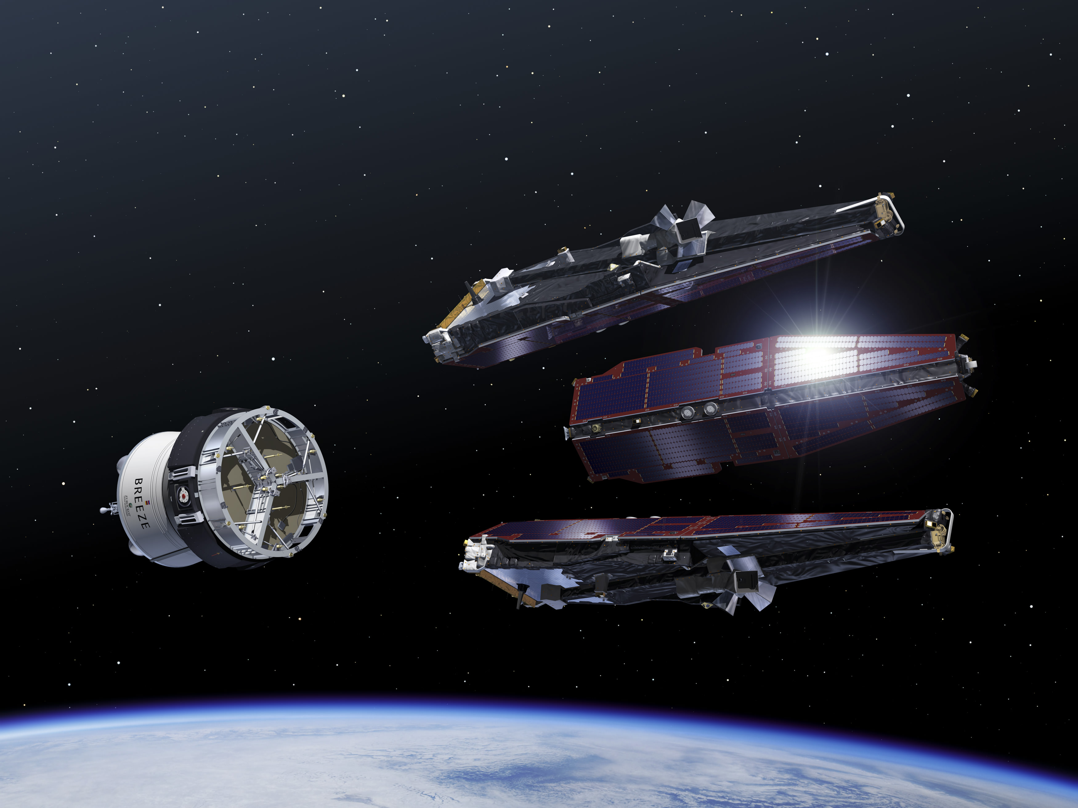
Artist's conception of the Swarm satellites during launch. Credit: ESA–P. Carril, 2013

A satellite triplet was born last week. The European Space Agency’s Swarm constellation flew into space on Friday (Nov. 22) on a quest to understand more about the Earth’s magnetic field.

Around the same time, ESA put out a few videos explaining why the magnetic field is important. This one explains that the magnetic field has weakened over the past few years, while the north pole has shifted direction. “In fact, a whole pole reversal is possible,” the narrator says. “It happened last 780,000 years ago at the very beginning of human history. But cavemen didn’t have mobile phone networks, GPS networks or power supplies.”

If a reversal did happen, it could affect those systems, the video adds, asking “Will we soon find ourselves back in the stone age?”

In the short term, however, the focus is on Swarm’s science. The satellites successfully unfurled their booms on Saturday (Nov. 23) and are now starting three months of commissioning before their planned four-year mission.

Once they get going, the satellites will make observations from two altitudes — a pair at about 285 miles (460 kilometers) in altitude and the final of the trio at a higher altitude of 330 miles (530 kilometers). They will monitor any changes in the Earth’s magnetic field, looking at spots ranging from the core of our planet to areas of the upper atmosphere.

Check out this ESA web page for more information about the mission.

UrtheCast: Cameras for Live Video Views of Planet Earth To Launch Nov. 25

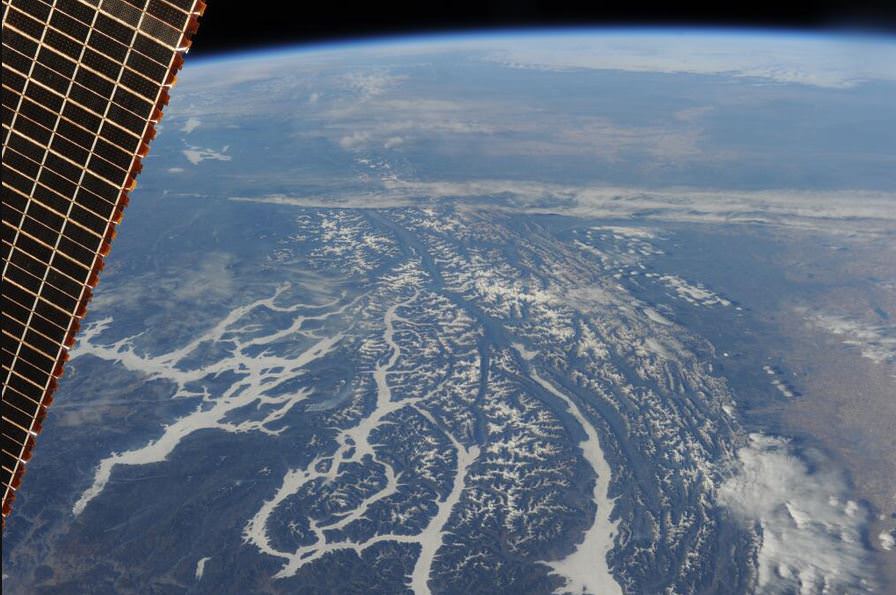
A view of rivers in Montana, USA, from the ISS. Credit: ESA/Luca Parmitano.

A Canadian camera system aiming to provide near-realtime video views of Earth is readying for a launch from Kazakhstan.

If all goes well, the UrtheCast dual camera system will blast off in a Progress supply ship on Nov. 25, 2013.

This will be the world’s first ever high definition, live-streaming video platform of planet Earth from the International Space Station.

“Imagine you have a nearly live Google Earth, but it isn’t four year old data – you have data that is being refreshed all the time, with videos coming down over interesting areas where interesting events are going on, showing you what is changing, what is going on,” said George Tyc, the Chief Technology Officer at UrtheCast, in an interview with Universe Today earlier this year. “What we really hope to pull off is to change the paradigm, get the everyday person interacting and seeing the data coming down from space to see the Earth and how it is evolving over time in a way that isn’t available right now.”

Last week at the Canadian Space Society Summit, UrtheCast co-founder Wade Larson explained the camera setup will take place in phases, with Phase 1 of the project having two cameras facing the ground, with one having a fixed gaze and the other one featuring maneuverability to points of interest. These should be installed on the station sometime in December 2013, Larson said, with data coming in the first quarter of 2014.

The company’s aim is to make Earth video data more accessible to individuals and schoolchildren, who would log in on UrtheCast’s website, as well as the traditional customers of government and private companies. Additionally, a recent partnership agreement with the UN will see them offer real-time information on dynamic situations such as floods and mass movements of people during humanitarian disasters. They will also be integrating the data with live social media feeds as well as opening up their API for app developers.

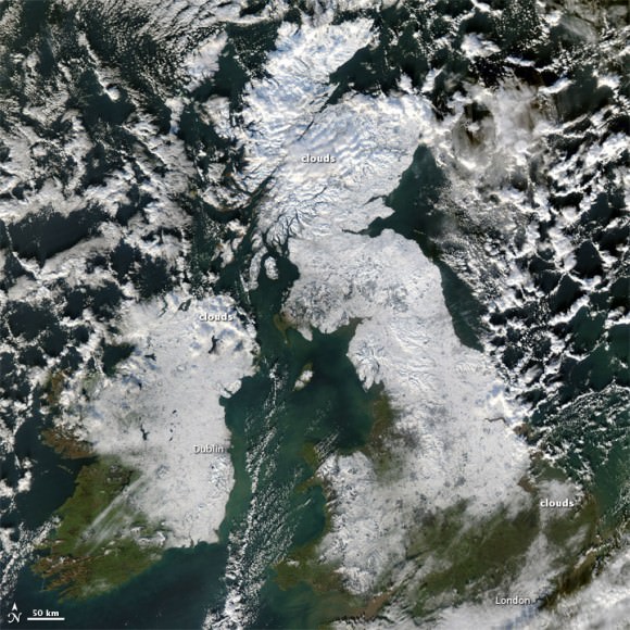
The UK covered in snow, as seen on Dec. 8, 2010. Credit: NASA's Aqua satellite.
The UK covered in snow, as seen on Dec. 8, 2010. Credit: NASA’s Aqua satellite.

Current sponsors on the project from UrtheCast (pronunced “Earthcast”) include Roscosmos, MacDonald, Dettwiler and Associates, the Discovery Channel, Energia, Unosat and RAL Space, Larson added.

The UrtheCast team is working in an exclusive relationship with the Russian Aerospace giant RSC Energia (NASA is not involved at all), and cosmonauts on board the ISS will install the cameras. The video data of the Earth will be down-linked to ground stations around the planet and then displayed in near real time on the UrtheCast web platform.

“We had to meet quite a strict set of requirements that the cameras are safe for cosmonauts and astronauts,” Tyc said, “as there can’t be any toxic substances because they will be inside the ISS before they are installed.”

Tyc added that it will take two spacewalks to do the full installation. The cameras are expected to last at least five years, and Tyc expects them to be up there even longer. “We’re looking at putting additional cameras up there for a second generation, and we expect to be up there for the life of the station, really,” he said.

Tyc said he thinks the social media aspect of UrtheCast will be a big part of the entire experience.

“For example, in a natural disaster or big event we’ll also incorporate videos from the ground of things going on, to experience an event in a far different way than you can now,” he said. “And it’s not being filtered through a media agency — it is what it is – and people can draw their own conclusions and add their own voice.”

Tyc said that if the concept takes off, they think this will be a shift in how people can interact with others around the world. “It could be a feeling of the Overview effect – people who go to space are have a completely changed perspective – we’re trying to bring a little bit of that to the ground,” he said.

The team said the name UrtheCast is a bit of a double entendre, as it is pronounced like “EarthCast” but also looks like “You Are the Cast” since it will be live views of planet Earth.

Find out more at the UrtheCast website.


Nancy Atkinson also contributed to this report.

‘Force Field’ Could Protect New Weather Satellite, Future Human Missions

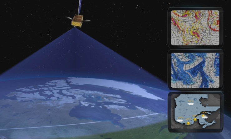
Typical meteorological applications for the Polar Communications and Weather (PCW) mission. Credit: CSA.

OTTAWA, CANADA — A new Canadian satellite — should it launch — might carry a sort of magnetized force field on board to keep charged particles away from vital electronics.

The Polar Communications and Weather Satellite (PCW), depending on its orbit, could skim through the radiation-filled Van Allen belts on its mission to deliver reliable weather reports and communications to northern communities.

Its polar orbit will likely take it through clouds of charged particles high above Earth. If the particles hit crucial components on the spacecraft, it can short out electronics and cause brownouts or complete failure. This has happened several times before, such as to the Japanese ADEOS-II satellite after a large solar storm in 2003.

A concept being explored by Winnipeg’s Magellan Aerospace, one of the companies working on the early phase studies, would make a plasma field around PCW, a sort of “mini magnetosphere” that would use large dipole magnets to deflect charged particles.

It may also be useful for human missions in the future, said Paul Harrison, a satellite control systems engineer at Magellan Aerospace, although he acknowledged the technology is still in an early stage and that they would like a demonstrator mission to fly first.

“It’s still very much in the development phase. We want to develop for satellites before we start sticking people in them,” Harrison said in a presentation at the Canadian Space Society annual summit in Ottawa, Canada, today (Nov. 14.)

He also said it is not clear if the technology would be useful for cosmic rays that originate from outside the solar system, as well as charged particles that flow from the sun and are present near the Earth.

pcw_banner_e

PCW has not been assigned a launch date yet and is still in the early stages of development. Other issues being explored include how to keep track of it without constant access to near-equator-orbiting GPS satellites, and how to maintain temperature control as it plunges from day to night to day again during its journey.

Its orbit could be a 12-hour Molniya orbit or perhaps a 16-hour or 24-hour highly eccentric orbit, depending on what designers feel is best.

CORRECTION: This article has been changed to say “near-equator-orbiting” GPS satellites.

‘Super-Typhoon’ Haiyan Looms Large In Space Station Video

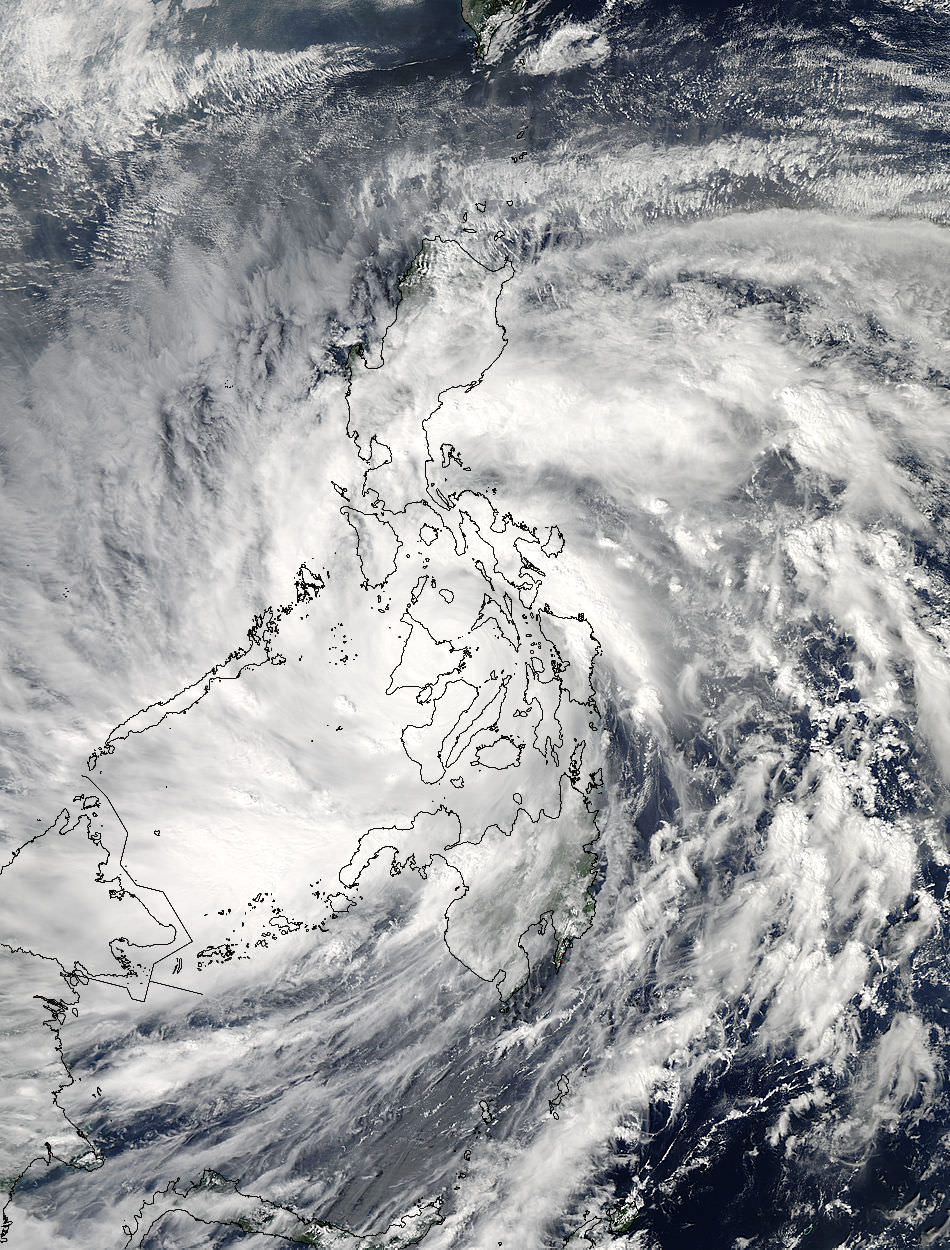
As Super-Typhoon Haiyan moved over the central Philippines on Nov. 8 at 05:10 UTC/12:10 a.m. EDT, the MODIS instrument aboard NASA's Aqua satellite captured this visible image. Credit: NASA Goddard MODIS Rapid Response Team

The scary extent of Typhoon Haiyan, which devastated the Philippines, is apparent in this shot from the International Space Station. From the orbital perch about 250 miles (400 kilometers) above Earth, the estimated Category 5 typhoon fills most of the view. On the ground, wind speeds reached as high as 235 miles an hour (378 kph), reports say.

NASA and others are saying that the storm is likely the biggest one on record to make landfall. As of this morning, the official death count from a Philippines disaster agency is 2,275, but it will be a while before numbers become more clear. Initial estimates of the death toll ranged as high as 10,000, but in media reports from this morning, Philippines president Benigno Aquino III estimated deaths would be between 2,000 and 2,500.

Meanwhile, the United Nations is asking for $301 million to assist the estimated 11 million people who were affected by the storm, including more than 670,000 who have fled from their homes to escape the powerful surge. Assistance agencies are struggling to get people the help they need.

“There are still many places that are not accessible yet,” Elizabeth Byrs, a spokeswoman for the World Food Program said in Geneva, said in a New York Times report. The WFP plans to charter boats to send more supplies, she added.

More views from orbit are visible in this past Universe Today story by Ken Kremer.