5 Landsat Pictures That Changed the World

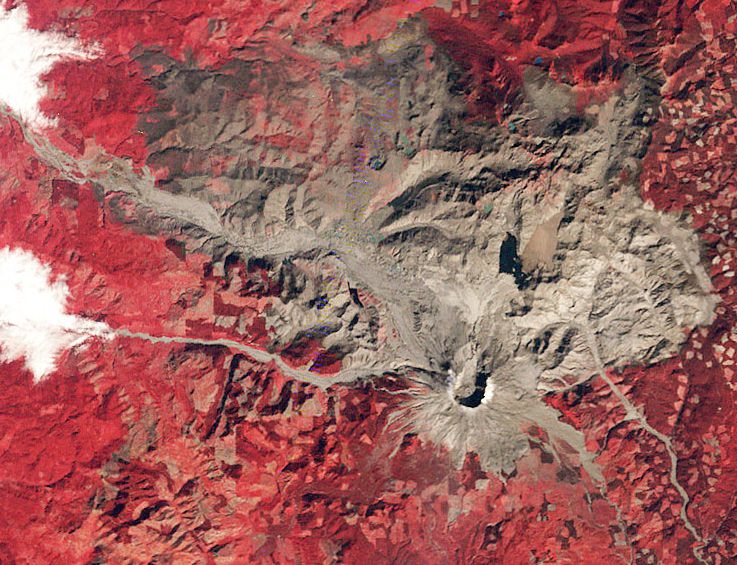
Mount St. Helens shortly after its eruption in 1980. Credit: Landsat

Turn a camera to a location for four decades, and you can see a lot of change. Streets appear or disappear. Trees grow and eventually, die. Houses spring up and slowly decay.

Landsat is the longest-running Earth observation program, with four decades of observations behind it. Today, to celebrate the launch of Landsat 5 on this day in 1984, here are five Landsat images that helped us better understand the Earth and at times, how humans affect its environment.

Mount St. Helens


When Washington State’s Mount St. Helens exploded in May 1980, it killed 57 people and obliterated much of the surrounding countryside. For American volcanologists, however, St. Helens was an easy target to study both up close and with the Landsat satellite. This 1980 image shows the devastated countryside in the weeks after the eruption. Landsat photos from every year since demonstrate how the area has recovered in the past two decades.

3-D Antarctica
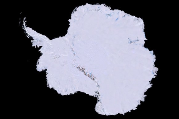
A 3-D map of Antarctica using 1,100 images from the Landsat 7 satellite. Credit: Landsat
A 3-D map of Antarctica using 1,100 images from the Landsat 7 satellite. Credit: Landsat/USGS

That image up there was years in the making. First, scientists collected 1,100 images of Antarctica using the Landsat 7 satellite. That process took three years, between 1999 and 2001. They combined elevation data and field measurements. Next came the painstaking process of stitching it together. It was finally released to the public in 2007. An unexpected benefit? Spying the continent from space allowed scientists to better track Emperor penguins. That brown stain on the image is actually where the penguins were sitting when the pictures were taken.

Rushing to Kuwait’s rescue
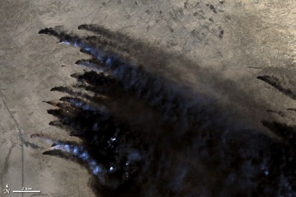
Oil well fires burn in Kuwait during the 1991 Persian Gulf War. Credit: Landsat
Oil well fires burn in Kuwait during the 1991 Persian Gulf War. Credit: Landsat/USGS

As Iraq pulled out from Kuwait during the Persian Gulf War in 1991, Iraqi troops set fire to some 650 oil wells. The environmental devastation was enormous. This Landsat image, among many others, was crucial for Kuwaiti emergency responders to figure out where the fires were burning and how best to approach them.

Landsat’s Van Gogh image
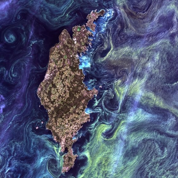
NASA once compared this image of phytoplankton surrounding Gotland to Vincent Van Gogh's "Starry Night." Credit: Landsat
NASA once compared this image of phytoplankton surrounding Gotland to Vincent Van Gogh’s “Starry Night.” Credit: Landsat/USGS

Are those stars and nebulas we see above? Not quite, but NASA points out it does look very similar to the Vincent Van Gogh image “Starry Night.” That 2005 snapshot from Landsat 7 actually shows phytoplankton surrounding the Swedish island of Gotland in the Baltic Sea. The picture was voted the top snapshot by NASA visitors to the “Earth As Art” contest held in 2012.

Shrinking Aral Sea
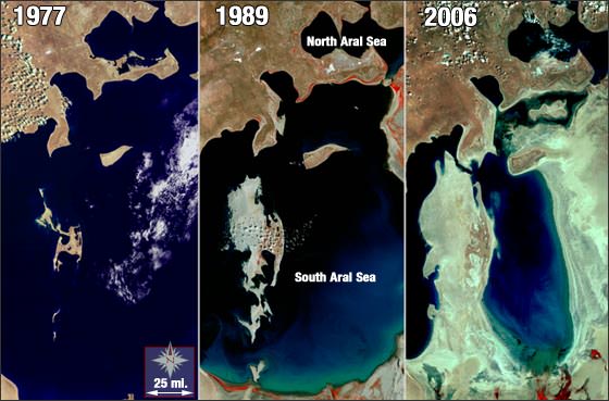
The Aral Sea has shrunk to half its size in just 40 years. Credit: Landsat
The Aral Sea has shrunk to half its size in just 40 years. Credit: Landsat/USGS

The series of Landsat images above show just how much of the Aral Sea disappeared between 1977 and 2006. The body of water, located between Uzbekistan (south) and Kazakhstan, used to be the fourth-largest lake in the world. The Soviets tapped into the sea several decades ago to irrigate the surrounding area. While local authorities are working to reverse the damage, the sea is still about half the size it used to be.

There’s more Landsat magic to come in the next few years. The Landsat Data Continuity Mission left Earth last month and will take more pictures of the Earth in even better resolution than its ancestors. Take a look at its launch video below.

As Seen From Space: Mt. Etna Boils Over

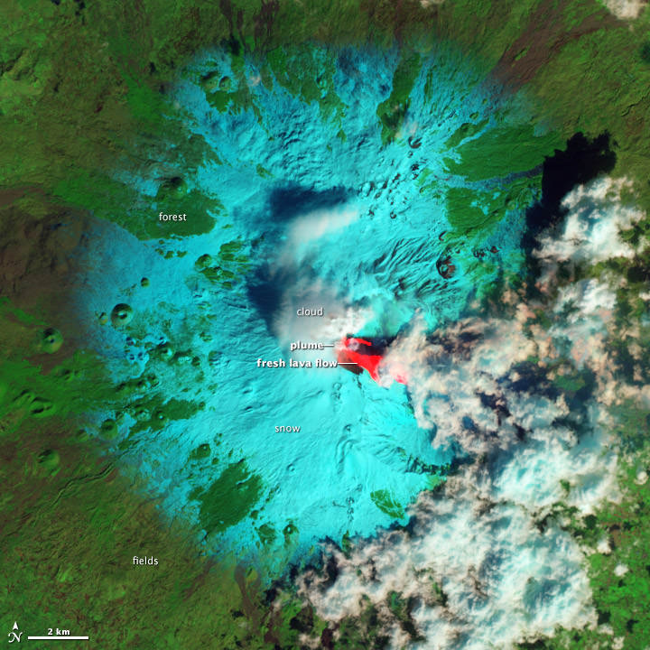
Lava flows on Mt. Etna visible from the The Advanced Land Imager (ALI) on the Earth Observing-1 (EO-1) satellite captured Etna on February 19, 2013. Credit: NASA

Italy’s Mount Etna has turned on again, spewing lava and gas in its first big eruption in 2013. The volcano is one of the most active in the world, and is Europe’s tallest active volcano, currently standing about 3,329 m (10,922 ft) high.

The volcano has been “simmering” for 10 months, but on February 19 and 20, the famous volcano came to life, providing dramatic visuals from the ground (see the video below) as well as from space, with three outbursts in less than 36 hours. This image from the Advanced Land Imager (ALI) on the Earth Observing-1 (EO-1) satellite captured Etna on February 19 at 9:59 a.m. Central European Time, about 3 hours after the end of the first outbursts.

The false-color image combines shortwave infrared, near infrared, and green light in the red, green, and blue channels of an RGB picture. This combination differentiates the appearance of fresh lava, snow, clouds, and forest.

Fresh lava is bright red—the hot surface emits enough energy to saturate the instrument’s shortwave infrared detectors, but is dark in near infrared and green light. Snow is blue-green, because it absorbs shortwave infrared light, but reflects near infrared and green light. Clouds made of water droplets (not ice crystals) reflect all three wavelengths of light similarly, and are white. Forests and other vegetation reflect near infrared more strongly than shortwave infrared and green light, and appear green. Dark gray areas are lightly vegetated lava flows, 30 to 350 years old.

The video from the ground was captured by Klaus Dorschfeldt, a videographer and webmaster at Italy’s National Institute of Geophysics and Volcanology.

In an update today on the Italian National Institute of Geophysics and Vocanology website, a fourth episode of lava fountains was reported. “Like the previous paroxysms, this event produced fountains and lava and an ash cloud that has shifted to the northern sector of the volcano.”

If you want to keep updated on what Mt. Etna is doing, there’s a webcam where you can watch the eruptions live.

Source: NASA’s Earth Observatory

Another Incredible Timelapse from the ISS

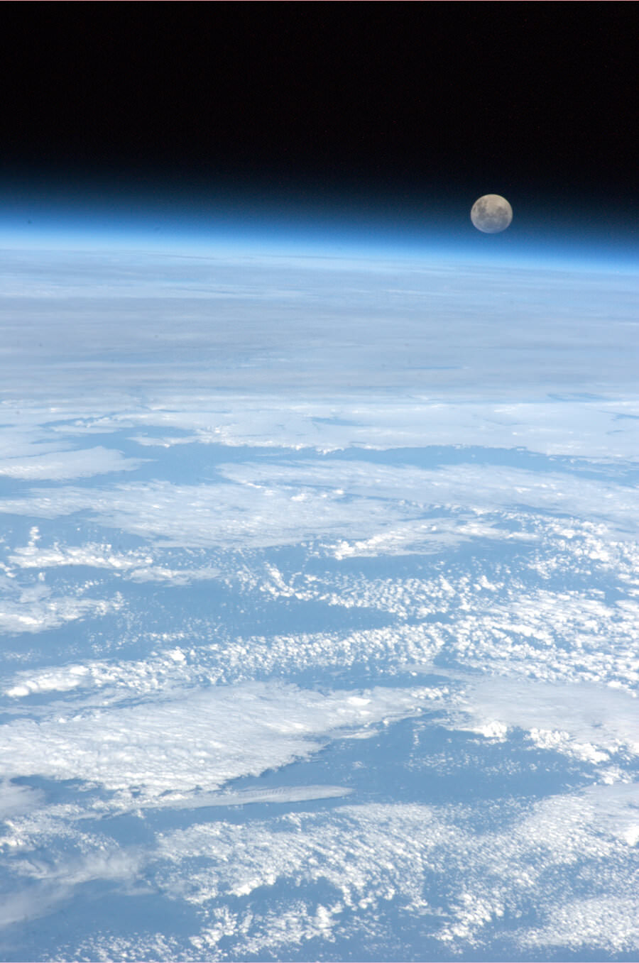
'The full moon rises over the only planet we have ever called home,' Tweeted astronaut Chris Hadfield.

We never get tired of these amazing views from the International Space Station, but this one has it all: a silvery Moon setting into the Earth’s atmosphere, the dazzling Milky Way rising into a brilliant sunrise, airglow of all colors, popping lightning, shimmering aurorae, and incredible views of the stunning space station and our gorgeous planet. Brian Tomlinson put this one together, using stills from the Johnson Space Center’s “Gateway to Astronaut Photography of the Earth.

Below is a recent image taken by Canadian astronaut Chris Hadfield showing the Moon hovering above Earth, as seen from the ISS, similar to the views in the opening of the video:

An Enormous Arctic Spiral

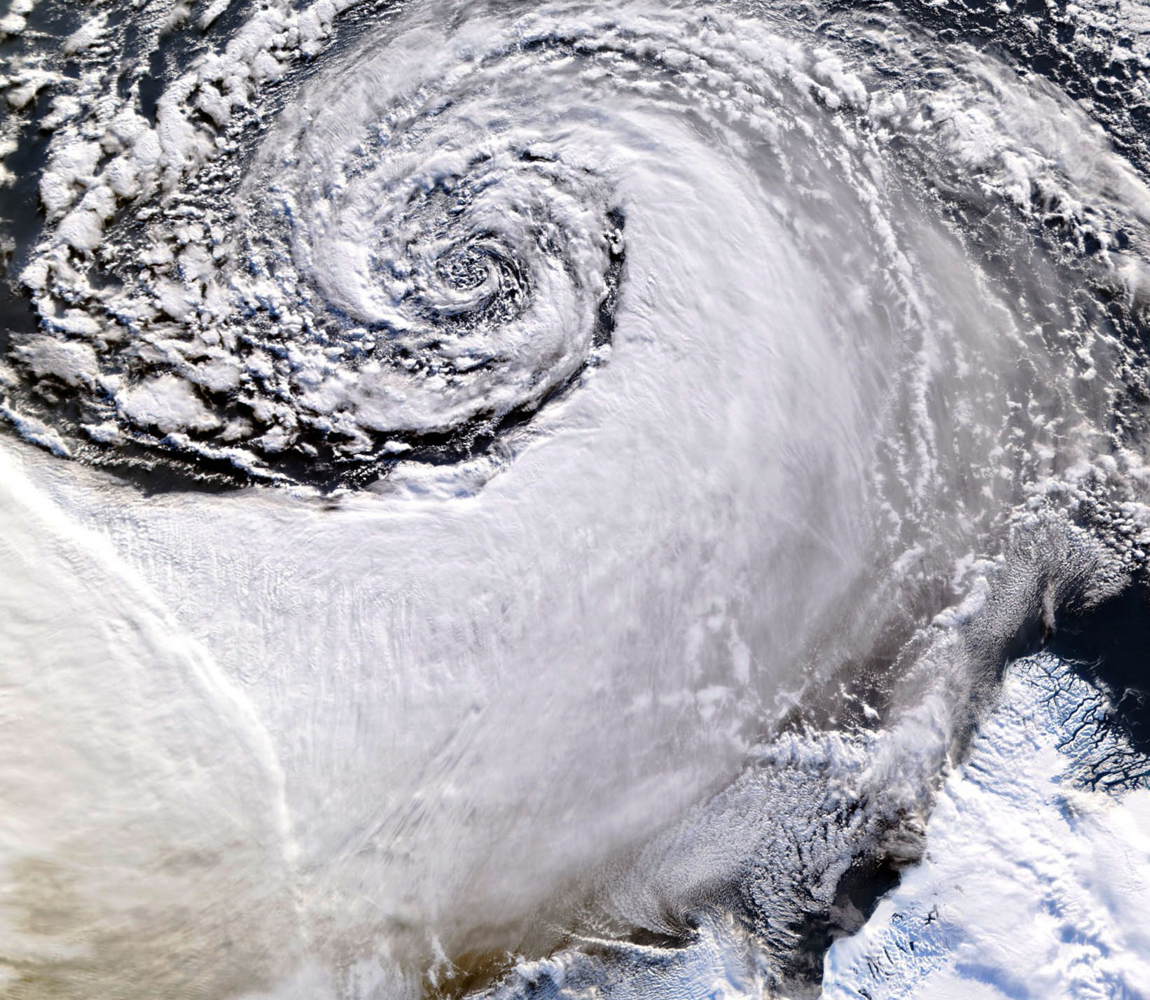
Satellite image of a cloud vortex off the coast of Greenland (NASA/MODIS/Chelys)

Looking south across the southern tip of Greenland, this satellite image shows an enormous cloud vortex spiraling over the northern Atlantic ocean on January 26, 2013. An example of the powerful convection currents in the upper latitudes, these polar low cyclones are created when the motion of cold air is energized by the warmer ocean water beneath.

Sometimes referred to as Arctic cyclones, these spiraling storms can bring gale-force winds and heavy snowfall over a wide area of ocean during their 12- to 36-hour lifespans. Hurricane-type storms don’t only form in the tropics!

This image was captured by the MODIS instrument on NASA’s Aqua satellite from its polar orbit 705 km (438 miles) above the Earth. The view has been rotated so south is up; the southernmost tip of Greenland can be seen at lower right. Click for an impressive high-resolution view.

Image via EOSNAP/Chelys

NASA Satellite Snaps Winter Storm “Nemo”

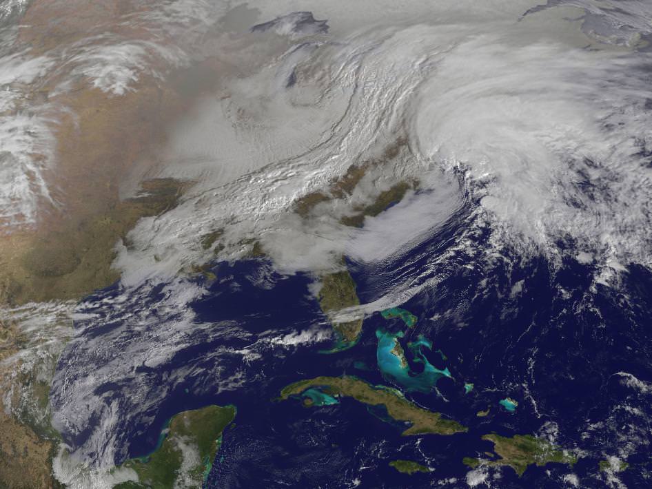
GOES-13 satellite view of the eastern US on Feb. 8 (NASA)

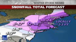
Captured by NASA’s GOES-13 weather satellite on Friday, Feb. 8, this image shows the convergence of two massive low-pressure systems that are expected to bring high winds and up to 2–3 feet of snowfall across much of New England over the next 24 hours. This is the second and most powerful “nor’easter” of the season, and states in the region are preparing for the worst.

Acquired at 9:01 a.m. EST, the GOES image shows clouds associated with the western frontal system stretching from Canada through the Ohio and Tennessee valleys and down into the Gulf of Mexico. The comma-shaped low pressure system located over the Atlantic, east of Virginia, is forecast to merge with the front and create a powerful nor’easter, which The Weather Channel (in a recent move to name winter storms) has dubbed “Nemo.”

Watch a video of this process in action below.

Snowfall forecasts for New England states (Weather Channel)

At the time of this writing, the snow has begun to fall outside this writer’s house. Accumulations are less than an inch — but that’s soon to change! Many cancellations and closings have already been announced across the region, with people making apprehensive associations with the infamous Blizzard of ’78. It’s unlikely that as many people will be caught unprepared, though, especially since modern forecasting methods have dramatically improved over the past 35 years — due in no small part to space technology like NASA’s GOES (Geostationary Operational Environment Program) satellites.

Orbiting Earth at an altitude of 35,790 km (22,240 miles) the 4 operational GOES satellites keep a constant eye on the globe, providing the NOAA with accurate, real-time measurements of water vapor and land and sea temperature variations. See more GOES image data here.

In the path of Nemo? Here’s some tips on how to be prepared.

Another Amazing Earth View: The Andes Under a Blue Pacific Fog

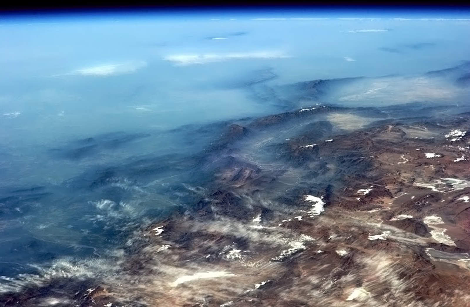
View of the Andes from the ISS on Feb. 4, 2013 (NASA)

Even though he’s a busy guy, Expedition 34 astronaut Chris Hadfield still takes the time to share some of his amazing views from orbit aboard the ISS. One of his most recent photos is this stunning view of Andean ridges rising up from a blue haze of Pacific fog, the arc of Earth’s horizon in the distance. Gorgeous! (Edit: according to a labeled image by Peter Caltner, this is looking southeast into northern Argentina – no Pacific in view. So the haze is coming from the valley, not the ocean.)

Shared on Twitter at 6:25 p.m. EST, this has quickly become one of Hadfield’s more popular images — and for good reason. In fact sometimes it’s hard to keep up with this high-flying Canadian, who easily posts half a dozen or more photos from all across the world every day on Twitter, Facebook, and his Google+ profile (which is managed by his son Evan.) But since the ISS goes around the globe 16 times a day, there’s certainly no shortage of sights for Chris and the Exp. 34 crew!

Check out a few more of Chris Hadfield’s recent photos below:

BCSx8vRCYAAp7H7.jpg-large

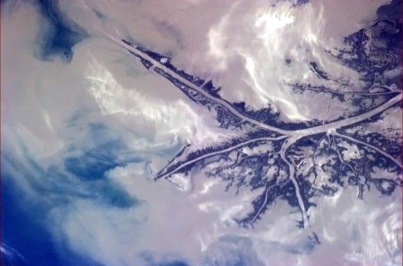
The Mississippi delta deposits “the soil of America’s heartland” into the Gulf of Mexico (NASA)

BCSGDM6CAAAlncM.jpg-large

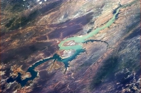
“It’s a bird, it’s a plane… it’s a river in South America!” tweeted Hadfield. (Actually it’s looking west along the Rio São Francisco river in Brazil.) NASA

BCNlZIhCUAEJqIA.jpg-large

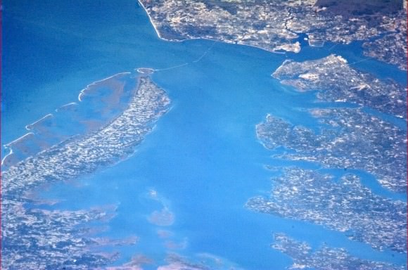
Chesapeake Bay from orbit. “You can even see the causeway,” Hadfield noted. (NASA)

BCIsyfPCEAA2A2i.jpg-large

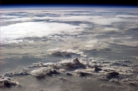
On Feb. 2, Hadfield took this photo of storm clouds over Africa. “My breath was taken away,” he wrote. (NASA)

BCHoyr5CEAEHRGi.jpg-large

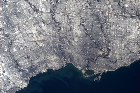
Toronto on the shore of Lake Ontario, “Canada’s most populous city” (NASA)

Want to see more of Chris Hadfield’s images from orbit? Follow him on Twitter and Facebook and over on Google+. (Just don’t be surprised if you find yourself changing your desktop background a lot more often!)

And for even more space adventures, tune in to the CSA website on February 7 at 10:30 a.m. EST when Col. Hadfield will have a live chat with William Shatner, building upon their brief (but immensely popular) impromptu web conversation from last month. He’ll also be taking questions from “space tweeps” on-site at CSA.

NASA: Reaches for New Heights – Greatest Hits Video

Video Caption: At NASA, we’ve been a little busy: landing on Mars, developing new human spacecraft, going to the space station, working with commercial partners, observing the Earth and the Sun, exploring our solar system and understanding our universe. And that’s not even everything.Credit: NASA

Check out this cool action packed video titled “NASA: Reaching for New Heights” – to see NASA’s ‘Greatest Hits’ from the past year

The 4 minute film is a compilation of NASA’s gamut of Robotic Science and Human Spaceflight achievements to explore and understand Planet Earth here at home and the heavens above- ranging from our Solar System and beyond to the Galaxy and the vast expanse of the Universe.

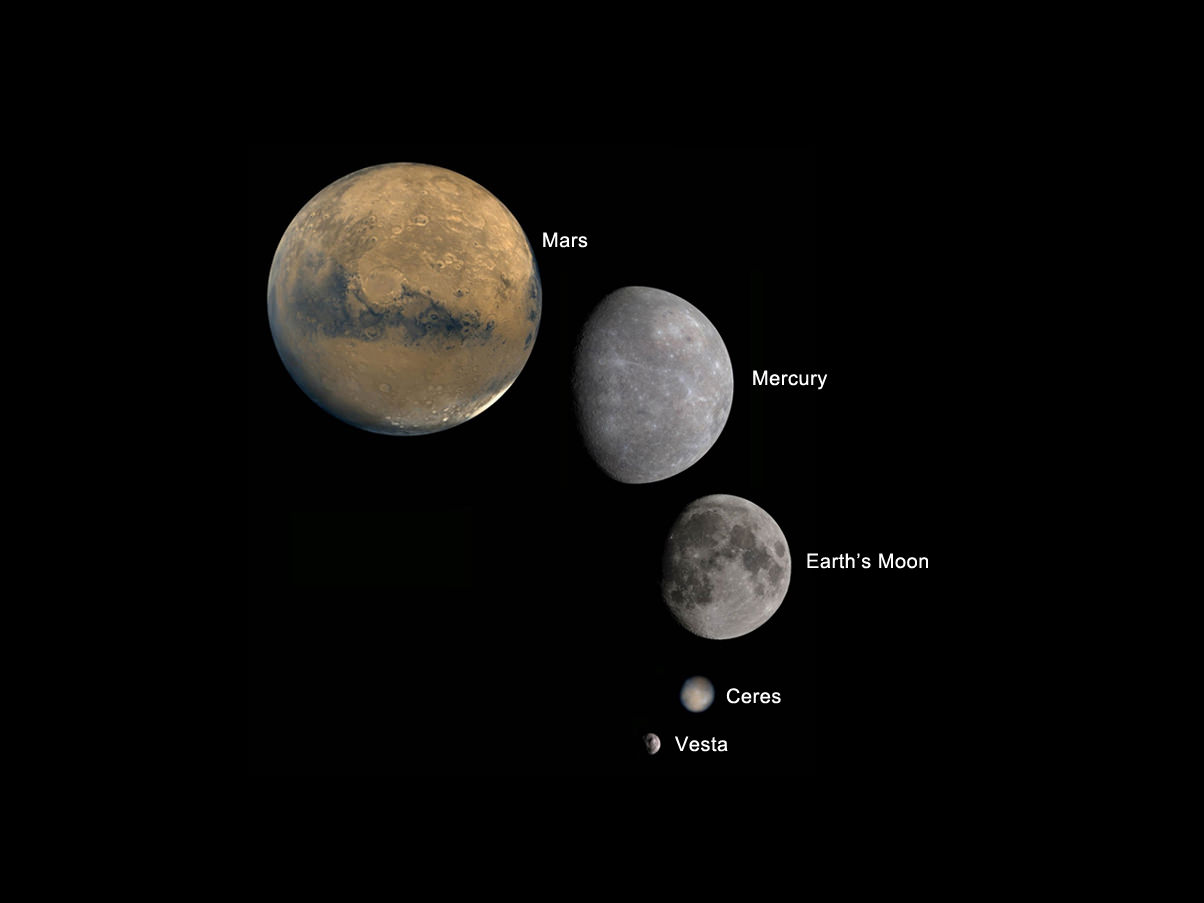
Image caption: Planets and Moons in perspective. Credit: NASA

The missions and programs featured include inspiringly beautiful imagery from : Curiosity, Landsat, Aquarius, GRACE, NuSTAR, GRAIL, Dawn at Asteroid Vesta, SDO, X-48C Amelia, Orion, SLS, Apollo, SpaceX, Sierra Nevada Dream Chaser, Boeing CST-100, Commercial Crew, Hurricane Sandy from the ISS, Robonaut and more !

And even more space exploration thrills are coming in 2013 !

Ken Kremer

IMG_3760a_SpaceX launch 22 May 2012

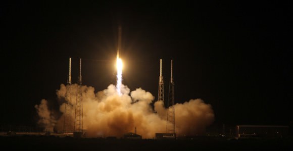
Image caption: SpaceX Falcon 9 rocket blasts off on May 22, 2012 with Dragon cargo capsule from Space Launch Complex-40 at Cape Canaveral Air Force Station, Fla., on the first commercial mission to the International Space Station. The next launch is set for March 1, 2013. Credit: Ken Kremer

Noctilucent Clouds Imaged by Astronaut Chris Hadfield

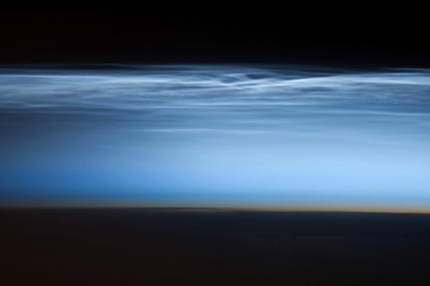
Noctilucent clouds, also known as “night shining” clouds imaged by Chris Hadfield. Image credit: NASA

What a perspective! Canadian astronaut Chris Hadfield captured this stunning image of noctilucent clouds above the Pacific South Ocean on January 5th, 2013. Also known as “night shining”, or noctilucent clouds, they form at the edge of much larger polar mesospheric clouds.

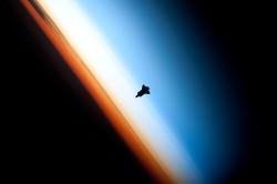
Endeavour_silhouette_STS-130Polar mesospheric clouds form at an altitude of 76 to 85 kilometers, near the boundary between the mesosphere and the thermosphere. The mesosphere is the layer of the atmosphere above the stratosphere (where airplanes fly), and the thermosphere is above that, where solar radiation causes a significant spike in temperature. (The Space Shuttle photo over on the right is positioned right between those two layers).

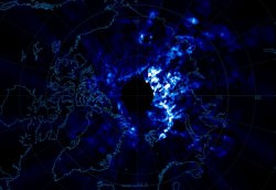
Northpoleclouds_AIMData_cThese clouds are typically seen between 70°-75° in latitude, and last for a season of 60-80 days during the late Spring and early Summer. The clouds themselves are made up of ice crystals which measure up to 100 nm in diameter. Scientists are still working out exactly what causes noctilucent clouds; they’re still a bit of a mystery. But their appearance has become more frequent, increasing in brightness and extent, so it’s possible they’re an indication of increasing climate change.

In this photograph, the Sun is below the horizon, and the ground is dark. Those clouds are still partially illuminated by the Sun, and so we see them with this ethereal wispy structure. Hadfield used a Nikon D35 camera with a 400 mm telephoto lens. At the very bottom of the image, you can see the pale orange color of the stratosphere.

Canadian astronaut Chris Hadfield (did I mention he’s Canadian?) launched to the International Space Station on December 19, 2012 to participate in Expedition 34. He has been returning wondering pictures and sharing them on Twitter and Google+.

Original Source: NASA Earth Observatory

Space Station Gets a New Telescope

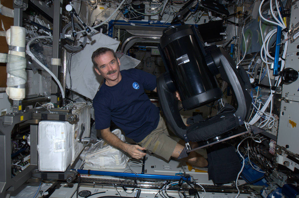
Canadian astronaut Chris Hadfield with the new ISERV (International Space Station SERVIR Environmental Research and Visualization System), a modified Celestron telescope for Earth observation. Credit: NASA/CSA

Astronauts on the International Space Station today are installing a new modified Celestron telescope. This won’t be used to observe the stars, but instead look back to Earth to acquire imagery of specific areas of the world for disaster analysis and environmental studies. Called ISERV (International Space Station SERVIR Environmental Research and Visualization System), it is a new remote-controlled imaging system.

“Essentially, it will be pointed out of one of the windows of the Space Station, and used for Earth imaging,” Andrea Tabor, social media coordinator for Celestron told Universe Today, “especially for natural disasters and to help countries that may not have their own Earth-observing satellites to help assess damage and assist with evacuations.”

ISERV will be installed in the Window Observational Research Facility (WORF) in the station’s Destiny laboratory.

The Celestron CPC 925, is a 9.25″ diffraction limited Schmidt-Cassegrain telescope and off-the-shelf sells for $2,500 including the mount, (just the 9.25 inch optical tube sells for $1,479). It was modified at the Marshall Space Flight Center.

“They used the fork mount that comes with it,” Tabor said, “but they just removed the tripod and replaced it with a specialized mount to anchor and stabilize it on the ISS.”

Because it is pointed out of a window and because the ISS is moving so fast, it would be difficult to align it with the sky and do any celestial imaging, Tabor said.

ISERV is the first of what is hoped to be a series of space station Earth-observing instruments, each to feature progressively more capable sensors to help scientists gain operational experience and expertise, as well as help design better systems in the future. Scientists envision that future sensors could be mounted on the exterior of the station for a clearer, wider view of Earth.

It arrived on the ISS in July of 2012 on board the Japanese HTV-3.

“It’s been up there sitting in a box, so today was unboxing and assembly day,” Tabor said. She added that they hope to post some of the first images from the telescope on their Twitter and Facebook pages.

The telescope will normally be operated by remote-controlled from Earth and so the astronauts won’t likely be working with it directly except for assessing its operation or troubleshooting any problems.

“Images captured from ISERV on the ISS could provide valuable information back here on Earth,” said Dan Irwin, SERVIR program director at Marshall. “We hope it will provide new data and information from space related to natural disasters, environmental crises and the increased effects of climate variability on human populations.”

Image via @Cmdr_Hadfield on Twitter

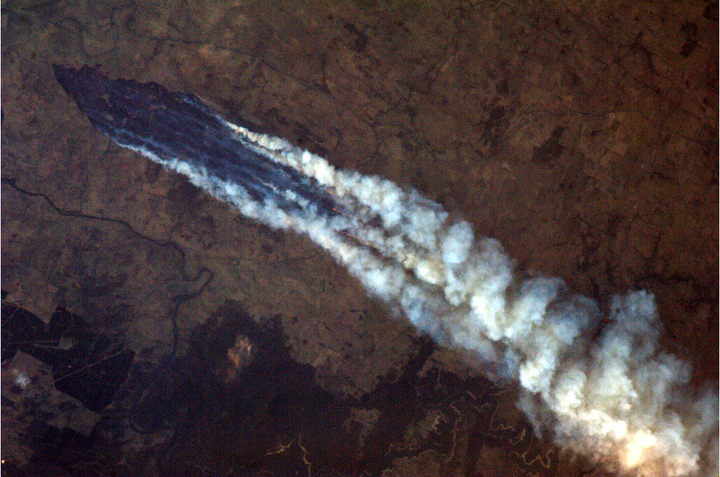
Astronaut Captures Incredible Images of Australian Bush Fires

Lines of scorched earth and huge smoke plumes from wild fires in Australia were visible from the International Space Station on January 8, 2013. Credit: NASA/Chris Hadfield

Intense wild fires, or bush fires as they are called in Australia, are burning out of control across southeast Australia with authorities describing the condition as “catastrophic.” The huge fires were easily visible from the International Space Station on Tuesday and onboard, Canadian astronaut Chris Hadfield has been watching from above.

See more of his images below:

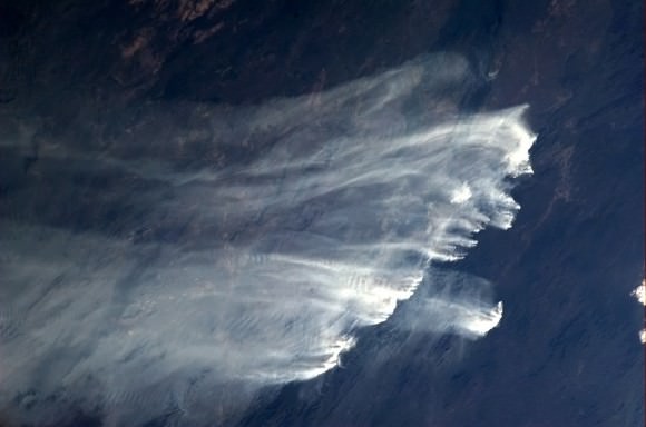
A long line of bush fires range in Australia, and are visible from space. Credit: NASA/Chris Hadfield

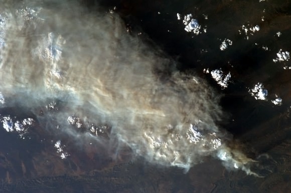
Officials say more than 130 fires, many uncontained, are burning in the heavily populated New South Wales state, where dry conditions are fueling the fires as temperatures reached 45 degrees and wind gusts reached more than 100 kilometers per hour.

Huge plumes of smoke from bush fires in Australia were visible from the International Space Station. Credit: NASA/Chris Hadfield.

In Tasmania, an island south of Australia, rescue officials are still trying to locate around 100 residents who have been missing after a fire tore through a village, destroying dozens of homes. You can see images from the Moderate Resolution Imaging Spectroradiometer (MODIS) on NASA’s Terra satellite that were taken on January 7, 2013 at the Earth Observatory website.

Follow Chris Hadfield on Twitter to see more images.

Additional information on the bush fires from Voice of America