Earthrise, Revisited

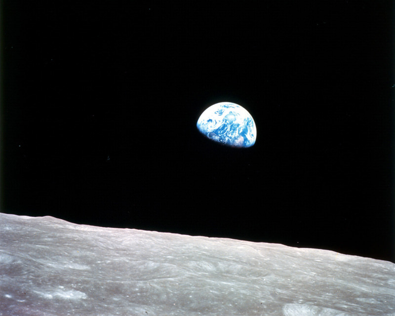
The first color photo of Earth taken from orbit around the Moon. (NASA)


On December 24, 1968, Apollo 8 astronauts Frank Borman, William Anders and Jim Lovell were the first humans to witness an Earthrise as our home planet came up over the lunar horizon. The photos they captured were the first of their kind, instantly inspiring the imaginations of millions and highlighting the beauty and fragility of our world.

Now, NASA has used modern satellite data to recreate the scenes that the Apollo 8 astronauts saw 44 years ago and combined them with their historic photographs to present a new “Earthrise”… version 2.0.

Created in recognition of Earth Day 2012, the Earthrise animation was made from data acquired by NASA’s Lunar Reconnaissance Orbiter’s laser altimeter, as well as the Moderate Resolution Imaging Spectroradiometer (MODIS) on the Terra Earth-observing satellite.

“This visualization recreates for everyone the wondrous experience of seeing Earth from that privileged viewpoint,” says LRO Project Scientist Rich Vondrak of NASA’s Goddard Space Flight Center.

Animator Ernie Wright recreated the scene using Apollo mission reports and photos taken by the crew. The audio is a recording of original communication from the astronauts.

[/caption]

“I think the one overwhelming emotion that we had was when we saw the earth rising in the distance over the lunar landscape… it makes us realize that we all do exist on one small globe. For from 230,000 miles away it really is a small planet.”

— Frank Borman, Apollo 8 Commander

Read the release on the NASA LRO site here.

Video: NASA/GSFC

Earth Day Timelapse

In honor of Earth Day, enjoy this beautiful timelapse compiled by science educator James Drake, who put together one of the first ISS flyover videos. This video was created from images produced by the Russian geostationary Electro-L Weather Satellite, and the images are some of the largest whole disk images of our planet, as the satellite is orbiting at about 40,000 km. Each image is 121 megapixels, and the resolution is 1 kilometer per pixel. They are taken every half hour in four different wavelengths of light — three visible, and one infrared. The infrared light is reflected by forests and vegetation, which appear orange in these images. Enjoy!

See more at Drake’s Planet Earth web page, including a zoomable, full resolution image of Earth, as well as other image downloads.

Is This The Last Image From Envisat?

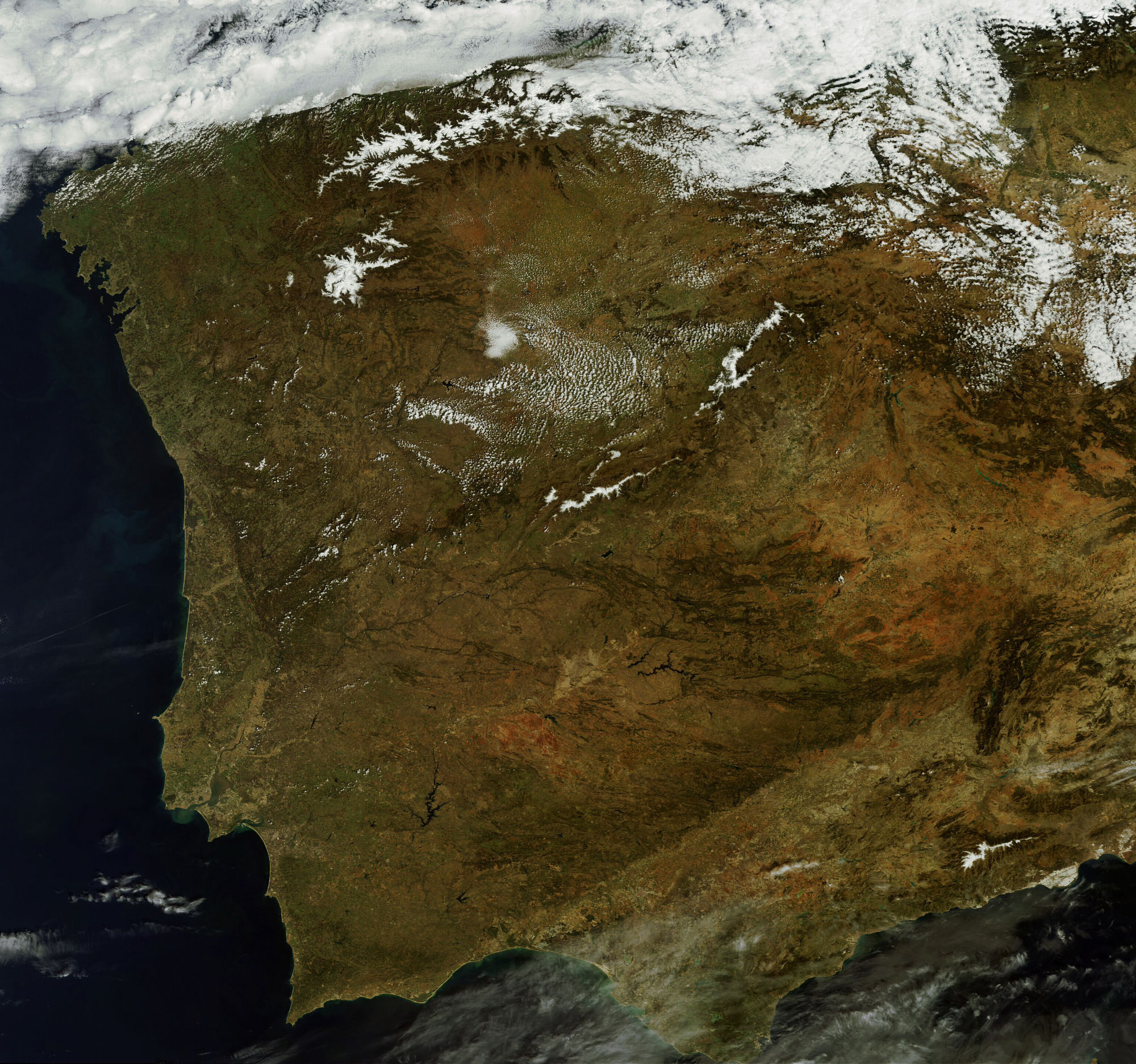
This MERIS image of Spain and Portugal could be Envisat's last. (Chelys/EOsnap)

[/caption]

The European Space Agency’s venerable Envisat satellite may have sent back its final image, according to recent news from the Agency.

On April 8, ESA lost communication with the Earth-observation satellite, preventing reception of data as it passed over the Kiruna station in Sweden. Although it’s been confirmed that the satellite is still in orbit, the recovery team has not been able to re-establish contact.

The image above, showing part of the Iberian peninsula, was from the last data to be received from Envisat before it fell silent.

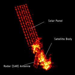
Radar image of Envisat. (Fraunhofer Institute for High Frequency Physics and Radar Techniques.)

Launched in March 2002, Envisat has been helping researchers examine our planet for over ten years — five years longer than its original mission duration. It has completed more than 50,000 orbits and returned thousands of images, as well as a wealth of data about the land, oceans and atmosphere.

Envisat data was instrumental in over 4,000 projects from 70 countries.

Germany’s Tracking and Imaging Radar captured an image of the satellite, revealing that it is still intact and in a stable orbit. Still, all attempts at recovery have so far been unsuccessful.

A contingency agreement with the Canadian Space Agency on Radarsat will be activated to fulfill user requirements if Envisat cannot be brought back online.

Read the official release on the ESA site here.

Dubai’s Island Version of the World, As Seen from Space

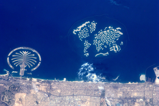
The Palm and The World Islands, Dubai. Credit: NASA/ESA

[/caption]

Usually astronauts have to go much farther away than low Earth orbit to see the entire world in one view, but The World Islands resorts in Dubai provides a unique — if not manufactured — view of Earth’s continents from space. The World Islands are a collection of man-made islands shaped into the continents of the world, and ultimately will consist of 300 small private artificial islands divided into four categories – private homes, estate homes, dream resorts, and community islands.

To the east is another man-made archipelago named The Palm, for obvious reasons, and another island chain is due to be built between these reclaimed lands which will be called The Universe.

ESA astronaut André Kuipers took this image on April 10, 2012 during his long duration mission on the International Space Station. See more of his images at the ESA FLickr page.

Earth’s Van Gogh Oceans

I was traveling the day this video was released, so missed posting it earlier. If you haven’t seen it yet, this animation of ocean surface currents is just mesmerizing. It shows ocean currents from June 2005 to December 2007, created with data from NASA satellites. In the video you can see how bigger currents like the Gulf Stream in the Atlantic Ocean and the Kuroshio in the Pacific carry warm waters across thousands of kilometers at speeds greater than six kilometers per hour 4 mph), as well as seeing how thousands of other ocean create slow-moving, circular pools called eddies. The entire visualization is reminiscent of Vincent Van Gogh’s “Starry Night” painting.
Continue reading “Earth’s Van Gogh Oceans”

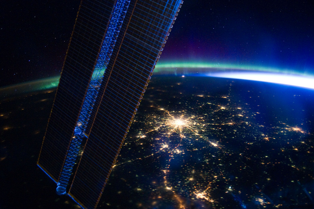
Moscow At Night

Photo by Expedition 30 crew during a night pass over Moscow on March 28, 2012.

[/caption]

Tracing a bright star upon the Earth, the lights of Russia’s capital city blaze beyond the solar panels of the International Space Station in this photo, captured by the Expedition 30 crew on the night of March 28, 2012.

As an electric-blue dawn flares around Earth’s northeastern limb, the green and purple fire of the Aurora Borealis shimmers and stretches away to the northwest above a pale yellow line of airglow.

Traveling at 17,500 miles an hour (28,163 km/hr), the ISS was approximately 240 miles (386 km) above the Russian city of Volgograd (formerly Stalingrad) when this photo was taken.

Image: NASA

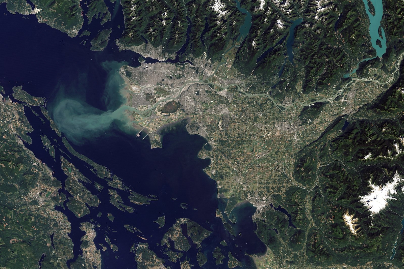
Satellite Photo of Vancouver and the Fraser River

Fraser River seen from space

[/caption]
I just had to post this satellite photograph of Vancouver with the sediment plume streaming out of the Fraser River. Not just because it’s beautiful, which it is, but also because so much of my life is tied together with that city and river.

I was born in Vancouver, and spent half my time there and half my time over on Vancouver Island which is on the left-hand side of this image. I currently live on Vancouver Island, but I have to commute to Vancouver quite a bit, which involves taking a ferry ride across the Straight of Georgia. When you take the route that carries you from Nanaimo (on the island) over to Tsawassen (the ferry terminal that juts out), you have to cross this plume.

Where you see the plume depends on the tides and the amount of material flowing out of the Fraser River, but it’s a stunning sight to see. It’s like the water has been separated into two different colors, with a very distinct dividing line between them.

You can see the line from a few kilometers away standing on the ferry deck, and then it approaches and widens, and then you cross it. The water switches from deep blue to muddy brown with almost no blending in between. Even the shape of the waves in the plume is different.

Anyway, cool image, thanks to NASA’s Earth Observatory.

Antarctica Gives NASA Satellite The Ol’ Frazil Dazzle

Tendrils of ice particles, called frazil, extend out into Antarctica's Mackenzie Bay. (NASA/EO-1 - ALI)

[/caption]

Ghostly green tendrils drift out into Mackenzie Bay off the coast of eastern Antarctica in this image, acquired by NASA’s Earth-Observing (EO-1) satellite on Feb. 12, 2012.

The tendrils are made of fine particles of ice called frazil, the result of upwelling cold water from deep beneath the Amery ice shelf.

Sea water flowing in currents under the Amery ice shelf gets cooled to temperatures below freezing, the result of greater water pressures existing at depth. As some of the water rises and flows along the underside of the shelf toward the open ocean, it gradually encounters less pressure since the ice thickness decreases the further away from shore it extends.

When the supercold water approaches the surface where pressure is lowest, it instantly freezes, forming needle-like ice particles called frazil.

Only 3 -4 millimeters wide, the frazil crystals can still be concentrated enough to be visible from orbit as it drifts into the bay, flowing around icebergs as it is carried along by wind and currents. (The largest iceberg in the image is a little over 4 km/2.5 miles long.)

Eventually the warmer surface water that surrounds the southern continent melts the frazil, and the tendrils fade away.

Scheduled to fly for a year and only designed to last a year and a half, EO-1 celebrated its eleventh anniversary on November 21, 2011. During its time in orbit the satellite has accomplished far more than anyone dreamed, and its Earth-observing mission continues on. Read more on the EO-1 site here.