Landsat 9 Joins a Fleet of Earth Observation Satellites

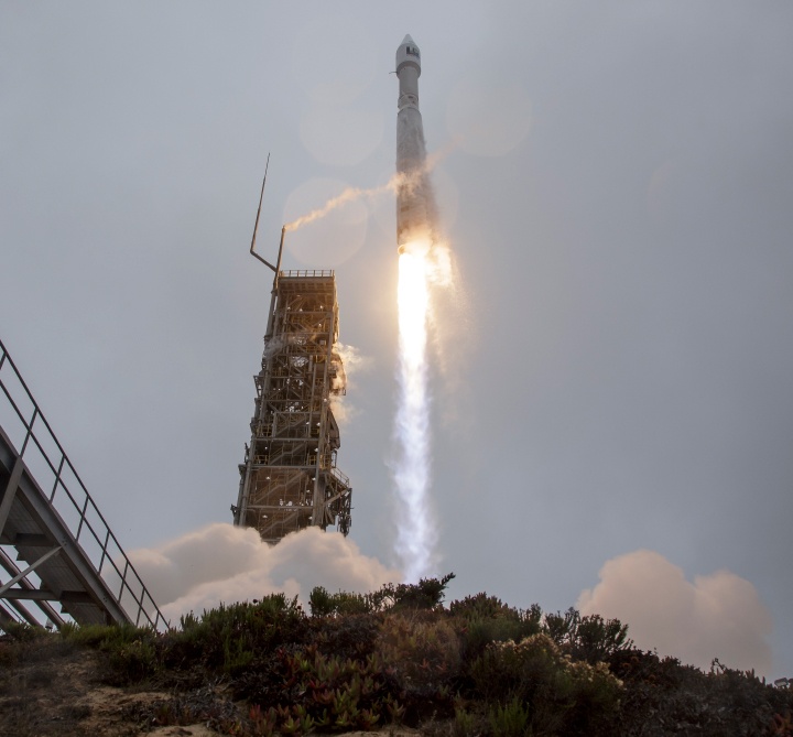
Landsat 9 lifted off from Vandenberg Space Force Base on September 27, 2021 on an an Atlas V 401 rocket. Credit: NASA

Earth has a new eye in orbit to monitor our changing planet.  

Landsat 9 launched on September 27, 2021 continuing the Landsat family of satellite’s nearly 50-year tradition of making critical observations to help with energy and water management, forest monitoring, human and environmental health, urban planning, disaster recovery and agriculture.

Continue reading “Landsat 9 Joins a Fleet of Earth Observation Satellites”

Satellite Images Can Help Predict When Underwater Volcanos are About to Erupt

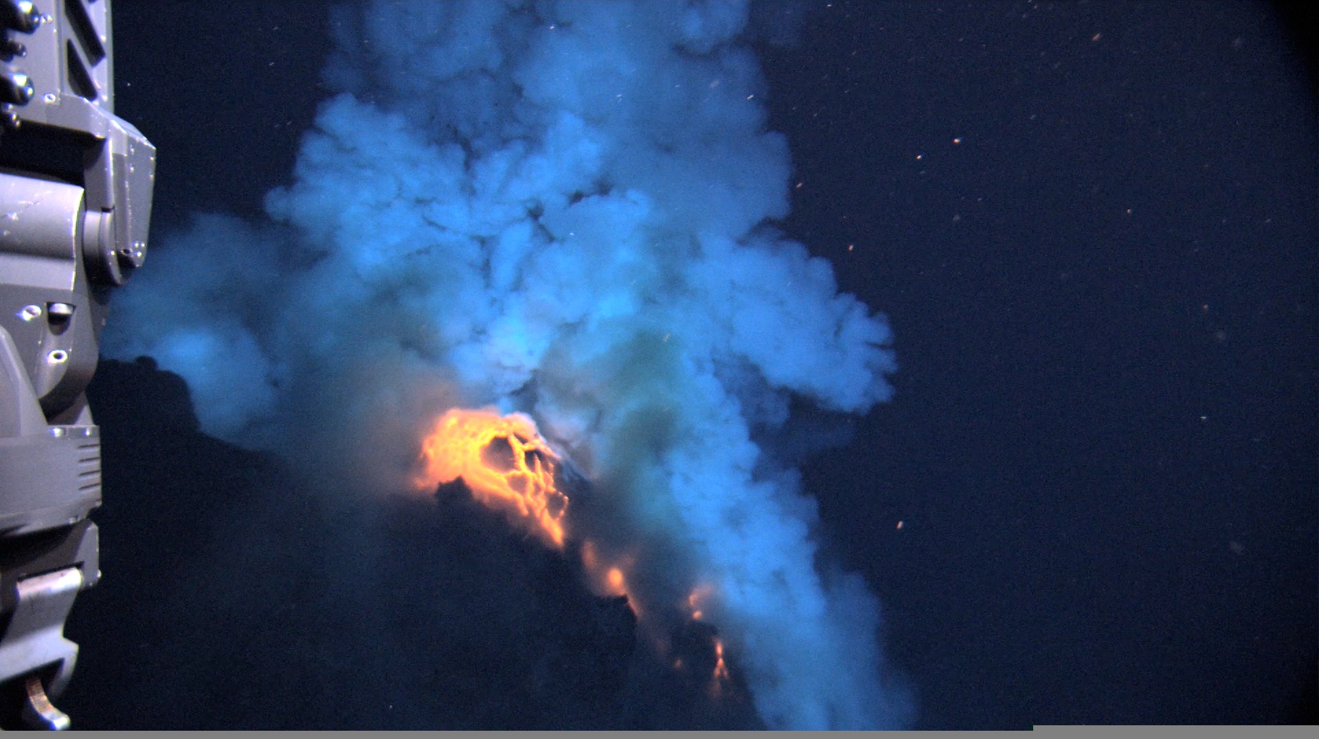
Predicting volcanic eruptions is notoriously tricky. In large part this is because volcanos are unique, each with their own quirks and personalities: the lessons learned from studying one volcano may not apply directly to another. Luckily, researchers are getting better at finding warning signs that they can apply broadly. Some of the most well-known are heightened seismic activity, rising temperatures, expanding magma pools, and the release of gases. New research using satellite imagery now offers a new warning sign for underwater volcanos: a change in the color of the ocean.

Continue reading “Satellite Images Can Help Predict When Underwater Volcanos are About to Erupt”

After British Columbia’s Record-Breaking Heatwave, Here Come the Wildfires

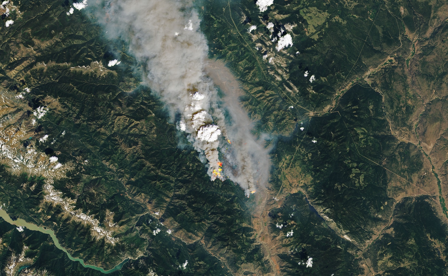
Image taken by the Landsat 8 OLI on June 30th, 2021. Credit: NASA EO

Every day, there are more indications that show how anthropogenic factors are causing uncomfortable changes in our climate. Here in beautiful British Columbia, this means that wildfires are once again threatening countless acres of forests, communities, and wildlife. By the end of June 2021, more than 40 wildfires were raging across the province, including a rather substantial cluster around the town of Lytton.

Located just 150 km (about 93 mi) northeast of the city of Vancouver, Lytton, had to be evacuated on June 30th after an extreme heatwave led to wildfire sweeping through the area. These wildfires and the impact they were having at the time was being monitored by some of NASA’s Earth Observatory satellites. In a series of images recently shared on their website, they show the fires that were raging near Lytton just hours before the evacuation.

Continue reading “After British Columbia’s Record-Breaking Heatwave, Here Come the Wildfires”

This is Currently the World’s Largest Iceberg

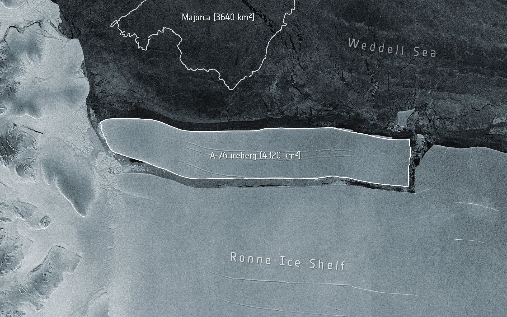
An enormous iceberg has calved from the western side of the Ronne Ice Shelf, lying in the Weddell Sea, in Antarctica. Image by the Copernicus Sentinel-1 mission. Credit: ESA

A gigantic chunk of ice recently broke off from an ice shelf in Antarctica, and is currently the world’s largest iceberg. The iceberg, dubbed A-76, measures around 4,320 square km (1,670 square miles) in size. At 170 km (106 miles) in length and 25 km (15 miles) wide, the iceberg is slightly larger than the Spanish island of Majorca, and bigger than the state of Rhode Island in the US.

A-76 was captured in the above image by ESA’s Copernicus Sentinel-1 satellite. Below is an animation of the iceberg calving off the Ronne Ice Shelf.

Continue reading “This is Currently the World’s Largest Iceberg”

The Galápagos Islands From Space

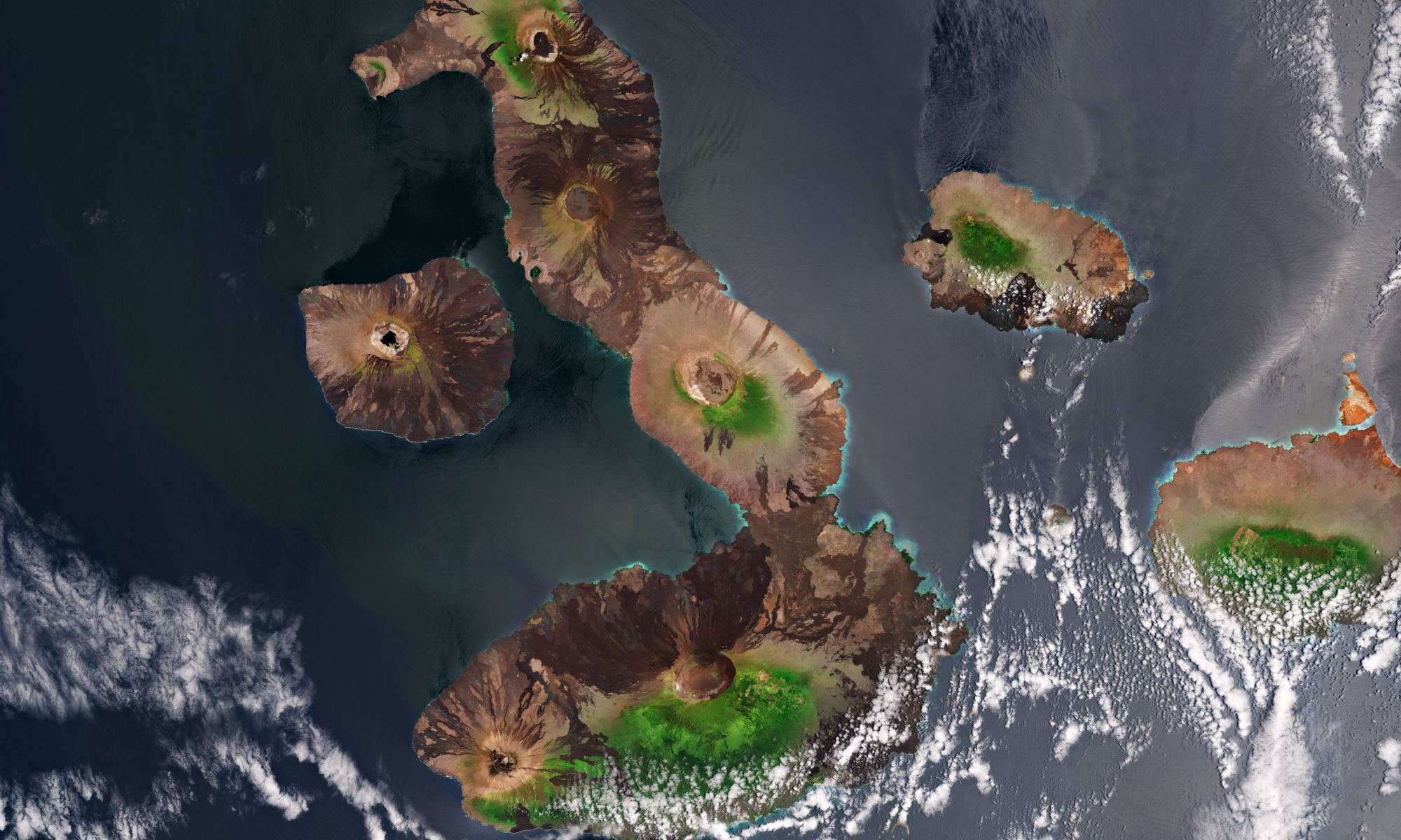
A satellite image from the Copernicus Sentinel-2 mission showing the Galápagos Islands – a volcanic archipelago situated some 1000 km west of Ecuador in the Pacific Ocean. Credit: Modified Copernicus Sentinel data (2020), processed by ESA.

The Galápagos Islands hold an honored place in science history. I often wonder, if Charles Darwin could have seen this volcanic archipelago from this vantage point – a satellite view – how might have that aided or changed his research on evolution?

Continue reading “The Galápagos Islands From Space”

Another Big Iceberg Just Broke off from Antarctica

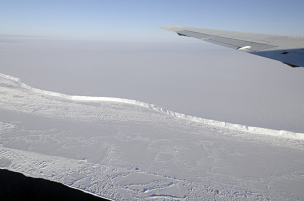
The wing of NASA's DC-8 cuts across the frozen expanse of the Brunt Ice Shelf, with its 100-foot-high cliff face. Credit: Michael Studinger/NASA.

Glaciologists have been closely monitoring ice shelves in Antarctica for signs of cracks and chasms that indicate breakups. The loss of ice around the Earth’s polar regions is one of many consequences of climate change, which is leading to rising ocean levels and various feedback mechanisms. Recently, the ESA’s Copernicus Sentinel-1 satellite witnessed a giant iceberg breaking off from Antarctica’s Brunt Ice Shelf on February 26th.

The Copernicus Sentinel mission consists of two polar-orbiting satellites that rely on C-band synthetic aperture radar imaging to conduct Earth observations in all weather conditions. In recent years, it has been monitoring the Brunt Ice Shelf for signs of cracks and chasms. According to the images it recently captured, an iceberg larger than New York City broke free and began floating out to sea.

Continue reading “Another Big Iceberg Just Broke off from Antarctica”

Earth’s Atmosphere Can Generate a “Space Hurricane”

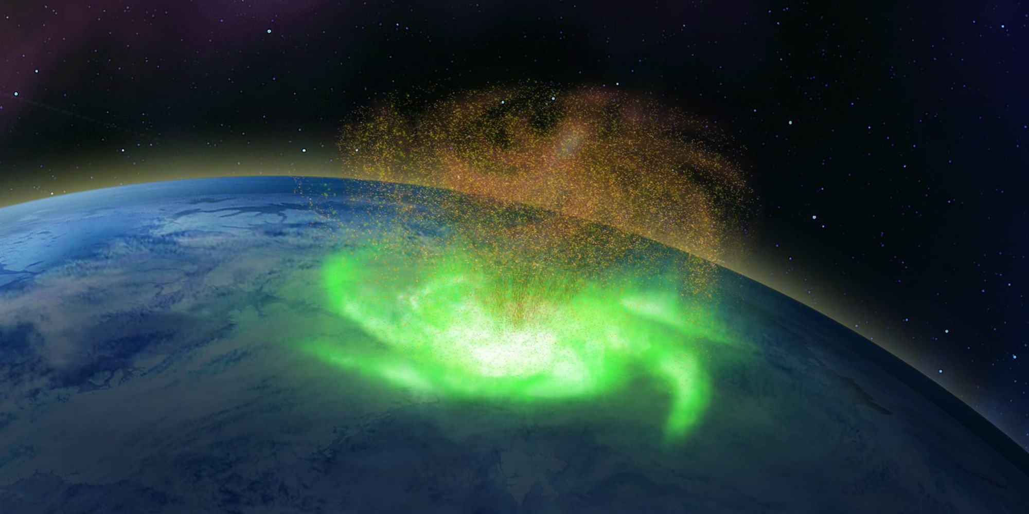
Illustration of a space hurricane, created using the observational data. Credit: Qing-He Zhang / Shandong University

There are hurricanes in space.

Researchers looking through archival data found evidence of a previously unobserved phenomenon — a giant swirling mass of plasma above Earth’s northern polar region. The “space hurricane,” as the science team calls it, churned for hours, raining down electrons instead of water.

Continue reading “Earth’s Atmosphere Can Generate a “Space Hurricane””

Three Storms Have Dumped Snow on Mauna Loa and Mauna Kea

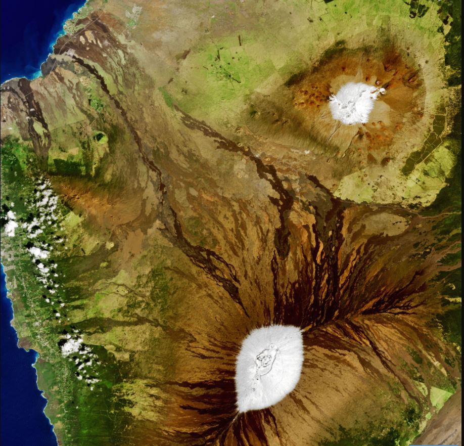
Satellite view of the Big Island of Hawaii on February 6, 2021. Credit: NASA.

The words “snow” and “Hawai’i” are not often mentioned in the same paragraph – or even on the same vacation. But snow does fall in Hawai’i almost every year, and 2021 has seen a deep cold front drop snow on the summits of Mauna Loa and Mauna Kea on the Big Island at least three times in the past few weeks – as well as on Haleakala on Maui. This means there are currently in snowcaps on Hawai’i’s three tallest mountains.

Continue reading “Three Storms Have Dumped Snow on Mauna Loa and Mauna Kea”

It Looks Like Iceberg A-68A is Coming Apart

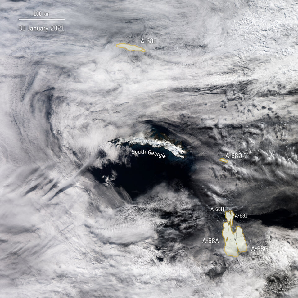
A-68 iceberg positions as seen by Copernicus Sentinel-3 mission on January 30 2021. Image Credit: ESA

Iceberg A-68A, the massive frigid behemoth posing a threat to South Georgia Island, might be breaking into pieces. Satellite images from the European Space Agency showed large cracks forming in the iceberg.

Now it appears to breaking apart.

Continue reading “It Looks Like Iceberg A-68A is Coming Apart”

2020 Ties for the Hottest Year on Record

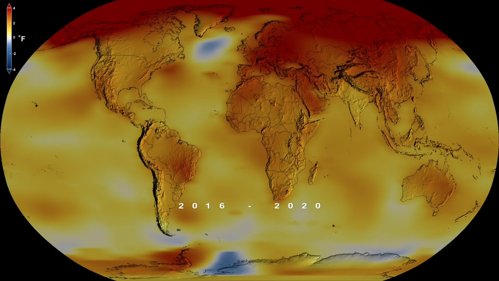
Credit: NASA/GISS

According to multiple sources – which includes NASA, the NOAA, the Berkeley Earth research group, and the Met Office Hadley Centre (UK) – global temperatures over the past few years have been some of the hottest on record. This is the direct result of anthropogenic factors like overpopulation, urbanization, deforestation, and increased greenhouse gas emissions (like carbon dioxide and methane).

According to a recent press release from NASA, in terms of global temperatures, 2020 was the hottest year on record – effectively tying it with 2016 (the previous record-holder). The release includes a dramatic video that illustrates average temperature increases since 1880 and the ecological crises that have taken place just this past year. This is yet another warning of how human agency is impacting the very systems we depend upon for our continued survival.

Continue reading “2020 Ties for the Hottest Year on Record”