Solar Orbiter Caught Venus, Earth and Mars in One of its Photos
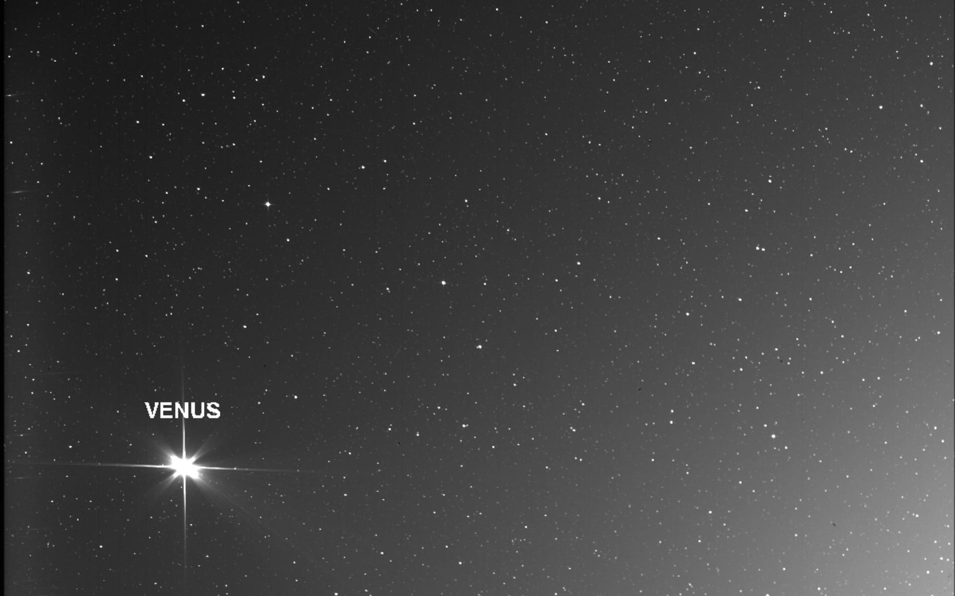
The Solar Orbiter spacecraft took this image of three Solar System planets: Venus (left), Earth (middle), and Mars (right). Stars are visible in the background. Image taken on November 18, 2020. Credit: ESA/NASA.

The Solar Orbiter spacecraft is heading towards the center of the Solar System, with the goal of capturing the closest images ever taken of our Sun. But during its flight, the spacecraft turned back to look towards home. It captured Venus, Earth, and Mars together, as seen from about 155.7 million miles (250.6 million kilometers) away.

Continue reading “Solar Orbiter Caught Venus, Earth and Mars in One of its Photos”

These Bizarre Cloud Patterns are von Kármán’s Vortices, Caused by the air Wrapping Around Tall Islands

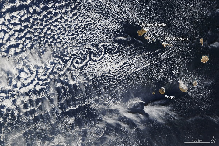
Three peaks in Cape Verde form von Kármán vortex streets when wind conditions are right. Image Credit: Lauren Dauphin, using MODIS data from NASA EOSDIS/LANCE and GIBS/Worldview.

This is an image of some of the islands that make up the nation of Cape Verde. While most in that group of ten islands are flat, some are very tall: Fogo, Santa Antão, and São Nicolau. Those three stand well above their compatriots, with Fogo reaching an altitude of 2,829 metres (9,281 feet).

The three tall volcanic islands sometimes interact with the wind to create von Kármán vortices, also called von Kármán vortex streets.

Continue reading “These Bizarre Cloud Patterns are von Kármán’s Vortices, Caused by the air Wrapping Around Tall Islands”

Iceberg A-68A is Turning. Will it Miss South Georgia Island After All?

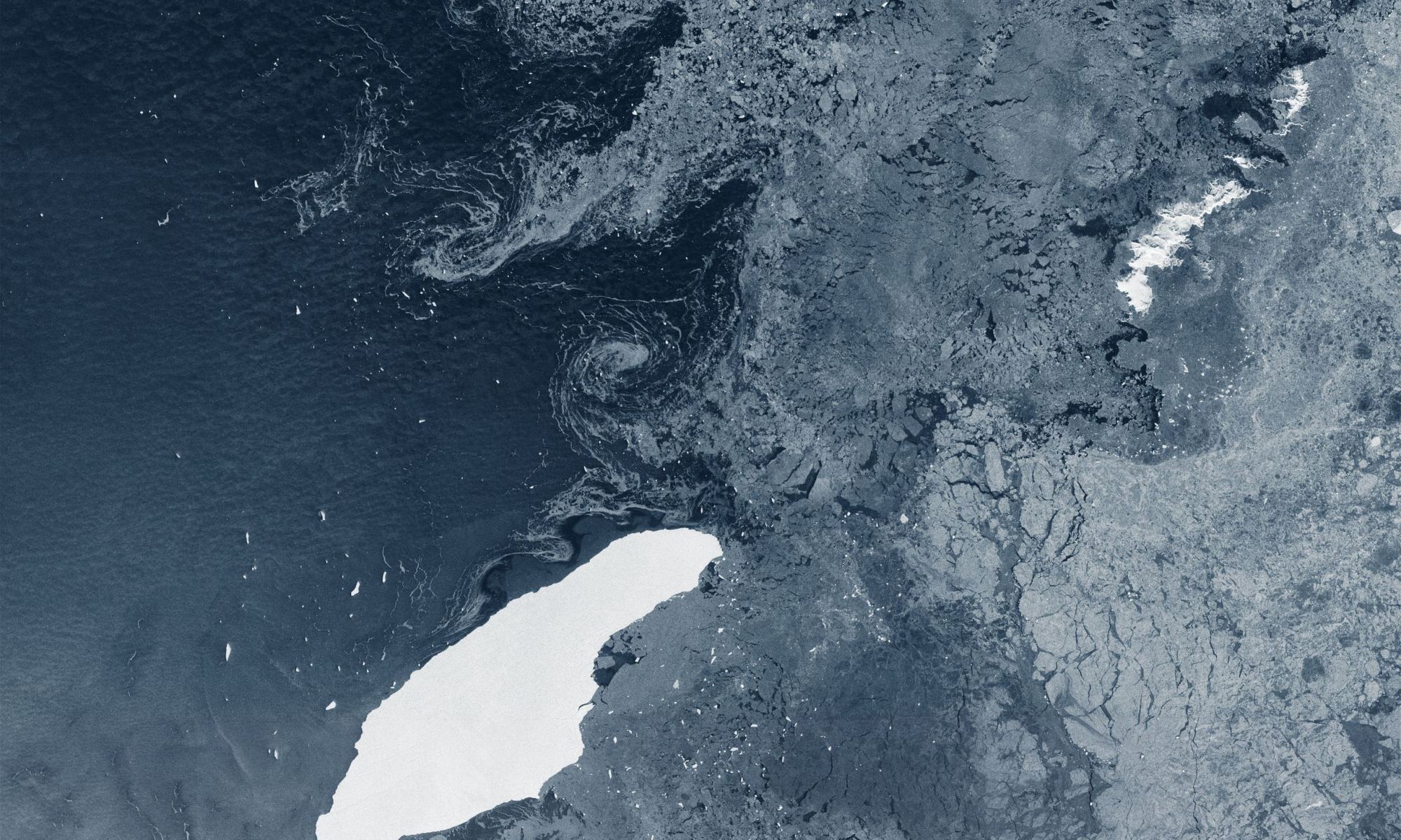
The iceberg A-68A floating in open waters about 1050 km from its birthplace. It's been floating for three years. Image Credit: contains modified Copernicus Sentinel data (2020), processed by ESA, CC BY-SA 3.0 IGO

A massive iceberg named A-68A is on a long journey through the seas near Antarctica. Though largely empty, those waters do host some islands, most notably South Georgia Island. In recent weeks satellite images showed the iceberg heading right for South Georgia.

That upcoming collision could have devastating consequences for wildlife that congregates on the island. But now, it looks like the collision might not happen.

Continue reading “Iceberg A-68A is Turning. Will it Miss South Georgia Island After All?”

An Iceberg the Size of South Georgia Island is on a Collision Course with… South Georgia Island

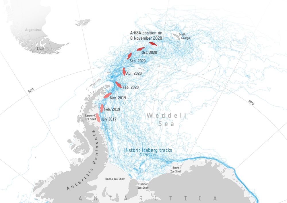
An iceberg the size of South Georgia Island is on a collision course with... South Georgia Island. Image Credit: contains modified Copernicus Sentinel data (2017–20), processed by ESA; Antarctic Iceberg Tracking Database

Back in July 2017, satellites watched as an enormous iceberg broke free from Antarctica’s Larsen C ice shelf on the Antarctic Peninsula. The trillion-ton behemoth has been drifting for over three years now. While it stayed close to its parent ice shelf for the first couple of years, it’s now heading directly for a collision with South Georgia Island.

It could be a slow-motion collision, but a collision nonetheless. If it does collide with the island and its shallow sea-floor, it won’t be the first iceberg to do so. And if the first one was any indication, wildlife could suffer.

Continue reading “An Iceberg the Size of South Georgia Island is on a Collision Course with… South Georgia Island”

This is the View You Get Staring out of the Space Station’s Cupola Module

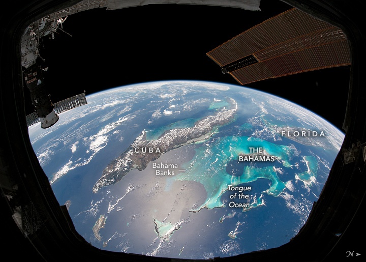
Clouds trace out the islands of the Caribbean Sea in this photo taken by an astronaut from inside the Cupola on the International Space Station. Credit NASA/NASA Earth Observatory.

Those lucky few who have the incredible opportunity to see the Earth from space often report the view gives them a sense of awe, unity and clarity. This perspective-altering experience has come to be known as the Overview Effect, from a book by the same name published 1987 by space philosopher Frank White.

Continue reading “This is the View You Get Staring out of the Space Station’s Cupola Module”

Earth Observation Satellites Could be Flown Much Lower than Current Altitudes and Do Better Science

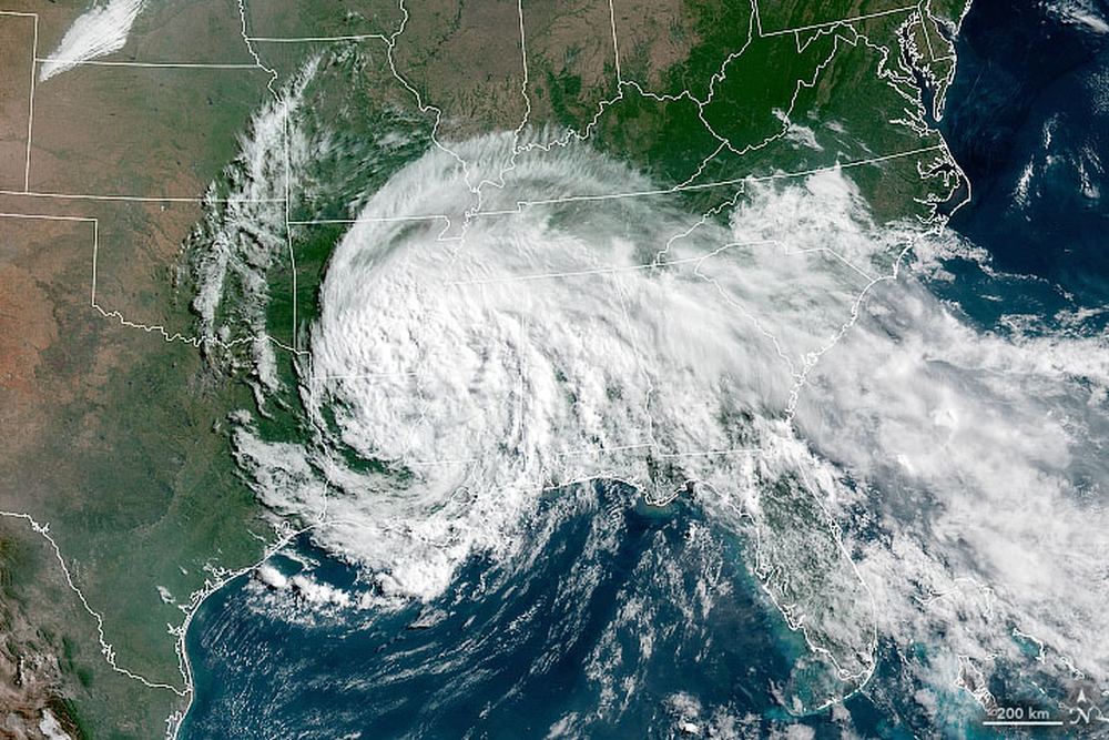
A satellite image of Tropical Depression Cristobal over the US. Image Credit: NASA Earth Observatory.

Satellite engineers know what every photographer knows: get close to your subject to get better pictures. Not just visible light pictures, but all across the spectrum. The lower altitude also improves things like radar, lidar, communications, and gps.

But when your subject is Earth, and Earth is surrounded by an atmosphere, getting closer is a delicate dance with physics. The closer a satellite gets to Earth, the more atmospheric drag it encounters. And that can mean an unscheduled plummet to destruction for Earth-Observing (EO) satellites.

Continue reading “Earth Observation Satellites Could be Flown Much Lower than Current Altitudes and Do Better Science”

Dust Seen Streaming Out of Namibia Into the Atlantic Ocean

Landsat 8 strikes again.

Landsat 8 is the United States Geological Survey’s most recently launched satellite, and it holds the powerful Operational Land Imager (OLI.) The OLI is a powerful multi-spectral imager with a wide dynamic range.

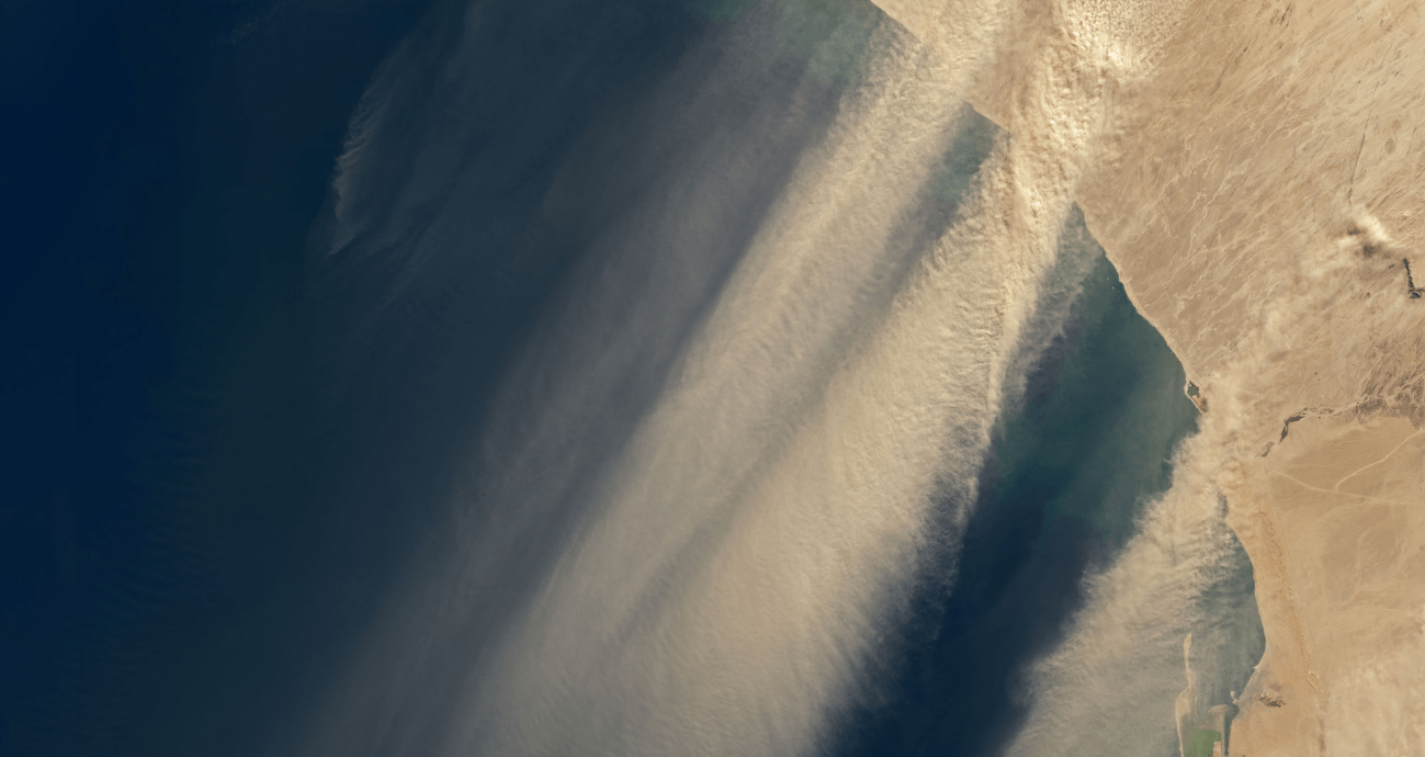
The OLI does a great job of keeping an eye on Earth, and now its captured images of winds in Namibia picking dust up and carrying it out over the Atlantic Ocean.

Continue reading “Dust Seen Streaming Out of Namibia Into the Atlantic Ocean”

Mount Everest, Seen from Space!

Mount Everest, as seen from the International Space Station. Picture taken by cosmonaut Oleg Artemyev.

One under-appreciated space asset is the photography skills of the Russian cosmonauts on board the International Space Station. They are extremely skillful photographers who don’t get the same recognition as their astronaut counterparts in their Earth observation skills. In particular, they have taken some stunning high-oblique shots of objects close to the horizon, with almost an 3-D effect.

Continue reading “Mount Everest, Seen from Space!”

Watch the Incredible Plume of Dust from Africa Cross the Entire Atlantic Ocean

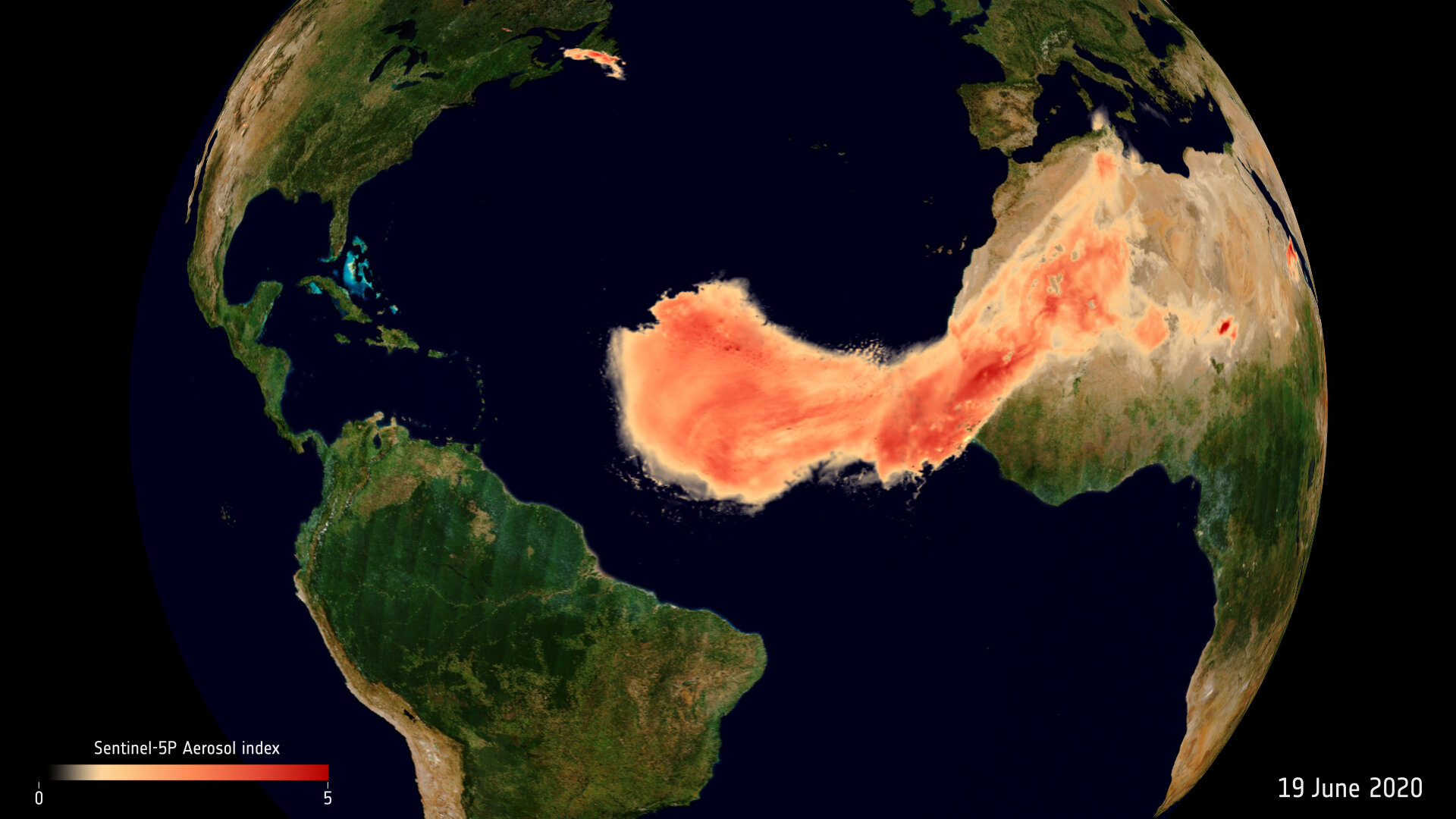
The Saharan dust plume over the Atlantic Ocean. Image Credit: contains modified Copernicus Sentinel data (2020), processed by ESA, CC BY-SA 3.0 IGO

Dust plumes are a natural phenomena, part of Earth’s nutrient cycle. They occur when high-velocity winds pick up tiny dry particles from the Earth’s surface and carry them long distances. Every summer, dust plumes from Africa’s Sahara desert travel across the Atlantic Ocean.

They’re usually not this big, and they often sink into the ocean. But this one’s coming right to America.

Continue reading “Watch the Incredible Plume of Dust from Africa Cross the Entire Atlantic Ocean”

This Giant Iceberg Has Been Sailing the Southern Seas for Three Years Now

The iceberg A-68A floating in open waters about 1050 km from its birthplace. It's been floating for three years. Image Credit: contains modified Copernicus Sentinel data (2020), processed by ESA, CC BY-SA 3.0 IGO

An iceberg that calved off of from a larger ice formation has spent three years floating on the ocean near Antarctica. The iceberg broke off of the Larsen Ice Shelf in mid-July 2017. It’s been battered and split up into three pieces, but it’s still going.

Continue reading “This Giant Iceberg Has Been Sailing the Southern Seas for Three Years Now”