40 Years Ago, Mount St. Helens Blew its Top Off

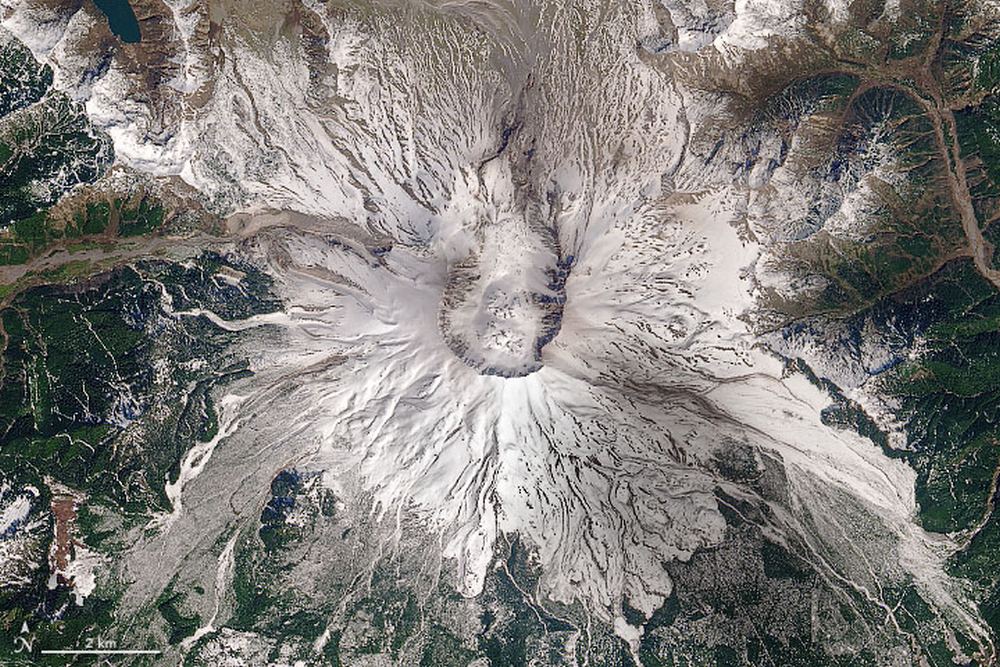
Mt. St. Helens in May, 2020, in an image from the Operational Land Imager (OLI) on LandSat8. Image Credit: Joshua Stevens, Robert Simmon, and Jesse Allen, using Landsat data from the U.S. Geological Survey.

One day, my Grade Nine science class got way more interesting.

Suddenly, volcanoes weren’t just something in textbooks. Though I was in neighbouring British Columbia when Mt. St. Helens erupted, there was still a layer of ash on our cars and everything else. For a teenager with a burgeoning interest in science, it was awesome.

Continue reading “40 Years Ago, Mount St. Helens Blew its Top Off”
New Data Show How Phytoplankton Pumps Carbon Out of the Atmosphere at an Enormous Scale

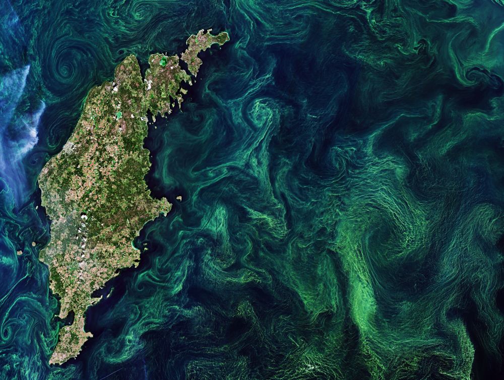
One of the most fascinating things about planet Earth is the way that life shapes the Earth and the Earth shapes life. We only have to look back to the Great Oxygenation Event (GOE) of 2.4 billion years ago to see how lifeforms have shaped the Earth. In that event, phytoplanktons called cyanobacteria pumped the atmosphere with oxygen, extinguishing most life on Earth, and paving the way for the development of multicellular life.

Early Earth satisfied the initial conditions for life to appear, and now, lifeforms shape the atmosphere, the landscape, and the oceans in many different ways.

At the base of many of these changes is phytoplankton.

Continue reading “New Data Show How Phytoplankton Pumps Carbon Out of the Atmosphere at an Enormous Scale”

Anak Krakatau Erupted a Few Days Ago. Here’s What it Looked Like From Space

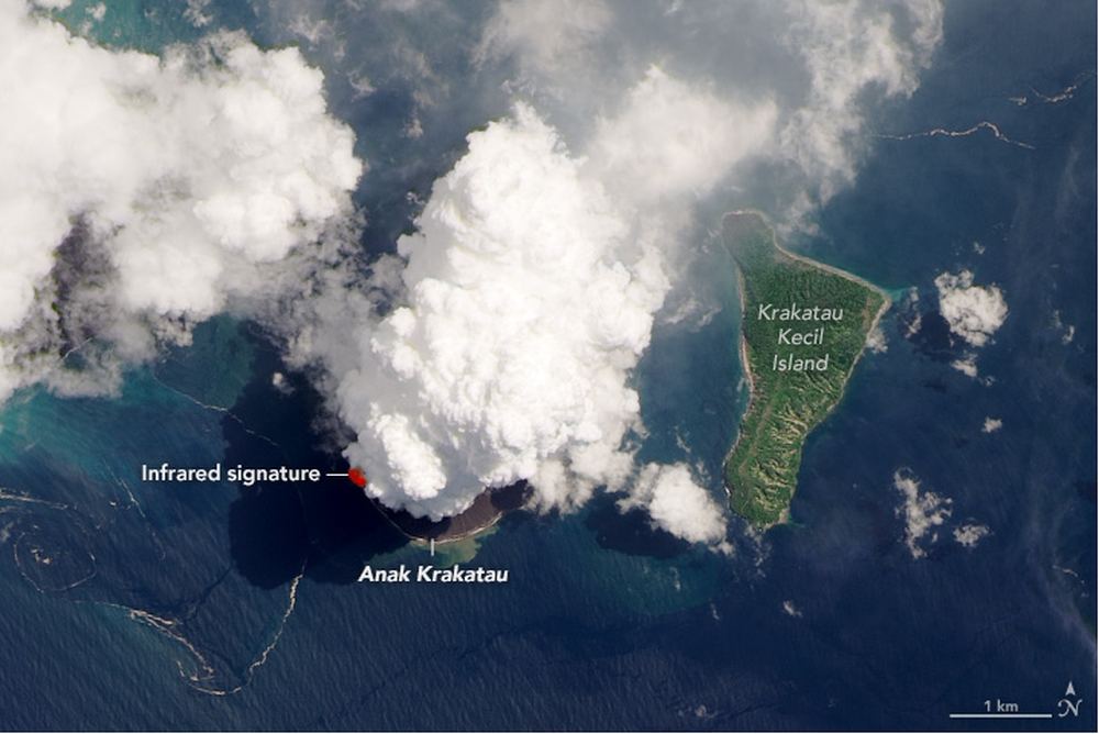
Plumes rise from Anak Krakatau on April 13th 2020 in this LandSat 8 OLI image. Image Credit: NASA Earth Observatory image by Lauren Dauphin, using Landsat data from the U.S. Geological Survey.

In between the Indonesian islands of Java and Sumatra lies the Sunda Strait. And in the Sunda Strait lies the much smaller island of Anak Krakatau, one of Earth’s active volcanoes. It’s erupted more than 50 times in the past 2,000 years, and now it’s doing it again.

Continue reading “Anak Krakatau Erupted a Few Days Ago. Here’s What it Looked Like From Space”

Venice From Space Looks Very Different This Year

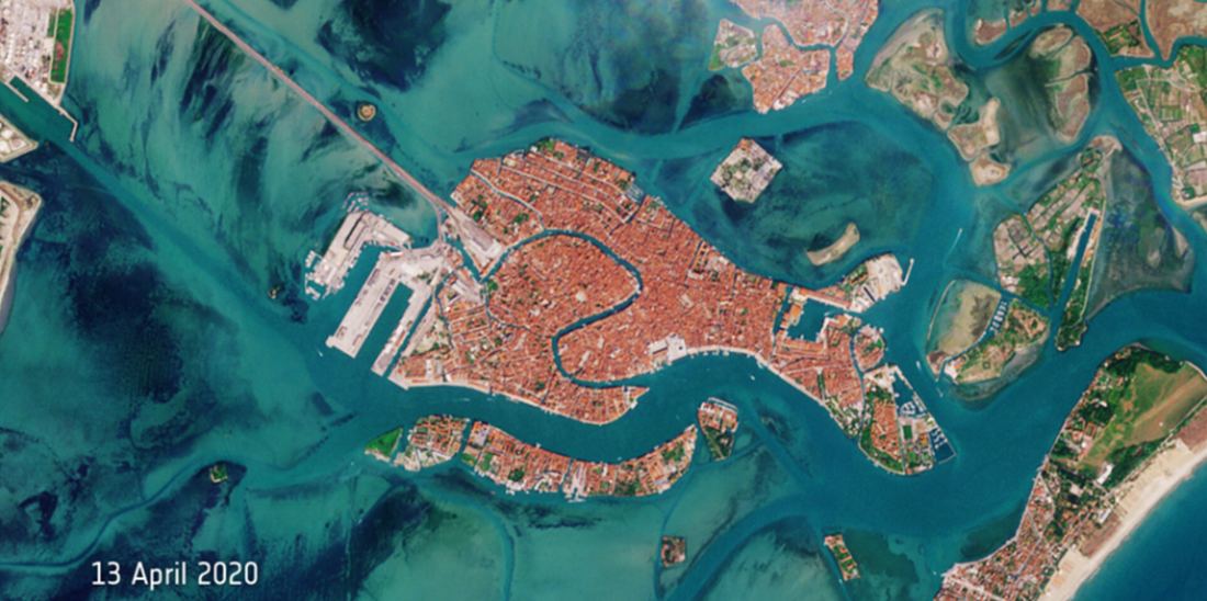
The Venetian Lagoon is deserted during the Coronavirus pandemic shutdown. Image Credit: contains modified Copernicus Sentinel data (2019-20), processed by ESA, CC BY-SA 3.0 IGO

The Coronavirus shutdown has given us an unprecedented opportunity to look at our civilization a little differently. We all have our own ground-level view of life during this pandemic, but our satellites are giving us another look at this Earthly pause on a grand scale. The latest view comes from the European Space Agency’s Copernicus Sentinel-2 mission.

Continue reading “Venice From Space Looks Very Different This Year”

As Temperatures Increase, Forests are Having More Trouble Soaking up Carbon

Envisat image, acquired on 14 January 2009, features the Congo River Basin’s rainforests. Credit: ESA

On Earth, one of the most important factors regulating our climate is the carbon cycle. This refers to the processes by which carbon compounds are sequestered by biological (photosynthesis) and geological processes and released through volcanic activity and organic processes (decay and respiration). For billions of years, this cycle has kept temperatures relatively stable on Earth and allowed for life to flourish.

For the past few centuries, human activity has tipped the scales to the point that some refer to the current geological epoch as the Anthropocene. According to a new study by an international team of researchers, human activity is also leading to a situation where tropical rainforests (a major sequester of carbon dioxide) are not only losing their ability to soak up carbon but could actually be adding to the problem in the coming years.

Continue reading “As Temperatures Increase, Forests are Having More Trouble Soaking up Carbon”

Phew, Earth-Watching DSCOVR is Operational Again

Image of Earth from 2020, over the South Pacific Ocean from the EPIC camera on the DSCOVR satellite. Many things affect Earth's albedo, including clouds, snow cover, and vegetation. How does exoplanet vegetation affect albedo and climate? Credit: NASA/NOAA

Rejoice! If you’ve missed your daily fix of seeing views of our rotating Earth from space, NOAA announced that its Deep Space Climate Observatory (DSCOVR) is now back in action. The deep space satellite, which produces incredible full-disk images of our Blue Marble, has been offline since June 27, 2019 because of a problem with the spacecraft’s attitude control system. But NOAA and NASA engineers developed and uploaded a software patch to restore DSCOVR’s operations.

Continue reading “Phew, Earth-Watching DSCOVR is Operational Again”

North and South America, At Night

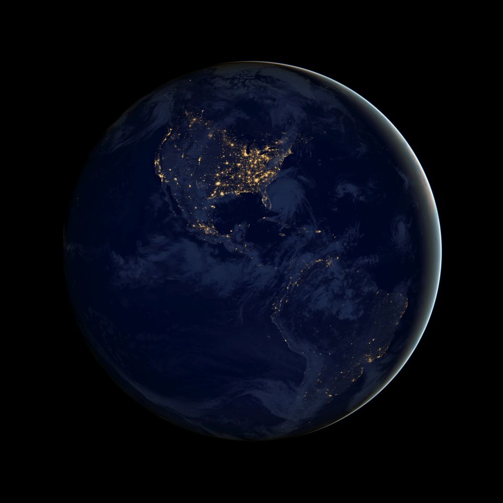
Composite image of the Americas at night from the Suomi NPP satellite. Image Credit: NASA

Along with all of their space-exploration, planet-hunting, and astronomy-based endeavours, NASA also keeps a very keen eye on Earth. In fact, they have 18 satellites whose job it is to look only at Earth. And those 18 advanced satellites are helping us understand Earth in unprecedented scientific detail.

And they take pretty pictures, too.

Continue reading “North and South America, At Night”

A Brand New Island in the Pacific has Survived 5 Years

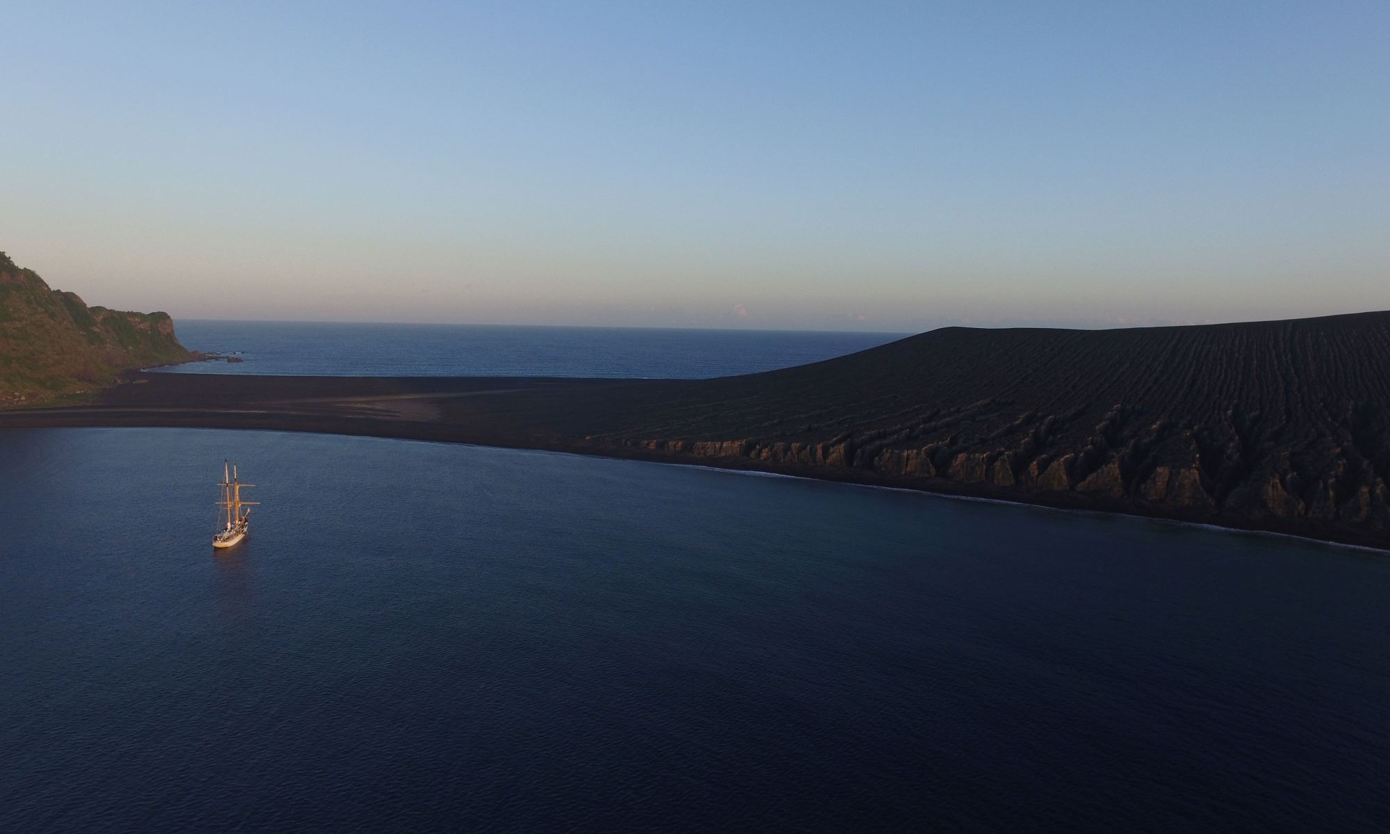
Hunga Tonga-Hunga Ha‘apai with the ship SSV Robert C. Seamans. Image Credit: Captain Chris Nolan (Sea Education Association) of the SSV Robert C. Seamans (Oct. 2019).

A surtseyan eruption is a volcanic eruption in shallow water. It’s named after the island Surtsey, off the coast of iceland. In 2015, a surtseyan eruption in the Tongan Archipelago created the island Hunga Tonga-Hunga Ha‘apai. Despite the odds, that island is still there almost five years later.

Continue reading “A Brand New Island in the Pacific has Survived 5 Years”