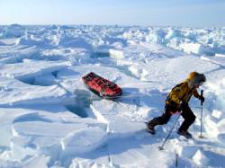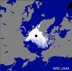
Sometimes you wish records didn’t get broken. A group of Japanese science agencies announced today that the area of the Arctic Sea covered by ice is at its lowest level ever recorded. It reached this low point on August 15th, and it’s going to get worse. Ice levels should continue to shrink all the way through mid-September. If reality matches predictions, the ice levels will reach IPCC predictions 40 years ahead of schedule.
On August 15th, 2007 the area of Arctic sea ice was 5.31 million square km (2.1 million square miles). This beats the previous record of 5.32 million seen back in September 2005. That might sound like it’s almost the same amount, but just you wait, ice is expected to continue shrinking until mid-September, getting as small as 4.5 million square km.
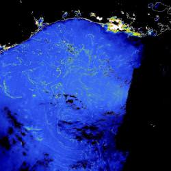
These results were announced today by the Japan Agency for Marine-Earth Science and Technology (JAMSTEC) and the Japan Aerospace Exploration Agency (JAXA), which have been tracking Arctic ice levels by satellite since 1978. By their calculation, an amount of ice equal to the Japanese archipelago has been lost in just the last 3 years.
According to the Japanese agencies, there could be several reasons why the ice levels are so low this year. One explanation is that ice in coastal areas which is more prone to melting could have entered the Arctic Sea. It’s also possible that melting within the Arctic Sea has quickened – thanks to global warming – and is leading to the ocean absorbing more sunlight. Finally, they suggest that more sea ice could have drifted from the Arctic Sea to the warmer Atlantic Ocean and melted.
Here’s the scary part. The United Nations Intergovernmental Panel on Climate Change predicted that this level of ice coverage would be met in 2050. I’ll say that again, Arctic ice will reach levels predicted for 2050 by the end of this summer. I wonder what the levels will be in 2050?
Here’s what one official had to say about the IPCC predictions:
The IPCC forecast cannot adequately explain what is now happening in the Arctic Sea.
Original Source: JAXA News Release