Time-lapse Captured from the International Space Station

Time lapse photography from astronaut Christina Koch aboard the ISS. Image Credit: ISS Crew Earth Observations Facility and the Earth Science and Remote Sensing Unit.

400 photos. 11 minutes. That’s what it took to create this time-lapse of the Earth and stars as the International Space Station over Namibia toward the Red Sea. NASA astronaut Christina Koch captured these images.

Continue reading “Time-lapse Captured from the International Space Station”

Thanks to Trump, We’ve Got a Better Idea of the Capabilities of US Surveillance Satellites

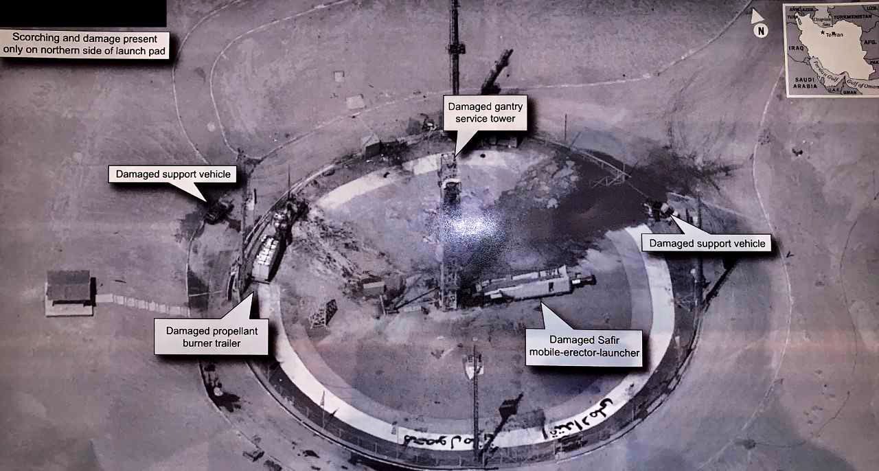
Trump tweeted this image from an American recon satellite whose imaging capabilities were being kept secret. It shows the aftermath of a failed rocket launch attempt at Iran's Imam Khomeini Space Center. Image Credit: NSA? (maybe)

The US President has done it again.

Just when you think things can’t get any more—”unusual”— in the White House, the President has Tweeted an American spy satellite image as part of a juvenile jab at Iranian leadership. After some sleuthing, astronomers were able to figure out which satellite it came from: a (formerly) top-secret satellite called USA 224, an optical reconnaissance satellite.

Continue reading “Thanks to Trump, We’ve Got a Better Idea of the Capabilities of US Surveillance Satellites”

There’s A Fire in Greenland… Again. It’s 10 Degrees Hotter Than Normal

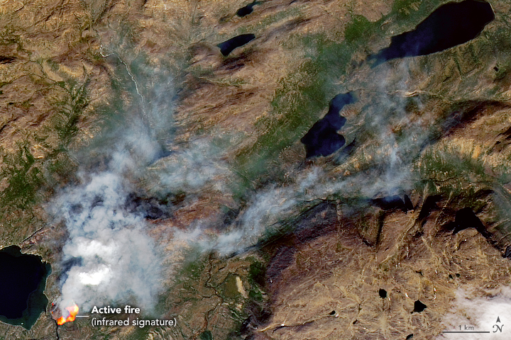
This fire in Greenland is near Sisimiut, in Western Greenland. It was likely caused by a hiker. Image Credit: NASA Earth Observatory

As global warming ramps up, expect to see Greenland in the news a lot. That’s because its ice sheet is under threat of melting. But that’s not the only reason. The other reason is fire.

Continue reading “There’s A Fire in Greenland… Again. It’s 10 Degrees Hotter Than Normal”

Eruption of the Raikoke Volcano, Seen From Space

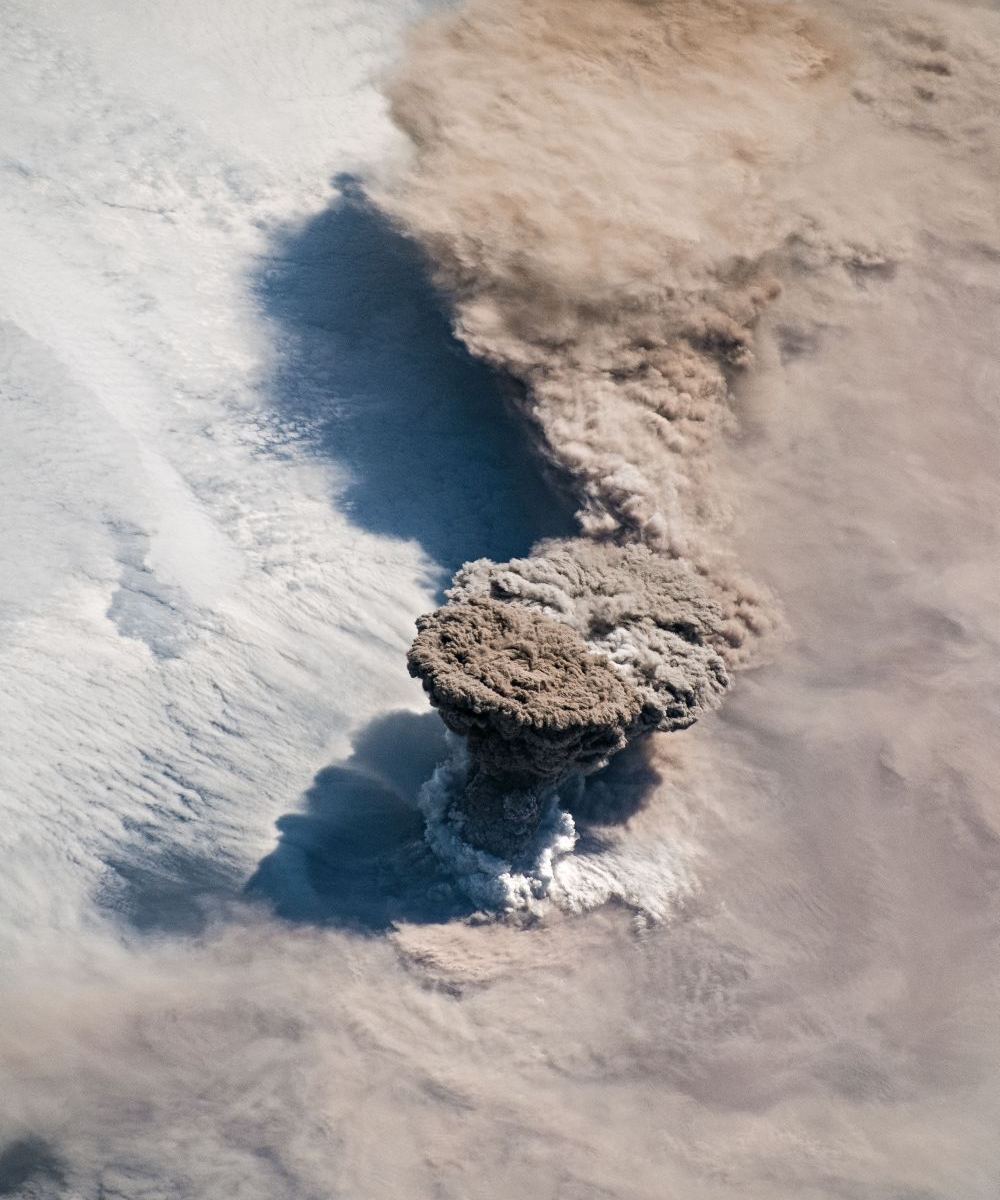
The Raikoke Volcano erupting on June 22nd, as imaged by NASA astronauts on the ISS. Image Credit: NASA

The Raikoke Volcano, dormant for a very long time, has awoken from its slumber. The volcanic island is in the Kuril Island chain, near the Kamchatka Peninsula in Russia. Unlike its more volcanically active neighbours, Raikoke has been dormant since 1924.

Thanks to astronauts on the International Space Station, we have gorgeous photos of the eruption.

Continue reading “Eruption of the Raikoke Volcano, Seen From Space”

The World’s Glaciers are Down by 9 Trillion Tonnes of Ice in the Last Half Century

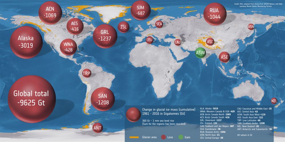
This graphic shows the change in cumulative ice mass over the last 50 years in different glacial regions on Earth. Image Credit: ESA, adapted from Zemp et al. (2019) Nature, and data courtesy of World Glacier Monitoring Service

Things are not looking good for Earth’s glaciers. Usually, when it comes to climate change and melting ice, we think of the Earth’s polar regions. But they’re not the only important ice formations, and they’re not the only ice that’s melting due to climate change.

Continue reading “The World’s Glaciers are Down by 9 Trillion Tonnes of Ice in the Last Half Century”

Huge Asteroid Impact Crater Found Just Under the Ice in Greenland

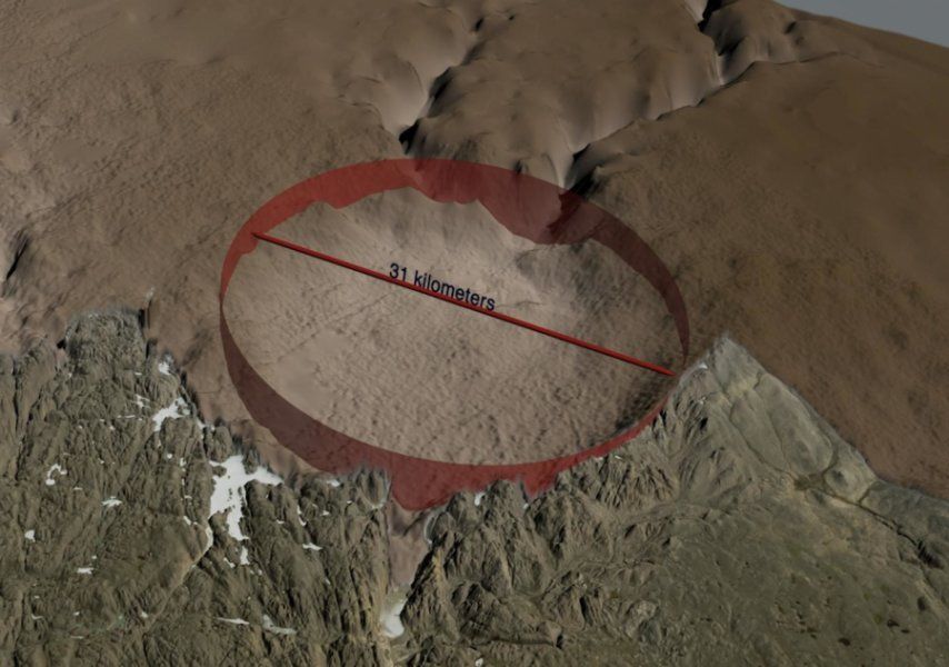
The newly-discovered crater is 31 km. across, larger than Paris. Image: NASA's Goddard Space Flight Center.

An international team of scientists have discovered what lay hidden under Arctic ice for thousands or even hundreds of thousands of years. Using data primarily from NASA’s Operation IceBridge, they discovered one of the 25 largest impact craters anywhere on Earth. And its discovery may re-ignite an old climate debate.

Continue reading “Huge Asteroid Impact Crater Found Just Under the Ice in Greenland”

That Rectangular Iceberg Took a Long, Hazardous Journey

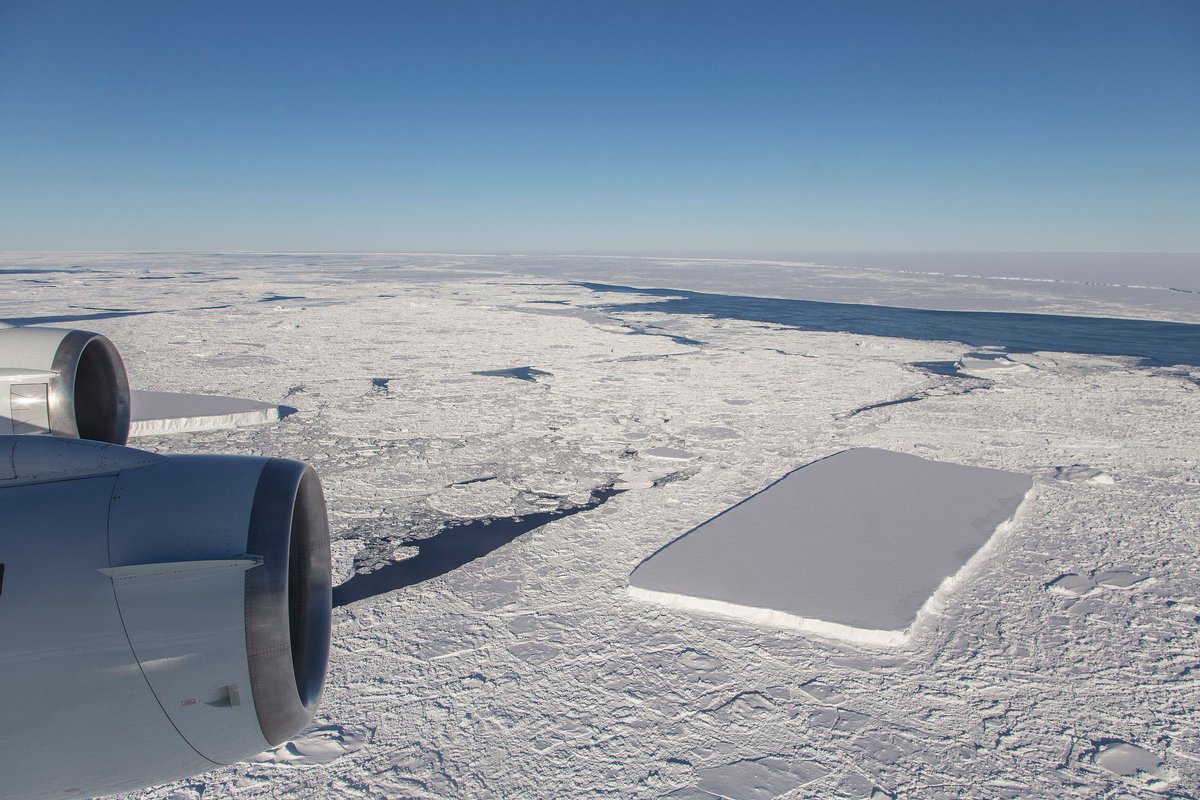
The rectangular iceberg spotted in mid-October had a much longer and more perilous journey than we thought. Image Credit: NASA/Jeremy Harbeck

That stunning rectangular iceberg that was photographed in mid-October by NASA scientist Jeremy Harbeck had a much more harrowing journey than we thought. Scientists looked back through satellite images to retrace the ‘berg’s journey. They found that it calved from the Larsen C Ice Shelf in November 2017.

Continue reading “That Rectangular Iceberg Took a Long, Hazardous Journey”

This is What Icebergs Look Like at the End of Their Lives. This One’s 18 Years Old

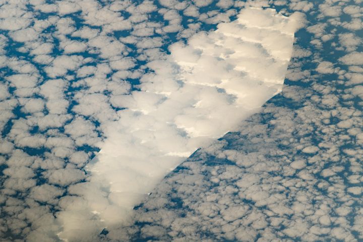
The coffin-shaped iceberg B-15T is drifting to its death after 18 years of "life." Image Credit: NASA/Jeremy Harbeck.

Nothing lasts forever, especially an iceberg drifting away from its frigid home. This coffin-shaped iceberg was spotted by astronauts on the International Space Station as it drifted northwards. It split off from a much larger iceberg about 18 years ago, and is moving into warmer and warmer waters.

Continue reading “This is What Icebergs Look Like at the End of Their Lives. This One’s 18 Years Old”

You’ve Got to Watch this Stunning NASA Video of Arctic Sea Ice. Now at its Lowest Levels

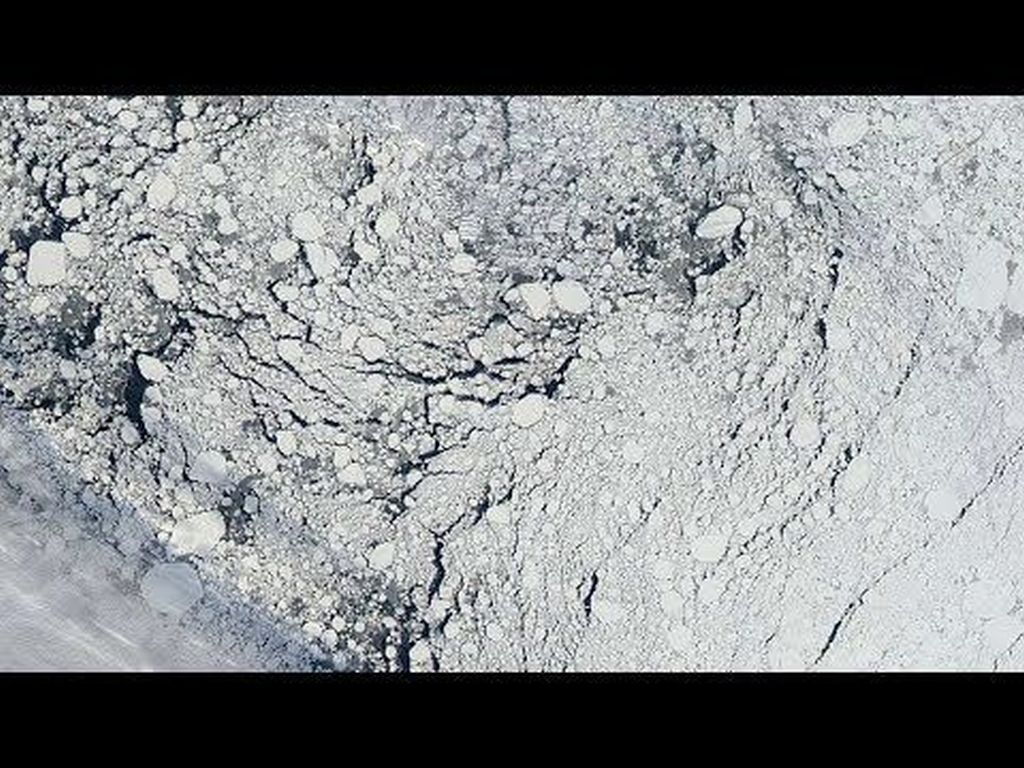
Arctic sea ice. Image: NASA

Arctic sea ice is getting thinner and younger. Satellite data and sonar records from submarines show how the ice coverage in the north is getting more and more seasonal. In the past, ice would build up year over year, getting thicker and stronger. But seasonal ice disappears each summer, meaning more open ocean in the summer, and less of the Sun’s energy being reflected back into space.

Continue reading “You’ve Got to Watch this Stunning NASA Video of Arctic Sea Ice. Now at its Lowest Levels”

NASA Tests a Tiny Satellite to Track Extreme Weather and Storms

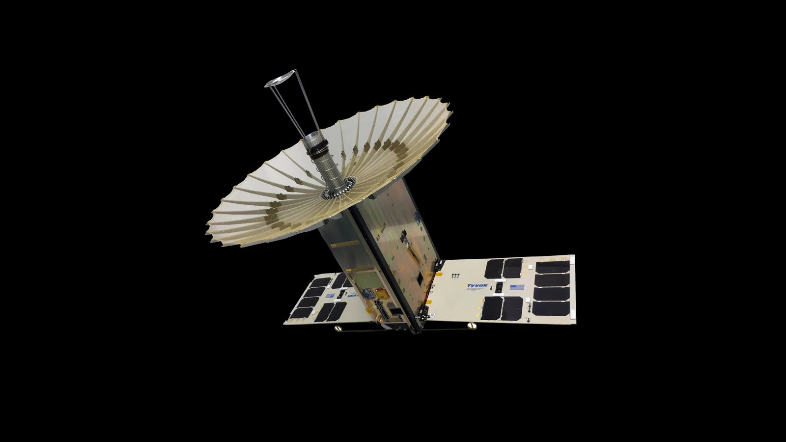
The RainCube 6U CubeSat with fully-deployed antenna. Credit: NASA/JPL-Caltech

Weather tracking is difficult work, and has historically relied on satellites that are large and cost millions of dollars to launch into space. And with the threat of climate change making things like tropical storms, tornadoes and other weather events more violent around the world today, people are increasingly reliant on early warnings and real-time monitoring.

However, NASA is looking to change that by deploying a new breed of weather satellite that takes advantage of recent advances in miniaturization. This class of satellite is known as the RainCube (Radar in CubeSat), which uses experimental technology to see storms by detecting rain and snow using very small and sophisticated instruments.

Continue reading “NASA Tests a Tiny Satellite to Track Extreme Weather and Storms”