NASA’s Magnetospheric Multiscale (MMS) Spacecraft Set for March Blastoff to study Earth’s Magnetic Reconnection Events

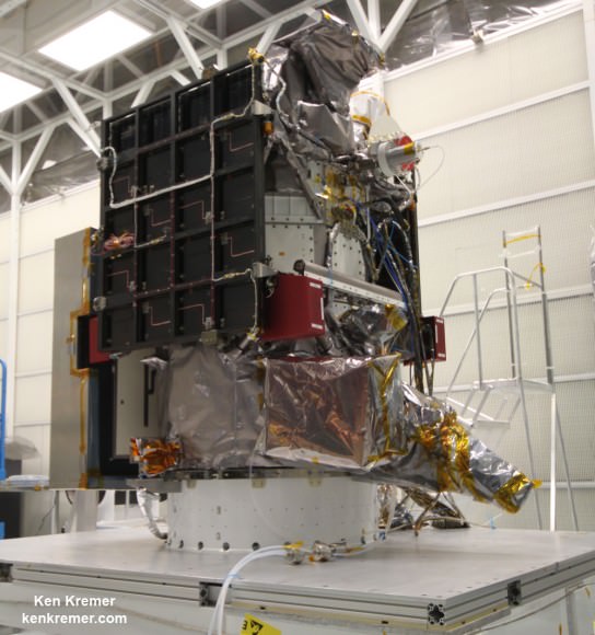
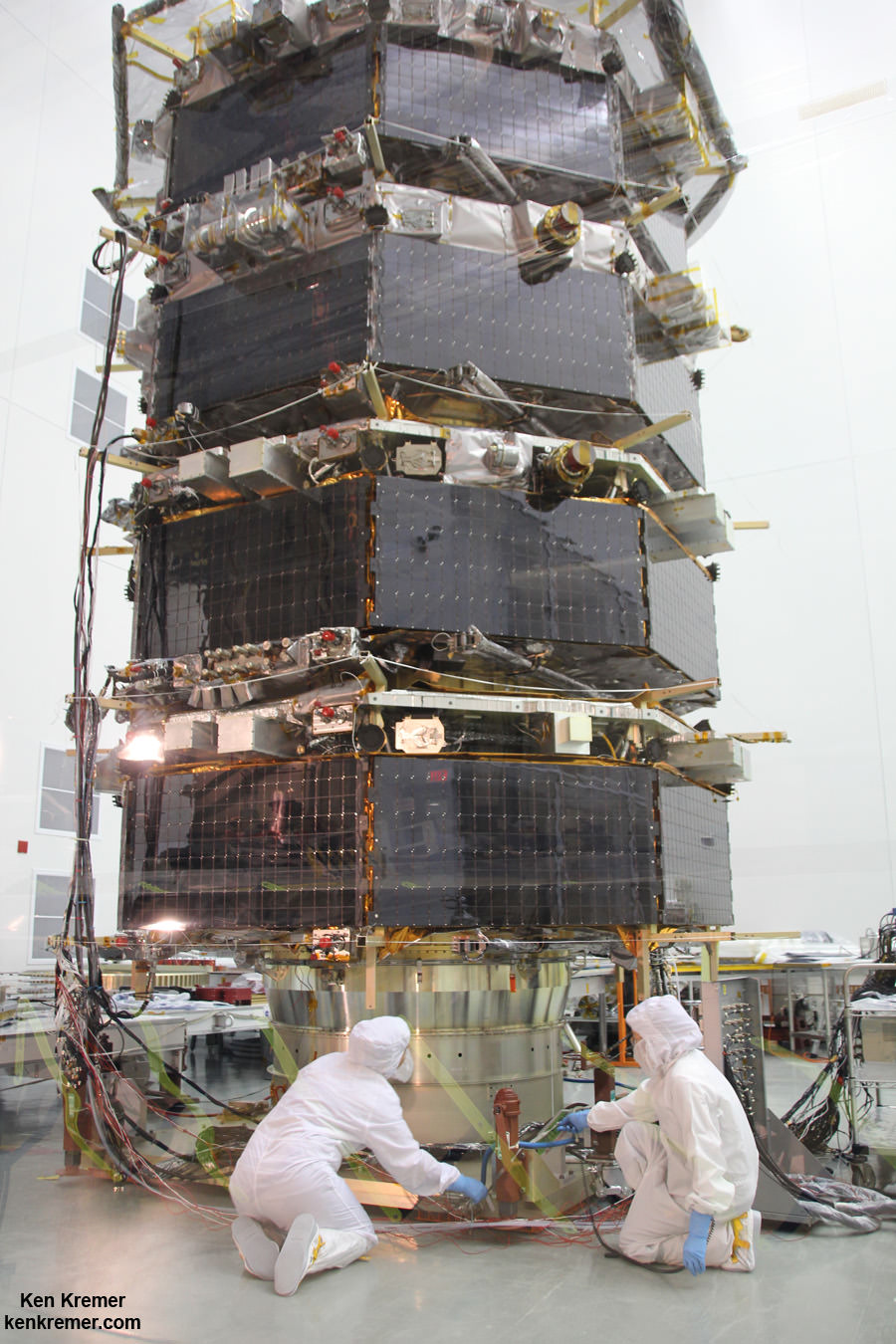
Technicians work on NASA’s 20-foot-tall Magnetospheric Multiscale (MMS) mated quartet of stacked observatories in the cleanroom at NASA's Goddard Space Flight Center in Greenbelt, Md., on May 12, 2014. Credit: Ken Kremer- kenkremer.com

NASA’s first mission dedicated to study the process in nature known as magnetic reconnection undergoing final preparation for launch from Cape Canaveral, Florida in just under two weeks time.

The Magnetospheric Multiscale (MMS) mission is comprised of a quartet of identically instrumented observatories aimed at providing the first three-dimensional views of a fundamental process in nature known as magnetic reconnection.

Magnetic reconnection is the process whereby magnetic fields around Earth connect and disconnect while explosively releasing vast amounts of energy. It occurs throughout the universe.

“Magnetic reconnection is one of the most important drivers of space weather events,” said Jeff Newmark, interim director of the Heliophysics Division at NASA Headquarters in Washington.

“Eruptive solar flares, coronal mass ejections, and geomagnetic storms all involve the release, through reconnection, of energy stored in magnetic fields. Space weather events can affect modern technological systems such as communications networks, GPS navigation, and electrical power grids.”

The four MMS have been stacked on top of one another like pancakes, encapsulated in the payload fairing, transported to the launch pad, hoisted and mated to the top of the 195-foot-tall rocket.
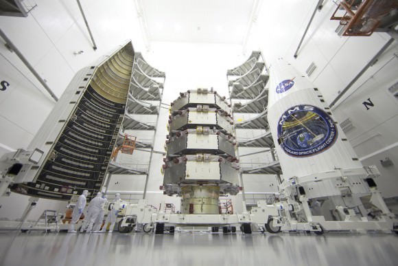
NASA's Magnetospheric Multiscale (MMS) observatories are shown here in the clean room being processed for a March 12, 2015 launch from Space Launch Complex 41 on Cape Canaveral Air Force Station, Florida.  Credit: NASA/Ben Smegelsky
NASA’s Magnetospheric Multiscale (MMS) observatories are shown here in the clean room being processed for a March 12, 2015 launch from Space Launch Complex 41 on Cape Canaveral Air Force Station, Florida. Credit: NASA/Ben Smegelsky

The nighttime launch of MMS on a United Launch Alliance Atlas V rocket should put on a spectacular sky show for local spectators along the Florida space coast as well as more distant located arcing out in all directions.

Liftoff is slated for 10:44 p.m. EDT Thursday March 12 from Space Launch Complex 41 on Cape Canaveral Air Force Station, Florida.

The launch window extends for 30 minutes.
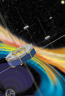
Artist rendition of the four MMS spacecraft in orbit in Earth’s magnetic field. Credit: NASA

After a six month check out phase the probes will start science operation in September.

Unlike previous missions to observe the evidence of magnetic reconnection events, MMS will have sufficient resolution to measure the characteristics of ongoing reconnection events as they occur.

The four probes were built in-house by NASA at the agency’s Goddard Space Flight Center in Greenbelt, Maryland where is visited them during an inspection tour by NASA Administrator Charles Bolden.

I asked Bolden to explain the goals of MMS during a one-on-one interview.

“MMS will help us study the phenomena known as magnetic reconnection and help us understand how energy from the sun – magnetic and otherwise – affects our own life here on Earth,” Bolden told Universe Today.

“MMS will study what effects that process … and how the magnetosphere protects Earth.”

MMS measurements should lead to significant improvements in models for yielding better predictions of space weather and thereby the resulting impacts for life here on Earth as well as for humans aboard the ISS and robotic satellite explorers in orbit and the heavens beyond.
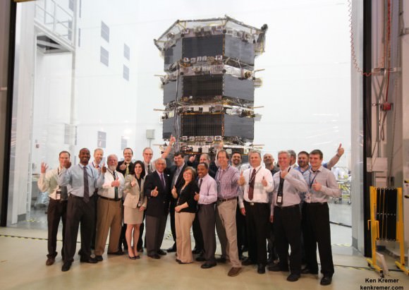
NASA Administrator Charles Bolden poses with the agency’s Magnetospheric Multiscale (MMS) spacecraft, mission personnel, Goddard Center Director Chris Scolese and NASA Associate Administrator John Grunsfeld, during visit to the cleanroom at NASA's Goddard Space Flight Center in Greenbelt, Md., on May 12, 2014.  Credit: Ken Kremer- kenkremer.com
NASA Administrator Charles Bolden poses with the agency’s Magnetospheric Multiscale (MMS) spacecraft, mission personnel, Goddard Center Director Chris Scolese and NASA Associate Administrator John Grunsfeld, during visit to the cleanroom at NASA’s Goddard Space Flight Center in Greenbelt, Md., on May 12, 2014. Credit: Ken Kremer- kenkremer.com

The best place to study magnetic reconnection is ‘in situ’ in Earth’s magnetosphere. This will lead to better predictions of space weather phenomena.

“This is the perfect time for this mission,” said Jim Burch, principal investigator of the MMS instrument suite science team at Southwest Research Institute (SwRI) in San Antonio, Texas.

“MMS is a crucial next step in advancing the science of magnetic reconnection. Studying magnetic reconnection near Earth will unlock the ability to understand how this process works throughout the entire universe.”

Magnetic reconnection is also believed to help trigger the spectacular aurora known as the Northern or Southern lights.

MMS is a Solar Terrestrial Probes Program, or STP, mission within NASA’s Heliophysics Division.

Watch for Ken’s ongoing MMS coverage and he’ll be onsite at the Kennedy Space Center in the days leading up to the launch on March 12.

Stay tuned here for Ken’s continuing MMS, Earth and planetary science and human spaceflight news.

Ken Kremer
………….
Learn more about MMS, Mars rovers, Orion, SpaceX, Antares, NASA missions and more at Ken’s upcoming outreach events:

Mar 6: “MMS Update, Future of NASA Human Spaceflight, Curiosity on Mars,” Delaware Valley Astronomers Assoc (DVAA), Radnor, PA, 7 PM.

Mar 10-12: “MMS, Orion, SpaceX, Antares, Curiosity Explores Mars,” Kennedy Space Center Quality Inn, Titusville, FL, evenings

Incredible “Birdman”-like Tracking-Shot Timelapse of Earth from Space

The Academy Award winning film “Birdman” used what’s called tracking shot to create the sense of a seamless one-shot film. A new timelapse created from imagery captured by astronauts on the International Space Station uses the same technique — which has not been used in previous ISS timelapses — with stunning results. Additionally, the footage is very recent, from January and February 2015. It was compiled by Phil Selmes.

“The footage has been composited and edited to show enhanced camera movement, a day to night transition, and an uninterrupted camera movement which links two timelapse shots seamlessly,” Selmes told Universe Today. “These processes have never been used to present ISS time lapse footage in this way before.”
Continue reading “Incredible “Birdman”-like Tracking-Shot Timelapse of Earth from Space”

25 Years Since Voyager’s ‘Pale Blue Dot’ Images

These six narrow-angle color images were made from the first ever "portrait" of the solar system taken by Voyager 1 on Valentine’s Day on Feb. 14, 1990, which was more than 4 billion miles from Earth and about 32 degrees above the ecliptic. Venus, Earth, Jupiter, and Saturn, Uranus, Neptune are seen in these blown-up images, from left to right and top to bottom. Credit: NASA/JPL-Caltech

A quarter of a century has passed since NASA’s Voyager 1 spacecraft snapped the iconic image of Earth known as the “Pale Blue Dot” that shows all of humanity as merely a tiny point of light.

The outward bound Voyager 1 space probe took the ‘pale blue dot’ image of Earth 25 years ago on Valentine’s Day, on Feb. 14, 1990 when it looked back from its unique perch beyond the orbit of Neptune to capture the first ever “portrait” of the solar system from its outer realms.

Voyager 1 was 4 billion miles from Earth, 40 astronomical units (AU) from the sun and about 32 degrees above the ecliptic at that moment.

The idea for the images came from the world famous astronomer Carl Sagan, who was a member of the Voyager imaging team at the time.

He head the idea of pointing the spacecraft back toward its home for a last look as a way to inspire humanity. And to do so before the imaging system was shut down permanently thereafter to repurpose the computer controlling it, save on energy consumption and extend the probes lifetime, because it was so far away from any celestial objects.

Sagan later published a well known and regarded book in 1994 titled “Pale Blue Dot,” that refers to the image of Earth in Voyagers series.

This narrow-angle color image of the Earth, dubbed "Pale Blue Dot," is a part of the first ever "portrait" of the solar system taken by Voyager 1 on Valentine’s Day on Feb. 14, 1990.  Credit: NASA/JPL-Caltech
This narrow-angle color image of the Earth, dubbed “Pale Blue Dot,” is a part of the first ever “portrait” of the solar system taken by Voyager 1 on Valentine’s Day on Feb. 14, 1990. Credit: NASA/JPL-Caltech

“Twenty-five years ago, Voyager 1 looked back toward Earth and saw a ‘pale blue dot,’ ” an image that continues to inspire wonderment about the spot we call home,” said Ed Stone, project scientist for the Voyager mission, based at the California Institute of Technology, Pasadena, in a statement.

Six of the Solar System’s nine known planets at the time were imaged, including Venus, Earth, Jupiter, and Saturn, Uranus, Neptune. The other three didn’t make it in. Mercury was too close to the sun, Mars had too little sunlight and little Pluto was too dim.

Voyager snapped a series of images with its wide angle and narrow angle cameras. Altogether 60 images from the wide angle camera were compiled into the first “solar system mosaic.”

Voyager 1 was launched in 1977 from Cape Canaveral Air Force Station in Florida as part of a twin probe series with Voyager 2. They successfully conducted up close flyby observations of the gas giant outer planets including Jupiter, Saturn, Uranus and Neptune in the 1970s and 1980s.

Both probes still operate today as part of the Voyager Interstellar Mission.

“After taking these images in 1990, we began our interstellar mission. We had no idea how long the spacecraft would last,” Stone said.

Hurtling along at a distance of 130 astronomical units from the sun, Voyager 1 is the farthest human-made object from Earth.

Solar System Portrait - 60 Frame Mosaic. The cameras of Voyager 1 on Feb. 14, 1990, pointed back toward the sun and took a series of pictures of the sun and the planets, making the first ever "portrait" of our solar system as seen from the outside.   Missing are Mercury, Mars and Pluto Credit:  NASA/JPL-Caltech
Solar System Portrait – 60 Frame Mosaic. The cameras of Voyager 1 on Feb. 14, 1990, pointed back toward the sun and took a series of pictures of the sun and the planets, making the first ever “portrait” of our solar system as seen from the outside. Missing are Mercury, Mars and Pluto. Credit: NASA/JPL-Caltech

Voyager 1 still operates today as the first human made instrument to reach interstellar space and continues to forge new frontiers outwards to the unexplored cosmos where no human or robotic emissary as gone before.

Here’s what Sagan wrote in his “Pale Blue Dot” book:

“That’s here. That’s home. That’s us. On it everyone you love, everyone you know, everyone you ever heard of, every human being who ever was, lived out their lives. … There is perhaps no better demonstration of the folly of human conceits than this distant image of our tiny world.”

Stay tuned here for Ken’s continuing Earth and planetary science and human spaceflight news.

Ken Kremer

Black Moon: Why the New Moon on February 18th is Special

Credit and copyright: Frank Miller.

Did you hear the one about last month’s ‘supermoon?’

Yeah, we know. The hype was actually for an event that was less than spectacular, as it revolved around the first New Moon of 2015 on January 20th. Said suspect Moon was touted as ‘super’ (we prefer the quixotic term proxigean) as it occurred 18 hours prior to perigee.

Not that the first lunar perigee of 2015 was an especially close one in time or space at 359,642 kilometres distant. Is every New and Full Moon now destined to become branded ‘super’ in the never ending SEO quest to get eyeballs on web pages?

But wait, there’s more. We’ve noticed as of late that another popular term is creeping into the popular astronomical vernacular: that of a ‘Black Moon’.

Black Moons for the next decade. Created by the author.

We’ve written lots about Moons both of the Black and Blue variety before. We’ll also let you in on a small secret: astronomers rarely sit around observatories discussing these Moons, be they Blue, Black or Super. At most, astronomers note the weeks surrounding New as the ‘Dark of the Moon,’ a prime time to go deep for faint objects while the light polluting Moon is safely out of the sky. And yes, terms such as ‘Super’ or ‘Black Moon’ have dubious roots in astrology, while the term Blue Moon comes down to us via a curious mix-up from Sky and Telescope and the Maine Farmer’s Almanac.

Simply put, a Black Moon is the New Moon version of a Blue Moon, and is either:

  1. A month missing a Full or New Moon… this can only occur in February, as the lunar synodic period from like phase to phase is 29.5 days long. This last occurred in 2014 and will next occur in 2018.
  2. The second New Moon in a month with two. This can happen in any calendar month except February.
  3. And now for the most convoluted definition: the third New Moon in an astronomical season with four.

We bring this up because the February 18th New Moon is ‘Black’ in the sense that it meets the requirements expressed in rule 3. The fourth New Moon of the season falls on March 20th, just 13 hours before the northward equinox on the same date.

Credit: David Blanchflower.
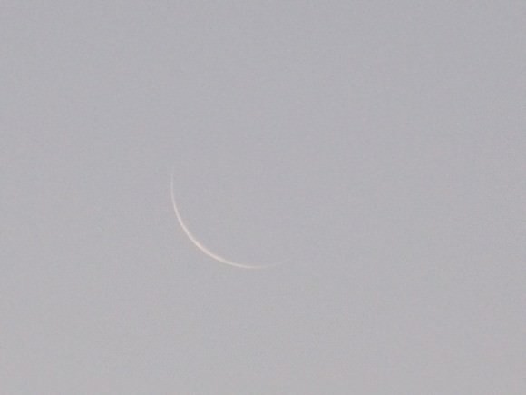
An extremely thin crescent Moon against a low contrast twilight sky. Credit and copyright: David Blanchflower.

Such are the curious vagaries of the juxtaposition of the lunar cycle on our modern day Gregorian calendar. Unfortunately, this doesn’t mean you’ll win the lottery or be lucky in love: any Earthly woes are strictly your own affairs to deal with, Black Moon or no. Continue reading “Black Moon: Why the New Moon on February 18th is Special”

Catch a ‘Conjunction Triple Play’ on February 20th as the Moon Meets Venus & Mars

The Moon passes Mars and Venus last month... this week's pass is much closer! (Photo by Author).

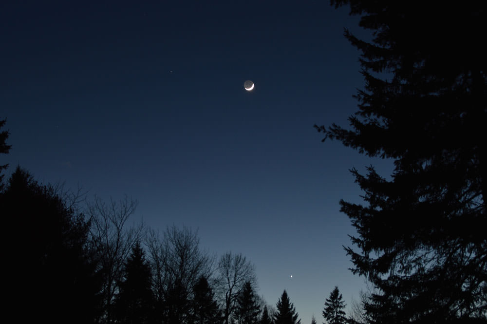
Fear not, the chill of late February. This Friday gives lovers of the sky a reason to brave the cold and look westward for a spectacular close triple conjunction of the planets Mars, Venus and the waxing crescent Moon.

This week’s New Moon is auspicious for several reasons.  We discussed the vagaries of the Black Moon of February 2015 last week, and the lunacy surrounding the proliferation of the perigee supermoon. And Happy ‘Year of the Goat’ as reckoned on the Chinese luni-solar calendar, as this week’s New Moon marks the start of the Chinese New Year on February 19th. Or do you say Ram or Sheep? Technical timing for the New Moon is on Wednesday, February 18th at 23:47 UT/6:47 PM EST, marking the start of lunation 1140. The next New Moon on March 20th sees the start of the first of two eclipse seasons for 2015, with a total solar eclipse for the high Arctic. More on that next month!
Continue reading “Catch a ‘Conjunction Triple Play’ on February 20th as the Moon Meets Venus & Mars”

Space Weather Storm Monitoring Satellite Blasts off for Deep Space on SpaceX Rocket

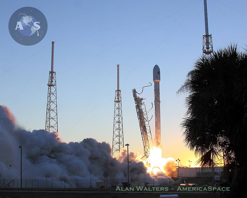
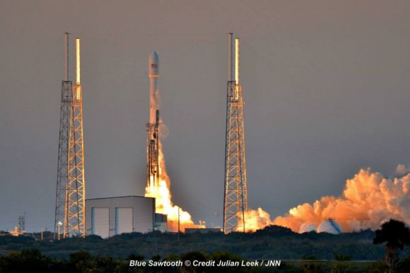
NOAA's DSCOVR satellite launches from Cape Canaveral Air Force Station on Feb. 11, 2015. DSCOVR will provide NOAA space weather forecasters more reliable measurements of solar wind conditions, improving their ability to monitor potentially harmful solar activity. Credit: Alan Walters/AmericaSpace

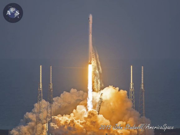
After a 17 year long wait, a new American mission to monitor intense solar storms and warn of impeding space weather disruptions to vital power grids, telecommunications satellites and public infrastructure was launched atop a SpaceX Falcon 9 on Wednesday, Feb. 11, from Cape Canaveral, Florida, to start a million mile journey to its deep space observation post.

The third time proved to be the charm when the Deep Space Climate Observatory, or DSCOVR science satellite lifted off at 6:03 p.m. EST Wednesday from Space Launch Complex 40 at Cape Canaveral Air Force Station in Florida.

The spectacular sunset blastoff came after two scrubs this week forced by a technical problem with the Air Force tracking radar and adverse weather on Sunday and Tuesday.

The $340 million DSCOVR has a critical mission to monitor the solar wind and aid very important forecasts of space weather at Earth at an observation point nearly a million miles from Earth. It will also take full disk color images of the sunlit side of Earth at least six times per day that will be publicly available and “wow” viewers.

Launch of NOAA DSCOVR satellite from Cape Canaveral Air Force Station on Feb. 11, 2015 to monitor solar storms and space weather.   Credit:  Julian Leek
Launch of NOAA DSCOVR satellite from Cape Canaveral Air Force Station on Feb. 11, 2015 to monitor solar storms and space weather. Credit: Julian Leek

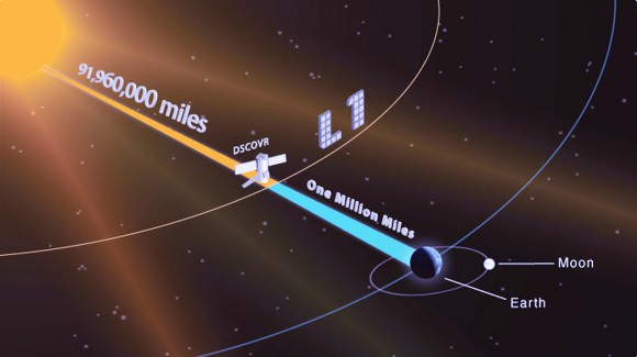
The couch sized probe was targeted to the L1 Lagrange Point, a neutral gravity point that lies on the direct line between Earth and the sun located 1.5 million kilometers (932,000 miles) sunward from Earth. At L1 the gravity between the sun and Earth is perfectly balanced and the satellite will orbit about that spot just like a planet.

L1 is a perfect place for the science because it lies outside Earth’s magnetic environment. The probe will measure the constant stream of solar wind particles from the sun as they pass by.

The DSCOVR spacecraft (3-axis stabilized, 570 kg) will be delivered to the Sun-Earth L1 point, 1.5 million km (1 million miles) from the Earth, directly in front of the Sun. A Halo (Lissajous) orbit will stabilize the craft's position around the L1 point while keeping it outside the radio noise emanating from the Sun. (Illustratin Credit: NASA)
The DSCOVR spacecraft (3-axis stabilized, 570 kg) will be delivered to the Sun-Earth L1 point, 1.5 million km (1 million miles) from the Earth, directly in front of the Sun. A Halo (Lissajous) orbit will stabilize the craft’s position around the L1 point while keeping it outside the radio noise emanating from the Sun. (Illustratin Credit: NASA)

DSCOVR is a joint mission between NOAA, NASA, and the U.S Air Force (USAF) that will be managed by NOAA. The satellite and science instruments are provided by NASA and NOAA. The rocket was funded by the USAF.

The mission is vital because its solar wind observations are crucial to maintaining accurate space weather forecasts to protect US infrastructure such as power grids, aviation, planes in flight, all types of Earth orbiting satellites for civilian and military needs, telecommunications, ISS astronauts and GPS systems.

It will take about 150 days to reach the L1 point and complete satellite and instrument checkouts.

DSCOVR will then become the first operational space weather mission to deep space and function as America’s primary warning system for solar magnetic storms.

It will replace NASA’s aging Advanced Composition Explorer (ACE) satellite which is nearly 20 years old and far beyond its original design lifetime.

“DSCOVR is the latest example of how NASA and NOAA work together to leverage the vantage point of space to both understand the science of space weather and provide direct practical benefits to us here on Earth,” said John Grunsfeld, associate administrator of NASA’s Science Mission Directorate in Washington.

DSCOVR was first proposed in 1998 by then US Vice President Al Gore as the low cost ‘Triana’ satellite to take near continuous views of the Earth’s entire globe to feed to the internet as a means of motivating students to study math and science. It was eventually built as a much more capable Earth science satellite that would also conduct the space weather observations.

But Triana was shelved for purely partisan political reasons and the satellite was placed into storage at NASA Goddard and the science was lost until now.

DSCOVR mission logo.  Credit: NOAA/NASA/U.S. Air Force
DSCOVR mission logo. Credit: NOAA/NASA/U.S. Air Force

DSCOVR is equipped with a suite of four continuously operating solar science and Earth science instruments from NASA and NOAA.

It will make simultaneous scientific observations of the solar wind and the entire sunlit side of Earth.

The 750-kilogram (1250 pound) DSCOVR probe measures 54 inches by 72 inches.

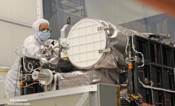
Technician works on NASA Earth science instruments and Earth imaging EPIC camera (white circle) housed on NOAA/NASA Deep Space Climate Observatory (DSCOVR) inside NASA Goddard Space Flight Center clean room in November 2014.  Credit: Ken Kremer/kenkremer.com/AmericaSpace
Technician works on NASA Earth science instruments and Earth imaging EPIC camera (white circle) housed on NOAA/NASA Deep Space Climate Observatory (DSCOVR) inside NASA Goddard Space Flight Center clean room in November 2014. Credit: Ken Kremer/kenkremer.com/AmericaSpace

The two Earth science instruments from NASA are the Earth Polychromatic Imaging Camera (EPIC) and the National Institute of Standards and Technology Advanced Radiometer (NISTAR).

EPIC will provide true color spectral images of the entire sunlit face of Earth at least six times per day, as viewed from an orbit around L1. They will be publically available within 24 hours via NASA Langley.

It will view the full disk of the entire sunlit Earth from sunrise to sunset and collect a variety of science measurements including on ozone, aerosols, dust and volcanic ash, vegetation properties, cloud heights and more.

Listen to my post launch interview with the BBC about DSCOVR and ESA’s successful IXV launch on Feb. 11.

A secondary objective by SpaceX to recover the Falcon 9 first stage booster on an ocean going barge had to be skipped due to very poor weather and very high waves in the Atlantic Ocean making a safe landing impossible. The stage did successfully complete a soft landing in the ocean.

Stay tuned here for Ken’s continuing Earth and planetary science and human spaceflight news.

Ken Kremer

NOAA/NASA Deep Space Climate Observatory (DSCOVR) undergoes processing in NASA Goddard Space Flight Center clean room. Solar wind instruments at right. DSCOVER will launch in February 2015 atop SpaceX Falcon 9 rocket.  Credit: Ken Kremer/kenkremer.com/AmericaSpace
NOAA/NASA Deep Space Climate Observatory (DSCOVR) undergoes processing in NASA Goddard Space Flight Center clean room. Solar wind instruments at right. DSCOVER will launch in February 2015 atop SpaceX Falcon 9 rocket. Credit: Ken Kremer/kenkremer.com/AmericaSpace
Launch of NOAA DSCOVR satellite from Cape Canaveral Air Force Station on Feb. 11, 2015 to monitor solar storms and space weather.   Credit:  John Studwell
Launch of NOAA DSCOVR satellite from Cape Canaveral Air Force Station on Feb. 11, 2015 to monitor solar storms and space weather. Credit: John Studwell
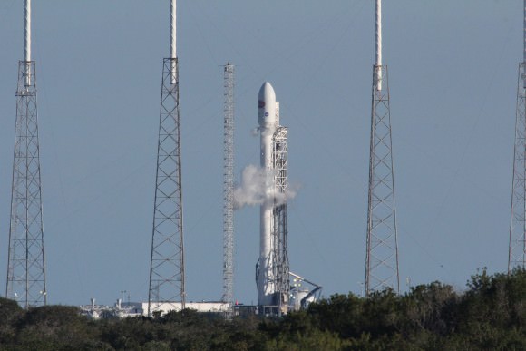
Prelaunch view of SpaceX rocket on Cape Canaveral launch pad taken from LC-39 at the Kennedy Space Center.  Credit: Chuck Higgins
Prelaunch view of SpaceX rocket on Cape Canaveral launch pad taken from LC-39 at the Kennedy Space Center. Credit: Chuck Higgins

What Could Explain the Mysterious Ring in Antarctica?

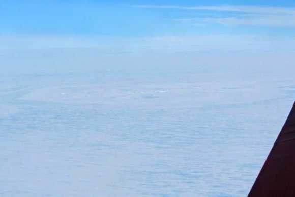
Aerial photo of the crater site, taken with the Polar 6 board camera, while the aircraft was flying 7000 feet above the ice shelf. Credit: Alfred-Wegener-Institut

Ever since its discovery was announced earlier this year, the 3 km-wide ring structure discovered on the of Antarctica has been a source of significant interest and speculation. Initially, the discovery was seen as little more than a happy accident that occurred during a survey of East Antarctica by a WEGAS (West-East Gondwana Amalgamation and its Separation) team from the Alfred Wegener Institute.

However, after the team was interviewed by the Brussels-based International Polar Foundation, news of the find and its possible implication spread like wildfire. Initial theories for the possible origin of the ring indicated that it could be the result of the impact of a large meteor. However, since the news broke, team leader Olaf Eisen has offered an alternative explanation: that the ring structure is in fact the result of other ice-shelf processes.

As Eisen indicated in a new entry on the AWI Ice Blog: “Doug MacAyeal, glaciologist from the University of Chicago, put forward the suggestion that the ring structure could be an ice doline.” Ice dolines are round sinkholes that are caused by a pool of melt water formed within the shelf ice. They are formed by the caving in of ice sheets or glaciers, much in the same way that sinkholes form over caves.

“If the melt water drains suddenly,” he wrote, “like it often does, the surface of the glacier is destabilised and does collapse, forming a round crater. Ice depressions like this have been observed in Greenland and on ice shelves of the Antarctic Peninsula since the 1930s.”

A discovery photo of the ringed formation, 2km (1.24 miles) that AWI researchers are proposing is a meteorite impact site. (Credit:Tobias Binder, AWI)
Aerial photo of the ringed formation that the AWI researchers found on the Antarctic ice shelf. Credit: Tobias Binder, AWI

However, in glaciers, these cavities form much more rapidly, as the meltwater created by temperature variations causes englacial lakes or water pockets to from which then drains through the ice sheet. Such dolines have been observed for decades, particularly in Greenland and the Antarctic Peninsula where the ice melts during the summertime.

Initial analysis of satellite images appear to confirm this, as they indicate that the feature could have been present before the supposed impact took place around 25 years ago. In addition, relying on data from Google Maps and Google Earth, the WEGAS (West-East Gondwana Amalgamation and its Separation) team observed that the 3 km ring is accompanied by other, smaller rings.

Such formations are inconsistent with meteorite impacts, which generally leave a single crater with a raised center. And as a general rule, these craters also measure between ten to twenty times the size of the meteorite itself – in this case, that would mean a meteorite 200 meters in diameter. This would mean that, had the ring structure been caused by a meteorite, it would have been the largest Antarctic meteor impact on record.

It is therefore understandable why the announcement of this ring structure triggered such speculation and interest. Meteorite impacts, especially record-breaking ones are nothing if not a hot news item. Too bad this does not appear to be the case.

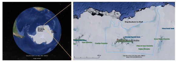
Location of the ring formation on the ice shelf off the Antarctic continent. The site is on the King Baudouin Ice Shelf. (Map Credits: Google Maps, NOAA)
Location of the ring formation on the King Baudouin Ice Shelf off the Antarctic continent. Credit: Google Maps, NOAA

However, the possibility that the ring structure is the result of an ice doline raises a new host of interesting questions. For one, it would indicate that dolines are much more common in East Antarctica than previously thought. Ice dolines were first noticed in the regions of West Antarctica and the Antarctic Peninsula, where rapid warming is known to take place.

East Antarctica, by contrast, has long been understood to be the coldest, windiest and driest landmass on the planet. Knowing that such a place could produce rapid warming that would lead to the creation of a significant englacial lake would certainly force scientists to rethink what they know about this continent.

“To form an ice doline this size, it would need a considerable reservoir of melt water,” Eisen said. “Therefore we would need to ask, where did all this melt water come from? Which melting processes have caused such an amount of water and how does the melting fit into the climate pattern of East Antarctica?”

In the coming months, Eisen and the AWI scientists plant to analyze the data from the Polar 6 (Eisen’s mission) measurements thoroughly, in the hopes of getting all the facts straight. Also, Jan Lenaerts – a Belgian glaciologist with AWI – is planning an land-based expedition to the site; which unfortunately due to the short Antarctic summer season and the preparation time needed won’t be taking place until the end of 2015.

AWI's Polar 6 aircraft takes off from the runway at the Princess Elisabeth Antarctica research station. © International Polar Foundation / Jos Van Hemelrijck
AWI’s Polar 6 aircraft takes off from the runway at the Princess Elisabeth Antarctica research station.
Credit: International Polar Foundation / Jos Van Hemelrijck

But what is especially interesting, according to Eisen, is the rapid pace at which the debate surrounding the ring structure occurred. Within days of their announcement, the WEGAS team was astounded by the nature of the debate taking place in the media and on the internet (particularly Facebook), bringing together glaciologists from all around the world.

As Eisen put it in his blog entry, “For the WEGAS team, however, our experience of the last few days has shown that modern scientific discussion is not confined to the ivory towers of learned meetings, technical papers, and lecture halls, but that the public and social media play a tremendous role. For us, cut off from the modern world amongst the eternal ice, this new science seems to have happened at an almost breathtaking pace.”

This activity brought the discussion about the nature of the ring structure forward by several weeks, he claims, focusing attention on the true causes of the surprise discovery itself and comparing and contrasting possible theories.

Further Reading: Helmholtz Gemeinschaft, AWI

Gorgeous Sunrises, Auroras, Landscapes, and More from Space Station Crew

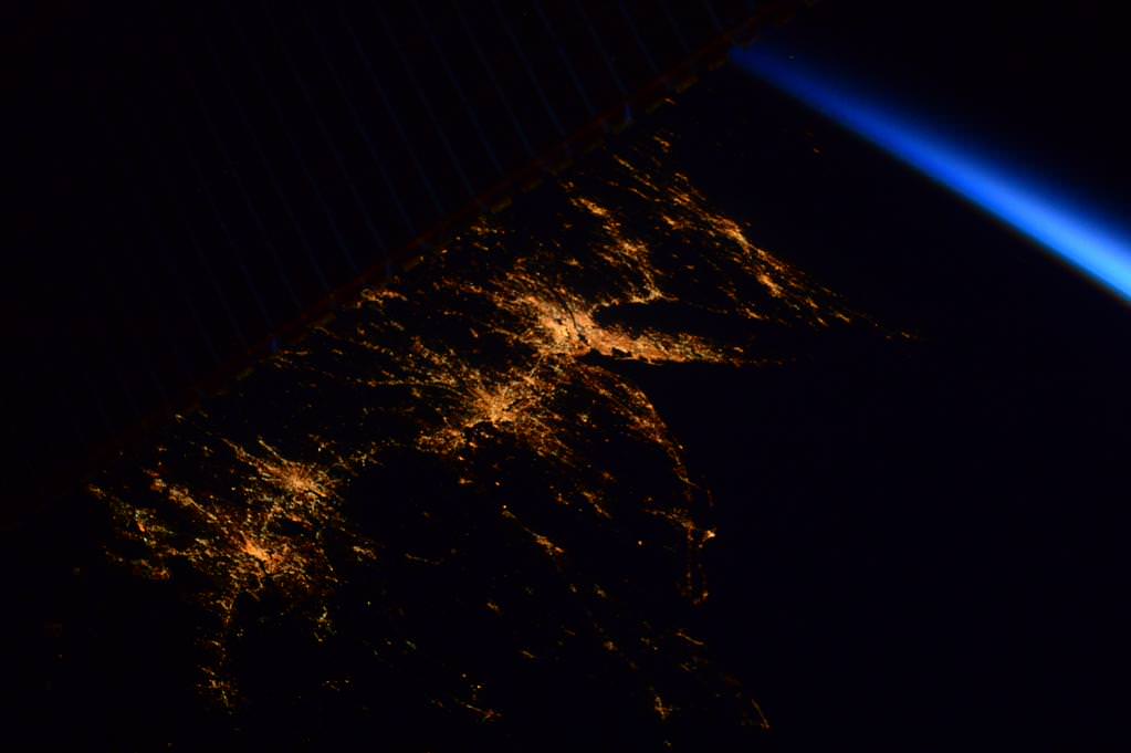
Almost disappearing behind the solar panels before sunrise: the US East coast from DC to Boston. #HelloEarth. Credit: NASA/ESA/Samantha Cristoforetti

The Expedition 42 crew aboard the International Space Station (ISS) continues to delight us with stunning views of ‘Our Beautiful Earth from Space.’

Here’s a collection of a few of the newest sunrises, auroras, landscapes, nightlights, and more snapshots from the multinational crew of six astronauts and cosmonauts living and working aboard the ISS orbiting some 250 miles (400 kilometers) overhead.

And don’t forget that at sunset tonight (Feb. 8), a SpaceX Falcon 9 rocket is due to blastoff at 6:10 p.m., EST, if all goes well carrying the DSCOVR space weather satellite about a million miles (1.5 million kilometers) away to the L1 Lagrange point.

The Falcon 9 will blastoff from Cape Canaveral, Florida, pictured below:

From Key West to the Gulf of Mexico and #Atlanta, a very nice, clear, half moonlit night.  Credit: NASA/Terry Virts.   KSC and Cape Canaveral launch pads along Florida east coast at right.
From Key West to the Gulf of Mexico and #Atlanta, a very nice, clear, half moonlit night. Credit: NASA/Terry Virts.
KSC and Cape Canaveral launch pads along Florida east coast at right.

Tens of millions of you are included in the lead sunrise photo of the U.S. East Coast – taken by ESA astronaut Samantha Cristoforetti perched aboard the orbiting lab complex.

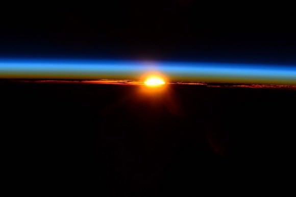
And here’s a “speechless sunrise” taken today by NASA astronaut Terry Virts. We agree!

#speechless from this #sunrise.   Credit: NASA/Terry Virts
#speechless from this #sunrise. Credit: NASA/Terry Virts
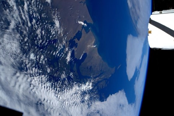
Always happy to see this lovely sight that has become familiar in #Patagonia.  Credit: NASA/ESA/Samantha Cristoforetti
Always happy to see this lovely sight that has become familiar in #Patagonia. Credit: NASA/ESA/Samantha Cristoforetti
This, on the contrary, I've seen only once: the Strait of Magellan and la Tierra del Fuego free of clouds!  Credit: NASA/ESA/Samantha Cristoforetti
This, on the contrary, I’ve seen only once: the Strait of Magellan and la Tierra del Fuego free of clouds! Credit: NASA/ESA/Samantha Cristoforetti
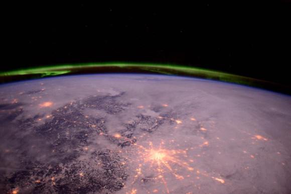
#Moscow shining like a bright star under the aurora.    Credit: NASA/Terry Virts
#Moscow shining like a bright star under the aurora. Credit: NASA/Terry Virts
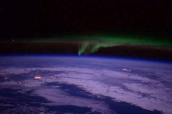
#aurora over Anchorage and Fairbanks #Alaska.   Credit: NASA/Terry Virts
#aurora over Anchorage and Fairbanks #Alaska. Credit: NASA/Terry Virts

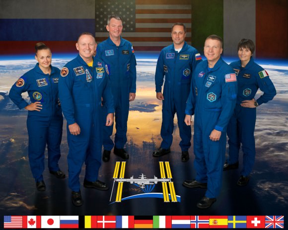
The current six person crew includes astronauts and cosmonauts from three nations; America, Russia and Italy including four men and two women serving aboard the massive orbiting lab complex.

They comprise Expedition 42 Commander Barry “Butch” Wilmore and Terry Virts from NASA, Samantha Cristoforetti from the European Space Agency (ESA) and cosmonauts Aleksandr Samokutyayev, Yelena Serova, and Anton Shkaplerov from Russia.

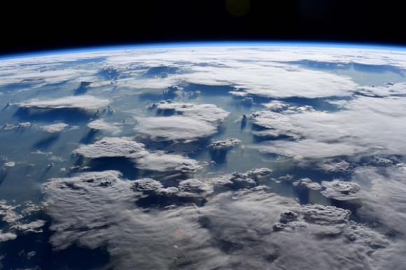
Brazilian clouds showing off their #majesty.  Credit: NASA/Terry Virts
Brazilian clouds showing off their #majesty. Credit: NASA/Terry Virts
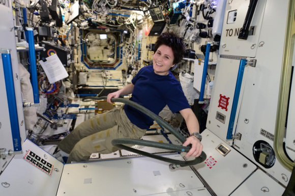
L+72/73: Logbook. Wow, this has been a busy week! But we can still catch up a little bit...  ESA astronaut Samantha Cristoforetti
L+72/73: Logbook. Wow, this has been a busy week! But we can still catch up a little bit… ESA astronaut Samantha Cristoforetti

L+72/73: Logbook. Wow, this has been a busy week! But we can still catch up a little bit… ESA astronaut Samantha Cristoforetti
….https://plus.google.com/app/basic/stream/z12iczzoqovhfdo2z23odnbwmz3cir0ox04?cbp=1hmsp4t51xmr3&sview=27&cid=5&soc-app=115&soc-platform=1&spath=%2Fapp%2Fbasic%2F%2BSamanthaCristoforetti%2Fposts …

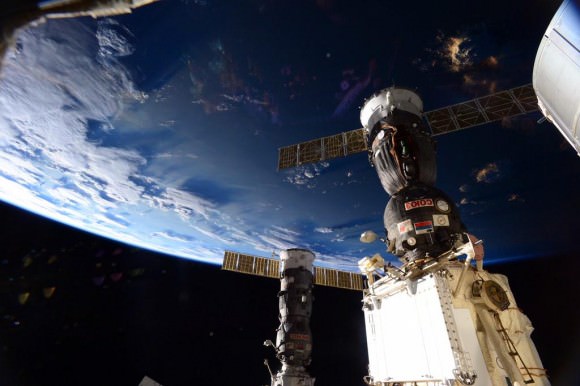
Soyuz- everyone’s ride to space and back!

#soyuz #earth #beauty.  Credit: NASA/Terry Virts
#soyuz #earth #beauty. Credit: NASA/Terry Virts

Stay tuned here for Ken’s continuing Earth and planetary science and human spaceflight news.

Ken Kremer

'I wish I could bring all of you up to see this!'  Credit: NASA/Terry Virts
‘I wish I could bring all of you up to see this!’ Credit: NASA/Terry Virts
ISS Expedition 42. Credit: NASA/ESA/Roscosmos

NOAA/NASA/USAF Deep Space Climate Observatory (DSCOVR) Launching Feb. 8 to Monitor Solar Winds

DSCOVR mission logo. Credit: NOAA/NASA/U.S. Air Force

The long awaited Deep Space Climate Observatory, or DSCOVR science satellite is slated to blast off atop a SpaceX Falcon 9 on Sunday, Feb. 8, from Cape Canaveral, Florida on a mission to monitor the solar wind and aid very important forecasts of space weather at Earth.

DSCOVR is a joint mission between NOAA, NASA, and the U.S Air Force (USAF) that will be managed by NOAA. The satellite and science instruments are provided by NASA and NOAA.

Update Feb 8: Hold, Hold, Hold !!! 6:10 PM 2/8/15 Terminal Count aborted at T Minus 2 min 26 sec due to a tracking issue. NO launch of Falcon 9 today. rocket being safed now. next launch opportunity is Monday. Still TBD.

The rocket is provided by the USAF. SpaceX will try to recover the first stage via a guided descent to a floating barge in the Atlantic Ocean.

The weather outlook is currently very promising with a greater than 90 percent chance of favorable weather at launch time shortly after sunset on Sunday which could make for a spectacular viewing opportunity for spectators surrounding the Florida Space coast.

Liftoff atop the SpaceX Falcon 9 rocket is targeted for at 6:10:12 p.m. EST on Feb. 8, from Cape Canaveral Air Force Station Space Launch Complex 40.

There is an instantaneous launch window, meaning that any launch delay due to weather, technical or other factors will force a scrub to Monday.

The launch will be broadcast live on NASA TV: http://www.nasa.gov/nasatv

NASA’s DSCOVR launch blog coverage of countdown and liftoff will begin at 3:30 p.m. Sunday.

NOAA/NASA Deep Space Climate Observatory (DSCOVR) undergoes processing in NASA Goddard Space Flight Center clean room. Solar wind instruments at right. DSCOVER will launch in February 2015 atop SpaceX Falcon 9 rocket.  Credit: Ken Kremer/kenkremer.com/AmericaSpace
NOAA/NASA Deep Space Climate Observatory (DSCOVR) undergoes processing in NASA Goddard Space Flight Center clean room. Solar wind instruments at right. DSCOVER will launch in February 2015 atop SpaceX Falcon 9 rocket. Credit: Ken Kremer/kenkremer.com/AmericaSpace

“DSCOVR is NOAA’s first operational space weather mission to deep space,” said Stephen Volz, assistant administrator of the NOAA Satellite and Information Service in Silver Spring, Maryland, at the pre-launch briefing today (Feb. 7) at the Kennedy Space Center in Florida.

The mission of DSCOVR is vital because its solar wind observations are crucial to maintaining accurate space weather forecasts to protect US infrastructure from disruption by approaching solar storms.

“DSCOVR will maintain the nation’s solar wind observations, which are critical to the accuracy and lead time of NOAA’s space weather alerts, forecasts, and warnings,” according to a NASA description.

“Space weather events like geomagnetic storms caused by changes in solar wind can affect public infrastructure systems, including power grids, telecommunications systems, and aircraft avionics.”

DSCOVR will replace NASA’s aging Advanced Composition Explorer (ACE) satellite which is nearly 20 years old and far beyond its original design lifetime.

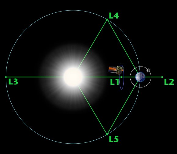
The couch sized probe is being targeted to the L1 Lagrange Point, a neutral gravity point that lies on the direct line between Earth and the sun located 1.5 million kilometers (932,000 miles) sunward from Earth. At L1 the gravity between the sun and Earth is perfectly balanced and the satellite will orbit about that spot just like a planet.

L1 is a perfect place for the science because it lies outside Earth’s magnetic environment. The probe will measure the constant stream of solar wind particles from the sun as they pass by.

Diagram of the five Lagrange points associated with the sun-Earth system, showing DSCOVR orbiting the L-1 point. Image is not to scale.  Credit:  NASA/WMAP Science Team
Diagram of the five Lagrange points associated with the sun-Earth system, showing DSCOVR orbiting the L-1 point. Image is not to scale. Credit: NASA/WMAP Science Team

This will enable forecasters to give a 15 to 60 minute warning of approaching geomagnetic storms that could damage valuable infrastructure.

DSCOVR is equipped with a suite of four continuously operating solar science and Earth science instruments from NASA and NOAA.

It will make simultaneous scientific observations of the solar wind and the entire sunlit side of Earth.

Three instruments will help measure the solar wind on the DSCOVR mission: (shown from left to right), the Faraday cup to monitor the speed and direction of positively-charged solar wind particles, the electron spectrometer to monitor electrons, and a magnetometer to measure magnetic fields.  Credit: NASA/DSCOVR
Three instruments will help measure the solar wind on the DSCOVR mission: (shown from left to right), the Faraday cup to monitor the speed and direction of positively-charged solar wind particles, the electron spectrometer to monitor electrons, and a magnetometer to measure magnetic fields. Credit: NASA/DSCOVR

The 750-kilogram DSCOVR probe measures 54 inches by 72 inches.

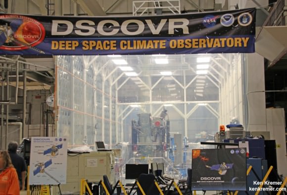
I saw the DSCOVR spacecraft up close at NASA Goddard Space Flight Center in Maryland last fall during processing in the clean room.

NOAA/NASA/USAF Deep Space Climate Observatory (DSCOVR) undergoes processing in NASA Goddard Space Flight Center clean room.  Probe will launch in February atop SpaceX Falcon 9 rocket.  Credit: Ken Kremer - kenkremer.com
NOAA/NASA/USAF Deep Space Climate Observatory (DSCOVR) undergoes processing in NASA Goddard Space Flight Center clean room. Probe will launch in February atop SpaceX Falcon 9 rocket. Credit: Ken Kremer – kenkremer.com

A secondary objective of the rocket launch for SpaceX is to conduct their second attempt to recover the Falcon 9 first stage booster on an ocean going barge. Read my articles about the first attempt in January 2015, starting here.

It was originally named ‘Triana’ (aka Goresat) and was conceived by then US Vice President Al Gore as a low cost satellite to take near continuous views of the Earth’s entire globe to feed to the internet as a means of motivating students to study math and science. It was eventually built as a much more capable Earth science satellite as well as to conduct the space weather observations.

But Triana was shelved for purely partisan political reasons and the satellite was placed into storage and the science was lost until now.

Stay tuned here for Ken’s continuing Earth and planetary science and human spaceflight news.

Ken Kremer

The team is ready for the launch of NASA's DSCOVR spacecraft aboard a SpaceX Falcon 9 rocket. L/R Mike Curie KSC NASA News Chief, Stephen Volz, assistant administrator NOAA, Tom Berger, director of NOAA Space Weather Prediction Center Boulder Colorado,Steven Clark, NASA Joint Agency Satellite Division, Col. D. Jason Cothern, Space Demonstration Division chief at Kirkland AFB NM. Hans Koenigsmann, VP of mission assurance at SpaceX in Hawthorne, California, Mike McAlaneen, launch weather officer 45th Space wing Cape Canaveral Air Force Station, Florida.  Credit: Julian Leek
The team is ready for the launch of NASA’s DSCOVR spacecraft aboard a SpaceX Falcon 9 rocket. L/R Mike Curie KSC NASA News Chief, Stephen Volz, assistant administrator NOAA, Tom Berger, director of NOAA Space Weather Prediction Center Boulder Colorado,Steven Clark, NASA Joint Agency Satellite Division, Col. D. Jason Cothern, Space Demonstration Division chief at Kirkland AFB NM. Hans Koenigsmann, VP of mission assurance at SpaceX in Hawthorne, California, Mike McAlaneen, launch weather officer 45th Space wing Cape Canaveral Air Force Station, Florida. Credit: Julian Leek

Amazing Pictures of the Underside of an Iceberg

This stunning glacial portrait was photographed in Cierva Cove, Antarctica. An incredibly rare sight--this photo reveals the beautiful colors and pure surface of the underside of an iceberg. Credit and copyright: Alex Cornell.

In December 2014, designer and musician Alex Cornell traveled to Antarctica. While he saw many unique views of the Antarctic landscape, one extremely rare view stands out. He saw an iceberg that had recently flipped over, exposing the usually unseen – but gorgeous — underside.

“Icebergs are typically white, like you see in pictures,” Cornell told Universe Today. “But this one had recently flipped over and had this arresting alien-green color to it. It looked a lot more like a parked spacecraft than a floating iceberg.”

He said the experience was “magical.”

This stunning glacial portrait was photographed in Cierva Cove, Antarctica. An incredibly rare sight--this photo reveals the beautiful colors and pure surface of the underside of an iceberg. Credit and copyright: Alex Cornell.
This stunning glacial portrait was photographed in Cierva Cove, Antarctica. An incredibly rare sight–this photo reveals the beautiful colors and pure surface of the underside of an iceberg. Credit and copyright: Alex Cornell.

He traveled with family members and brought his camera rig, hoping to shoot the glaciers, ice and penguins.

“We saw thousands of icebergs of course, but only one revealed its gorgeous underside — the 90% ‘below the surface’ you hear so much about,” he said.

Scientists say that icebergs will flip over when the “topside” melts enough to change the shape of the iceberg, creating a shift in equilibrium.

Why is the underside so different in color?

Ice is full of tiny air bubbles that scatter all color wavelengths the same amount, usually giving the ice a white appearance. But, according to scientists at Ohio State University, if the ice is compressed – as it would be for the underwater portion of the iceberg — the bubbles are squeezed out and the blue light is scattered much more than other colors – making the ice appear blue. Also, algae often grow on the underside of icebergs, producing green stripes that are only revealed when the ice rolls over and exposes the previously underwater sections.

A zoomed out version of a flipped iceberg in Cierva Cove, Antarctica. Credit and copyright: Alex Cornell.

“I shot these pictures from a Zodiac (boat) which allowed me to get pretty close,” Cornell said via email. “There’s always a danger of the iceberg flipping back over, so we couldn’t get *too* close.”

“From an artistic perspective, they are beautiful photos, but their beauty is the result of what was captured. I was just lucky to be there to snap it. You could have pointed an iPhone at this thing and come away with something spectacular. What luck to get to share something so magical!”

Thanks to Alex for sharing his unique images with Universe Today. See more of his wonderful imagery from his Antarctica trip on his website.

A Sun halo seen among the the landscape and ice flows of Antarctica. Credit and copyright: Alex Cornell.