Commercial Antares/Cygnus Rocket Loaded with Science for July 13 Virginia Launch – Watch Live

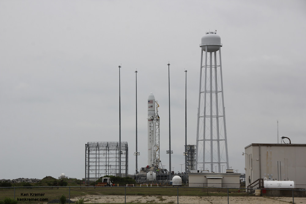
Antares rocket and Cygnus spacecraft await launch on Orb 2 mission on July 13, 2014 from Launch Pad 0A at NASA Wallops Flight Facility Facility, VA. LADEE lunar mission launch pad 0B stands adjacent to right of Antares. Credit: Ken Kremer - kenkremer.com

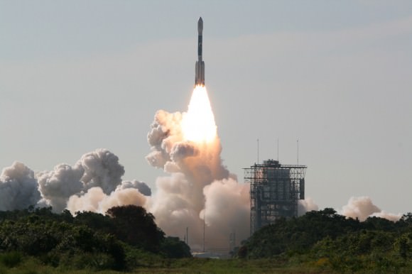
NASA WALLOPS FLIGHT FACILITY, VA – Following further weather delays this week Orbital Sciences Corp. commercial Antares rocket is at last set to soar to space at lunchtime Sunday, July 13, from a beachside launch pad in Virginia carrying a private Cygnus cargo freighter loaded with a diverse array of science experiments including a flock of nanosatellites and deployers, student science experiments and small cubesat prototypes that may one day fly to Mars.

The privately developed Antares rocket is on a critical cargo resupply mission – named Orb-2 – bound for the International Space Station (ISS) and now targeting liftoff at 12:52 p.m. on July 13 from Launch Pad 0A at the Mid-Atlantic Regional Spaceport (MARS) at NASA Wallops Island on Virginia’s Eastern shore.

Read my complete Antares launch viewing guide here – “How to See the Antares/Cygnus July 13 Blastoff”

Severe thunderstorms up and down the US East coast forced two consecutive postponements this week from the Atlantic Ocean region launch pad at NASA’s Wallops Flight Facility, VA, from July 11 to July 13.
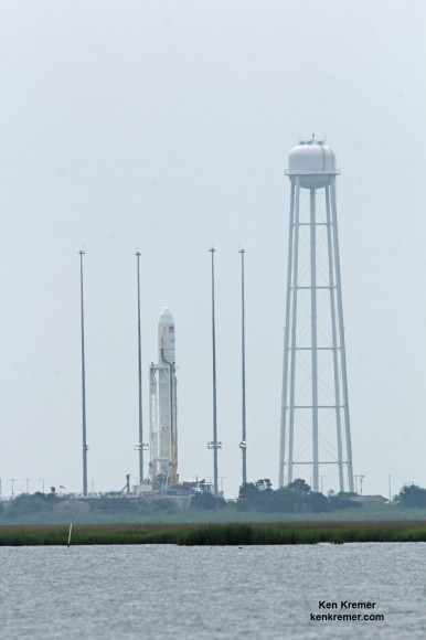
Antares rocket and Cygnus spacecraft await launch on Orb 2 mission on July 13, 2014 from Launch Pad 0A at NASA Wallops Flight Facility Facility, VA. Credit: Ken Kremer - kenkremer.com
Antares rocket and Cygnus spacecraft await launch on Orb 2 mission on July 13, 2014 from Launch Pad 0A at NASA Wallops Flight Facility Facility, VA. Credit: Ken Kremer – kenkremer.com

“Orbital’s launch team has made great progress in preparing the rocket for the Orb-2 mission, which will be the fourth flight of Antares in the past 15 months,” Orbital said in a statement.

“However, severe weather in the Wallops area has repeatedly interrupted the team’s normal operational schedule leading up to the launch. As a result, these activities have taken longer than expected. Orbital has decided to postpone the Orb-2 mission by an additional day in order to maintain normal launch operations processing.”

The pressurized Cygnus cargo freighter will deliver 1,657 kg (3653 lbs) of cargo to the ISS Expedition 40 crew including over 700 pounds (300 kg) of science experiments and instruments, crew supplies, food, water, computer equipment, spacewalk tools and student research experiments.

A flock of 28 nanosatellites from Planet Labs of San Francisco are aboard to take pictures of Earth.
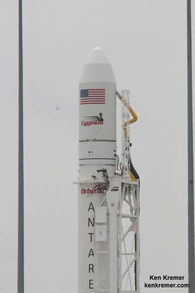
Close-up view of Cygnus spacecraft atop Antares rocket on Orb 2 mission launching on July 13, 2014 from Launch Pad 0A at NASA Wallops Flight Facility Facility, VA. Credit: Ken Kremer - kenkremer.com
Close-up view of Cygnus spacecraft atop Antares rocket on Orb 2 mission launching on July 13, 2014 from Launch Pad 0A at NASA Wallops Flight Facility Facility, VA. Credit: Ken Kremer – kenkremer.com

After deployment from the Japanese JEM module they will form “the largest constellation of imaging satellites in Earth orbit,” said Robbie Schingler, Co-Founder of PlanetLabs.

“The individual satellites will take images that will be combined into a whole Earth mosaic,” Schingler told me in an interview at Wallops.

15 student experiments on the “Charlie Brown” mission are aboard and hosted by the Student Spaceflight Experiment Program, an initiative of the National Center for Earth and Space Science Education (NCESSE) and NanoRacks.

“The student experiments were chosen from over 1000 proposals from Grades 5 to 12,” said Jeff Goldstein, NCESSE director.

They will investigate plant, lettuce, raddish and mold growth and seed germination in zero-G, penecilium growth, corrosion inhibitors, oxidation in space and microencapsulation experiments.

The TechEdSat-4 is a small cubesat built by NASA’s Ames Research Center in California that will investigate technology to return small samples to Earth from the space station.

NASA will broadcast the Antares launch live on NASA TV starting at 12 Noon – http://www.nasa.gov/nasatv

The weather prognosis is very favorable with a 90% chance of acceptable weather at launch time during the 5 minute window.

The Antares/Cygnus Orbital-2 (Orb-2) mission is the second of eight cargo resupply missions to the ISS under Orbital’s Commercial Resupply Services (CRS) contract with NASA.

NASA will broadcast the Antares launch live on NASA TV starting at 12 Noon – http://www.nasa.gov/nasatv

Depending on local weather conditions, portions of the daylight liftoff could be visible to millions of spectators along the US Eastern seaboard stretching from South Carolina to Massachusetts.

Here’s a viewing map:
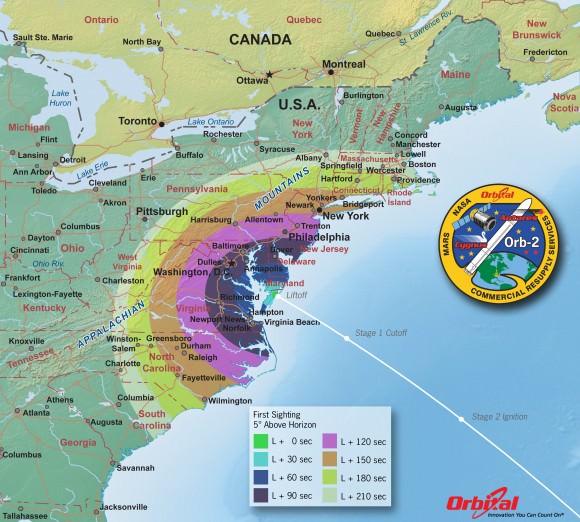
Orbital 2 Launch from NASA Wallops Island, VA on July 12, 2014- Time of First Sighting Map   This map shows the rough time at which you can first expect to see Antares after it is launched on July 12, 2014. It represents the time at which the rocket will reach 5 degrees above the horizon and varies depending on your location . We have selected 5 degrees as it is unlikely that you'll be able to view the rocket when it is below 5 degrees due to buildings, vegetation, and other terrain features. As an example, using this map when observing from Washington, DC shows that Antares will reach 5 degrees above the horizon more than a minute.   Credit: Orbital Sciences
Orbital 2 Launch from NASA Wallops Island, VA on July 13, 2014- Time of First Sighting Map This map shows the rough time at which you can first expect to see Antares after it is launched on July 13, 2014. It represents the time at which the rocket will reach 5 degrees above the horizon and varies depending on your location . We have selected 5 degrees as it is unlikely that you’ll be able to view the rocket when it is below 5 degrees due to buildings, vegetation, and other terrain features. As an example, using this map when observing from Washington, DC shows that Antares will reach 5 degrees above the horizon more than a minute. Credit: Orbital Sciences

The best viewing will be in the mid-Atlantic region closest to Wallops Island.

Locally at Wallops you’ll get a magnificent view and hear the rockets thunder at either the NASA Wallops Visitor Center or the Chincoteague National Wildlife Refuge/Assateague National Seashore.

For more information about the Wallops Visitors Center, including directions, see: http://www.nasa.gov/centers/wallops/visitorcenter

NASA will have special “countdown speakers” set up at the NASA Wallops Visitor Center, Chincoteague National Wildlife Refuge/Assateague National Seashore and Ocean City inlet.
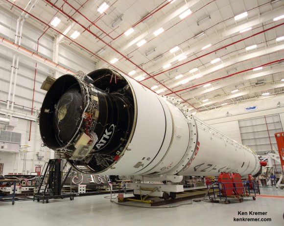
ATK built 2nd stage integrated onto 1st stage of Orbital Sciences Antares rocket slated for July 11, 2014 launch on the Orb-2 mission from NASA’s Wallops Flight Facility in Virginia, bound for the ISS.  The rocket undergoes processing at the Horizontal Integration Facility at NASA Wallops during visit by Universe Today/Ken Kremer.  Credit: Ken Kremer - kenkremer.com
ATK built 2nd stage integrated onto 1st stage of Orbital Sciences Antares rocket slated for July 11, 2014 launch on the Orb-2 mission from NASA’s Wallops Flight Facility in Virginia, bound for the ISS. The rocket undergoes processing at the Horizontal Integration Facility at NASA Wallops during visit by Universe Today/Ken Kremer. Credit: Ken Kremer – kenkremer.com

Orbital Sciences was awarded a $1.9 Billion supply contract by NASA to deliver 20,000 kilograms of research experiments, crew provisions, spare parts and hardware for 8 flight to the ISS through 2016 under the Commercial Resupply Services (CRS) initiative.

The July mission marks the second operational Antares/Cygnus flight.

The two stage Antares rocket stands 132 feet tall. It takes about 10 minutes from launch until separation of Cygnus from the Antares vehicle.
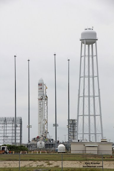
Antares rocket and Cygnus spacecraft await launch on Orb 2 mission on July 13, 2014 from Launch Pad 0A at NASA Wallops Flight Facility Facility, VA. LADEE lunar mission launch pad 0B stands adjacent to right of Antares. Credit: Ken Kremer - kenkremer.com
Antares rocket and Cygnus spacecraft await launch on Orb 2 mission on July 13, 2014 from Launch Pad 0A at NASA Wallops Flight Facility Facility, VA. LADEE lunar mission launch pad 0B stands adjacent to right of Antares. Credit: Ken Kremer – kenkremer.com

SpaceX has a similar resupply contract using their Falcon 9 rocket and Dragon cargo carrier and just completed their 3rd operational mission to the ISS in May.

Watch for Ken’s onsite Antares Orb-2 mission reports from NASA Wallops, VA.

Stay tuned here for Ken’s continuing ISS, OCO-2, GPM, Curiosity, Opportunity, Orion, SpaceX, Boeing, Orbital Sciences, MAVEN, MOM, Mars and more Earth & Planetary science and human spaceflight news.

Ken Kremer

…………….

Learn more about NASA’s Mars missions and Orbital Sciences Antares ISS launch on July 13 from NASA Wallops, VA in July and more about SpaceX, Boeing and commercial space and more at Ken’s upcoming presentations.

July 11/12/13: “Antares/Cygnus ISS Launch from Virginia” & “Space mission updates”; Rodeway Inn, Chincoteague, VA, evening

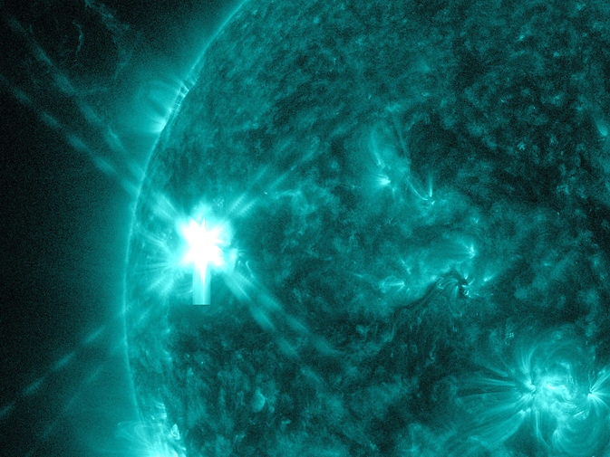
Blast! Sun Pops Off A Moderate Solar Flare. Could Others Follow Soon?

A moderate solar flare erupts on the sun July 8, 2014 in this image from NASA's Solar Dynamics Observatory. Credit: NASA/SDO

With a watchful NASA spacecraft capturing its moves, the Sun sent off a “mid-level” solar flare on Tuesday (July 8) that you can watch (over and over again) in the video above. The Solar Dynamics Observatory caught the explosion around 12:20 p.m. EDT (4:20 p.m. UTC), which led into a coronal mass ejection that sent a surge of solar material into space.

Solar flares can be disruptive to Earth communications and also cause auroras in the atmosphere. In this case, the M6 solar flare created “short-lived impacts to high frequency radio communications on the sunlit side of Earth … as a result,” wrote the National Oceanic and Atmospheric Administration in a forecast July 8.

In this case, however, the coronal mass ejection (seen by the Solar Dynamics Observatory) is not expected to hit Earth. But with the Sun around its maximum of solar activity in the 11-year cycle, other eruptions could head into space in the coming days. M is considered a moderate flare and X the strongest kind.

“Solar activity is low, but the quiet is unlikely to persist,” wrote SpaceWeather.com in an update published today (July 10). “There are three sunspots with unstable magnetic fields capable of strong eruptions: AR2108, AR2109, AR2113. NOAA forecasters estimate a 75% chance of M-flares and 15% chance of X-flares on July 10th.”

This flare caused a surge in shortwave activity that you can hear in this audio file, recorded by New Mexico amateur astronomer Thomas Ashcraft. “Radio bursts such as these are sparked by shock waves moving through the sun’s atmosphere,” SpaceWeather added. “Set in motion by flares, these shock waves excite plasma instabilitties that emit static-y radio waves.”

Cyclone Spying: 3-D Hurricane View Of Arthur Reveals Rain Towers

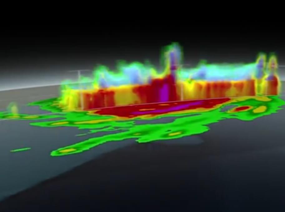
A 3-D view of Hurricane Arthur in July 2014, taken from instruments aboard the NASA-JAXA Global Precipitation Measurement (GPM) Core Observatory. Credit: NASA / YouTube (screenshot)

While Hurricane Arthur was still a hurricane, the new Global Precipitation Measurement (GPM) Core Observatory flew over the storm last week and captured its structure in 3-D. This was a good test of the new satellite, which is supposed to help NASA track these Atlantic storms to better precision than before.

The joint NASA-Japanese Aerospace Exploration Agency mission allowed researchers to do better forecasting because they could track the precipitation to 1,000 feet vertically and three miles horizontally (305 meters and five kilometers).

“Hurricane features pop out more. They’re sharper, there’s more clarity to the structures,” stated NASA Goddard hurricane researcher Scott Braun. “Being able to see the structures more clearly may allow for better determination of the structure of the eye wall and rainbands, thereby providing clues about the likelihood of a storm intensifying or weakening.”

For more information on the findings, check out this NASA web page.

Spectacular Southern Lights, Shooting Stars, Sahara Snapshots and more from ESA’s Alexander Gerst aboard ISS

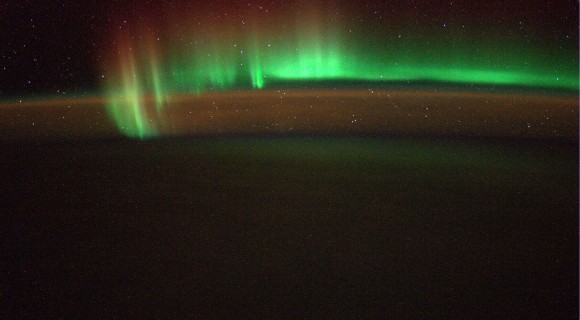
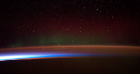
“Saw a beautiful Southern Light last night. I so wish you could see this with your own eyes!” Image taken from the International Space Station (ISS) on 5 July 2014. Credit: ESA/Alexander Gerst

Spectacular snapshots of the Southern Lights, Shooting Stars, the Sahara Desert and much more are streaming back from space to Earth courtesy of Alexander Gerst, ESA’s German astronaut currently serving aboard the International Space Station (ISS).

See a gallery of Alex’s stunning space-based views (sagenhafte Weltraum bilder) collected herein – starting with the auroral fireworks seen from space – above. It coincides with the Earth-based fireworks of America’s 4th of July Independence Day weekend celebrations and spectacular Noctilucent Clouds (NLCs) wafting over the Northern Hemisphere. NLC gallery here.

“Saw a beautiful Southern Light last night. I so wish you could see this with your own eyes!” Alex tweeted in English.

Gerst is posting his Earth & space imagery from the ISS on a variety of social media including Twitter, Facebook, Google+ and his ESA astronaut blog bilingually in English and German.

Another new snapshot of Earth’s “beautiful Southern Lights”  taken from the ISS on 5 July 2014. Credit: ESA/Alexander Gerst
Another new snapshot of Earth’s “beautiful Southern Lights” taken from the ISS on 5 July 2014. Credit: ESA/Alexander Gerst

“Habe gestern ein wunderschönes Südlicht gesehen. Ich wünschte ihr könntet das mit eigenen Augen sehen!” Alex tweeted in German.

Check out Alexander Gerst’s stunning 1st timelapse video from the ISS:

Video Caption: ESA astronaut Alexander Gerst’s first timelapse from the International Space Station features the first shooting star that he saw from above. Made by stitching together over 250 images this short clip shows the beauty of our world and the space around it. Published on July 5, 2014. Credit: ESA/Alexander Gerst

Gerst launched to the ISS on his rookie space flight on May 28, 2014 aboard a Russian Soyuz capsule along with Russian cosmonaut Maxim Suraev and NASA astronaut Reid Wiseman.

ISS Expedition 40 patch

The trio are members of Expeditions 40 and 41 and joined three more station flyers already aboard – cosmonauts Alexander Skvortsov & Oleg Artemyev and astronaut Steve Swanson – to bring the station crew complement to six.

Alex will spend six months on the ISS for ESA’s Blue Dot mission. He is Germany’s third astronaut to visit the ISS. He is trained as a geophysicist and a volcanologist.

Gerst also has practiced and honed another talent – space barber! He shaved the heads of his two American crew mates – to match his bald head – after winning a friendly wager with them when Germany beat the US in a 2014 FIFA World Cup match on June 26.

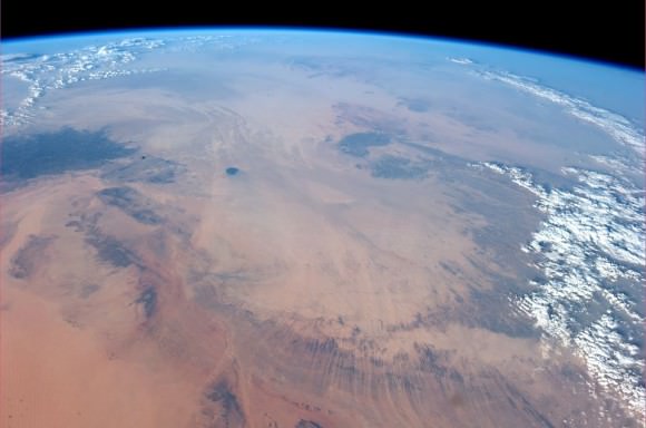
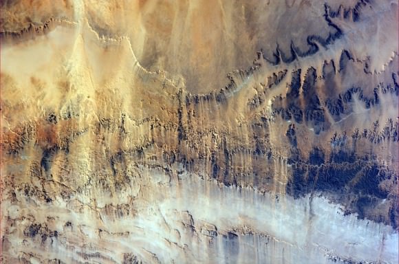
Here’s several of Alexander Gerst’s newest views of the Sahara Desert and more.

“Even from space, the Sahara looks dry! Sogar vom Weltraum aus, sieht die Sahara trocken aus!” Taken from the ISS on 6 July 2014. Credit: ESA/Alexander Gerst
“Harsh land. Windswept valleys in northern Africa. Hartes Land. Windgefraeste Taeler in Nordafrika.” Taken from the ISS on 6 July 2014. Credit: ESA/Alexander Gerst
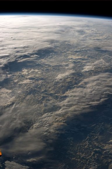
“Sometimes our atmosphere looks incredibly complex and three-dimensional, sometimes you don't even see it. Manchmal schaut unsere Atmosphäre unglaublich Komplex und dreidimensional aus, manchmal fast unsichtbar.”  Taken from the ISS on 5 July 2014. Credit: ESA/Alexander Gerst
“Sometimes our atmosphere looks incredibly complex and three-dimensional, sometimes you don’t even see it. Manchmal schaut unsere Atmosphäre unglaublich Komplex und dreidimensional aus, manchmal fast unsichtbar.” Taken from the ISS on 5 July 2014. Credit: ESA/Alexander Gerst
Antarctic aurora.  The Antarctic aurora, photographed by ESA astronaut Alexander Gerst and posted on social media with the comment: "Antarctic Aurora fleeing from  sunrise. I have rarely seen something more magical in my life!" Credits: ESA/NASA/Alexander Gerst
Antarctic aurora. The Antarctic aurora, photographed by ESA astronaut Alexander Gerst and posted on social media with the comment: “Antarctic Aurora fleeing from sunrise. I have rarely seen something more magical in my life!” Credits: ESA/NASA/Alexander Gerst

Stay tuned here for Ken’s continuing ISS, OCO-2, GPM, Curiosity, Opportunity, Orion, SpaceX, Boeing, Orbital Sciences, MAVEN, MOM, Mars and more Earth & Planetary science and human spaceflight news.

Ken Kremer

…………….

Learn more about Orbital Sciences Antares ISS launch on July 11 from NASA Wallops, VA, and more about SpaceX, Boeing, commercial space, NASA’s Mars missions and more at Ken’s upcoming presentations.

July 10/11: “Antares/Cygnus ISS Launch from Virginia” & “Space mission updates”; Rodeway Inn, Chincoteague, VA, evening
Rare and Beautiful Noctilucent Clouds Wow Over Holland – Gallery

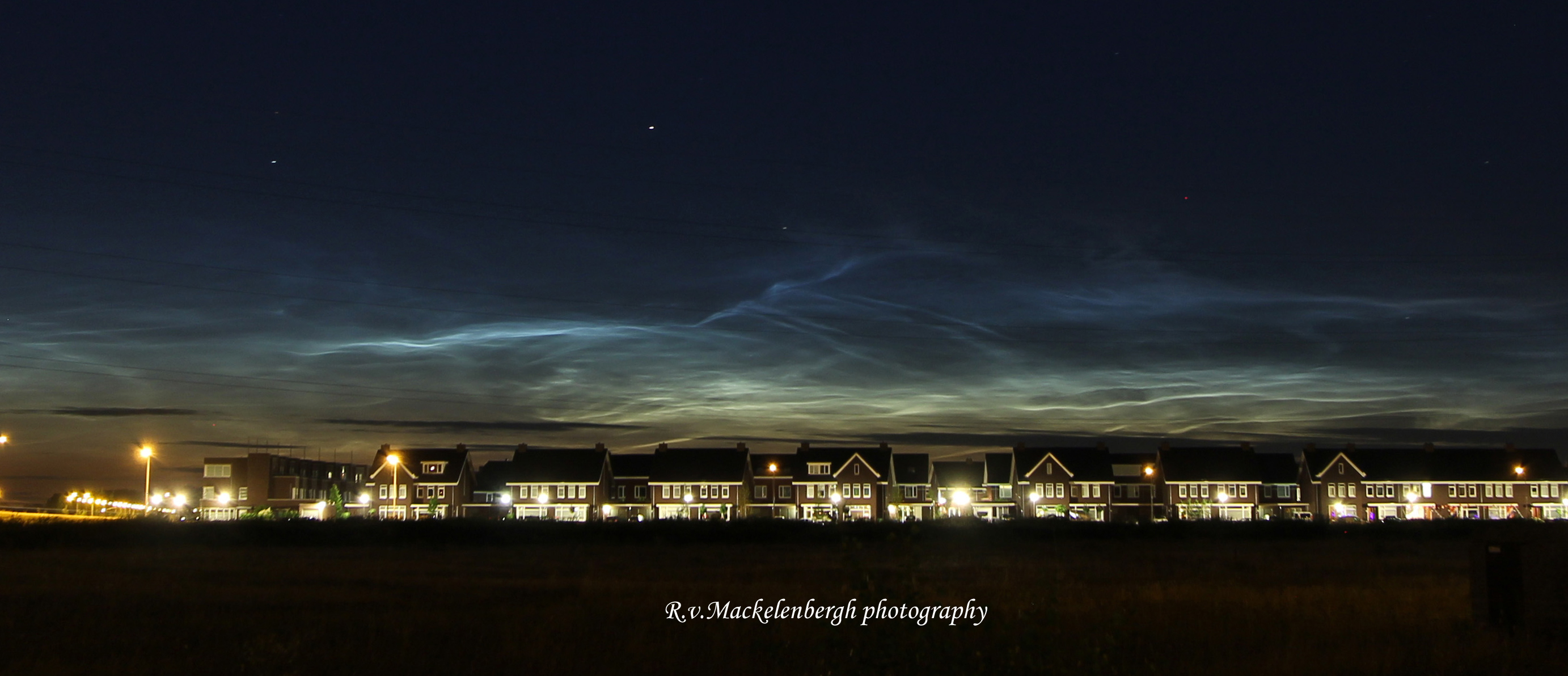
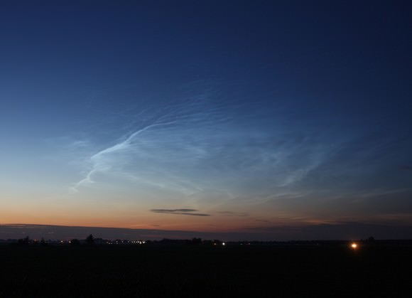
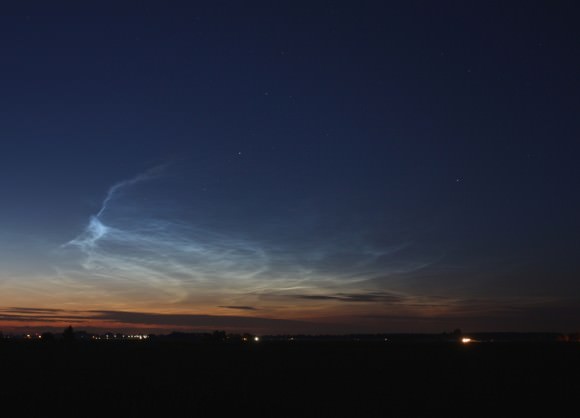
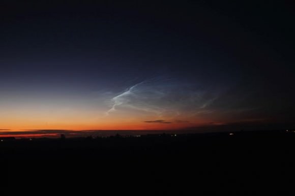
Noctilucent clouds over the city of Rosmalen, Holland, July 3, 2014. Taken with Canon 60D, 28 mm lens. Credit: Rob van Mackelenbergh

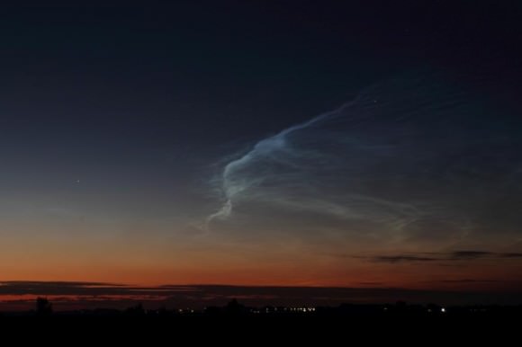
A trio of talented Dutch astrophotographers have captured a series of magnificent views of the rare and beautiful phenomena known as Noctilucent Clouds, or NLCs, during a spectacular outburst on the night of July 3, 2014 in the dark skies over southern Holland – coincidentally coinciding with the fireworks displays of the Dutch 2014 FIFA World Cup team and America’s 4th of July Independence Day celebrations!

“I suddenly saw them above my city on the night of July 3rd and ran for my camera!” said Dutch astrophotographer Rob van Mackelenbergh, who lives in the city of Rosmalen and excitedly emailed me his photos – see above and below.

“I was lucky to see them because I left work early.”

Noctilucent clouds are rather mysterious and often described as “alien looking” with “electric-blue ripples and pale tendrils reaching across the night sky resembling something from another world,” according to a NASA description.

Noctilucent clouds over the city of Rosmalen, Holland, July 3, 2014. Taken with Canon 60D, 28 mm lens. Credit: Rob van Mackelenbergh

They are Earth’s highest clouds, forming on tiny crystals of water ice and dust particles high in the mesosphere near the edge of space by a process known as nucleation, at altitudes of about 76 to 85 kilometers (47 to 53 miles).

NLCs are generally only visible on rare occasions in the late spring to summer months in the hours after sunset and at high latitudes – 50° to 70° north and south of the equator.

Noctilucent clouds over the city of Rosmalen, Holland, July 3, 2014. Taken with Canon 60D, 28 mm lens. Credit: Rob van Mackelenbergh

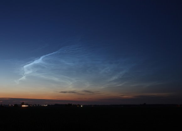
Another pair of Dutch guys, Raymond Westheim and Edwin van Schijndel, quickly hit the road to find a clear view when they likewise saw the mesmerizingly colorful and richly hued outburst on July 3rd and also sent me their fabulous NLC photos.

“To have a free view to the horizon, we drove to the countryside just north of the city of Oss. On a small road we have stopped to witness these beautiful NLCs and to take pictures,” said Westheim.

Late night Noctilucent clouds outside Oss, Holland, July 3, 2014. Taken with Canon EOS 450D, 17-40 mm lens, ISO 200, f=5.6, exposure time 5-15 seconds Credit: Raymond Westheim
Late night Noctilucent clouds outside Oss, Holland, July 3, 2014. Taken with Canon EOS 450D, 17-40 mm lens, ISO 200, f=5.6, exposure time 5-15 seconds. Credit: Raymond Westheim

See a gallery of Raymond’s and Edwin’s photos herein.

“The NLCs of last night were the most beautiful ones since 2010. They were remarkably bright and rapidly changing and could be seen drifting towards the South,” Westheim explained with glee.

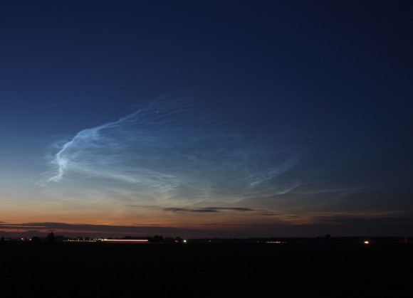
“These pictures were taken a few kilometers north of our city Oss between 23:15 p.m. and 0:15 a.m. (Central Europe Time) on Thursday evening, July 3,” said Edwin van Schijndel.

Noctilucent clouds near Oss, Holland on July 3, 2014. Taken with Canon EOS 60 D, 17 - 40 Canon lens, exposure time 2 to 4 seconds, ISO 200. Credit: Edwin van Schijndel
Noctilucent clouds near Oss, Holland on July 3, 2014. Taken with Canon EOS 60 D, 17 – 40 Canon lens, exposure time 2 to 4 seconds, ISO 200. Credit: Edwin van Schijndel

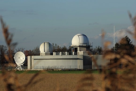
Rob, Raymond and Edwin are all members of the “Sterrenwacht Halley” Observatory which was built in 1987. It houses a planetarium and a Celestron C14 Schmidt-Cassegrain telescope. The observatory is located about 50 kilometers from the border with Belgium, near Den Bosch – the capitol city of southern Holland. The well known club hosts astronomy lectures and star parties to educate the public about astronomy and science.

The spectacular NLC sky show is apparently visible across Europe. Spaceweather.com has received NLC reports “from France, Germany, Poland, the Netherlands, Scotland, Ireland, England, Estonia and Belgium.”

Here are some additional NLC Observing Tips from NASA:

NLC Observing tips: Look west 30 to 60 minutes after sunset when the Sun has dipped 6 degrees to 16 degrees below the horizon. If you see luminous blue-white tendrils spreading across the sky, you’ve probably spotted a noctilucent cloud. Although noctilucent clouds appear most often at arctic latitudes, they have been sighted in recent years as far south as Colorado, Utah and Nebraska. NLCs are seasonal, appearing most often in late spring and summer. In the northern hemisphere, the best time to look would be between mid-May and the end of August.

The first reported sighting of NLC’s are relatively recent in 1885 by a German astronomer named T.W. Backhouse, some two years after the enormous eruption of the Krakatoa Volcano in 1883 that wreaked enormous death and destruction and which may or may not be related.

Over the past few years, astronaut crews aboard the ISS have also photographed splendid NLC imagery from low Earth orbit.

Stay tuned here for Ken’s continuing OCO-2, GPM, Curiosity, Opportunity, Orion, SpaceX, Boeing, Orbital Sciences, MAVEN, MOM, Mars and more Earth & Planetary science and human spaceflight news.

Ken Kremer

Late night Noctilucent clouds outside Oss, Holland, July 3, 2014. Taken with Canon EOS 450D, 17-40 mm lens, ISO 200, f=5.6, exposure time 5-15 seconds Credit: Raymond Westheim
Late night Noctilucent clouds outside Oss, Holland, July 3, 2014. Taken with Canon EOS 450D, 17-40 mm lens, ISO 200, f=5.6, exposure time 5-15 seconds. Credit: Raymond Westheim

…………….

Learn more about NASA’s Mars missions and Orbital Sciences Antares ISS launch on July 11 from NASA Wallops, VA in July and more about SpaceX, Boeing and commercial space and more at Ken’s upcoming presentations.

July 10/11: “Antares/Cygnus ISS Launch from Virginia” & “Space mission updates”; Rodeway Inn, Chincoteague, VA, evening
Late night Noctilucent clouds outside Oss, Holland, July 3, 2014. Taken with Canon EOS 450D, 17-40 mm lens, ISO 200, f=5.6, exposure time 5-15 seconds.  Credit: Raymond Westheim
Late night Noctilucent clouds outside Oss, Holland, July 3, 2014. Taken with Canon EOS 450D, 17-40 mm lens, ISO 200, f=5.6, exposure time 5-15 seconds. Credit: Raymond Westheim
Noctilucent clouds near Oss, Holland on July 3, 2014. Taken with Canon EOS 60 D, 17 - 40 Canon lens, exposure time 2 to 4 seconds, ISO 200. Credit: Edwin van Schijndel
Noctilucent clouds near Oss, Holland on July 3, 2014. Taken with Canon EOS 60 D, 17 – 40 Canon lens, exposure time 2 to 4 seconds, ISO 200. Credit: Edwin van Schijndel
Sterrenwacht Halley Observatory in Holland.  Credit: Rob van Mackelenbergh
Sterrenwacht Halley Observatory in Holland. Credit: Rob van Mackelenbergh

Astronauts Keep an Eye on Tropical Storm Arthur from the Space Station

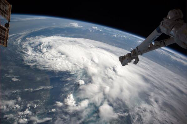
Astronauts on the International Space Station took this image of Tropical Storm Arthur on July 2, 2014. Credit: Reid Wiseman/NASA.

The first storm of the Atlantic hurricane season is easily visible from space. International Space Station astronaut Reid Wiseman tweeted this picture of the storm, saying, “Just flew over Tropical Storm Arthur – hoping it heads to sea. Looks mean.”

Forecasters said the storm is slowly strengthening off Florida’s east coast, but will move up the coast just in time for the July 4th holiday in the US. While Tropical Storm Arthur is likely to stay offshore while it cruises by Florida, it might become a hurricane by Thursday. The National Hurricane Center reported at 2 pm EDT Wednesday that a tropical storm warning is in effect for all of coastal North Carolina with a hurricane watch the for the portion of the state that extends into the Atlantic Ocean. As of the time of the report, Tropical Storm Arthur was about 160 km (100 miles) east of Daytona Beach, Florida and 378 km (235 miles) south of Charleston, South Carolina.
A graphic showing Tropical Storm Force Wind Speed Probabilities for Tropical Storm Arthur, from July 2 through July 7. Credit: National Hurricane Center/NOAA.
For current information about this storm, see the National Hurricane Center’s website.

NASA’s Carbon Observatory Blasts off on Workhorse Delta II to Measure Carbon Dioxide Greenhouse Gas and Watch Earth Breathe

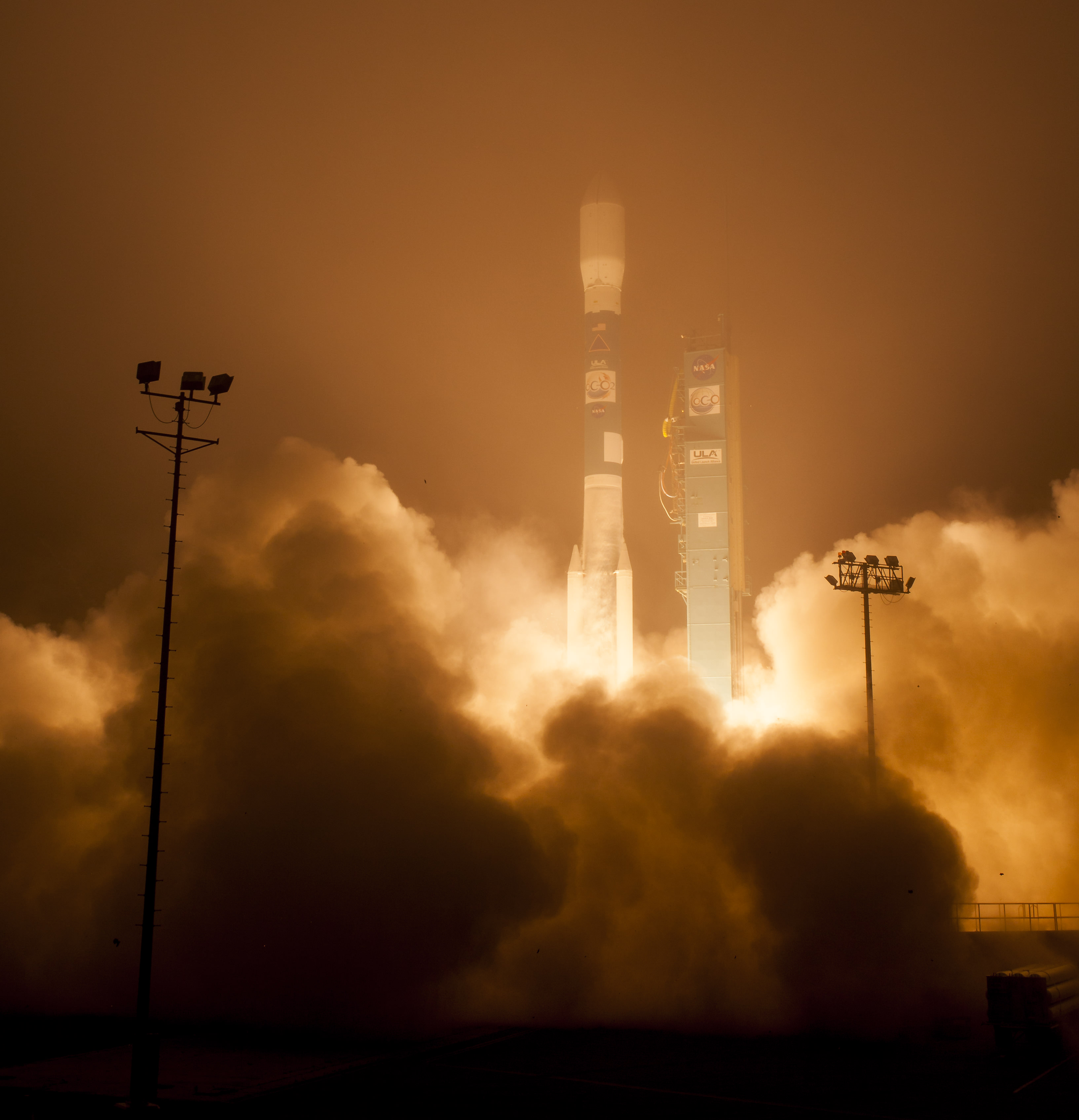
The Orbiting Carbon Observatory-2, NASA's first mission dedicated to studying carbon dioxide in Earth's atmosphere, lifts off from Vandenberg Air Force Base, California, at 2:56 a.m. Pacific Time, July 2, 2014 on a Delta II rocket. The two-year mission will help scientists unravel key mysteries about carbon dioxide. Credit: NASA/Bill Ingalls
The Orbiting Carbon Observatory-2, NASA’s first mission dedicated to studying carbon dioxide in Earth’s atmosphere, lifts off from Vandenberg Air Force Base, California, at 2:56 a.m. Pacific Time, July 2, 2014 on a Delta II rocket. The two-year mission will help scientists unravel key mysteries about carbon dioxide. Credit: NASA/Bill Ingalls
Story updated[/caption]

Following a nearly three-year long hiatus, the workhorse Delta II rocket successfully launched NASA’s first spacecraft dedicated to watching Earth breathe by studying Earth’s atmospheric carbon dioxide (CO2) – the leading human-produced greenhouse gas and the principal human-produced driver of climate change.

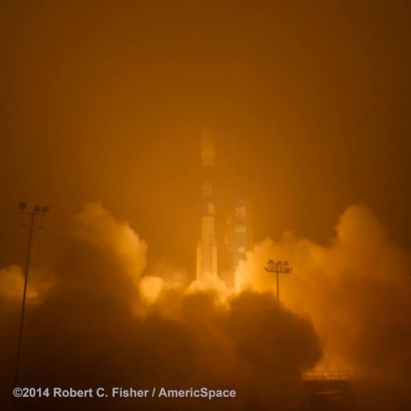
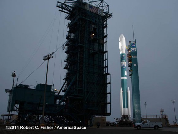
The Orbiting Carbon Observatory-2 (OCO-2) raced to orbit earlier this morning, during a spectacular nighttime blastoff at 2:56 a.m. PDT (5:56 a.m. EDT), Tuesday, July 2, 2014, from Vandenberg Air Force Base, California, atop a United Launch Alliance Delta II rocket.

The flawless launch marked the ‘return to flight’ of the venerable Delta II and was broadcast live on NASA TV.

Blastoff of NASA’s Orbiting Carbon Observatory-2 dedicated to studying carbon dioxide in Earth's atmosphere, from Vandenberg Air Force Base, California, at 2:56 a.m. Pacific Time, July 2, 2014. Credit: Robert Fisher/America/Space
Blastoff of NASA’s Orbiting Carbon Observatory-2 dedicated to studying carbon dioxide in Earth’s atmosphere, from Vandenberg Air Force Base, California, at 2:56 a.m. Pacific Time, July 2, 2014. Credit: Robert Fisher/America/Space

A camera mounted on the Delta II’s second stage captured a breathtaking live view of the OCO-2 spacecraft during separation from the upper stage, which propelled it into an initial 429-mile (690-kilometer) orbit.

The life giving solar arrays were unfurled soon thereafter and NASA reports that the observatory is in excellent health.

“Climate change is the challenge of our generation,” said NASA Administrator Charles Bolden in a statement.

“With OCO-2 and our existing fleet of satellites, NASA is uniquely qualified to take on the challenge of documenting and understanding these changes, predicting the ramifications, and sharing information about these changes for the benefit of society.”

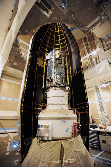
NASA's Orbiting Carbon Observatory-2, or OCO-2, inside the payload fairing in the mobile service tower at Space Launch Complex 2 on Vandenberg Air Force Base in California. The fairing will protect OCO-2 during launch aboard a United Launch Alliance Delta II rocket, scheduled for 5:56 a.m. EDT on July 1. OCO-2 is NASA’s first mission dedicated to studying atmospheric carbon dioxide, the leading human-produced greenhouse gas driving changes in Earth’s climate.   Credit: NASA/30th Space Wing USAF
NASA’s Orbiting Carbon Observatory-2, or OCO-2, inside the payload fairing in the mobile service tower at Space Launch Complex 2 on Vandenberg Air Force Base in California. The fairing will protect OCO-2 during launch aboard a United Launch Alliance Delta II rocket, which occurred at 5:56 a.m. EDT on July 2. OCO-2 is NASA’s first mission dedicated to studying atmospheric carbon dioxide, the leading human-produced greenhouse gas driving changes in Earth’s climate. Credit: NASA/30th Space Wing USAF

Over the next three weeks the OCO-2 probe will undergo a thorough checkout and calibration process. It will also be maneuvered into a 438-mile (705-kilometer) altitude, near-polar orbit where it will become the lead science probe at the head of the international Afternoon Constellation, or “A-Train,” of Earth-observing satellites.

“The A-Train, the first multi-satellite, formation flying “super observatory” to record the health of Earth’s atmosphere and surface environment, collects an unprecedented quantity of nearly simultaneous climate and weather measurements,” says NASA.

Science operations begin in about 45 days.

The 999 pound (454 kilogram) observatory is the size of a phone booth.

OCO-2 is equipped with a single science instrument consisting of three high-resolution, near-infrared spec¬trometers fed by a common telescope. It will collect global measurements of atmospheric CO2 to provide scientists with a better idea of how CO2 impacts climate change and is responsible for Earth’s warming.

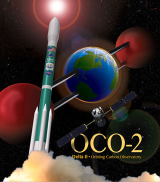
OCO-2 poster. Credit: ULA/NASA

During a minimum two-year mission the $467.7 million OCO-2 will take near global measurements to locate the sources and storage places, or ‘sinks’, for atmospheric carbon dioxide, which is a critical component of the planet’s carbon cycle.

OCO-2 was built by Orbital Sciences as a replacement for the original OCO which was destroyed during the failed launch of a Taurus XL rocket from Vandenberg back in February 2009 when the payload fairing failed to open properly and the spacecraft plunged into the ocean.

The OCO-2 mission will provide a global picture of the human and natural sources of carbon dioxide, as well as their “sinks,” the natural ocean and land processes by which carbon dioxide is pulled out of Earth’s atmosphere and stored, according to NASA.

“This challenging mission is both timely and important,” said Michael Freilich, director of the Earth Science Division of NASA’s Science Mission Directorate in Washington.

“OCO-2 will produce exquisitely precise measurements of atmospheric carbon dioxide concentrations near Earth’s surface, laying the foundation for informed policy decisions on how to adapt to and reduce future climate change.”

It will record around 100,000 precise individual CO2 measurements around the worlds entire sunlit hemisphere every day and help determine its source and fate in an effort to understand how human activities impact climate change and how we can mitigate its effects.

At the dawn of the Industrial Revolution, there were about 280 parts per million (ppm) of carbon dioxide in Earth’s atmosphere. As of today the CO2 level has risen to about 400 parts per million.

“Scientists currently don’t know exactly where and how Earth’s oceans and plants have absorbed more than half the carbon dioxide that human activities have emitted into our atmosphere since the beginning of the industrial era,” said David Crisp, OCO-2 science team leader at NASA’s Jet Propulsion Laboratory in Pasadena, California, in a statement.

“Because of this, we cannot predict precisely how these processes will operate in the future as climate changes. For society to better manage carbon dioxide levels in our atmosphere, we need to be able to measure the natural source and sink processes.”

OCO-2 is the second of NASA’s five new Earth science missions planned to launch in 2014 and is designed to operate for at least two years during its primary mission. It follows the successful blastoff of the joint NASA/JAXA Global Precipitation Measurement (GPM) Core Observatory satellite on Feb 27.

Prelaunch view of NASA’s Orbiting Carbon Observatory-2 and United Launch Alliance Delta II rocket unveiled at  Space Launch Complex 2 at Vandenberg Air Force Base in California. Credit: Robert Fisher/America/Space
Prelaunch view of NASA’s Orbiting Carbon Observatory-2 and United Launch Alliance Delta II rocket unveiled at Space Launch Complex 2 at Vandenberg Air Force Base in California. Credit: Robert Fisher/America/Space

The two stage Delta II 7320-10 launch vehicle is 8 ft in diameter and approximately 128 ft tall and was equipped with a trio of first stage strap on solid rocket motors. This marked the 152nd Delta II launch overall and the 51st for NASA since 1989.

The last time a Delta II rocket flew was nearly three years ago in October 2011 from Vandenberg for the Suomi National Polar-Orbiting Partnership (NPP) weather satellite.

The final Delta II launch from Cape Canaveral on Sept. 10, 2011 boosted NASA’s twin GRAIL gravity mapping probes to the Moon.

The next Delta II launch later this year from Vandenberg involves NASA’s Soil Moisture Active Passive (SMAP) mission and counts as another of NASA’s five Earth science missions launching in 2014.

Stay tuned here for Ken’s continuing OCO-2, GPM, Curiosity, Opportunity, Orion, SpaceX, Boeing, Orbital Sciences, MAVEN, MOM, Mars and more Earth & Planetary science and human spaceflight news.

Ken Kremer

NASA Set to Launch OCO-2 Observatory on July 1 – Sniffer of Carbon Dioxide Greenhouse Gas

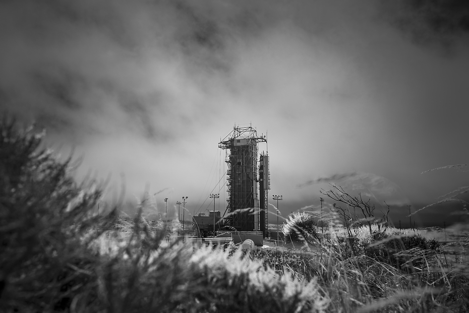
NASA’s Orbiting Carbon Observatory-2 (OCO-2) at the Launch Pad. This black-and-white infrared view shows the launch gantry, surrounding the United Launch Alliance Delta II rocket with the Orbiting Carbon Observatory-2 (OCO-2) satellite onboard. The photo was taken at Space Launch Complex 2, Friday, June 27, 2014, Vandenberg Air Force Base, Calif. OCO-2 is set for a July 1, 2014 launch. Credit: NASA/Bill Ingalls

NASA’s Orbiting Carbon Observatory-2 (OCO-2) at the Launch Pad
This black-and-white infrared view shows the launch gantry, surrounding the United Launch Alliance Delta II rocket with the Orbiting Carbon Observatory-2 (OCO-2) satellite onboard. The photo was taken at Space Launch Complex 2, Friday, June 27, 2014, Vandenberg Air Force Base, Calif. OCO-2 is set for a July 1, 2014 launch. Credit: NASA/Bill Ingalls[/caption]

After a lengthy hiatus, the workhorse Delta II rocket that first launched a quarter of a century ago and placed numerous renowned NASA science missions into Earth orbit and interplanetary space, as well as lofting dozens of commercial and DOD missions, is about to soar again this week on July 1 with NASA’s Orbiting Carbon Observatory-2 (OCO-2) sniffer to study atmospheric carbon dioxide (CO2).

OCO-2 is NASA’s first mission dedicated to studying atmospheric carbon dioxide, the leading human-produced greenhouse gas and the principal human-produced driver of climate change.

The 999 pound (454 kilogram) observatory is equipped with one science instrument consisting of three high-resolution, near-infrared spectrometers fed by a common telescope. It will collect global measurements of atmospheric CO2 to provide scientists with a better idea of how CO2 impacts climate change.

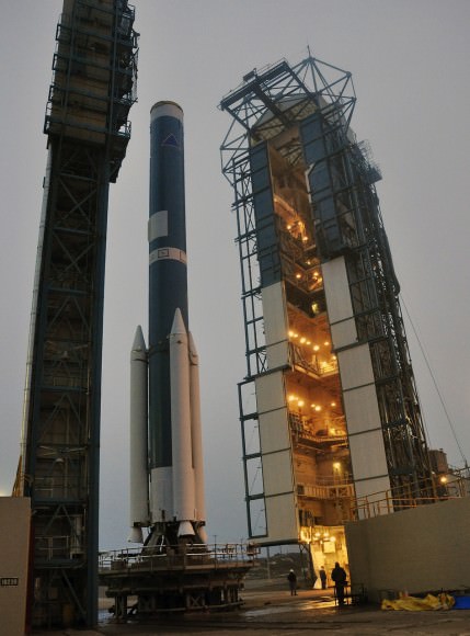
OCO-2's Delta II Rocket, First Stage  At Space Launch Complex 2 on Vandenberg Air Force Base in California, the mobile service tower rolls away from the launch stand supporting the first stage of the Delta II rocket for NASA's Orbiting Carbon Observatory-2 mission. Three solid rocket motors (white) have been attached to the first stage. The photo was taken during operations to mate the rocket's first and second stages. Credit: NASA/Randy Beaudoin
OCO-2’s Delta II Rocket, First Stage At Space Launch Complex 2 on Vandenberg Air Force Base in California, the mobile service tower rolls away from the launch stand supporting the first stage of the Delta II rocket for NASA’s Orbiting Carbon Observatory-2 mission. Three solid rocket motors (white) have been attached to the first stage. The photo was taken during operations to mate the rocket’s first and second stages. Credit: NASA/Randy Beaudoin

The $467.7 million OCO-2 mission is set to blastoff atop the United Launch Alliance (ULA) Delta II rocket on Tuesday, July 1 from Space Launch Complex 2 at Vandenberg Air Force Base in California.

Liftoff is slated for 5:56 a.m. EDT (2:56 a.m. PDT) at the opening of a short 30-second launch window.

NASA TV will broadcast the launch live with countdown commentary beginning at 3:45 a.m. EDT (12:45 a.m. PDT): http://www.nasa.gov/multimedia/nasatv/

The California weather prognosis is currently outstanding at 100 percent ‘GO’ for favorable weather conditions at launch time.

OCO-2 poster. Credit: ULA/NASA

The two stage Delta II 7320-10 launch vehicle is 8 ft in diameter and approximately 128 ft tall. It is equipped with a trio of strap on solid rocket motors. This marks the 152nd Delta II launch overall and the 51st for NASA since 1989.

The last time a Delta II rocket flew was nearly three years ago in October 2011 from Vandenberg for the Suomi National Polar-Orbiting Partnership (NPP) weather satellite.

The final Delta II launch from Cape Canaveral on Sept. 10, 2011 boosted NASA’s twin GRAIL gravity mapping probes to the Moon.

The Delta II will boost OCO-2 into a 438-mile (705-kilometer) altitude, near-polar orbit. Spacecraft separation from the rocket occurs 56 minutes 15 seconds after launch.

It will lead a constellation of five other international Earth monitoring satellites that circle Earth.

NASA's Orbiting Carbon Observatory-2, or OCO-2, inside the payload fairing in the mobile service tower at Space Launch Complex 2 on Vandenberg Air Force Base in California. The fairing will protect OCO-2 during launch aboard a United Launch Alliance Delta II rocket, scheduled for 5:56 a.m. EDT on July 1. OCO-2 is NASA’s first mission dedicated to studying atmospheric carbon dioxide, the leading human-produced greenhouse gas driving changes in Earth’s climate.   Credit: NASA/30th Space Wing USAF
NASA’s Orbiting Carbon Observatory-2, or OCO-2, inside the payload fairing in the mobile service tower at Space Launch Complex 2 on Vandenberg Air Force Base in California. The fairing will protect OCO-2 during launch aboard a United Launch Alliance Delta II rocket, scheduled for 5:56 a.m. EDT on July 1. OCO-2 is NASA’s first mission dedicated to studying atmospheric carbon dioxide, the leading human-produced greenhouse gas driving changes in Earth’s climate. Credit: NASA/30th Space Wing USAF

The phone-booth sized OCO-2 was built by Orbital Sciences and is a replacement for the original OCO which was destroyed during the failed launch of a Taurus XL rocket from Vandenberg back in February 2009 when the payload fairing failed to open properly.

OCO-2 is the second of NASA’s five new Earth science missions launching in 2014 and is designed to operate for at least two years during its primary mission. It follows the successful blastoff of the joint NASA/JAXA Global Precipitation Measurement (GPM) Core Observatory satellite on Feb 27.

Orbiting Carbon Observatory-2 (OCO-2) mission will provide a global picture of the human and natural sources of carbon dioxide, as well as their “sinks,” the natural ocean and land processes by which carbon dioxide is pulled out of Earth’s atmosphere and stored, according to NASA..

“Carbon dioxide in the atmosphere plays a critical role in our planet’s energy balance and is a key factor in understanding how our climate is changing,” said Michael Freilich, director of NASA’s Earth Science Division in Washington.

“With the OCO-2 mission, NASA will be contributing an important new source of global observations to the scientific challenge of better understanding our Earth and its future.”

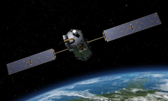
Artist's rendering of NASA's Orbiting Carbon Observatory (OCO)-2, one of five new NASA Earth science missions set to launch in 2014, and one of three managed by JPL. Credit:  NASA-JPL/Caltech
Artist’s rendering of NASA’s Orbiting Carbon Observatory (OCO)-2, one of five new NASA Earth science missions set to launch in 2014, and one of three managed by JPL. Credit: NASA-JPL/Caltech

It will record around 100,000 CO2 measurements around the world every day and help determine its source and fate in an effort to understand how human activities impact climate change and how we can mitigate its effects.

At the dawn of the Industrial Revolution, there were about 280 parts per million (ppm) of carbon dioxide in Earth’s atmosphere. As of today the CO2 level has risen to about 400 parts per million.

Stay tuned here for Ken’s continuing OCO-2, GPM, Curiosity, Opportunity, Orion, SpaceX, Boeing, Orbital Sciences, MAVEN, MOM, Mars and more Earth & Planetary science and human spaceflight news.

Ken Kremer

Blastoff of twin GRAIL A and B lunar gravity mapping spacecraft on a Delta II Heavy rocket on Sept. 10 from Pad 17B Cape Canaveral Air Force Station in Florida at 9:08 a.m. EDT. Credit: Ken Kremer/kenkremer.com
Blastoff of twin GRAIL A and B lunar gravity mapping spacecraft on a Delta II Heavy rocket on Sept. 10, 2011, from Pad 17B Cape Canaveral Air Force Station in Florida at 9:08 a.m. EDT. Credit: Ken Kremer/kenkremer.com

The Place Where Earth from Space Looks Like a Floating Piece of Cardboard

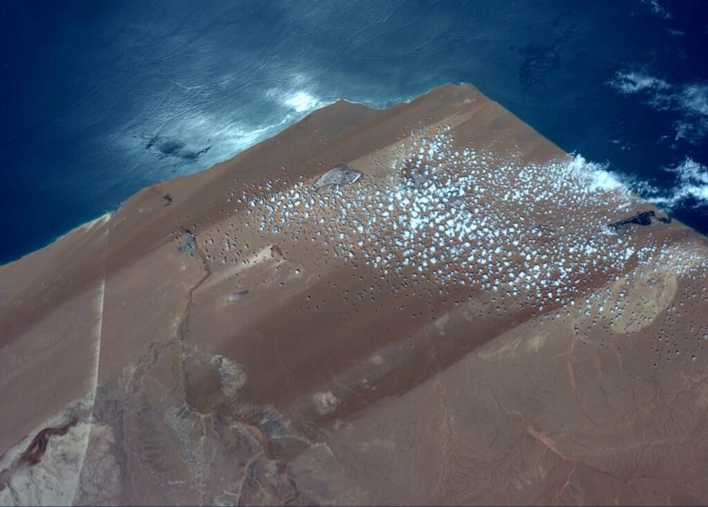
An image taken from the International Space Station taken on Jun 23, 2014 showing Western Sahara , near El Aaiun. Credit: Reid Wiseman/NASA.

As we’ve noted before, astronaut Reid Wiseman is sending out a bevy of tweets and pictures from his perch on board the International Space Station, but this recent image got our attention.

“Can’t explain it, just looked oddly unnatural to me and I liked it,” Wiseman said on Twitter, leaving no info on what Earthly feature might be.

Floating cardboard? That’s what many people thought. Comments from Twitter:

So what is this image and where on Earth is it?

I checked with Peter Caltner, who regularly tweets information on astronaut photos and he said the image shows Western Sahara, near El Aaiun (coordinates 26.824071,-13.222504) and the straight white line is a conveyor belt facility from a phosphate mine at Bou Craa that goes to a loading port at the coast. The conveyer belt is about 60 miles/100 km long, Peter noted.

You can see more images of this feature in this Google search, but none of them have quite the angle Wiseman had, which gave it the straight-edge box-like appearance from space.

See more comments about the image here.

Thanks again to Peter Caltner for his assistance!

How to See Airglow, the Green Sheen of Night

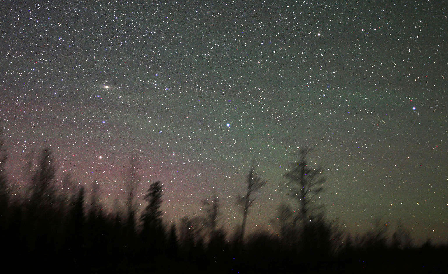
Airglow shows as wavy stripes of pale green across the northeastern sky on May 24, 2014. Andromeda Galaxy at left. the banding was faintly visible with the naked eye as a soft, diffuse glow. The red glow at lower left is airglow from atomic oxygen 90-185 miles up. Details: 20mm lens, ISO 3200, 30". Credit: Bob King

Emerald green, fainter than the zodiacal light and visible on dark nights everywhere on Earth, airglow pervades the night sky from equator to pole. Airglow turns up in our time exposure photographs of the night sky as ghostly ripples of aurora-like light about 10-15 degrees above the horizon. Its similarity to the aurora is no coincidence. Both form at around the same altitude of  60-65 miles (100 km) and involve excitation of atoms and molecules, in particular oxygen. But different mechanisms tease them to glow. 

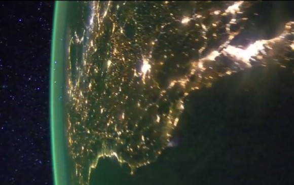
Photo taken of Earth at night from the International Space Station showing bright splashes of city lights and the airglow layer off in the distance rimming the Earth's circumference. Credit: NASA
Earth at night from the International Space Station showing bright splashes of city lights and the airglow layer created by light-emitting oxygen atoms some 60 miles high in the atmosphere.  This green cocoon of light is familiar to anyone who’s looked at photos of Earth’s night-side from orbit. Credit: NASA

Auroras get their spark from high-speed electrons and protons in the solar wind that bombard oxygen and nitrogen atoms and molecules. As excited electrons within those atoms return to their rest states, they emit photons of green and red light that create shimmering, colorful curtains of northern lights.

Green light from excited oxygen atoms dominates the glow. The atoms are 90-100 km (56-62 mile) high in the thermosphere. The weaker red light is from oxygen atoms further up. Sodium atoms, hydroxyl radicals (OH) and molecular oxygen add to the light. Credit: Les Cowley
Green light from excited oxygen atoms dominates the light of airglow. The atoms are 56-62 miles high in the thermosphere. The weaker red light is from oxygen atoms further up. Sodium atoms, hydroxyl radicals (OH) and molecular oxygen add their own complement to the light. Credit: Les Cowley

Airglow’s subtle radiance arises from excitation of a different kind. Ultraviolet light from the daytime sun ionizes or knocks electrons off of oxygen and nitrogen atoms and molecules;  at night the electrons recombine with their host atoms, releasing energy as light of different colors including green, red, yellow and blue.  The brightest emission, the one responsible for creating the green streaks and bands visible from the ground and orbit, stems from excited oxygen atoms beaming light at 557.7 nanometers, smack in the middle of  the yellow-green parcel of spectrum where our eyes are most sensitive.

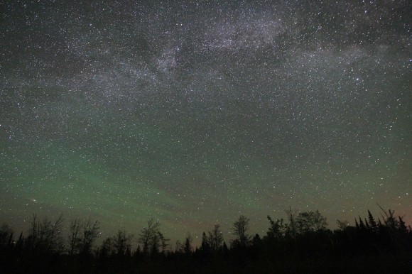
Airglow across the eastern sky below the summertime Milky Way. Notice that unlike the vertical rays and gently curving arcs of the aurora, airglow is banded and streaky and in places almost fibrous. Credit: Bob King
Airglow across the eastern sky below the summertime Milky Way. Notice that unlike the vertical rays and gently curving arcs of the aurora, airglow is banded, streaky and in places almost fibrous. It’s brightest and best visible 10-15 degrees high along a line of sight through the thicker atmosphere. If you look lower, its feeble light is absorbed by denser air and dust. Looking higher, the light spreads out over a greater area and appears dimmer. Credit: Bob King
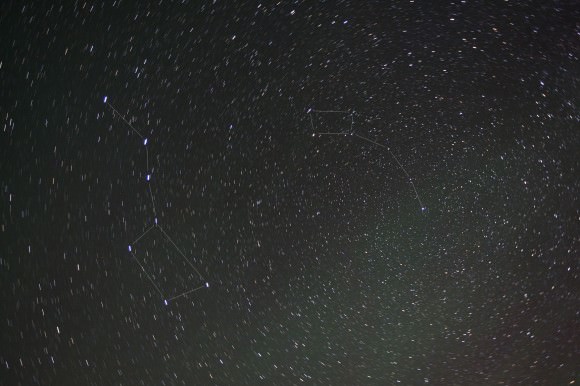
A large, faint patch of airglow below the Dippers photographed last month on a very dark night. To the eye, all airglow appears as colorless streaks and patches. Unlike the aurora, it's typically too faint to see color. No problem for the camera though! Credit: Bob King
A large, faint patch of airglow below the Dippers photographed May 24. To the eye, airglow appears as colorless streaks and patches. Unlike the aurora, it’s typically too faint to excite our color vision. Time exposures show its colors well. This swatch is especially faint because it’s much higher above the horizon. Credit: Bob King

That’s not saying airglow is easy to see! For years I suspected streaks of what I thought were high clouds from my dark sky observing site even when maps and forecasts indicated pristine skies. Photography finally taught me to trust my eyes. I started noticing green streaks near the horizon in long-exposure astrophotos. At first I brushed it off as camera noise. Then I noticed how the ghostly stuff would slowly shape-shift over minutes and hours and from night to night. Gravity waves created by jet stream shear, wind flowing over mountain ranges and even thunderstorms in the lower atmosphere propagate up to the thermosphere to fashion airglow’s ever-changing contours.

Airglow across Virgo last month. Mars is the bright object right and below center. Credit: Bob King
An obvious airglow smear across Virgo last month. Mars is the bright object below and right of center. Light pollution from Duluth, Minn. creeps in at lower left. Credit: Bob King

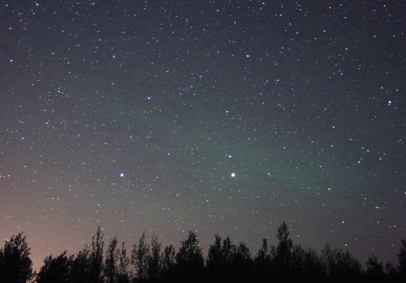
Last month, on a particularly dark night, I made a dedicated sweep of the sky after my eyes had fully adapted to the darkness. A large swath of airglow spread south of the Big and Little Dipper. To the east, Pegasus and Andromeda harbored hazy spots of  varying intensity, while brilliant Mars beamed through a long smear in Virgo.

To prove what I saw was real, I made the photos you see in this article and found they exactly matched my visual sightings. Except for color. Airglow is typically too faint to fire up the cone cells in our retinas responsible for color vision. The vague streaks and patches were best seen by moving your head around to pick out the contrast between them and the darker, airglow-free sky. No matter what part of the sky I looked, airglow poked its tenuous head. Indeed, if you were to travel anywhere on Earth, airglow would be your constant companion on dark nights, unlike the aurora which keeps to the polar regions. Warning – once you start seeing it, you

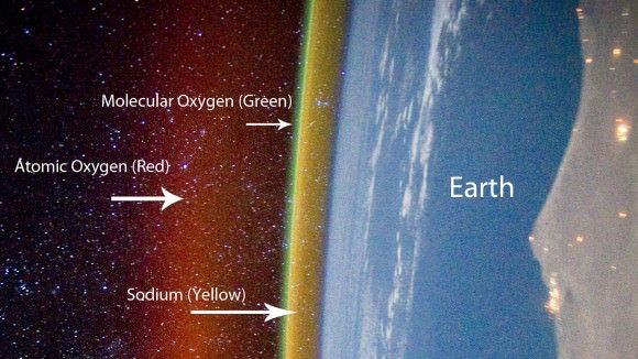
Excited oxygen at higher altitude creates a layer of faint red airglow. Sodium excitation forms the yellow layer at 57 miles up. Credit: NASA with annotations by Alex Rivest
Excited oxygen at higher altitude creates a layer of faint red airglow. Sodium excitation forms the yellow layer at 57 miles up. Airglow is brightest during daylight hours but invisible against the sunlight sky. Credit: NASA with annotations by Alex Rivest

Airglow comes in different colors – let’s take a closer look at what causes them:

* Red –  I’ve never seen it, but long-exposure photos often reveal red/pink mingled with the more common green. Excited oxygen atoms much higher up at 90-185 miles (150-300 km) radiating light at a different energy state are responsible. Excited -OH (hydroxyl) radicals give off deep red light in a process called chemoluminescence when they react with oxygen and nitrogen. Another chemoluminescent reaction takes place when oxygen and nitrogen molecules are busted apart by ultraviolet light high in the atmosphere and recombine to form nitric oxide  (NO).

* Yellow – From sodium atoms around 57 miles (92 km) high. Sodium arrives from the breakup and vaporization of minerals in meteoroids as they burn up in the atmosphere as meteors.

* Blue – Weak emission from excited oxygen molecules approximately 59 miles (95 km) high.

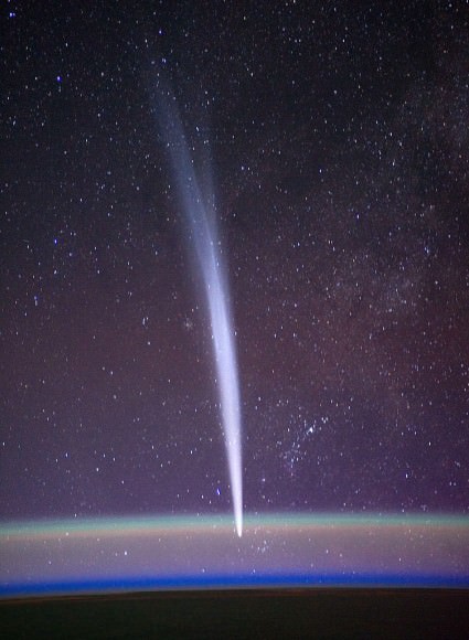
Comet Lovejoy passing behind green oxygen and sodium airglow layers on December 22, 2011 seen from the space station. Credit: NASA/Dan Burbank

Airglow varies time of day and night and season, reaching peak brightness about 10 degrees, where our line of sight passes through more air compared to the zenith where the light reaches minimum brightness. Since airglow is brightest around the time of solar maximum (about now), now is an ideal time to watch for it. Even cosmic rays striking molecules in the upper atmosphere make a contribution.


See lots of airglow and aurora from orbit in this video made using images taken from the space station.

If you removed the stars, the band of the Milky Way and the zodiacal light, airglow would still provide enough illumination to see your hand in front of your face at night. Through recombination and chemoluminescence, atoms and molecules creates an astounding array of colored light phenomena. We can’t escape the sun even on the darkest of nights.