Here’s Your Chance To Help Blend Earth And Mars Rocks

The official poster of the World Space Week Association 2013 campaign. Credit: World Space Week Association

The organizers of the World Space Week Association are working to create an “Earth Master Sample”, and they want your help. Anyone worldwide can send the association a fist-sized rock from their locale.

Next will come the interplanetary recipe magic: Once the samples arrive, a tiny bit of each rock will be procured and ground into a powder. The powder will be mixed together, with a dash of Mars meteorite added in. Next, a crystal company (Swarovski) will melt down the combination into 100 crystals.

These crystals will be shown off at Yuri’s Night celebrations on April 12, 2014; the event commemorates the first human spaceflight by Yuri Gagarin, which took place on that day in 1961. More importantly, the organizers said, the crystals will stand as a symbol of the importance of doing “planetary analog” research on Earth to better understand the conditions on other planets.

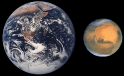
Are Earthlings really Martians ? Did life arise on Mars first and then journey on meteors to our planet and populate Earth billions of years ago?  Earth and Mars are compared in size as they look today.
Earth and Mars are compared in size as they look today.

“By participating in the Earth Master Sample campaign, people can show their support for analog exploration and their aspiration to see Mars exploration continue through sample return missions and, eventually, human expeditions,” stated Remco Timmermans, the association’s executive director.

Here are the instructions (reproduced below verbatim from the association):

  1. Take a picture of the sample site and a scale (e.g. classmate, family member etc.) from at least 10m distance
  2. Take a close-up picture with a scale (e.g. hammer, pen, etc)
  3. Note your geographical location (e.g. 31°22.363 N 4°4.357 W)
  4. Take a fist-sized rock sample. (No soil samples, no sand please).
  5. Put the sample into a clean plastic bag. IMPORTANT: Label the sampling bag with: date (DD/MM/YY) + Time (HH:MM) + geographical coordinates. (e.g. 17AUG13 17:22, 47.234 N / 11.234 E)
  6. Send an email to [email protected] listing the geographical location, the two pictures and the details of a contact person.
  7. Mail the rock-sample to: Austrian Space Forum / Earth Master Sample Project, Sillufer 3a, 6020 Innsbruck, AUSTRIA
  8. Deadline: 15. November 2013 (for arrival of rocks at the Austrian Space Forum)

This year, World Space Week runs from Oct. 4 to Oct. 10, 2013. The association will hold events at the Austrian Space Forum in Innsbruck, Austria. Here’s more information on their activities.

Could The U.S. Government Shutdown Hammer Earth and Mars Missions?

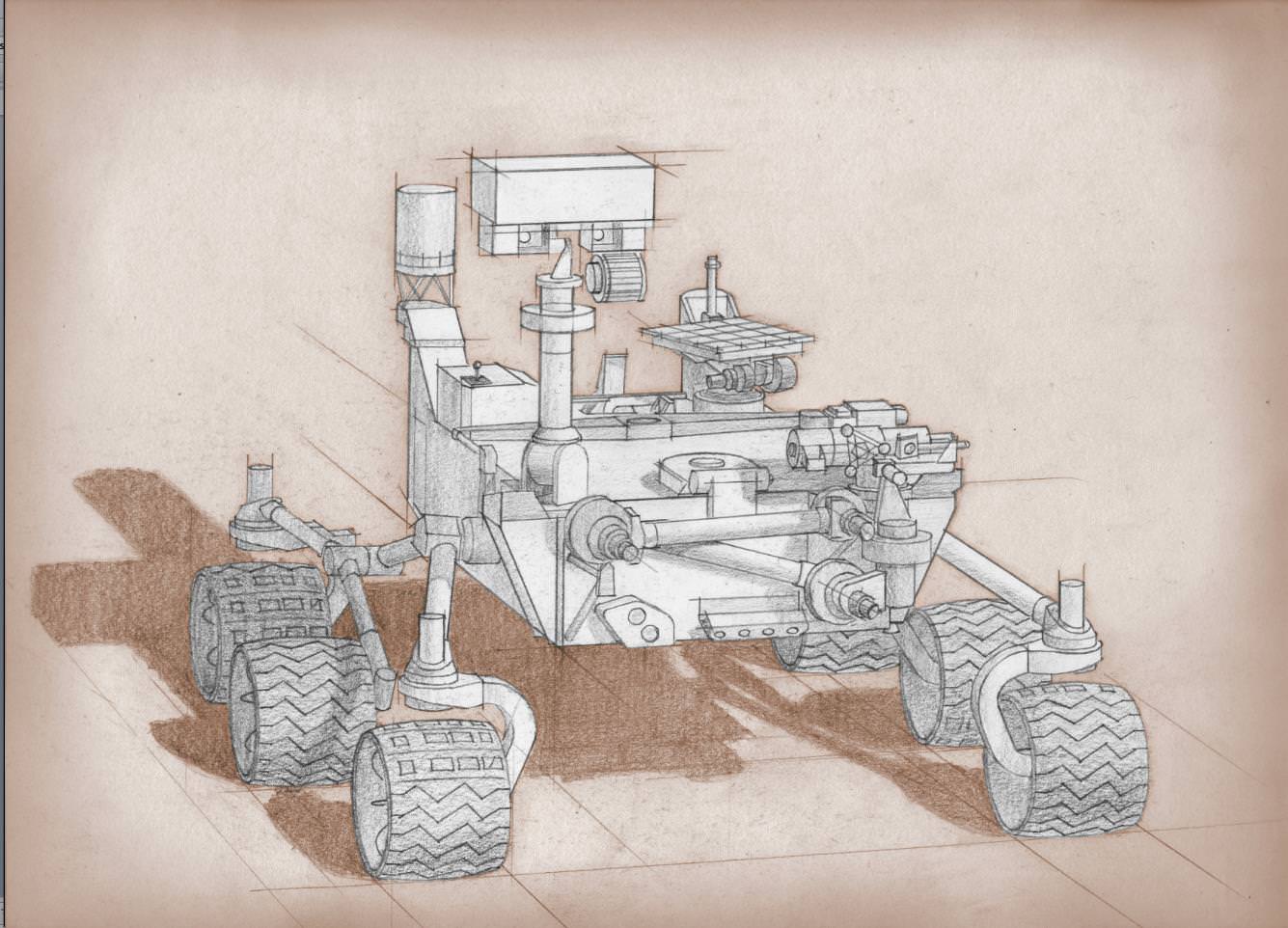
Artist's conception of the Mars 2020 rover. Credit: NASA

As Day 2 of the United States government shutdown continues, some short-term effects are already in evidence when it comes to Earth and space.

Most of the NASA and National Oceanic and Atmospheric Administration (NOAA) websites are offline. Social media updates are silent. At NASA, 97% of agency employees are off work and media reports indicate that 55% of NOAA’s employees are furloughed.

If the shutdown lasts for very long, however, long-term programs could feel the pain. This includes a couple of Mars missions NASA is developing, as well as Earth-based climate research and satellite observation from NOAA.

Mars 2020

A twin rover to Mars Curiosity, called Mars 2020 for now, is expected to leave for the Red Planet in 2020 and do investigations into past life and habitability. Planning is still in the early stages, but an announcement of opportunity for science investigators was supposed to happen on Oct. 8. Notices of intent were due Oct. 15.

“The preproposal conference, scheduled for 10/8, may be rescheduled and the due date for NOIs (currently 10/15) could be delayed, if the government is still shut down closer to those dates,” NASA officials wrote in an update before the shutdown on Monday.

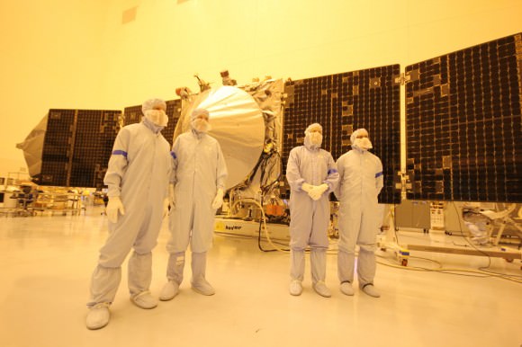
MAVEN team members, including chief scientist Bruce Jakosky (2nd from left)  pose with spacecraft inside the cleanroom at the Kennedy Space Center on Sept. 27, 2013. Credit: Ken Kremer/kenkremer.com
MAVEN team members, including chief scientist Bruce Jakosky (2nd from left) pose with spacecraft inside the cleanroom at the Kennedy Space Center on Sept. 27, 2013. Credit: Ken Kremer/kenkremer.com

MAVEN

As widely reported yesterday, the next Mars orbiter from NASA is expected to lift off from Earth on Nov. 18. Now, however, preparatory work has ceased and there is some concern from team members that it will miss the launch window, which extends into December. At worst, this means MAVEN’s launch could be delayed until 2016, when the next opportunity opens.

“The hardware is being safed, meaning that it will be put into a known, stable, and safe state,” Bruce Jakosky, MAVEN’s principal investigator, told Universe Today‘s Ken Kremer yesterday. “We’ll turn back on when told that we can. We have some margin days built into our schedule.”

NOAA

As with NASA, NOAA is keeping up with mission-critical activities — which in their case, includes weather forecasting. Long-term climate research, however, is reportedly being shelved.

“For example, Harold Brooks, a top tornado researcher who works at the National Severe Storms Laboratory in Norman, Okla., reported his furlough notice on Facebook on Tuesday,” Climate Central wrote on Oct. 1. “Much of the staff at NOAA’s Earth Systems Research Lab and the Geophysical Fluid Dynamics Laboratory, except for positions related to maintaining computing resources, have also been furloughed. Those two labs are heavily involved in NOAA’s climate research programs.”

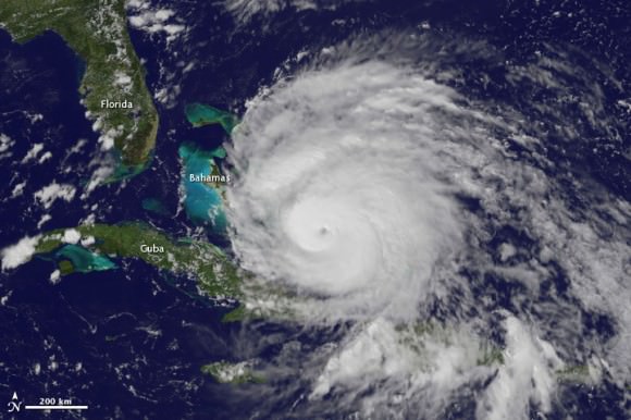
A view of Hurricane Irene taken by the GOES satellite at 2:55 p.m. Eastern Daylight Time on August 24, 2011. Credit: NASA

Observers are also worried that a lengthy shutdown could push back the time when new weather satellites become available. There have been multiple reports about a “weather satellite gap” coming in the United States as many of NOAA’s geostationary and polar-orbiting satellites are nearing the end of their expected lives. The Subcommittees on Oversight and Environment held hearings into this issue in September.

What’s still online?

These are some of the programs that are still happening at NASA and NOAA:

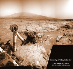
NASA’s Curiosity rover reaches out in ‘handshake’ like gesture with dramatic scenery of Mount Sharp in the background. This mosaic of images was snapped by Curiosity on Sol 262 (May 2, 2013) and shows her flexing the robotic arm. Two drill holes are visible on the surface bedrock below the robotic arm’s turret. Credit: NASA/JPL-Caltech/Ken Kremer-(kenkremer.com)/Marco Di Lorenzo

NASA:

  • Bare-bones management on programs such as the International Space Station and several robotic missions that are already in operation (such as the Lunar Atmosphere and Dust Environment Explorer (LADEE).
  • Certain missions are in critical phases that could be hurt if work stops, such as the James Webb Space Telescope, which is undergoing cryogenic testing on some of its instruments.
  • Several missions run out of the Jet Propulsion Laboratory and Applied Physics Laboratory are still running as usual, according to the Planetary Society, as these receive contract money from NASA; this means Mars Curiosity is still working, for example.
  • The Mars Reconnaissance Orbiter’s HiRISE camera is still snapping pictures, its Twitter account reported, which is positive given that it was intended to snap shots of Comet ISON during its closest approach to Mars yesterday.
  • The decades-long Landsat Earth observation program is still operating, according to The Atlantic, with data being sent back to Earth as usual. The difference is this information won’t be packaged as usual until government operations restart.

NOAA (all information according to this Department of Commerce document):

  • The Office of Oceanic and Atmospheric Research will keep 73 employees on board “to ensure continuity of crucial long-term historical climate records, and real-time regular research to support ongoing weather and air quality prediction services,” NOAA said.
  • 184 employees will stay with the Environmental Satellite and Data Information Service for command and control of several satellites for NOAA and the Department of Defense.
  • 474 employees will remain with the National Marine Fisheries Service. 174 are funded in another form besides appropriations. The others are a mix of law enforcement, fisheries management and property protection officials.
  • 490 employees are with the Office of Marine and Aviation Operations for observational data collection related to weather forecasting.
  • 173 employees are with the National Ocean Service. 17 are funded outside of appropriations, while the 156 remaining “are required to protect against imminent and significant threats to life and property by supporting safe maritime commerce in U.S. waters, including real-time water level data for ships entering U.S. ports, critical nautical chart updates, and accurate position information,” NOAA stated. Some are also monitoring marine health aspects such as algal blooms.
  • There are 19 IT-related employees and 20 employees providing support services.
  • The large bulk of employees still at work, 3,935 people, are with the National Weather Service to keep up weather forecasting.

There’s no word yet on when government employees could go back to work. Congress representatives are jousting over the implementation of a spending bill to keep the money flowing to government departments. One big issue: whether to include the Affordable Care Act, sometimes dubbed Obamacare, in the bill.

Another deadline is looming, too. Treasury Secretary Jack Lew has warned repeatedly that on Oct. 17, if the debt ceiling is not raised, the United States government may default on some financial obligations.

How Long Will Life Survive on Earth?

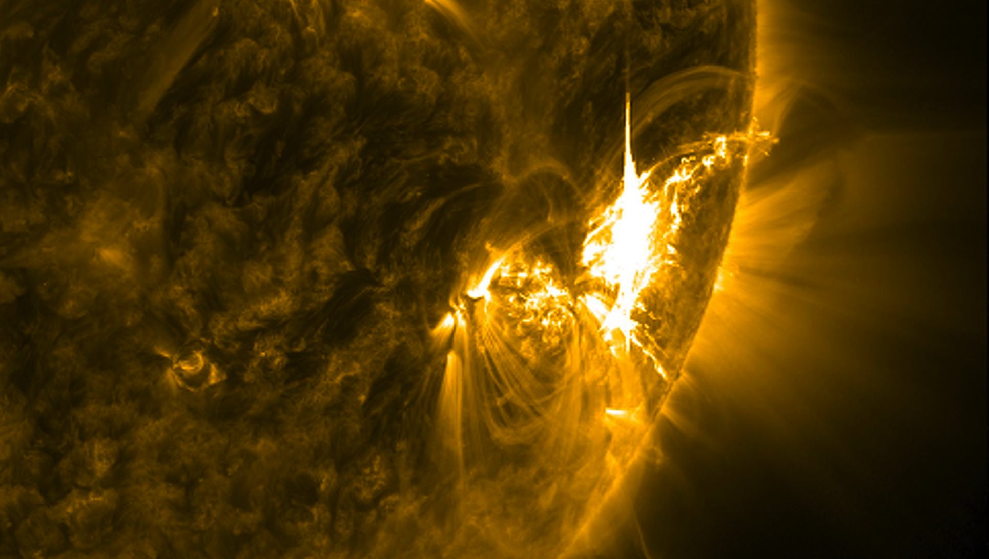
A powerful X-class solar flare erupting on the sun on July 6, 2012 photographed by the Solar Dynamics Observers. Credit: NASA

Life has existed on Earth for billions of years, appearing shortly after the planet had cooled and liquid water became available.

From the first bacteria to the amazingly complex animals we see today, life has colonized every corner of our planet.

As you know, our Sun has a limited lifespan.

Over the next 5 billion years, it will burn the last of its hydrogen, bloat up as a red giant and consume Mercury and Venus.

This would be totally disastrous for local flora and fauna, but all life on the surface of the Earth will already be long gone.

In fact, we have less than a billion years to enjoy the surface of our planet before it becomes inhospitable.

Because our Sun… is heating up.

You can’t feel it over the course of a human lifetime, but over hundreds of millions of years, the amount of radiation pouring out of the Sun will grow.

This will heat the surface of our planet to the point that the oceans boil.

At the core of the Sun, the high temperatures and pressures convert hydrogen into helium. For every tonne of material the Sun converts, it shrinks a bit making the Sun denser, and a little hotter.

Over the course of the next billion years or so, the amount of energy the Earth receives from the Sun will increase by about 10%. Which doesn’t sound like much, but it means a greenhouse effect of epic proportions.

A TerraSAR-X stripmap image from 23 April 2009. The larger icebergs are bright, while smaller icebergs are capsized and appear as dark blocks. The inset shows two superimposed Envisat ASAR images from 24 and 27 April. The region outlined in red indicates the area of the TerraSAR-X image.   Credits: DLR, ESA (Annotations by A. Humbert, Münster University
A TerraSAR-X stripmap image of icebergs.
Whatever is left of the ice caps will melt, and the water itself will boil away, leaving the planet dry and parched. Water vapor is a powerful greenhouse gas, this will drive the temperatures even hotter.

Plate tectonics will shut down, and all the carbon will be stripped from the atmosphere.

It’ll be bad.

As temperatures rise, complex lifeforms will find life on Earth less hospitable. It will seem as if evolution is running in reverse, as plants and animals die off, leaving the invertebrates and eventually just microbial life.

This rise in temperature will be the end of life on the surface of Earth as we know it.

Still, there are reserves of water deep underground which will continue to protect microbial life for billions of years.

Perhaps they’ll experience that final baking when the Sun does reach the end of its life.

Even a few hundred million years is an incomprehensible amount of time compared to the age of our civilization.

If humanity does survive well into the future, is there anything we could do about this problem?

As the Sun heats up, making Earth inhospitable, it heats up the rest of the Solar System too. Frozen worlds in the Solar System will melt, becoming more habitable.

Encaladus, a moon of Saturn, as shown in this Voyager 1 image. Credit: NASA
It’s possible that future civilizations could relocate to the asteroid belt, or the moons of Saturn. We could try something even more radical: move the Earth.

By carefully steering asteroids so they barely miss us, an advanced civilization could distort the Earth’s orbit, relocating our planet further from the Sun.

As the Sun heats up, our planet would be continuously repositioned so the surface temperature stays roughly the same. Of course, this would be tricky business. Make the wrong move, and you’re facing the frigid cold of the outer Solar System.

So there’s no need to panic. Life here has a few hundred million years left; a billion, tops. But if we want to continue on for billions of years, we’ll want to add solar heating to our growing list of big problems.

Doubly Historic Day for Private Space: Cygnus docks at Station & Next Gen Falcon 9 Soars

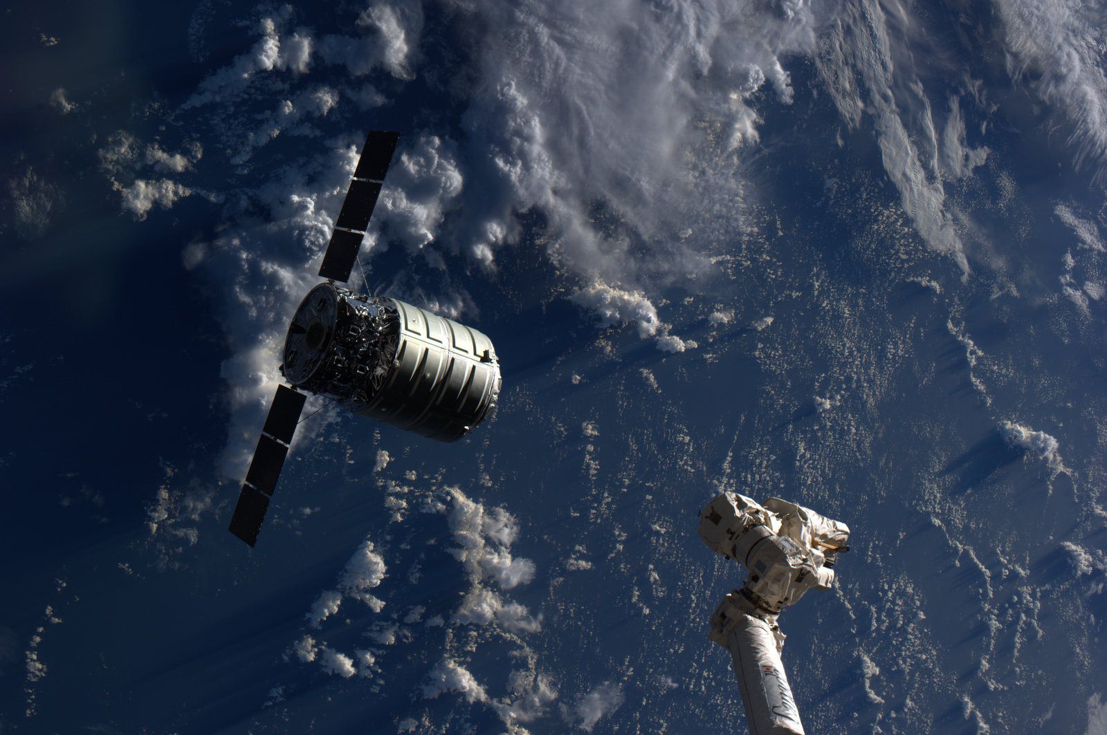
The Cygnus cargo spacecraft is just a few feet away from the International Space Station's Canadarm2 during rendezvous and berthing on Sept 29, 2013. Credit: NASA

The Cygnus cargo spacecraft is just a few feet away from the International Space Station’s Canadarm2 during rendezvous and berthing on Sept 29, 2013. Credit: NASA
Updated – See Falcon 9 launch video below[/caption]

Today (Sept. 29) was a doubly historic day for private spaceflight! And a boon to NASA as well!

Early this morning the Orbital Sciences Cygnus commercial cargo ship docked at the International Space Station (ISS) speeding along some 250 miles (400 km) overhead in low Earth orbit.

Barely a few hours later the Next Generation commercial SpaceX Falcon 9 rocket soared to space on a demonstration test flight from the California coast carrying a Canadian satellite to an elliptical earth orbit.

These missions involved the dramatic maiden flights for both Cygnus and the upgraded Falcon 9.

And both were high stakes endeavors, with literally billions of dollars and the future of commercial spaceflight, as well as the ISS, on the line. Their significance cannot be overstated!

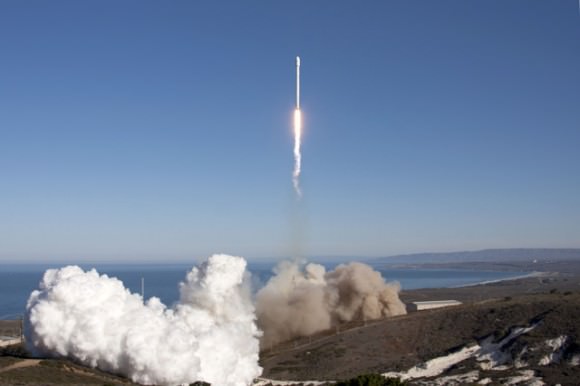
Falcon 9 lifts off from SpaceX’s pad at Vandenberg on Sept 29, 2013, carrying Canada's CASSIOPE satellite to orbit. Credit: SpaceX
Falcon 9 lifts off from SpaceX’s pad at Vandenberg on Sept 29, 2013, carrying Canada’s CASSIOPE satellite to orbit. Credit: SpaceX

Both Cygnus and Falcon 9 were developed with seed money from NASA in a pair of public-private partnerships between NASA and Orbital Sciences and SpaceX under NASA’s COTS commercial transportation initiative aimed at fostering the development of America’s private space industry to deliver critical and essential supplies to the ISS.

The powerful new Falcon 9 will also be used to send cargo to the ISS.

America completely lost its capability to send humans and cargo to the ISS when NASA’s space shuttles were retired in 2011. Orbital Sciences and SpaceX were awarded NASA contracts worth over $3 Billion to restore the unmanned cargo resupply capability over 20 flights totally.

The Cygnus spacecraft put on a spectacular space ballet – and was no worse for the wear after its docking was delayed a week due to an easily fixed communications glitch.

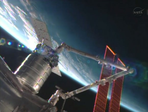
The Cygnus commercial resupply craft is installed by the Canadarm2 to the Harmony node. Credit: NASA TV
The Cygnus commercial resupply craft is installed by the Canadarm2 to the Harmony node.
Credit: NASA TV

Cygnus is a privately developed resupply vessel built by Orbital Sciences Corp and Thales Alenia Space that is a crucial railroad to orbit for keeping the massive orbital lab complex well stocked with everyday essentials and science experiments that are the purpose of the ISS.

Cygnus was grappled in free drift by Expedition 37 space station astronauts Luca Parmitano and Karen Nyberg at about 7 a.m. EDT Sunday morning.

The pair were working at two robotics work stations from inside the Cupola and Destiny modules. They used the stations 57 foot long Canadarm2 to snare Cygnus at a distance of about 30 feet (10 meters). They gradually motioned the arm closer.

Running a bit ahead of schedule they successfully berthed Cygnus at the earth facing port of the Harmony module by about 8:44 a.m. EDT.

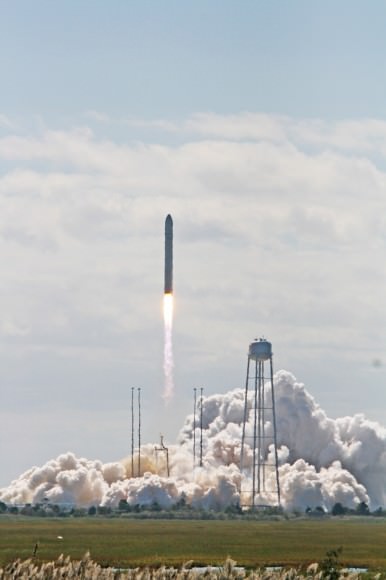
Cygnus was launched to orbit on its inaugural flight on Sept. 18 atop Orbital’s commercial Antares rocket from NASA’s Wallops Flight Facility on the Eastern shore of Virginia.

Sept. 22 had been the initially targeted station docking date for this demonstration mission.

Hatches to Cygnus will be opened on Monday, Sept. 30 after completing leak checks.

“Today, with the successful berthing of the Orbital Sciences Cygnus cargo module to the ISS, we have expanded America’s capability for reliably transporting cargo to low-Earth orbit, “ said NASA Admisistrator Charles Bolden in a statement.

“It is an historic milestone as this second commercial partner’s demonstration mission reaches the ISS, and I congratulate Orbital Sciences and the NASA team that worked alongside them to make it happen.”

“Orbital joins SpaceX in fulfilling the promise of American innovation to maintain America’s leadership in space. As commercial partners demonstrate their new systems for reaching the Station, we at NASA continue to focus on the technologies to reach an asteroid and Mars,” said Bolden.

Cygnus delivers about 1,300 pounds (589 kilograms) of cargo, including food, clothing, water, science experiments, spare parts and gear to the Expedition 37 crew.

The upgraded SpaceX Falcon 9 blasted off from Space Launch Complex 4 at Vandenberg Air Force Base in California at 9 a.m. PDT (12 p.m. EDT).

Here’s a video of the launch:

It successfully deployed Canada’s 1,060 pound (481 kg) Cascade, Smallsat, and Ionospheric Polar Explorer (CASSIOPE) weather satellite and several additional small satellites.

This powerful new version of the Falcon 9 dubbed v1.1 is powered by a cluster of nine of the new Merlin 1D engines that are about 50% more powerful compared to the standard Merlin 1C engines and can therefore boost a much heavier cargo load to the ISS and beyond.

The next generation Falcon 9 is a monster. It’s much taller than a standard Falcon 9 – some 22 stories vs. 13.

It could launch from Cape Canaveral as early as this Fall.

Ken Kremer

…………….

Learn more about Cygnus, Antares, SpaceX, Curiosity, Mars rovers, MAVEN, Orion, LADEE and more at Ken’s upcoming presentations

Oct 3: “Curiosity, MAVEN and the Search for Life on Mars – (3-D)”, STAR Astronomy Club, Brookdale Community College & Monmouth Museum, Lincroft, NJ, 8 PM

Oct 8: NASA’s Historic LADEE Lunar & Antares/Cygnus ISS Rocket Launches from Virginia”; Princeton University, Amateur Astronomers Assoc of Princeton (AAAP), Princeton, NJ, 8 PM

Antares rocket lifts off at 10:58 a.m. EDT Sept 18 with commercial Cygnus cargo resupply ship bound for the International Space Station (ISS) from Mid-Atlantic Regional Spaceport Pad-0A at NASA’s Wallops Flight Facility in Virginia.  Credit: Ken Kremer (kenkremer.com)
Antares rocket lifts off at 10:58 a.m. EDT Sept 18 with commercial Cygnus cargo resupply ship bound for the International Space Station (ISS) from Mid-Atlantic Regional Spaceport Pad-0A at NASA’s Wallops Flight Facility in Virginia. Credit: Ken Kremer (kenkremer.com)
Antares and Cygnus streak to space and the ISS from NASA Wallops on Sept. 18, 2013.  Credit: Ken Kremer (kenkremer.com)
Antares and Cygnus streak to space and the ISS from NASA Wallops on Sept. 18, 2013. Credit: Ken Kremer (kenkremer.com)

Pakistan’s “Earthquake Island” Seen From Space

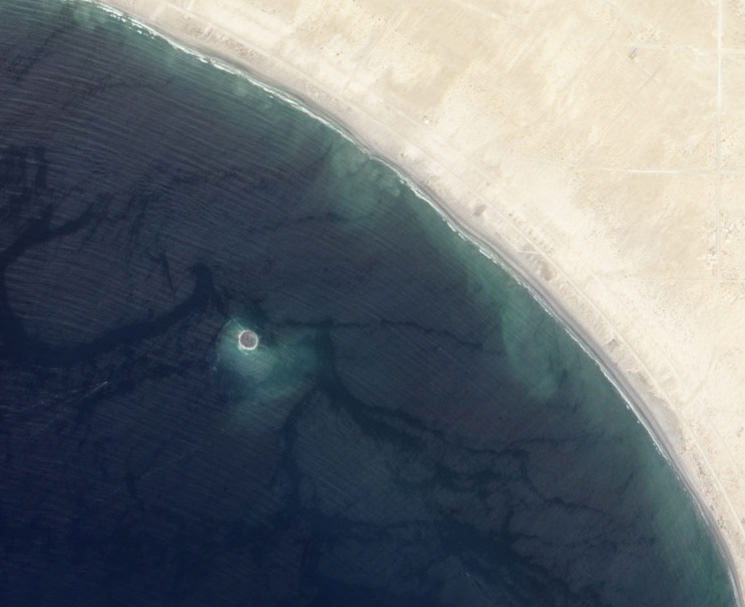
Mud island off the coast of Gwadar imaged by NASA's EO-1 satellite on Sept. 26, 2013

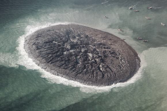
On the afternoon of Tuesday September 24, 2013, a 7.7-magnitude earthquake struck Balochistan province in southern Pakistan, causing widespread destruction across several districts during more than 2 minutes of powerful tremors and shaking. Sadly at least 400 people were killed (some reports say 600) and over 100,000 have been left homeless. But a weirder — if much less tragic — effect of the quake that was soon reported worldwide was the sudden appearance of a new island off the coast, a mound of mud and bubbling methane seeps rising nearly 20 meters (70 feet) from the ocean surface.

The image above, taken by NASA’s Earth Observing-1 satellite, shows the newly-formed mud island a kilometer (0.6 miles) off the Gwadar coast.

According to an article by the Pakistani news site Dawn.com, the 250-by-100-foot-long pile of mud and rocks is leaking flammable gases.

“Our team found bubbles rising from the surface of the island which caught fire when a match was lit and we forbade our team to start any flame,” said Mohammad Danish, a marine biologist from Pakistan’s National Institute of Oceanography. “It is methane gas.”

Aerial photo of the Gwadar mud volcano (National Institute of Oceanography, Pakistan)

Pakistan’s many earthquakes are the result of collisions between the Indian, Arabian, and Eurasian tectonic plates. These sorts of mud volcanoes are not particularly unusual after large quakes there… it just so happened that this one occurred near a populated coast and in relatively shallow water. (Source)

(In fact two days later another mud island was spotted off the coast of the nearby coastal town of Ormara.)

The mud volcano, which is being called “Zalzala Jazeera” (earthquake island) is not expected to last long. Wave action will eventually sweep the sediment away over the course of several months. (Dawn.com.)

Unfortunately earthquake relief efforts in the remote Taliban-dominated region are being hampered by militant activity.

Image source: NASA Earth Observatory

Electro-L’s Fully Lit View of Planet Earth at the Autumnal Equinox

The entire disk of the Earth lit during the equinox on September 22, 2013. Credit: Roscosmos / NTSOMZ / SRC "Planeta" / zelenyikot.livejournal.com

Here’s a fantastic view of our home planet taken by the Russian weather satellite Electro-L. And while Elektro-L can take gigantic photographs of the entire planet every 30 minutes, it only can get a fully-lit view like this just twice a year — at the spring and autumn equinoxes. This image was taken during the autumnal equinox on September 22, 2013.

Below is an animated gif of the view, going from day to night.

Animation of the Electro-L satellite's view of Earth on September 22, 2013. Credit: Roscosmos / NTSOMZ / SRC "Planeta" / zelenyikot.livejournal.com
Animation of the Electro-L satellite’s view of Earth on September 22, 2013. Credit: Roscosmos / NTSOMZ / SRC “Planeta” / zelenyikot.livejournal.com

Elektro-L orbits Earth in a geostationary orbit 36,000 kilometers above the equator, and with the Sun exactly behind the satellite on the equinox — the day the north and south poles get the same amount of light — the entire disk is fully lit.

You can see the typhoon Usagi raging over Southeast Asia, clouds and rain over Russia and swirling clouds in the ocean near Antarctica.

Electro-L was launched in 2011 and is Russia’s first geostationary weather satellite. It’s a data hog – sending back 2.56 to 16.36 megabits per second, with resolution of 1 kilometer per pixel. You can see the big 5000 x 5000 pixel version at the Electro-L website.

Thanks to Vitaliy Egorov for sharing this image with UT. He has posted the images at his zelenyikot/livejournal website.

Why Are There Seasons?

Why Are There Seasons?

We’re in the middle of Summer here on Vancouver Island, the Sun is out, the air is warm, and the river is great for swimming.

Three months from now, it’s going to be raining and miserable.

Six months from now, it’s still going to be raining, and maybe even snowing.

No matter where you live on Earth, you experience seasons, as we pass from Spring to Summer to Fall to Winter, and then back to Spring again.

Why do we have variations in temperature at all? What causes the seasons?

If you ask people this question, they’ll often answer that it’s because the Earth is closer to the Sun in the summer, and further in the winter.

But this isn’t why we have seasons. In fact, during Winter in the Northern Hemisphere, the Earth is actually at the closest point to the Sun in its orbit, and then farthest during the Summer. It’s the opposite situation for the Southern hemisphere, and explains why their seasons are more severe.

So if it’s not the distance from the Sun, why do we experience seasons?

We have seasons because the Earth’s axis is tilted.

Consider any globe you’ve ever used, and you’ll see that instead of being straight up and down, the Earth is at a tilt of 23.5-degrees.

The Earth’s North Pole is actually pointed towards Polaris, the North Star, and the south pole towards the constellation of Octans. At any point during its orbit, the Earth is always pointed the same direction.

For six months of the year, the Northern hemisphere is tilted towards the Sun, while the Southern hemisphere is tilted away. For the next six months, the situation is reversed.

Whichever hemisphere is tilted towards the Sun experiences more energy, and warms up, while the hemisphere tilted away receives less energy and cools down.

Consider the amount of solar radiation falling on part of the Earth.

When the Sun is directly overhead, each square meter of Earth receives about 1000 watts of energy.

But when the Sun is at a severe angle, like from the Arctic circle, that same 1000 watts of energy is spread out over a much larger area.

This tilt also explains why the days are longer in the Summer, and then shorter in the Winter.

The longest day of Summer, when the Northern Hemisphere is tilted towards the Sun is known as the Summer Solstice.

And then when it’s tilted away from the Sun, that’s the Winter Solstice.

When both hemispheres receive equal amounts of energy, it’s called the Equinox. We have a Spring Equinox, and then an Autumn Equinox, when our days and night are equal in length.

So how does distance from the Sun affect us?

The distance between the Earth and has an effect on the intensity of the seasons.

The Southern Hemisphere’s Summer happens when the Earth is closest to the Sun, and their winter when the Earth is furthest. This makes their seasons even more severe.

You might be interested to know that the orientation of the Earth axis is actually changing.

full-526px-earth_precessionsvgOver the course of a 26,000 year cycle, the Earth’s axis traces out a great circle in the sky. This is known as the precession of the equinoxes.

At the halfway point, 13,000 years, the seasons are reversed for the two hemispheres, and then they return to original starting point 13,000 years later.

You might not notice it, but the time of the Summer Solstice comes earlier by about 20 minutes every year; a full day every 70 years or so.

I hope this helps you understand why the Earth – and any planet with a tilted axis – experiences seasons.

New U.S. Climate Map Shows Temperature Changes In HD. How To Prepare?

Average temperatures in the United States. Top, what they were in the 1950s. Bottom, the predictions for the 2090s. Credit: NASA

If you’re interested to see how warm your neighborhood will look like at 2090, here’s a chance. There’s new data available that has monthly climate projections for the continental United States at the size of a neighborhood, or about a  half-mile (800 meters).

Readers who have moderate to advanced knowledge of how to manipulate datasets can see instructions for how to get the raw information here. As for everyone else, NASA briefly summarized how the information could be used for community planners to deal with the effects of climate change.

The map charts how rain and temperatures in the United States will be affected based on greenhouse gases. Because, of course, this is a projection, the researchers ran four different scenarios for the period between 1950 and 2099. Climate projections came from global climate models from the upcoming Inter-Governmental Panel on Climate Change 5th Assessment Report and historical surface observations.

The projections “may make it easier for resource managers to quantify anticipated climate change impacts on a wide range of conditions and resources important to local communities,” NASA stated.

The agency then provided a long list of research areas that would benefit, including “water supplies and winter snow packs, public health and the spread of insect-borne diseases, flood risk and potential impacts to critical urban infrastructure, wildfire frequency and severity, agricultural production, and wildlife and biodiversity.”

On this map of Nevada - northern California are superimposed graphics representing the average temperatures in the 1950s (top) and projected temperatures for the 2090s. Credit: NASA
On this map of Nevada – northern California are superimposed graphics representing the average temperatures in the 1950s (top) and projected temperatures for the 2090s. Credit: NASA

As you can see from the climate map above, Nevada and California are highly affected by the projections, and officials in the region are paying attention, according to NASA.

“We are using the 800-meter downscaled datasets for conservation planning and resource management in the San Francisco Bay Area,” stated Stuart Weiss, a researcher at the Terrestrial Biodiversity Climate Change Collaborative in the San Francisco Bay Area.

“They provide an indispensable, if necessarily hazy, crystal ball into hydrological and ecological responses through the 21st century.  It will be a very useful tool for climate change planning and adaptation that will be exported to the remainder of California and eventually the western United States.”

The data was crunched using supercomputers at NASA’s Ames Research Center, allowing the team to “produce the downscaled, high resolution climate dataset for the U.S. within months of release of the final global climate scenarios prepared for the next IPCC assessment report,” NASA added.

Source: NASA

Cometary Collisions Could Have Created Life On Earth

Water, ammonia, methanol and carbon dioxide could have come to Earth from cometary sources, according to a new study. Source: Lawrence Livermore National Laboratory

The energy of comets smashing into Earth billions of years ago could have generated life out of the building blocks of life that those extraterrestrial objects brought, according to new experiments published in a peer-reviewed study.

The finding comes after a team “shock compressed” an icy slush similar in composition to that found on comets, which are sometimes called “dirty snowballs” because they are a mixture of ice and rock. The compression, which researchers say is similar in intensity to comets hitting the Earth, generated amino acids – considered the basic bits of life.

“Our work shows that the basic building blocks of life can be assembled anywhere in the Solar System and perhaps beyond,” stated Zita Martins, a co-author of the paper who is with Imperial College London’s department of Earth science and engineering.

“However, the catch is that these building blocks need the right conditions in order for life to flourish. Excitingly, our study widens the scope for where these important ingredients may be formed in the Solar System and adds another piece to the puzzle of how life on our planet took root.”

An object entering a planet's atmosphere. Credit: Imperial College London
An object entering a planet’s atmosphere. Credit: Imperial College London

Whether life arose on Earth, or was imported from other locations in the Solar System or universe, has been a hot-button topic for decades. Learning the answer not only has implications for our own planet, but also for understanding how likely it is that life exists in other Solar System planets and moons — not to mention moons or planets in other star systems.

The new experiment — which the researchers say uncovers evidence of a “cosmic factory” process for starting life — saw the team at the University of Kent and the Imperial College using a gas gun to send a projectile into an ice combination similar to what one would find a comet. After the impact, the researchers saw amino acids forming.

The work builds on research initially done by Nir Goldman, a scientist with the Lawrence Liverpool National Laboratory, who predicted the results based on simulations in the laboratory’s supercomputer. Goldman found that comets could have imported life’s building blocks (ammonia, methanol, carbon dioxide and water). Then, as they smashed into Earth, the energy produced could be enough to jump-start life.

The building blocks of proteins are molecules called amino acids. Most types of amino acids can exist in two different forms, one that is 'left-handed' and the other as 'right-handed.' Credit: NASA
The building blocks of proteins are molecules called amino acids. Most types of amino acids can exist in two different forms, one that is ‘left-handed’ and the other as ‘right-handed.’ Credit: NASA

“This process demonstrates a very simple mechanism whereby we can go from a mix of simple molecules, such as water and carbon-dioxide ice, to a more complicated molecule, such as an amino acid,” stated Mark Price, a co-author and physicist from the University of Kent.

“This is the first step towards life. The next step is to work out how to go from an amino acid to even more complex molecules such as proteins.”

You can read the research paper, which was published Sept. 15, on Nature Geoscience.

Sources: Imperial College London and Lawrence Livermore National Laboratory

Why Does the Earth Spin?

Why Does the Earth Spin?

In a classic episode of this video series, I did the calculations for how fast the Earth is spinning.

We know the Earth is rotating, but why? Why is it spinning?

Why is everything in the Solar System spinning? And why is it mostly all spinning in the same direction?

It can’t be a coincidence. Look down on the Earth from above, and you’d see that it’s turning in a counter-clockwise direction. Same with the Sun, Mars and most of the planets.

4.54 billion years ago, our Solar System formed within a cloud of hydrogen not unlike the Orion Nebula, or the Eagle Nebula, with its awesome pillars of creation.

Then, it took some kick, like from the shockwave from a nearby supernova, and this set a region of the cold gas falling inward through its mutual gravity. As it collapsed, the cloud began to spin.

But why?

It’s the conservation of angular momentum.

Think about the individual atoms in the cloud of hydrogen. Each particle has its own momentum as it drifts through the void. As these atoms glom onto one another with gravity, they need to average out their momentum. It might be possible to average out perfectly to zero, but it’s really really unlikely.

Which means, there will be some left over. Like a figure skater pulling in her arms to spin more rapidly, the collapsing proto-Solar System with its averaged out particle momentum began to spin faster and faster.

This is the conservation of angular momentum at work.

As the Solar System spun more rapidly, it flattened out into a disk with a bulge in the middle. We see this same structure throughout the Universe: the shape of galaxies, around rapidly spinning black holes, and we even see it in pizza restaurants.

Solar nebulaThe Sun formed from the bulge at the center of this disk, and the planets formed further out. They inherited their rotation from the overall movement of the Solar System itself.

Over the course of a few hundred million years, all of the material in the Solar System gathered together into planets, asteroids, moons and comets. Then the powerful radiation and solar winds from the young Sun cleared out everything that was left over.

Without any unbalanced forces acting on them, the inertia of the Sun and the planets have kept them spinning for billions of years.

And they’ll continue to do so until they collide with some object, billions or even trillions of years in the future.

So are you still wondering, why does the Earth spin?

Western Hemisphere of EarthThe Earth spins because it formed in the accretion disk of a cloud of hydrogen that collapsed down from mutual gravity and needed to conserve its angular momentum. It continues to spin because of inertia.

The reason it’s all the same direction is because they all formed together in the same Solar Nebula, billions of years ago.