What Does Antarctica Look Like Under the Ice?

New topography map of Antarctica by the British Antarctic Survey's Bedmap2 (NASA/GSFC)

Although it sits isolated at the “bottom of the world” Antarctica is one of the most influential continents on Earth, affecting weather, climate, and ocean current patterns over the entire planet. But Antarctica is also one of the most enigmatic landmasses too, incredibly remote, extremely harsh, and covered by a layer of ice over 2 km thick. And as Earth’s global temperature continues to climb steadily higher, the future of ice in Antarctica — a continent half again as large as the contiguous United States — is a big concern for scientists… but in order to know exactly how its ice will behave to changing conditions, they need to know what’s under it.

This is where the British Antarctic Survey — using data gathered by NASA’s ICESat and Operation IceBridge missions — comes in, giving us a better view of what lies beneath the southern continent’s frozen veil.

A new dataset called Bedmap2 gives a clearer picture of Antarctica from the ice surface down to the bedrock below. Bedmap2 is a significant improvement on the previous collection of Antarctic data — known as Bedmap — that was produced more than 10 years ago. The product was a result of work led by the British Antarctic Survey, where researchers compiled decades worth of geophysical measurements, such as surface elevation measurements from NASA’s Ice, Cloud and Land Elevation Satellite (ICESat) and ice thickness data collected by Operation IceBridge.

Bedmap2, like the original Bedmap, is a collection of three datasets—surface elevation, ice thickness and bedrock topography. Both Bedmap and Bedmap2 are laid out as grids covering the entire continent, but with a tighter grid spacing Bedmap2 includes many surface and sub-ice features too small to be seen in the previous dataset. Additionally, the extensive use of GPS data in more recent surveys improves the precision of the new dataset.

Improvements in resolution, coverage and precision will lead to more accurate calculations of ice volume and potential contribution to sea level rise.

Ice sheet researchers use computer models to simulate how ice sheets will respond to changes in ocean and air temperatures. An advantage of these simulations is that they allow testing of many different climate scenarios, but the models are limited by how accurate the data on ice volume and sub-ice terrain are.
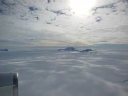
Only the tips of many of Antarctica's mountains are visible above thousands of feet of ice. (Oct. 2012 IceBridge photo. Credit: NASA / Christy Hansen)
Only the tips of many of Antarctica’s mountains are visible above thousands of feet of ice. (Oct. 2012 IceBridge photo. Credit: NASA / Christy Hansen)

“In order to accurately simulate the dynamic response of ice sheets to changing environmental conditions, such as temperature and snow accumulation, we need to know the shape and structure of the bedrock below the ice sheets in great detail,” said Michael Studinger, IceBridge project scientist at NASA Goddard.

Knowing what the bedrock looks like is important for ice sheet modeling because features in the bed control the ice’s shape and affect how it moves. Ice will flow faster on a downhill slope, while an uphill slope or bumpy terrain can slow an ice sheet down or even hold it in place temporarily. “The shape of the bed is the most important unknown, and affect how ice can flow,” said Nowicki. “You can influence how honey spreads on your plate, by simply varying how you hold your plate.” The vastly improved bedrock data included in Bedmap2 should provide the level of detail needed for models to be realistic.
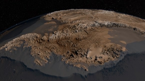
Bedmap2 data of Antarctica's bedrock. Verical elevation has been exaggerated by 17x. (NASA/GSFC)
Bedmap2 data of Antarctica’s bedrock. Verical elevation has been exaggerated by 17x. (NASA/GSFC)

“It will be an important resource for the next generation of ice sheet modelers, physical oceanographers and structural geologists,” said Peter Fretwell, BAS scientist and lead author.

The BAS’ work was published recently in the journal The Cryosphere. Read more on the original release by George Hale here.

Source: NASA Earth

NASA’s Operation IceBridge Surveys Greenland and Earth’s Polar Ice Sheets

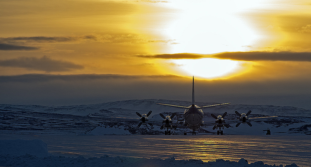
NASA P-3B waits outside the hangar at Thule Air Base with the Greenland Ice sheet in the background. The aircraft is set to begin the 2013 season of NASA’s Operation IceBridge mission to survey Earth's polar ice sheets in unprecedented three-dimensional detail. The plane just arrived from NASA Wallops Flight Facility in Virginia - see my P-3B photos below. Credit: NASA/Goddard/Michael Studinger

NASA’s Operation IceBridge has begun the 2013 research season of Ice Science flights in Greenland and the Arctic to survey the regions ice sheets and land and sea ice using a specially equipped P-3B research aircraft from NASA’s Wallops Flight Facility in Wallops Island, Va.

Operation IceBridge began in 2009 as part of NASA’s six-year long effort to conduct the largest airborne survey of Earth’s polar ice ever flown.

The goal is to obtain an unprecedented three-dimensional, multi-instrument view of the behavior of Greenland, Arctic and Antarctic ice sheets, ice shelves and sea ice which have been undergoing rapid and dramatic changes and reductions.

“We’re starting to see how the whole ice sheet is changing,” said Michael Studinger, IceBridge project scientist at NASA’s Goddard Space Flight Center in Greenbelt, Md. “Thinning at the margins is now propagating to the interior.”

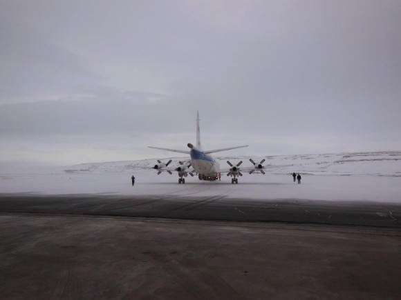
The P-3 exiting the hanger pre-flight in Thule. Credit: NASA

The airborne campaign was started in order to maintain a continuous record of measurements in changes in polar ice after NASA’s Earth orbiting ICESat (Ice, Cloud and Land Elevation Satellite) probe stopped collecting data in 2009.

ICESat-2 won’t be launched until 2016, so NASA’s IceBridge project and yearly P-3 airborne campaigns will fill in the science data gap in the interval.

The P-3B Orion just arrived from NASA’s Wallops Flight Facility in Virginia where I visited it before departure – see my P-3B photos herein.

NASA IceBridge P-3B research aircraft prepares for departure from runway at NASA Wallops Flight Facility in Virginia to Thule Air Base in Greenland.  Credit: Ken Kremer (kenkremer.com)
NASA IceBridge P-3B research aircraft prepares for departure from runway at NASA Wallops Flight Facility in Virginia to Thule Air Base in Greenland. Credit: Ken Kremer (kenkremer.com)

IceBridge is operating out of airfields in Thule and Kangerlussuaq, Greenland, and Fairbanks, Alaska.

The P-3B survey flights over Greenland and the Arctic will continue until May. They are conducted over Antarctica during October and November.

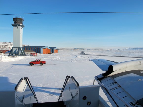
A sunny view of the ramp at Thule Air Base, Greenland, shortly after the NASA P-3B research aircraft arrived on Mar. 18, 2013. Credit: NASA / Jim Yungel

The measurements collected by IceBridge instruments will characterize the annual changes in thickness of sea ice, glaciers, and ice sheets. The data are used to help predict how climate change affects Earth’s polar ice and the resulting rise in sea-levels.

Researchers with the U.S. Army Corps of Engineers are collaborating with the IceBridge project to collect snow depth measurements near Barrow , Alaska. High school science teachers from the US, Denmark and Greenland will fly along on the P-3B survey flights to learn about polar science.

NASA Wallops has a wide ranging research and development mission and is home to the Virginia launch pad for the new Antares/Cygnus commercial ISS resupply rocket set for its maiden launch in mid April 2013; detailed in see my new story – here.

Ken Kremer

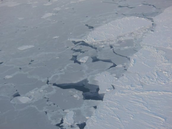
Sea ice in the southern Beaufort Sea. Credit: NASA
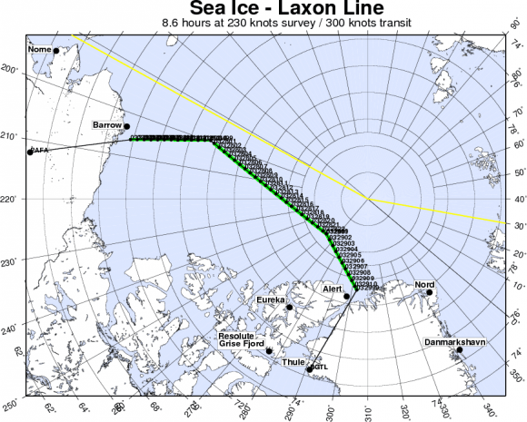
IceBridge departing to Fairbanks to start their sea ice flights that will cover the Beauford and Chukchi seas - via the Laxon sea ice route for the transit. Credit: NASA
IceBridge departing to Fairbanks to start their sea ice flights that will cover the Beauford and Chukchi seas – via the Laxon sea ice route for the transit. Credit: NASA

NASA: Reaches for New Heights – Greatest Hits Video

Video Caption: At NASA, we’ve been a little busy: landing on Mars, developing new human spacecraft, going to the space station, working with commercial partners, observing the Earth and the Sun, exploring our solar system and understanding our universe. And that’s not even everything.Credit: NASA

Check out this cool action packed video titled “NASA: Reaching for New Heights” – to see NASA’s ‘Greatest Hits’ from the past year

The 4 minute film is a compilation of NASA’s gamut of Robotic Science and Human Spaceflight achievements to explore and understand Planet Earth here at home and the heavens above- ranging from our Solar System and beyond to the Galaxy and the vast expanse of the Universe.

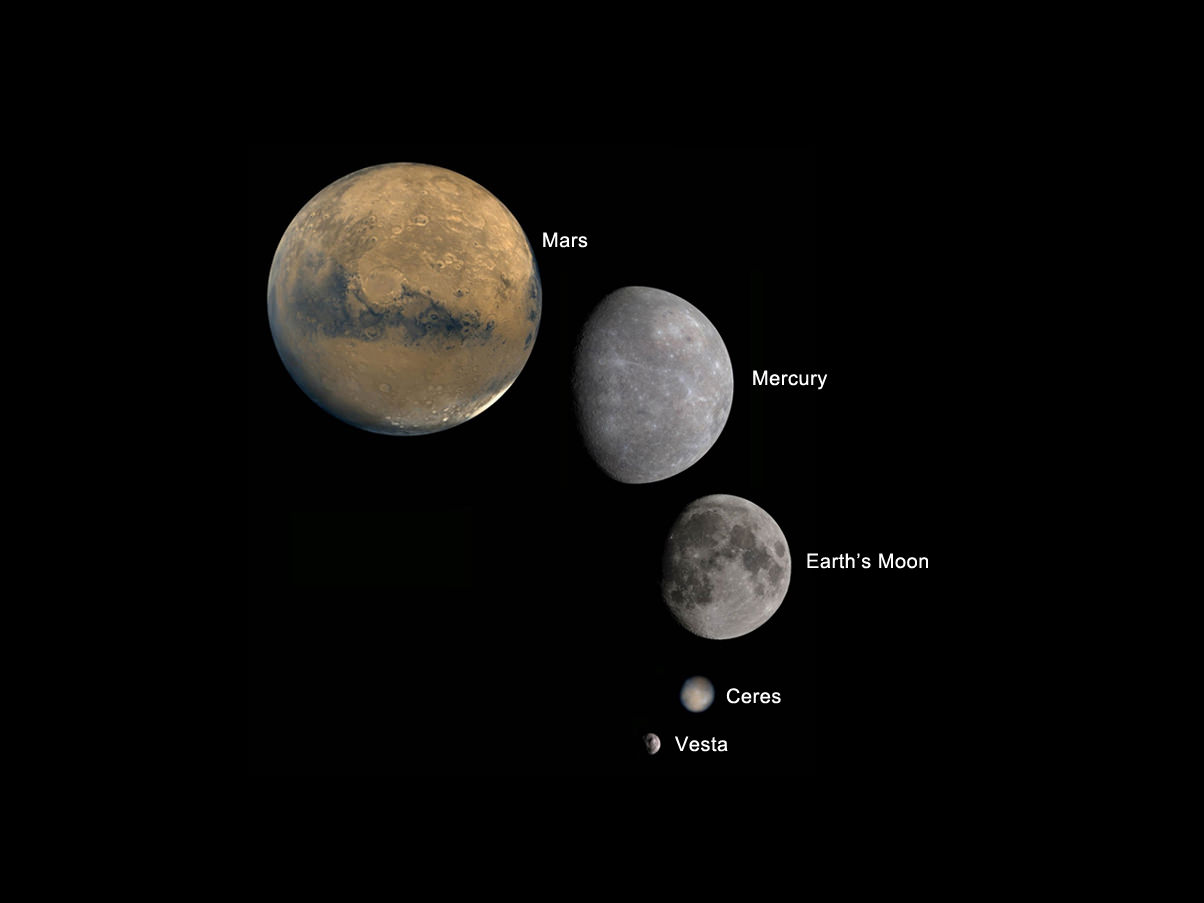
Image caption: Planets and Moons in perspective. Credit: NASA

The missions and programs featured include inspiringly beautiful imagery from : Curiosity, Landsat, Aquarius, GRACE, NuSTAR, GRAIL, Dawn at Asteroid Vesta, SDO, X-48C Amelia, Orion, SLS, Apollo, SpaceX, Sierra Nevada Dream Chaser, Boeing CST-100, Commercial Crew, Hurricane Sandy from the ISS, Robonaut and more !

And even more space exploration thrills are coming in 2013 !

Ken Kremer

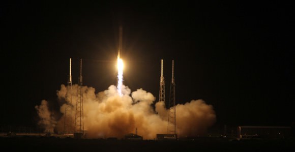
IMG_3760a_SpaceX launch 22 May 2012

Image caption: SpaceX Falcon 9 rocket blasts off on May 22, 2012 with Dragon cargo capsule from Space Launch Complex-40 at Cape Canaveral Air Force Station, Fla., on the first commercial mission to the International Space Station. The next launch is set for March 1, 2013. Credit: Ken Kremer

Space Station Gets a New Telescope

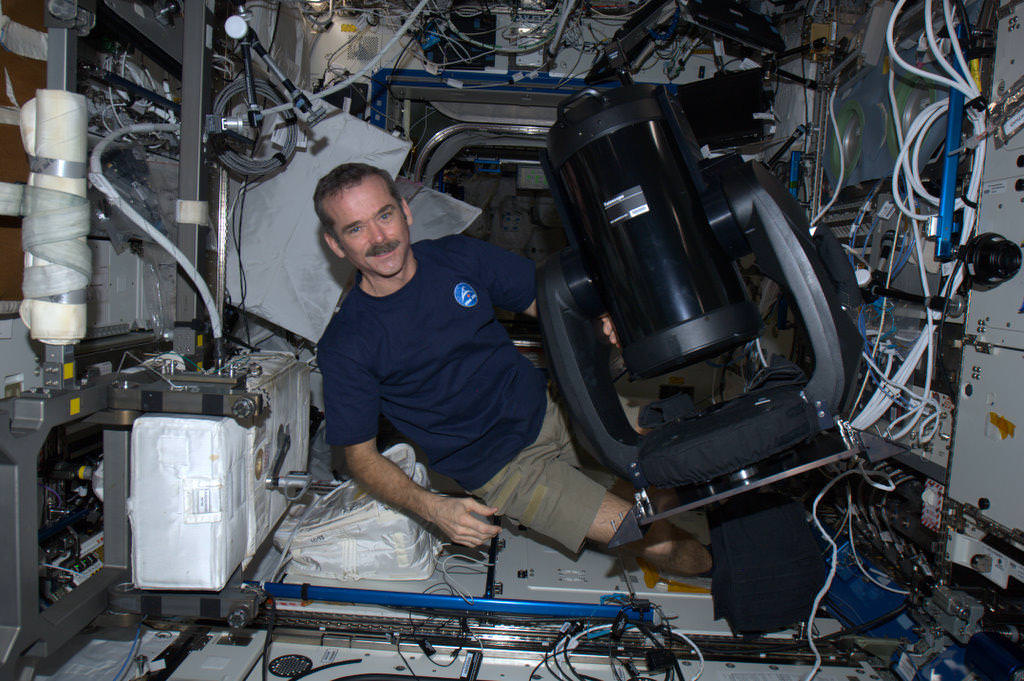
Canadian astronaut Chris Hadfield with the new ISERV (International Space Station SERVIR Environmental Research and Visualization System), a modified Celestron telescope for Earth observation. Credit: NASA/CSA

Astronauts on the International Space Station today are installing a new modified Celestron telescope. This won’t be used to observe the stars, but instead look back to Earth to acquire imagery of specific areas of the world for disaster analysis and environmental studies. Called ISERV (International Space Station SERVIR Environmental Research and Visualization System), it is a new remote-controlled imaging system.

“Essentially, it will be pointed out of one of the windows of the Space Station, and used for Earth imaging,” Andrea Tabor, social media coordinator for Celestron told Universe Today, “especially for natural disasters and to help countries that may not have their own Earth-observing satellites to help assess damage and assist with evacuations.”

ISERV will be installed in the Window Observational Research Facility (WORF) in the station’s Destiny laboratory.

The Celestron CPC 925, is a 9.25″ diffraction limited Schmidt-Cassegrain telescope and off-the-shelf sells for $2,500 including the mount, (just the 9.25 inch optical tube sells for $1,479). It was modified at the Marshall Space Flight Center.

“They used the fork mount that comes with it,” Tabor said, “but they just removed the tripod and replaced it with a specialized mount to anchor and stabilize it on the ISS.”

Because it is pointed out of a window and because the ISS is moving so fast, it would be difficult to align it with the sky and do any celestial imaging, Tabor said.

ISERV is the first of what is hoped to be a series of space station Earth-observing instruments, each to feature progressively more capable sensors to help scientists gain operational experience and expertise, as well as help design better systems in the future. Scientists envision that future sensors could be mounted on the exterior of the station for a clearer, wider view of Earth.

It arrived on the ISS in July of 2012 on board the Japanese HTV-3.

“It’s been up there sitting in a box, so today was unboxing and assembly day,” Tabor said. She added that they hope to post some of the first images from the telescope on their Twitter and Facebook pages.

The telescope will normally be operated by remote-controlled from Earth and so the astronauts won’t likely be working with it directly except for assessing its operation or troubleshooting any problems.

“Images captured from ISERV on the ISS could provide valuable information back here on Earth,” said Dan Irwin, SERVIR program director at Marshall. “We hope it will provide new data and information from space related to natural disasters, environmental crises and the increased effects of climate variability on human populations.”

Image via @Cmdr_Hadfield on Twitter

In an Isolated, Ice-Covered Antarctic Lake Far Below Freezing, Life is Found

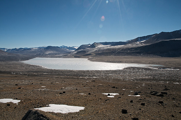
Lake Vida lies within one of Antarctica’s cold, arid McMurdo Dry Valleys (Photo: Desert Research Institute)

Even inside an almost completely frozen lake within Antarctica’s inland dry valleys, in dark, salt-laden and sub-freezing water full of nitrous oxide, life thrives… offering a clue at what might one day be found in similar environments elsewhere in the Solar System.


Researchers from NASA, the Desert Research Institute in Nevada, the University of Illinois at Chicago and nine other institutions have discovered colonies of bacteria living in one of the most isolated places on Earth: Antarctica’s Lake Vida, located in Victoria Valley — one of the southern continent’s incredibly arid McMurdo Dry Valleys.

These organisms seem to be thriving despite the harsh conditions. Covered by 20 meters (65 feet) of ice, the water in  Lake Vida is six times saltier than seawater and contains the highest levels of nitrous oxide ever found in a natural body of water. Sunlight doesn’t penetrate very far below the frozen surface, and due to the hypersaline conditions and pressure of the ice water temperatures can plunge to a frigid -13.5 ºC (8 ºF).

Yet even within such a seemingly inhospitable environment Lake Vida is host to a “surprisingly diverse and abundant assemblage of bacteria” existing within water channels branching through the ice, separated from the sun’s energy and isolated from exterior influences for an estimated 3,000 years.

Originally thought to be frozen solid, ground penetrating radar surveys in 1995 revealed a very salty liquid layer (a brine) underlying the lake’s year-round 20-meter-thick ice cover.

“This study provides a window into one of the most unique ecosystems on Earth,” said Dr. Alison Murray, one of the lead authors of the team’s paper, a molecular microbial ecologist and polar researcher and a member of 14 expeditions to the Southern Ocean and Antarctic continent. “Our knowledge of geochemical and microbial processes in lightless icy environments, especially at subzero temperatures, has been mostly unknown up until now. This work expands our understanding of the types of life that can survive in these isolated, cryoecosystems and how different strategies may be used to exist in such challenging environments.”

Sterile environments had to be set up within tents on Lake Vida’s surface so the researchers could be sure that the core samples they were drilling were pristine, and weren’t being contaminated with any introduced organisms.

According to a NASA press release, “geochemical analyses suggest chemical reactions between the brine and the underlying iron-rich sediments generate nitrous oxide and molecular hydrogen. The latter, in part, may provide the energy needed to support the brine’s diverse microbial life.”

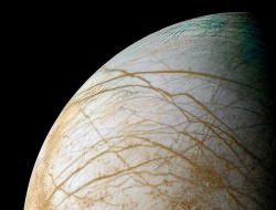
“This system is probably the best analog we have for possible ecosystems in the subsurface waters of Saturn’s moon Enceladus and Jupiter’s moon Europa.”

– Chris McKay, co-author, NASA’s Ames Research Center

What’s particularly exciting is the similarity between conditions found in ice-covered Antarctic lakes and those that could be found on other worlds in our Solar System. If life could survive in Lake Vida, as harsh and isolated as it is, could it also be found beneath the icy surface of Europa, or within the (hypothesized) subsurface oceans of Enceladus? And what about the ice caps of Mars? Might there be similar channels of super-salty liquid water running through Mars’ ice, with microbes eking out an existence on iron sediments?

“It’s plausible that a life-supporting energy source exists solely from the chemical reaction between anoxic salt water and the rock,” explained Dr. Christian Fritsen, a systems microbial ecologist and Research Professor in DRI’s Division of Earth and Ecosystem Sciences and co-author of the study.

“If that’s the case,” Murray added, “this gives us an entirely new framework for thinking of how life can be supported in cryoecosystems on earth and in other icy worlds of the universe.”

Read more: Europa’s Hidden Great Lakes May Harbor Life

More research is planned to study the chemical interactions between the sediment and the brine as well as the genetic makeup of the microbial communities themselves.

The research was published this week in the Proceedings of the National Academy of Science (PNAS). Read more on the DRI press release here, and watch a video below showing highlights from the field research.

Funding for the research was supported jointly by NSF and NASA. Images courtesy the Desert Research Institute. Dry valley image credit: NASA/Landsat. Europa image: NASA/Ted Stryk.)

Hunting for High Life: What Lives in Earth’s Stratosphere?

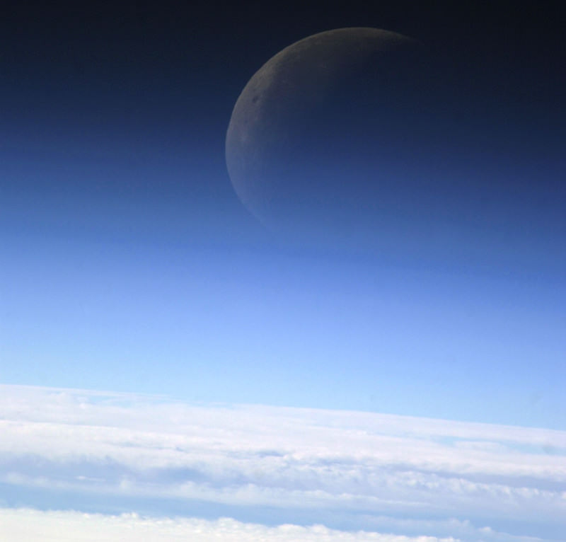
The Moon photographed through the layers of the atmosphere from the ISS in December 2003 (NASA/JSC)

What lives at the edge of space? Other than high-flying jet aircraft pilots (and the occasional daredevil skydiver) you wouldn’t expect to find many living things over 10 kilometers up — yet this is exactly where one NASA researcher is hunting for evidence of life.

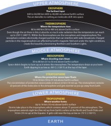
Earth’s stratosphere is not a place you’d typically think of when considering hospitable environments. High, dry, and cold, the stratosphere is the layer just above where most weather occurs, extending from about 10 km to 50 km (6 to 31 miles) above Earth’s surface. Temperatures in the lowest layers average -56 C (-68 F) with jet stream winds blowing at a steady 100 mph. Atmospheric density is less than 10% that found at sea level and oxygen is found in the form of ozone, which shields life on the surface from harmful UV radiation but leaves anything above 32 km openly exposed.

Sounds like a great place to look for life, right? Biologist David Smith of the University of Washington thinks so… he and his team have found “microbes from every major domain” traveling within upper-atmospheric winds.

Smith, principal investigator with Kennedy Space Center’s Microorganisms in the Stratosphere (MIST) project, is working to take a census of life tens of thousands of feet above the ground. Using high-altitude weather balloons and samples gathered from Mt. Bachelor Observatory in central Oregon, Smith aims to find out what kinds of microbes are found high in the atmosphere, how many there are and where they may have come from.

“Life surviving at high altitudes challenges our notion of the biosphere boundary.”

– David Smith, Biologist, University of Washington in Seattle

Although reports of microorganisms existing as high as 77 km have been around since the 1930s, Smith doubts the validity of some of the old data… the microbes could have been brought up by the research vehicles themselves.

“Almost no controls for sterilization are reported in the papers,” he said.

But while some researchers have suggested that the microbes could have come from outer space, Smith thinks they are terrestrial in origin. Most of the microbes discovered so far are bacterial spores — extremely hardy organisms that can form a protective shell around themselves and thus survive the low temperatures, dry conditions and high levels of radiation found in the stratosphere. Dust storms or hurricanes could presumably deliver the bacteria into the atmosphere where they form spores and are transported across the globe.

If they land in a suitable environment they have the ability to reanimate themselves, continuing to survive and multiply.

Although collecting these high-flying organisms is difficult, Smith is confident that this research will show how such basic life can travel long distances and survive even the harshest environments — not only on Earth but possibly on other worlds as well, such as the dessicated soil of  Mars.

“We still have no idea where to draw the altitude boundary of the biosphere,” said Smith. This research will “address how long life can potentially remain in the stratosphere and what sorts of mutations it may inherit while aloft.”

Read more on Michael Schirber’s article for Astrobiology Magazine here, and watch David Smith’s seminar “The High Life: Airborne Microbes on the Edge of Space” held May 2012 at the University of Washington below:

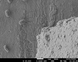
Inset images – Top: layers of the atmosphere, via the Smithsonian/NMNH. Bottom: Scanning electron microscope image of atmospheric bacterial spores collected from Mt. Bachelor Observatory (NASA/KSC)

Space Junk: Ideas for Cleaning up Earth Orbit

Artist's impression of debris in low Earth orbit. Credit: ESA

Caption: Artist’s impression of debris in low earth orbit Credit: ESA

Space may be big — vastly, hugely, mind-bogglingly big — but the space around Earth is beginning to get cluttered with space junk. This poses a threat, not only to other satellites, space stations and missions, but to us here on Earth as well. While we wrestle with environmental issues posed by human activity on our planet, ESA’s new ‘Clean Space’ initiative aims to address the same issues for its missions, making them greener by using more eco-friendly materials and finding ways to cut down levels of space debris.

Last month ESA and Eurospace organized the Clean Space Eco-design and Green Technologies Workshop 2012 held in the Netherlands. Clean Space is a major objective of Agenda 2015, the Agency’s upcoming action plan. The aim was outlined by ESA Director General Jean-Jacques Dordain: “If we are convinced that space infrastructure will become more and more essential, then we must transmit the space environment to future generations as we found it, that is, pristine.”

The workshop looked at all aspects of space missions, their total environment impact, from concept development to end of life. The impact of regulations regarding substances such as hydrazine, which is used widely as a propellant in space programs and the development of Green Propulsion with propellants that have a reduced toxicity. Environmental friendliness and sustainability often mean increased efficiency, which ESA hopes will give the industry a competitive advantage, so they are looking at technologies which will consume less energy and produce less waste, therefore cutting costs.

Finally they looked at debris mitigation to minimize the impact to the space environment as well as the debris footprint on Earth using controlled and uncontrolled re-entry events and passive de-orbiting systems along with active de-orbiting and re-orbiting systems. They are even considering tethers or sails to help drag abandoned satellites out of low orbit within 25 years. New ‘design for demise’ concepts hope to prevent chunks of satellites surviving re-entry and hitting the ground intact. Active removal of existing debris is also needed, including robotic missions to repair or de-orbit satellites.

6,000 satellites have been launched during the Space Age; less than 1000 of these are still in operation. The rest are derelict and liable to fragment as leftover fuel or batteries explode. Traveling at around 7.5 km/s, a 2 cm screw has a ‘lethal diameter’ sufficient to take out a satellite. Taking the recent loss of the Envisat satellite as an example, this satellite now poses a considerable threat as space junk. An analysis of space debris at Envisat’s orbit suggests there is a 15% to 30% chance of collision with another piece of junk during the 150 years it is thought Envisat could remain in orbit. The satellite’s complexity and size means even a small piece of debris could cause a “fragmentation event” producing its own population of space garbage. Envisat is also too big to be allowed to drift back into the Earth’s atmosphere. The choices seem to be to raise the satellite to a higher, unused orbit, or guide it back in over the Pacific Ocean.

As ESA Director General Jean-Jacques Dordain says “We will not succeed alone; we will need everyone’s help. The entire space sector has to be with us.”

Find out more about ESA’s Clean Space initiative here

Ecological Concerns in Losing Our Starry Night

Earth at Night. Courtesy DMSP and NASA

[/caption]

Images of the Earth at night, taken from space are always a stunning sight, with cities, countries and whole continents glittering like jewels. But this beauty comes at a price. It used to be that anyone looking up on a clear night could see the Milky Way. As more and more of us are drawn to live in urban areas, our view of the sky is blotted out by the glare of our lights. Astronomers have known about the growing problem of light pollution for a long time. Now ecologists are becoming concerned that our artificial lights are affecting more than our view of the stars.

Researchers at the University of Exeter studying the ecological impact of artificial lighting have noted changes in distribution of invertebrate communities around artificial lighting which could affect the broader wildlife that depend on them. Simply put, it is easier for predators to find their prey, and harder for the prey to hide, in brightly lit areas. Streetlights may also be disrupting the natural rhythms of both fauna and flora, changing hibernation patterns and flowering times. It may also be affecting our own circadian rhythms as well as being a colossal waste of energy, an estimated $2.2 billion per year in the U.S. alone! On average, 30% of the light from a streetlight shines up and out.

Light pollution is a growing problem. Artificial lighting is increasing at the rate of 6% each year globally and is only going to get worse, as developing nations use more and more electric light. Since 1988 The International Dark-Sky Association has campaigned to protect and preserve the night environment and promote energy efficient options. Light what you need, when you need it, they say.

One of their projects is the International Dark Sky Places program which certify locations with exceptional nightscapes, either as communities, parks or reserves. The Kielder Forest and adjacent Northumberland national park covering 400 square miles in the UK is the latest area hoping to join the 12 dark sky reserves already recognised by the IDA worldwide. Such status can bring economic advantages too, astronomy is rapidly growing in popularity and with it astronomy based tourism, offering dark skies, observing opportunities and star parties and star camps.

Losing the stars can have a lasting impact on our culture too. Think of all the art, literature and music that have been inspired by the night sky. As we become increasingly disconnected from nature the stars are one of our most important links. There are many people today who have never been able to look up and see the Milky Way arching over their heads. Looking up at the stars allows us a vital opportunity to engage with the larger questions posed by the universe.

Find out more at The International Dark-Sky Association
and The British Astronomical Association’s Campaign for Dark Skies

Is Earth Alive? Scientists Seek Sulfur For An Answer

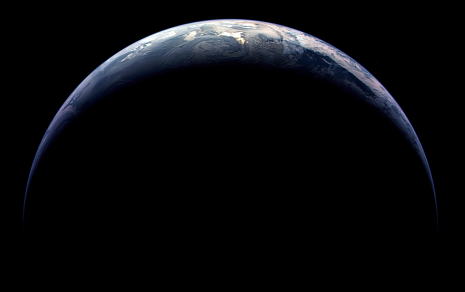
Image of Earth taken by ESA's Rosetta spacecraft in 2009

[/caption]

Researchers at the University of Maryland have discovered a way to identify and track sulfuric compounds in Earth’s marine environment, opening a path to either refute or support a decades-old hypothesis that our planet can be compared to a singular, self-regulating, living organism — a.k.a. the Gaia theory.

Proposed by scientists James Lovelock and Lynn Margulis in the 70s, the Gaia theory likens Earth to a self-supporting singular life form, similar to a cell. The theory claims that, rather than being merely a stage upon which life exists, life — in all forms — works to actively construct an Earthly environment in which it can thrive.

Although named after the Greek goddess of Earth, the Gaia theory is not so much about mythology or New Age mysticism as it is about biology, chemistry and geology — and how they all interact to make our world suitable for living things.

Once called the Gaia hypothesis, enough scientific cross-disciplinary support has since been discovered that it’s now commonly referred to as a theory.

Marine phytoplankton -- like these diatoms -- may produce sulfur compounds that can be transmitted into the air, affecting climate. (NOAA image)

One facet of the Gaia theory is that sulfur compounds would be created by microscopic marine organisms — such as phytoplankton and algae — and these compounds could be transmitted into the air, and eventually (in some form) to the land, thus helping to support a sulfur cycle.

Sulfur is a key element in both organic and inorganic compounds. The tenth most abundant element in the Universe, sulfur is crucial to climate regulation — as well as life as we know it.

In particular, two sulfur compounds — dimethylsulfoniopropionate and its atmospherically-oxidized version, dimethylsulfide — are considered to be likely candidates for the products created by marine life. It’s these two compounds that UMD researcher Harry Oduro, along with geochemist and professor James Farquhar and marine biologist Kathryn Van Alstyne (of Western Washington University) have discovered a way to track across multiple environments, from sea to air to land, allowing scientists to trace which isotopes are coming from what sources.

“What Harry did in this research was to devise a way to isolate and measure the sulfur isotopic composition of these two sulfur compounds,” said Farquhar. “This was a very difficult measurement to do right, and his measurements revealed an unexpected variability in an isotopic signal that appears to be related to the way the sulfur is metabolized.”

The team’s research can be used to measure how the organisms are producing the compounds, under which circumstances and how they are ultimately affecting their — and our — environment in the process.

“The ability to do this could help us answer important climate questions, and ultimately better predict climate changes,” said Farquhar. “And it may even help us to better trace connections between dimethylsulfide emissions and sulfate aerosols, ultimately testing a coupling in the Gaia hypothesis.”

Whether or not Earth can be called a singular — or possibly even sentient — living organism of which all organisms are contributing members thereof may still be up for debate, but it is fairly well-accepted that life can shape and alter its own environment (and in the case of humans, often for the worse.) Research like this can help science determine just how far-reaching those alterations may be.

The study appears in this week’s Online Early Edition of the Proceedings of the National Academy of Sciences (PNAS).

Read more on the University of Maryland’s news page here.

Image credit: ESA ©2009 MPS for OSIRIS Team MPS/UPD/LAM/IAA/RSSD/INTA/UPM/DASP/IDA. Edited by J. Major.

Chaos and Education at 120,000 feet for Camilla the Rubber Chicken

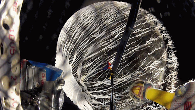
The helium balloon pops at the apex of the flight on March 10, 2012. Credit: Earth to Sky-Bishop CA

[/caption]

In my travels, I’ve had the pleasure of regularly meeting up with Camilla the Rubber Chicken, the social media maven and mascot for NASA’s Solar Dynamics Observatory. But lately I’ve been seeing here virtually everywhere — on television, splashed across all sorts of websites, and even in my local newspaper. What Camilla does is try to capture the imagination of students and get them interested in space and science. With her latest adventures she’s done just that, and now captured the attention of people all around the world, too.

What did she do? She flew to the stratosphere — about 36,000 meters (120,000 ft) up — on a helium balloon right into the throes of one of the most intense solar radiation storms since 2003.

“I am still glowing,” Camilla joked.

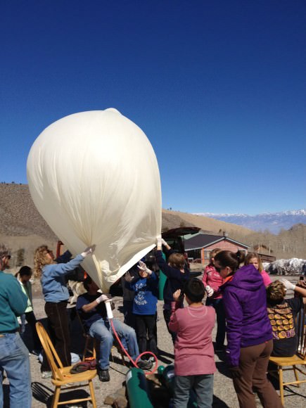
Inflating Camilla's ride. Image courtesy Bishop Union High School.

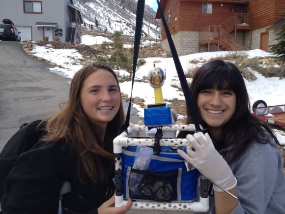
Students from Bishop Union High School’s Earth to Sky group spearheaded the flights, as Camilla actually flew twice — once on March 3 before the radiation storm and again on March 10 while the storm was in full swing. This would give the students a basis for comparison of the radiation environment.

On board with Camilla was a payload of four cameras, a cryogenic thermometer two GPS trackers, radiation detectors, Seven insects and two-dozen sunflower seeds (fittingly, the variety known as “Sunspot” — Helianthus annuus) all inside a modified department store lunchbox.

“We equipped Camilla with sensors to measure the radiation,” says Sam Johnson, 16, of Bishop Union High School’s Earth to Sky student group. “At the apex of our flight, the payload was above 99 percent of Earth’s atmosphere.”

Camilla made it back in one piece, but unfortunately, the insects died.

“This story is really about STEM (science, technology, engineering and math) and about these kids from Bishop, California who have worked really hard in developing the mission, planning it, and then executing it,” Camilla told Universe Today. “They had to overcome set-backs, review their processes, come up with better solutions and implement them. For them it was a great hands-on learning experience and they are and can be proud of their accomplishments.”

NASA knows that these kinds of programs, where kids can get involved in hands-on research, are very important for introducing and keeping students interested in STEM subjects, important areas of study for future NASA scientists and engineers.

“As you know, I not only want to educate about our Sun and space weather, but I want to inspire and show kids (and adults) how much fun science and engineering really is,” Camilla said via email. “Team SDO’s goal has always been to encourage more girls into STEM careers and seeing that this team had several girls on the team was just the most rewarding.”

Students prepare Camilla for her ride into the stratosphere. Image courtesy Bishop Union High School.

The video of the balloon popping and part of Camilla’s flight:

During the two-and-a-half-hour flights, Camilla spent approximately 90 minutes in the stratosphere where temperatures ( -40 to -60 C, -40 to -76 F) and air pressures (1 percent sea level) are akin to those on the planet Mars. The balloon popped, as planned, at an altitude of about 40 km (25 miles) and Camilla parachuted safely back to Earth. The entire payload was recovered intact from a landing site in the Inyo Mountains.

The fifth grade students who assisted with the flight have planted the sunflower seeds to see if radiated seeds produce flowers any different from seeds that stayed behind on Earth. They also pinned the corpses of the insects to a black “Foamboard of Death,” a rare collection of bugs that have been to the edge of space.

Meanwhile, Camilla’s radiation badges have been sent to a commercial laboratory for analysis.

The students say they are looking forward to the data and perhaps sending Camilla back for more.

“I truly believe that text books will always be around,” Camilla said, “but real-life hands-on projects like these are wonderful, and will become more popular.”

Here’s a video of an X-class flare from sunspot AR1429, which unleashed more than 50 solar flares during the first two weeks of March:

Read more about Camilla’s adventures, or our previous article, How a Rubber Chicken is Spreading the Word About NASA’s Space Missions and Science.