What is a Subduction Zone?

Transform Plate Boundary
Tectonic Plate Boundaries. Credit:

IF you don’t know anything about plate tectonics you might be wondering about what is a subduction zone. A subduction zone is a region of the Earth’s crust where tectonic plates meet. Tectonic plates are massive pieces of the Earth’s crust that interact with each other. The places where these plates meet are called plate boundaries. Plate boundaries occur where plates separate, slide alongside each other or collide into each other. Subduction zones happen where plates collide.

When two tectonic plates meet it is like the immovable object meeting the unstoppable force. However tectonic plates decide it by mass. The more massive plate, normally a continental will force the other plate, an oceanic plate down beneath it. This is the subduction zone. When the other plate is forced down the process is called subduction. The plate enters into the magma and eventually it is completely melted. That is how the surface of the earth makes way for the crust created over time at other plate boundaries.

Subduction zones have key characteristics that help geologist and seismologist identify them. The first is mountain formation. Subduction zones always have mountain ranges caused by plate subduction. The next is volcanic activity as a plate is subducted the pressure and heat turns it into magma. These pockets of magma find paths to the surface and create volcanoes. A good example is the subduction zone near Chile. The final sign is deep marine trenches. These are the best evidence of a subduction zone as they are visible evidence of the crease formed by subduction of a plate. The most famous is the Mariana Trench.

There are some interesting theories about why Subduction occurs in the Earth’s crust. One common theory is that subduction was initiated by major impacts by asteroids or comets early in Earth’s history. This makes a lot of sense due to the geologic evidence of large impacts scattered around the world.

Understanding how subduction zones work is important because it helps scientist to identify areas of high volcanic and seismic activity. Monitoring these areas can help them warn people who live near them of imminent events and also people who could be affected by the side effects of such events such as ash clouds or tsunamis.

Subduction continues to be one of the most powerful and dynamic processes on planet Earth and as technology improves we can come to understand more about this amazing process.

We have written many articles about the subduction zone for Universe Today. For example, here is one on the Ring of Fire and plate boundaries.

You should also check out plate tectonics and subduction.

If you’d like more info on the subduction zone, check out the U.S. Geological Survey Website. And here’s a link to NASA’s Earth Observatory.

We’ve also recorded related episodes of Astronomy Cast about Plate Tectonics. Listen here, Episode 142: Plate Tectonics.

Sources:
http://en.wikipedia.org/wiki/Subduction
http://myweb.cwpost.liu.edu/vdivener/notes/subd_zone.htm

Subduction is a process in geology where one tectonic plates slides underneath another one and merges into the Earth’s mantle. The denser plate is the one that slips under the less dense plate; the younger plate is the less dense one. The process is not a smooth one. The tectonic plates grate against each other, which often causes earthquakes. The plate that slips under does not stay that way. Due to the heat caused by it rubbing against the other plate as well as the natural heat of the mantle, the plate melts and turns into magma. The area where subduction occurs is known as the subduction zone.

When one plate begins to slip underneath another one a trench is formed. The earthquakes that result due to the plates grinding against each other often cause magma to spill out through the trench in submarine volcanoes. Various formations such as mountain ranges, islands, and trenches are caused by subduction and the volcanoes and earthquakes it triggers. In addition to causing earthquakes, subduction can also trigger tsunamis.

When the older plate is holding a continent however, it does not sink, which is reassuring. Instead, the less dense material slips into a trench behind the denser oceanic crust where it gets stuck. The pressure continues to build until the trench flips over and the less dense plate slips underneath the one with the continent.

It is possible for a whole tectonic plate to disappear. This happens when the plate goes through subduction faster than new material can be added to the plate through seafloor spreading. The spreading pushes the plate slowly toward the subduction zone until the whole thing disappears. When this happens, the other tectonic plates rearrange to cover the area.

Subduction zones are mainly located in the Pacific Ocean. This is because seafloor spreading – the process by which new oceanic crust is created – occurs mostly in the Pacific. Thus the new material pushes the older plates outward and then they need to undergo subduction. This also explains why so many earthquakes originate in the Pacific Ocean near the Ring of Fire. That is where the subduction zones are concentrated.

Continental plates also converge, but this is not considered subduction because these plates do not have different densities and thicknesses to subduct. Landforms such as the Himalayas are formed from these convergences though.


Geomagnetic Reversal

Magnetic Field
Earth's magnetic field protects us from the solar wind. Image credit: NASA

[/caption]

Geomagnetic reversal is when the orientation of the Earth’s magnetic field becomes reversed. Thus, magnetic north and south switch places. The process is a gradual one though that can take thousands of years. The possibility that the magnetic field could reverse was first brought up in the early 1900’s. However, at this time scientists did not understand the Earth’s magnetic field very well so they were not interested in the concept of geomagnetic reversal. It was not until the 1950’s that scientists began a more in-depth study of geomagnetic reversal.

Scientists have not reached a consensus on what causes pole reversal. Some believe that it is simply an effect of the nature of the planet’s magnetic field. They base this hypothesis on the magnetic field lines’ tendency to move around and think that it becomes agitated enough to flip. Other scientists propose that external influences cause the shift. For example, a tectonic plate that undergoes subduction and goes into the Earth’s mantle may disturb the magnetic field enough to make it turn off. When the field restarts, it randomly chooses orientation, so it could shift.

 In order to better understand the process, scientists study past geomagnetic reversals. This is possible because the reversals have been recorded in minerals found in sedimentary deposits or hardened magma. Scientists have discovered that the magnetic field has actually reversed thousands of times. Scientists also discovered a record of reversals on the ocean floor.

The time between geomagnetic eruptions is not constant. One time, five reversals occurred over a period of a million years. Sometimes however, none happen for a very long time. These periods are known as superchrons. The last time a geomagnetic reversal occurred was 780,000 years ago and is referred to as the Brunhes-Matumaya reversal.

Geomagnetic reversal has also been linked to 2012. Some people believe that in 2012 when the Mayan calendar runs out we will experience some cataclysmic event that will destroy our world or life as we know it. There are various theories for exactly what this event is. One theory says that geomagnetic reversal will occur during 2012. Since the magnetic field is weaker at first when it switches, some claim that the Earth will be ravaged by solar rays. Scientists still have not determined what effects a geomagnetic reversal will have on humans; however, humans did survive the last reversal 780,000 years ago. One hypothesis is that the solar winds actually create a magnetic field sufficient enough to protect us while Earth’s magnetic field restarts.

Universe Today has articles on no geomagnetic reversal in 2012 and field reversal may take 7000 years.

For more information, you should check out geomagnetic flip may not be random and magnetic storm.

Astronomy Cast has an episode on magnetism everywhere.

Reference:
NASA: Earth’s Inconstant Magnetic Field

2003 ub313

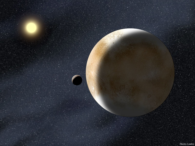
The mysterious Eris and moons. Credit: NASA

[/caption]

In 2003, a celestial object was discovered, but little did astronomers know that this object, which was designated 2003ub313, was going to change astronomy forever. Although the object was first photographed in 2003 by Mike Brown and other astronomers, it was not until 2005 that astronomers announced their discovery. You may better know 2003 ub 313, which was its designation given when it was believed to be a minor planet, as Eris. Eris made such a fuss because it is larger than Pluto – 27% more massive. Some people labeled it as the tenth planet while others did not think it should join the ranks of the nine planets we had. Finally, the International Astronomical Union (IAU) met to decide on a definition of a planet. Eventually, they decided on a definition in 2006, and 2003ub313 was not classified as a planet but rather a dwarf planet.  In addition to Eris, Pluto was reclassified as a dwarf planet, and several other celestial bodies – including Ceres, Haumea, and Makemake – were classified as dwarf planets. Astronomers are evaluating dozens more celestial bodies to see whether they fall under the classification of dwarf planets.

Eris is the ninth largest celestial body in our Solar System that orbits the Sun and the most distant object orbiting the Sun. It takes the dwarf planet 556.7 years to orbit our star. Eris is located in the scattered disc, which is a region beyond the Kuiper Belt. In addition to being a dwarf planet, Eris is also classified as a Trans-Neptunian Object (TNO). The surface of the dwarf planet is grey, and astronomers believe that the surface is covered with methane ice, which is what causes it to appear grey.  Methane is the same substance that makes Uranus and Neptune blue. Scientists think that Eris’ composition is similar to that of Pluto. Eris also has a very eccentric orbit, and it is also highly inclined. At some point in its orbit, Eris will actually be closer to the Sun than Pluto will be.

Like most celestial bodies, Eris was named after a figure in mythology. Eris was the Greek goddess of strife and discourse. Many believe this is a very fitting name for the dwarf planet, which caused so much division over the definition of a planet and the fate of Pluto.  The dwarf planet Eris also has a moon, which was named Dysnomia. Dysnomia was Eris’ daughter in Greek mythology and the demon of lawlessness.

Universe Today has articles on Eris including dwarf planet Eris and plutoid Eris is changing.

For more information, check out the discovery of Eris and former 10th planet officially named Eris.

Astronomy Cast has an episode on Pluto’s planetary crisis you will want to hear.

Source: NASA

Satellite Map

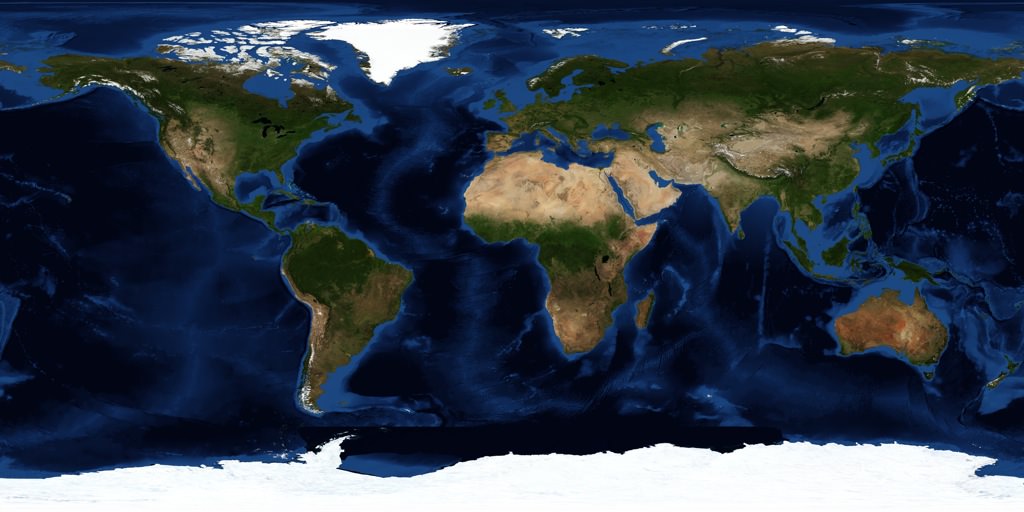
NASA satellite map of the Earth

[/caption]
There are thousands of satellites overhead in space right now, and many of them are being used to map every single square meter of planet Earth. And many of these images are being freely distributed on the Internet so you can access them through any browser. If you’re looking for a satellite map, there are many services out there that can help you out.

Probably the easiest and best place to start is with the Google Maps service from Google. This allows you to see a satellite map of the entire Earth. You can drag around the map to browse around the planet, and you can zoom out and in right down to the highest resolution images they have in their server. In many cases this means you can see your house, your yard, and even your car parked out in the street. You can also type in a specific address location and go straight there. There are street maps you can overlay or remove, you can get driving directions, and much more. And the Google Maps API has been made available by Google to other websites, so people are developing mashups that let you track running routes and find the nearest bathroom.

An even cooler satellite mapping service is Google Earth. Unlike Google Maps, you have to download Google Earth to your local PC, Mac or Linux machine (there’s even an iPhone version). Then you get this cool spinning 3-D version of the Earth. You can zoom out and in, type in a specific location address or geocode to find any spot on Earth. They also have a big library of additional layers that you can put over top, to see additional information mapped on the Earth. It’s well worth the download.

Another good service is TerraServer; they let you buy satellite maps if you want a nice printed version for your wall. If you don’t want to use Google, there are similar mapping tools from Microsoft and Yahoo.

We have written many articles about how satellites are being used to map the Earth. Here’s an article about how scientists use satellite photos to track penguin poop from space, and how Google’s maps had a satellite view of Obama’s inauguration.

We have also recorded an episode of Astronomy Cast all about Earth. Listen here, Episode 51: Planet Earth.

What is the Most Remote Place on Earth?

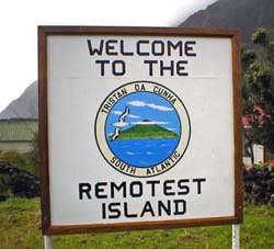
Remotest Island

Have you had enough of kids, car alarms and the obnoxious laugh of your neighbor down the hall? You may find yourself wanting to get away from it all. If you aren’t lucky enough to have the magical nose of Sam Stephens to zap you into another dimension, you can visit Bouvet Island; an uninhabited, glacier clad island located between the southern tip of Africa and Antarctica. By all accounts, this is the remotest place on Earth, but if you don’t like the cold or have something against Norway, the county to which it belongs, take heart, you can always move to the comparatively burgeoning metropolis of Tristan da Cunha, a group of British, volcanic islands half way between South America and Africa. One of the islands in this group is actually called Inaccessible Island; and that’s saying something given its neighbors!

The most remote place on Earth can be defined as the landmass furthest from any other landmass and either inhabited or uninhabited. Since Tristan da Cunha is a group of islands, they can’t be defined as being furthest from another land mass, but taken as a whole, they tie with Bouvet Island as the most remote. The Tristan da Cunha group includes Ascension, Saint Helena and Tristan da Cunha itself which has a total population of 284. The islands are 2,816 km away from the nearest landmass.

What is Tristan da Cunha famous for, other than being hard to get to? Wideawake Airfield on Ascension Island was jointly owned by the US and British governments and used extensively during WWII, but then fell into disuse. In 1982, the British used Ascension Island as a staging base for the Falklands War. It’s famous also, for housing one of the 5 worldwide GPS ground antennae which you would no doubt, need to even get there!

Want more Earth extremes? Here’s an article about the hottest place on Earth, and here’s an article about the coldest place on Earth.

Here’s the guide to visiting Tristan da Cunha.

We have recorded an episode of Astronomy Cast all about Earth. Listen here, Episode 51: Earth.

Betelgeuse

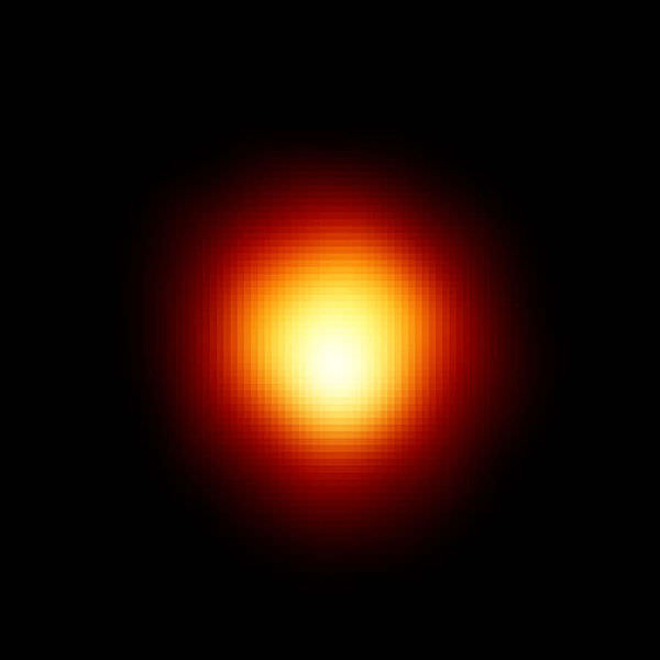
Betelgeuse. Image credit: Hubble

[/caption]
Betelgeuse is the ninth brightest star in the sky, and the second brightest in the constellation of Orion (it’s the red one, on the opposite side of the Belt from Rigel, which is the blue one, and the brightest).

With a mass of some 20 sols (= the mass of 20 Suns), Betelgeuse is evolving rapidly, even though it’s only a few million years old. It’s now a red supergiant, burning helium in a shell, and (very likely) burning carbon in another shell (closer to the nucleus), and (possibly) oxygen, silicon, and sulfur in other nested shells (like Russian dolls).

Betelgeuse is enormous … if it were where the Sun is, all four inner planets would be inside it! Because it’s so big, and is only approx 640 light-years away, Betelgeuse appears to about 1/20 of an arcsecond in size; this made it an ideal target for optical interferometry. And so it was that in 1920 Michelson and Pease used the 100″ Mt Wilson telescope, with a 20 m interferometer attached to the front, to measure Betelgeuse’s diameter.

The Hubble Space Telescope imaged Betelgeuse directly, in 1995, in the ultraviolet (see above). Why the UV? Because ground-based telescopes can’t make such observations, and because the Hubble’s resolution is greatest in the UV.

Since the 1920s Betelgeuse has been observed, from the ground, by many different optical interferometers, at many wavelengths. Its diameter varies somewhat, as does its brightness (Herschel is perhaps the first astronomer to describe its variability, in 1836). It also has ‘hotspots’, which are ginormous.

Betelgeuse is also shedding mass in giant plumes that stretch to over six times its diameter. Although these plumes will certainly cause it to ‘slim down’, they won’t be enough to stop its core turning to iron (when the silicon there is exhausted, if it hasn’t already done so). Not long afterwards, perhaps within the next thousand years or so, Betelgeuse will go supernova … making it the brightest and most spectacular supernova visible from Earth in perhaps a million years. Fortunately, because we are not looking directly down on its pole, when Betelgeuse does go bang, we won’t be fried by a gamma ray burst (GRB) which may occur (while a core collapse supernova can cause one kind of GRB, it is not yet known if all such supernovae produce GRBs; in any case, such a GRB is one of a pair of jets which rip through the poles of the dying star).

AAVSO has an excellent article on Betelgeuse, and COAST’s (Cambridge Optical Aperture Synthesis Telescope) webpage on its observations of Betelgeuse gives a good summary of one interferometric technique (and some great images too!).

Universe Today has many stories on just about every aspect of Betelgeuse, from its varying size (The Curious Case of the Shrinking Star), the bubbles it’s blowing and its plumes (Closest Ever Look at Betelgeuse Reveals its Fiery Secret), featured in What’s Up This Week, to the bow shock it creates in the interstellar medium (The Bow Shock of Betelgeuse Revealed).

Astronomy Cast’s The Life of Other Stars is a whole episode on the evolution of stars other than the Sun.

References:
http://en.wikipedia.org/wiki/Betelgeuse
http://www.solstation.com/x-objects/betelgeuse.htm

Greenwich Mean Time

Prime Meridian in Greenwich, England

[/caption]

Greenwich Mean Time was formulated in the 1800’s in order to deal with the confusion that existed when each country decided its own solar time. This was especially important with the increase in traveling and train schedules. In 1884, at the Meridian Conference, 27 countries decided to implement a system that is practically the same one that we have today. They based their system on one formulated by a Canadian railway planner and engineer, Sir Sanford Fleming.

In this system, there are 24 lines that go from the North to the South called meridians of longitude. They are spaced 15° apart. The first line, known as the prime meridian, is located in Greenwich, England.  It is 0° longitude. Greenwich Mean Time (GMT) refers to solar mean time at the Royal Observatory in Greenwich, England. Solar mean time is calculated using the angle of the mean Sun – a fictional Sun used to compute time. Since Britain was an advanced maritime nation, they had long used Greenwich as a point of longitude to calculate their longitude in relation to the Greenwich meridian. Due to its long history, the world decided to accept it as the prime meridian as well.

Different countries have legally defined their local time in reference to Greenwich Mean Time. These countries include the United Kingdom, Belgium, the Republic of Ireland, and Canada. Although GMT is used all year round in Iceland, it is only used during the winter in Ireland and the UK. During the summer, British Summer Time (BST) is used. This is also known as Greenwich Daylight Savings Time (GDT), which corresponds to daylights savings time in the United States. The Greenwich Mean Time is also known as the Universal Time (UT).

The issue of time zones is made more complicated because the zones are not always split along the longitudinal lines. They are also divided along political boundaries. This means that although it may be one time in the one country, if you head north or south while staying in the same longitude, the time may change.

GMT is used for a variety of things. For example, many emails between people from different time zones include a reference to GMT, explaining how many hours that person’s time zone is from GMT. On the International Space Station, they use GMT. The US Government National Weather Service and the Weather Channel both use weather maps that use GMT. These are just a few of many ways that the GMT is used today.

Universe Today has a number of articles on interesting facts about Earth and how long a day on Earth is.

If you are looking for more information, you should check out what is GMT and Greenwich Mean Time.

Astronomy Cast has an episode on Earth.

Sources: NASA, Wikipedia

Evening Star

Venus. Credit: NASA

[/caption]

Venus is also known as the evening star. It was given that name by ancient civilizations, such as the Greeks and Egyptians, who saw it in the sky. The planet was eventually named after the Roman goddess of love because of its beauty. Many ancient cultures have his planet with love and womanhood. Venus has been an important object in a number of different cultures including to the Babylonians and Mayans. The Mayans even used the movement of the planet to help create their complex calendar.

Venus is close to the Earth as well as the Sun. As soon as the Sun sets and it gets dark enough, Venus can often be seen in the sky. Because it seems In addition to being known as the evening star, Venus was also called the morning star because it could be seen for a few hours before the Sun grew too bright. The planet actually becomes brightest before the Sun rises or just after sunset. The ancient civilizations thought that the morning star and the evening star were separate celestial bodies. Pythagoras, the famous Greek mathematician, is believed to be the first person to realize that the morning and evening stars were actually the same object – Venus.

The Egyptians had two names for the planets because they thought it was actually two stars. The morning star was called Tioumoutri, and the evening star was known as Ouaiti. The Greeks called the evenings star Hesperos, the “star of the evening.” The Greeks called the morning star, Phosphoros “the Bringer of Light,” or Eosphoros, “the Bringer of Dawn.”

 Besides the Sun and Earth’s Moon, Venus is the brightest object in our Solar System. Its brightness is caused in part by the clouds of toxic gases that comprise its atmosphere. The sulfur dioxide and other elements in these clouds reflect light from the Sun causing the planet to shine.

Long after astronomers discovered that Venus was no longer the evening or morning star it has captivated the imagination of many. The swirling clouds that hid the surface of this shining planet from view were thought to shield a tropical paradise. Ironically, what many considered to be the most beautiful planet turned out to be a burning wasteland – the hottest planet in our Solar System. Another one of Venus’ many names is Earth’s twin because it is similar in size and mass to our own planet.

Universe Today has articles on the morning and evening star and the history of Venus.

For more information, you should take a look at Venus and an introduction to Venus.

Astronomy Cast has an episode on Venus.

References:
NASA History: Earth’s Sister and the Twilight Planet
NASA: Planets

Why is the Sun Hot?

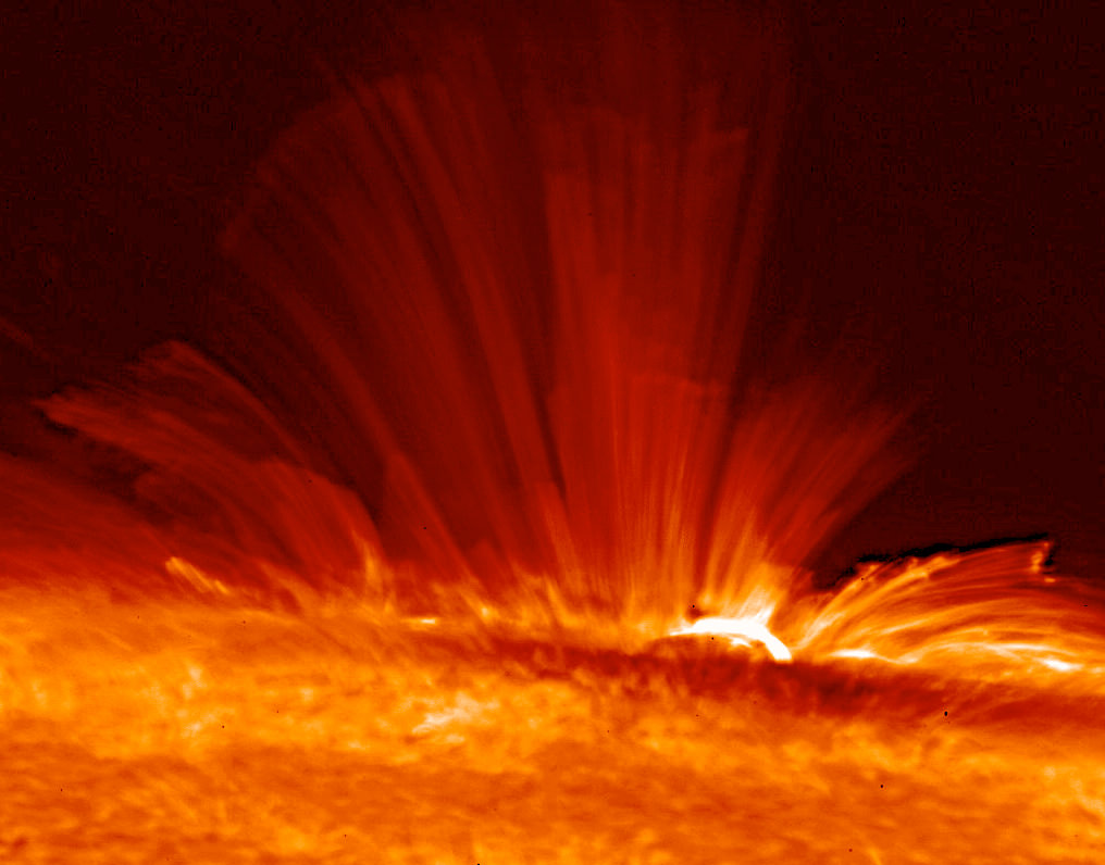
Plasma on the surface of the Sun. Image credit: Hinode

[/caption]
The Sun is the hottest place in the Solar System. The surface of the Sun is a mere 5,800 Kelvin, but down at the core of the Sun, the temperatures reach 15 million Kelvin. What’s going on, why is the Sun hot?

The Sun is just a big plasma ball of hydrogen, held together by the mutual gravity of all its mass. This enormous mass pulls inward, trying to compress the Sun down. It’s the same reason why the Earth and the rest of the planets are spheres. As the pull of gravity compresses the gas inside the Sun together, it increases the temperature and pressure in the core.

If you could travel down into the Sun, you’d reach a point where the pressure and temperature are enough that nuclear fusion is able to take place. This is the process where protons are merged together into atoms of helium. It can only happen in hot temperatures, and under incredible pressures. But the process of fusion gives off more energy than it uses. So once it gets going, each fusion reaction gives off gamma radiation. It’s the radiation pressure of this light created in the core of the Sun that actually stops it from compressing any more.

The Sun is actually in perfect balance. Gravity is trying to squeeze it together into a little ball, but this creates the right conditions for fusion. The fusion releases radiation, and it’s this radiation that pushes back against the gravity, keeping the Sun as a sphere.

We have written many articles about the Sun for Universe Today. Here’s an article about how hot the surface of the Sun is, and here’s an article about the parts of the Sun.

If you’d like more information on the Sun, check out NASA’s Solar System Exploration Guide on the Sun, and here’s a link to the SOHO mission homepage, which has the latest images from the Sun.

We have also recorded an episode of Astronomy Cast about the Sun. Check it out, Episode 30: The Sun, Spots and All.

When Was the Sun Discovered?

Solar flares on the Sun

[/caption]
When was the Sun discovered? Obviously the Sun is such an important feature in our lives, and the absolute necessity to all life on Earth. It’s kind of impossible to say when the Sun was discovered, since the first life forms on Earth probably relied on its energy. Humans have been well aware of the Sun for tens of thousands of years, and before modern astronomy had no idea what it was.

So perhaps a better question might be, when did we realize that the Sun is a star?

The Sun is incredibly important to our lives. When the Sun is in the sky, we have day. And when the Sun is below the horizon, we have night. Our biological clocks are programmed on it, and we life our lives by this routine. Ancient peoples thought the Sun was some kind of deity, and many civilizations – like the Inca in South America – worshipped it.

The Greek philosopher Anaxagoras first proposed that the Sun was a burning ball of fire, larger than a Greek Island, and not the chariot of a god. And other astronomers were able to calculate the distance to the Sun with surprising accuracy. In the modern scientific era Lord Kelvin proposed that the Sun was ball of hot liquid that was slowly cooling. But it wasn’t until the early 20th century that scientists were finally able to figure out what the source of the Sun’s energy is.

Ernest Rutherford proposed that the Sun’s heat came from radioactive decay, and it was Albert Einstein who used his famous mass-energy equation (E=mc2) to suggest that the Sun was converting mass into energy. And finally, the theoretical concept of fusion was created in the 30s by Subrahmanyan Chandrasekhar and Hans Bethe. They were able to calculate the actual fusion reactions in the Sun that convert hydrogen into helium.

I would say then, that the Sun was really discovered in the 1930s, when astrophysicists finally understood the mechanisms working inside the Sun that gave off so much energy.

We have written many articles about the Sun for Universe Today. Here’s an article about how big the Sun is, and here’s an article about the Sun’s future.

If you’d like more information about the Sun, check out NASA’s website for the SOHO spacecraft mission.

And you should check out an episode of Astronomy Cast where we talk all about the Sun. Listen here, Episode 30: The Sun, Spots and All.

References:
NASA: The Sun, Our Nearest Star
NASA: A History of Our Understanding of the Sun – A Closer Look
NASA: The Life Cycles of Stars