
Video Caption: This JPL video shows the complicated choreography to get drill samples to Curiosity’s instruments as she prepares for 2nd drilling at “Cumberland.” See where “Cumberland” is located in our panoramic photo mosaic below.
It’s time at last for “Drill, Baby, Drill!” – Martian Style.
Ever wonder how Curiosity “Does It”
Well, check out this enlightening and cool new NASA video for an exquisitely detailed demonstration of just how Curiosity shakes, rattles and rolls on the Red Planet and swallows that mysterious Martian powder.
“Shake, shake, shake… shake that sample. See how I move drilled rock to analytical instruments,” tweeted Curiosity to millions of fans.
Get set to witness Martian gyrations like you’ve never seen before.
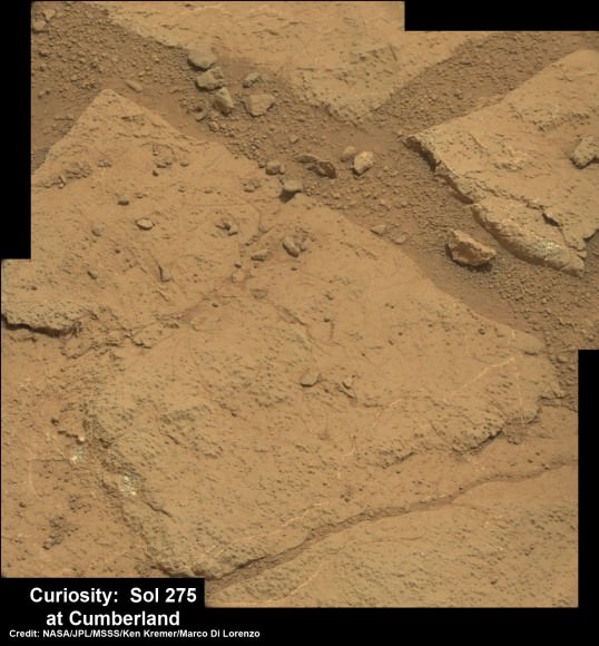
After a pair of short but swift moves this past week, NASA’s Curiosity rover is finally in position to bore into the Red Planet’s alien surface for the second time – at a target called “Cumberland.”
See where “Cumberland” is located in our panoramic photo mosaic below.
“Two short drives & 3.8 meters later, I’m zeroing in on my second Mars drilling target,” tweeted Curiosity.
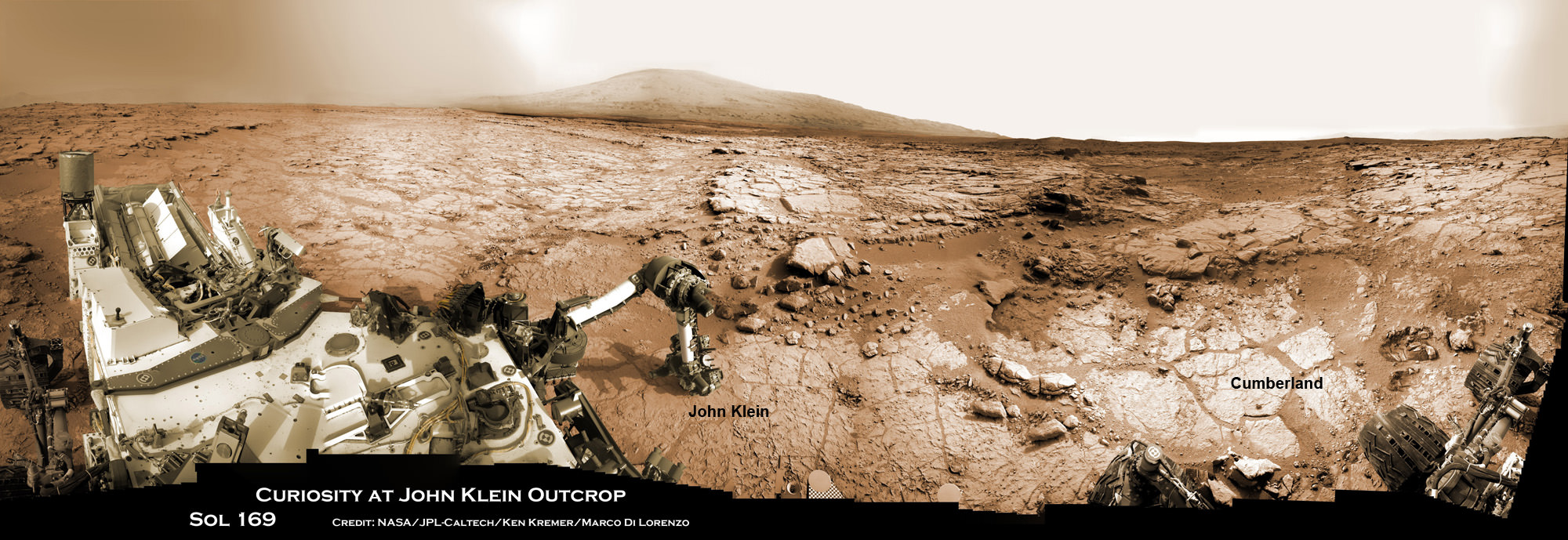
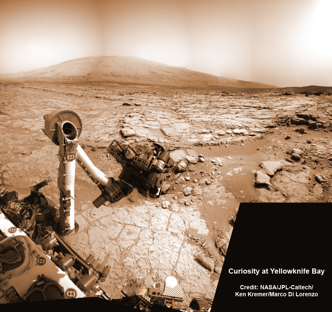
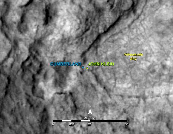
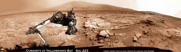
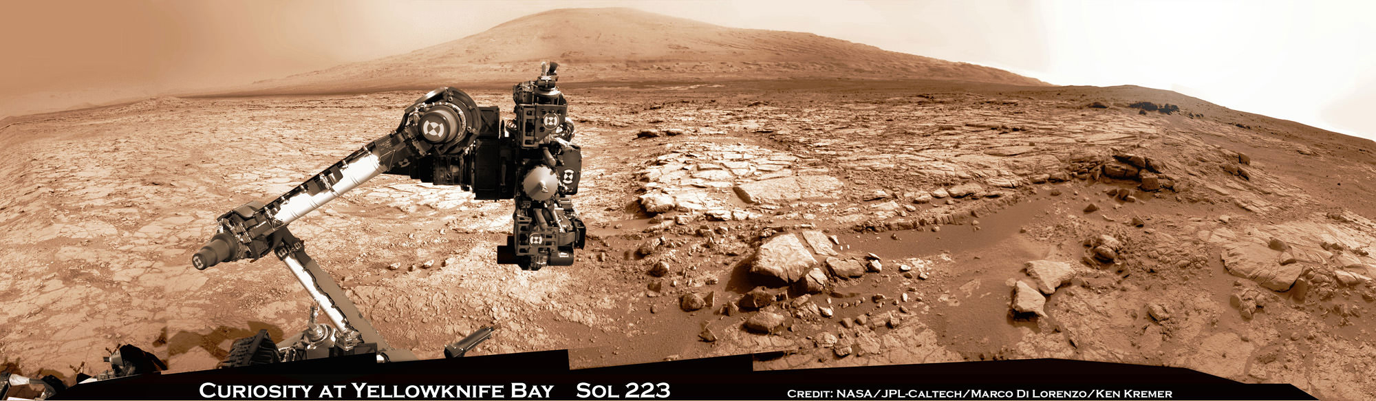
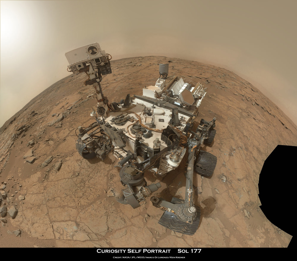
Panoramic view of Yellowknife Bay basin back dropped by Mount Sharp shows the location of the first two drill sites – John Klein & Cumberland – targeted by NASA’s Curiosity Mars rover. Curiosity accomplished historic 1st drilling into Martian rock at John Klein outcrop on Feb 8, 2013 (Sol 182) near where the robotic arm is touching the surface. This week the rover scooted about 9 feet to the right to Cumberland (right of center) for 2nd drill campaign in late-May 2013.
Credit: NASA/JPL-Caltech/Ken Kremer/Marco Di Lorenzo [/caption]
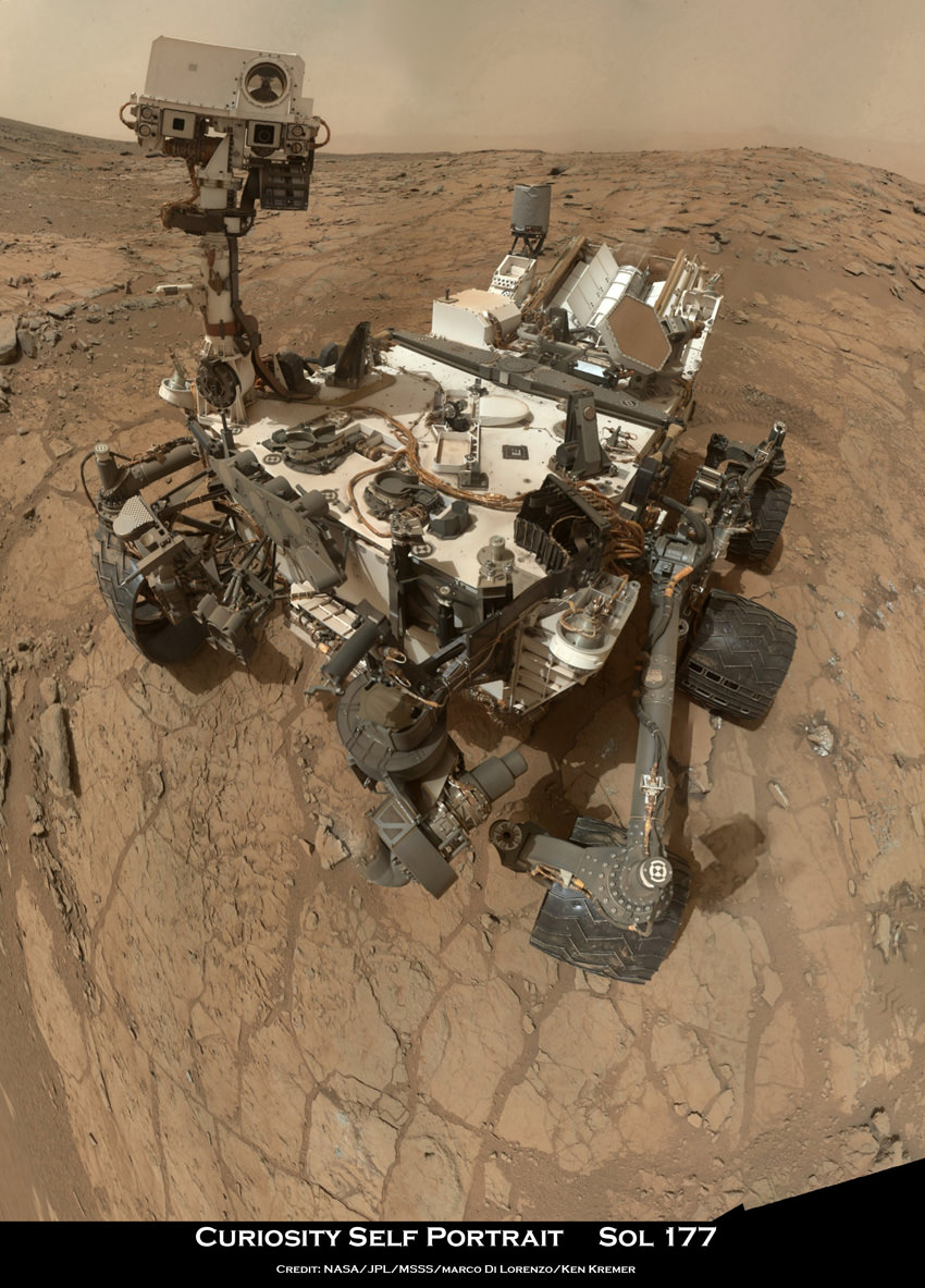
These were Curiosity’s first drives since arriving at the “John Klein” outcrop in mid- January 2013 where she carried out the historic first ever interplanetary drilling by a robot on another world.
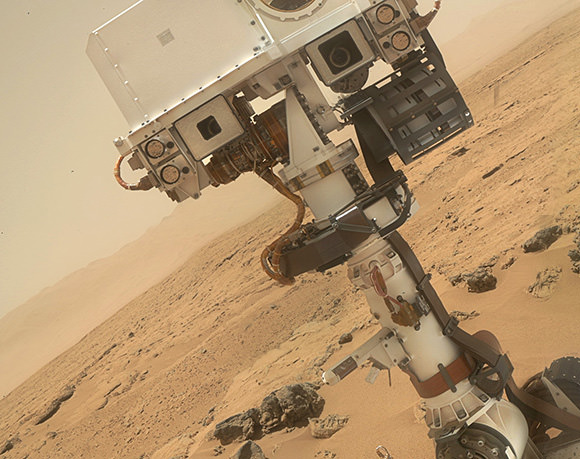
For the past few days the robot has snapped a series of close up images of “Cumberland” with the high resolution MAHLI camera on the “hand” of the dextrous robotic arm.
And now that Curiosity has switched to the B-side computer, the rover has switched over to an back up set of never before used cameras on the mast head, which appear to be functioning perfectly.
“Curiosity is now using the new pair of navigation cameras associated with the B-side computer,” said Curiosity science team member Kimberly Lichtenberg to Universe Today.
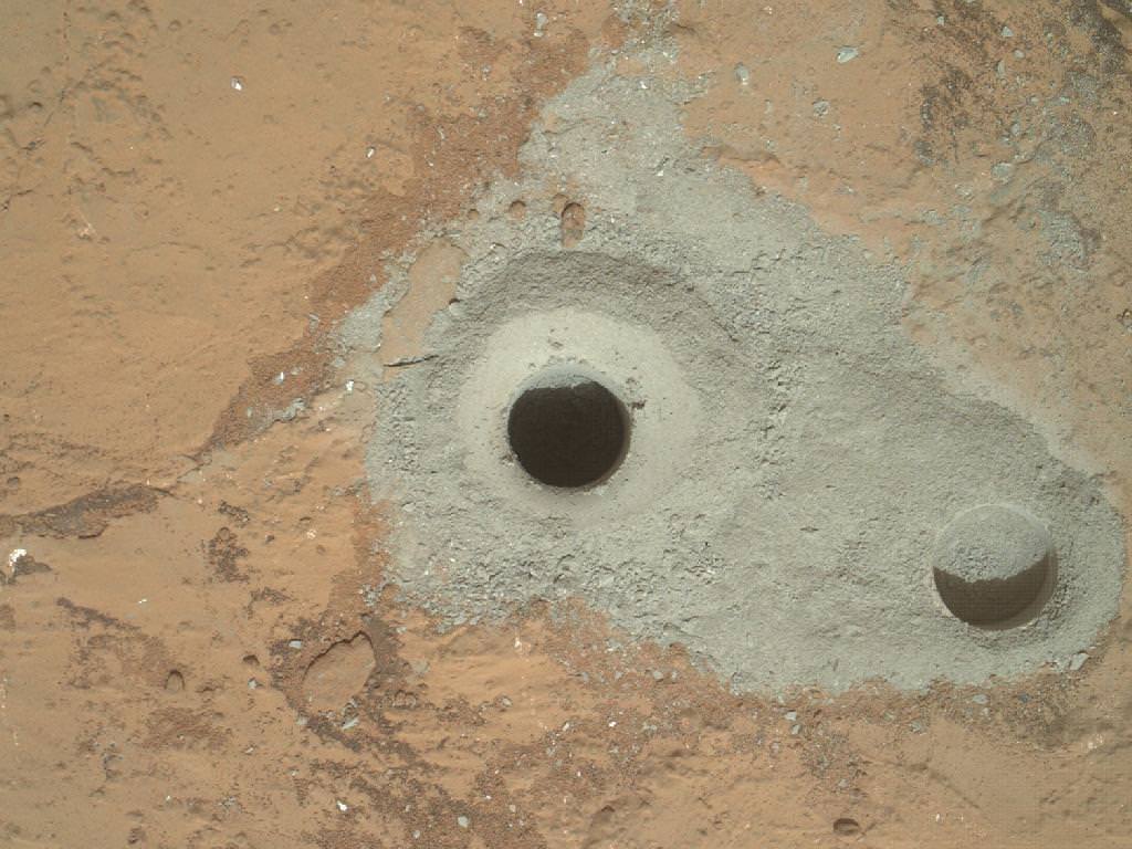
The rover also evaluated the potential drill site with the ChemCAM and APXS instruments to confirm whether ‘Cumberland’ is indeed a worthy target for the time consuming process to collect the drill tailings for delivery to the duo of miniaturized chemistry labs named SAM and Chemin inside her belly
As outlined in the video, the robot engages in an incredibly complex procedure to collect the drill bit tailings and then move and pulverize them through the chambers of the CHIMRA sample system on the tool turret for processing, filtering and delivery for in situ analysis that could take weeks to complete.
The state-of-the-art SAM and Chemin chemistry labs test aspirin sized quantities of the carefully sieved powder for the presence of organic molecules – the building blocks of life – and determine the inorganic chemical composition.
The science team wants to know how ‘Cumberland’ stacks up compared to ‘John Klein’, inside the shallow depression named ‘Yellowknife Bay’ where Curiosity has been exploring since late 2012.
“We’ll drill another hole to confirm what we found in the John Klein hole,” said John Grotzinger to Universe Today. Grotzinger, of the California Institute of Technology in Pasadena, Calif., leads NASA’s Curiosity Mars Science Laboratory mission.
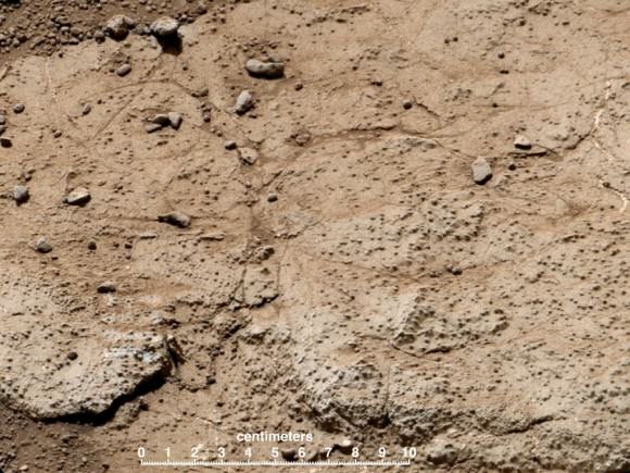
‘Cumberland’ and ‘John Klein’ are patches of flat-lying bedrock shot through with pale colored hydrated mineral veins composed of calcium sulfate hydrated and a bumpy surface texture at her current location inside the ‘Yellowknife Bay’ basin that resembles a dried out lake bed.
“The bumpiness is due to erosion-resistant nodules within the rock, which have been identified as concretions resulting from the action of mineral-laden water,” according to NASA.
At Yellowknife Bay, Curiosity found evidence for an ancient habitable environment that could possibly have supported simple Martian microbial life forms eons ago when the Red Planet was warmer and wetter.
Analysis of the gray colored rocky Martian powder at ‘John Klein’ revealed that the fine-grained, sedimentary mudstone rock possesses significant amounts of phyllosilicate clay minerals; indicating the flow of nearly neutral liquid water and a habitat friendly to the possible origin of microbes.
Curiosity is expected to drill and swallow the ‘Cumberland’ powder at any moment if all goes well, a team member told Universe Today.
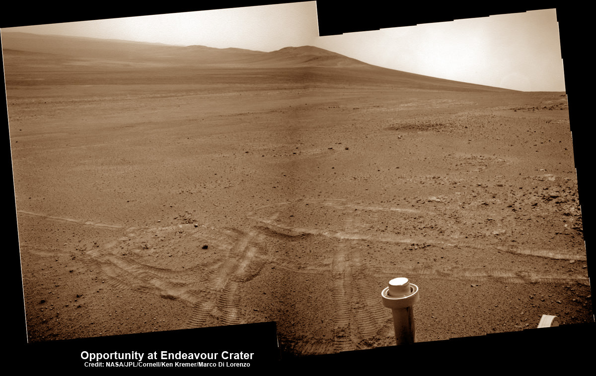
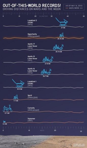
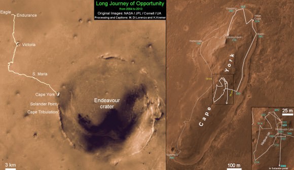
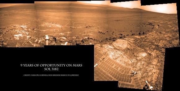
Meanwhile as Curiosity was moving to Cumberland, her older sister Opportunity was blazing a trail at Endeavour Crater on the opposite side of Mars and breaking the distance driving record for an American space rover. Read all about it in my new story – here.
And don’t forget to “Send Your Name to Mars” aboard NASA’s MAVEN orbiter- details here. Deadline: July 1, 2013
…………….
Learn more about Mars, Curiosity, Opportunity, MAVEN, LADEE and NASA missions at Ken’s upcoming lecture presentations:
June 11: “Send your Name to Mars” and “LADEE Lunar & Antares Rocket Launches from Virginia”; NJ State Museum Planetarium and Amateur Astronomers Association of Princeton (AAAP), Trenton, NJ, 8 PM.
June 12: “Send your Name to Mars” and “LADEE Lunar & Antares Rocket Launches from Virginia”; Franklin Institute and Rittenhouse Astronomical Society, Philadelphia, PA, 8 PM.

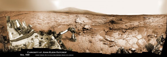
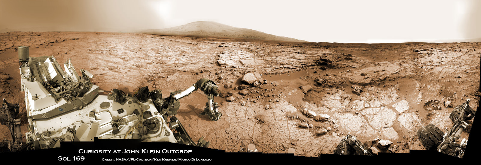

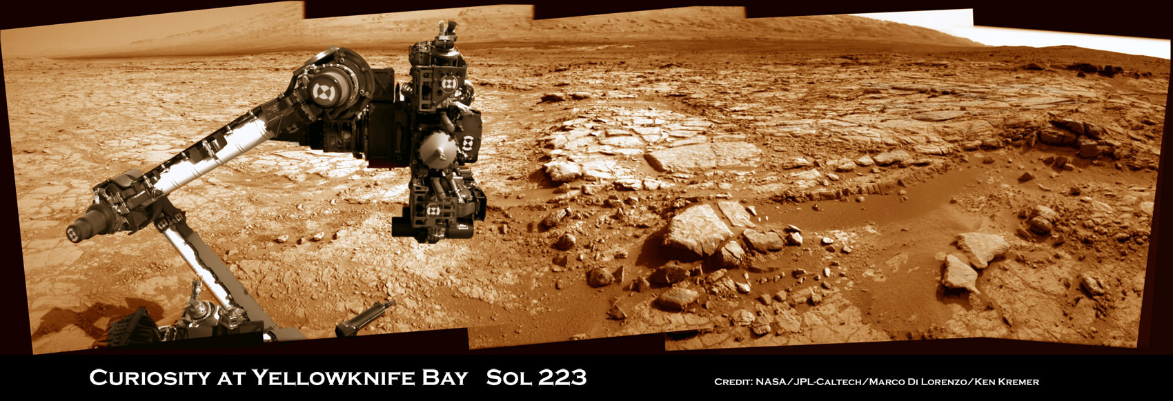


 Curiosity accomplished Historic 1st drilling into Martian rock at John Klein outcrop on Feb 8, 2013 (Sol 182), shown in this context mosaic view of the Yellowknife Bay basin taken on Jan. 26 (Sol 169) where the robot is currently working. The robotic arm is pressing down on the surface at John Klein outcrop of veined hydrated minerals – dramatically back dropped with her ultimate destination; Mount Sharp. Credit: NASA/JPL-Caltech/Ken Kremer/Marco Di Lorenzo