Scientists Recreate Mars Spiders in the Lab

NASA's Mars Reconnaissance Orbiter, acquired May 13, 2018 during winter at the South Pole of Mars, shows a carbon dioxide ice cap covering the region and as the sun returns in the spring, "Mars spiders" begin to emerge from the landscape. Credit: NASA

In 2003, strange features on Mars’s surface got scientists’ “spidey senses” tingling when they saw them. That’s when unusual “anareiform terrain” landforms appeared in images from the Mars Reconnaissance Orbiter. They’ve returned each year, spreading across the southern hemisphere surface.

Continue reading “Scientists Recreate Mars Spiders in the Lab”

There are Important Differences Between the Ice Caps on Mars

This image shows eroded channels near the Martian poles filled with bright frozen carbon dioxide, in contrast to the muted red of the underlying ground. Credit:NASA/JPL/University of Arizona

In the 17th century, astronomers Giovanni Domenica Cassini and Christian Huygens noted the presence of hazy white caps while studying the Martian polar regions. These findings confirmed that Mars had ice caps in both polar regions, similar to Earth. By the 18th century, astronomers began to notice how the size of these poles varied depending on where Mars was in its orbital cycle. Along with discovering that Mars’ axis was tilted like Earth’s, astronomers realized that Mars’ polar ice caps underwent seasonal changes, much like Earth’s.

While scientists have been aware that Mars’ polar ice caps change with the seasons, it has only been within the last 50 years that they have realized that they are largely composed of frozen carbon dioxide (aka. “dry ice”) that cycles in and out of the atmosphere – and questions as to how this happens remain. In a recent study, a team of researchers led by the Planetary Science Institute (PSI) synthesized decades of research with more recent observations of the poles. From this, they determined how the Martian poles differ in terms of their seasonal accumulation and release of atmospheric carbon dioxide.

Continue reading “There are Important Differences Between the Ice Caps on Mars”

Curiosity Rover is Climbing Through Dramatic Striped Terrain on Mars

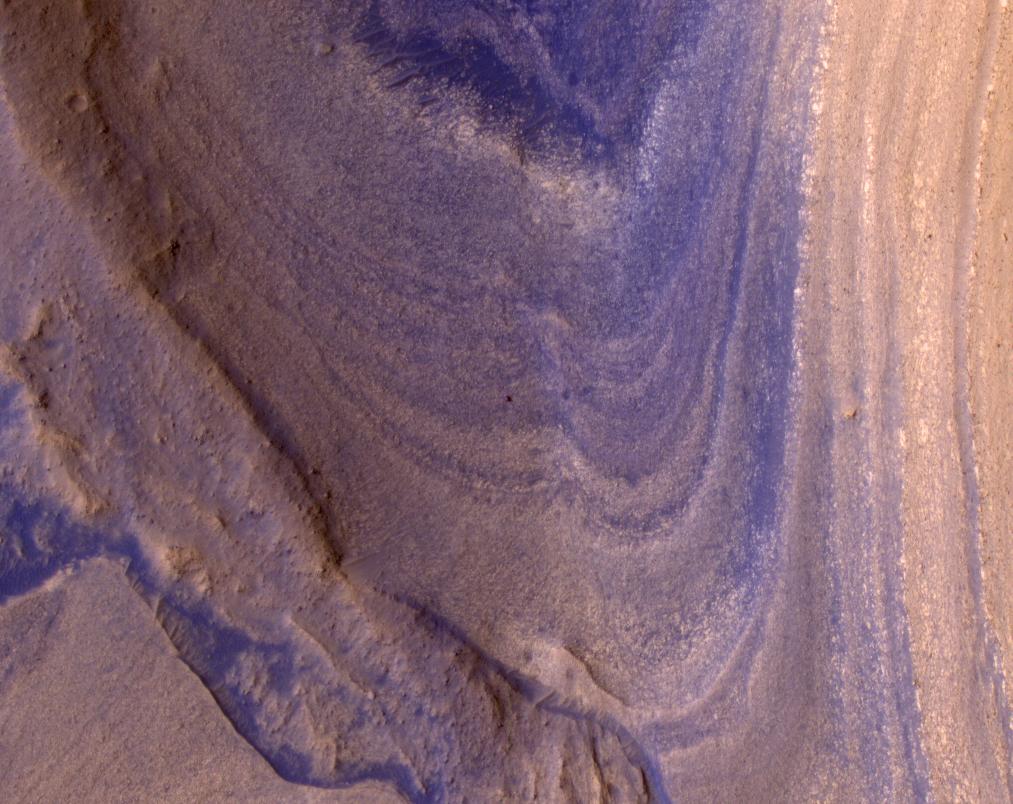
HiRISE spots Curiosity driving toward upper Gediz Vallis. Credit: NASA/JPL-Caltech/University of Arizona

Just about every day we here on Earth get a breathtaking picture of Mars’s terrain sent back by a rover. But, the view from space can be pretty amazing, too. The Mars Reconnaissance Orbiter (MRO) just sent back a thought-provoking picture of Curiosity as it makes its way up a steep ridge on Mount Sharp.

Continue reading “Curiosity Rover is Climbing Through Dramatic Striped Terrain on Mars”

A Collapsed Martian Lava Chamber, Seen From Space

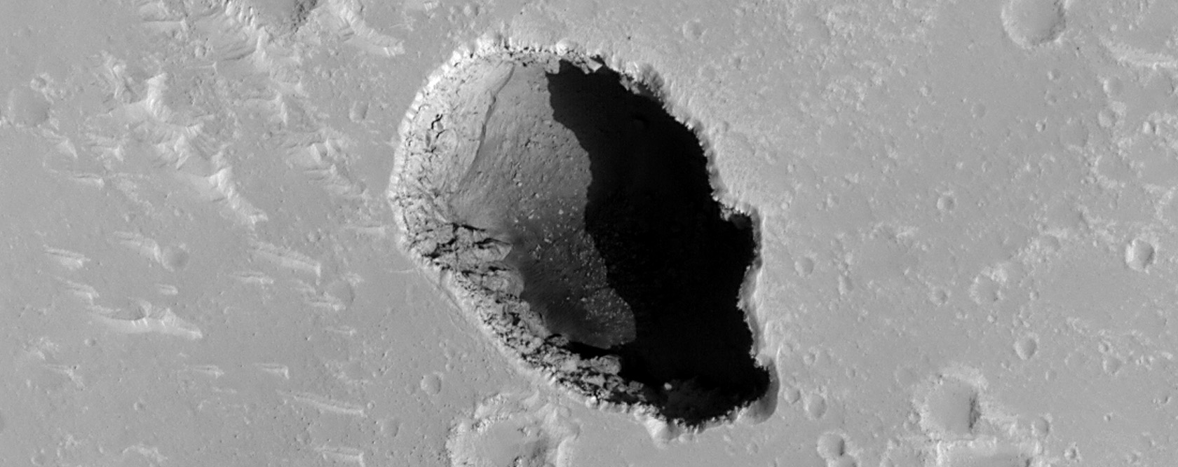
This HiRise image of Hephaestus Fossae shows a volcanic area that's collapsed into a pit. We should explore it. Image Credit: NASA/JPL-Caltech/UArizona

Lava tubes and chambers attract a lot of attention as potential sites for bases on the Moon and Mars. They provide protection from radiation, from temperature swings, and even from meteorites. They beg to be explored.

Continue reading “A Collapsed Martian Lava Chamber, Seen From Space”

A New Map Shows Where Mars is Hiding all its Ice

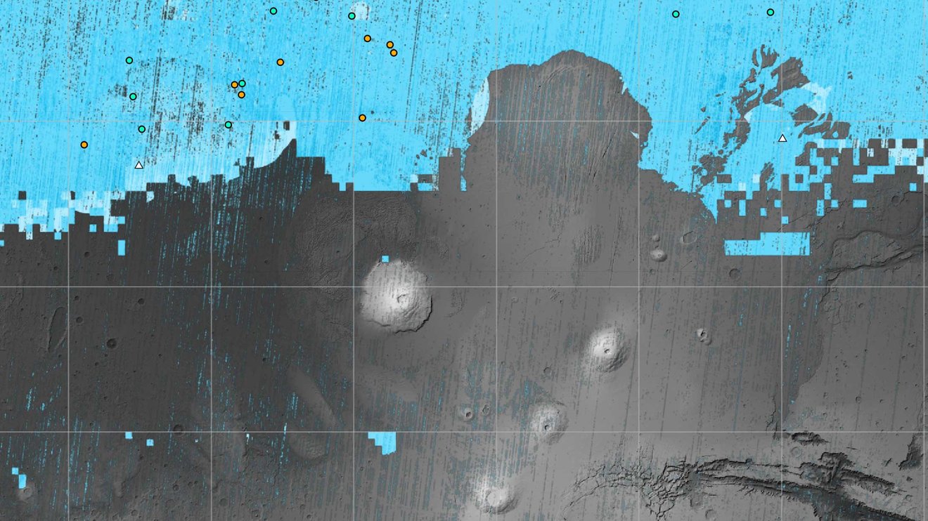
The blue areas on this map of Mars are regions where NASA missions have detected subsurface water ice (from the equator to 60 degrees north latitude). Scientists can use the map – part of the Subsurface Water Ice Mapping project – to decide where the ... Credit: NASA/JPL-Caltech/Planetary Science Institute.

Water will be one of the most important resources for human explorers on Mars. They’ll need it for drinking, propellant, breathing, and more. It makes sense to land near a spot where there’s water ice close to the surface.

NASA has released a new map of Mars’s northern hemisphere showing all the places where subsurface water ice has been detected, some of which are surprisingly close to the equator, as well as surprisingly close to the surface. This map could decide the first human landing site.

Continue reading “A New Map Shows Where Mars is Hiding all its Ice”

Amazing Video Takes Flight Across the Dunes of Mars

This is a screenshot from the flyover video of Mars' Matara Crater created from HiRise data. Image Credit: NASA/JPL-Caltech/UArizona

Mars may be a cold, dry, dead world, but it’s still part of nature. As part of nature, it displays a sort of haunted beauty as only non-living forces shape its surface over long periods of time. It’s like a rocky-planet laboratory shaped by natural forces where interference from living processes is absent.

Continue reading “Amazing Video Takes Flight Across the Dunes of Mars”

Navigate a Global Image of Mars (If Your Computer Can Handle It)

The Global CTX Mosaic of Mars allows scientists and the public to explore the planet like never before. It includes different layers of data that can be turned on or off, like these labels for named geographic features on the planet. Credits: NASA/JPL-Caltech/MSSS,

Using data from the Mars Reconnaissance Orbiter (MRO), planetary scientists have created one of the most unique and detailed maps of Mars ever. But fair warning, the biggest version of this is a could overload your computer.  

Global CTX Mosaic of Mars is the highest-resolution global image of the Red Planet ever created and it even allows you see Mars in 3D.

Continue reading “Navigate a Global Image of Mars (If Your Computer Can Handle It)”

Fly Around Jezero Crater on Mars in This New Video

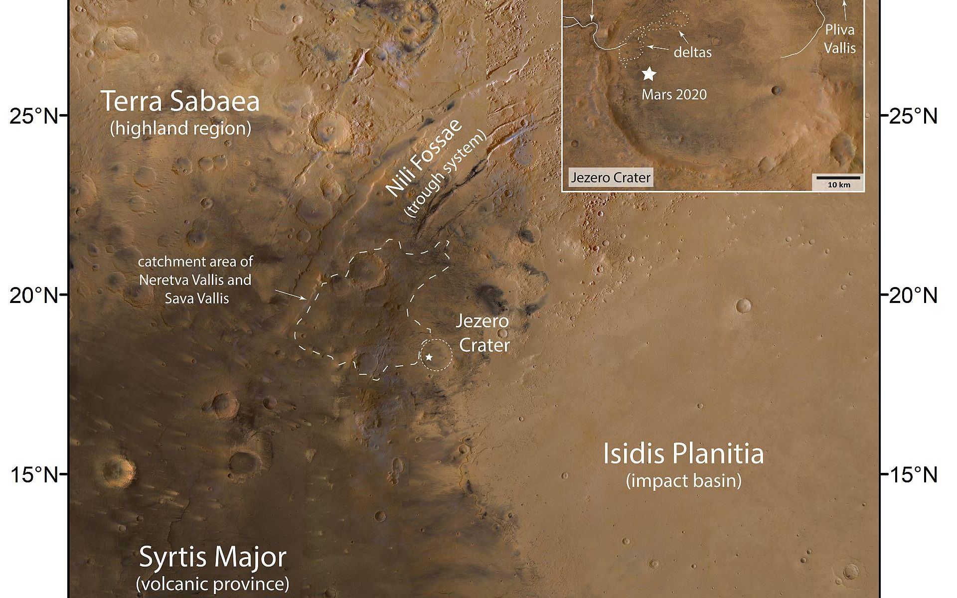
Image of the region around Jezero Crater. Credit: NASA/JPL.

There’s a reason Jezero Crater was chosen as the landing site for the Perseverance Rover: it is considered one of the likeliest places to find any evidence if Mars was ever habitable for long periods of time. In this great new flyby video from ESA, you can get a birds-eye look at Perseverance’s home.

Created from data ESA’s Mars Express and NASA’s Mars Reconnaissance Orbiter, the video takes you on an aerial tour of the crater. From this perspective, you can see the water features in this ancient impact crater and understand why this was considered one of the best places to explore Mars.

Continue reading “Fly Around Jezero Crater on Mars in This New Video”

There's a Crater on Mars That Looks Like a Bear

A bear on Mars? Credit: NASA/JPL-Caltech/UArizona.

Facial pareidolia is the human tendency or illusion of seeing facial structures in an everyday objects – such as seeing the “man in the Moon,” or the face of Jesus on a piece of toast. But here’s a newly found crater on Mars that might be a case of ‘bear-adoilia.’

Continue reading “There's a Crater on Mars That Looks Like a Bear”

InSight Heard Four Meteoroids Crash Into Mars

These craters were formed by a Sept. 5, 2021, meteoroid impact on Mars, the first to be detected by NASA’s InSight. Taken by NASA’s Mars Reconnaissance Orbiter, this enhanced-color image highlights the dust and soil disturbed by the impact in blue in order to make details more visible to the human eye. Credits: NASA/JPL-Caltech/University of Arizona.

For the first time, a spacecraft has detected acoustic and seismic waves from impacts on Mars. NASA’s InSight lander made the detections from four meteoroids that crashed on Mars in 2020 and 2021. Ever since the mission landed on the Red Planet in 2018, scientists have been hoping to be able to detect impacts with InSight’s seismometer, which was mainly designed to sense Marsquakes. But these impacts are the first the lander has detected.

Continue reading “InSight Heard Four Meteoroids Crash Into Mars”