Weird Mars Rock Has Interesting Back Story

The rock chosen for the first contact science investigations for the Curiosity rover. Credit: NASA/JPL-Caltech

The rock chosen for the first contact science investigations for the Curiosity rover. Credit: NASA/JPL-Caltech

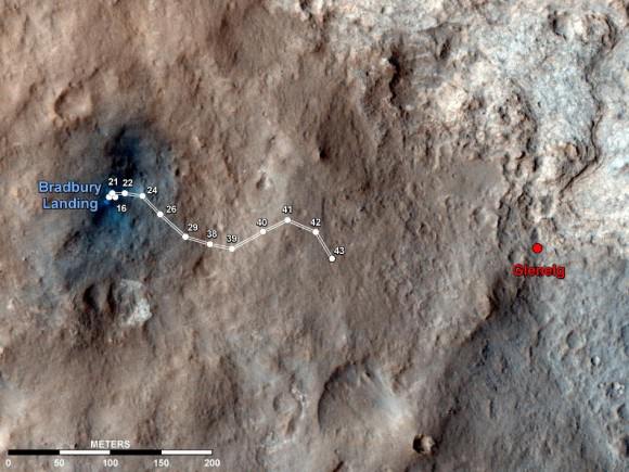
The Mars Science Laboratory team has identified their target for the first full-up contact science investigations using all the instruments attached to the Curiosity rover’s robotic arm. And ‘target’ is the operative word here, as this rock will be shot with Curiosity’s laser to help determine it chemical makeup. Interestingly, it has an unusual pyramid shape, and it was described as a “cool-looking rock sitting out on the plains of Mars,” by MSL project scientist John Grotzinger. But the rock now has a name, and while we don’t know everything about it yet, like its namesake, this rock likely has a very interesting back story.


The rock has been dubbed “Jake Matijevic,” named for the surface operations systems engineer for all the Mars rover missions so far. But unfortunately, Matijevic passed away at age 64 just days after Curiosity touched down on Mars last month. Matijevic was one of the original technology developers for rovers on Mars — figuring out how to link the mechanics, avionics and all the systems together. He led the surface operations for the Sojourner rover in 1996, worked for years with the Spirit and Opportunity rovers, and was instrumental in getting the Curiosity rover ready for its mission.

Matijevic originally was a mathematician and he developed the Matijevic Theorem, which MSL’s John Cook described as “an obscure mathematical theorem” but others have said it was “one of the most beautiful results of recent years in commutative algebra.”

“To honor Jake and his contributions we’ve named the first rock where we’re going to do contact science after him,” said Grotzinger.

The rock named Jake is about 25 centimeters (10 inches) tall and 40 cm (16 in) wide at the base, so it’s not a very large rock, nor is it very eccentric. It likely is a shapely lump of basic basalt ejecta. It is uniform in color and is actually similar in size, shape and composition to the first rock studied by the Spirit rover over eight years ago. But being a rather ordinary rock is a good thing, said Grotzinger.

“The science team has had interest for some time to find a rock that is relatively uniform in composition to do comparisons,” between the ChemCam (the laser-zapper tool) and the Alpha Particle X-ray Spectrometer (APXS), Grotziner said, to calibrate both instruments, especially the ChemCam, which is a new version of an instrument that is on the MER rovers.

“Here we get to really test a comparison between something that is tried and true with the latest and greatest technology,” he said.

Grotziner noted that most of the terrain they are seeing so far in Gale Crater has a rather uniform surface soil with some bedrock peeking out occasionally. But darker rocks like Jake, just sitting on the surface, are not quite so common. So how did Jake get there?
“Our general consensus is that it might be a piece of secondary of impact ejecta, maybe from an impact somewhere else, maybe outside of Gale Crater,” Grotziner said, “where a rock was thrown into Gale Crater and it has just sat there for a long time. It appears to have weathered more slowly than the stuff that’s around it, so that means it’s probably a harder rock.”

So a rock blasted from a huge impact on another location on Mars ends up sitting in Gale Crater where the Curiosity rover is going to zap it with a laser.

Oh, the stories this rock will be able to tell. And hopefully the instruments on Curiosity will allow the rock to divulge its secrets.

This map shows the route driven by NASA’s Mars rover Curiosity through the 43rd Martian day, or sol, of the rover’s mission on Mars (Sept. 19, 2012). Credit: NASA/JPL-Caltech/Univ. of Arizona

Curiosity Captures a Martian Eclipse

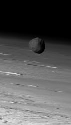
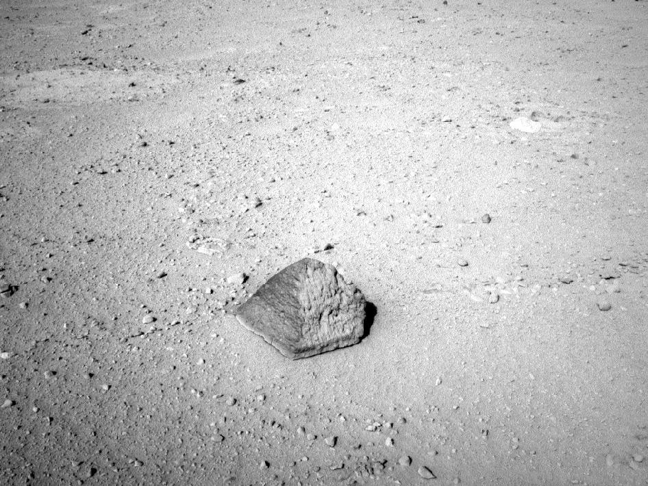
Yes, Mars gets eclipses too! This brief animation, made from ten raw subframe images acquired with Curiosity’s Mastcam on September 13 — the 37th Sol of the mission — show the silhouette of Mars’ moon Phobos as it slipped in front of the Sun’s limb.

The entire animation spans a real time of about 2 minutes.

As a moon Phobos really is an oddity. In addition to its small size – only 8 miles (13 km) across at its widest – and irregular shape, it also orbits its parent planet at a very low altitude, only 5,840 miles (9,400 km) and thus needs to travel at a relatively high velocity in order to even stay in orbit. Phobos actually orbits Mars over three times faster than Mars rotates, appearing to rise in Mars’ western sky. And its orbit is so low that it can’t even be seen from the polar regions!

Since Phobos, and its even more petite sibling Deimos, are so small, the Mars rovers won’t ever see a total solar eclipse. In fact these events are often referred to as transits rather than actual eclipses.

This isn’t the first time an eclipse was captured by a Mars Exploration Rover; Opportunity witnessed a similar partial eclipse of the Sun by Phobos in December 2010, and Spirit caught a lunar (or “Phobal?”) eclipse on camera back in 2005, when the moon passed into the shadow of Mars.

Curiosity’s find was no accident, either, as mission engineers had the Mastcam already positioned to capture the event. Preparation really pays off!

See the latest images and news from the MSL mission here.

Images: NASA/JPL-Caltech/Malin Space Science Systems. Animation by Jason Major. Inset image: Phobos as seen by Mars Express ESA/DLR/FU Berlin (G. Neukum)

UPDATE 9/19/12: See a close-up animation of the eclipse event here.

In Fact It’s Cold As Hell: Mars Isn’t As Earthlike As It Might Look

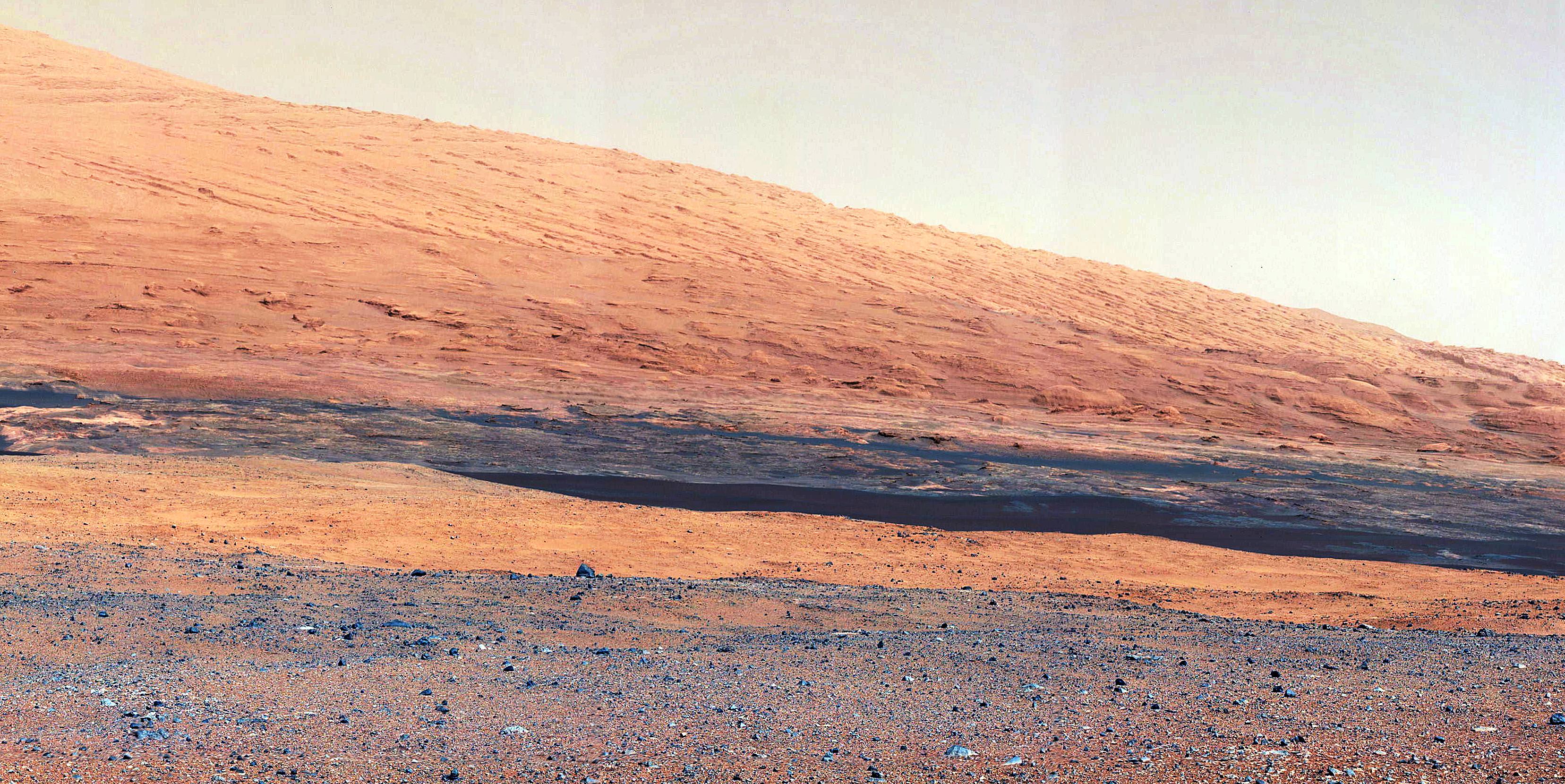
The slopes of Gale Crater as seen by Curiosity are reminiscent of the American southwest (NASA/JPL-Caltech)

“Mars ain’t no kind of place to raise your kids; in fact it’s cold as hell” sang Elton John in “Rocket Man”, and although the song was released in 1972 — four years before the first successful landing on Mars — his weather forecast was spot-on. Even though the fantastic images that are being returned from NASA’s Curiosity rover show a rocky, ruddy landscape that could easily be mistaken for an arid region of the American Southwest one must remember three things: this is Mars, we’re looking around the inside of an impact crater billions of years old, and it’s cold out there.

Mars Exploration Program blogger Jeffrey Marlow writes in his latest “Martian Diaries” post:

Over the first 30 sols, air temperature has ranged from approximately -103 degrees Fahrenheit (-75 Celsius) at night to roughly 32 degrees Fahrenheit (0 Celsius) in the afternoon. Two factors conspire to cause such a wide daily range (most day-night fluctuations on Earth are about 10 to 30 degrees Fahrenheit). The martian atmosphere is very thin; with fewer molecules in the air to heat up and cool down, there’s more solar power to go around during the day, and less atmospheric warmth at night, so the magnitude of temperature shifts is amplified. There is also very little water vapor; water is particularly good at retaining its heat, and the dryness makes the temperature swings even more pronounced. 

In that way Mars is like an Earthly desert; even after a blisteringly hot day the temperatures can plummet at night, leaving an ill-prepared camper shivering beneath the cold glow of starlight. Except on Mars, where the Sun is only 50% as bright as on Earth and the atmosphere only 1% as dense, the nighttime lows dip to Arctic depths.

“Deserts on Earth have very extreme temperature ranges,” says Mars Science Laboratory Deputy Project Scientist, Ashwin Vasavada. “So if you take a desert on Earth and put it in a very thin atmosphere 50% farther from the Sun, you’d have something like what we’re seeing at Gale Crater.”

And although the afternoon temperatures in Gale may climb slightly above freezing that doesn’t mean liquid water will be found pooling about in any large amounts. Curiosity’s in no danger from flash floods on Mars… not these days, anyway.

With atmospheric pressure just above water’s thermodynamic triple point, and temperatures occasionally hovering around the freezing point, it is likely that local niches are seeing above-zero temperatures, and Vasavada acknowledges, “liquid water could exist here over a tiny range of conditions.” But don’t expect a Culligan water plant in Gale Crater any time soon. “We wouldn’t expect for Curiosity to see liquid water, because it would evaporate or re-freeze too quickly,” explains Vasavada. “With so little water vapor in the atmosphere, any liquid water molecules on the surface would quickly turn to gas.”

So when on Mars, drink your coffee quickly. (And pack a blanket.)

“Gale Crater may look like the dusty, basaltic basins of the American southwest, but one look at the thermometer will send you running for the winter coat.”

– Jeffrey Marlow, Martian Diaries

Read Marlow’s full article here.

Image: Sunset on Mars seen by the MER Spirit from Gusev Crater in 2005 (NASA/JPL-Caltech)

An Awesome View of Curiosity’s Tummy

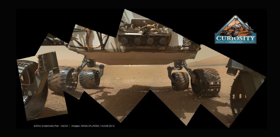
Curiosity’s underside as imaged by the MAHLI camera. Credit: NASA/JPL/MSSS; image editing by Astro0.

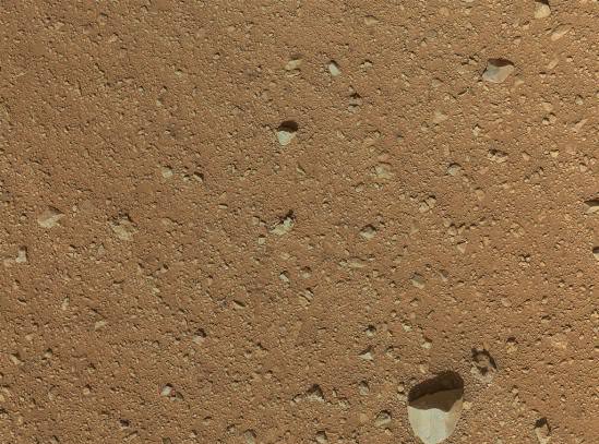
One of Curiosity’s amazing color cameras, the Mars Hand Lens Imager (MAHLI) that is mounted on the turret at the end of the MSL robotic arm, is now officially in action, with its dust cover removed over the weekend. The first picture it sent back to Earth was of the soil in its field of view (see below). That’s great, as the camera’s purpose is to acquire close-up images of materials on the Martian surface—rocks, fine particles and even frost. But then engineers commanded the camera to take a look at Curiosity’s underbelly – the rover’s ‘tummy’ so to speak. And the views are awesome, especially when some of the image wizards at UnmannedSpaceflight stitched a few of the images together to put together a mosaic of the entire view of the rover’s underside. This image was put together by Astro0 at UMSF. Click the image to see a larger version on his website.

The first image to come from Curiosity’s Mars Hand Lens Imager (MAHLI) with the dust cap off. Credit: NASA/MSL-Caltech

MAHLI, built by Malin Space Science Systems (MSSS) will be used to help characterize the geology of the site investigated by MSL, and it will be used to document the materials being examined by MSL’s geochemical and mineralogical experiments.

You can see the “raw images” at the MSL website, the images that are just being beamed back from the rover, and see more at UnmannedSpaceflight; Emily Lakdawalla at the Planetary Blog also has some images she has put together from MAHLI’s views of Curiosity’s underside.

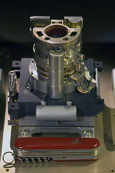
Here’s a picture of the camera itself:

The Mars Hand Lens Imager (MAHLI) camera head. The knife is 88.9 mm (3.5 inches) long. Image credit: Malin Space Science Systems

MAHLI is the equivalent of a 2 Megapixel camera. Because MAHLI can focus at infinity, in addition to being able to get microscopic views of surface materials MAHLI can also be used for other purposes, including inspection of areas on the rover or imaging the local landscape — as the images here attest.

MAHLI can also acquire multiple images of the same feature at different focus positions; additionally look upcoming for 3-D views of selected targets from this camera, since it is located on the robotic arm, it will be relatively easy to move the camera to take two images of the same object from different positions.

Learn more about MAHLI at the Malin Space Science Systems website.

Clay Deposits Don’t Prove Existence of Ancient Martian Lakes

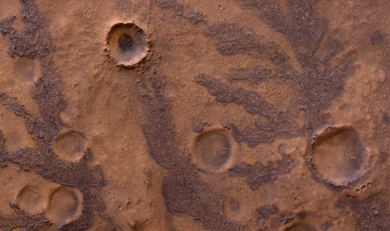
HiRISE image of branching features in the floor of Antoniadi Crater thought to contain clay material. (NASA/JPL/University of Arizona)

In the hunt for evidence of a warmer, wetter past on Mars, clay deposits have been viewed as good indications that stable liquid water existed on its surface for some time — perhaps even long enough to allow life to develop. But new research conducted here on Earth shows that some clays don’t necessarily need lakes of liquid water to form. Instead they can be the result of volcanic activity, which is not nearly so hospitable to life.

A research team led by Alain Meunier of the Université de Poitiers in France studied lavas containing iron and magnesium — similar to ancient clays identified on the surface of Mars — in the French Polynesian atoll of Moruroa. The team’s findings show that the same types of clay outcrops can be caused by the solidifying of water-rich magma in a volcanic environment, and don’t require Earthlike aquatic conditions at all.

The results also correlate to the deuterium-to-hydrogen (D/H) ratio within clays found in Martian meteorites.

Read: Life from Mars Could Have Polluted Earth

“To crystallize, clays need water but not necessarily liquid water,” said Alain Meunier to the Agençe France-Presse (AFP). “Consequently, they cannot be used to prove that the planet was habitable or not during its early history.”

Additionally, the clay deposits found on Mars can be several hundred meters thick, which seems to be more indicative of upwelling magma than interactions with water.

“[This] new hypothesis proposes that the minerals instead formed during brief periods of magmatic degassing, diminishing the prospects for signs of life in these settings,” wrote Brian Hynek from the Department of Geological Sciences at the University of Colorado, in response to the paper by Meunier et al. which was published in the September 9 edition of the journal Nature Geoscience.

This does not necessarily mean that all Martian clays weren’t formed in the presence of water, however. Gale Crater — where NASA’s Curiosity rover is now exploring — could very well have been the site of a Martian lake, billions of years in the past. Clays found there could have been created by water.

Read: Take a Trip to Explore Gale Crater

According to Bethany Ehlmann of the California Institute of Technology, co-author of the study, “there are particular characteristics of texture” to clays formed under different conditions, and “Gale is a different flavor of Mars.”

Perhaps Curiosity will yet discover if Gale’s original flavor was more cool and wet than hot and spicy.

Read more on New Scientist and Cosmos Magazine.

Inset image: Moruroa Atoll (NASA) 

An Inside Look at Curiosity’s Inner Workings

NASA’s Curiosity rover raised robotic arm with drill pointed skyward while exploring Vera Rubin Ridge at the base of Mount Sharp inside Gale Crater - backdropped by distant crater rim. This navcam camera mosaic was stitched from raw images taken on Sol 1833, Oct. 2, 2017 and colorized. Credit: NASA/JPL/Ken Kremer/kenkremer.com/Marco Di Lorenzo

What makes a rover rove? At the very basic level, it comes down to gears, and all the gears have to made very precisely: there’s no going to Mars to fix anything that doesn’t move just right. This video shows how a gear company in Rockford, Illinois made all the gears for the Curiosity rover — created from titanium — putting in extra hours and effort to get everything just right (they also made the gears for the Mars Exploration Rovers).

It also subtly emphasizes how the money spent on space exploration isn’t just stuffed into a rocket and blasted into space. Almost all of Curiosity’s parts were made from different companies in 33 states in the US; the rest came from companies in partner countries, all which employs hundreds, if not thousands, of people.

You have to bet that every person who created or touched any of the parts — big or small — on Curiosity were just as jazzed as the cheering team at JPL when the rover landed successfully. And that Curiosity is working so well and roving around in Gale Crater has to be a a great feeling of accomplishment and satisfaction, too.
Continue reading “An Inside Look at Curiosity’s Inner Workings”

Curiosity Snaps Evocative Self Portrait

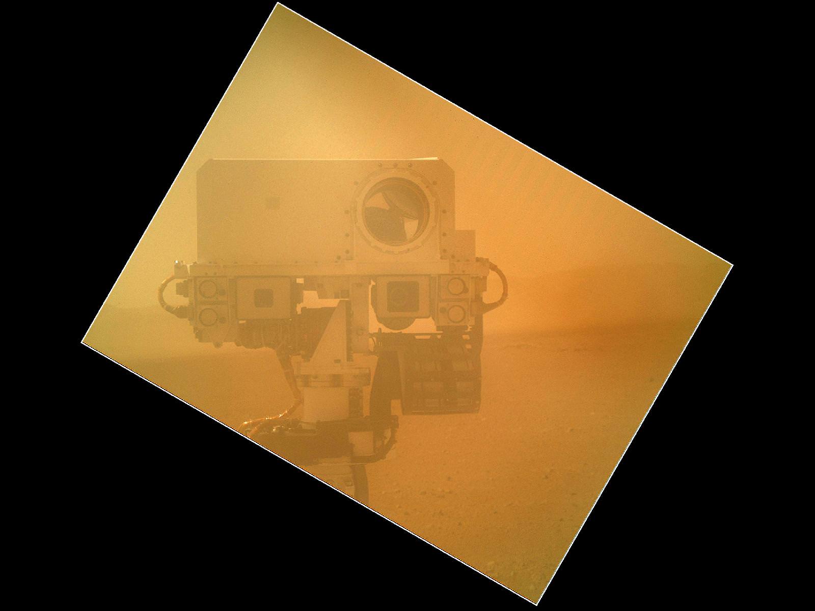
Image Cation: Curiosity takes Self Portrait on Sol 32 with the Mars Hand Lens Imager (MAHLI). Image has been rotated up and enhanced by JPL. Credit: NASA/JPL-Caltech/Malin Space Science Systems

Curiosity has snapped an evocative new color self-portrait – and it’s totally unique, being the 1st head shot pose, showing the top of the Remote Sensing Mast (RSM).

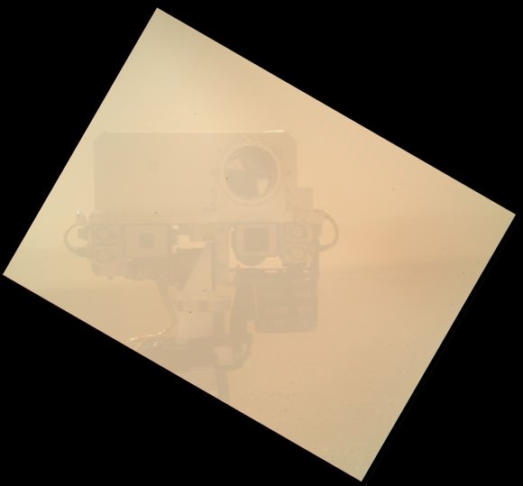
You’ll notice it’s a bit dusty ! That’s because it was acquired through the transparent dust cover protecting the high resolution Mars Hand Lens Imager (MAHLI) camera positioned on the turret at the end of Curiosity’s 7 foot (2.1 meter) long robotic arm.

The gorgeous new image was taken on Sol 32 (Sept. 7, 2012) with the dust cover closed over the camera lens and thus provides a taste of even more spectacular views yet to come. The picture beautifully shows the Mastcam, Chemcam and Navcam cameras with the rim of Gale Crater in the background.

The MAHLI image above has been enhanced and rotated – to right side up. See the MAHLI raw image below.

The image was taken as JPL engineers were inspecting and moving the arm turret holding MAHLI and the other science instruments and tools and looking back to image them in turn using the Mast’s cameras.

NASA’s mega Martian rover is pausing for about a week or two at this location reached after driving on Sol 29 (Sept. 2) and will thoroughly check out the robotic arm and several science instruments.

So far Curiosity has driven about 358 feet (109 meters) and is sitting roughly 270 feet from the “Bradbury Landing” touchdown spot as the Martian crow flies.

The car sized robot is about a quarter of the way to Glenelg, the destination of her first lengthy science stop where three different types of geologic terrain intersect and are easily accessible for a detailed science survey using all 10 state of the art instruments including the rock drill and soil sampling mechanisms.

Ken Kremer

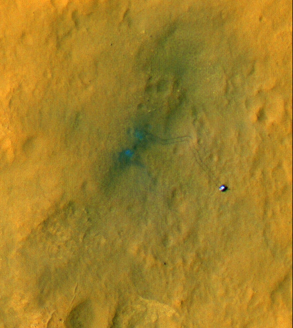
Curiosity on the Move! HiRISE Spies Rover Tracks on Mars

The beginning of Curiosity’s journeys. Credit: NASA/JPL-Caltech/Univ. of Arizona
Yes, the Curiosity rover is on the move, evidenced by the rover tracks seen from above by the outstanding HiRISE camera on board the Mars Reconnaissance Orbiter. If you look closely, visible are the rover’s wheels and even the camera mast. While this image’s color has been enhanced to show the surface details better, this is still an amazing view of Curiosity’s activities, displaying the incredible resolving power of the High-Resolution Imaging Science Experiment.

“These are great pictures that help us see context,” said Curiosity mission manager Mike Watkins at a press conference today. “Plus they’re just amazing photos.”

The two “blue” marks (blue is, of course, false color) seen near the site where the rover landed were formed when reddish surface dust was blown away by the rover’s descent stage, revealing darker basaltic sands underneath. Similarly, the tracks appear darker where the rover’s wheels disturbed the top layer of dust.

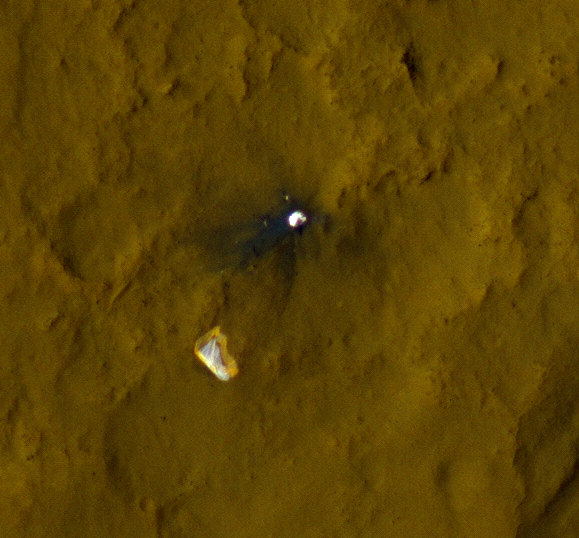
Below is another great view showing Curiosity’s parachute and backshell in color, highlighting the color variations in the parachute, along with a map of where Curiosity has been and will be going.

Curiosity’s parachute and backshell in color. Credit: NASA/JPL-Caltech/Univ. of Arizona
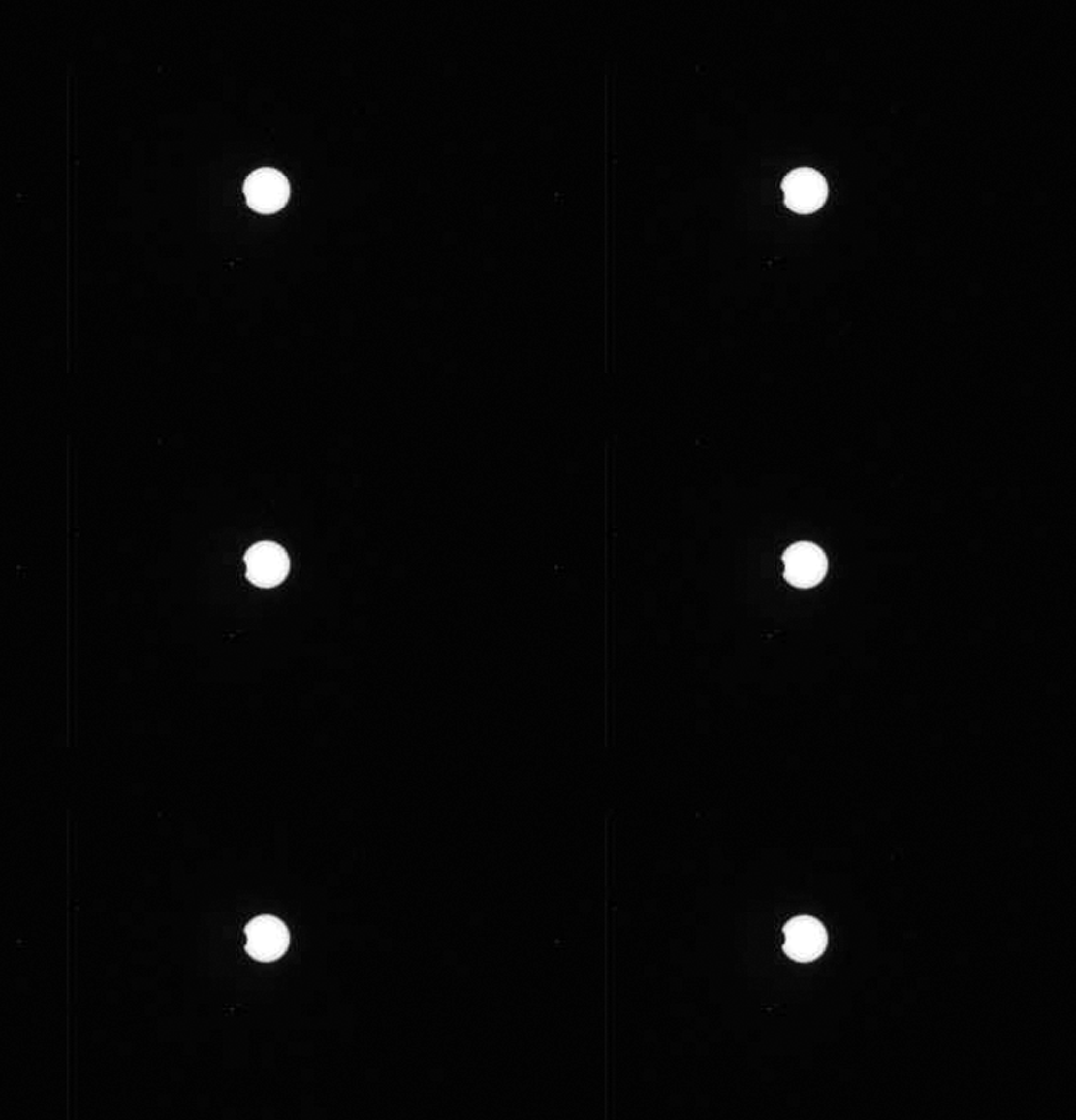
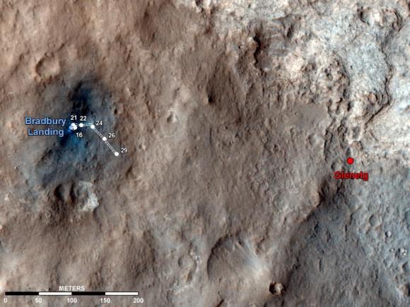
Map of Curiosity’s travels so far. Credit: NASA/JPL-Caltech/Univ. of Arizona.

This map shows the route driven by NASA’s Mars rover Curiosity overlaid on the HiRISE image, showing where Curiosity has driving through the 29th Martian day, or sol, of the rover’s mission on Mars, which equals Sept. 4, 2012 here on Earth.

The route starts at Bradbury Landing, Curiosity’s landing site. Numbering of the dots along the line indicate the sol numbers of each drive. North is up. The scale bar is 200 meters (656 feet).

By Sol 29, Curiosity had driven at total of 358 feet (109 meters). While scientists say the rover can travel up to a hundred meters a day, the team has been putting the rover through tests of the robotic arms and other instruments.

The first area of real interest that the team wants to study is the Glenelg area, farther east. The science team said the Glenelg region should provide a good target for Curiosity’s first analysis of powder collected by drilling into a rock.

How long will it take to get to Glenelg? It is about 400 meters away, and the rover is about a quarter of the way there so far.

“If you drove every day and didn’t do the context science it would take a couple of weeks to drive to Glenelg, at 30-40 meters a day,” said Matt Robinson, lead engineer for Curiosity’s robotic arm testing and operations. “But I think we will stop and do the context science. My guess is it will be a few weeks before we get to Glenelg.

The drive to Mt. Sharp, which is about 8 km away, will take much longer, months, maybe even a year.

“If we use our full driving mode and do up to one hundred meters a day, and not stop, it would take about 3 months,” said Robinson, “but we might only be driving for one-half to one-third of the time, it depends on how interesting the terrain is along the way.”

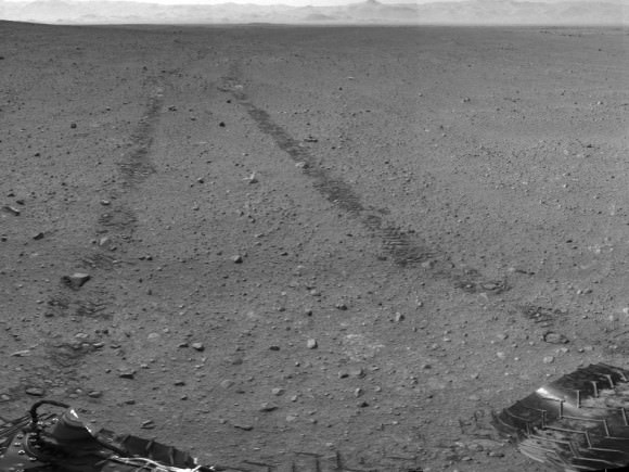
This scene shows the surroundings of the location where NASA Mars rover Curiosity arrived on the 29th Martian day, or sol, of the rover’s mission on Mars (Sept. 4, 2012). It is a mosaic of images taken by Curiosity’s Navigation Camera (Navcam) following the Sol 29 drive of 100 feet (30.5 meters). Tracks from the drive are visible in the image. For scale, Curiosity leaves parallel tracks about 9 feet (2.7 meters) apart. At this location on Sol 30, Curiosity began a series of activities to test and characterize the rover’s robotic arm and the tools on the arm.

The panorama is centered to the north-northeast, with south-southwest at both ends.

Image credit: NASA/JPL-Caltech

The view of Curiosity’s surroundings is fascinating to both Mars enthusiasts and the scienctists.
Joy Crisp, the deputy project scientist for the mission said two main things have intrigued her. “One is the Mastcam imaging of Mt. Sharp, seeing structures and layers. The other is the amazing rock textures. Some rocks have light-toned grains mixed in a dark matrix. We need to examine rocks like those more thoroughly.”

“That’s what’s been exciting, to see things we haven’t seen before on Mars,” Crisp added.

See more info and larger versions of these images at this NASA webpage.

Bradbury Landing on Mars Chronicled in 3-D

Image Caption:3-D View from Bradbury Landing- from Navcam cameras.. See the full panorama below. Credit: NASA/JPL-Caltech

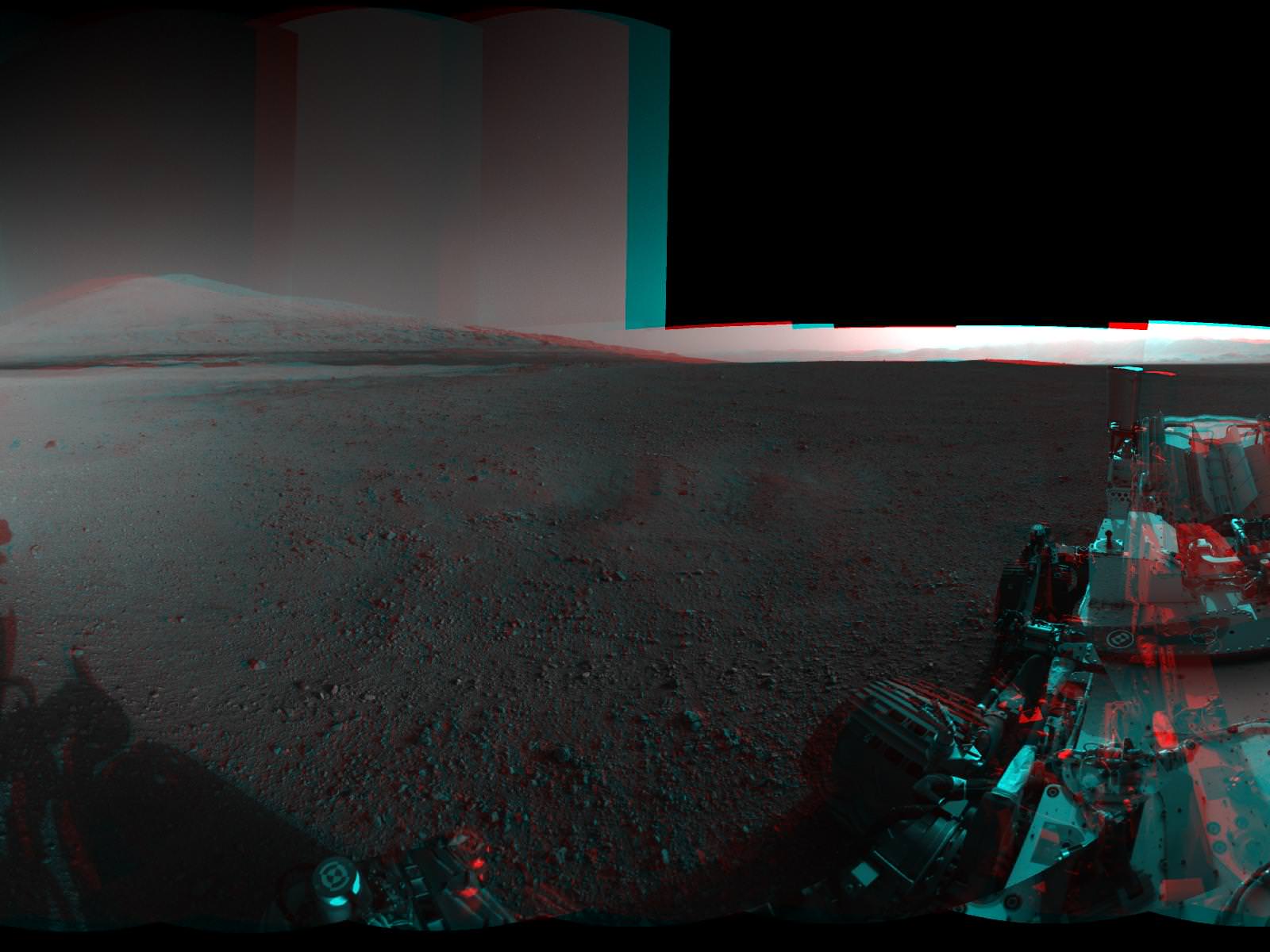
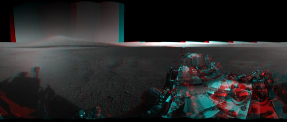
Now you can enjoy the thrills of Curiosity’s touchdown site at Bradbury Landing as if you there – chronicled in stunning 3 D !! Check out this glorious 360-degree stereo panorama just released by JPL.

The pano was assembled by JPL from individual right and left eye images snapped by the rover’s mast mounted navigation cameras on sols 2 and 12 of the mission – Aug. 8 and 18, 2012.

So whip out your handy-dandy, red-blue (cyan) anaglyph glasses and start exploring the magnificent home of NASA’s newest Mars rover inside Gale Crater.

Image Caption: Complete 360 degree Panoramic 3-D View from Bradbury Landing by NASA’s Curiosity Mars rover. Credit: NASA/JPL-Caltech

The mosaic shows Curiosity’s eventual mountain destination – Mount Sharp – to its visible peak at the right, as well as the eroded rim of Gale Crater and a rover partial self portrait. Curiosity cannot see the actual summit from the floor of Gale Crater at Bradbury landing.

In about a year, the 1 ton behemoth will begin climbing up the side of Mount Sharp – a layered mountain some 3.4 miles (5.5 kilometers) high that contains deposits of hydrated minerals.

Curiosity will investigate and sample soils and rocks with her powerful suite of 10 state of the art science instruments.

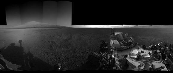
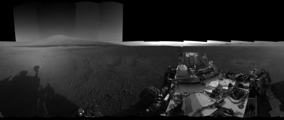
See below JPL’s individual right and left eye pano’s from which the 3-D mosaic was created.

Image Caption: Complete 360 degree Panoramic left eye View from Bradbury Landing by NASA’s Curiosity Mars rover – from Navcam cameras. Credit: NASA/JPL-Caltech

Image Caption: Complete 360 degree Panoramic right eye View from Bradbury Landing by NASA’s Curiosity Mars rover- from Navcam cameras. Credit: NASA/JPL-Caltech

The rover has now departed Bradbury landing and begun her long Martian Trek on an easterly path to Glenelg – her first stop designated for a lengthy science investigation.

Glenelg lies at the intersection of three distinct types of geologic terrain.

So far Curiosity has driven 358 feet (109 meters) and is in excellent health.

Ken Kremer

Life from Mars could have ‘polluted’ Earth: Krauss

Unless you’ve been living under a rock — Earth or Martian — in the past month, surely you have heard about the Curiosity rover’s landing and early adventures on Mars.

The prospects for what the rover could find has many in the space community very excited, even though Curiosity is supposed to look for habitable environments, not life itself.

However, a couple of weeks ago, noted theoretical physicist Lawrence Krauss said he wouldn’t be surprised if we do find evidence of life on Mars.

In an interview with CNN, Krauss said it’s possible Martian life could have “polluted” Earth early in our planet’s history, giving rise to life as we know it today.

The big surprise (in finding life) would be if it weren’t our cousins. Because what we’ve learned is that material goes back and forth between the planets all the time. We have discovered Martian meteorites in Antarctica, for example, and it goes the other way around, and microbes certainly (can) survive the the eight-month voyage in a rock.

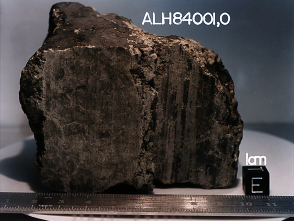
Though Krauss did not specify which meteorites in Antarctica he was referring to, he is most likely talking about ALH84001, which was found in 1984.

The meteorite shot to international prominence in 1996 when scientists, led by NASA’s David McKay, published an article in the journal Science saying there was evidence the meteorite showed “primitive bacterial life” from Mars. In particular, they used a high-power electron microscope and found formations that they said are consistent with those caused by bacterial life.

The team’s proclamation met with scientific skepticism. The Lunar and Planetary Institute’s Allan Treiman said even if it did show evidence of life, the rocks could have been contaminated by Antarctic life or by handling of the meteorite after it was found.

John Bradley, an adjunct professor at the Georgia Institute of Technology, took his skepticism a step further: “Unfortunately, there are many signatures in the fossil record here on Earth, and probably on Mars, that look very similar to bacterial signatures. But they are not unique to bacterial processes,” he said in an undated NASA page (most likely from 2001, since it references a meeting from that time) that was reportedly based on a SPACE.com story.

NASA revisited the sample in 2009 with more advanced equipment and argued that life was the most plausible explanation for the formations. In a paper published in Geochimica et Cosmochimica Acta, the authors rejected the alternate hypotheses of shock or heating affecting the meteorite based on their experiments.

That said, the 1996 announcement is still a long way from confirmation. Krauss’ interview is below. What do you think of his views of Martian life?

Lead image courtesy of NASA.

Elizabeth Howell (M.Sc. Space Studies ’12) is a contributing editor for SpaceRef and award-winning space freelance journalist living in Ottawa, Canada. Her work has appeared in publications such as SPACE.com, Air & Space Smithsonian, Physics Today, the Globe and Mail, the Canadian Broadcasting Corp.,  CTV and the Ottawa Business Journal.