Curiosity raises Mast and snaps 1st Self Portrait and 1st 360 Panorama

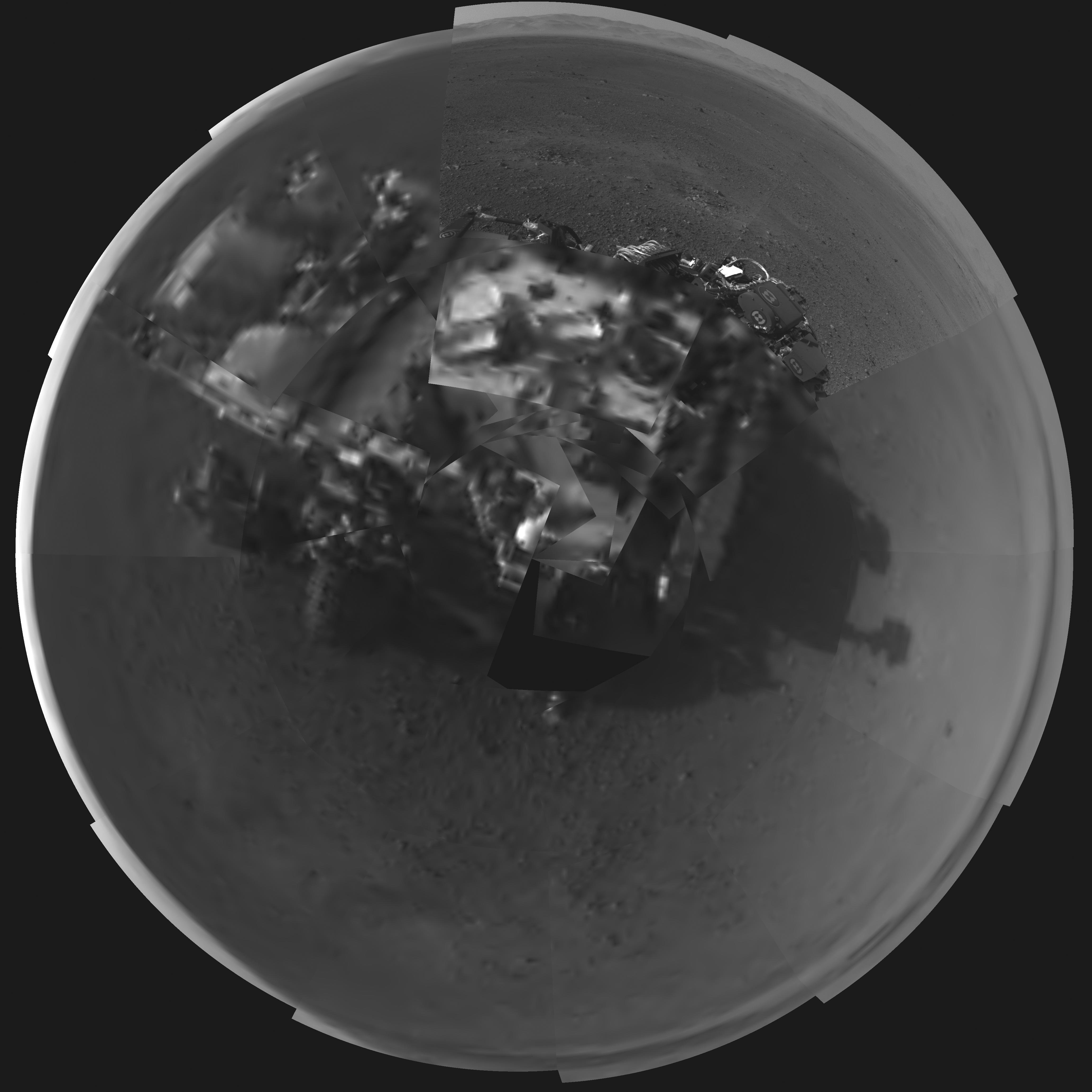
Image Caption: Rover’s Self Portrait -This Picasso-like self portrait of NASA’s Curiosity rover was taken by its Navigation cameras, located on the now-upright mast. The camera snapped pictures 360-degrees around the rover, while pointing down at the rover deck, up and straight ahead. Those images are shown here in a polar projection. Most of the tiles are thumbnails, or small copies of the full-resolution images that have not been sent back to Earth yet. Two of the tiles are full-resolution. Credit: NASA/JPL-Caltech.
See below the 1st 360 degree panorama from Curiosity and an enhanced Sol 2 mosaic of the full resolution view of the north rim of Gale Crater by this author

The rover Curiosity continues her marathon run of milestone achievements – snapping her 1st self portrait and 1st 360 degree panorama since touchdown inside Gale Crater barely over 2 sols, or Martian days ago.

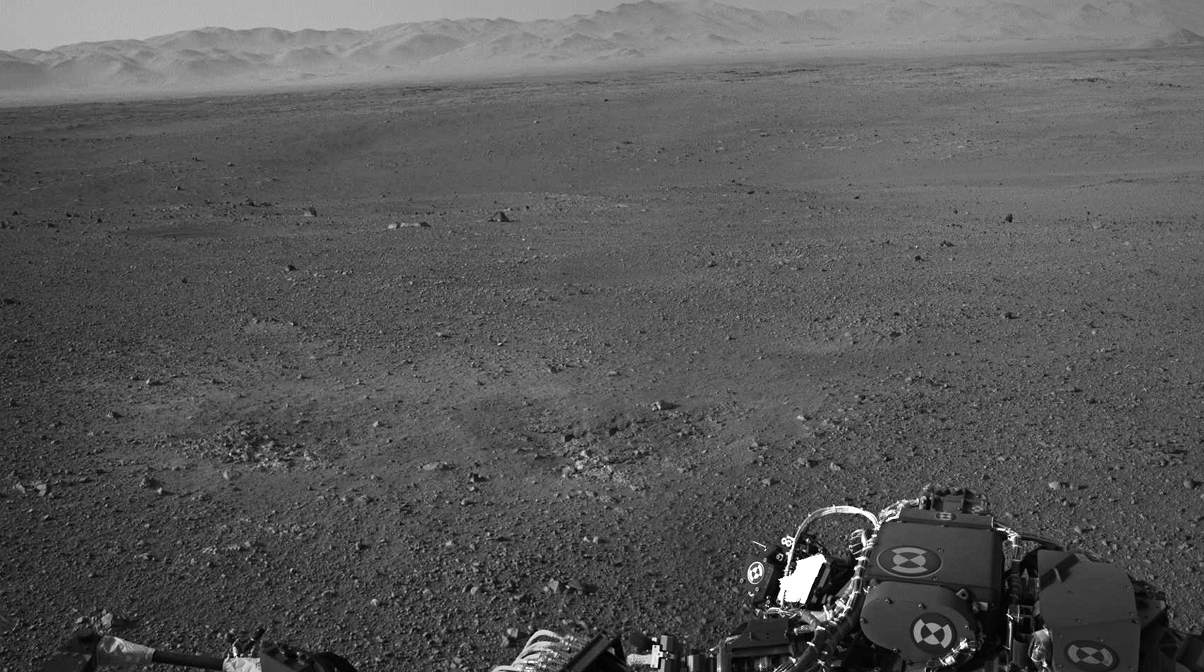
To take all these new images, Curiosity used a new camera, the just-activated higher resolution navigation cameras (Navcam) positioned on the mast. Several of the new images provide the best taste yet of the stupendous vistas coming soon. See our enhanced Sol 2 mosaic below.

The 3.6 foot-tall (1.1 meter) camera mast on the rover deck was just raised and activated earlier today, Wednesday, Aug. 8.

The mast deployment is absolutely crucial to Curiosity’s science mission. It is also loaded with the high resolution MastCam cameras and the ChemCam instrument with the laser rock zapper.

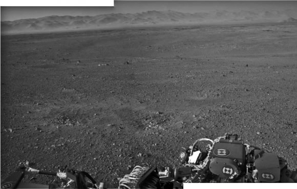
Most of the images Navcam images beamed back today were lower-resolution thumbnails. But 2 high-resolution Navcams from the panorama and the self portrait were also downlinked and provide the clearest view yet of the breathtaking terrain surrounding Curiosity in every direction.

“The full frame navcams show the north rim of Gale Crater,” said Justin Maki, MSL navcam lead, at a briefing today at JPL. “The Navcam’s are identical to the MER Navcam’s.”

The hi res images also show how the descent thruster excavated the topsoil like Phoenix.

Image Caption: Curiosity Looks Away from the Sun – This is the first 360-degree panoramic view from NASA’s Curiosity rover, taken with the Navigation cameras. Most of the tiles are thumbnails, or small copies of the full-resolution images that have not been sent back to Earth yet. Two of the tiles near the center are full-resolution. Mount Sharp is to the right, and the north Gale Crater rim can be seen at center. The rover’s body is in the foreground, with the shadow of its head, or mast, poking up to the right. These images were acquired at 3:30 pm on Mars, or the night of Aug. 7 PDT (early morning Aug. 8 EDT). Thumbnails are 64 by 64 pixels in size; and full-resolution images are 1024 by 1024 pixels. Credit: NASA/JPL-Caltech

Image Caption: Looking to Martian bedrock and Gale Carter North Rim, Enhanced Mosaic- This mosaic was assembled from the first two full resolution Navcam images returned by Curiosity on Sol 2 (Aug 8) and enhanced to bring out further details. Processing by Ken Kremer and Marco Di Lorenzo. Topsoil in the foreground has been excavated by the descent landing thrusters to expose what the team believes is bedrock. Credit: NASA/JPL-Caltech/Ken Kremer/Marco di Lorenzo

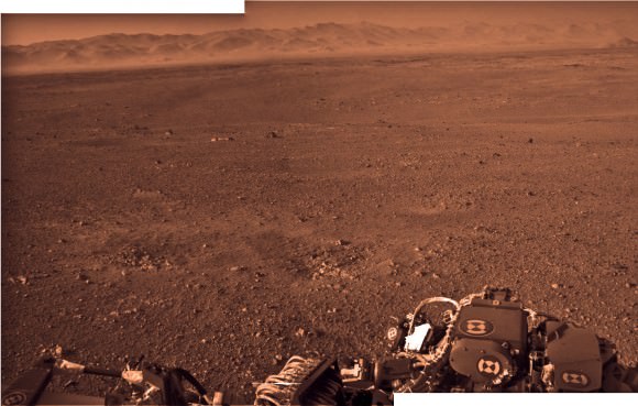
“These Navcam images indicate that our powered descent stage did more than give us a great ride, it gave our science team an amazing freebie,” said John Grotzinger, project scientist for the mission from the California Institute of Technology in Pasadena. “The thrust from the rockets actually dug a one-and-a-half-foot-long [0.5-meter] trench in the surface. It appears we can see Martian bedrock on the bottom. Its depth below the surface is valuable data we can use going forward.”

Gale Crater is unlike anything we’ve seen before on Mars.

It also distinctly reminded Grotzinger of Earth and looked to him like the rover set down in the Mojave desert. “The thing that’s amazing about this is to a certain extent the first impression you get is how earth-like this seems, looking at that landscape.”

Curiosity carries 10 science instruments with a total mass 15 times as large as the science payloads on NASA’s Mars rovers Spirit and Opportunity. Some of the tools, such as a laser-firing instrument for checking rocks’ elemental composition from a distance, are the first of their kind on Mars. Curiosity will use a drill and scoop, which are located at the end of its robotic arm, to gather soil and powdered samples of rock interiors, then sieve and parcel out these samples into the rover’s analytical laboratory instruments.

So far everything is going very well with Curiosity’s mechanical and instrument checkout. And there is even more power than expected from the RTG nuclear power source.

“We have more power than we expected and that’s going to be fantastic for being able to keep the rover awake longer,” said Mission manager Jennifer Trosper of JPL.

Ken Kremer

Looking to Martian bedrock and Gale Carter North Rim, Enhanced Mosaic with False Color- This mosaic was assembled from the first two full resolution Navcam images returned by Curiosity on Sol 2 (Aug 8) and enhanced and colorized to bring out further details. Processing by Ken Kremer and Marco Di Lorenzo. Topsoil in the foreground has been excavated by the descent landing thrusters to expose what the team believes is bedrock. Credit: NASA/JPL-Caltech/Ken Kremer/Marco di Lorenzo

Amazing Sharper View of MSL Hanging by its Parachute

I have to steal a phrase from Phil Plait, the Bad Astronomer, who earlier this week said something like, “Things just can’t keep getting more cool all the time, right?”

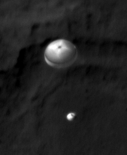
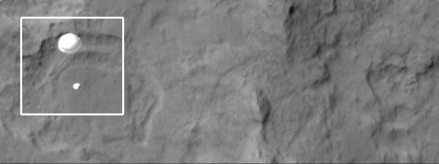
Well, apparently they can. Here’s a sharpened view from HiRISE of the Mars Science Laboratory descending to Mars on a parachute. It shows greater detail of the parachute and even MSL itself.

Just wow.

The original image cropped image:

The HiRISE team describes how they sharpened the image: “This image was given special processing by members of the HiRISE Team, that included removing detector noise and optical blur. The sharpening was achieved by converting the image to its frequency components, correcting for the minor blur that was characterized by pre-flight laboratory measurements, and converting back.”

All I know is that it’s awesome.

See our article on the original image and how the team captured it.

See more details at the HiRISE website.

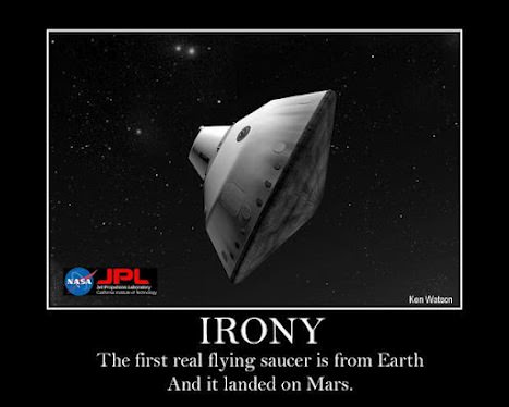
Ironic Science Reality: Flying Saucers on Mars from Earth

“Irony: The first real flying saucer is from Earth. And it landed on Mars.”

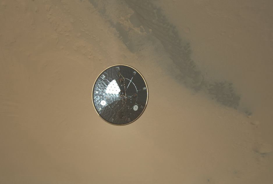
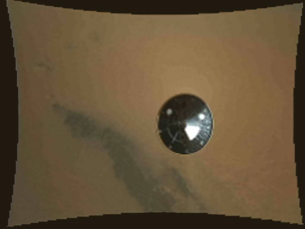
That’s a quote we saw via UT writer Ray Sanders, from a great graphic making its way around the internet. But amazingly, it’s true. Above is a high resolution image from the Mars Science Laboratory’s MARDI instrument showing the heat shield falling away from the spacecraft and heading towards Mars, looking like a classic flying saucer UFO. This image shows the 4.5-meter (15-foot) diameter heat shield when it was about 16 meters (50 feet) from the spacecraft.

The image shows so much detail that “You can actually see the stitching in the thermal blanket and some wiring” said Mike Malin during a press conference at JPL today.

Here’s a new, higher resolution video of the heat shield’s descent from what was previously available:

This image shows the inside surface of the heat shield, with its protective multi-layered insulation. The bright patches are calibration targets for MARDI. Also visible is the Mars Science Laboratory Entry, Descent, and Landing Instrument (MEDLI) hardware attached to the inside surface.

Malin said that at this range, the image has a spatial scale of 0.4 inches (1 cm) per pixel. It is the 36th MARDI image, obtained about three seconds after heat shield separation and about two and one-half minutes before touchdown.

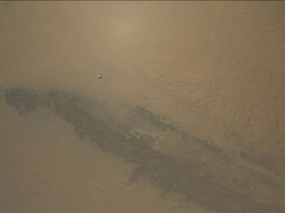
Emily Lakdawalla has another image that she “tweaked” that shows another look at the heat shield when it is farther away from MSL:


Caption: MSL’s heat shield falling towards Mars. Credit: NASA/JPL/MSSS/Emily Lakdawalla

“It is still mind-blowing to think that this snapshot was taken by a spacecraft flying in the air above a different planet,” Emily wrote on the Planetary Blog.

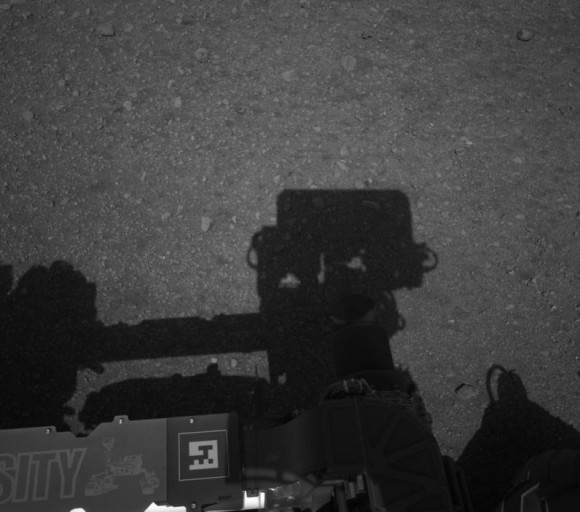
In other MSL news, Curiosity’s mast is deployed, evidenced by this shadow self-portrait:

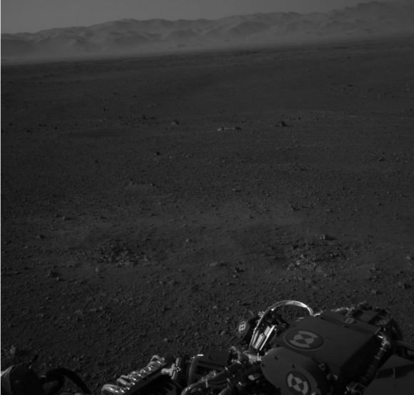
And also from the images from the Navigation Cameras on the mast:

At the press conference, Curiosity’s Chief Scientist John Grotzinger said the view reminded him of the Mojave Desert, and remarked on the striking familiarity of an almost “Earth-like” plain with the crater rim in the distance. There also appears to be a little haze in the air that Grotzinger likened to “LA smog.”

Jason Major also posted a panoramic view of Curiosity’s surroundings by combining a couple of shots from the Navigation cameras.

And here’s that great graphic by Ken Watson:

Here’s where you can find more of the latest images from MSL.

A Panorama of Curiosity’s Surroundings

Taken this morning (mission Sol 2) with the rover’s left Navcam, here’s a high-res panorama of Curiosity’s view at its landing site within Gale crater. The wide-angle view was assembled from two separate raw images, so while the mountainous rim of the crater is lined up horizontally there’s some distortion in alignment of objects closer to the rover due to the angle of the Navcam lens. Still, it’s a very cool view of Curiosity’s surroundings!

See the latest images from the MSL mission here, and check out 3D anaglyph images from Curiosity here.

Image: NASA/JPL-Caltech. Edited by J. Major.

(Image updated to link to full-size version.)

Mount Sharp on Mars: 1st 2-D and 3-D Views of Curiosity’s Ultimate Mountain Goal

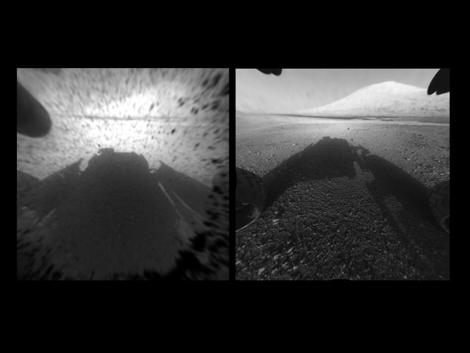
Image Caption: Clear View on Mars – This image comparison shows a view through a Hazard-Avoidance camera on NASA’s Curiosity rover before and after the clear dust cover was removed. Both images were taken by a camera at the front of the rover. Mount Sharp, the mission’s ultimate destination, looms ahead. See the first 3 D and 2 D full res images with no dust cover, below. Image credit: NASA/JPL-Caltech

Curiosity, NASA’s new car sized rover on Mars has sent back her first breathtaking views of Mount Sharp, the huge nearby mountain that enticed scientists to set Gale Crater as her touchdown goal.

And already within the first 2 Sols, or martian days, the rover has beamed back magnificent 2D and 3 D vistas of the landscape surrounding her.

The unprecedented rocket powered “Sky Crane” descent maneuver that lowered Curiosity by cables upon the Red Planet’s surface rover with pinpoint accuracy, set her down in a position inside Gale Crater that fortuitously pointed her front Hazard Avoidance (Hazcam) cameras towards a stupendous panoramic view of Mount Sharp.

The terrain is strewn with small pebbles that may stem from a nearby alluvial fan through which liquid water flowed long ago, scientist think.

The top image set shows the spectacular side by side views of Mount Sharp before and after the protective dust covers were popped off.

Mount Sharp is taller than Mount Ranier, the tallest mountain in the US in the lower 48 states. It’s about 3.5 miles (5.5 km) high.

Curiosity is roughly 6 km distant from Mount Sharp, as the martian crow flies.

The image below is the first full resolution Hazcam version of Mount Sharp.

Curiosity’s Early Views of Mars. This full-resolution image shows one of the first views from NASA’s Curiosity rover, which landed on Mars the evening of Aug. 5 PDT (early morning hours Aug. 6 EDT). It was taken through a “fisheye” wide-angle lens on one of the rover’s front Hazard-Avoidance cameras. These engineering cameras are located at the rover’s base. Image credit: NASA/JPL-Caltech

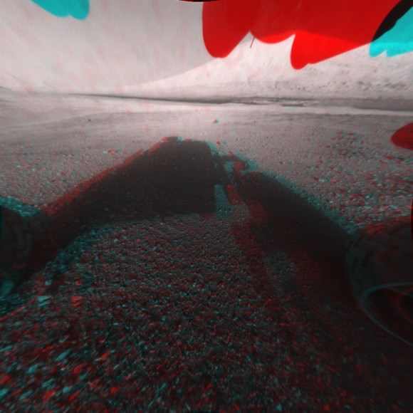
Here’s the first 3D version of Mount Sharp assembled from both front cameras.

Image Caption: 3-D View from the Front of Curiosity. This image is a 3-D view in front of NASA’s Curiosity rover, which landed on Mars on Aug. 5 PDT (Aug. 6 EDT). The anaglyph was made from a stereo pair of Hazard-Avoidance Cameras on the front of the rover. Mount Sharp, a peak that is about 5.5 kilometers (3.4 miles) high, is visible rising above the terrain, though in one “eye” a box on the rover holding the drill bits obscures the view. This image was captured by Hazard-Avoidance cameras on the front of the rover at full resolution shortly after the rover landed. It has been linearized to remove the distorted appearance that results from its fisheye lens. Credit: NASA/JPL-Caltech

Ken Kremer

Rover, Sky Crane, Heat Shield and Parachute Located from Orbit by HiRISE

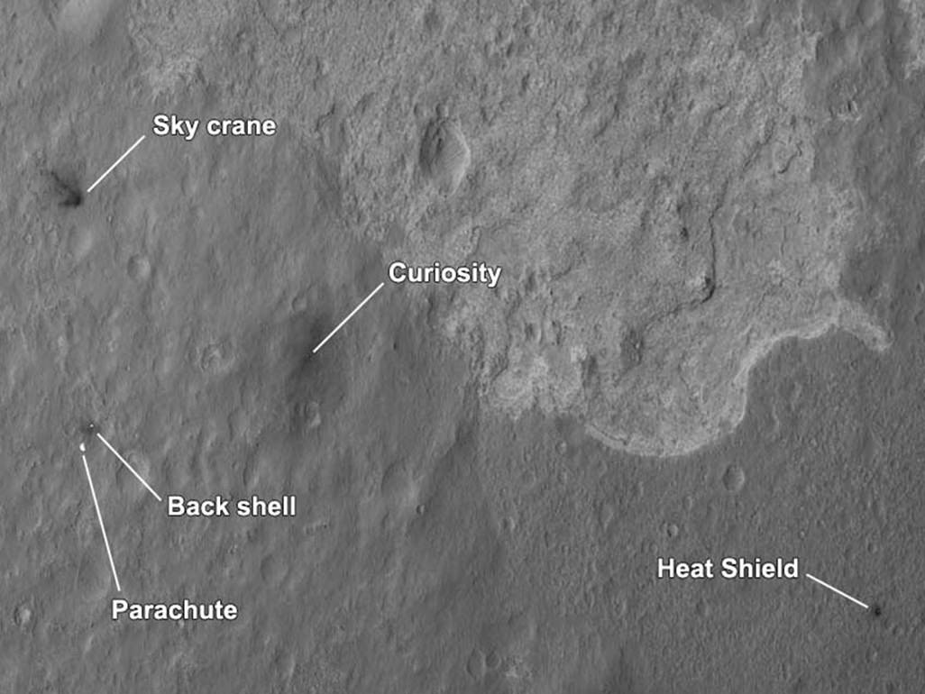
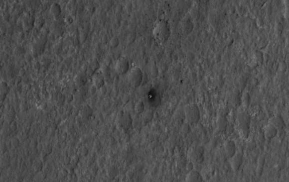
More awesomeness from HiRISE! A new orbital image shows the Curiosity rover sitting on Mars’ surface, along with all the accoutrements needed to get it there safely: the heat shield, backshell, parachute, and the Sky Crane. The High-Resolution Imaging Science Experiment (HiRISE) camera captured this image just 24 hours after MSL’s landing.

“This is like the crime scene photo here,” HiRISE team member Sarah Milkovich said during a press conference on Aug. 7.

Of course, yesterday the HiRISE team revealed they had captured MSL in the act of landing.

In re-inacting the scene of the crime, er… incredible landing, the heat shield, lower right, was the first piece to hit the ground, followed by the back shell attached to the parachute, then the rover itself touched down. Then, and finally, after cables were cut, the sky crane flew away to the northwest and crashed.
The heat shield is about 1,220 meters (4,000 feet) from Curiosity, the backshell and parachute are about 610 meters (2,000 feet) away from the rover, and the Sky Crane is about 620 meters (2,100 feet) away.

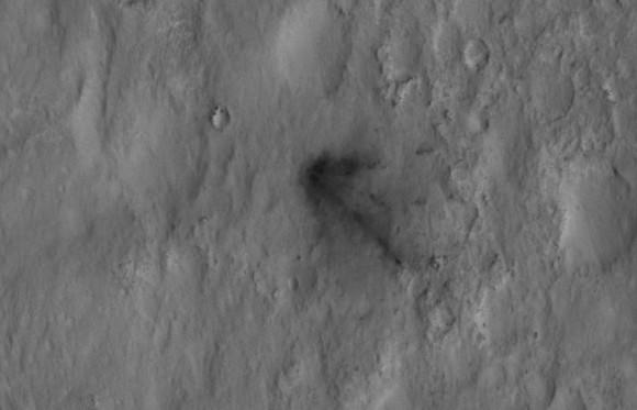
The relatively dark areas in all four spots are from disturbances of the bright surface dust, revealing darker soil underneath. If you look closely, even visible are the black streaks where the sky crane thrusters kicked up dust. Malkovich said scientists have looked at the streak patterns to verify Curiosity’s orientation — which confirms the information from the rover’s first pictures from surface.


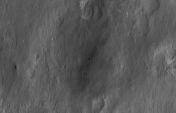
Close-up of Curiosity sitting on Mars’ surface. Credit: NASA/JPL/University of Arizona

The darkened radial jets from the sky crane are downrange from the point of oblique impact, much like the oblique impacts of asteroids. In fact, NASA said, they make an arrow pointing to Curiosity.


Close-up of the Sky Crane. Credit: NASA/JPL/University of Arizona

HiRISE’s image of MSL’s landing site shows the rover and the hardware doing their jobs exactly as they were designed to do.

The image was acquired from a special 41-degree roll of MRO, larger than the normal 30-degree limit. It rolled towards the west and towards the Sun, which increases visible scattering by atmospheric dust as well as the amount of atmosphere the orbiter has to look through, thereby reducing the contrast of surface features. Malkovich said that future images taken from a higher angle will show the hardware in greater detail.


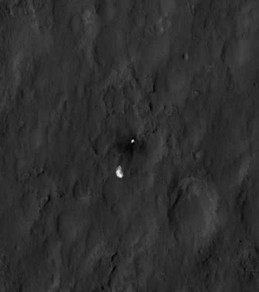
Close-up of the parachute and backshell. Credit: NASA/JPL/University of Arizona


Close-up of the heat shield. Credit: NASA/JPL/University of Arizona

See larger versions and additional info at the HiRISE website.

Curiosity Beams 1st Color Image from Mars

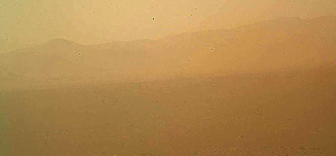
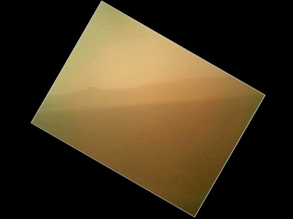
Image caption: This murky view from Curiosity shows the martian landscape looking north to the rim from inside the Gale Crater landing site and is her first color image beamed back to Earth. It’s murky because the dust cover is still attached. See full MAHLI image below. Also see below full res Hazcam image of crater rim. Credit: NASA/JPL-Caltech/Malin Space Science Systems

NASA’s Curiosity Mars rover has beamed back her first color view since touchdown, showing a view of the alien landscape pointing northward towards the eroded rim of Gale crater.

The picture was snapped by the rovers Mars Hand Lens Imager (MAHLI) camera on the afternoon of the first day after the pinpoint landing – signified as Sol 1 on Aug. 6, 2012.

The MAHLI image looks murky because the protective dust cover is still in place and is coated with a film of martian dust sprayed up by the descent retrorockets during the terminal phase of the hair-raising landing on Aug 5/6.

The camera’s dust cover is intentionally transparent so that initial images can still be snapped through the cover before it’s popped off in about a week.

MAHLI is located on the turret at the end of the rover’s 8 foot long robot arm which has been stowed in place on the front left side of Curiosity since long before the Nov. 26 liftoff from Cape Canaveral, Florida.

In the stowed position, MAHLI is rotated about 30 degrees as seen in the image below. The top image has been rotated to correct for the tilt and shows the sky “up” as Curiosity is actually sitting on the Martian surface.


Image caption: This full frame view from Curiosity shows the martian landscape looking north to the rim from inside the Gale Crater landing site and is her first color image beamed back to Earth. It’s murky because the dust cover is still attached. The image is from the MAHLI camera on the robot arm and currently in the stowed position. It has been rotated 30 degress. Credit: NASA/JPL-Caltech/Malin Space Science Systems

During her 2 year prime mission, Curiosity’s goal is to determine if Mars was ever capable of supporting microbial life, past or present and to search for the signs of life in the form of organic molecules with a payload of 10 science instruments weighing 15 times more than any prior roving vehicle.

Curiosity is the 3rd generation of NASA rover’s delivered to the Red Planet

Ken Kremer

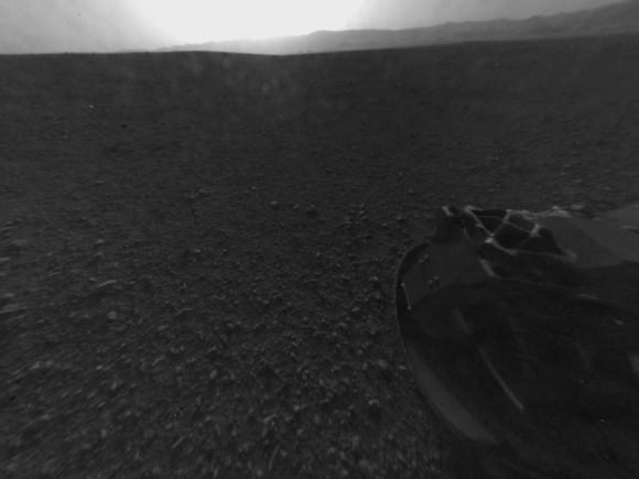
Image Caption: Looking Back at the Crater Rim – This is the full-resolution version of one of the first images taken by a rear Hazard-Avoidance camera on NASA’s Curiosity rover, which landed on Mars the evening of Aug. 5 PDT (morning of Aug. 6 EDT). The image was originally taken through the “fisheye” wide-angle lens, but has been “linearized” so that the horizon looks flat rather than curved. The image has also been cropped. A Hazard-avoidance camera on the rear-left side of Curiosity obtained this image. Part of the rim of Gale Crater, which is a feature the size of Connecticut and Rhode Island combined, stretches from the top middle to the top right of the image. One of the rover’s 20 inch wide wheels can be seen at bottom right. Image credit: NASA/JPL-Caltech

Curiosity’s Dramatic MARDI Descent Movie

Image Caption: Curiosity Heat shield falls away from the bottom of Curiosity and the Sky Crane descent stage in this image from the MARDI camera.
Watch the video below. Credit: NASA/JPL/MSSS

As NASA’s Curiosity Mars Science Lab (MSL) was in the final stages of her flawless but harrowing decent to Gale Crater on Mars overnight (Aug. 5/6) employing the never-before-used rocket powered sky crane descent stage, dramatic movie-like imagery of the plunge was being recorded by MARDI, the Mars Descent Imager camera positioned on the belly of the rover and pointed downwards.

The first low resolution MARDI images and video (above and below) were beamed back to Earth just hours after landing and clearly show the jettisoning of the heat shield moments after it sprung loose to expose Curiosity and MARDI for landing.

“We see the heat shield falling away about 2 minutes and 30 seconds from touchdown,” said Mike Malin, MARDI Principal Investigator from Malin Space Systems at a post-landing news briefing today (Aug. 6). “The heat shield is about 16 meters (50 ft) away in the image and 4.5 m (15 ft) across.”

“I’m very excited to be at Gale Crater”.

“So far we have received about 297 thumbnail images (192 x 144 pixels) so far and created a stop motion video. MADRI was collecting images at 4 frames per second. In the final frames you can see dust being kicked up the rocket engines.”
Curiosity landed at 1:32 on Aug. 6, EDT (11:32 p.m. Aug. 5, PDT), near the foot of a mountain three miles(5 km) tall inside Gale Crater, 96 miles (154 km) in diameter.

Video Caption: The Curiosity Mars Descent Imager (MARDI) captured the rover’s descent to the surface of the Red Planet. The instrument shot 4 fps video from heatshield separation to the ground. Credit: NASA/JPL/MSSS

“The image sequence received so far indicates Curiosity had, as expected, a very exciting ride to the surface,” said Mike Malin, imaging scientist for the Mars Science Lab mission from Malin Space Systems in San Diego. “But as dramatic as they are, there is real other-world importance to obtaining them. These images will help the mission scientists interpret the rover’s surroundings, the rover drivers in planning for future drives across the surface, as well as assist engineers in their design of forthcoming landing systems for Mars or other worlds.”

“A good comparison is to that grainy onboard film from Apollo 11 when they were about to land on the moon,” said Malin.

Over 1500 hundred more low and high resolution MARDI images (1600 x 1200 pixels) will be sent back over the next few weeks to make a full frame animation and will provide the most complete and dramatic imagery of a planetary landing in the history of exploration.

The team has been able to determine Curiosity’s location to “within” about 1 meter says Malin, by matching the MARDI and MRO HiRISE images as well as the Hazcam images.

“So far the rover is healthy and we are ecstatic with its performance,” said Jennifer Trospher, MSL mission manager

The next steps are to deploy the high gain antenna (HGA), raise the mast with the higher resolution cameras and continue to check out the mechanical and electrical systems as well the science instruments as the rover is transitioned to surface operations mode.

Ken Kremer

Curiosity’s Awesome Landing “Trailer”

MSL Curiosity is busy investigating the surface of Mars, to see if that planet could have harbored life. Image: NASA/JPL/Cal-Tech

This short compilation video is a great overview of all the action on landing night for the Curiosity rover: Suspense, intrigue and definitely a happy ending. Only this “made for movie theater”-like trailer really happened.

UPDATE: We’ve gotten comments and questions that some people can’t see the video above, so we’ve added the You Tube version, below.
Continue reading “Curiosity’s Awesome Landing “Trailer””

“Nailed It!” HiRISE Captures Incredible Image of Curiosity’s Descent to Mars

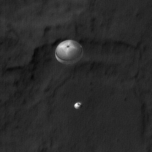
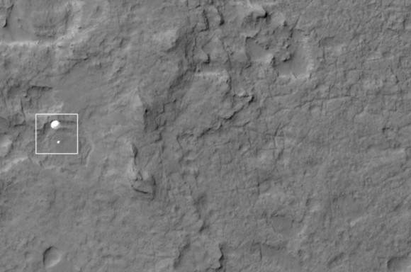
The HiRISE team has outdone themselves this time. Using their incredible instrument, the High Resolution Imaging Science Experiment, they have captured an absolutely amazing image of the Curiosity rover, descending on a parachute through Mars’ atmosphere.

“Nailed it!” Tweeted Christian Schaller of the HiRISE team. “My goodness, @MarsCuriosity you look pretty.”

Wow!

Full image below.

Link to original image (2.7 MB)

Schaller told Universe Today that the MSL Navigation team, the MRO Navigation team and the MRO FET (flight engineering team) “seriously rock. Seriously.”

The planning by those teams made this image possible.

Schaller is the software developer responsible for the primary planning tools the MRO and HiRISE targeting specialists and science team members use to plan their images.

“The Mars background looks a little blurry or smeared because we set up the timing to capture Curiosity, not the Martian surface,” Schaller said via email after the image was released at the press conference from JPL on Monday morning.

The image was set up so that as MSL was descending, MRO “slewed” the HiRISE field of view across the expected descent path. But obviously, MRO didn’t have to slew too much. “We were almost directly overhead, and had a very, very small angle to take the image,” said HiRISE team member Sarah Malkovich at the press conference. “MRO was essentially overhead.”

HiRISE Principal Investigator Alfred McEwen said before the landing that they expected only a 60% chance of success.

McEwen wrote the HiRISE website of the image:

The parachute appears fully inflated and performing perfectly. Details in the parachute such as the band gap at the edges and the central hole are clearly visible. The cords connecting the parachute to the backshell cannot be seen, although they were seen in the image of Phoenix descending, perhaps due to the difference in lighting angles.

The bright spot on the backshell containing MSL might be a specular reflection off of a shiny area. MSL was released from the backshell sometime after this image was acquired.

This view is one product from an observation made by HiRISE targeted to the expected location of MSL about 1 minute prior to landing. It was captured in HiRISE CCD RED1, near the eastern edge of the swath width (there is a RED0 at the very edge). This means that MSL was a bit further east or downrange than predicted.

The image scale is 33.6 cm/pixel.

MRO was 340 km away from Curiosity when the image was taken, and that is line of sight distance, said Malkovich. “HiRISE has taken over 120 pictures of Gale Crater in preparation for MSL’s mission, but I think this is the coolest one,” she said.

McEwen said more details and image products will be available and we will post them as soon as they are available.

This animation shows how HiRISE planned to capture MSL’s descent:

Malkovich said that the HiRISE team already has plans to take images of Curiosity sitting on the surface of Mars later this week that will be of higher resolution than the descent image.