NASA Preps for Nail-biting Comet Flyby of Mars

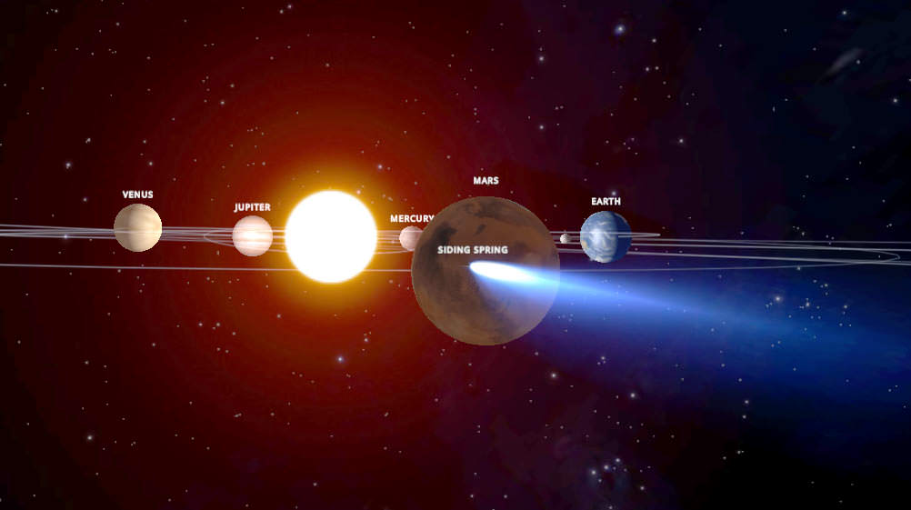
This graphic depicts the orbit of comet C/2013 A1 Siding Spring as it swings around the sun in 2014. On Oct. 19, the comet will have a very close pass at Mars. Its nucleus will miss Mars by about 82,000 miles (132,000 kilometers). The comet's trail of dust particles shed by the nucleus might be wide enough to reach Mars or might also miss it. Credit: NASA/JPL

As Comet C/2013 A1 Siding Spring inches closer to the Red Planet, NASA’s taking steps to protect its fleet of orbiting Mars spacecraft. On October 19, the comet’s icy nucleus will miss the planet by just 82,000 miles (132,000 km). That’s 17 times closer than the closest recorded Earth-approaching comet, Lexell’s Comet in 1770. 

Comet C/2013 A1 (Siding Spring) on July 11, 2014. The comet, discovered by comet hunter Rob McNaught from Siding Spring Observatory in New South Wales, Australia on January 3, 2013, shows a bright coma and well-developed tail. Credit: Joseph Brimacombe
Comet C/2013 A1 (Siding Spring) on July 11, 2014. The comet, discovered by comet hunter Robert McNaught from Siding Spring Observatory in New South Wales, Australia on January 3, 2013, shows a bright coma and well-developed tail. Credit: Joseph Brimacombe

No one’s worried about the tiny nucleus doing any damage. It’ll zip right by. Rather it’s dust particles embedded in vaporizing ice that concern NASA planners. Dust spreads into a broad tail that could potentially brush Mars’ upper atmosphere and strike an orbiter. A single particle of debris half a millimeter across may not seem like your mortal enemy, but when it’s traveling at 35 miles (56 km) per second relative to the spacecraft, one hit could spell trouble.
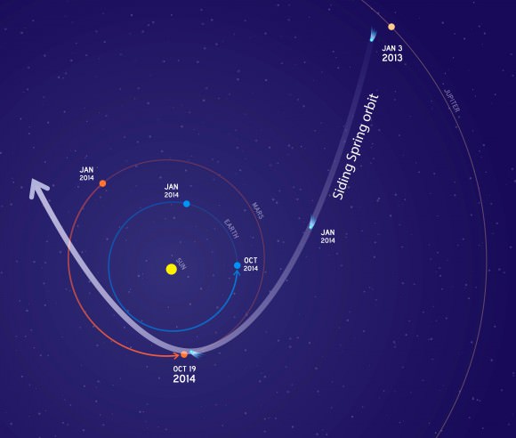
This graphic depicts the orbit of comet C/2013 A1 Siding Spring as it swings around the sun in 2014. On Oct. 19, the comet will have a very close pass at Mars. Its nucleus will miss Mars by about 82,000 miles (132,000 kilometers). The comet's trail of dust particles shed by the nucleus might be wide enough to reach Mars or might also miss it. Credit: NASA/JPL
The orbit of comet C/2013 A1 Siding Spring as it swings around the sun in 2014. NASA’s already begun moving the Mars orbiters toward safe positions in preparation for the upcoming flyby. Credit: NASA/JPL

“Three expert teams have modeled this comet for NASA and provided forecasts for its flyby of Mars,” explained Rich Zurek, chief scientist for the Mars Exploration Program at NASA’s Jet Propulsion Laboratory in Pasadena, California. “The hazard is not an impact of the comet nucleus, but the trail of debris coming from it. Using constraints provided by Earth-based observations, the modeling results indicate that the hazard is not as great as first anticipated. Mars will be right at the edge of the debris cloud, so it might encounter some of the particles — or it might not.”

The agency’s taking a prudent approach. NASA currently operates the Mars Reconnaissance Orbiter (MRO) and Mars Odyssey spacecraft with a third orbiter, MAVEN, currently on its way to the planet and expected to settle into orbit a month before the comet flyby. Teams operating the orbiters plan to have all spacecraft positioned on the opposite side of Mars when the comet is most likely to pass by.

Already, mission planners tweaked MRO’s orbit on July 2 to move it toward a safe position with a second maneuver to follow on August 27. A similar adjustment is planned for Mars Odyssey on August 5 and October 9 for the Mars Atmosphere and Volatile Evolution (MAVEN) probe. The time of greatest risk to the spacecraft is brief – about 20 minutes – when the widest part of the comet’s tail passes closest to the planet.

Will dust shed by the comet streak as meteors in the Martian sky on October 19?  The rovers will be watching. Credit: NASA/JPL
Will dust shed by the comet streak as meteors in the Martian sky on October 19? The rovers will be watching. Credit: NASA/JPL

One question I’m always asked is whether the Mars rovers are in any danger of dust-producing meteors in the comet’s wake. While the planet might get peppered with a meteor shower, its atmosphere is thick enough to incinerate cometary dust particles before they reach the surface, not unlike what happens during a typical meteor shower here on Earth. Rover cameras may be used to photograph the comet before the flyby and to capture meteors during the comet’s closest approach.

Despite concerns about dust, NASA knows a good opportunity when it sees one. In the days before and after the flyby, all three orbiters will conduct studies on the comet.

According to a recent NASA press release, instruments on MRO and Odyssey will examine the nucleus, coma and tail and possible effects on the Martian atmosphere:

Comet Siding Spring observed by the Spitzer Space Telescope in two wavelengths of infrared light in March 2014. The hint of blue-white corresponds to dust, red-orange to gas. Credit: NASA
Comet Siding Spring observed by the Spitzer Space Telescope in two wavelengths of infrared light in March 2014. The hint of blue-white corresponds to dust, red-orange to gas. Credit: NASA/JPL-Caltech/M. Kelley (Univ. Maryland)

“Odyssey will study thermal and spectral properties of the comet’s coma and tail. MRO will monitor Mars’ atmosphere for possible temperature increases and cloud formation, as well as changes in electron density at high altitudes and MAVEN will study gases coming off the comet’s nucleus as it’s warmed by the sun. The team anticipates this event will yield detailed views of the comet’s nucleus and potentially reveal its rotation rate and surface features.”

This is Comet Siding Spring’s first trip to the inner solar system. Expect exciting news as we peer up close at pristine ices and dust that have been locked in deep freeze since the time the planets formed.

For more information on the event, check out this NASA website devoted to the comet.


Having Fun with the Equation of Time

An analemma of the Sun, taken from Budapest, Hungary over a one year span. (Courtesy of György Soponyai, used with permission).

If you’re like us, you might’ve looked at a globe of the Earth in elementary school long before the days of Google Earth and wondered just what that strange looking figure eight thing on its side was.

Chances are, your teacher had no idea either, and you got an answer such as “it’s a calendar, kid” based on the months of the year marking its border.

In a vague sense, this answer is correct… sort of. That funky figure eight is what’s known as an analemma, and it traces out the course of the Sun in the sky through the year as measured from a daily point fixed in apparent solar time.

Analemma (Wikimedia Commons image).
Ye ole analemma… perpetually lost in the South Pacific? (Wikimedia Commons image).

But try explaining that one to your 3rd grade teacher. Turns out, measuring the passage of time isn’t as straight forward as you’d think. Our modern day clock and calendar is a sort of compromise, a method of marking the passage of time in a continuing battle to stay in sync with the heavens.

For most of history, the daily passage of time was denoted by the Sun. Solar Noon occurs when the Sun stands at its highest elevation (also known as its altitude) above the local horizon when it transits the north-south meridian. The trouble is, the passage apparent solar time doesn’t exactly match what we call solar mean time, or the 24 hour rotation of the Earth. In fact, this discrepancy can add up to as much as more than 16 minutes ahead of solar noon in late October and November and over 12 minutes behind it in February. This is worth bringing up this week because this factor, known as “The Equation of Time” — think “equation” in the sense that sundial owners must factor it in to make solar mean and apparent time “equal” — reaches its shallow minimum for 2014 this Saturday at 7:00 UT/3:00 AM EDT with a value of -6.54 minutes.

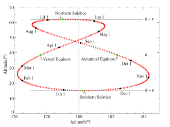
The solar analemma as plotted from the latitude of the Greenwich Observatory in England. (Wikimedia Commons/PAR/JPL Horizons).

So, what gives? Why won’t the pesky universe stay in sync?

Well, the discrepancy arises from two factors: the eccentricity of the Earth’s orbit, or how much it deviates from circular and the obliquity of the ecliptic to the celestial equator, think the tilt of Earth’s axis. Of the two, obliquity is the major factor, with eccentricity playing a minor but measurable role. And remember, we move slightly faster in our orbit in January near perihelion as per Kepler’s Laws of planetary motion than at aphelion, which occurred earlier this month , though be careful not to confuse the term “faster” with “sun fast.”

This means that were the Earth to orbit the Sun in a perfect circle with its poles perpendicular to its orbit, apparent and mean time would essentially stay in sync. Of course, no known planet has such a perfect alignment scenario, and other worlds do indeed host alien analemmas (analemmae?) of their own.

It’s also interesting to note that the two each major and minor minima of the Equation of Time roughly coincide with the four cross quarter tie in days of the year (marked by Groundhog’s Day, May Day, Lammas Day and Halloween, respectively) while the zero value points fall within a few weeks of the equinoxes and solstices.

A graph showing the flucuation of the value of the Equation of Time throughout the callendar year. (Created by the author).
A graph showing the fluctuation of the value of the Equation of Time (with minutes on the vertical axis) throughout the calendar year. (Created by the author).

In the current epoch, the deep minimum falls on February 21st, while the highest maximum falls on November 3rd on non-leap years. The four zero value dates are April 15th, June 13th, September 1st and December 25th respectively. The exact timing of these also slip to the tune of about a second a year, but of course, most sundials lack this sort of precision.

A "globe sundial" on the University of North Dakota at grand Forks campus. (Photo by author).
A “globe sundial” on the University of North Dakota at Grand Forks campus. (Photo by author).

So, why should we care about the Equation of Time in the modern atomic clock age? It is true that there have been calls over the past few years to “abolish the leap second” and go off of the astronomical time standard entirely… if this ever does come to pass, some future Pope Gregory will have to institute a “leap hour” circa 10,000 A.D. or so to stop the Sun from rising at 2 AM. But some modern day Sun tracking devices (think heliostats or solar panels) do in fact use mechanical timers and must take the equation of time into account to maximize effectiveness.

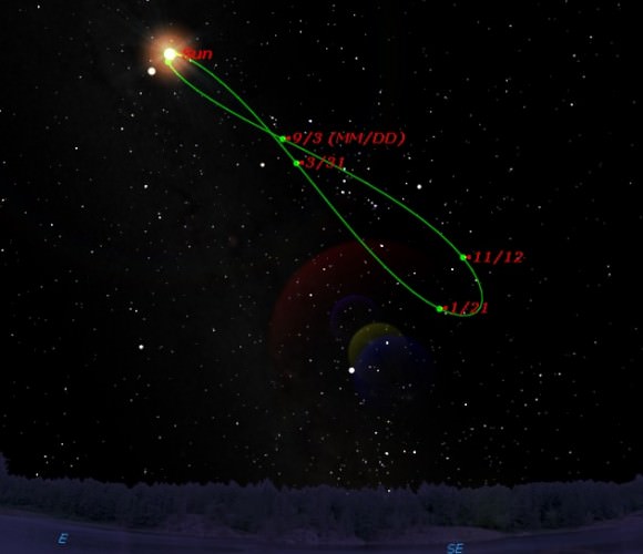
You can plot your very own simulated analemma using a desktop planetarium program. (Credit: Starry Night Education software).
Impatient? You can plot your very own simulated analemma using a desktop planetarium program. (Credit: Starry Night Education software).

Want to see the Equation of Time in action? You can make your own analemma simply by photographing the position of the Sun at the same time each day. Just remember to account for the shift on and off of Daylight Saving if you live in an area that observes the archaic practice, residents of Arizona need not to take heed. Otherwise, you’ll end up with a “split analemma…” Wintertime near the December Solstice is the best time to start this project, as the Sun is at its lowest noonday culmination and this will assure that your very own personal analemma won’t fall below the local horizon.

Farther afield, the effects of the Precession of the Equinoxes will also tweak the dates of the Equation of Time values a bit. Live out a full 72 year life span, and the equinoctial points will have drifted along the ecliptic by about one degree, twice the diameter of the Full Moon. Incidentally, the failure to take Precession into account is yet another spectacular fail of modern astrology: most “houses” or “signs” have drifted in the past millennia to the point where most “Leos” are in fact “Cancers!”

Such is the challenges and vagaries of modern day astronomical time-keeping. Let us know of your tales of tragedy and triumph as you hunt down the elusive analemma.

Watch Live: ‘Mars’ Crew Emerges From Simulation After 120 Days

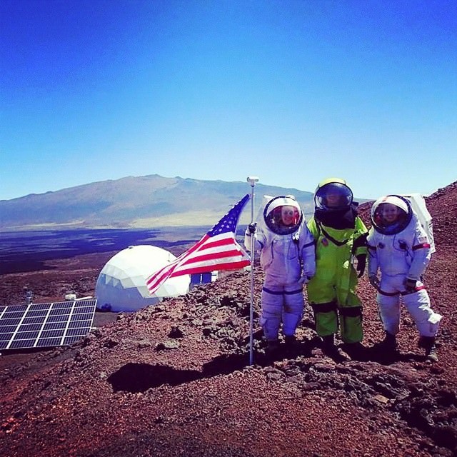
United States members of the second HI-SEAS (Hawaii Space Exploration Analog and Simulation) crew celebrate Independence Day during their simulated 120-day Mars mission. Credit: Casey Stedman/Instagram

If you spent 120 days cooped up in a small habitat with six people, what’s the first thing you’d want to do upon emerging? Celebration would likely be one of them, and you can watch the festivities as the HI-SEAS crew leaves their Mars simulation later today.

The broadcast takes place between 2 p.m. EDT and 4 p.m. EDT (6 p.m. and 8 p.m. UTC) and you can watch everything above. As with all live events, the schedule can always change at the last minute.

HI-SEAS (an acronym for Hawaii Space Exploration Analog and Simulation) is one of a number of simulated space missions that have taken place on Earth. The Mars Society regularly runs missions at its Mars Desert Research Station and Flashline Arctic Mars Station. There also was an effort called Mars 500, which saw a crew spend more than 500 days in a habitat to simulate the length of a Mars mission.

The goal of simulations such as these is to test out processes that could be used in space, and also to see how humans behave. There is considerable debate about how accurate these simulations are in comparison to spaceflight. There are obvious physical differences such as gravity, and some argue that the psychological aspects are different as well — in many cases, crews can easily open a door to escape others on Earth, while in space it’s not that simple.

As is the usual for space missions, though, HI-SEAS has strived to keep the public apprised of their activities through pictures and through videos. Coming up sometime afterwards will be the results of the scientific experiments.

Full disclosure: I am a classmate of HI-SEAS crew member Tiffany Swarmer’s in the Space Studies department at the University of North Dakota. She and the department have not asked me to write this article, nor were they aware of its publication before it went online.

Members of the 2nd Hawaii Space Exploration Analog and Simulation (HI-SEAS) crew get dressed up for May 4, sometimes called "Star Wars day" because the date plays on a famous expression from the movie: "May the force be with you." Credit: Ross Lockwood/Instagram
Members of the 2nd Hawaii Space Exploration Analog and Simulation (HI-SEAS) crew get dressed up for May 4, sometimes called “Star Wars day” because the date plays on a famous expression from the movie: “May the force be with you.” Credit: Ross Lockwood/Instagram

To Help Mars Rovers Phone Home, NASA Asks For Ideas To Close Looming Communications Gap

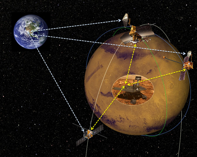
Artist's conception of commercial satellites orbiting Mars and beaming information back to Earth. Credit: NASA/JPL-Caltech

Remember during the government shutdown when it looked as though a NASA Mars mission would be delayed? Launch preparations continued because delaying the Mars Atmosphere and Volatile EvolutioN (MAVEN) spacecraft — which could have pushed its window back by years — would cause “imminent risk to life or property”, administrator Charles Bolden told Universe Today in November.

Both NASA’s Mars Reconnaissance Orbiter and Mars Odyssey currently provide a vital data link to send huge streams of information from the rovers on the surface, Opportunity and Curiosity. (And the Mars 2020 rover is coming up in a few years, too.) While both orbiters are working well, they are both well over their design lifetimes. MAVEN is now on its way to Mars and should get there in September.

MAVEN’s mission, however, is only designed to last for a year. While it could last longer, NASA is already thinking ahead for satellite backups — especially for the 2020s. And that could include commercial participation, according to a new request for information the agency put out this week.

“NASA has no scheduled Mars science orbiters after MAVEN arrives on the Red Planet in the fall,” the agency warned in a press release. “This creates the need to identify cost-effective options to ensure continuity of reliable, high-performance telecommunications relay services for the future.”

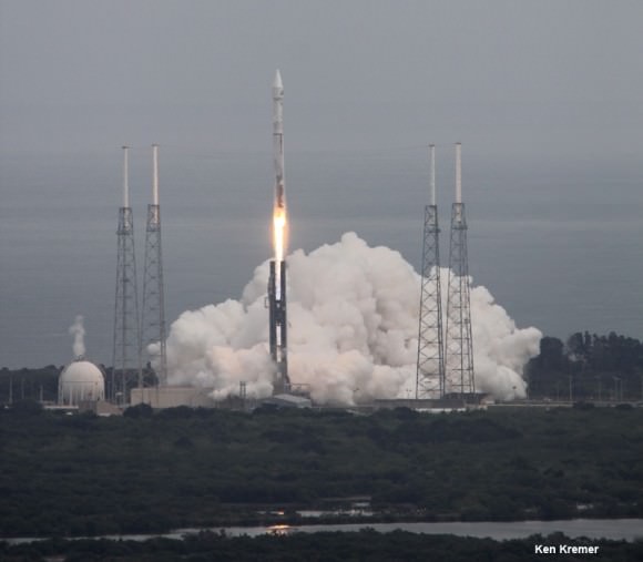
NASA’s Mars bound MAVEN spacecraft launches atop Atlas V booster at 1:28 p.m. EST from Space Launch Complex 41 at Cape Canaveral Air Force Station on Nov. 18, 2013. Image taken from the roof of the Vehicle Assembly Building (VAB) at NASA’s Kennedy Space Center.  Credit: Ken Kremer/kenkremer.com
NASA’s Mars bound MAVEN spacecraft launches atop Atlas V booster at 1:28 p.m. EST from Space Launch Complex 41 at Cape Canaveral Air Force Station on Nov. 18, 2013. Image taken from the roof of the Vehicle Assembly Building (VAB) at NASA’s Kennedy Space Center. Credit: Ken Kremer/kenkremer.com

The solicitation (which you can see here) proposes to have NASA purchase telecommunications services from some “commercial service provider” that would be responsible for operating and owning the satellites. This isn’t necessarily open only to industry, either. NASA says that organizations could include commercial providers, its own centers, universities, non-profits, federally funded research and development centers and even U.S. government and international organizations.

“We are looking to broaden participation in the exploration of Mars to include new models for government and commercial partnerships,” stated John Grunsfeld, associate administrator of NASA’s science mission directorate. “Depending on the outcome, the new model could be a vital component in future science missions and the path for humans to Mars.”

And it’s possible these orbiters could explore new technologies for Mars — specifically, laser/optical communications, which were used to great success on the Lunar Atmosphere and Dust Environment Explorer (LADEE) mission. And other laser missions are coming up. This could make it easier to send back movies from Mars as well as still pictures.

Source: NASA Jet Propulsion Laboratory

Astrophoto: Kaleidoscopic View of Mars

8 months of Mars observations in a single image, from October 2013 ending end of June 2014. Credit and copyright: Leo Aerts.

Astrophotographer Leo Aerts from Belgium took advantage of the recent opposition of Mars and captured the Red Planet both “coming and going” in this montage of images taken from October 2013 to June of 2014. Mars reached opposition in April of this year, meaning it was closest to Earth, allowing for the brightest and best viewing.

Leo even shows the changing locations in the sky where Mars appeared across the months, allowing also for the apparent retrograde motion through Virgo during the months on either side of opposition.

Opposition of Mars (or any planet) means that planet and the Sun are on directly opposite sides of Earth. From our perspective on a spinning Earth, the other planet rises in the east just as the Sun sets in the west. Then, after staying up in the sky the entire night, the other planet sets in the west just as the Sun rises in the east.

Mars’ opposition happens about every 26 months. Opposition time is also a good time to send spacecraft to Mars, since our two planets are the closest, meaning less fuel (and time) will be needed to reach the planet. Hence, we’ve got two missions on their way to the Red Planet: MAVEN will arrive at Mars on September 21, 2014, and India’s Mars Orbiter Mission (MOM) will get there on September 24.

This year’s opposition was pretty close, but we’re currently on an improving trend: the next opposition in 2016 Mars will look even bigger and brighter and during the 2018 opposition, Mars will nearly be as close as it was in 2003.

Want to get your astrophoto featured on Universe Today? Join our Flickr group or send us your images by email (this means you’re giving us permission to post them). Please explain what’s in the picture, when you took it, the equipment you used, etc.

Insta-Mars: Crew Wraps Up Mock Mission With Pictures Of Their Hawaiian Adventure

Casey Stedman, commander of the 2014 HI-SEAS mission, points towards its habitat module and Maunea Kea during the Hawaiian mission. Credit: Casey Stedman/Instagram

It’s the final countdown for a hardy group of people who have been on “Mars” for the past four months. On Friday (July 25), the HI-SEAS crew will make their return after simulating Red Planet exploration in Hawaii. And you can bet there are certain things they are missing about the outside world, or “Earth”.

“I haven’t seen a tree, smelled the rain, heard a bird, or felt wind on my skin in four months,” said Casey Stedman, the commander of the latest Hawai’i-Space Exploration and Analog Simulation, said in a statement on Instagram’s blog yesterday (July 20). Added chief technologist Ross Lockwood, “We’ve basically been subsisting on mush. Flavorful mush, but mush nonetheless.”

Despite the sacrifices, there’s a certain excitement to doing four solid months of experiments and “spacewalks” and other Martian activities. Luckily for us, the crew has been liveblogging their adventures on social media! Below the jump is some of their best Instagram photos from the trip.

HI-SEAS aims to closely simulate Mars exploration. The University of Hawaii runs the site, and every field season volunteers apply to participate in the missions. The first mission took place in 2012 and lasted 118 days. This mission is taking place in the same location, high on the slope of the Mauna Loa volcano.

Besides Instagram, some of the crew members are also accessible on Twitter. You can follow them at @rosslockwood, @Space_Chicken_, @TSwarmer and @casey_stedman. You can also read more about HI-SEAS on its official site.

Edit, July 24: Angelo Vermeulen (the commander of the first HI-SEAS mission last year) has just opened an Instagram account of his own where he is uploading pictures of the mission.

Full disclosure: I am a classmate of Tiffany Swarmer’s in the Space Studies department at the University of North Dakota. She and the department have not asked me to write this article, nor were they aware of its publication before it went online.

Sunset over Maui from Mauna Loa, as seen from the #HISEAS habitat #Mars #Space #Hawaii #NASA #NoFilter

Chicken tortilla soup with freshly baked corn bread. #HISEAS

The #HISEAS crew learns about Hawaiian vulcanism during their geology field lessons

May the Fourth Be With You – From your #HISEAS crew.

The 3 Americans of the 2nd #HISEAS crew celebrate #IndependenceDay #Mars #Hawaii #Space #NASA

Commander @casey_stedman and I are heading out on a sample collecting EVA. #HISEAS

Volcanic tephra from Kilauea Iki eruption- could similar deposits be found on #Mars? #HISEAS #Planetary

Just a little reading to learn about the responsibilities of commanding a space mission #HISEAS #Spaceflight #Astronaut #Science #ISS #NASA

Fresh lettuce on sMars courtesy of Lucie Poulet (@Space_Chicken_)! #HISEAS

It’s a good day to record sMars’ first podcast. #HISEAS

Crew quarters inside of the#HISEAS habitat module

Multitasking at its finest. #HISEAS

Simulating an EVA during the #HISEAS analog mission #Mars #Hawaii #Space #NASA

sTent accomplished. #HISEAS

The things I put up while while out on EVA. #HISEAS

The Kilauea Caldera as seen by the #HISEAS crew during their geology field lessons in Hawaiian Volcanoes National Park

Sparks Fly on Mars as Curiosity Laser Blasts Red Planet Rock – Photos/Video

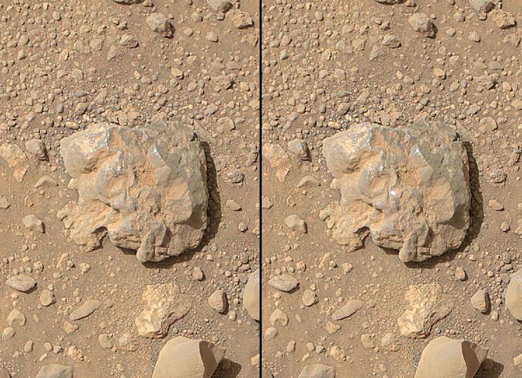
NASA's Curiosity Mars rover used the Mars Hand Lens Imager (MAHLI) camera on its arm to catch the first images of sparks produced by the rover's laser being shot at a rock on Mars. Credit: NASA/JPL-Caltech/MSSS

Curiosity has zapped hundreds of Red Planet rocks with her powerful laser blaster during her lifetime and has now caught the sparks flying for the first time as they happened – as seen in new photos and video above and below released this week by NASA.

As the NASA rover’s million watt Chemistry and Camera (ChemCam) instrument fired multiple laser shots at a rock fortuitously named “Nova” the team commanded her arm-mounted Mars Hand Lens Imager (MAHLI) high resolution imaging camera to try and capture the action as it occurred, for the first time. And they succeeded.

Curiosity blasted the baseball sized “Nova” rock target over 100 times on July 12, 2014, or Sol 687.

Since the nail biting touchdown nearly two years ago on Aug. 5, 2012 inside Gale Crater, ChemCam has aimed the laser instrument at more than 600 rock or soil targets and fired more than 150,000 laser shots.

Here’s a NASA/JPL video showing the laser flash:

Video Caption: The sparks that appear on the baseball-sized rock (starting at :17) result from the laser of the ChemCam instrument on NASA’s Curiosity Mars rover hitting the rock. Credit: NASA/JPL-Caltech/MSSS

ChemCam is used to determine the composition of Martian rocks and soils at a distance of up to 25 feet (8 meters) yielding preliminary data for the scientists and engineers to decide if a target warrants up close investigation and in rare cases sampling and drilling activities.

ChemCam works through a process called laser-induced breakdown spectroscopy. The laser hits a target with pulses to generate sparks, whose spectra provide information about which chemical elements are in the target.

Successive laser shots are fired in sequence to gradually blast away thin layers of material. Each shot exposes a slightly deeper layer for examination by the ChemCam spectrometer.

As Curiosity fired deeper into “Nova” it showed an increasing concentration of aluminum as the sequential laser blasts penetrated through the uninteresting dust on the rock’s surface. Silicon and sodium were also detected.

“This is so exciting! The ChemCam laser has fired more than 150,000 times on Mars, but this is the first time we see the plasma plume that is created,” said ChemCam Deputy Principal Investigator Sylvestre Maurice, at the Research Institute in Astrophysics and Planetology, of France’s National Center for Scientific Research and the University of Toulouse, France, in a statement.

“Each time the laser hits a target, the plasma light is caught and analyzed by ChemCam’s spectrometers. What the new images add is confirmation that the size and shape of the spark are what we anticipated under Martian conditions.”

A Martian target rock called "Nova," shown here, displayed an increasing concentration of aluminum as a series of laser shots from NASA's Curiosity Mars rover penetrated through dust on the rock's surface. This pattern is typical of many rocks examined with the rover's laser-firing ChemCam.  Credit: NASA/JPL-Caltech/LANL/CNES/IRAP/LPGNantes/CNRS/IAS
A Martian target rock called “Nova,” shown here, displayed an increasing concentration of aluminum as a series of laser shots from NASA’s Curiosity Mars rover penetrated through dust on the rock’s surface. This pattern is typical of many rocks examined with the rover’s laser-firing ChemCam. Credit: NASA/JPL-Caltech/LANL/CNES/IRAP/LPGNantes/CNRS/IAS

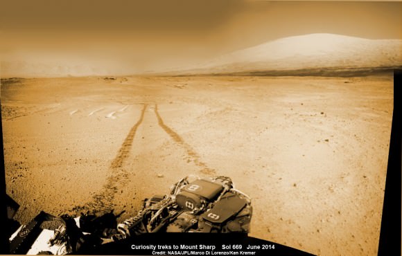
The SUZ sized rover is driving as swiftly as possible to the base of Mount Sharp which dominates the center of Gale Crater and reaches 3.4 miles (5.5 km) into the Martian sky – taller than Mount Rainier.

During Year 1 on Mars, Earth’s emissary has already accomplished her primary objective of discovering a habitable zone on the Red Planet that contains the minerals necessary to support microbial life in the ancient past when Mars was far wetter and warmer billions of years ago.

To date, Curiosity’s odometer totals over 5.1 miles (8.4 kilometers) since landing inside Gale Crater on Mars in August 2012. She has taken over 166,000 images.

1 Martian Year on Mars!  Curiosity treks to Mount Sharp in this photo mosaic view captured on Sol 669, June 24, 2014.    Navcam camera raw images stitched and colorized.   Credit: NASA/JPL-Caltech/Marco Di Lorenzo/Ken Kremer – kenkremer.com
1 Martian Year on Mars! Curiosity treks to Mount Sharp in this photo mosaic view captured on Sol 669, June 24, 2014. Navcam camera raw images stitched and colorized. Credit: NASA/JPL-Caltech/Marco Di Lorenzo/Ken Kremer – kenkremer.com

Curiosity still has about another 2.4 miles (3.9 kilometers) to go to reach the entry way at a gap in the treacherous sand dunes at the foothills of Mount Sharp sometime later this year.

Stay tuned here for Ken’s continuing Curiosity, Opportunity, Orion, SpaceX, Boeing, Orbital Sciences, commercial space, MAVEN, MOM, Mars and more planetary and human spaceflight news.

Ken Kremer

Ancient Snow Shaped A Martian Basin That’s Half The Size Of Brazil

Perspective view of Hellas Basin taken with the High Resolution Stereo Camera on ESA’s Mars Express in January 2014, and released in July 2014. Credit: ESA/DLR/FU Berlin

Such great heights! A mountain chain peeks in the background of this new view of Hellas Basin, based on information taken by a European spacecraft circling the Red Planet.

Beyond the pretty picture is a tale of how snow behaved on the Martian surface, according to the European Space Agency. The vast basin is about half the size of Brazil.

The wrinkled view of that crater in front is a product of snowing and freezing that took place when the Martian surface was wetter, ESA said.

A map of the Hellas basin in the southern hemisphere of Mars, as well as the rocky Hellespontus Montes. Image taken by the High Resolution Stereo Camera on ESA’s Mars Express. Credit: NASA MGS MOLA Science Team/Freie Universitaet Berlin

“During this period, snow fell and covered the surface and later moved downhill into the crater. Once inside the crater, the snow became trapped and soon covered by surface dust, before compacting to form ice. The number of concentric lines indicates many cycles of this process and it is possible that craters like these may still be rich in ice hidden beneath just tens of metres of surface debris.”

Additionally, the high hill chain in the back (called Hellespontus Montes) is a remnant of how Hellas basin was formed, the agency said.

“This feature is a product of the final stages of the formation of the vast Hellas impact basin itself, most likely as the basin walls – which were first pushed outwards by the extraordinary forces at work during the formation of the basin – later collapsed and sank inwards to create the observed stair-stepped shape.”

The image was taken by ESA’s Mars Express spacecraft, which is just one of several robotic emissaries circling the Red Planet.

Source: European Space Agency

Feel The Heat! New Mars Map Shows Differences Between Bedrock And Sand

An impact crater on Mars called Graterri, which is only 4.3 miles (6.9 km) in diameter, shines in a global heat map of the Red Planet produced in 2014. Credit: NASA/JPL-Caltech/Arizona State University

For years, NASA’s Mars Odyssey has been working on some night moves. It’s been taking pictures of the Red Planet during nighttime — more than 20,000 in all — to see how the planet’s heat signature looks while the sun is down.

The result is the highest-resolution map ever of the thermal properties of Mars, which you can see here. Why is this important? Researchers say it helps tell the story about things such as if an area is shrouded with dust, where bare bedrock is, and whether sediments in a crater are packed tight or floating freely.

“Darker areas in the map are cooler at night, have a lower thermal inertia and likely contain fine particles, such as dust, silt or fine sand,” stated Robin Fergason at the USGS Astrogeology Science Center in Arizona, who led the map’s creation. Brighter areas are warmer, likely yielding regions of bedrock, crust or coarse sand.

The map from Odyssey’s Thermal Emission Imaging System (THEMIS) is also used for a more practical purpose: deciding where to set down NASA’s next Mars mission.

After assisting in landing site selection for the Curiosity mission, the THEMIS data will be used to figure out where the Mars 2020 rover will be placed, Arizona State University stated.

You can check out more recent THEMIS images (updated daily) on this website.

Source: Arizona State University

Rock On! Curiosity Spots a Heavy Metal Meteorite

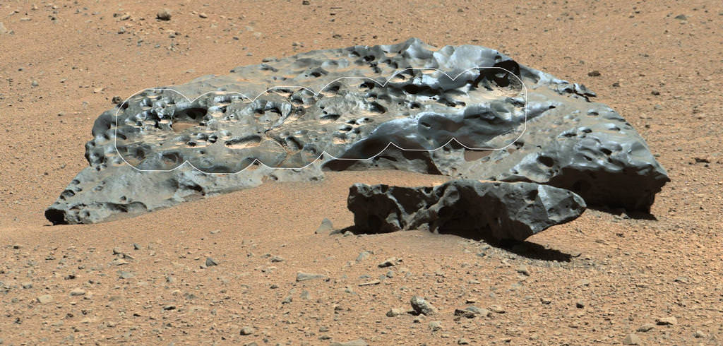
2-meter wide iron meteorite dubbed "Lebanon," as imaged by Curiosity's ChemCam and Mastcam on May 25, 2014

Talk about heavy metal! This shiny, lumpy rock spotted by NASA’s Curiosity rover is likely made mostly of iron — and came from outer space! It’s an iron meteorite, similar to ones found in years past by Curiosity’s forerunners Spirit and Opportunity, but is considerably larger than any of the ones the MER rovers came across… in fact, at 2 meters (6.5 feet) wide this may very well be the biggest meteorite ever discovered on Mars!

Click the image for a supermetallicious high-resolution version from JPL’s Planetary Photojournal.

Original raw Mastcam (right) image of Lebanon and Lebanon B from Sol 640 (NASA/JPL-Caltech/MSSS)

The picture above was made by combining high-resolution circular images (outlined in white) acquired with the Remote Micro-Imager (RMI) of Curiosity’s ChemCam instrument with color and context from the rover’s Mastcam. The images were taken on mission Sol 640 (May 25, 2014) and have been adjusted to simulate more Earth-like illumination.

Dubbed “Lebanon,” the large meteorite has a smaller fragment lying alongside it, named “Lebanon B.”

While iron meteorites are fairly common on Earth, on Mars they are by far the most common types of meteorites that have been discovered — if just for the sheer fact that they are highly resistant to erosion.*

Find more news and images from the MSL mission on the JPL site here.

Image credit: NASA/JPL-Caltech/LANL/CNES/IRAP/LPGNantes/CNRS/IAS/MSSS

Source: NASA

*Note: that isn’t to say iron meteorites can’t be eroded; on the contrary, much of their signature surface sheen and pitted texture comes from various erosion processes. See a related study from J. W. Ashley et al. here.