Phoenix Spies Possible Ice; TEGA Short Circuit Likely

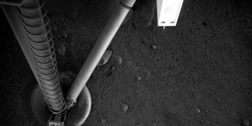
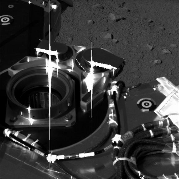
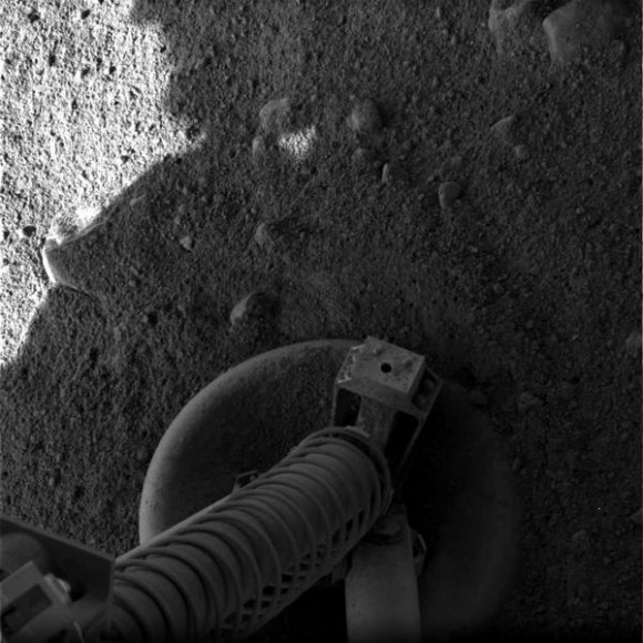
Scientists from the Phoenix mission say the lander may have exposed ice just beneath Mars surface when soil was blown away as the spacecraft landed last Sunday, May 25. The possible ice appears in an image the robotic arm camera took underneath the lander, near a footpad. The robotic arm was moved so the camera could peer beneath the lander to make sure Phoenix’s footing is secure before any digging operations start. In the top center of the image above is the area in question.


“We could very well be seeing rock, or we could be seeing exposed ice in the retrorocket blast zone,” said Ray Arvidson of Washington University, St. Louis, Mo., co-investigator for the robotic arm. “We’ll test the two ideas by getting more data, including color data, from the robotic arm camera. We think that if the hard features are ice, they will become brighter because atmospheric water vapor will collect as new frost on the ice.”

Arvidson said in today’s Phoenix press conference that Phoenix will provide full confirmation of what lies below the lander when it excavates and analyzes layers in the nearby landscape.

One bad piece of news for the nearly flawless mission, however. The Thermal and Evolved Gas Analyzer (TEGA) instrument that “bakes and sniffs” samples to identify the chemical make-up of the soil might have a short circuit. In a test conducted on Thursday, the instrument exhibited electrical behavior consistent with an intermittent short circuit in the spectrometer portion. The team is currently developing diagnostic steps that will be sent to the lander in the next few days. TEGA includes a calorimeter that tracks how much heat is needed to melt or vaporize substances in a sample, plus a mass spectrometer to examine vapors driven off by the heat.

“We have developed a strategy to gain a better understanding of this behavior, and we have identified workarounds for some of the possibilities,” said William Boynton of the University of Arizona, Tucson, lead scientist for the instrument.

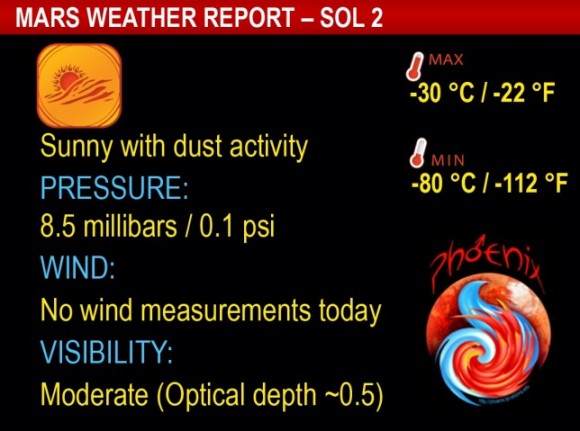
The latest data from the Canadian Space Agency’s weather station shows another sunny day at the Phoenix landing site with temperatures holding at minus 30 degrees Celsius (minus 22 degrees Fahrenheit) as the sol’s high, and a low of minus 80 degrees Celsius (minus 112 degrees Fahrenheit). The LIDAR instrument was activated for a 15-minute period just before noon local Mars time, and showed increasing dust in the atmosphere.
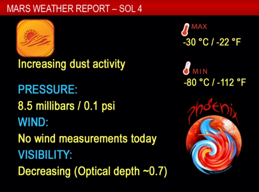
If you’d like to download this Phoenix weather widget for your desktop, check HERE.

“This is the first time LIDAR technology has been used on the surface of another planet,” said the meteorological station’s chief engineer, Mike Daly, from MDA in Brampton, Canada. “The team is elated that we are getting such interesting data about the dust dynamics in the atmosphere.” HERE is an animation of the LIDAR

The mission passed a “safe to proceed” review on Thursday evening, meeting criteria to proceed with evaluating and using the science instruments.

“We’re still in the process of checking out our instruments,” Phoenix project scientist Leslie Tamppari of JPL said. “The process is designed to be very flexible, to respond to discoveries and issues that come up every day. We’re in the process of taking images and getting color information that will help us understand soil properties. This will help us understand where best to first touch the soil and then where and how best to dig.”

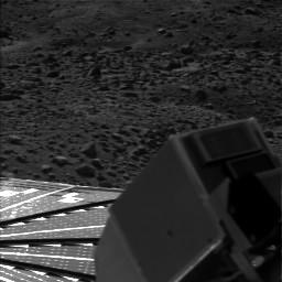
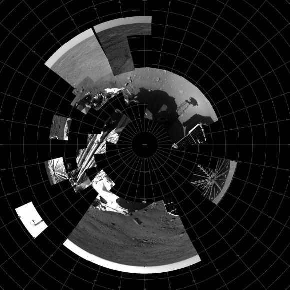
And finally, here’s the latest version of Phoenix’s panorama, compiled of images from Phoenix’s Stereo Surface Imager (SSI) camera that were taken on sols 1 and 3. The top portion has been stretched eight fold to show details of features in the background. Phoenix’s parachute, backshell, heatshield, and impact site can also be seen.

Phoenix News & Weather; Full Panorama Complete, Arm “Raring To Go”

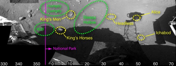
Phoenix’s Surface Stereo Imager (SSI) has finished its initial survey of the area surrounding the Phoenix lander, and returned the images to Earth for completion of the first panorama, seen above. “The panorama takes your around the entire scene,” said Phoenix Principal Investigator Peter Smith. “We see this “hummocky” terrain, with troughs in between the hummocks. In the background we can see the backshell and parachute.” Also visible are disturbances in the soil caused by the landing. And one of the most important aspects of the image shows the robotic arm now up and off the lander, with its scoop in the ready position. Flight Software Lead Matt Robinson reported, “The arm is busted loose now and is raring to go!”

Robinson said the arm is now unstowed out of all its launch restraints, and it required movement from all four of the joints to break loose of the bio-barrier that covered the arm during its journey from Earth. However, it will probably be next week before any digging is done with the arm. The team will first need to determine the stability of the lander. The camera on the end of the arm will look up under the lander to make sure everything is stable, and that each footpad is secure.


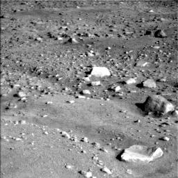
Smith said the rocks in the area are fist size, and there are ample places between the rocks to dig down to look for the ice layer thought to lie beneath the Martian surface. Data from the Odyssey spacecraft has indicated water in the form of ice lies beneath the Mars arctic region. Smith added that smaller rocks can be moved by robotic arm, if necessary, to get a good place to dig.

As customary, the science team has begun naming the rocks in the area to help distinguish them, and are using themes from fairy tale characters from Humpty Dumpty, The Legend of sleepy hollow, and Alice in Wonderland.


The “scoop” on the end of Phoenix’s robotic arm is now up and off the lander.

Science team is looking at the patterns in the rocks, and patterns in how they are distributed around the hummocks and troughs. “We do not have a full spectral analysis of any of the rocks, so its early to say anything about their composition,” Smith said. “That’s high on our list of things to do.” He added that the 12 spectroscopic filters on the SSI should be able to tell us if they are the same as the five other locations we’ve studied on Mars. He also offered a couple of clues about the rocks: Many are flat like paving stones, which may be a clue to their origin, and the rocks seem to be brighter than the surface rather than darker.

The SSI can also be used to create stereoscopic images that allow them to get elevation information. Additionally, the camera on the end of the arm, while not stereoscopic, can take one image and then be moved slightly to create stereoscopic images. The suite of science instruments on the arm also includes a microscopic imager with resolution 6 times better than the MER instruments.

Asked how he thought the mission has been going so far, Phoenix project manager Barry Goldstein said, “We’ve exceeded even our optimistic goals.”

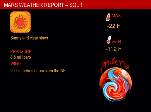
And now, here’s the latest weather report from the Phoenix landing site:

Quicktime hi-res movie of the terrain to the northwest of the Phoenix lander.

Link for Mars Weather Widget — Get Mars Weather on your desktop!
Image sources: Phoenix Gallery

Listen to Phoenix Descend

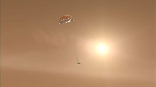
Europe’s Mars Express orbiter picked up the signal that Phoenix was transmitting as it descended to Mars’ surface on May 25. The data from the Mars Express Lander Communication system (MELACOM) tracked Phoenix and the signal was received on Earth soon after the Phoenix landing. The Mars Express Flight Control Team has now processed the signals, and the sounds of Phoenix descending are audible, loud and clear. ESA says the signal was tracked successfully, even during the expected transmission blackout window of the descent, until the lander was out of Mars Express’s view. The transmission blackout window is caused because of ionization around the probe, which builds up as the lander descends through the atmosphere and only very weak signals come through.

The closest Mars Express got to Phoenix was 1550 km. Then, as Mars Express flew away, the lander deployed its parachute, separated from it and landed. Then the signal from the lander was cut off.

Listening to the recording, you’ll notice the Doppler effect, which is very similar to what we hear when listening to the whistle of a passing train, of Phoenix and Mars Express getting closer and then farther away from each other.

Link to the sound recording.

The rest of the recording, the start and the end, contains background noise generated by Mars Express itself.

During the descent, all of the capabilities of Mars Express were focussed on tracking Phoenix with MELACOM. Unfortunately, the science observations carried out during the descent did not lead to the anticipated results.

Over the next few days, Mars Express will monitor Phoenix using MELACOM 15 more times; at least one of these will be used to demonstrate and confirm that the ESA spacecraft can be used as a data relay station for NASA, receiving data from the surface and transmitting test commands to the lander, which may be important if any issues remain with the communication troubles between Phoenix and the Mars Reconnaissance Orbiter.

Source: ESA

Comm Glitch Resolved; New Raw Images from Phoenix

The UHF radio on the Mars Reconnaissance Orbiter that had gone into standby mode yesterday was successfully restarted. The orbiter was then able to receive information from the Phoenix Mars Lander late Tuesday evening and relay the transmission to Earth, which included images and other data collected by Phoenix during the mission’s second day after landing on Mars. The radio system used by the orbiter to communicate with the lander experienced an undetermined “transient event” early Tuesday and shut itself off. This prevented sending Phoenix any new commands from Earth on Tuesday. Instead, the lander carried out a backup set of activity commands that had been sent Monday, which included taking additional pictures of itself and the landing site. Above is one of the raw, unprocessed image the lander took of itself.


We’ve gotten used to the panoramic images of Mars from the Mars Exploration Rovers, and we can expect more of the same from Phoenix. Above is the beginnings of a panoramic view of the lander and its surroundings. The Surface Stereo Imager is in the process of taking multiple images, which the imaging team will process and piece together to form a a large color panorama.

And how do these raw, black and white images become colorful photos and panoramas? At left is a calibration target on Phoenix. It has grayscale and color dots. Before launch, the calibration targets are imaged and measured very accurately, so that the imaging team back on Earth knows what the colors and different shades of grey are.

Once on Mars, a picture is taken of the target. The picture will be processed through the software they use, and if it comes out looking the same as the pictures taken of the target before launch, the imaging team knows they have processed the picture correctly. They then use the same technique to process the images of Mars surface, and produce images that are as close as possible to the “real” colors on Mars.

Here’s one more raw image, the beginnings the panorama of the entire spacecraft, of the SSI camera looking down on the spacecraft itself.

Image Source: Phoenix Gallery

Communication Glitch for Phoenix, MRO

The UHF communications radio on board the Mars Reconnaissance Orbiter has switched to standby and was unable to relay instructions to the Phoenix lander for its activities for sol 2, which included unstowing its robotic arm. The problem arose at 0608 PDT on Tuesday. MRO did receive the sol 2 sequence from Earth – meaning the communications link between Earth and MRO continues to operate normally. But subsequently MRO reported that there had been a “problem with the handshake between MRO and Phoenix,” said Fuk Li, manager of NASA’s Mars Exploration Program. A ‘handshake’ is the set of signals the radios on the two spacecraft send each other to establish a data-communications link.

“All this is is a one-day hiccup in being able to move the arm around, so it’s no big deal,” said Ed Sedivy, Phoenix program manager at Lockheed Martin Space Systems.

The next opportunity to send commands to Phoenix will occur on Wednesday morning, when Mars Odyssey, the other spacecraft used to communicate with Phoenix, passes over the landing site. At that time, the commands that failed to reach the lander today will be transmitted. We’ll keep you posted.

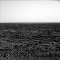
Also, we’ll take this opportunity to share a couple of other tidbits about Phoenix. The image above was taken on sol 1, and shows Phoenix’s backshell off in the distance.


On board Phoenix is a weather station, contributed by the Canadian Space Agency and University of Aarhus in Denmark. The weather station was activated in the first hour after landing on Mars. Measurements are being recorded continuously. Skies were clear and sunny on Sol 1 on Mars. The temperature varied between minus 112 degrees Fahrenheit in the early morning and minus 22 degrees Fahrenheit in the afternoon. The average pressure was 8.55 millibars, which is less than a 1/100th of the sea level pressure on Earth.

This image shows the spacecraft’s robotic arm in its stowed configuration, with the a biobarrier, a shiny, protective film, that covers the arm on landing day, or Sol (Martian day) 0, and then the biobarrier was removed during lander’s first full day on Mars, Sol 1.

The “elbow” of the arm can be seen at the top center of the picture, and the biobarrier is the shiny film seen to the left of the arm.

The biobarrier is an extra precaution to protect Mars from contamination with any bacteria from Earth. While the whole spacecraft was decontaminated through cleaning, filters and heat, the robotic arm was given additional protection because it is the only spacecraft part that will directly touch the ice below the surface of Mars. After Phoenix landed, springs were used to pop back the barrier, giving it room to deploy.

These images were taken on May 25, 2008 and May 26, 2008 by the spacecraft’s Surface Stereo Imager.

News Sources: Astrobiology Magazine, JPL Phoenix News

Why the Phoenix Landing Site is Perfect

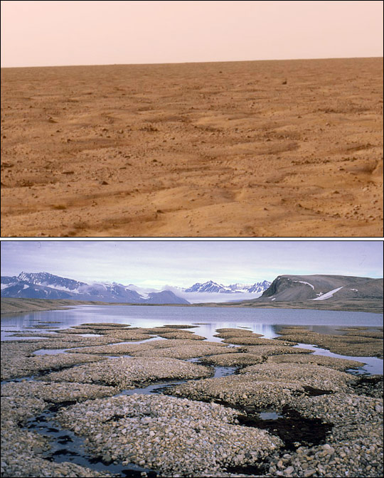
Permafrost on Mars (top) compared to Earth (bottom). Image credit: NASA Earth Observatory

Phoenix’s landing site may look flat and uninteresting. But actually, the site is perfect, and is exactly what the Phoenix science team was hoping for. You see, Phoenix is actually more interested in what is below the surface. From one of the first images sent back by Phoenix, a view of Mars’ surface at this site reveals a landscape familiar to polar scientists on Earth: a pattern of interlocking polygon shapes that form in permafrost that freezes and thaws seasonally. These polygon patterns were seen in orbital pictures taken by the Mars Reconnaissance Orbiter, as well as other spacecraft, and these polygon shapes are part of the evidence that Mars’ polar regions harbor large quantities of frozen water.

This pair of images above shows the similarities between the surface of Mars where Phoenix landed (top) and permafrost on northeastern Spitsbergen, Svalbard (bottom) an archipelago in the Arctic Ocean north of mainland Europe, about midway between Norway and the North Pole. The polygon patterns in the permafrost form when the upper parts of the ground thaw and refreeze from season to season. The ground contracts in the winter cold, creating small spaces that fill with melted water in the summer. When winter returns and the water freezes, it acts like a wedge, enlarging the cracks.


The Phoenix landing site with polygon shapes visible from orbit via MRO.

The only difference in these photos is the Earth image shows water on the surface, and on Mars, water couldn’t pool on the surface because the low atmospheric pressure would cause any water that might bubble to the surface to sublimate. But the thaw/freeze process could presumably occur beneath Mars’ surface with far less water.

And why is this so interesting? On Earth, permafrost, glaciers, and other frozen environments can preserve organic molecules, bacteria, and fungi for hundreds of thousands, even millions, of years. The Phoenix spacecraft has scientific instruments that will dig into the frozen ground of the Martian Arctic, vaporize the soil sample, and analyze the chemistry of the vapors. Scientists hope to learn whether ice just below the surface ever thaws and whether some chemical ingredients of life are preserved in the icy soil.

That’s why Phoenix’s landing site is perfect.

Original News Source: NASA Earth Observatory

HiRISE Does It Again; Captures Phoenix On Mars’ Surface

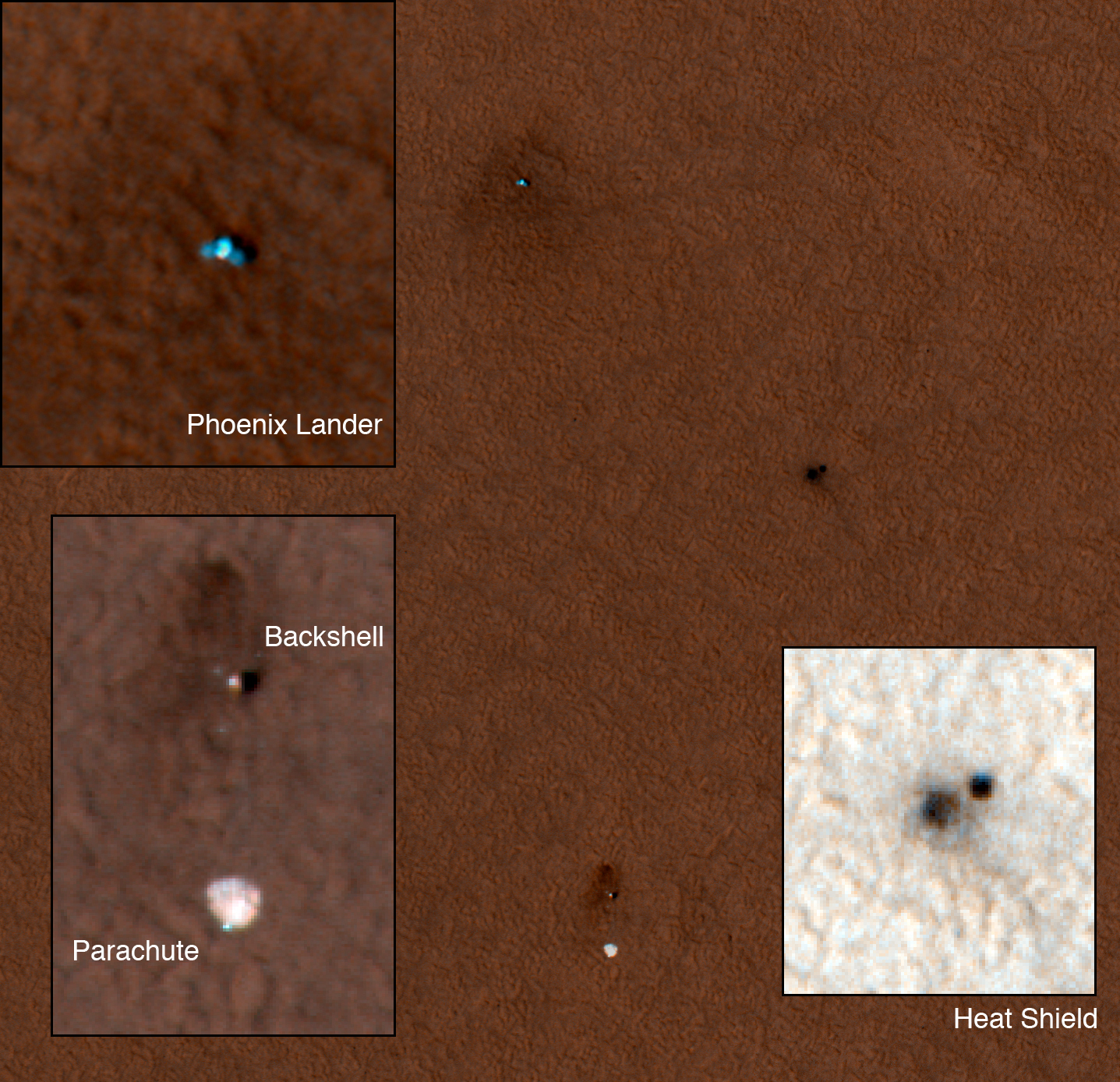
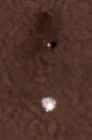
The HiRISE Camera Imaging Team for the Mars Reconnaissance Orbiter keeps outdoing themselves. First, they imaged Mars’ surface in such fine detail to help choose a safe yet interesting landing site for Phoenix. Then they beat the odds and actually captured Phoenix during its descent to Mars surface, which is completely incredible. And now, in very short order they’ve located and imaged Phoenix and all its accoutrements sitting on Mars north polar region. The parachute (lower left) is easy to identify because it is especially bright and the backshell is still attached to the parachute cords. The double dark marking at right is consistent with disturbance of the ground from impact and bouncing of the heat shield, which fell from a height of about 10 kilometers. The last object (upper left) is the Phoenix Lander whose two solar panels on either side of the lander are clearly visible.

To give you a sense of scale of what you’re seeing, the solar panels are about 5.5 meters (about 18 feet) across, and about 22 pixels in this image. The parachute and lander are about 300 meters, roughly 1,000 feet, apart. All seen and imaged by MRO from orbit. Amazing.

I love HiRISE.

In other Phoenix news, the commands to activate the robotic arm will be sent Wednesday morning via communications with, appropriately enough, MRO.

See below for close-ups and the entire image without the inserts.

All these images were acquired about 22 hours after Phoenix landed at about 3:00PM local time on the surface. The rest of the HiRISE observation shows a cloud free day for Phoenix Lander operations.

Close up of the Phoenix lander.

Parachute and backshell.

Source: HiRISE

Life Found a Mile Below Terrestrial Seabed; Implications For Life on Mars

Prokaryotes are found in very extreme places (Cyanosite)

We all know how hard life can be, but spare a thought for the microbes recently discovered 1.6 kilometres (1 mile) below the seabed off the coast of Canada. The living conditions are cramped, the environment is a searing 100°C (212F), and yet these hardy cells appear to be thriving. In the midst of the historic landing of Phoenix in the arctic wastes of Mars yesterday, the interest in finding life on the Red Planet has, yet again, reached fever pitch. Although Phoenix isn’t built to look for life, it is assessing the Martian surface water content for signs that it may (or may have been able to) support life. This new discovery of life so deep below the Earth’s surface may set some new limits on just how extreme life can be on other planets…

Off the Newfoundland coastline, scientists have burrowed far below the seabed. Smashing the previous record for subterranean life, this new discovery has found one of the most basic forms of terrestrial life living a mile deep (the previous record held at 842 meters, or 0.5 miles). As I’m no biologist, I’ll leave it to the Reuters news source to describe as to what was found:

Prokaryotes are microbes lacking nuclei, comprising archaea and some types of bacteria. The lack of cell nuclei distinguishes them from eukayrotes, or all animal and plant life.Reuters

These prokaryote specimens were scooped from sediments dating 111 million years old. At these depths, the sediment is subjected to temperatures from 60-100°C (140-212F), and John Parks, professor at the University of Wales (UK), belives that this type of microbe can live even deeper. He believes more prokaryotes could be discovered up to 4 km (2.5 miles) below the seabed. This leads to the question as to whether life on other planets may not be found on the surface, but deep inside their crust.

If there is a substantial subsurface biosphere on earth there could also be substantial biospheres on other planets. Just taking a scoop from the surface of Mars is not going to tell you whether there is life on Mars or not.” – Prof. John Parks

This obviously relates to the attempts made by previous Mars landers to analyse the surface for extraterrestrial microbes. However, a lot of information can be gained by analysing the surface composition for the materials required by life (as we know it) to survive. The Phoenix lander for instance was not designed for life hunting in mind, but it was designed to analyse the top layer of regolith for water content and evidence that liquid water may have once flowed in recent Mars history. Now we have extended our limit on where life may thrive, missions to Mars will need to burrow deeper into the surface, or we’ll simply have to wait till we can do it ourselves.

It is not clear where these subterranean microbes get their energy from. Sunlight probably isn’t a factor; methane and heat from volcanic vents seem more obvious candidates.

There is a problem associated with finding life this deep. It complicates possible plans to bury carbon dioxide emissions deep underground to slow the effects of climate change. It is a completely untouched ecosystem, dumping our waste could have serious consequences for these colonies of microbes. However, it might take some convincing as the U.N. Climate Panel has announced that carbon dioxide burial may be the key tool in the future to prevent this greenhouse gas from escaping into the atmosphere.

Source: Reuters

One-Way Mission to Mars: US Soldiers Will Go

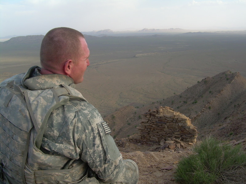
Sergeant First Class William H. Ruth III contemplates his current duty in a barren landscape in Afghanistan, and says he’s willing to lead a human mission to Mars.

An article published on Universe Today back in March of this year detailing former NASA engineer Jim McLane’s idea for on a one-way, one-person mission to Mars generated a lot of interest. The many comments on the subject posted here on UT and numerous other websites such as ABC News ranged from full support to complete disbelief of the idea. McLane’s concept has literally gone around the world, and a journalist from Spain, Javier Yanes who writes for the newspaper Publico shared with me his correspondence with a US soldier stationed in Afghanistan, who says that battle-hardened soldiers would be the perfect choice to send on a mission of no return to a new world. SFC William H. Ruth III says he and the men in the 101st Airborne Division are ready and willing to go.

SFC Ruth wrote, “While reading Jim McLane and Nancy Atkinson’s thoughts on Space Colonization, I started to realize that we ALL have lost our way. We have become so consumed by petty differences and dislikes of others that we all have forgotten our pre destiny of something better.”

And what is the ‘something better’ that Ruth envisions? Military personnel from different countries joining together to make “the ultimate sacrifice” of forging the way to establish an outpost on another world, like Mars.

“Here is an ‘out of the box’ idea,” Ruth writes. “Let the heroes of all our countries, for once, risk the ultimate sacrifice for something greater than one man’s idea. Maybe once let these men and woman that rise every morning and say ‘today I will stand for something and say ‘evil will not prevail, not on my watch.’ For once let them volunteer for us all, you never know, mankind, the human race. It might just catch on if we let it.”

Ruth continues, “Will we falter at a hint of death or danger? Or will we do now what so many in all of the world’s history has done before us. NASA of all thinking societies should understand this. Would there even be an America or NASA if a man named Columbus had not pursued a dangerous and possibly deadly voyage to a new world? He certainly had to consider whether or not he would ever return home to see all those he loved so dearly. But what of those aboard his ships, those that left Spain knowing that they would never return. Those few that willingly risked all for the chance at a new world and a new future, could they have possibly known what effects they would have had on the future due to their sacrifices? Now can we have enough vision to see our destiny, can we, for a moment, see past our petty differences of race and religion to see peace, prosperity and possibly a new world.”

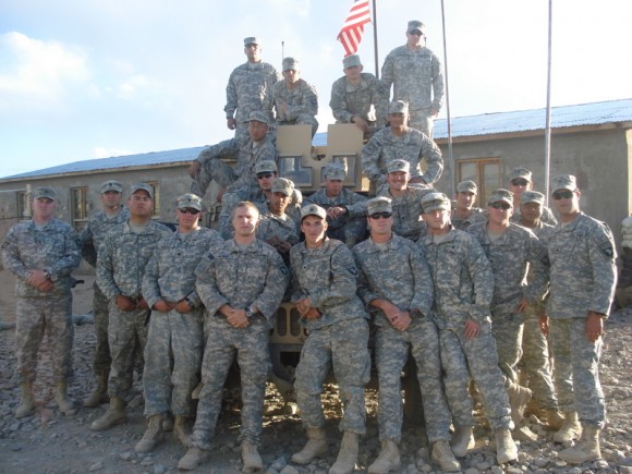
3rd Platoon at Fire Base Ter-Wa, April 2008. SFC Ruth is first on the left.

Ruth says 15 years in the military has prepared him for such a mission. “So I am no fool and I am no stranger to what some might call high risks,” he says. “Hundreds of thousands of fighting men and woman from around this world have walked, rode, swam and even jumped into what some would call a high risk situation. Some even considered suicide missions, ones with low probability of success. And why, what did they risk all for? Each and every one of us, even those throughout this earth that has made that choice, risk all for what we believed would make our world better.”

Ruth first began pondering such a mission after reading a quote by Stephen Hawking on Space.com: “The discovery of the New World made a profound difference on the old,” Hawking said. “Spreading out into space will have an even greater effect. It will completely change the future of the human race, and maybe determine whether we have any future at all.”

Ruth sent an email to Space.com’s Anthony Duignan-Cabrera, which was posted on the LiveScience blog: “Here is an idea: Send battle-hardened, strong-minded soldiers and marines on the long trips into space. We are conditioned to live with the bare minimal (of) life’s necessities and are trained to be prepared for the worst conditions that any environment could throw at us. Hell, me and my men will go, set up a colony somewhere and await colonists to arrive.”

Javier Yanes read Ruth’s proposition and contacted him, sending him the link to the Universe Today article with McLane’s idea.

Ruth responded by sending Yanes a written statement called “A Soldier’s Perspective;,” Yanes wrote an article about Ruth in Publico, and shared Ruth’s proposal and pictures with me.

Ruth doesn’t agree with McLane’s idea of a one-person mission to Mars, but supports the one-way idea.

“I fully agree with NASA and others that it is completely dangerous and potentially deadly for anyone who sets out on this voyage,” he wrote. “But since when has that ever stopped anyone? A one way trip is the way to go about this, it is a proven fact of human history that when the human species is thrown into a no alternative situation, that they will prevail and survive.

The military would never send someone out alone, and Ruth thinks a multiple ship mission is the way to proceed, with three to four smaller vessels, with four to six crew members each.

Ruth admits that other might see sending soldiers into space as more like an invasion or occupation than exploration. “To those who share this concern, consider this for a moment and ask yourself, who else?” Ruth asked. “Who else has the mentality to volunteer to face certain danger and possibly death, thousands of miles away from their homes? I could think of a few hundred thousand that do it everyday across this planet.”

Ruth says that getting the worlds militarys involved with something other than making war with each other could change humanity’s future for the better.

“I wonder who will be the first to extend the hand of complete partnership, representing the whole human species?” Ruth asks. “Could this be the answer that so many have searched for? Could this one thing unite humanity in a new era of global cooperation and a new planetary respect for human life, unlike we know it today? My answer is ask me again when I’ve reached the new world!”

First Images from Phoenix

Phoenix sent its first images of itself and Mars’s surface, which indicate that all is well with the spacecraft. The lander is stable, the solar arrays have deployed, and Phoenix appears to be sitting on a smooth, landscape that is just what the scientists were hoping for. “It looks like a good place to start digging!” said Dan McCleese from JPL.


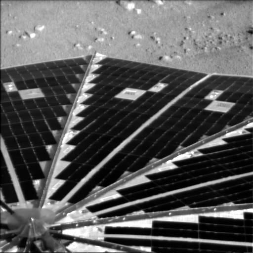
This image of Phoenix’s solar arrays indicates that the arrays have deployed fully. Data indicates the batteries are fully charged as well, meaning the solar arrays are working perfectly.


This image shows the lander’s footpad planted quite nicely, not sunk into the surface at all. This indicates great stability for Phoenix.


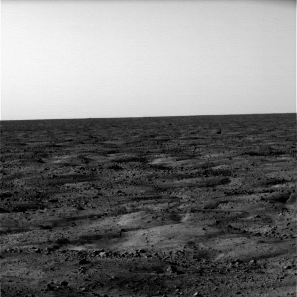
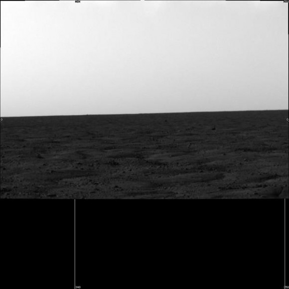
This is a second, and not quite complete landscape image that Phoenix sent back to Earth of its surroundings.